
Cruchley, George Frederick (sold)

George Frederick Cruchley (April 23, 1797 - June 16, 1880) was a London based book and map seller active in the middle part of the 19th century. Cruchley began his cartographic career as an apprentice at the venerable Aaroon Arrowsmith firm. Many of Cruchley's earliest maps bear the words 'From Arrowsmith's' on the imprint. In 1844, Cruchley acquired the massive stock of the important early 19th century firm of John Cary. Cruchley published his own maps as well as reissues of Cary's stock well into the 1870s. He is best known for his detailed plans of London, which in recent years have become increasingly scarce and desirable. Cruchley was based in London on 38 Ludgate Street until 1834 when he moved his offices to 81 Fleet Street. Shortly before his death in 1880 Cruchely auctioned (Hodgson's Auctions, Jan 16, 1877) his entire stock. Many of his map plates were thusly acquired by 'Gall and Inglis' who continued the Cruchley tradition well into the early 20th century. Cruchley's son, also George Frederick (1837 - 1882), continued to work as a book and map seller until his death.
Elphinstone's map of London, with original silk roll-bag.
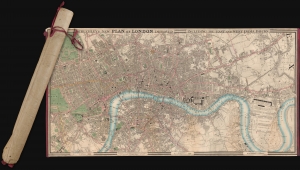
Cruchley's New Plan of London Improved including the East and West India Docks.
sold
- Digital Map Information
- Suitable for large format printing
- Full resolution TIFF file
- ICC color profile embedded
- Delivered instantly via download link
A fine example of the scarce 1831 edition of George Frederick Cruchley's large and famous city plan or map of London, contained within its original rolled silk slip-bag, a unique presentation giving the piece an authentic objective tactility. (more details)
An example of an early edition of one of the most celebrated maps of London.
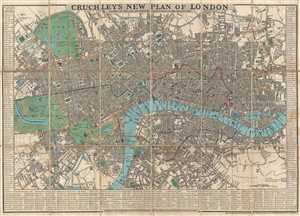
Cruchley's New Plan of London. Shewing All the New and Intended Improvements to the Present Time.
sold
- Digital Map Information
- Suitable for large format printing
- DPI: 300
- File Size: 14.97 MB
- File Type: ZIP / TIFF
- ICC color profile embedded
- Delivered instantly via download link
This is an 1834 edition of George Frederick Cruchley's famous city map or plan of London, England. The map depicts the city from Hyde Park to the London Docks and from Regent's Park and the Regents Canal to Kennington and Walworth. Highly detailed, myriad streets ... (more details)
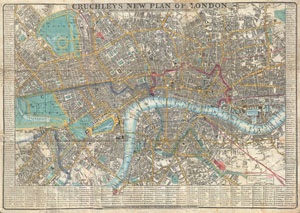
Cruchley's New Plan of London Shewing all the new and intended improvements to the Present Time. / Cruchley's Superior Map of London, with references to upwards of 500 Streets, Squares, Public Places & C. improved to 1848: with a compendium of all Place of Public Amusements also shewing the Railways & Stations.
sold
- Digital Map Information
- Suitable for large format printing
- DPI: 300
- File Size: 19.07 MB
- File Type: ZIP / TIFF
- ICC color profile embedded
- Delivered instantly via download link
This is a very attractive example of G. F. Cruchley's highly desirable 1848 Map of London, England. Covers London from Hyde Park in the west to the London Docks in the east. Extends north to include all of Regents Park and south as far as the South Western ... (more details)
Cruchley's last New Plan of London.
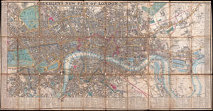
Cruchley's New Plan of London Shewing all the New and Intended Improvements to the Present Time.
sold
- Digital Map Information
- Suitable for large format printing
- DPI: 300
- File Size: 25.43 MB
- File Type: ZIP / TIFF
- ICC color profile embedded
- Delivered instantly via download link
This is a very uncommon and obscure example of Cruchley's New Plan of London . Cruchley's famous plan of London was first issued in 1827 and was updated yearly until this issue, in 1849. The original New Plan of London was much smaller than the current ... (more details)
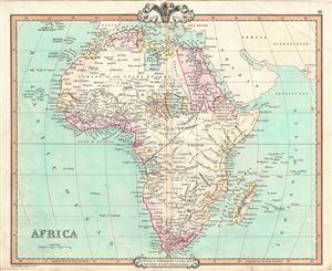
Africa.
sold
- Digital Map Information
- Suitable for large format printing
- DPI: 300
- File Size: 7.53 MB
- File Type: ZIP / TIFF
- ICC color profile embedded
- Delivered instantly via download link
This is a beautiful 1850 map of Africa issued by George Frederick Cruchley. It details the continent of Africa, including Madagascar, on the cusp of the great exploratory expeditions of the mid-19th century undertaken by Speke, Livingstone, and Stanley. ... (more details)
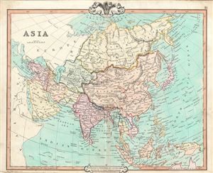
Asia.
sold
- Digital Map Information
- Suitable for large format printing
- DPI: 300
- File Size: 8.91 MB
- File Type: ZIP / TIFF
- ICC color profile embedded
- Delivered instantly via download link
This is a fine example of George Frederick Cruchley's 1850 map of Asia. The map covers the entire continent from the Red Sea to the Kamchatka Sea and from the Arctic to the Gulf of Carpentaria. Shows the Chinese Empire including Tibet, Korea and ... (more details)
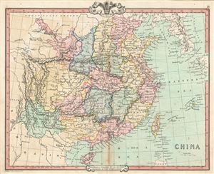
China.
sold
- Digital Map Information
- Suitable for large format printing
- DPI: 300
- File Size: 8.25 MB
- File Type: ZIP / TIFF
- ICC color profile embedded
- Delivered instantly via download link
A lovely 1850 map of China by George Frederick Cruchley. It covers the traditional provinces of mainland China, as well as adjacent Corea (Korea) and Formosa (Taiwan). Hong Kong Island and Macao are identified. The Grand Canal is also noted. ... (more details)
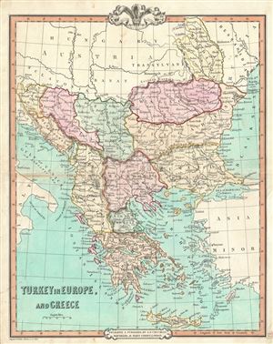
Turkey in Europe and Greece.
sold
- Digital Map Information
- Suitable for large format printing
- DPI: 300
- File Size: 9.06 MB
- File Type: ZIP / TIFF
- ICC color profile embedded
- Delivered instantly via download link
A beautiful 1850 map of Greece, the Balkans and the European part of Turkey by George Frederick Cruchley. It covers from Moldavia to Candia and from the Gulf of Venice or the Adriatic Sea to the Sea of Marmara. The modern day states of ... (more details)
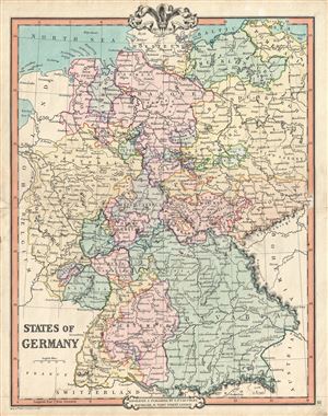
States of Germany.
sold
- Digital Map Information
- Suitable for large format printing
- DPI: 300
- File Size: 9.95 MB
- File Type: ZIP / TIFF
- ICC color profile embedded
- Delivered instantly via download link
A fine example of G. F. Cruchley's 1850 map of Germany. Cities, towns, rivers, mountains and other topographical features are noted, with relief shown by hachures. The map is color coded according to Germanic states. This map was made ... (more details)
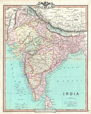
India.
sold
- Digital Map Information
- Suitable for large format printing
- DPI: 300
- File Size: 8.43 MB
- File Type: ZIP / TIFF
- ICC color profile embedded
- Delivered instantly via download link
This is an attractive 1850 map of India by George Frederick Cruchley. It covers the Indian subcontinent from Kashmir to the Indian Ocean and includes Ceylon or Sri Lanka as well as parts of Afghanistan and Tibet. The map is color ... (more details)
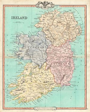
Ireland.
sold
- Digital Map Information
- Suitable for large format printing
- DPI: 300
- File Size: 9.04 MB
- File Type: ZIP / TIFF
- ICC color profile embedded
- Delivered instantly via download link
A lovely 1850 map of Ireland by George Frederick Cruchley. The map covers the the entirity of Irealand and is divided four provinces: Ulster, Connaught, Leinster and Munster. Tuscan Rock, near the southeast coast of Ireland, ... (more details)

Canaan or the Land of Promise As divided among the Tribes.
sold
- Digital Map Information
- Suitable for large format printing
- DPI: 300
- File Size: 7.34 MB
- File Type: ZIP / TIFF
- ICC color profile embedded
- Delivered instantly via download link
This is a fascinating 1850 map of Canaan (Israel or Palestine) by George Frederick Cruchley. It covers the region as it existed in Biblical times with divisions for each of the Tribes of Israel and includes the modern day ... (more details)
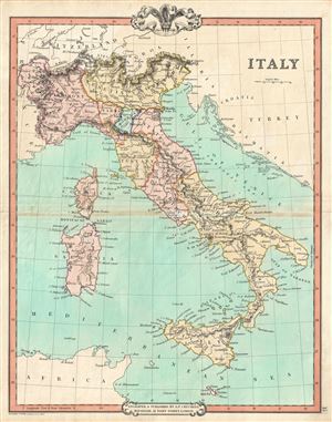
Italy.
sold
- Digital Map Information
- Suitable for large format printing
- DPI: 300
- File Size: 7.48 MB
- File Type: ZIP / TIFF
- ICC color profile embedded
- Delivered instantly via download link
This is an attractive 1850 map of Italy by George Frederick Cruchley. It covers the pre-Garibaldi Italy split into numerous small duchies and states from Venetian Lombardy south to Sicily and Malta. Also includes the ... (more details)
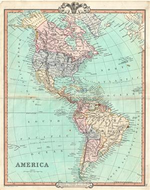
America.
sold
- Digital Map Information
- Suitable for large format printing
- DPI: 300
- File Size: 8.39 MB
- File Type: ZIP / TIFF
- ICC color profile embedded
- Delivered instantly via download link
An attractive 1850 map of North and South America by George Frederick Cruchley. The map covers all of North America as well as South America from the Arctic to Cape Horn. In North America, Russian and British ... (more details)
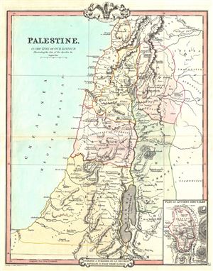
Palestine, In the Time of our Saviour Illustrating the Acts of the Apostles etc.
sold
- Digital Map Information
- Suitable for large format printing
- DPI: 300
- File Size: 6.46 MB
- File Type: ZIP / TIFF
- ICC color profile embedded
- Delivered instantly via download link
This is a fine example of George Frederick Cruchley's 1850 map of Palestine, Israel or the Holy Land in Biblical times. Centered on the Jordan River, the map covers the regions between modern day Israel and ... (more details)
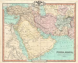
Persia, Arabia, Cabool, Afghanistan, etc.
sold
- Digital Map Information
- Suitable for large format printing
- DPI: 300
- File Size: 9.17 MB
- File Type: ZIP / TIFF
- ICC color profile embedded
- Delivered instantly via download link
A fine example of the 1850 map of Persia, Arabia and Afghanistan by G. F. Cruchley. Centered on the Persian Gulf, this map covers from the Mediterranean and Red Sea eastward as far as India, including all ... (more details)
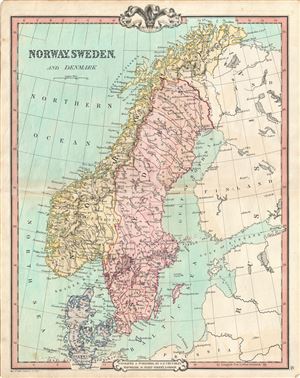
Norway, Sweden and Denmark.
sold
- Digital Map Information
- Suitable for large format printing
- DPI: 300
- File Size: 8.91 MB
- File Type: ZIP / TIFF
- ICC color profile embedded
- Delivered instantly via download link
This is a fine example of G. F. Cruchley's 1850 map of Scandinavia, including Norway, Sweden and Denmark. It covers from the Arctic south to Holstein and east as far as the Gulf of Finland. As this map ... (more details)
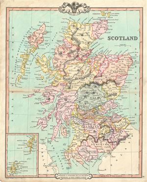
Scotland.
sold
- Digital Map Information
- Suitable for large format printing
- DPI: 300
- File Size: 7.86 MB
- File Type: ZIP / TIFF
- ICC color profile embedded
- Delivered instantly via download link
An attractive map of Scotland by George Frederick Cruchley dated to 1850. It covers Scotland from the Orkney Islands to Wigton in the south, including the Hebrides or Western Isles. The Shetland and ... (more details)
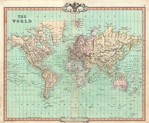
The World.
sold
- Digital Map Information
- Suitable for large format printing
- DPI: 300
- File Size: 8.49 MB
- File Type: ZIP / TIFF
- ICC color profile embedded
- Delivered instantly via download link
This is a fine example of G.F. Cruchley's 1850 map of the World. An interesting map issued just as most of the Earth's non-polar shores had been explored. Cruchley depicts the world showing the six ... (more details)
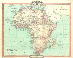
Africa.
sold
- Digital Map Information
- Suitable for large format printing
- DPI: 300
- File Size: 8.04 MB
- File Type: ZIP / TIFF
- ICC color profile embedded
- Delivered instantly via download link
This is a beautiful 1852 map of Africa issued by George Frederick Cruchley. It details the continent of Africa, including Madagascar, on the cusp of the great exploratory expeditions of the mid-19th ... (more details)
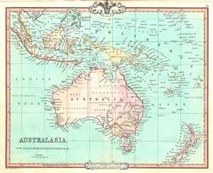
Australasia, New Zealand, East India Islands, etc. etc.
sold
- Digital Map Information
- Suitable for large format printing
- DPI: 300
- File Size: 6.55 MB
- File Type: ZIP / TIFF
- ICC color profile embedded
- Delivered instantly via download link
This is a fine example of George Frederick Cruchley's 1852 map of Australia, New Zealand and the East India Islands. It covers from the Malay Peninsula to New Zealand, including Australia, Malaysia, ... (more details)
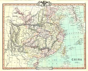
China.
sold
- Digital Map Information
- Suitable for large format printing
- DPI: 300
- File Size: 7.81 MB
- File Type: ZIP / TIFF
- ICC color profile embedded
- Delivered instantly via download link
A lovely 1852 map of China by George Frederick Cruchley. It covers the traditional provinces of mainland China, as well as adjacent Corea (Korea) and Formosa (Taiwan). Hong Kong Island and Macao ... (more details)
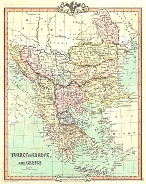
Turkey in Europe, and Greece.
sold
- Digital Map Information
- Suitable for large format printing
- DPI: 300
- File Size: 7.45 MB
- File Type: ZIP / TIFF
- ICC color profile embedded
- Delivered instantly via download link
This is a beautiful 1852 map of Greece, the Balkans and the European part of Turkey by George Frederick Cruchley. It covers from Moldavia to Candia and from the Gulf of Venice or the Adriatic Sea ... (more details)
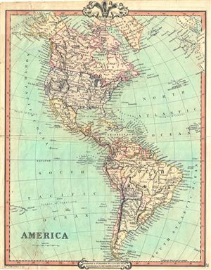
America.
sold
- Digital Map Information
- Suitable for large format printing
- DPI: 300
- File Size: 8.93 MB
- File Type: ZIP / TIFF
- ICC color profile embedded
- Delivered instantly via download link
This is an attractive 1852 map of North and South America by George Frederick Cruchley. The map covers all of North America as well as South America from the Arctic to Cape Horn. In North ... (more details)
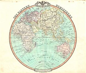
The Eastern Hemisphere.
sold
- Digital Map Information
- Suitable for large format printing
- DPI: 300
- File Size: 7.09 MB
- File Type: ZIP / TIFF
- ICC color profile embedded
- Delivered instantly via download link
A fascinating 1852 map of the Eastern Hemisphere issued by George Frederick Cruchley. It offers a fascinating snapshot of the world during a period of rapid globalization and discovery, ... (more details)
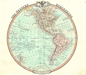
The Western Hemisphere.
sold
- Digital Map Information
- Suitable for large format printing
- DPI: 300
- File Size: 6.4 MB
- File Type: ZIP / TIFF
- ICC color profile embedded
- Delivered instantly via download link
A beautiful 1852 George Frederick Cruchley map of the Western Hemisphere. It offers a fascinating snapshot of the world during a period of rapid globalization and discovery, and ... (more details)
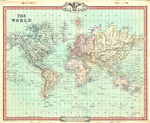
The World.
sold
- Digital Map Information
- Suitable for large format printing
- DPI: 300
- File Size: 9.03 MB
- File Type: ZIP / TIFF
- ICC color profile embedded
- Delivered instantly via download link
This is a fine example of G.F. Cruchley's 1852 map of the World. An interesting map issued just as most of the Earth's non-polar shores had been explored. Cruchley depicts the ... (more details)
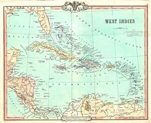
West Indies.
sold
- Digital Map Information
- Suitable for large format printing
- DPI: 300
- File Size: 6.58 MB
- File Type: ZIP / TIFF
- ICC color profile embedded
- Delivered instantly via download link
This is a beautiful 1852 map of the West Indies by George Frederick Cruchley. Centered on Haiti or San Domingo (Hispaniola), the map covers the Caribbean from Florida to ... (more details)
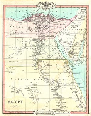
Egypt.
sold
- Digital Map Information
- Suitable for large format printing
- DPI: 300
- File Size: 5.7 MB
- File Type: ZIP / TIFF
- ICC color profile embedded
- Delivered instantly via download link
This is an attractive 1853 map of Egypt issued by George Frederick Cruchley. Centered on the Nile Valley, Cruchley's map covers Egypt from the Mediterranean to Nubia. ... (more details)
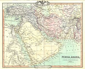
Persia, Arabia, Cabool, Afghanistan, etc.
sold
- Digital Map Information
- Suitable for large format printing
- DPI: 300
- File Size: 8.73 MB
- File Type: ZIP / TIFF
- ICC color profile embedded
- Delivered instantly via download link
A fine example of the 1853 map of Persia, Arabia and Afghanistan by G. F. Cruchley. Centered on the Persian Gulf, this map covers from the Mediterranean and Red Sea ... (more details)
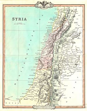
Syria.
sold
- Digital Map Information
- Suitable for large format printing
- DPI: 300
- File Size: 6.27 MB
- File Type: ZIP / TIFF
- ICC color profile embedded
- Delivered instantly via download link
This is an appealing 1853 map of Syria issued by George Frederick Cruchley. It covers from Tripoli to the Dead Sea and includes the modern day countries of Lebanon, ... (more details)