
Bien, Julius

Julius (Julien) Bien (September 27, 1826 - December 21, 1909) was a German-Jewish lithographer and engraver based in New York City. Bien was born in Naumburg, Germany. He was educated at the Academy of Fine Arts, Cassell and at Städel's Institute, Frankfurt-am-Main. Following the suppression of the anti-autocratic German Revolutions of 1848, Bien, who participated in the pan-German movement, found himself out of favor in his home country and joined the mass German immigration to the United States. Bien can be found in New York as early as 1849. He established the New York Lithographing, Engraving & Printing Company in New York that focused on the emergent chromo-lithograph process - a method of printing color using lithographic plates. His work drew the attention of the U.S. Government Printing Office which contracted him to produce countless government maps and surveys, including the Pacific Railroad Surveys, the census, numerous coast surveys, and various maps relating to the American Civil War. Bien also issued several atlases both privately and in conjunction with a relation, Joseph Bien. At the height of his career Bien was elected president of the American Lithographers Association. After his death in 1909, Bien's firm was taken over by his son who promptly ran it into insolvency. The firm was sold to Sheldon Franklin, who, as part of the deal, retained the right to publish under the Julius Bien imprint. In addition to his work as a printer, Bien was active in the New York German Jewish community. He was director of the New York Hebrew Technical Institute, the New York Hebrew Orphan Asylum, and president of the B'nai B'rith Order.
First Battle of Corinth.
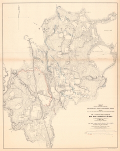
Map of the Country Between Monterey, Tenn. And Corinth,Miss. Showing the Lines of Entrenchments Made and the Routes Followed by the U.S. Forces under the Command of Maj. Gen'l. Halleck, U.S. Army, in Their Advance Upon Corinth, in May 1862.
$500.00
Acquire
- Digital Map Information
- Suitable for large format printing
- File Size: 78.4 MB
- File Type: ZIP / TIFF
- ICC color profile embedded
- Delivered instantly via download link
This is a separate issue 1862 Otto H. Matz map of American Civil War troop movements leading to the capture of Corinth, Mississippi, in May 1862. The map depicts from Cane Creek and the Tuscumbia River to Springer, Tennessee and Johnston, Mississippi and from Monterey, Tennessee to the George homestead in Mississippi. (more details)
Immediately prior to Cold Harbor.
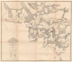
Map of the Battlefields of The Tolopotomoy and Bethesda Church Showing the Field of Operations of the Army of the Potomac Commanded by Maj. Gen. George G. Meade U.S. Army From May 28th to June 2nd 1864.
$750.00
Acquire
- Digital Map Information
- Suitable for large format printing
- File Size: 32.4 MB
- File Type: ZIP / TIFF
- ICC color profile embedded
- Delivered instantly via download link
This is an 1864 Charles W. Howell and James C. Duane map of the battle of Totopotomoy Creek, fought during the American Civil War (1861 - 1865). Depicting the battlefield and the immediate surroundings, red highlights Confederate lines while blue emphasizes Union positions. Red and blue lines illustrate Confederate positions captured by the Union. Army of the Potomac headquarters throughout the battle are labeled and marked with a small American flag. Homesteads in the region, the local store, and churches are identified by name. (more details)
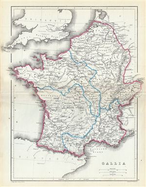
Gallia.
$100.00
Acquire
- Digital Map Information
- Suitable for large format printing
- File Size: 4.41 MB
- File Type: ZIP / TIFF
- ICC color profile embedded
- Delivered instantly via download link
A fine 1867 map of Gaul or Gallia or France by William Hughes. The map covers Gallia during the ancient Roman times and covers from the English Channel south as far as the Pyrenees Mountains and Hispania. It includes the modern day nations of France, Luxembourg, ... (more details)
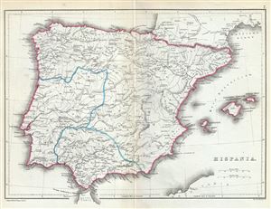
Hispania.
$100.00
Acquire
- Digital Map Information
- Suitable for large format printing
- File Size: 3.53 MB
- File Type: ZIP / TIFF
- ICC color profile embedded
- Delivered instantly via download link
This is a lovely 1867 map of Hispania or Spain and Portugal by William Hughes. The map depicts the Iberian Peninsula under the Roman Empire from the Atlantic Ocean to the Mediterranean Sea, including the Balearic Islands. The Roman provinces of Tarraconensis, ... (more details)
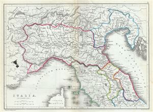
Italia (Northern Part).
$100.00
Acquire
- Digital Map Information
- Suitable for large format printing
- File Size: 3.89 MB
- File Type: ZIP / TIFF
- ICC color profile embedded
- Delivered instantly via download link
This is a fine 1867 William Hughes map of northern Italy during ancient Roman times. The map depicts the northern part of Italy from Lake Geneva in Switzerland to Lake Bolsena in Italy. The map identifies a host of important cities and towns and uses ancient ... (more details)

Italia (Southern Part).
$100.00
Acquire
- Digital Map Information
- Suitable for large format printing
- File Size: 4.06 MB
- File Type: ZIP / TIFF
- ICC color profile embedded
- Delivered instantly via download link
This is a fine 1867 William Hughes map of southern Italy during ancient Roman times. The map depicts the southern part of Italy from Lake Bolsena to Reggio in southern Italy. The map does not detail Sicily. An inset along the left border features the ... (more details)
The first published map of the area around Appomattox Court House - where the U.S. Civil War ended.
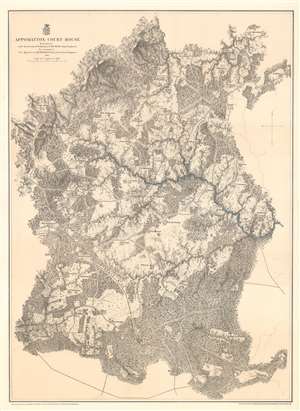
Appomattox Court House.
$450.00
Acquire
- Digital Map Information
- Suitable for large format printing
- File Size: 51.46 MB
- File Type: ZIP / TIFF
- ICC color profile embedded
- Delivered instantly via download link
This is an 1867 John Weyss and Nathaniel Michler map of Appomattox Court House, Virginia, where the American Civil War came to a close. The map depicts the region from Appomattox Station on the South Side Railroad to the Jenkins homestead and from the homestead of L. Marshall to Evergreen Station. Beautifully engraved, the area surrounding Appomattox Court House is illustrated in detail, with numerous homesteads noted throughout. Roads traverse the area, along with the South Side Railroad, and rivers and streams are noted. Forests and hills are also included. Troop locations and movements, however, are not depicted. (more details)
Lee's retreat from Richmond.
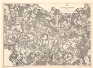
High Bridge and Farmville.
$375.00
Acquire
- Digital Map Information
- Suitable for large format printing
- File Size: 62.46 MB
- File Type: ZIP / TIFF
- ICC color profile embedded
- Delivered instantly via download link
This is an 1867 John Weyss and Nathaniel Michler map of the Battle of High Bridge, Virginia (1865) - a late American Civil War (1861- 1865) engagement of the Appomattox Campaign. The map depicts the region from the farmstead of A. Adams to the Parkinson homestead and from the home of H. Burt to Rice's Depot. Numerous other homesteads, farmsteads, churches, and mills are identified, along with Farmville and Jamestown on the Appomattox River, and Rice's Depot. The map highlights roads in the region, including the important Agola Road. (more details)
Ending the stalemate.
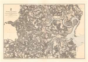
Bermuda Hundred.
$375.00
Acquire
- Digital Map Information
- Suitable for large format printing
- File Size: 48.99 MB
- File Type: ZIP / TIFF
- ICC color profile embedded
- Delivered instantly via download link
This is an 1867 John Weyss and Nathaniel Michler map of the Bermuda Hundred Campaign during the American Civil War. The map depicts the region from the Dunnson farm to the Jordan's Point Lighthouse on the James River and from Chaffin's Bluff and Drury's (Drewry's) Bluff to the J. Mason farm. (more details)
Lee's final victory.
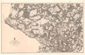
Cold Harbor.
$375.00
Acquire
- Digital Map Information
- Suitable for large format printing
- File Size: 53.87 MB
- File Type: ZIP / TIFF
- ICC color profile embedded
- Delivered instantly via download link
This is an 1867 John Weyss and Nathaniel Michler map of the battlefield of Cold Harbor, Virginia. The map depicts from the Virginia Central Railroad to Emanuel Church and Black Creek Church and from the Linney Farm to the Taylor Farm. The last battle of Union Lieutenant General Ulysses S. Grant's Overland Campaign, the Battle of Cold Harbor was a lopsided victory for General Robert E. Lee and the Confederacy, but it would prove to be his last. Grant had achieved the goal of the Overland Campaign and forced Lee into defending Richmond, the capital of the Confederacy, and Petersburg behind a network of trenches and other fortifications. Soon after the Battle of Cold Harbor, the Richmond-Petersburg Campaign, more popularly known as the Siege of Petersburg, began. This campaign was a nine-month saga of trench warfare and small battles, culminating in the capture of Petersburg and the evacuation of Richmond by the Confederate government. (more details)
One the earliest obtainable maps of Yosemite!
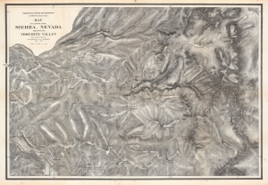
Map of a portion of the Sierra Nevada adjacent to the Yosemite Valley...
$950.00
Acquire
- Digital Map Information
- Suitable for large format printing
- File Size: 204.21 MB
- File Type: ZIP / TIFF
- ICC color profile embedded
- Delivered instantly via download link
This is an 1868 edition of Charles Hoffmann and James Gardiner's detailed map of Yosemite Valley, California, and its surroundings, considered one of the earliest obtainable maps of that region. This map represents early government efforts under Frederick Law Olmsted and Josiah Dwight Whitney to map Yosemite as America's first reserved parkland. It offers superb detail, noting El Capitan, Cathedral Peak, Yosemite Fall(s), Half Dome, the Merced and San Joaquin Rivers, Lake Eleanor, a portion of Mono Lake, and much more. (more details)
One the earliest obtainable maps of Yosemite!
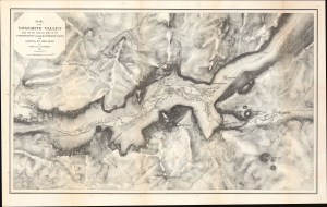
Map of the Yosemite Valley from Surveys made by order of the Commissioners to manage the Yosemite Valley and Mariposa Big Tree Grove.
$1,200.00
Acquire
- Digital Map Information
- Suitable for large format printing
- Full resolution TIFF file
- ICC color profile embedded
- Delivered instantly via download link
This is Clarence King and James Terry Gardiner's detailed map of the Yosemite Valley, California. Published in 1870, it is considered one of the earliest obtainable maps of that region. This map represents early government efforts under Frederick Law Olmsted and Josiah Dwight Whitney to map Yosemite as America's first reserved parkland. It offers superb detail, noting the Merced River, Virgin Tears, Yosemite Falls, Sentinel Rock and Dome, Bridal Veil Falls and Creek, Mariposa Trail, and much more. Important buildings on the valley floor also appear - including Yosemite's first two tourist hotels! (more details)
Administering the new Hawaii Territory.
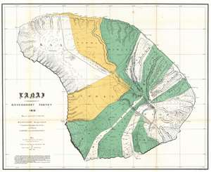
Lanai Government Survey.
$750.00
Acquire
- Digital Map Information
- Suitable for large format printing
- File Size: 37.18 MB
- File Type: ZIP / TIFF
- ICC color profile embedded
- Delivered instantly via download link
This is an exceptional 1878 map of the island of Lanai, in the Hawaiian Islands, prepared for the 1900 Report of the Governor of the Territory of Hawaii to the Secretary of the Interior. Although the cartographic work that produced this map was started in 1878, during the Hawaiian Monarchy, the map itself, and the report that contained it, was issued following the U.S. Government's 1898 annexation of the Hawaiian Republic. The Report was an attempt to assess and examine the newly created Hawaiian Territory's potential for Americanized administration and development. Consequently, the map focuses on Public Lands, Homestead Settlement Tracts, Grazing Lands, Pineapple Lands, Sugar Plantations, Forest Reserves, Forest Lands, Wet Lands, etc. It also features both practical and topographic details for use in administering the region. The governor at this time was George R. Carter. (more details)
Surveying the frontier.
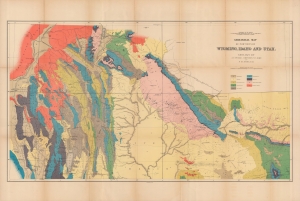
Geological map of portions of Wyoming, Idaho and Utah.
$400.00
Acquire
- Digital Map Information
- Suitable for large format printing
- File Size: 36.93 MB
- File Type: ZIP / TIFF
- ICC color profile embedded
- Delivered instantly via download link
A colorful 1878 geological map of the border region between Wyoming, Idaho, and Utah produced by the U.S. Geological and Geographical Survey of the Territories (USGGST). It was one of several such maps to appear in the Twelfth Annual Report of the USGGST, representing the first detailed geological surveys undertaken in this portion of the American West. (more details)
High Desert and Higher Mountains.
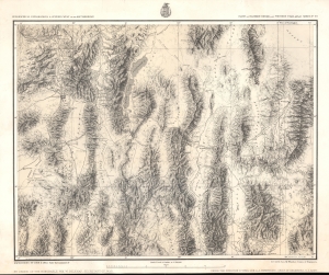
Parts Of Eastern Nevada And Western Utah, Atlas Sheet No. 49.
$350.00
Acquire
- Digital Map Information
- Suitable for large format printing
- File Size: 24.13 MB
- File Type: ZIP / TIFF
- ICC color profile embedded
- Delivered instantly via download link
A detailed c. 1879 George Montague Wheeler survey map of northeastern Nevada and northwestern Utah, issue for the Topographical Atlas Projected to Illustrate United States Geographical Surveys West of the 100th Meridian of Longitude. It is one of the earliest detailed maps of this region and includes interesting details on the Native American and early American inhabitants of the area, including mines, ranches, and early settlements. (more details)
Heartland of the Rockies
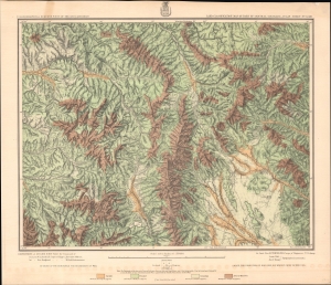
Land Classification Map Of Part Of Central Colorado, Atlas Sheet No. 52 (D).
$350.00
Acquire
- Digital Map Information
- Suitable for large format printing
- File Size: 29.51 MB
- File Type: ZIP / TIFF
- ICC color profile embedded
- Delivered instantly via download link
A chromolithograph survey map of the Rocky Mountains and environs in central Colorado, prepared in 1879 by George Wheeler and associates, representing the first detailed surveys of these lands. (more details)
First detailed survey of the Grand Canyon.
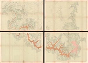
Geologic Map of the Southern Part of the Kaibab Plateau. / Geologic Map of the Southern Part of the Kaibab Plateau. / Geologic Map of the Grand Cañon in the Kaibab Plateau. / Geologic Map of the Southern part of the Kaibab Plateau - Head of the Grand Cañon.
$950.00
Acquire
- Digital Map Information
- Suitable for large format printing
- File Size: 101.44 MB
- File Type: ZIP / TIFF
- ICC color profile embedded
- Delivered instantly via download link
The first map of the Grand Canyon based on actual surveys - this is Clarence E. Dutton's 1882 four-part map of the Grand Canyon, published for the Atlas to Accompany the Monograph on the Tertiary History of the Grand Cañon District. (more details)
Important Charles Sargent forestry map of North America illustrating cypress growth
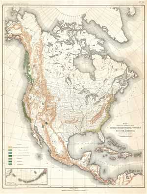
Map Showing the Distribution of the Genera Chamæcyparis and Cupressus in North America. Exclusive of Mexico.
$300.00
Acquire
- Digital Map Information
- Suitable for large format printing
- File Size: 9.89 MB
- File Type: ZIP / TIFF
- ICC color profile embedded
- Delivered instantly via download link
This is an 1884 Charles Sprague Sargent arboreal thematic map of North America. The map depicts the continent of North America from the Arctic Ocean, Alaska, and Canada south to Mexico and Central America as well as the extreme northern reaches of South ... (more details)
Dawn of Modern New York City.
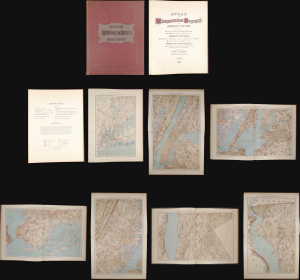
This is a stunning elephant folio chromolithograph atlas of New York City and environs by Julius Bien and C. C. Vermeule, dated 1891. It captures New York City and its surrounding area during a period of frenetic growth and modernization, which, in the following years, led to the consolidation of the five boroughs and the adoption of cutting-edge technology to facilitate the movement of people and goods through the metropolis. (more details)
Stunning map of the Hamptons, Long Island's summer paradise.
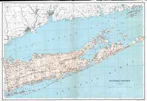
Suffolk County.
$700.00
Acquire
- Digital Map Information
- Suitable for large format printing
- File Size: 12.83 MB
- File Type: ZIP / TIFF
- ICC color profile embedded
- Delivered instantly via download link
This is an 1895 Julius Bien map of Suffolk County, New York. The map depicts the region from Queens County to Fishers Island and from Connecticut to the Atlantic Ocean. Highly detailed, the map illustrates and labels all the municipalities of Suffolk ... (more details)
Supplying the City and Suburbs with Water.
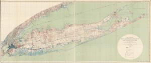
Map Showing the Waterworks Systems of Long Island, New York.
$1,500.00
Acquire
- Digital Map Information
- Suitable for large format printing
- File Size: 88.83 MB
- File Type: ZIP / TIFF
- ICC color profile embedded
- Delivered instantly via download link
This is a large-format 1903 map of Long Island by A.C. Veatch and Isaiah Bowman of the U.S. Geological Survey. It highlights the island's waterworks system, an essential factor in Long Island's rapid development in the early 20th century. (more details)
The Grand Canyon of Yellowstone.
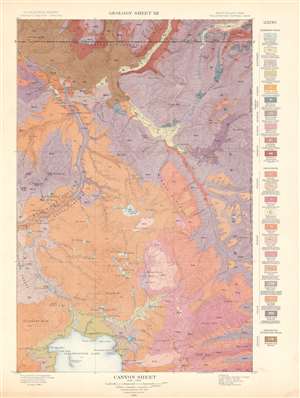
Canyon Sheet. Geology Sheet XII.
$250.00
Acquire
- Digital Map Information
- Suitable for large format printing
- File Size: 28.56 MB
- File Type: ZIP / TIFF
- ICC color profile embedded
- Delivered instantly via download link
This is a 1904 Arnold Hague's U.S. Geological Survey geological map of the spectacular Grand Canyon of the Yellowstone in Yellowstone National Park, Wyoming. The map depicts the entire Canyon Region and the Absaroka Range from the Yellowstone Lake northward, along the Yellowstone River, as far as the Hellroaring Creek in Montana. Many well-known Yellowstone sites are noted, including Elephant Back, Mirror Plateau, Sherman Volcano, and Fossil Forest, as well as various springs, peaks, creeks, and lakes. Twenty-two different colors highlight differing geological formations throughout the region and correspond with a legend situated along the right border. (more details)
A topographic map highlighting Yellowstone National Park's unique topography.
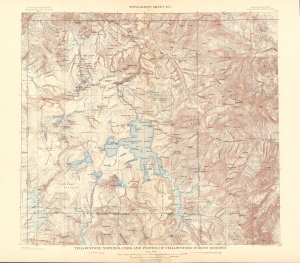
Yellowstone National Park and Portion of Yellowstone Forest Reserve. Topography Sheet XVI.
$250.00
Acquire
- Digital Map Information
- Suitable for large format printing
- File Size: 31.43 MB
- File Type: ZIP / TIFF
- ICC color profile embedded
- Delivered instantly via download link
This is a 1904 Arnold Hague and U.S. Geological Survey topographic map of Yellowstone National Park, Wyoming. Centered on the Yellowstone Lake, the largest mountain lake in the United States, the map depicts the entirety of Yellowstone National Park, as well as part of the Yellowstone Forest Reserve. It is part of Hague's study of the region's unique geology and related geothermal activity. Contour lines highlight the region's unique topography with elevation noted every 500 feet. A dashed line representing the Continental Divide winds its way through the park, while the red dashed lines mark roads. Creeks, rivers, and lakes are labeled, as are plateaus, gulches, and mountain peaks. (more details)
A topographic map of Travertine Terrace, Yellowstone National Park.
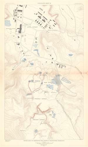
Detail Map of Mammoth Hot Springs Travertine Terraces. Topography Sheet XX.
$250.00
Acquire
- Digital Map Information
- Suitable for large format printing
- File Size: 23.7 MB
- File Type: ZIP / TIFF
- ICC color profile embedded
- Delivered instantly via download link
This is a 1904 Arnold Hague and U.S. Geological Survey topographic map of spectacular Mammoth Hot Springs Travertine Terraces of Yellowstone National Park, Wyoming. Centered on Cleopatra Spring in Minerva Terrace, the map depicts the Travertine Terraces from the Painted Pool on the White Elephant in Highland Terrace to McCartney Cave in Hotel Terrace. It also identifies Liberty Cap on Hymen Terrace. Contour lines highlight the region's unique topography with elevation noted every 500 feet. Roads and buildings are illustrated, including the Mammoth Hot Springs Hotel. (more details)
Water Supply for the Great Metropolis.
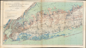
Map showing the Position of the Main Ground-water Table on Long Island, New York.
$350.00
Acquire
- Digital Map Information
- Suitable for large format printing
- Full resolution TIFF file
- ICC color profile embedded
- Delivered instantly via download link
This is a 1904 map of the groundwater table and water supply infrastructure on western Long Island produced by the U.S. Geological Survey. Part of the effort to map Long Island's water resources, it addressed a critical need for information as the water demands of the rapidly growing New York City increased. (more details)
Mammoth Hot Springs and the immediate vicinity.
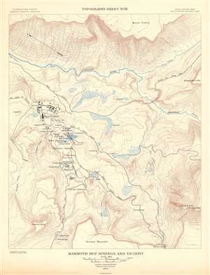
Mammoth Hot Springs and Vicinity. Topography Sheet XVIII.
$250.00
Acquire
- Digital Map Information
- Suitable for large format printing
- File Size: 16.72 MB
- File Type: ZIP / TIFF
- ICC color profile embedded
- Delivered instantly via download link
This is a 1904 Arnold Hague and U.S. Geological Survey topographic map of the spectacular Mammoth Hot Springs in Yellowstone National Park, Wyoming. The map depicts Mammoth Hot Spring Terraces from Terrace Mountain to Mount Everts. Building over thousands of years and still growing, the Mammoth Terraces constantly change shape and color. The map also features a handful of buildings, including the famous Mammoth Hotel built over the old terrace formation called Hotel Terrace. Contour lines highlight the region's unique topography with elevation noted every 500 feet. A dashed line representing the Continental Divide winds its way through the park, while the red dashed lines mark roads. Creeks, rivers, and lakes are labeled, as are plateaus, gulches, and mountain peaks. (more details)
Mammoth Hot Springs and the immediate vicinity.
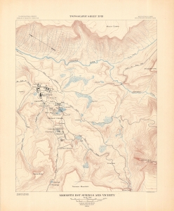
Mammoth Hot Springs and Vicinity. Topography Sheet XVIII.
$250.00
Acquire
- Digital Map Information
- Suitable for large format printing
- File Size: 45.63 MB
- File Type: ZIP / TIFF
- ICC color profile embedded
- Delivered instantly via download link
This is a 1904 Arnold Hague and U.S. Geological Survey topographic map of the spectacular Mammoth Hot Springs in Yellowstone National Park, Wyoming. The map depicts Mammoth Hot Spring Terraces from Terrace Mountain to Mount Everts. Building over thousands of years and still growing, the Mammoth Terraces constantly change shape and color. The map also features a handful of buildings, including the famous Mammoth Hotel built over the old terrace formation called Hotel Terrace. Contour lines highlight the region's unique topography with elevation noted every 500 feet. A dashed line representing the Continental Divide winds its way through the park, while the red dashed lines mark roads. Creeks, rivers, and lakes are labeled, as are plateaus, gulches, and mountain peaks. (more details)
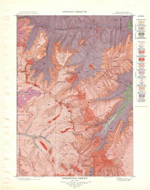
Ishawooa Sheet. Geology Sheet XV.
$250.00
Acquire
- Digital Map Information
- Suitable for large format printing
- File Size: 16.15 MB
- File Type: ZIP / TIFF
- ICC color profile embedded
- Delivered instantly via download link
A fine example of Arnold Hague's 1904 geological survey map of the spectacular Ishawooa Region in the Yellowstone National Park, Wyoming. Centered on Ishawooa Cone, the map covers the Absaroka Range from the Thorofare Plateau and Ash Mountain to ... (more details)
Home of the world's largest geysers - the Steamboat Geyser.
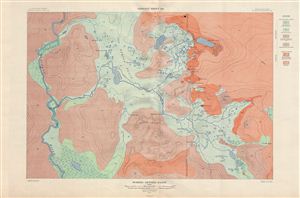
Norris Geyser Basin. Geology Sheet XXI.
$250.00
Acquire
- Digital Map Information
- Suitable for large format printing
- File Size: 26.84 MB
- File Type: ZIP / TIFF
- ICC color profile embedded
- Delivered instantly via download link
A fine example of Arnold Hague's 1904 topographical survey map of the spectacular Norris Geyser Basin in Yellowstone National Park, Wyoming. Centered on Tantalus Creek and the Reservoir (100 Spring Plain), the map covers the basin Gibbon River to ... (more details)
The geological wonder of Yellowstone.
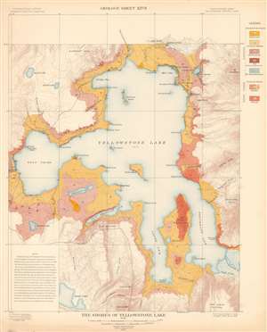
The Shores of Yellowstone Lake. Geology Sheet XXVII.
$250.00
Acquire
- Digital Map Information
- Suitable for large format printing
- File Size: 31.23 MB
- File Type: ZIP / TIFF
- ICC color profile embedded
- Delivered instantly via download link
A fine example of Arnold Hague's 1904 geological survey map of the shores of Yellowstone Lake in Yellowstone National Park, Wyoming. Centered on the Yellowstone Lake, the largest mountain lake in the United States, the map details the lake, its shores, and adjacent terraces and slopes. The map is part of Hague's study of the region's unique geology and related geothermal activity. A legend situated on the upper right identifies the various geological formations and matches them with the corresponding colors used here. A note in the lower left cites an 1889 geological survey of Yellowstone Lake. It also provides a short history of Yellowstone Lake's formation. (more details)
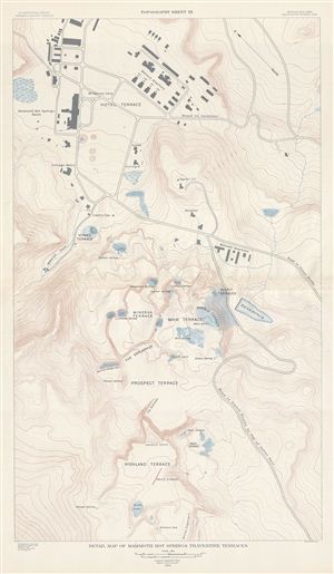
Detail Map of Mammoth Hot Springs Travertine Terraces. Topography Sheet XX.
$250.00
Acquire
- Digital Map Information
- Suitable for large format printing
- File Size: 17.9 MB
- File Type: ZIP / TIFF
- ICC color profile embedded
- Delivered instantly via download link
A fine example of Arnold Hague's 1904 topographical survey map of the spectacular Mammoth Hot Springs Travertine Terraces in Yellowstone National Park, Wyoming. Centered on the Cleopatra Spring in Minerva Terrace, this detailed map covers the ... (more details)
Northern Florida soil survey.
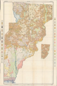
Soil map, Florida, Jefferson County sheet.
$350.00
Acquire
- Digital Map Information
- Suitable for large format printing
- File Size: 57.36 MB
- File Type: ZIP / TIFF
- ICC color profile embedded
- Delivered instantly via download link
A tall and impressive map of Jefferson County, situated in the Florida Panhandle, produced by the U.S. Department of Agriculture's Bureau of Soils in 1907. It carefully catalogs the area's sandy soils, part of a broader effort to survey Florida's soils in the early 20th century. (more details)
Surveying the sands of the Florida Panhandle.
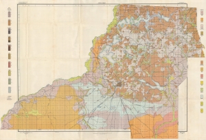
Soil map, Florida, Leon County sheet.
$400.00
Acquire
- Digital Map Information
- Suitable for large format printing
- File Size: 55.26 MB
- File Type: ZIP / TIFF
- ICC color profile embedded
- Delivered instantly via download link
A large and colorful soil map of Leon County, Florida, including Tallahassee, produced by the Bureau of Soils in 1905. It carefully catalogs the area's sandy soils, part of a broader effort to survey Florida's soils in the early 20th century. (more details)
Long Island, from the ground up.
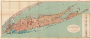
Geologic Map of Long Island, New York.
$1,000.00
Acquire
- Digital Map Information
- Suitable for large format printing
- File Size: 79.45 MB
- File Type: ZIP / TIFF
- ICC color profile embedded
- Delivered instantly via download link
This is a colorful large format 1913 geological map of Long Island made by the U.S. Geological Survey and the geologist Myron Fuller. It displays geological data, mostly defined by glacial activity in the last ice age, as well as signs of development on the island, whose population was rapidly increasing when this map was made. (more details)
Long Island, primed for a population boom.
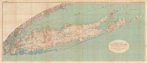
Topographic Map of Long Island, New York.
$1,000.00
Acquire
- Digital Map Information
- Suitable for large format printing
- File Size: 74.95 MB
- File Type: ZIP / TIFF
- ICC color profile embedded
- Delivered instantly via download link
This is a large format 1913 U.S. Geological Survey topographic map of Long Island. Aside from topography, the map provides a clear sense of the growing population and infrastructure of the island when the map was made. (more details)