
Walling, Henry Francis (sold)

Henry Francis Walling (June 11, 1825 - April 8, 1889) was an American civil engineer, cartographer, surveyor, and map publisher active from the middle to late 19th century. Walling was born in Providence, Rhode Island. He studied/worked at the Providence Athenaeum before discovering a talent for mathematics and surveying. Walling took a position with Samuel Barrett Cushing (1846 - 1888), a Providence-based civil engineer with whom he issued in 1846 a revision of James Steven's Topographical Map of the State of Rhode-Island. Walling established himself independently around 1850 and immediately began preparing a series of town plans focusing on Bristol County, near Providence. Buoyed by widespread interest in his plans, Walling expanded his operations to Massachusetts, where, by 1857, he had produced no less than 50 town plans. Apparently, Walling's business model involved a contract with town officials to produce a certain number of maps, after which he acquired the right to print and sell additional copies on his own account. This work eventually led to Walling's appointment as Massachusetts "Superintendent of the State Map", a designation that began appearing on his maps around 1855. While Walling's work focused heavily on city and county maps, he successfully published three scarce state maps: Maine, Vermont, and Rhode Island. In 1856, Walling relocated his headquarters to New York City, where he had better access to quality lithographers. The Civil War (1861 - 1865) proved difficult for Walling, and diminished sales may have forced him into a partnership with Ormando W. Gray, with whom he published numerous state, county, and national atlases in the 1860s and 1870s. Around 1880, Walling took a post with the U.S. Coast Survey, with whom he worked on various charts until requesting a transfer in 1883 to the newly formed U.S. Geological Survey. Walling remained with the Geological Survey until his untimely death of a heart attack in April 1889.
Rare map of Andover, Massachusetts identifying individual property owners.
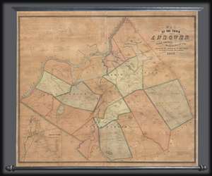
Map of the Town of Andover, Essex County, Massachusetts.
sold
- Digital Map Information
- Suitable for large format printing
- DPI: 300
- File Size: 33.99 MB
- File Type: ZIP / TIFF
- ICC color profile embedded
- Delivered instantly via download link
This is a scarce 1852 Henry F. Walling wall map of the towns of Andover and North Andover, Massachusetts. Like most Walling town maps, the cartographer has taken great pains to identify the homes of individual families and landowners, as well as important roads, ... (more details)
Scarce wall map of Rhode Island showing landholders.
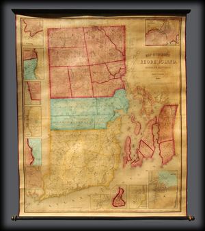
A remarkable rarely seen 1855 wall map of Rhode Island by the Civil engineer Henry F. Walling. Centered on Narragansett Bay, the map covers the entire state and offers no less than eleven detailed insets of various cities. Walling identifies countless ... (more details)
One of only 3 state maps issued by Walling.
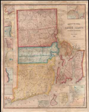
Map of the State of Rhode Island and Providence Plantations.
sold
- Digital Map Information
- Suitable for large format printing
- File Size: 103.61 MB
- File Type: ZIP / TIFF
- ICC color profile embedded
- Delivered instantly via download link
A scarce 1855 wall map of Rhode Island by the civil engineer Henry F. Walling. Centered on Narragansett Bay, the map covers the state and offers eleven detailed insets of various cities. Walling identifies countless individual estates and homesteads throughout - making this a treasure for anyone researching family history or mid-19th Rhode Island land holdings. Roads, counties, topography, railroads, lakes, and rivers are noted. Narragansett Bay features numerous depth soundings, no doubt drawn from the work of the U.S. Coast Survey. The insets, from top left detail Woonsocket, Pawtucket, Warren, Bristol, Westerly Village, Smithville (Scituate), Wickford, Block Island, Greenwich, Newport, and of course Providence. In the Providence inset the campus of Brown University is identified. (more details)
Bennington's transition into a regional commercial and manufacturing center.
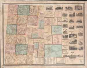
Map of Bennington County, Vermont.
sold
- Digital Map Information
- Suitable for large format printing
- File Size: 140.48 MB
- File Type: ZIP / TIFF
- ICC color profile embedded
- Delivered instantly via download link
This is an impressive large-scale 1856 wall map of Bennington County, Vermont, issued by Henry Francis Walling and C. B. Peckham. This map appeared just four years after the railroads arrived in Bennington, marking the town's transition into a regional manufacturing and commercial center. (more details)
Detailed map of The Berkshires, a haven for artists and music lovers in Massachusetts.
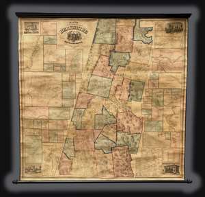
This is an 1858 Henry Francis Walling wall map of Berkshire County, Massachusetts. The map depicts Berkshire County from Williamstown, and North Adams to New Boston and Sheffield. Divided into townships, a highly detailed view of the county is presented. ... (more details)
The Berkshires.
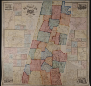
Map of the County of Berkshire Massachusetts.
sold
- Digital Map Information
- Suitable for large format printing
- File Size: 446.9 MB
- File Type: ZIP / TIFF
- ICC color profile embedded
- Delivered instantly via download link
This is an 1858 Henry Francis Walling wall map of Berkshire County, Massachusetts - the summer arts mecca. When issued, it was by far the largest and most detailed map of the Berkshires available. (more details)
'Down the Cape'.
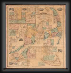
Map of the Counties of Barnstable, Dukes and Nantucket Massachusetts.
sold
- Digital Map Information
- Suitable for large format printing
- File Size: 263.56 MB
- File Type: ZIP / TIFF
- ICC color profile embedded
- Delivered instantly via download link
This is H. F. Walling's 1858 map of Cape Cod, Massachusetts, one of the largest and most decorative maps of this region to appear in the 19th century. The map encompasses from Buzzard Bay to Provincetown, embracing Barnstable, Dukes (Martha's Vineyard), and Nantucket counties. This was a map of exceptional significance to Walling since he was a Cape Codder himself, born and raised in Provincetown. The map thus is lavished with local detail at a density not present in most of his other work. (more details)
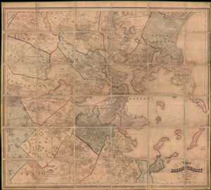
Map of Boston and its vicinity, from Actual Surveys
sold
- Digital Map Information
- Suitable for large format printing
- File Size: 29.7 MB
- File Type: ZIP / TIFF
- ICC color profile embedded
- Delivered instantly via download link
An expansive 1859 dissected case map of Boston, Massachusetts and its immediate vicinity compiled by Henry F. Walling. This enormous production is one of the large and most detailed maps of Boston to appear in the 19th century. Centered on Boston ... (more details)
First edition of an iconic Vermont map.
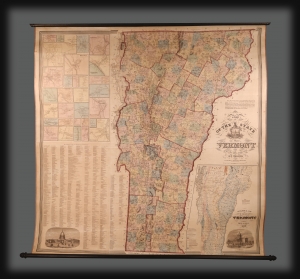
This is the extremely scarce 1859 first edition of H. F. Walling's spectacular wall map of Vermont, jointly published with 'Johnson and Browning'. It was the largest-scale and most accurate map of Vermont when it was issued, subsequently as the cartographic basis for two decades of Vermont maps. (more details)
Map of the most beautiful part of Coastal Maine, including Mount Desert Island and Acadia National Park.
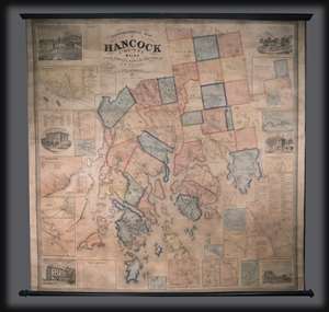
This is an 1860 Henry Francis Walling wall map of Hancock County, Maine. The map depicts from Aurora and Amherst to Isle au Haut and from the Penobscot River to Gouldsborough. Divided into townships, several towns in Hancock County are labeled, ... (more details)
Monumental map of Boston.
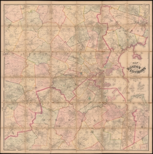
Map of the City of Boston and its Environs.
sold
- Digital Map Information
- Suitable for large format printing
- Full resolution TIFF file
- ICC color profile embedded
- Delivered instantly via download link
This is an 1867 Henry Francis Walling and Ormando W. Gray map of Boston, Massachusetts, and environs. Boston appears to the right of center, with East Boston and South Boston both labeled. Boston Common and the Public Garden are labeled in Boston, along with streets, wharves, railroad lines, and a handful of buildings. Outside Boston, the map depicts from Wilmington, Danvers, and North Beverly south to West Medway and Walpole Centre and from Ashland Center east to Marblehead, Salem, and Beverly. Hundreds (if not thousands) of private residences are identified by the owner's name throughout, along with banks, schools, railroad stations, churches, and cemeteries. Roads, railroads, hills, lakes, rivers, and other physical features are noted. (more details)
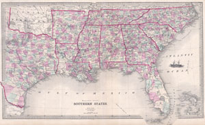
Southern States
sold
- Digital Map Information
- Suitable for large format printing
- File Size: 9.13 MB
- File Type: ZIP / TIFF
- ICC color profile embedded
- Delivered instantly via download link
This is an attractive map of the southeastern United States by Henry Walling. Dates to 1868, shortly after the conclusion of the Civil War. When this map was made the southern states were in the midst of economic depression and the ... (more details)
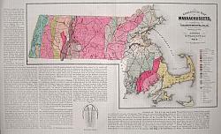
Massachusetts.
sold
- Digital Map Information
- Suitable for large format printing
- Full resolution TIFF file
- ICC color profile embedded
- Delivered instantly via download link
This hand-colored map is a steel-plate engraving, dating to 1871 by the American mapmakers Walling & Gray. It is a geological chart of Massachusetts. Vivid hand coloring, fine workmanship, and extreme detail are the hallmarks of ... (more details)
A Beautiful Map of Massachusetts Rich in Geological Data
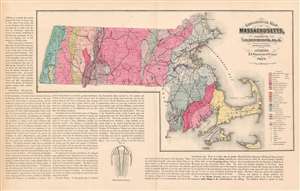
Geological Map of Massachusetts, Compiled by C. H. Hitchcock, Ph. D. Professor of Geology in Dartmouth College.
sold
- Digital Map Information
- Suitable for large format printing
- File Size: 23.38 MB
- File Type: ZIP / TIFF
- ICC color profile embedded
- Delivered instantly via download link
This is an attractive and richly informative geological map of Massachusetts, compiled by the geographer Charles Hitchcock and published by Walling and Gray in 1871. The map shows sources of iron, lead, copper, manganese and ... (more details)
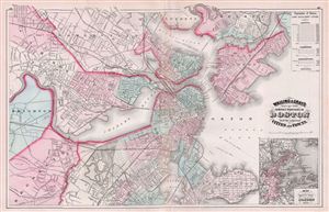
Walling & Gray's Map of the Compact Portions of Boston and the adjacent Cities and Towns.
sold
- Digital Map Information
- Suitable for large format printing
- File Size: 15.93 MB
- File Type: ZIP / TIFF
- ICC color profile embedded
- Delivered instantly via download link
A fine 1871 map of Boston, Massachusetts, published by Ormando Gray based upon the cartographic work of Henry S. Walling. The map covers central Boston as well as the adjacent cities and suburbs of South Boston, Brookline, ... (more details)
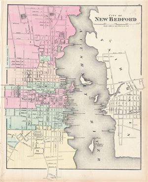
City of New Bedford.
sold
- Digital Map Information
- Suitable for large format printing
- File Size: 7.22 MB
- File Type: ZIP / TIFF
- ICC color profile embedded
- Delivered instantly via download link
A lovely 1871 map of the city of New Bedford, Massachusetts, by H. F. Walling and O. W. Gray. Centered on Acushnet River, the map covers the city from Sawyer St. to Cove St. and from Oak Grove Cemetery to Summer St. Color ... (more details)
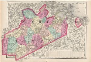
[Norfolk County].
sold
- Digital Map Information
- Suitable for large format printing
- File Size: 8.21 MB
- File Type: ZIP / TIFF
- ICC color profile embedded
- Delivered instantly via download link
This is a fine example of Walling and Gray's 1871 map of Norfolk County, Massachusetts. It covers the entire county along with parts of neighboring counties. The city of Boston is highly detailed. Needham, Brookline, ... (more details)
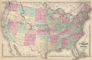
Map of the United States and Territories.
sold
- Digital Map Information
- Suitable for large format printing
- File Size: 15.11 MB
- File Type: ZIP / TIFF
- ICC color profile embedded
- Delivered instantly via download link
An attractive 1871 map of the United States issued by Henry Walling and Ormando Gray. This map covers the entire United States from Atlantic to Pacific, Canada to Mexico. It is color coded to identify all states. ... (more details)
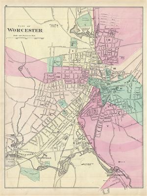
City of Worchester.
sold
- Digital Map Information
- Suitable for large format printing
- File Size: 7.6 MB
- File Type: ZIP / TIFF
- ICC color profile embedded
- Delivered instantly via download link
This is a fine example of Walling and Gray's 1871 map of the city of Worchester, Massachusetts. It covers the city from Salisbury Pond to Quinsigamond and Hop Cemetery. Color coded according to wards, the map is ... (more details)
Boston and its immediate surroundings.
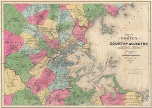
Map of Boston and the County Adjacent, From Actual Surveys.
sold
- Digital Map Information
- Suitable for large format printing
- Full resolution TIFF file
- ICC color profile embedded
- Delivered instantly via download link
This is an 1872 Henry Walling map of Boston, Massachusetts, and the surrounding region. Railroads run in and out of the city, including the Boston and Providence Railroad, the Boston and Worcester Railroad, and the Old Colony and Trail River Railroad. Several horse-drawn streetcar lines are illustrated as well. Boston Common, the hospital, state house, jail, and customs house are labeled within the city. Individual buildings appear, with some identified, such as factories, churches, and train stations. Concentric circles illustrating mile increments emanate from the State House in Boston. (more details)
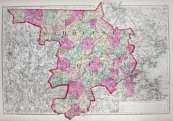
Middlesex County.
sold
- Digital Map Information
- Suitable for large format printing
- Full resolution TIFF file
- ICC color profile embedded
- Delivered instantly via download link
This hand-colored map is a steel-plate engraving, dating to 1873 by the American mapmakers Walling & Gray. It represents Middlesex County, Massachusetts. Middlesex County includes the immediate vicinity of ... (more details)
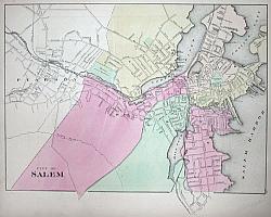
Salem, Massachusettes.
sold
- Digital Map Information
- Suitable for large format printing
- Full resolution TIFF file
- ICC color profile embedded
- Delivered instantly via download link
This hand-colored map is a steel-plate engraving, dating to 1873 by the American mapmakers Walling & Gray. It represents the city of Salem Massachusetts. Salem is infamous for the horrifying Salem ... (more details)
How people used to get out to the Vineyard.
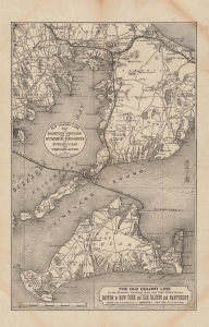
Old Colony Line map of Martha's Vineyard and the summer resorts of Buzzard's Bay and Vineyard Sound.
sold
- Digital Map Information
- Suitable for large format printing
- File Size: 13.01 MB
- File Type: ZIP / TIFF
- ICC color profile embedded
- Delivered instantly via download link
A c. 1886 Henry Francis Walling map of southern Cape Cod and Martha's Vineyard, highlighting the Old Colony Railroad network. It captures the region as it transitioned from whaling to tourism-based economies. The Old Colony network is illustrated near its height, with rail service to Cape Cod, ferry service to Martha's Vineyard, and a short-lived narrow-gauge railway on Martha's Vineyard itself. (more details)
A rare cyanotype print of a rare 19th century city plan of Bath, Maine.
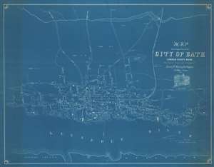
Map of the Compact Part of the City of Bath, Lincoln County, Maine.
sold
- Digital Map Information
- Suitable for large format printing
- File Size: 47.3 MB
- File Type: ZIP / TIFF
- ICC color profile embedded
- Delivered instantly via download link
A unique find, this is a 1934 Margaret W. Harkins cyanotype print of an 1851 Henry Frances Walling city map or plan of Bath, Maine. Oriented toward the west, the map depicts the city from Pine Street to the steam mill on the banks of the Kennebec River and from Sewell's Mills on what appears to be Whiskeag Creek west of town (although it is unlabeled) to the Kennebec River. Due to this map's unusually large scale for Walling city plans, the properties of individuals in town are illustrated and identified with the owner's name along with the streets and public buildings. Nearly all the streets are labeled, as are the wharves along the Kennebec, the shipyards, churches, hotels, and schools. City wards are labeled and the Kennebec and Portland Railroad line runs to a depot on the river. The ferry crossing from Bath to Woolwhich across the Kennebec is also illustrated. A view of Sagadahock House is situated just below the title. (more details)