
First printed map to accurately depict the southern shore of Java.
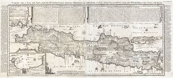
Carte de l'Ile de Java: partie Occidentale, partie Orientale, Dressée tout nouvellement sur les Mémoirs les plus exacts; Avec une Table des principales villes de cette Ile, La situation des comptoirs & autres places qu'y possedent les Hollandois, et des Remarques très curiueuses sur la maniere dont ils se sont établis dans la Ville de Batavia.
sold
- Digital Map Information
- Suitable for large format printing
- DPI: 300
- File Size: 20.25 MB
- File Type: ZIP / TIFF
- ICC color profile embedded
- Delivered instantly via download link
A beautiful example of Henri Chatelain's important 1718 map of Java. Covers the island in full as well as adjacent parts of Sumatra and Bali. Offers beautiful engraving and extraordinary detail throughout, noting rice plantations, mountain ranges, grazing lands, ... (more details)
An ephemeral map of Paris showing Napoleon's division of the city into 12 Municipalities.
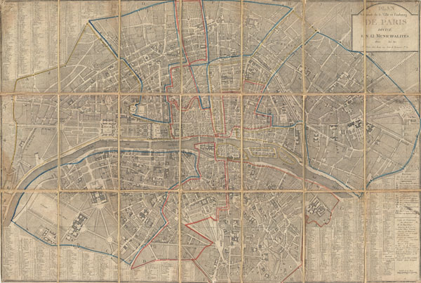
Plan Routier de la Ville et Faubourg de Paris Divise en 12 Municipalities.
sold
- Digital Map Information
- Suitable for large format printing
- DPI: 300
- File Size: 36.5 MB
- File Type: ZIP / TIFF
- ICC color profile embedded
- Delivered instantly via download link
An extraordinary map of pre-Haussmann Paris and the early Faubourgs (suburbs) issued in 1802, following Napoleon Bonaparte's 1800 reorganization of the city into 12 Municipalities. Covers Paris on both sides of the Seine from the Champ de Mars to Le Trone, ... (more details)
One of the last decorative maps of Florida and the Gulf of Mexico to appear in the 18th century.
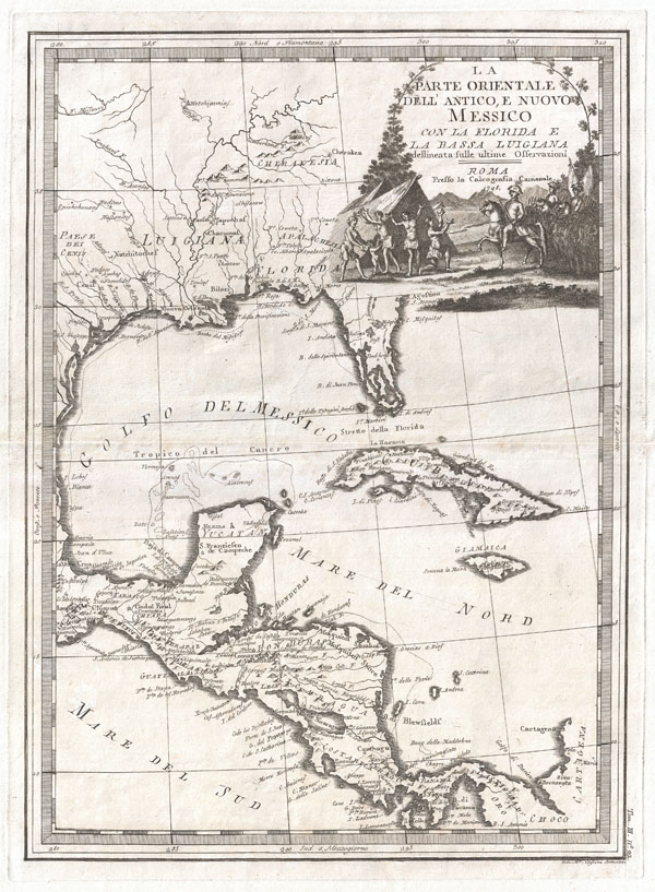
La parte orientale dell'antico e nuovo Messico con la Florida e la Bassa Luigiana dellineata sulle ultime osservazioni.
sold
- Digital Map Information
- Suitable for large format printing
- DPI: 300
- File Size: 11.5 MB
- File Type: ZIP / TIFF
- ICC color profile embedded
- Delivered instantly via download link
This is a stunningly rendered 1798 map of Florida, the Gulf of Mexico, Louisiana, and Central America by the Italian cartographer Giovanni Maria Cassini. While visually alluring, this map is cartographically primitive. Florida is here represented as an ... (more details)
Important Civil War Era mapping of the critical Mississippi River artery.
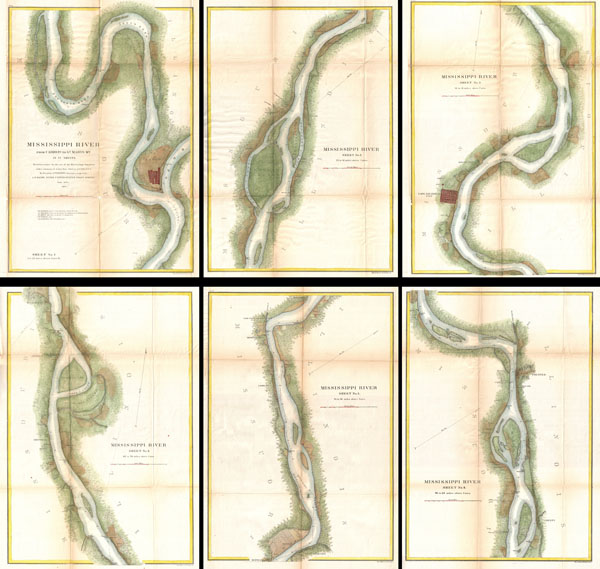
Mississippi River from Cairo Illinois to St. Mary’s Missouri in VI Sheets. Reconnaissance for the use of the Mississippi Squadron under the command of Acting Rear Admiral S.P.L.E.E, U.S.N. By the part of E. H. Gerdes, Assistant; assigned by A.D. Bache, Supdt. United States Coast Survey.
sold
- Digital Map Information
- Suitable for large format printing
- File Size: 53.97 MB
- File Type: ZIP / TIFF
- ICC color profile embedded
- Delivered instantly via download link
This is an important and rarely seen complete set of six charts from the 1865 U.S. Coast Survey mapping of the Mississippi River. Prepared by F. H. Gerdes, this map set details the territory from Cairo Illinois to St. Mary's Missouri. During the ... (more details)
Rare view depicting the 1655 Siege of Krakow, Poland.

Cracovia Sedes Regia obsessa età Serenissimo Sveo: Gothorum Rege Carolo Gustavo deditione capta d: 8 Octobr. 1655.
sold
- Digital Map Information
- Suitable for large format printing
- DPI: 300
- File Size: 12.97 MB
- File Type: ZIP / TIFF
- ICC color profile embedded
- Delivered instantly via download link
This is a rare 1697 view of Kracow (Cracow), Poland by the German historian Samuel Pufendorf. Depicts the city of Krakow at a pivotal moment in history as it resists the 1655 siege attempts of the Swedish King Carl Gustav X. Krakow appears in the ... (more details)
Seminal Map of the American Southwest by 'World's Greatest Living Man'.
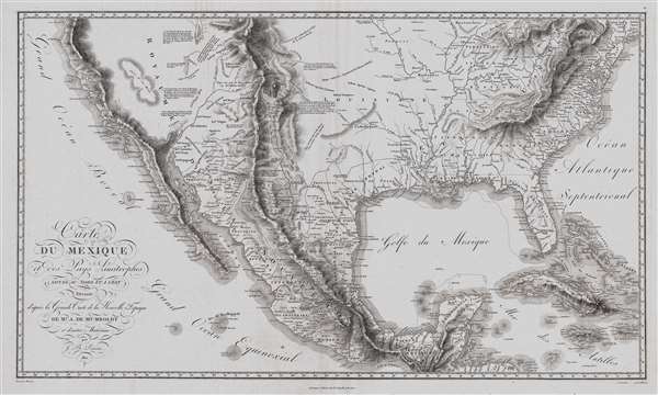
Carte Du Mexique et des Pays Limitrophes Situes Au Nord et a l'est Dressee d'apres la Grande Carte de la Nouvelle Espagne De Mr. A. De Humboldt et d'autres Materiaux par J.B. Poirson.
sold
- Digital Map Information
- Suitable for large format printing
- DPI: 300
- File Size: 15.17 MB
- File Type: ZIP / TIFF
- ICC color profile embedded
- Delivered instantly via download link
A seminal 1811 map of Mexico and the American West by Alexander von Humboldt. Humboldt, who during his lifetime was considered the 'world's greatest living man,' composed this map during his 1803 sojourn in Mexico. Though often playing second ... (more details)
Iconic wall sized map of India by Faden.
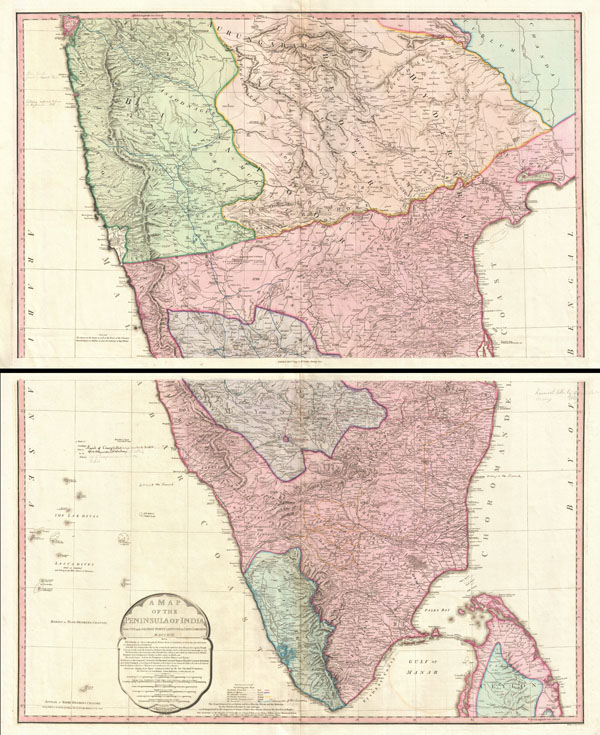
Iconic wall sized map of India chronicling the British military campaign in the subcontinent against Tipu Sultan of Mysore.
sold
- Digital Map Information
- Suitable for large format printing
- DPI: 300
- File Size: 43.81 MB
- File Type: ZIP / TIFF
- ICC color profile embedded
- Delivered instantly via download link
This is Faden's magnificent mapping of the Indian subcontinent, one of the largest and most impressive maps of India to appear in the 18th century. Highly desirable third edition. Presented in two panels, as issued. This chart depicts the ... (more details)
Important early map of the New England Colonies illustrating both the successes and failures of 18th century European mapping in the Americas.
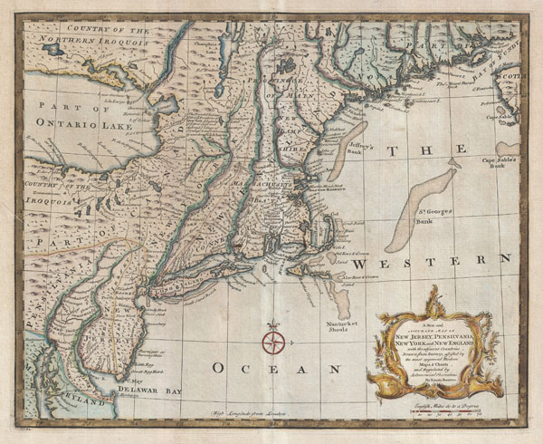
A New and Accurate Map of New Jersey, Pensilvania, New York and New England with the adjacent Countries.
sold
- Digital Map Information
- Suitable for large format printing
- Full resolution TIFF file
- ICC color profile embedded
- Delivered instantly via download link
A scarce and remarkable 1747 map of the New Jersey, New York, Pennsylvania, Maine, New Hampshire, and Connecticut by Emmanuel Bowen. Covering from the Chesapeake Bay to Lake Champlain and from Lake Ontario to Nova Scotia, this wonderful map is an excellent example of both the successes and failures of 18th century English mapping in the American colonies. It also makes evident the challenges of the European map publisher in piecing together numerous disparate reports and mappings into a single cohesive cartographic entity. (more details)
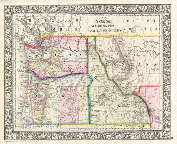
Map of Oregon, Washington, Idaho, and part of Montana.
sold
- Digital Map Information
- Suitable for large format printing
- File Size: 6.16 MB
- File Type: ZIP / TIFF
- ICC color profile embedded
- Delivered instantly via download link
A beautiful example of S. A. Mitchell Junior's 1866 map of Washington, Oregon, Idaho and Montana. Color coded according to county and territory. Identifies the proposed Stevens route for the Northern Pacific Railroad as well as the Emigrant ... (more details)
Rare deluxe edition of Desnos's Map of America.
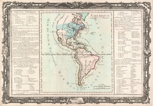
Amerique.
sold
- Digital Map Information
- Suitable for large format printing
- DPI: 300
- File Size: 10.75 MB
- File Type: ZIP / TIFF
- ICC color profile embedded
- Delivered instantly via download link
This is an extremely rare example of Desnos and Brion de la Tour's c. 1760 mapping of America. Covers both North America and South America from Greenland to Cape Horn. Overall the general form of the continents exhibit an craggy and ... (more details)
Important early map of Mexico.

Hispaniae Novae Nova Descriptio.
sold
- Digital Map Information
- Suitable for large format printing
- DPI: 300
- File Size: 12.49 MB
- File Type: ZIP / TIFF
- ICC color profile embedded
- Delivered instantly via download link
This is a rare and often under appreciated 1606 mapping New Spain by Hondius and Mercator. Covering the viceroyalty granted to Hernan Cortez following his conquest of the Aztec Empire, this map details, roughly, from Mexico City ... (more details)
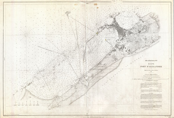
Mer Mediterranee Egypte Port D'Alexandrie.
sold
- Digital Map Information
- Suitable for large format printing
- File Size: 20.22 MB
- File Type: ZIP / TIFF
- ICC color profile embedded
- Delivered instantly via download link
This is a rare French nautical chart or map of Alexandria, Egypt dating to 1867 (updated to 1882). Prepared by the French Depot des Cartes et Plans de la Marine , this map offers extraordinary detail both inland and at sea. In ... (more details)
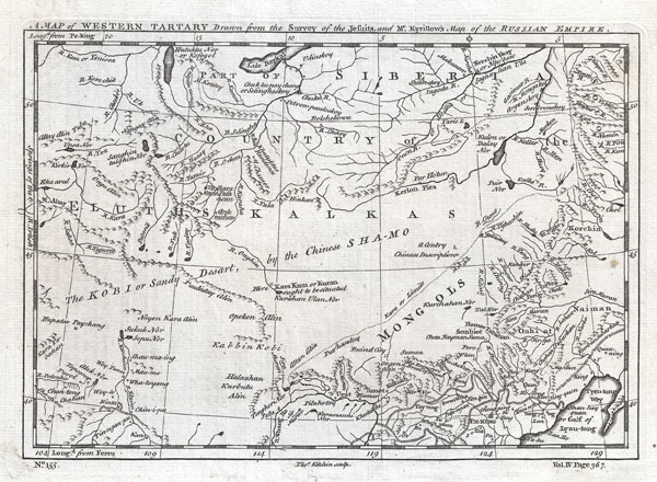
A Map of Western Tartary Drawn from the Survey of the Jesuits and Mr. Kyrillow's Map of the Russian Empire.
sold
- Digital Map Information
- Suitable for large format printing
- DPI: 300
- File Size: 2.25 MB
- File Type: ZIP / TIFF
- ICC color profile embedded
- Delivered instantly via download link
A fascinating 1747 European mapping of the Gobi Desert and the eastern portion of the Silk Route region by Thomas Kitchin. Covers from Lake Baikal in the north as far south as Beijing, east to the Gulf of Lyau-tong (Yellow ... (more details)
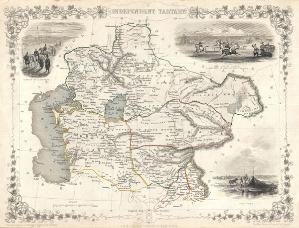
Independent Tartary.
sold
- Digital Map Information
- Suitable for large format printing
- DPI: 300
- File Size: 4.45 MB
- File Type: ZIP / TIFF
- ICC color profile embedded
- Delivered instantly via download link
A highly decorative 1851 map of Independent Tartary by John Tallis and John Rapkin. Covers the regions between the Caspian Sea and Lake Bakquash and between Russia and Afghanistan. These include the ancient Silk Route ... (more details)
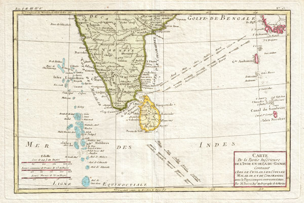
Carte De la Partie Inferieure de L'Inde en Deca du Gange Contenant L'Isle de Ceylan, Les Cotes de Malabar et de Coromandel, avec le Pays compris entre ces Cotes.
sold
- Digital Map Information
- Suitable for large format printing
- DPI: 300
- File Size: 3.66 MB
- File Type: ZIP / TIFF
- ICC color profile embedded
- Delivered instantly via download link
Attractive 1780 map of southern India by the French cartographer Rigobert Bonne. Covers from the Deccan plateau south as far as the Maldives and as far east as the Andaman and Nicobar Islands. Includes Ceylon or Sri ... (more details)
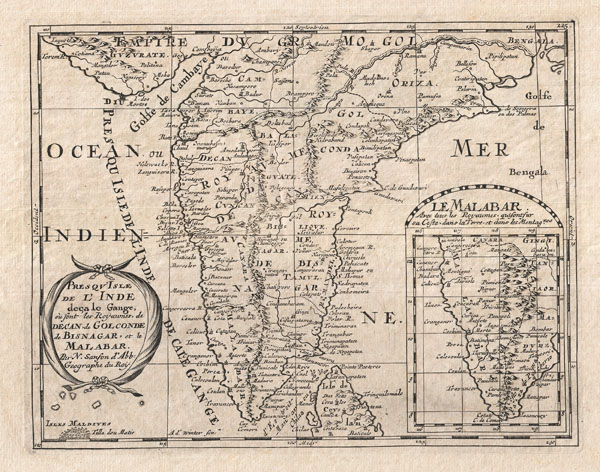
Presqu'Isle de L'Inde deca le Gange, ou sont les Royaumes de Decan, de Golconde, de Bisnagar, et le Malabar.
sold
- Digital Map Information
- Suitable for large format printing
- DPI: 300
- File Size: 3.14 MB
- File Type: ZIP / TIFF
- ICC color profile embedded
- Delivered instantly via download link
A small but attractive 1652 map of India by the French cartographer Nicholas Sanson. Covers the subcontinent From the Bay of Bengal and the Gulf of Cambay to Ceylon (Sri Lanka). Offers impressive detail given that ... (more details)
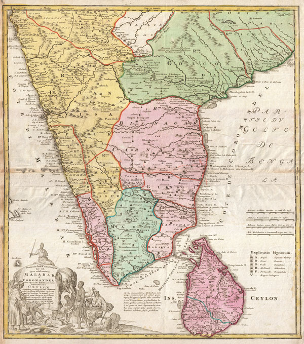
Peninsula Indiae citra Gangem, hoc est, Orae celeberrimae Malabar & Coromandel Cum adjacent Insula non minus celebratissima Ceylon Secundum prototypon Del' Islianum edita, insuperqs novissimis Observationibus correcta, et notates, quae cuivis genti Europaeae possidentur, terries et emporys, aucta, studio. Homannianorum Heredum Noriv. MDCCXXXIII Cum Privilegio S.C.M.
sold
- Digital Map Information
- Suitable for large format printing
- Full resolution TIFF file
- ICC color profile embedded
- Delivered instantly via download link
A rare map of India and Ceylon issued in 1733 by the Homann Heirs. Covers the subcontinent roughly from Bombay south to Cape Comorin and includes all of Ceylon (Sri Lanka). Homan offers good detail along the ... (more details)
Extremely scarce German edition of Rennell's map of India.
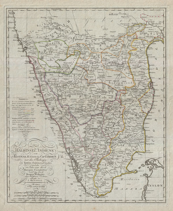
Die Halbinsel Indiens vom Kistnah Flusse bis Cap Comorin mit den Theilungen von Tippo Sahebs Landern nach den in Jahre 1782 durch Marquis Cornwallis und 1799 durch Marquis Wellesley abgeschloffenen, Tractaten, entworfenvon I. Rennell.
sold
- Digital Map Information
- Suitable for large format printing
- DPI: 300
- File Size: 13.78 MB
- File Type: ZIP / TIFF
- ICC color profile embedded
- Delivered instantly via download link
An extremely obscure German edition of Rennell's important late 18th century mapping of India. Covers the subcontinent roughly from Hyderabad and Goa south to Comorin and Ceylon (Sri Lanka). Shows the region ... (more details)
Shows the disputed Pinnacle Islands (Senkaku or Diaoyu Islands)

East India Archipelago [Eastern Passages to China and Japan] [Chart No. 7]
sold
- Digital Map Information
- Suitable for large format printing
- File Size: 41.68 MB
- File Type: ZIP / TIFF
- ICC color profile embedded
- Delivered instantly via download link
This is an extremely rare and highly desirable 1876 Imray blue-back chart depicting Taiwan (Formosa) and northern Luzon. Covers the regions between 16°30' to 25°40' North Latitude and between 188° 20' and 130° 20' East Longitude. Offers considerable detail along the cost of Formosa, particularly to the west in the Formosa Strait and around the Pescadore Islands. Countless depth soundings throughout. When Imray drew this nautical chart, very little was known about the seas between China and the Philippines. Indeed, the following note of caution appears in the lower right hand quadrant of the map:
The utmost care is requisite when navigating the seas comprised within the limits of this chart because they are very imperfectly known and it is believed that sunken reefs exist while have yet to be inserted on the chart, and the many of the known reefs are inaccurately placed in position.Despite the general paucity of information available, this chart represents one of the best mappings of the Taiwan region to appear in the 19th century. This region was not fully surveyed until the Japanese conquest of Taiwan in the late 19th and early 20th centuries. (more details)
Ephemeral mapping of Nevada and Utah.
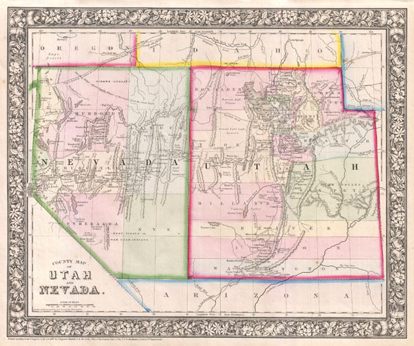
County Map of Utah and Nevada.
sold
- Digital Map Information
- Suitable for large format printing
- File Size: 5.65 MB
- File Type: ZIP / TIFF
- ICC color profile embedded
- Delivered instantly via download link
A beautiful example of S. A. Mitchell Junior's 1866 map of Utah and Nevada. Covers both the state of Nevada and the Territory of Utah. Highly detailed with notations on proposed railroads, topographical ... (more details)