
Eat Your (Sugar) Beets.

A Story of Sugar.
sold
- Digital Map Information
- Suitable for large format printing
- File Size: 237.81 MB
- File Type: ZIP / TIFF
- ICC color profile embedded
- Delivered instantly via download link
An informative large-scale schematic of beet sugar production, published by the National Capital Press for the United States Beet Sugar Association in 1932. It provides a comprehensive overview of the beet sugar production process from farm to table. (more details)
Enclosure and Assimilation.
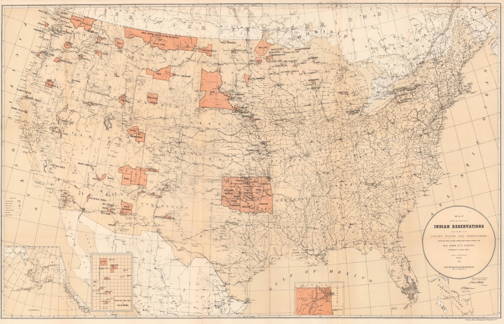
Map Showing Indian Reservations within the Limits of the United States.
sold
- Digital Map Information
- Suitable for large format printing
- File Size: 82.59 MB
- File Type: ZIP / TIFF
- ICC color profile embedded
- Delivered instantly via download link
An impressive 1885 map of the United States highlighting the location of Indian reservations, produced during the tenure of John DeWitt Clinton Atkins as Commissioner of Indian Affairs. (more details)
Scarce Woodcut of Szczecin / Stettin.

Der herzlichen und weitberhuempten Statt Stettin in Pomern warhaffte abcontrafactur.
sold
- Digital Map Information
- Suitable for large format printing
- DPI: 600
- File Size: 28.4 MB
- File Type: ZIP / TIFF
- ICC color profile embedded
- Delivered instantly via download link
This lively view of Szczecin, Poland is among the earliest acquirable printed images of that city, possibly the first. (more details)
A plan to improve the New York City Subway.

Rapid Transit Construction Program.
sold
This is a 1954 Hagstrom map of New York City Subway construction projects. It illustrates developments, such as the 2nd Avenue Line, that are only now coming to fruition. (more details)
First edition of the earliest acquirable view Frankfurt an der Oder.

Frankfurt an der Oder Anno Dni. 1548 RMD.
sold
- Digital Map Information
- Suitable for large format printing
- DPI: 600
- File Size: 28.46 MB
- File Type: ZIP / TIFF
- ICC color profile embedded
- Delivered instantly via download link
This Sebastian Münster's lively 1550 view of Frankfurt an der Oder, in Germany near the border of Poland, one of the earliest acquirable printed images of that city. This example is of the first edition of Munster's Cosmographia in which it appeared, the much-expanded German edition of 1550. (more details)
Extremely Rare: the first detailed map of the Republic of Uruguay.
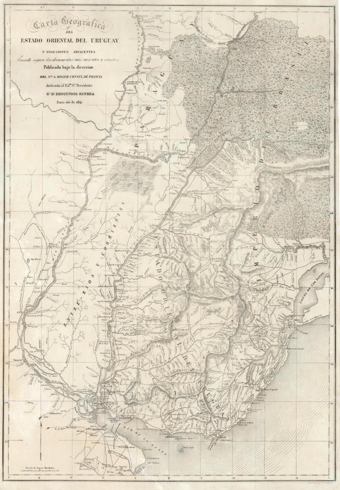
Carta Geografica del Estado Oriental del Uruguay y Posesiones Adyacentes Trazada segun los documentes mas recentes y exactes.
sold
- Digital Map Information
- Suitable for large format printing
- DPI: 600
- File Size: 83.16 MB
- File Type: ZIP / TIFF
- ICC color profile embedded
- Delivered instantly via download link
This is an extremely rare, separately issued lithograph 1841 map of the Republic of Uruguay during the early years of Uruguay's Independence and civil war. It was published in Paris on behalf of the French diplomat, Aimé Roger, and can be considered the first, detailed map of the independent Republic. (more details)
Republic of Texas at its height.

Texas Compiled from the latest and best Authorities.
sold
- Digital Map Information
- Suitable for large format printing
- DPI: 600
- File Size: 23.9 MB
- File Type: ZIP / TIFF
- ICC color profile embedded
- Delivered instantly via download link
This is Jeremiah Greenleaf’s 1842 map of the Republic of Texas. This highly sought-after map is one of the best depictions of the Republic produced during its brief existence. (more details)
First hydrographic map of the Senegal River.
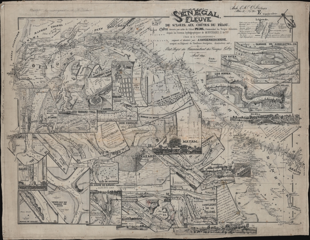
Senegal Fleuve de St. Louis aux Chütes du Félou.
sold
- Digital Map Information
- Suitable for large format printing
- File Size: 634.02 MB
- File Type: ZIP / TIFF
- ICC color profile embedded
- Delivered instantly via download link
This extraordinary item is a one-of-a-kind 1899 river guide map of the Senegal River issued by 'Colonel Pujol' for use by French colonial troops. This is the earliest known printed hydrographic chart of the Senegal River, based on the 1891-1893 surveys of Henri Pierre Gabriel Buchard, themselves comprising the first hydrographic mapping of the river. The chart was printed by helio-zincography, likely in St. Louis, the capital of Afrique-Occidentale Française, and designed by A. Vandenkerckhove, a sergeant in the all-African Senegalese Skirmishers. (more details)
Nantucket, as memorialized by a devoted, adoptive local artist.
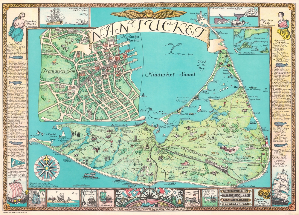
Nantucket.
sold
This is a beautiful example of the 1964 edition of Ruth Haviland Sutton’s pictorial map of Nantucket, Massachusetts. This vivacious depiction of the island emphasizes its nautical history and character. Its execution reflects the love of place that led Sutton to relocate there for most of her adult life. The waters around the island are decorated with boats and ships – some native, some European, some afloat but many shipwrecked (these last have the dates). (more details)
Second Anglo-Mysore War.
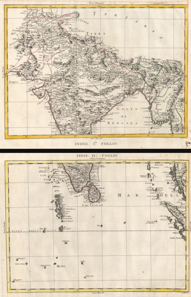
Indie Imo. Foglio. / Indie IIo. Foglio.
$1,200.00
Acquire
- Digital Map Information
- Suitable for large format printing
- Full resolution TIFF file
- ICC color profile embedded
- Delivered instantly via download link
This is a 1784 Antonio Zatta 2 sheet map of India. Published as the British East India Company was fighting to bring all of India within its sphere. At it went to the presses, the British East India Company and the Kingdom of Mysore were at a war, partially ignited by the American Revolutionary War (1775 - 1783), known as the Second Anglo-Mysore War (1780 - 1784). (more details)
The Illinois Central wants YOU to buy land in Illinois!
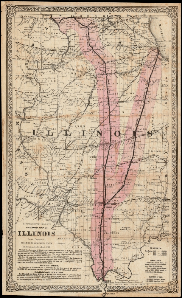
G. Woolworth Colton's Railroad Map of Illinois.
sold
- Digital Map Information
- Suitable for large format printing
- File Size: 45.14 MB
- File Type: ZIP / TIFF
- ICC color profile embedded
- Delivered instantly via download link
This is a scarce, separately issued first edition of G. W. Colton's 1861 map of Illinois, produced for the Illinois Central Railroad to promote land sales. Rare in any edition, this the first known state of the map, identified by the absence sales statistics appearing in subsequent printings. Dominating the map and spanning the state from north to the south are the Main Line and the Chicago Branch of the Illinois Central Railroad, and the thirty-mile-wide corridors of land granted by the Federal government for the construction of the railroad (highlighted in pink.) (more details)
Deciphering the 'Locked Country'.
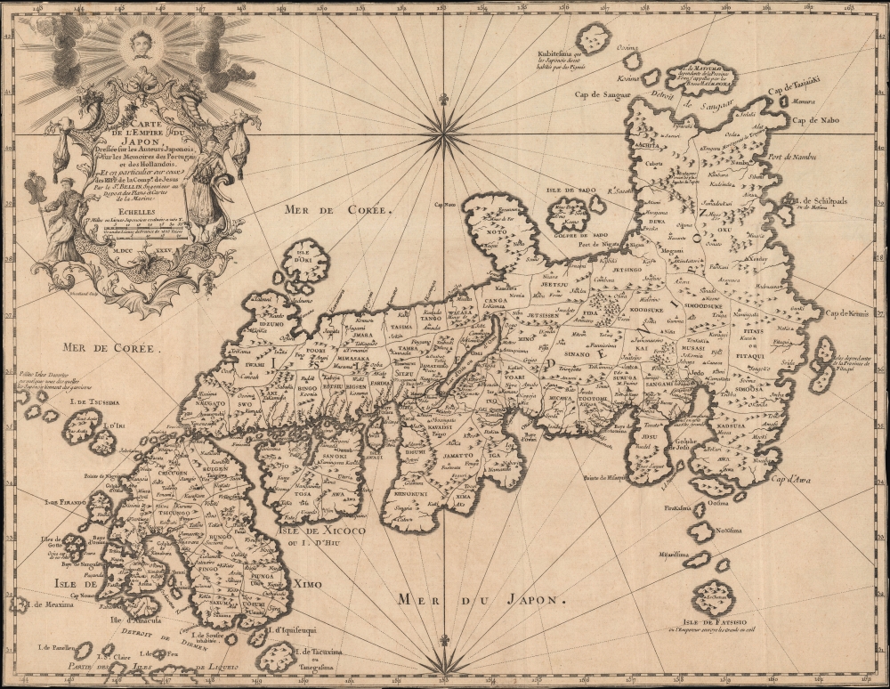
Carte de l'empire du Japon, dressée sur les auteurs japonois, sur les mémoires des portugais et des hollandois et en particulier sur ceux des RRPP. de la comp. de Jesus.
sold
- Digital Map Information
- Suitable for large format printing
- DPI: 600
- File Size: 17.77 MB
- File Type: ZIP / TIFF
- ICC color profile embedded
- Delivered instantly via download link
This is Jacques-Nicolas Bellin's 1735 / 1754 map of Japan, published in Pierre François Xavier de Charlevoix's Histoire et description générale du Japon, an influential work throughout the 18th century. (more details)
Ephemeral configuration of the Dakota Territory.

Nebraska and Northern Territories.
sold
- Digital Map Information
- Suitable for large format printing
- File Size: 57.39 MB
- File Type: ZIP / TIFF
- ICC color profile embedded
- Delivered instantly via download link
This is an 1868 Henry Stebbins and H. H. Lloyd map of Nebraska and the Northern Territories exhibiting an ephemeral configuration of the northern plains. Nebraska, Idaho, and Montana are recognizable, but 'Dakota' contains North and South Dakota and an unlabeled Wyoming is identified simply as 'Unexplored Territory'. (more details)
Major Changes in the Hudson Valley.
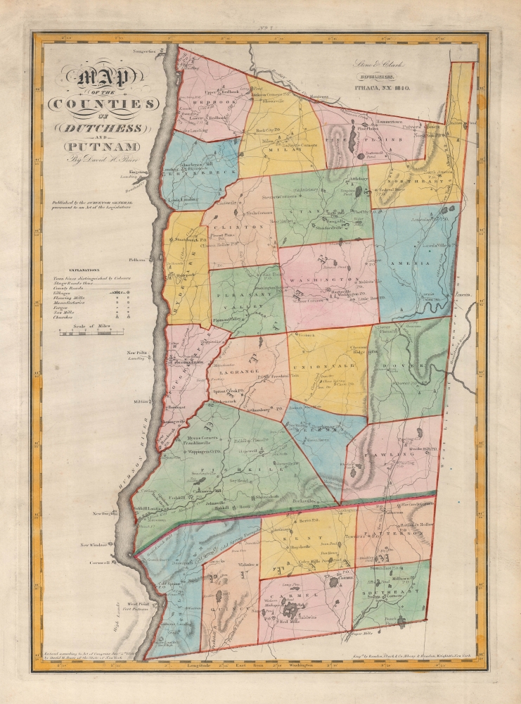
Map of the Counties of Dutchess and Putnam. / No. 7.
sold
- Digital Map Information
- Suitable for large format printing
- Full resolution TIFF file
- ICC color profile embedded
- Delivered instantly via download link
A very nice example of David Burr's rare and attractive map of Dutchess and Putnam Counties, New York, originally published in 1829, here appearing in the 1840 state of Stone and Clark's updated issue of Burr's Atlas of the State of New York. (more details)
An early geological map of the Grand Canyon region.
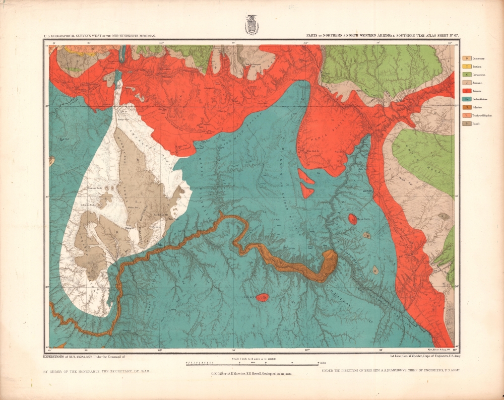
Parts of Northern and North Western Arizona and Southern Utah. Sheet No. 67.
$500.00
Acquire
- Digital Map Information
- Suitable for large format printing
- File Size: 21.85 MB
- File Type: ZIP / TIFF
- ICC color profile embedded
- Delivered instantly via download link
A beautifully chromolithographed geologic map of northern Arizona and environs, including the Grand Canyon, produced by the Wheeler Survey c. 1873 and published in the Topographical Atlas which summarized the survey's work. (more details)
Celebrating Japan's Great Victory over Russia.

旅順市街及戰蹟案内地圖 : 附戰蹟案内記及旅順一覽表 / [Street Map and Battle Guide of Ryojun : Supplemented by Tracks of the Battle and Tables].
sold
- Digital Map Information
- Suitable for large format printing
- Full resolution TIFF file
- ICC color profile embedded
- Delivered instantly via download link
A celebratory map of Japan's stunning victory over the Russian Empire in the Russo-Japanese War (1904 - 1905), this 1937 map by Hattori Kantarō covers the port of Lüshun / Ryojun (旅順), more commonly known internationally as Port Arthur, site of Japan's most significant land victory during the conflict. The map and verso content provide a tourist's guide to the port city, some thirty years after the decisive battle. (more details)
No longer a convict colony.
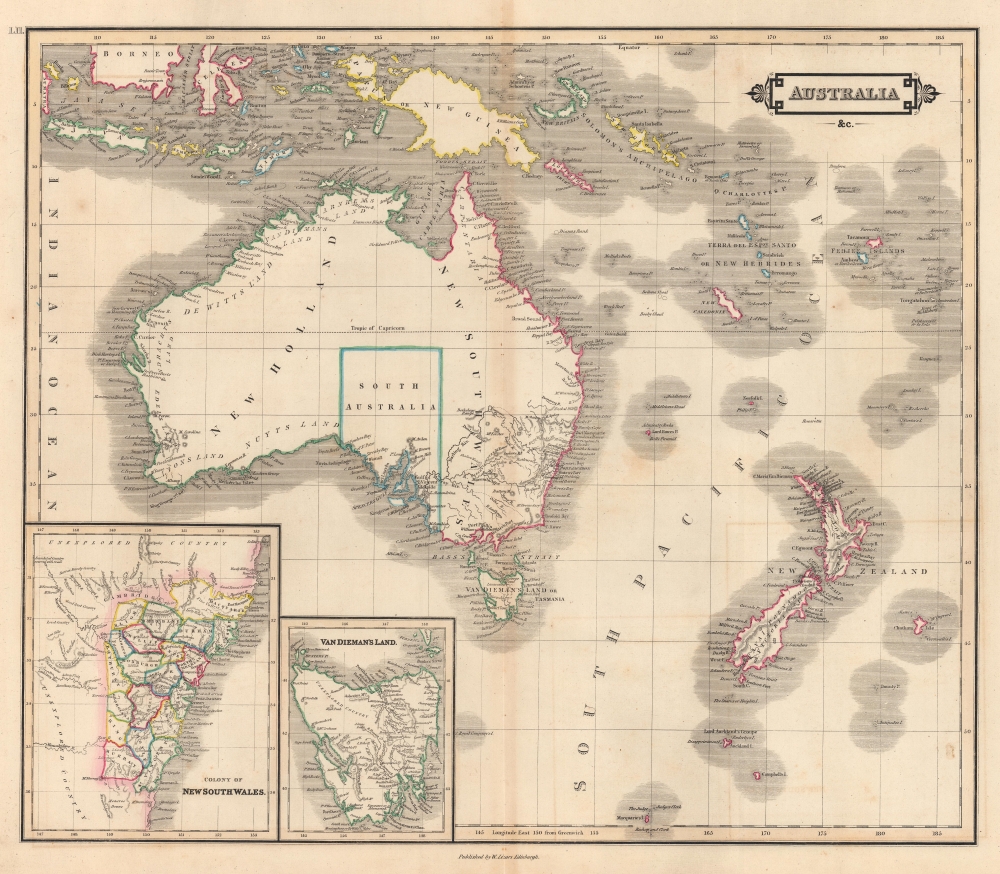
Australia etc.
sold
- Digital Map Information
- Suitable for large format printing
- DPI: 600
- File Size: 45.42 MB
- File Type: ZIP / TIFF
- ICC color profile embedded
- Delivered instantly via download link
This is an 1841 William Home Lizars map of Australia (New Holland), New Zealand, and Melanesia. The map captures the region at the end of its period as a 'convict colony' but ten years before the 1851 Australian Gold Rush, which transformed the national economy. (more details)
Geology of the Maxwell Land Grant.
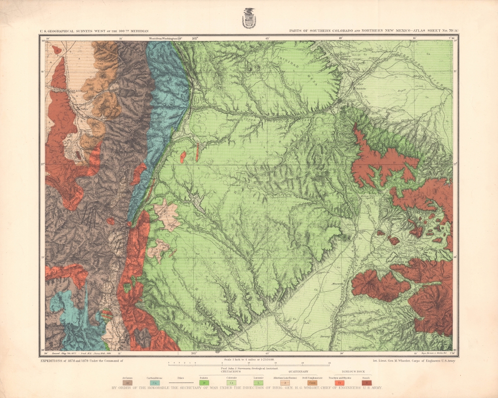
Parts of Southern Colorado and Northern New Mexico - Atlas Sheet No. 70 (A).
sold
- Digital Map Information
- Suitable for large format printing
- File Size: 30.17 MB
- File Type: ZIP / TIFF
- ICC color profile embedded
- Delivered instantly via download link
A brightly-colored chromolithograph geological map of lands along the New Mexico - Colorado border produced by the Wheeler Survey and published in the Topographical Atlas which summarized the survey's work. In addition to geological information, it reflects the growing settlement and infrastructure in the region, especially post offices and railroads. (more details)
Proposed railroads, American Indian Ranges, and the ephemeral Pembina Region.
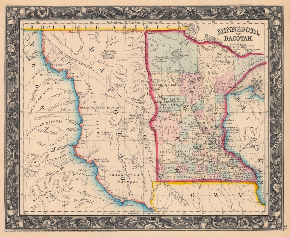
Minnesota and Dacotah.
sold
- Digital Map Information
- Suitable for large format printing
- File Size: 22.13 MB
- File Type: ZIP / TIFF
- ICC color profile embedded
- Delivered instantly via download link
This is an 1861 Samuel Augustus Mitchell, Jr. map of Minnesota and part of Wisconsin, Iowa, and the Nebraska Territory. It also includes the Dakota, then known as the Pembina Region, comprised of the portions of the Minnesota Territory between the Missouri River and the Red River that remained unorganized after Minnesota joined the Union in 1858. Governor Stevens' railroad surveys for the proposed Northern Pacific Line are also noted. (more details)
Features Lake Champlain and Lake George.

The Adirondack Picture Map.
sold
- Digital Map Information
- Suitable for large format printing
- Full resolution TIFF file
- ICC color profile embedded
- Delivered instantly via download link
This is a 1948 Arthur S. Knight map of the Adirondacks created to promote the region's beauty and facilitate tourism. It features striking illustrations of Lake Champlain and Lake George. (more details)