
The 29th Infantry: from the U.S. to D-Day to V-E Day.
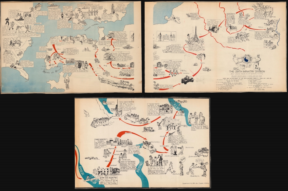
The 29th Infantry Division '29 Let's Go'.
sold
This is a 1945 29th Infantry Division World War II pictorial route map of Europe tracing the 29th's movements from the United States to England, across the English Channel to France on D-Day, and through Europe to Germany and the end of the war. Created by an unknown artist, the map provides a chronicle of the division's exploits meant for its veterans as a souvenir of all they had accomplished. (more details)
The Big Dipper.

[Ursa Major].
sold
- Digital Map Information
- Suitable for large format printing
- Full resolution TIFF file
- ICC color profile embedded
- Delivered instantly via download link
An exceptional example of the 1801 Johann Elbert Bode elephant folio celestial, constellation, or star map of Ursa Major (the Great Bear or Big Dipper) and Leo Minor. Considered the largest and most dramatic celestial maps of their era, possibly ever published, Bode's gigantic star charts detail thousands of stars, nebulae, and clusters. Constellations are dramatically represented in pictorial form, as was the convention of the previous century. Many of the newly discovered nebulae, double stars, star clusters discovered by European astronomers in the late 18th century, such as Lacaille, Lalande, Messier, and Herschel, are identified. Bode presents this map on a conic geocentric projection in which most constellations are seen as from Earth. The current example is spectacularly colored gold highlighting of important stars. (more details)
Most finely-engraved Ptolemaic map of Arabia.
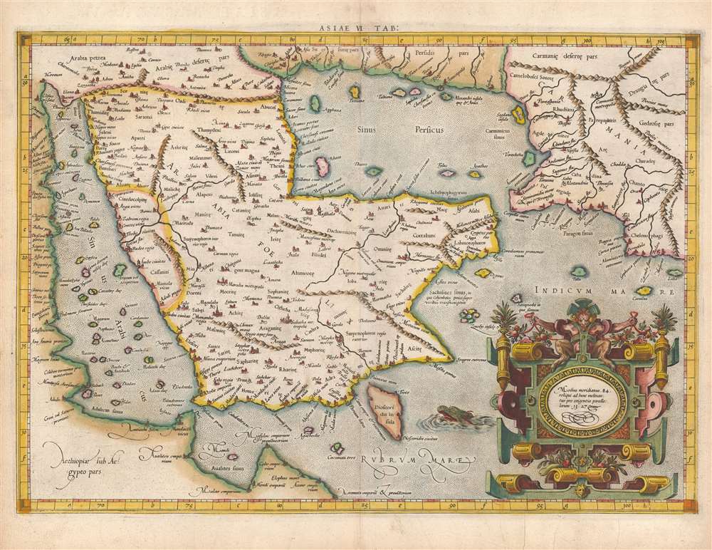
Asiae VI Tab.
sold
- Digital Map Information
- Suitable for large format printing
- Full resolution TIFF file
- ICC color profile embedded
- Delivered instantly via download link
This is Gerard Mercator's map of the Arabian Peninsula, based on the second-century mapping of Claudius Ptolemy (c. 100 - 170), the progenitor of modern geography. Mercator executed this map for his 1578 Duisberg edition of Ptolemy's Geographia, intended to be the definitive edition of that foundational work. (more details)
Master-pan of Haifa during its peak of prosperity.

Haifa./ הָ יפֵ ח / حيفا
sold
- Digital Map Information
- Suitable for large format printing
- File Size: 85.14 MB
- File Type: ZIP / TIFF
- ICC color profile embedded
- Delivered instantly via download link
This is an enormous rare 1937 map of Haifa, Israel (then British Mandate Palestine) at a time when it was an oasis of peace and cultural plurality in an otherwhile war-torn and chaotic region. It is the masterplan of that underpinned the city's growth at the height of this Interwar expansion. (more details)
Free land to the 1,000,000!

Fremont, Elkhorn and Missouri Valley R.R. and Connections, to the Free Homes for theMillion in Northwestern Nebraska and Southwestern Dakota. / The Elkhorn Valley Line to Northern Nebraska, Central Wyoming and The black Hills.
sold
- Digital Map Information
- Suitable for large format printing
- Full resolution TIFF file
- ICC color profile embedded
- Delivered instantly via download link
This is an impressive and highly detailed 1886 Rand McNally map of Wyoming, Dakota, and Nebraska issued to promoted migration to free 'government lands' in the west. It also illustrates the route of the important Fremont, Elkhorn and Missouri Valley Railroad. (more details)
Mapping 'butchness' in America.

A Butch Look at America.
sold
A rare and humorous 1982 J. Clark Henley pictorial map of the United States as a 'butch' alli-GAY-der paradise. The map follows on Henley's 1976 'Alligator Oz' map of San Francisco (see Geographicus: SanFranciscoAlligatorOz-henley-1976), in which he first introduced the alligator as a symbol of gay America. Here homosexual alligators, some in drag, frolic and enjoy themselves, their notably salacious thoughts on clear display - and as such is one of the few maps picturing any aspect of gay life. The map emerged during a period of LGBTQ+ awakening, after the 1969 Stonewall Riots, but before the full extent of the AIDS Epidemic became evident. It was a period of positivity and widespread expectations of emerging acceptance. (more details)
Iconic Shanghai hunting map.

A Map of the Shooting Districts Lying Between Shanghai and Wuhu.
sold
- Digital Map Information
- Suitable for large format printing
- Full resolution TIFF file
- ICC color profile embedded
- Delivered instantly via download link
This is Robert Alexis de Villard and Henling Thomas Wade's important 1893 hunting map of Shanghai and its environs. The map was created by de Villard in partnership the renowned sportsman Henling Thomas Wade, for use by expatriate hunting clubs in Shanghai. The map's coverage is expansive, bounded on the north and west by the main course of the Yangtze River, and on the east by Hangchow Bay. It includes from Nanjing (Nanking) and Zhenjiang (Chin-Kiang) to Hangzhou. Most locations are identified in English with Romanized Chinese. Some larger cities and towns, such as Nanjing (Nanking), Zhenjiang (Chin-Kiang), and Hangzhou (Hang-Chow), are also noted in Chinese. (more details)
Finely-presented map of Italy.
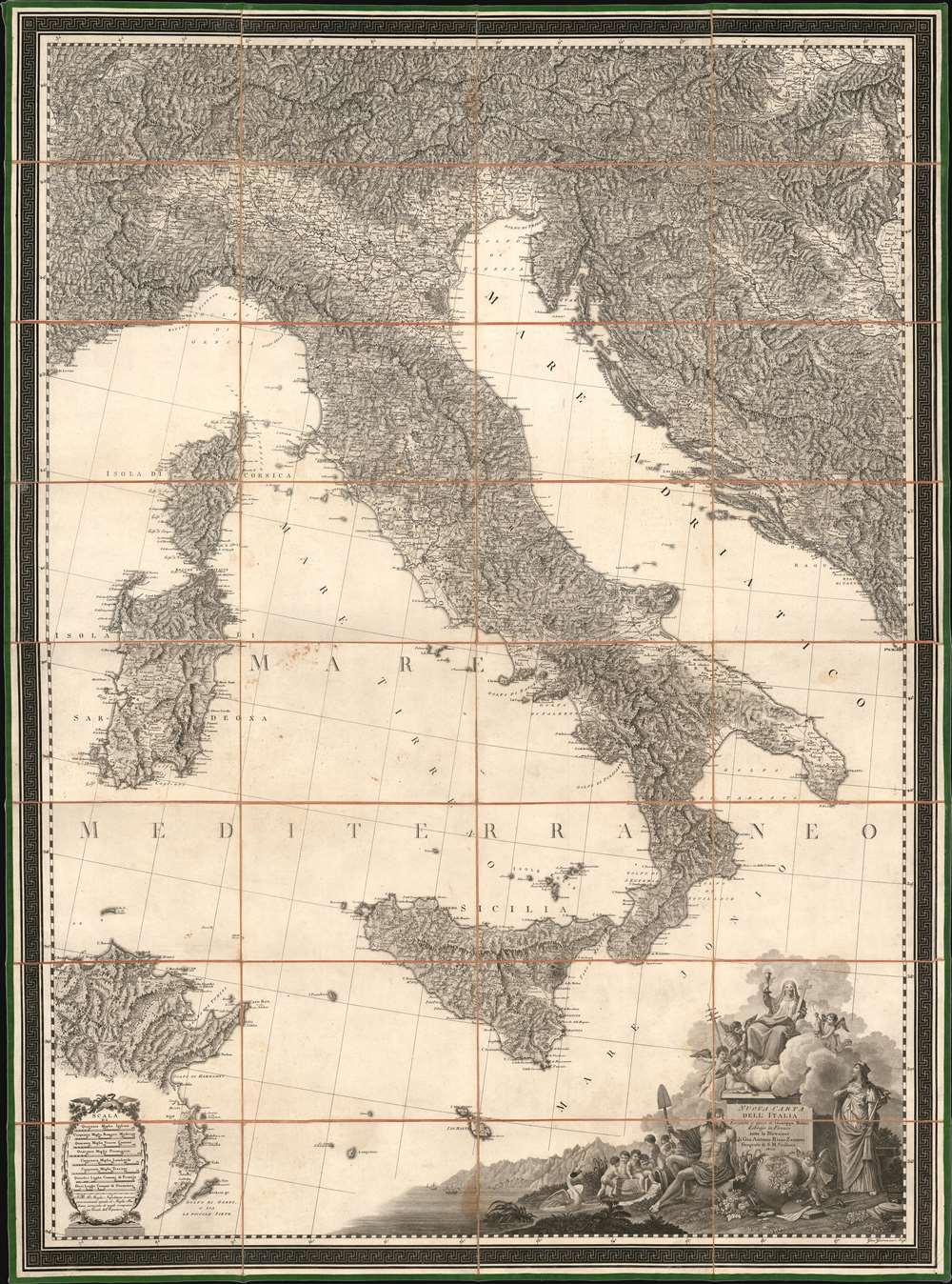
Nuova Carta Dell' Italia Eseguita a spese di Giuseppe Molini Librajo in Firenze sotto la Direzione di Gio. Antonio Rizzi-Zannoni Geografo di S. M. Siciliana 1802.
sold
- Digital Map Information
- Suitable for large format printing
- DPI: 600
- File Size: 130.39 MB
- File Type: ZIP / TIFF
- ICC color profile embedded
- Delivered instantly via download link
This the magnificent 1802 Rizzi-Zannoni large-scale map of Italy, in a beautiful example on original linen and original slipcase cover. (more details)
Ephemeral Confederate Arizona.

Johnson's California, Territories of New Mexico and Utah.
sold
- Digital Map Information
- Suitable for large format printing
- File Size: 56.68 MB
- File Type: ZIP / TIFF
- ICC color profile embedded
- Delivered instantly via download link
This is the 1862 Civil War edition of A. J. Johnson's map of California and the territories of Nevada, Utah, Colorado, New Mexico and Confederate Arizona - considered one of the scarcest and most historically significant of A. J. Johnson's southwest series due to its illustration of the ephemeral Confederate state of 'Arrizona'. (more details)
Meet me at the Zuiderzee.
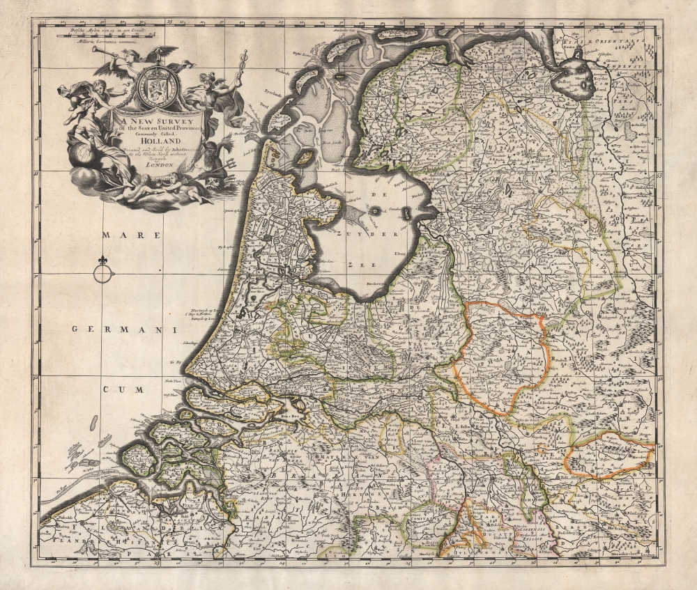
A New Survey of the Seaven United Provinces Commonly Called Holland.
sold
- Digital Map Information
- Suitable for large format printing
- Full resolution TIFF file
- ICC color profile embedded
- Delivered instantly via download link
An unrecorded c. 1740 John Overton map of the Netherlands, based on the 1721 map of the same by John Senex, published in the latter's A New General Atlas of the World. Adopting the convention of the time, 'Holland' is used synonymously with the entire United Provinces. (more details)
Earliest lithograph of the Galapagos Islands.
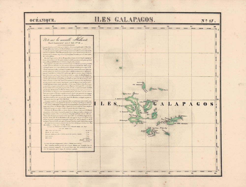
Iles Galapagos. Oceanique no. 17.
sold
- Digital Map Information
- Suitable for large format printing
- Full resolution TIFF file
- ICC color profile embedded
- Delivered instantly via download link
An 1827 Phillipe Vandermaelen map of the Galapagos Islands, considered the earliest lithographed map of those islands. Vandermaelen's Atlas Universel was the first lithograph atlas as well as the first whose maps were printed on a universal scale. (more details)
Before the Great Galveston Hurricane.
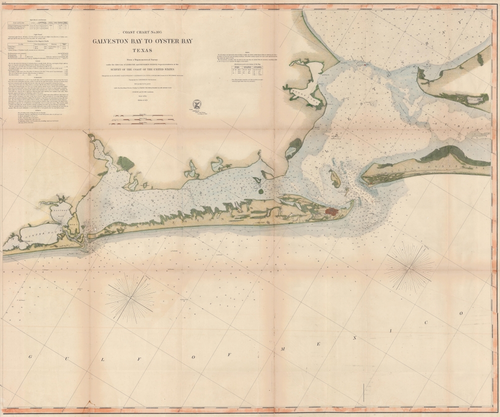
Coast Chart No. 105 Galveston Bay to Oyster Bay Texas.
$600.00
Acquire
- Digital Map Information
- Suitable for large format printing
- File Size: 138.67 MB
- File Type: ZIP / TIFF
- ICC color profile embedded
- Delivered instantly via download link
This is the 1870 edition of the U.S. Coast Survey nautical map of Galveston Bay, Texas. When this map was made Galveston was one of the most important American ports on the Gulf of Mexico. In just thirty years, it would be destroyed by the 1900 Great Galveston Hurricane, considered the deadliest natural disaster in United States history and the third-deadliest Atlantic hurricane. (more details)
Discover the modified Churchill tanks of World War II.

A New Odyssey Anni Mirabiles 1944 - 1945.
sold
- Digital Map Information
- Suitable for large format printing
- File Size: 29.12 MB
- File Type: ZIP / TIFF
- ICC color profile embedded
- Delivered instantly via download link
This is the c. 1945 1st Assault Brigade of Royal Engineers World War II pictorial route map of northern Europe. It was created by a British engineer brigade and notably illustrates its novel modified tanks. While such route maps are common for American units serving in the War, the convention was also espoused to a much lesser extent by the British - making all British route maps exceptionally rare finds. (more details)
Grand map of Grand Teton.
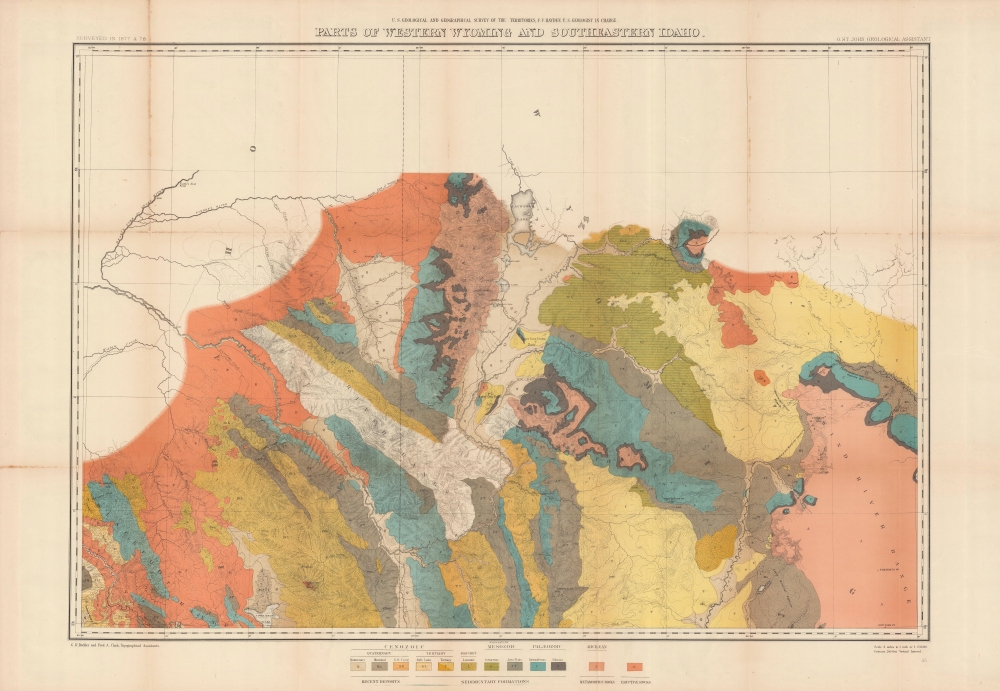
Parts of western Wyoming and southeastern Idaho.
sold
- Digital Map Information
- Suitable for large format printing
- File Size: 46.2 MB
- File Type: ZIP / TIFF
- ICC color profile embedded
- Delivered instantly via download link
A brightly colored, large-format map of Grand Teton and surrounding mountains produced in 1878 by the U.S. Geological and Geographical Survey of the Territories, forerunner to the U.S. Geological Survey. It is among the earliest mappings of this region, and certainly was the most comprehensive at the time of publication. (more details)
First map to show the continental shelf break for a significant portion of the west coast.

Pacific Coast from Point Pinos to Bodega Head California.
sold
- Digital Map Information
- Suitable for large format printing
- File Size: 100.44 MB
- File Type: ZIP / TIFF
- ICC color profile embedded
- Delivered instantly via download link
This is the 1866 United States Coast Survey map of San Francisco Bay and vicinity from Bodega Head south to Point Pinos and Monterey, California. (more details)
The Earliest Collectible Printed Image of Belgrade.

Kriechisch Wyssenburg.
sold
- Digital Map Information
- Suitable for large format printing
- DPI: 600
- File Size: 17.44 MB
- File Type: ZIP / TIFF
- ICC color profile embedded
- Delivered instantly via download link
This is the 1550 Sebastian Münster woodcut view of Belgrade - the earliest obtainable printed image of that city. (more details)
London to Marlborough by Foot or Horse.
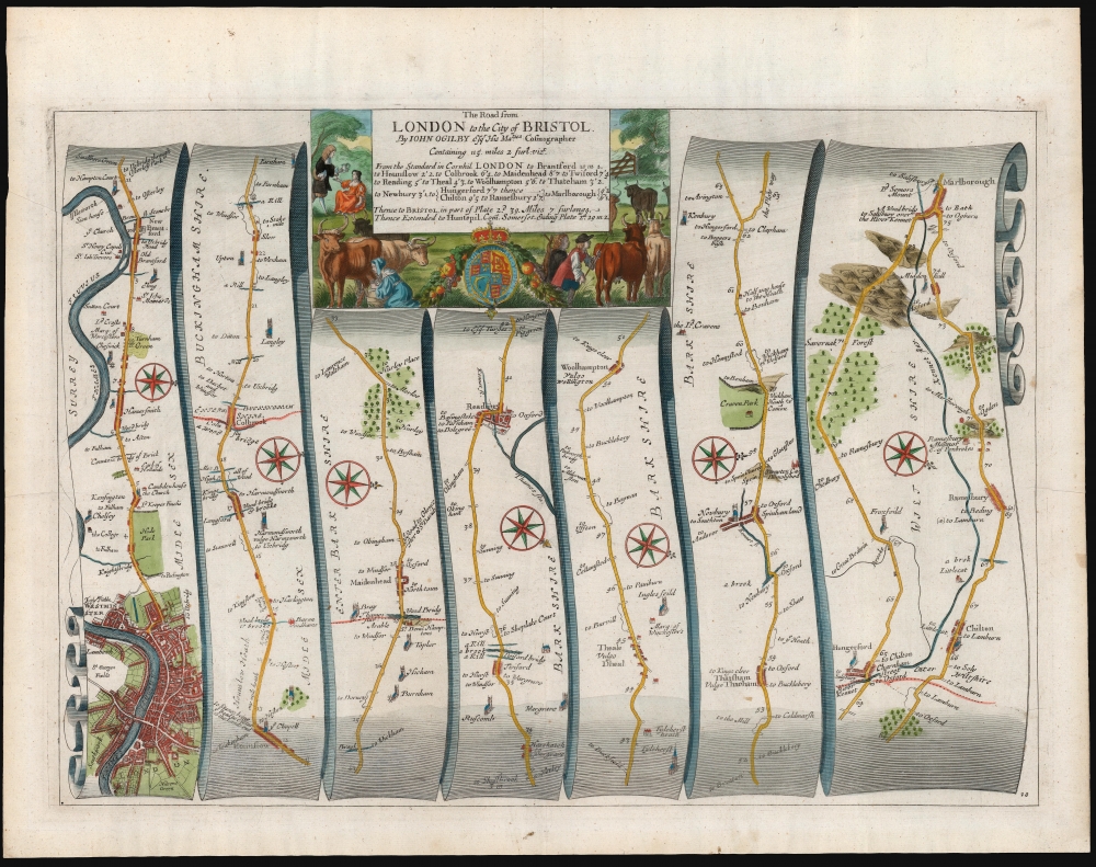
The Road from London to the City of Bristol...
sold
- Digital Map Information
- Suitable for large format printing
- DPI: 600
- File Size: 40.54 MB
- File Type: ZIP / TIFF
- ICC color profile embedded
- Delivered instantly via download link
This is John Ogilby's road map detailing the first leg of the road between the cities of London and Bristol. It is a strip-map, following the London Road and the Bath Road from London eastwards to Marlborough in seven lengths, presented as if on a single, unspooled scroll. The road passes through Hammersmith, Harlington and Harmondsworth, Colnbrook Maidenhead, Reading, Woolhampton, Thatcham, Newbury, Chilton, Ramesbury, and Marlborough. Smaller towns, bridges, forests, churches, manors, and county borders are all noted along the way. Parks, Greens, and even some ruins (for example Donnington Castle near Newbury) are marked as well. (more details)
New England's ephemeral trolley network.

Trolley Wayfinder Birds Eye View of Trolley Routes in New England.
sold
- Digital Map Information
- Suitable for large format printing
- Full resolution TIFF file
- ICC color profile embedded
- Delivered instantly via download link
A radiantly rich chromolithograph bird's-eye view style pocket map of New England issued in 1905 by John Jenness Lane and George Walker for the New England Street Railway Club. The view was produced upon Lane's election as secretary of the Club to promote the extensive but ephemeral New England streetcar network. (more details)
The early American frontier.
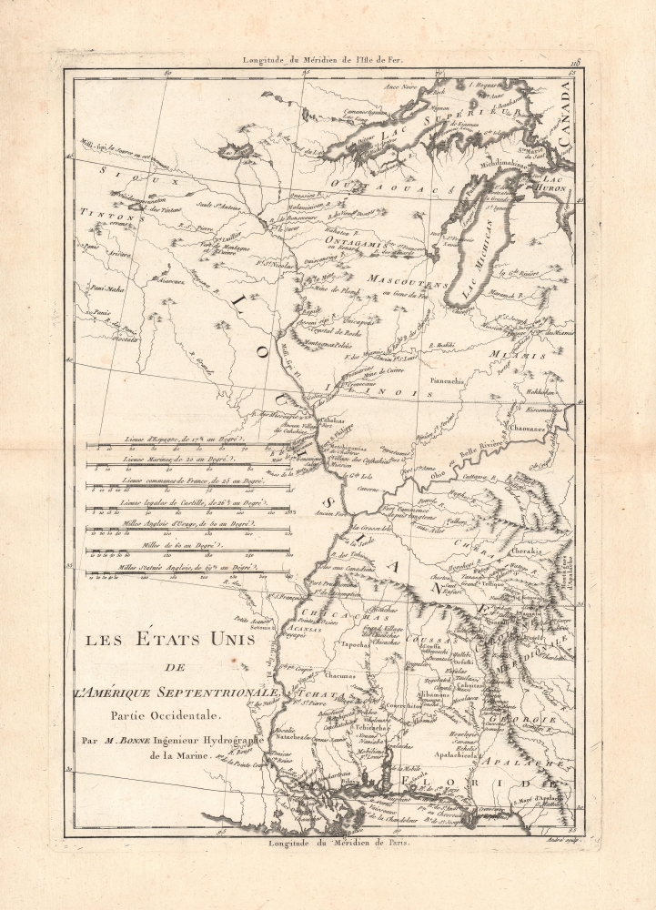
Les Etats Unis de L'Amerique Septentrionale, Partie Occidentale.
sold
- Digital Map Information
- Suitable for large format printing
- Full resolution TIFF file
- ICC color profile embedded
- Delivered instantly via download link
A detailed c. 1787 Rigobert Bonne map of the western part of the 'United States of North America', essentially the land between the Mississippi River and the Appalachian Mountains. It is significant for its recognition of the United States, which is early for a map of this type, as well as for its detailed cataloging of Native American groups on the American frontier. (more details)
Queen Elizabeth II's coronation.

Route Map of the Coronation of Her Majesty Queen Elizabeth II Head of the Commonwealth.
sold
- Digital Map Information
- Suitable for large format printing
- Full resolution TIFF file
- ICC color profile embedded
- Delivered instantly via download link
This is a 1953 Master Maps pictorial map of London highlighting the route of the Royal Procession following Queen Elizabeth II's coronation. (more details)