
The Alligator Loop.

Your Key to the Attractions of Fort Lauderdale, the Venice of America.
sold
A colorful piece of Florida history, this is a c. 1950 map and brochure for the 'jungle cruise' We-Kiva, published by the company itself. It focuses on roads, waterways, landmarks, and attractions in and around Fort Lauderdale. (more details)
Ending over 300 years of Spanish dominion in the Philippines.

Rand-McNally Map of Manila Harbor.
sold
- Digital Map Information
- Suitable for large format printing
- Full resolution TIFF file
- ICC color profile embedded
- Delivered instantly via download link
This is an uncommon 1898 Rand McNally map of Manila Harbor in the Philippines. The map illustrates the Battle of Manila, the historic 'turning of the tides' that ended nearly 300 years of Spanish dominion in the Philippines. (more details)
Majestic Seashore Route.

Map of the Ocean Drive. Atlantic City to Cape May, New Jersey.
sold
A charming set of maps of the Ocean Drive along the southern portion of New Jersey's Atlantic coastline from Atlantic City to Cape May. They were produced in 1967 by the Cape May County Bridge Commission, which operates five toll bridges along the route, and was printed by Laws Printing Industries. (more details)
Most beautiful early Uruguayan map of Uruguay.
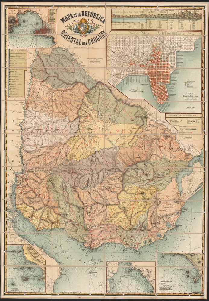
Mapa de la República oriental del Uruguay.
sold
- Digital Map Information
- Suitable for large format printing
- File Size: 2358.68 MB
- File Type: ZIP / TIFF
- ICC color profile embedded
- Delivered instantly via download link
This is a spectacular, folding chromolithograph map of the Republic of Uruguay, published c. 1884 by Uruguay's La Escuela de Artes Y Oficios. It is among the first maps of Uruguay published there, and it appears to be the first official map of the Republic. (more details)
The end of an era.

The Castro, San Francisco.
sold
A fascinating view of the Castro neighborhood in San Francisco, produced in 1985 by artist Graham Bruce. It combines elements of a conventional pictorial map of the period (advertisements for local businesses) with a more ethereal aesthetic, celebrating the nightlife of this 'mecca' of LGBTQ culture. However, the view was also produced in the most frightening period of the HIV/AIDS epidemic in San Francisco's gay community, and may have been intended as an elegy for both the people who had died and the culture of gay liberation that was imperiled by the epidemic. (more details)
Earliest map of Europe based on contemporaneous knowledge.

Description Nouvelle D'Europe.
sold
- Digital Map Information
- Suitable for large format printing
- Full resolution TIFF file
- ICC color profile embedded
- Delivered instantly via download link
This is a 1552 example of Sebastian Münster's southern-oriented map of Europe: the first acquirable map of Europe based on contemporary geographical information, and the only generally acquirable derivative of Martin Waldseemüller's unobtainable 1511 map of Europe. Münster's works provided for many years the literate European's only glimpses of the world, containing a disproportionate number of maps containing, for the first time, contemporaneous knowledge of the areas they depicted. For most of Münster's readership, this map would have been the first depiction of their home continent not based upon the 2nd century work of Claudius Ptolemy. (more details)
For slavers, by slavers.
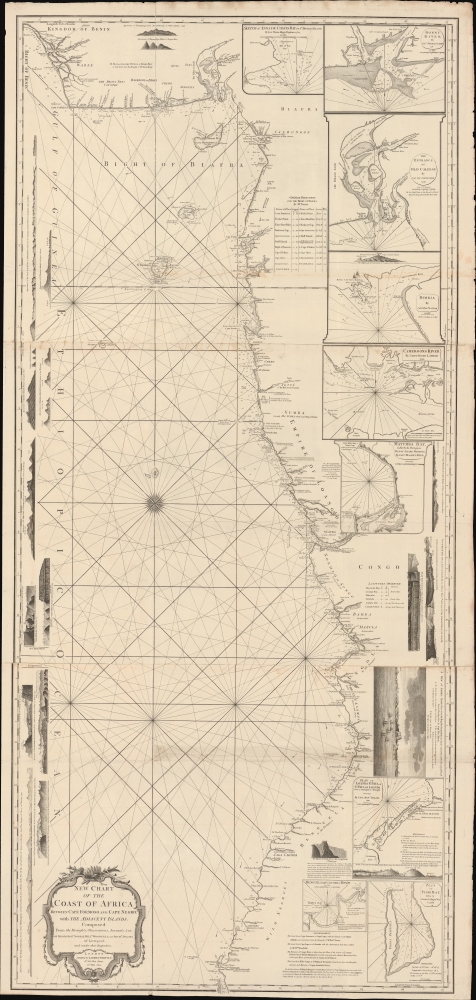
New Chart of the Coast of Africa between Cape Formoso and Cape Negro, with the Adjacent Islands.
sold
- Digital Map Information
- Suitable for large format printing
- DPI: 600
- File Size: 2103.64 MB
- File Type: ZIP / TIFF
- ICC color profile embedded
- Delivered instantly via download link
An intriguing 1794 nautical map of West Africa south of the Bite of Biafra. The chart was issued by Laurie and Whittle, but made for the African slave trade based on the detailed reports of prominent slavers and slave ship captains: Robert Norris, William Woodville, and Archibald Dalzel. It appeared at the height of the Triangle Trade, when countless Africans were captured and sold into captivity in the Americas. As such, the chart offers significant insights into the African Trade along central-west coasts. (more details)
Overlooking South Natick.
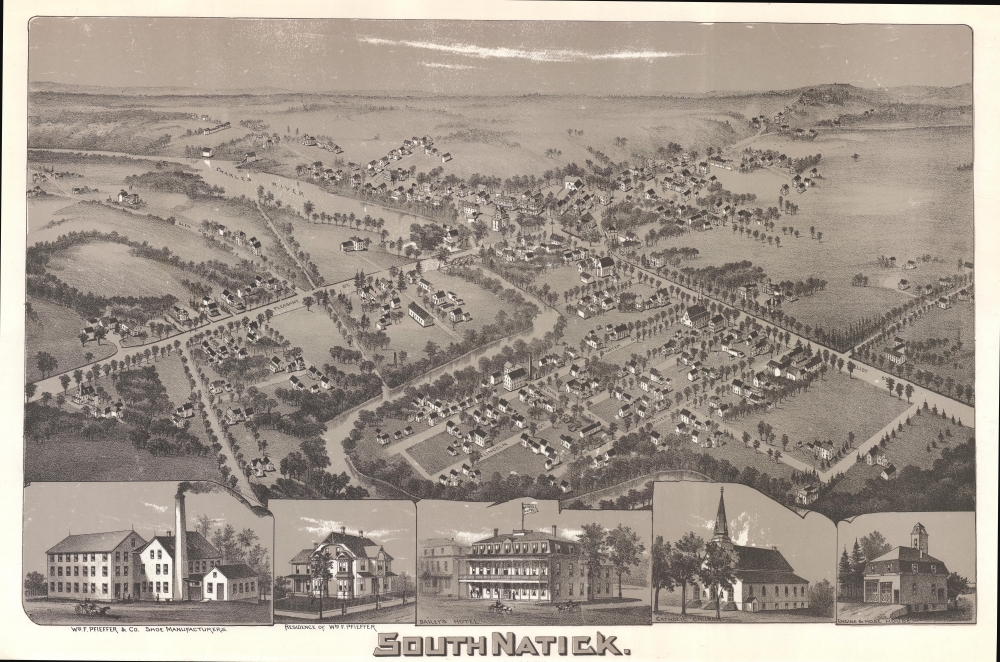
South Natick Massachusetts.
sold
- Digital Map Information
- Suitable for large format printing
- Full resolution TIFF file
- ICC color profile embedded
- Delivered instantly via download link
This is a rare 1887 lithograph bird's-eye view of South Natick, Massachusetts, by an unknown artist. (more details)
Paris of the Caribbean.

Plano parcial comercial de la Habana.
sold
- Digital Map Information
- Suitable for large format printing
- File Size: 90.52 MB
- File Type: ZIP / TIFF
- ICC color profile embedded
- Delivered instantly via download link
This is a rare and fascinating 1948 map of the commercial center of Havana, Cuba, printed there by Gilberto Machado Abreu for the use of English-speaking tourists and businessmen. It reveals a plethora of businesses catering to visitors of the city, from hotels to drug stores to record stores to photographers, providing a fascinating glimpse of the city during the Republican period prior to Batista's 1952 coup. It is the Havana that would have been familiar both to Ernest Hemingway, and to Graham Greene. (more details)
First comprehensive modern survey of Oahu.
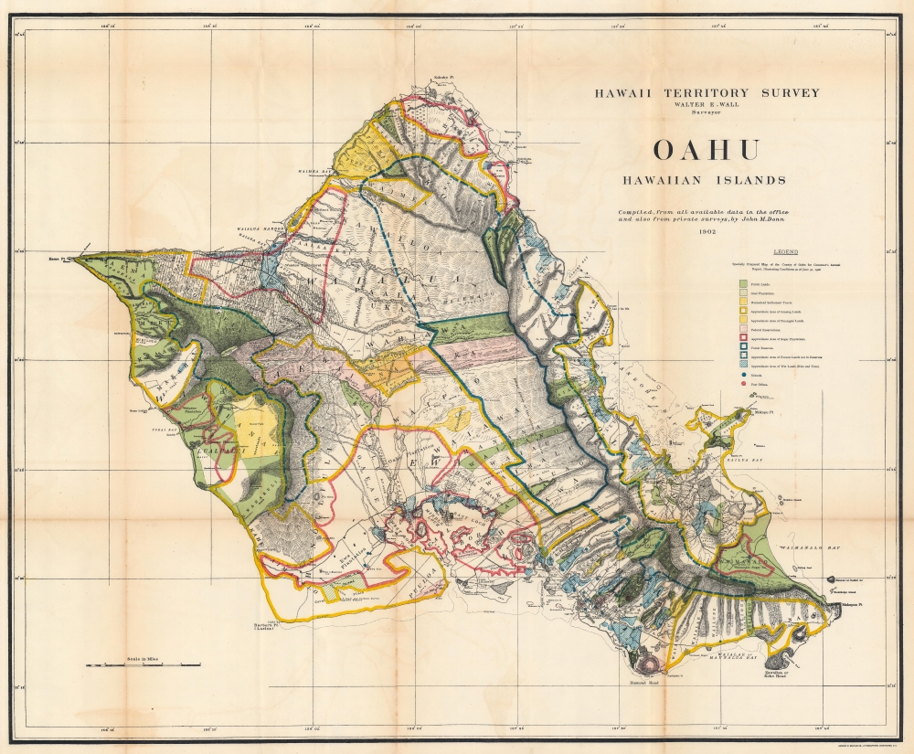
Oahu Hawaiian Islands.
sold
- Digital Map Information
- Suitable for large format printing
- File Size: 107.82 MB
- File Type: ZIP / TIFF
- ICC color profile embedded
- Delivered instantly via download link
This is a 1906 John M. Donn map of Oahu, Hawaiian Islands. It represents the first comprehensive modern mapping of Oahu. (more details)
Rare route map following an armored combat command.
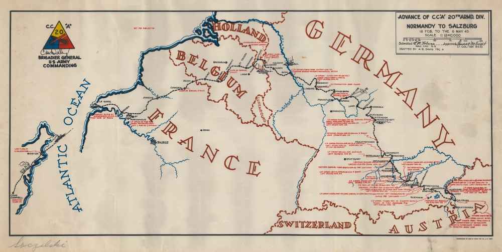
Advance of CC 'A' 20th Armd. Div. Normandy to Salzburg 18 Feb. to the 6 May 45.
sold
This is the rare 1945 A. B. Davis 20th Armored Division World War II pictorial route map of Europe. The map focuses on travels of the Combat Command A (CCA) of the 20th Armored Division. (more details)
One of the earliest uses of the term 'Arrowhead' to describe NE Minnesota.

The Arrowhead.
sold
This is a 1929 Irene Anderson and Kathryn Arnquist pictorial map of the Arrowhead Region of Minnesota. It represents one of the earliest uses of the term 'Arrowhead' to refer to northeastern Minnesota. (more details)
Yosemite by stagecoach!
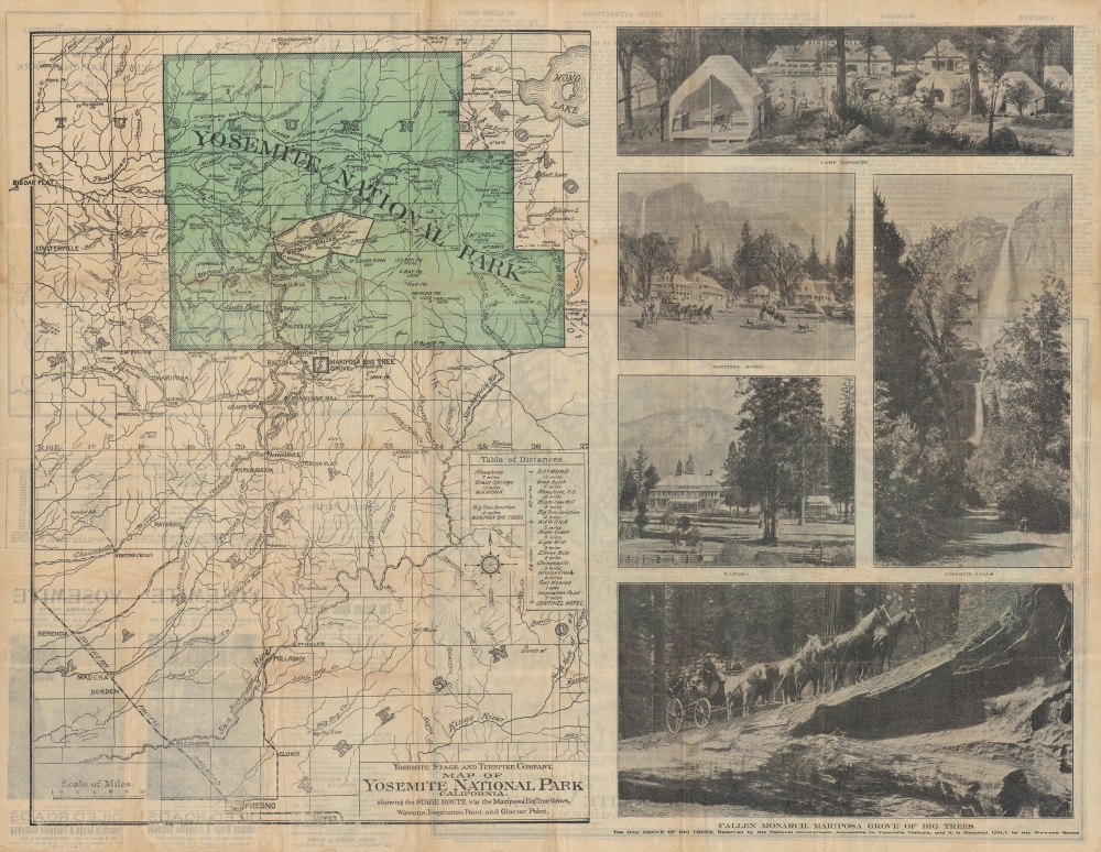
Yosemite Wawona Route via Mariposa Big Trees, Inspiration Point and Glacier Point.
sold
- Digital Map Information
- Suitable for large format printing
- Full resolution TIFF file
- ICC color profile embedded
- Delivered instantly via download link
This is a c. 1885 Yosemite Stage and Turnpike Company map of Yosemite National Park, California. (more details)
The Best Saltwater Fishing in Mississippi.
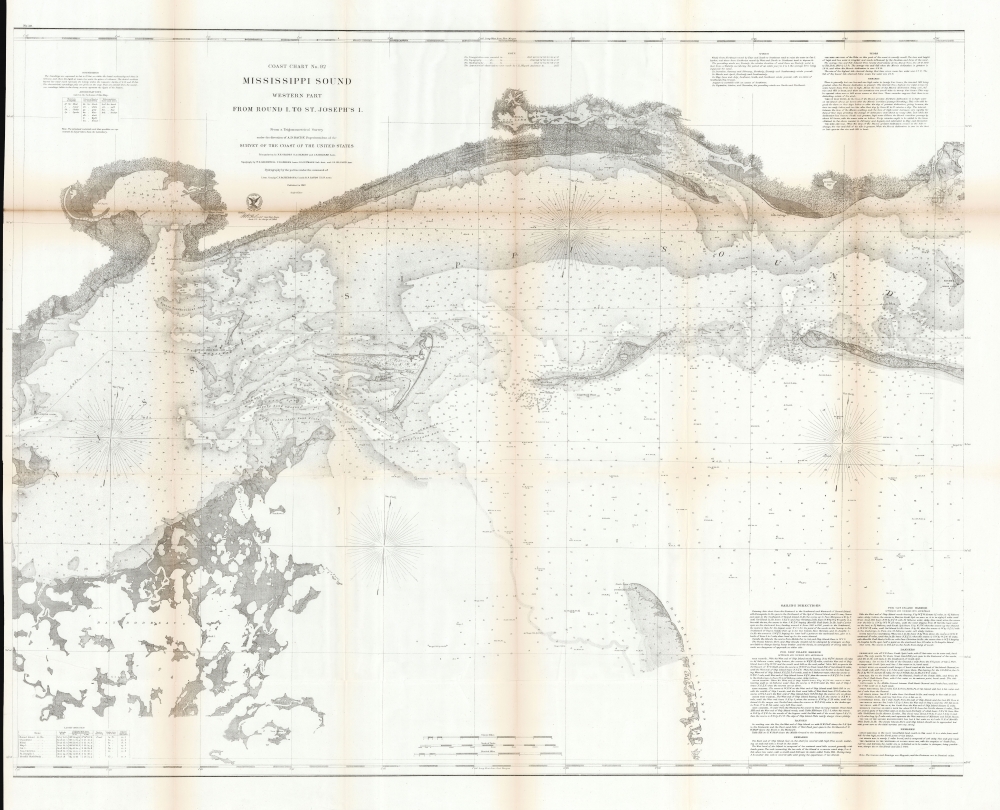
Coast Chart No. 92 Mississippi Sound Western Part From Round I. to St. Joseph's I.
sold
- Digital Map Information
- Suitable for large format printing
- File Size: 175.79 MB
- File Type: ZIP / TIFF
- ICC color profile embedded
- Delivered instantly via download link
This is a scarce 1860 U.S. Coast Survey chart of the western part of the Mississippi Sound. While charts of the Gulf Coast generally are not uncommon, very few address this part of the Mississippi sound with such detail, giving this chart a unique focus on a favored fishing haunt. (more details)
Predicting an Allied assault in Africa published three weeks before Operation Torch.
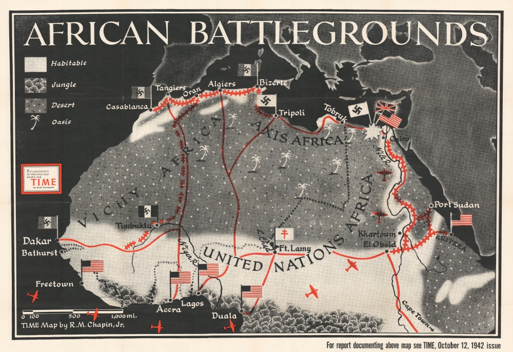
African Battlegrounds.
sold
This is a separately issued large-format 1942 Robert M. Chapin, Jr. map of North Africa. Focusing on the northern half of the continent, red lines connect major population centers and flags identify European occupation. In an intriguing detail, Vichy French-occupied cities are marked by flags bearing swastikas, leaving little doubt as to how the editors of TIME viewed Pétain's regime. Rail lines between Casablanca, Oran, Bizerte, and Timbuktu are illustrated, as are lines between Cairo and Eritrea. Airplane silhouettes reference the air resupply route between the United States and Cairo via West Africa. (more details)
Comical historical map of the Cape.
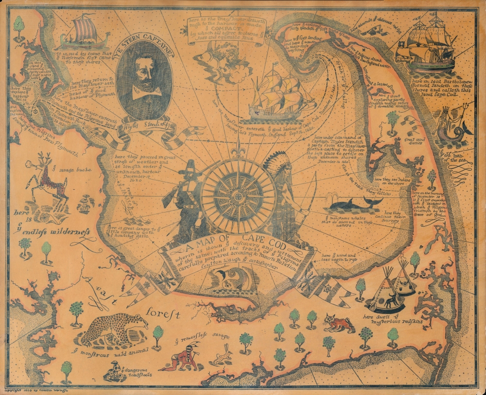
A Map of Cape Cod Wherin is showing ye discovery and ye settlement of the same; with the tracks of ye pilgrims carefully prepared according to Mourts Relation.
sold
- Digital Map Information
- Suitable for large format printing
- Full resolution TIFF file
- ICC color profile embedded
- Delivered instantly via download link
This is Coulton Waugh's 1926 map of Cape Cod. This is the second pictorial map issued by Waugh, predated only by his map of Provincetown (1924). (more details)
The produce and pleasures of Northern California.
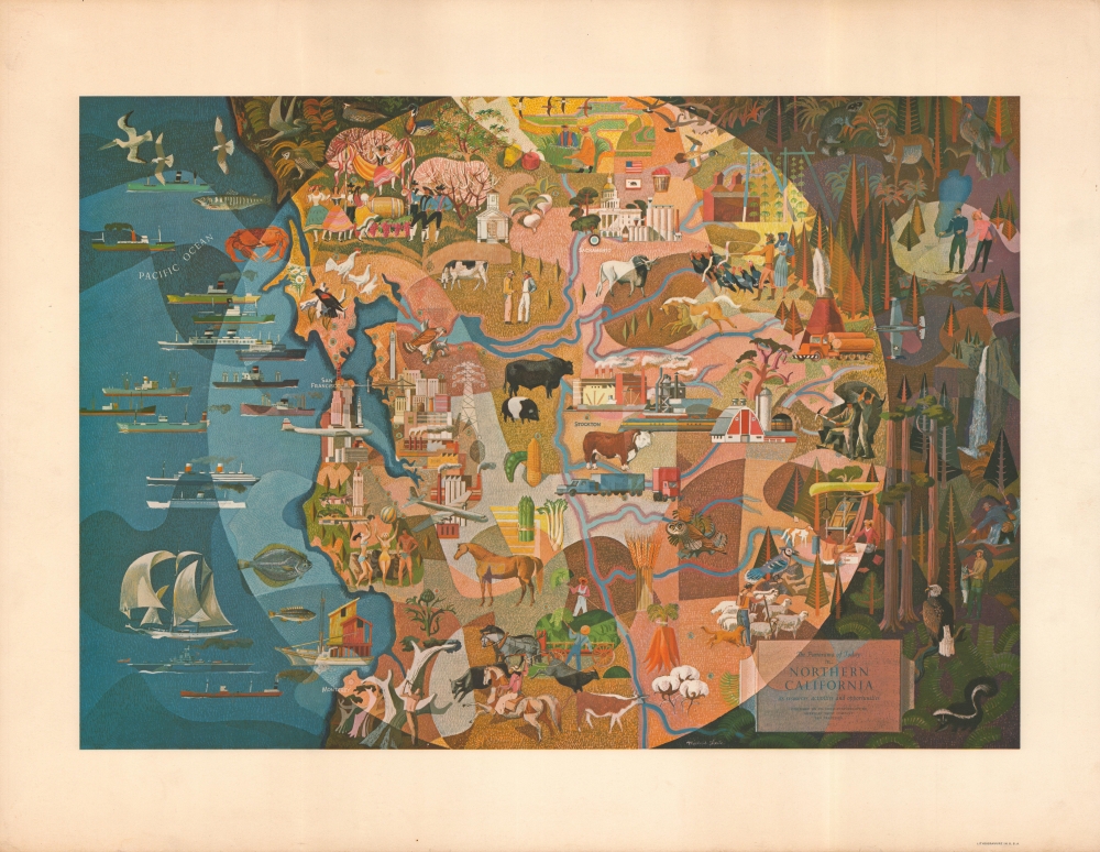
The Panorama Today in Northern California its resources activities and opportunities.
sold
- Digital Map Information
- Suitable for large format printing
- File Size: 31.85 MB
- File Type: ZIP / TIFF
- ICC color profile embedded
- Delivered instantly via download link
A highly-stylized c. 1950 pictorial map of Northern California by Millard Sheets, commissioned by the American Trust Company. It highlights the wide variety of economic and leisure activities in the region. (more details)
Take New York home with you.

[Manhattan].
sold
- Digital Map Information
- Suitable for large format printing
- Full resolution TIFF file
- ICC color profile embedded
- Delivered instantly via download link
An unusual and humorous die cut postcard pictorial map of Manhattan, produced in 1946 by Max Poschin. (more details)
Earliest Acquirable Accurate Map of the Southwest?
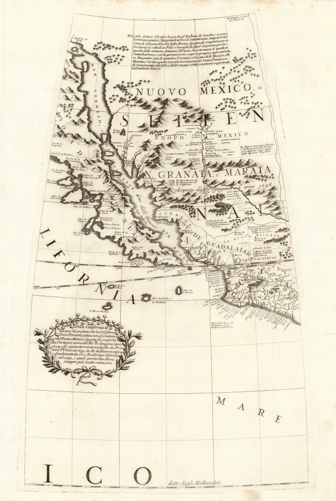
[Untitled Globe Gore of Western North America from the Equator to approximately 50º north].
sold
- Digital Map Information
- Suitable for large format printing
- Full resolution TIFF file
- ICC color profile embedded
- Delivered instantly via download link
This is the globe gore focusing on the American southwest, engraved in 1688 for Vincenzo Coronelli's 42-inch (3 1/2 foot) terrestrial globe, reprinted in 1697 for inclusion in his Libro dei Globi and Isolario. This beautiful engraving is striking in its presentation of the insular California, but this is not its most important feature. Rather it represents the earliest correct depiction of the Rio Grande generally acquirable to the collector. (more details)
Greenwich Village!
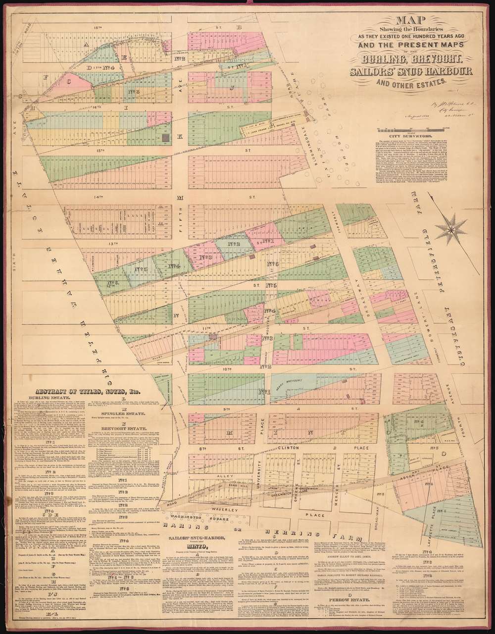
Map Showing the Boundaries As They Existed One Hundred Years Ago of the Burling, Brevoort, Sailors' Snug Harbour And Other Estates.
sold
- Digital Map Information
- Suitable for large format printing
- File Size: 67.22 MB
- File Type: ZIP / TIFF
- ICC color profile embedded
- Delivered instantly via download link
This is a John Bute Holmes 1882 cadastral map of eastern Greenwich Village, one of New York City's most famous neighborhoods, the cradle of the LGBT movement, and the home of New York University. The map depicts the neighborhood from Sixth Avenue to Fourth Avenue and from 18th Street to Waverly Place and Washington Square Park. Highly detailed, Holmes visually conveys the history of the development of this part of Greenwich Village, with the original lots illustrated in dotted lines superimposed over the street grid and the much smaller lots that make up the city blocks. Each lot within each city block is identified numerically. A brief history of the ownership of estates and other tracts in the neighborhood is printed on the map along the left side and the bottom. (more details)