
Visit the Texas Panhandle!
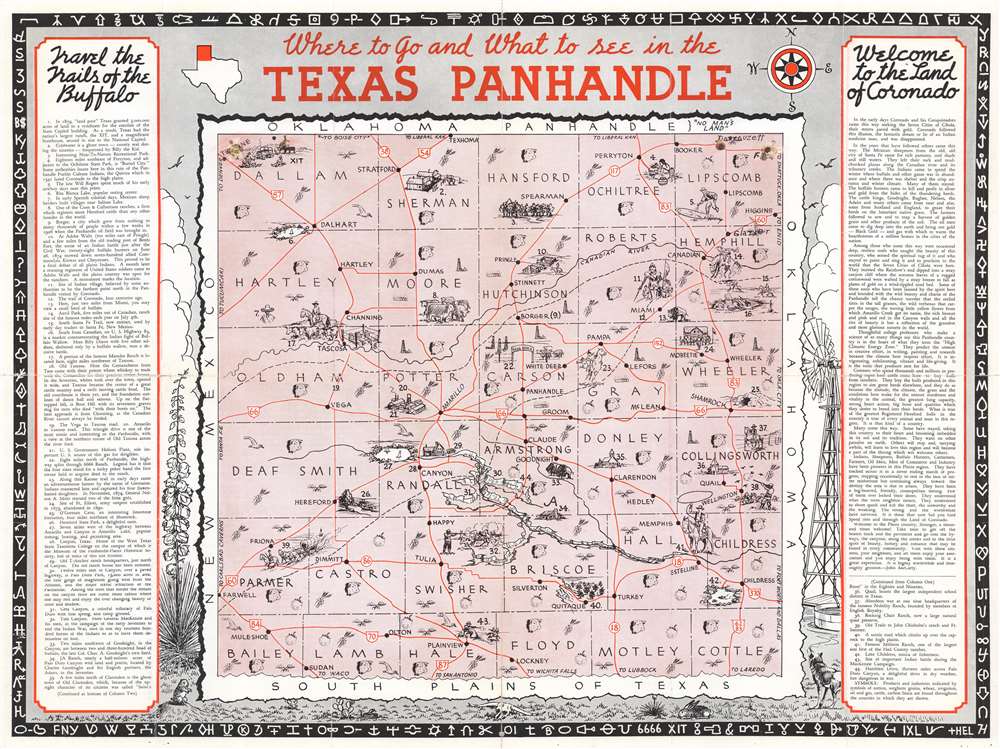
Where to Go and What to See in the Texas Panhandle.
sold
- Digital Map Information
- Suitable for large format printing
- Full resolution TIFF file
- ICC color profile embedded
- Delivered instantly via download link
This is a c. 1935 pictorial map of the Texas Panhandle by an unknown artist. Depicting from the Oklahoma border south to Bailey, Lamb, Hale, Floyd, Motley, and Cottle counties, counties throughout the panhandle are illustrated and labeled. Icons mark areas where wheat, cotton, and sorghum are grown, cattle are raised, and oil and gas are extracted. Vignettes illustrate ranchers and other frontier settlers, Native Americans, and sites across the Panhandle. Forty-four of these sites are numerically identified and correspond with an index situated in the text boxes to the left and right of the map. Among these are tourist attractions, historic sites, and ranches. Since this piece was created for tourists visiting the Panhandle, red lines trace the region's highways and cities and towns, including Amarillo, are labeled. A pictorial scene surrounds the map and illustrates a stereotypical understanding of life in the Texas Panhandle: a prairie dog, jackrabbit, and coyote appear alongside cacti, a longhorn skull, a windmill, and a flowering yucca plant. Clouds tower above it all, creating a feeling of the vastness of this part of the United States. The whole is surrounding by a border made up of cattle brands. (more details)
One of the world's greatest archeological treasures!
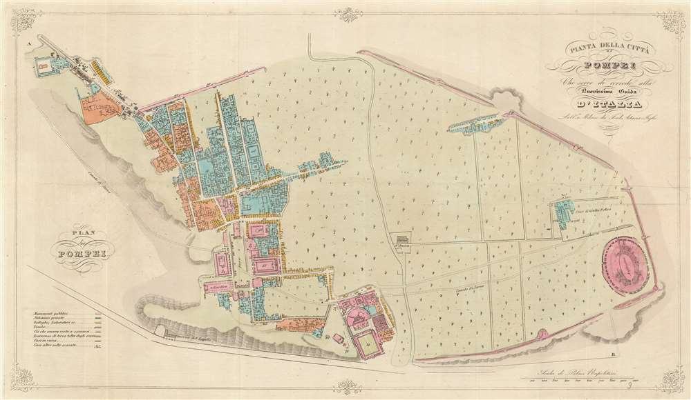
Pianta della Città di Pompei Cheserve di corredo alla nuovissima Guida d'Italia.
sold
- Digital Map Information
- Suitable for large format printing
- DPI: 600
- File Size: 10.36 MB
- File Type: ZIP / TIFF
- ICC color profile embedded
- Delivered instantly via download link
This is an 1841 Ferdinando Artaria city plan or map of ancient Pompeii. The map depicts the famously devastated city from the Villa of Diomede to the amphitheater. Colors differentiate between public buildings, private buildings, buildings in ruins, and areas that had not yet been excavated. Numbers identify over 110 locations throughout the city, but unfortunately, the corresponding index has been lost. The Forum, Basilica, Amphitheater, and Giulio Felice house are identified by name. (more details)
Likely published within days of the D-Day landings in Normandy, France.
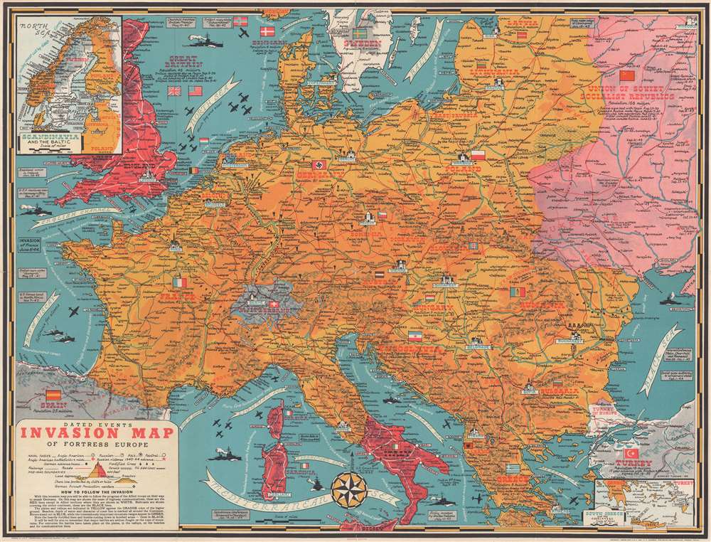
Dated Events Invasion Map of Fortress Europe. Seventh Edition.
sold
- Digital Map Information
- Suitable for large format printing
- Full resolution TIFF file
- ICC color profile embedded
- Delivered instantly via download link
This is a 1944 Stanley Francis Turner pictorial map of Europe just after the D-Day invasion of France. This is the first edition of Turner's 'Dated Events War Map' series to depict the D-Day invasions, published only days after the landings in France. (more details)
A wonderful wall map of the White Mountains.
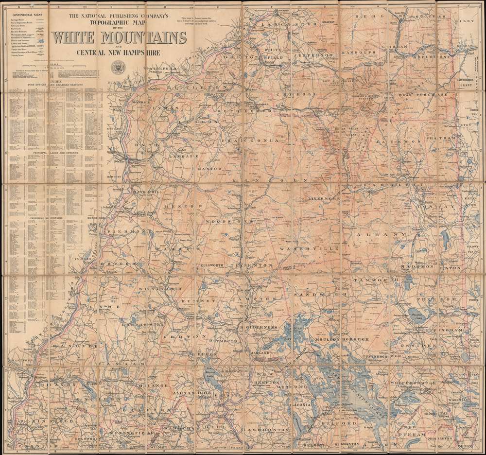
The National Publishing Company's Topographic Map of the White Mountains and Central New Hampshire.
sold
- Digital Map Information
- Suitable for large format printing
- File Size: 83.26 MB
- File Type: ZIP / TIFF
- ICC color profile embedded
- Delivered instantly via download link
This is a 1902 National Publishing Company map of the White Mountains and central New Hampshire that labels individual peaks throughout the area. Depicting central New Hampshire from Lancaster and Berlin Mills south to Cornish, South Danbury, and Alton Bay, cities, towns, and villages are labeled, with communities served by post offices and railroad stations labeled as such. Grants and purchases around the area are labeled in different typefaces, with some marked in large bold lettering, while others, like the Allen grant in Waterville County, are much less noticeable. Roads are illustrated, as are several railroads, including the Northern Division and the White Mountain Division of the Boston and Maine Railroad and several abandoned lumber railroads. Counties are demarcated and identified, and rivers and lakes are colored blue and labeled. Mountains are illustrated using contour lines, labeled, and their elevations provided. An index along the left side lists post offices, railroad stations, principal lakes and streams, and principal mountains and provides the grid location for each one. (more details)
On the eve of the Texan Revolution...
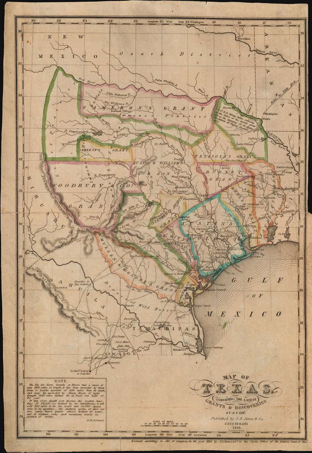
Map of Texas, containing the latest Grants and Discoveries by E. F. Lee.
sold
- Digital Map Information
- Suitable for large format printing
- Full resolution TIFF file
- ICC color profile embedded
- Delivered instantly via download link
The rare 1836 Edmund F. Lee map of Texas and accompanying History of Texas by David Barnett Edward - a seminal work published on the eve of the March 1836 Texan Revolution and founding of the Republic of Texas. The map is loosely derived from the Stephen Austin map, the only readily available source at the time, but has been reduced and revised by Lee for smaller format publication. It unveils Texas extending from the Sabine to the Nueces River and from Corpus Christi to the Red River. A note in the lower left expresses the Texan ambition to extend the boundary west as far as the Rio Grande. The map notes several early Texas Empresario Land Grants, including: 'McMullen and McGlone', Woodbury, Cameron (2), 'Austin and Williams', Austin, DeWitt, Austin's Colony, De Leon, Burnet, Powers, Whelin, Zavallo, and Felisola. (more details)
WWI Africa Campaign Espionage.

Mwánsa B3 / [Mwanza B3].
sold
- Digital Map Information
- Suitable for large format printing
- Full resolution TIFF file
- ICC color profile embedded
- Delivered instantly via download link
This is a unique manuscript record of reconnaissance and espionage at the height of the World War I East Africa Campaign compiled by Belgian Force Publique intelligence officer G. Massart. This c. 1916 hand-drawn field manuscript details the Mwanza region of northern Tanzania in anticipation of the Tabora Offensive, a major Allied action in the northwestern corner of German East Africa during the East Africa Campaign, World War I (1914 - 1918). The map shows latitude and longitude and offers a wealth never-before-mapped detail regarding topography, roads and paths (red lines), waterways, tribal villages, and geographical features. Before the war, the Mwanza was poorly understood, thus Massart would have been dispatched from the adjacent Belgian Congo to reconnoiter the area - vital for its port access to Lake Victoria - in advance of major action. (more details)
Extremely Rare Imprint of one of Blaeu's Rarest Maps.
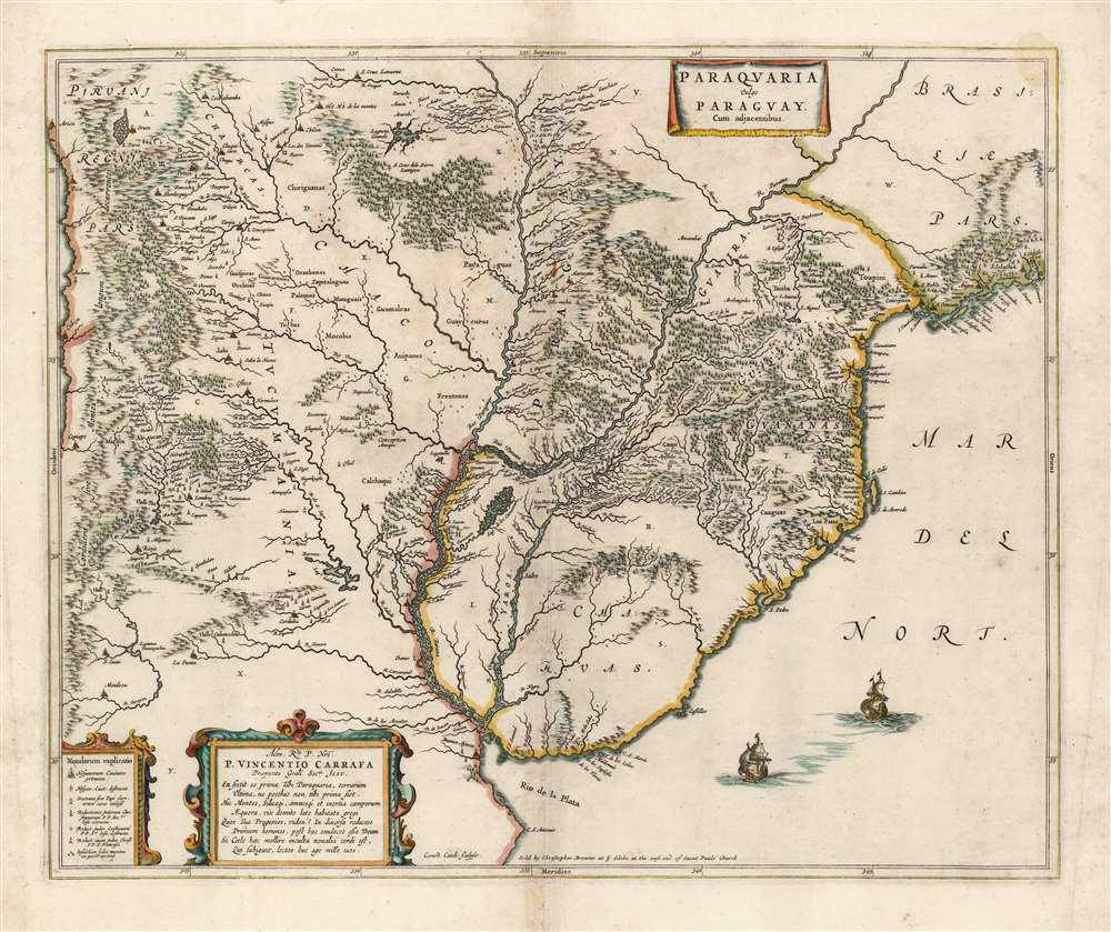
Paraquaria Vulgo Paraguay Cum adjacentibus.
sold
- Digital Map Information
- Suitable for large format printing
- Full resolution TIFF file
- ICC color profile embedded
- Delivered instantly via download link
This rare, superb Blaeu map is one of the finest maps of the lower Rio de la Plata, and the first map to name the Uruguay River. It covers what is now Uruguay, Paraguay, northern Argentina, and part of Chile in magnificent detail, illustrating the complicated regional river system, Argentina's endoheiric lakes, and other bodies of water appear. Some, for example the Lago de los Caracaras flowing into the Corriente River, depict areas accurately that remain poorly mapped today. (The Caracaras would appear to be the Itatí Lagoon.) Mountains and highlands are shown pictorially. Numerous settlements and missions are named. With the assistance of a key in the lower left, one is able to differentiate indigenous settlements from Spanish cities (both extant and ruined,) clerical schools, Jesuit missions (both extant and ruined,) and Franciscan missions. (more details)
A brilliant sun, and the bluest of skies...

Map of Texas A brilliant sun, and bluest skies, Where the world looks brighter to the eyes -- That's Texas.
sold
- Digital Map Information
- Suitable for large format printing
- Full resolution TIFF file
- ICC color profile embedded
- Delivered instantly via download link
One of only two known examples of the Godwin / McKenzie c. 1934 pictorial map of Texas. The map focuses on Texas, with surrounding regions blacked out. Other than city names, it features little political detail, but offers a wealth of illustrations humorously focusing on Texas history, folklore, flora, fauna, and culture. Derricks are evident throughout north Texas, underscoring the state's legendary oil deposits. The locations of Baylor University, Texas A and M, Simmons, and the University of Texas are noted. Major cities are illustrated as pictorial vignettes. Filling the 'blank' areas surrounding the state, there are illustrations of Texas flora, fauna, culture, points of pride, and the state capitol building. (more details)
Iconic Bird's-Eye View of Korea.

朝鮮安内 / [Guide to Chōsen].
sold
- Digital Map Information
- Suitable for large format printing
- Full resolution TIFF file
- ICC color profile embedded
- Delivered instantly via download link
This is a beautiful 1937 Koyama Kichizō bird's eye view map of the Korean Peninsula, with southern Japan and parts of northeastern China in the background. It was issued by the colonial Government-General (朝鮮總督府) in Keijo (京城 Seoul) for Japanese tourists, businessmen, and residents of Korea. A marginal note indicates that the military has reviewed and approved the mapping of fortifications in several regions. (more details)
Remarkable aerial photograph of Boston advertising lightbulbs.

Tercentenary Historic Boston View from the Air on the Way to Historic Danvers Home of Champion Lamps Tubes.
sold
- Digital Map Information
- Suitable for large format printing
- File Size: 27.12 MB
- File Type: ZIP / TIFF
- ICC color profile embedded
- Delivered instantly via download link
This is a 1930 Fairchild Aerial Surveys and Champion Radio Works map or view of Boston, Massachusetts. The map depicts Boston from the Charles River to Boston Harbor and the Fort Point Channel and from the Mystic River and Upper Boston Harbor to the Fort Point Channel. Twenty-one different locations in and around Boston are numerically labeled using what appear to be small pots. Notes locations include the south and north train stations, Boston Common, the Hotel Statler (then the newest of the 'large hotels'), and the Old North Church. Explanations for these locations are situated along both the left and right margins. By using an aerial photograph, this Champion Radio Works promo allows for a much more realistic view of Boston. Individual buildings are distinguishable, including Boston Garden, which was opened only two years before this photo was taken. The photograph is framed by an advertisement for Champion Lamps and Tubes. A Champion bulb is depicted in the upper left corner, along with a packaged radio tube on the lower left and a packaged lamp bulb on the lower right. (more details)
An Attractive 18th Century Map of Siam.
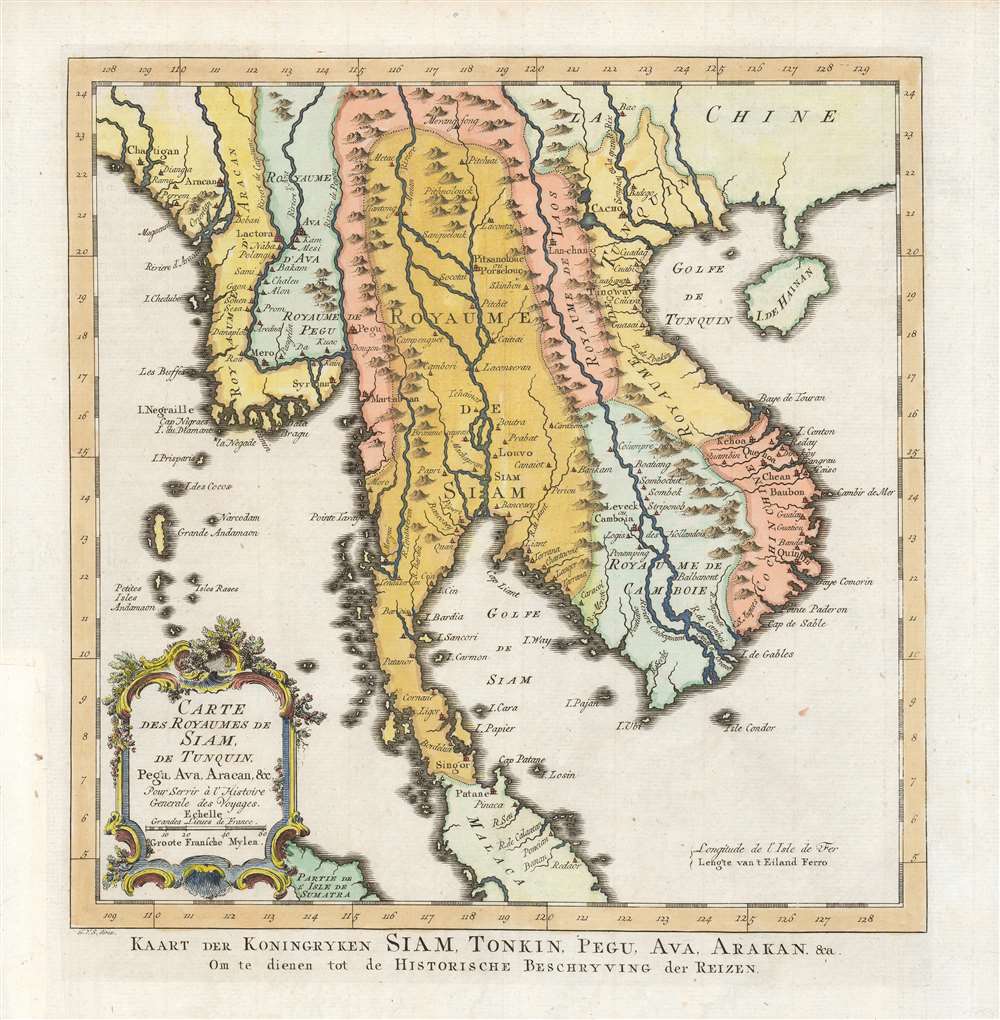
Carte des Royaumes de Siam, de Tunquin, Pegu, Ava, Aracan etc./ Kaart der Koningryken Siam, Tonkin, Pegu, Ava, Arakan etc./ Om te dienen tot de Historische Beschryving der Reizen.
sold
- Digital Map Information
- Suitable for large format printing
- Full resolution TIFF file
- ICC color profile embedded
- Delivered instantly via download link
This is the 1755 Dutch edition of Bellin's map of Southeast Asia, engraved by Jakob van der Schley for inclusion in the Dutch edition of Abbe Prévost's Histoire Générale des Voyages. Centered on the Chao Phraya River, this map covers from the Kingdom of Aracan to the Gulf of Tonkin and from China to the Malay Peninsula, including the modern day nations of Thailand, Cambodia, Laos, Vietnam, Burma, and Malaysia. This map represented a considerable advancement of mapping of the interior of Southeast Asia over the maps of De l'Isle which preceded it, with numerous cities, fortifications, temples, and mountain ranges noted. The map identifies the cities of Siam (Ayutthaya), Bangkok, Lau Chang (Luong Prabong), and Pegu. Many of the islands in the Gulf of Thailand, including Samui, and in the Andaman Islands are noted as well. (more details)
The Way of St. James... it is not the destination but the journey.
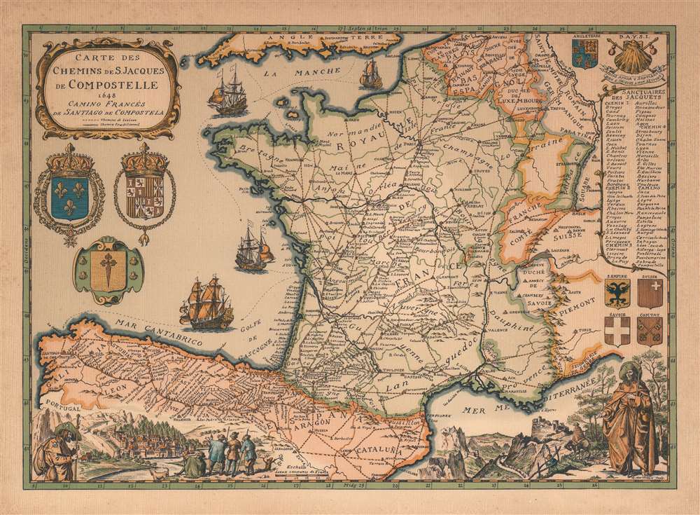
Carte des Chemins de S. Jacques de Compostelle 1648 Camino Francés de Santiago de Compostela.
sold
This is a 1973 Daniel-Louis Derveaux map of France and northern Spain, illustrating the historic pilgrimage to Santiago de Compostela. Derveaux crafted this map in the 17th - 18th century styles of J. B. Homann and Blaeu, but in fact the map was issued as a novelty item in the early 1970s. Dotted lines illustrate the historic pilgrimage routes across Europe from centers in Paris, Vezelay, and Le Puy, across the Pyrenees near Pamplona, then directly west across northern Spain to Santiago, located in the far northwestern province of Galicia. Iconography associated with the pilgrimage, including a scallop shell and multiple armorial crests, surround the map. In the lower right and left, vignette views feature a traditionally garbed pilgrim, complete with staff, hat, and scallop shells. (more details)
Pin the tail on the state...

The Flying Donkey Game.
sold
- Digital Map Information
- Suitable for large format printing
- Full resolution TIFF file
- ICC color profile embedded
- Delivered instantly via download link
This is a c. 1950 Edward Smith Manufacturing Company pictorial game map of the United States. Called 'The Flying Donkey Game' and played in much the same manner as pin the tail on the donkey, each player used one of the airplanes printed to the right (presumably cut out beforehand), was blindfolded, spun around, and pinned their airplane to the map. Depending on where the airplane landed, the player would act out the nearest action to the nose of the airplane, of which each state had its own. Among these actions are 'walk a straight line on tiptoes', 'don't let anyone make you smile', and 'howl like a hound dog'. Unfortunately, some actions, such as 'put real action into an Indian war dance' and 'ask a question using only sign language' (which is illustrated using Native American smoke signals) have not aged well. This game was marketed toward parents of young children as a party activity. (more details)
The Earthquake that Transformed Tokyo.

關東震災全地域鳥瞰圖繪 / [Bird's-eye View of the Entire Area of the Kanto Earthquake Disaster].
sold
- Digital Map Information
- Suitable for large format printing
- Full resolution TIFF file
- ICC color profile embedded
- Delivered instantly via download link
This is a rare, poignant bird's-eye view of Tokyo in the aftermath of the 1923 Great Kanto Earthquake by master painter-cartographer Yoshida Hatsusaburō. Coverage includes Tokyo, Yokohama, Mt. Fuji, and surrounding areas. This view was printed and distributed in 1924 (Taisho 13), just after the one-year anniversary of the disaster by the Osaka Mainichi Shimbun and is a fascinating record of both commemoration and reconstruction. (more details)
Celebrated Mexican artist Miguel Gomez Medina.

Mexico Pictorial Map.
sold
- Digital Map Information
- Suitable for large format printing
- File Size: 36.69 MB
- File Type: ZIP / TIFF
- ICC color profile embedded
- Delivered instantly via download link
This is a rare 1931 Miguel Gómez Medina pictorial map of Mexico. Depicting the entire country and beautifully illustrated, Medina seamlessly blends Mexico's culture, agriculture, and industry into a coherent and attractive whole. Mayan ruins are illustrated in the Yucatan Peninsula, highlighting Mexican history. Oranges, cacao, bananas, pineapple, coffee, and cotton are among the crops included to emphasize agriculture, while fish, sharks, oysters, and other sea life show the bounty of Mexico's coastal waters. Factories and oil derricks promote Mexican industry. Even Mexican terrain is depicted, from the deserts of the north to the jungles of the south. (more details)
Important early Civil War Map illustrating the first major Union victory on the Mississippi River at New Madrid or the Kentucky Bend.
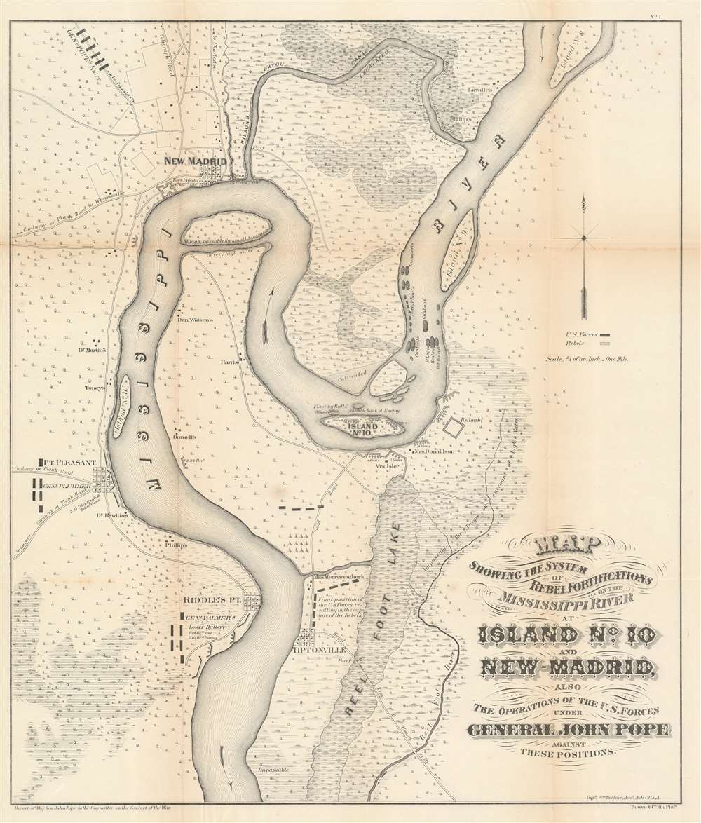
Map showing the system of rebel fortifications on the Mississippi River at Island No. 10 and New Madrid, also the operations of the U.S. forces under General John Pope against these positions.
sold
- Digital Map Information
- Suitable for large format printing
- File Size: 20.91 MB
- File Type: ZIP / TIFF
- ICC color profile embedded
- Delivered instantly via download link
A scarce and important 1862 Civil War map illustrating the course of the Mississippi River in the vicinity of New Madrid, Point Pleasant, Riddles Point, and Tiptonville. This region, collectively known as the Kentucky Bend, is situated at the meeting point of Missouri, Kentucky, and Tennessee. The map was prepared by Major General John Pope, a Union Commander, to illustrate his decisive siege and take over the strategically situated and heavily fortified Island No. 10. Located just upriver from New Madrid, Island No. 10 is situated at a sharp northward curve in the Mississippi. The Confederate Army fortified the island realizing that, if they could control Island No. 10, they could effectively prevent Union forces from using the Mississippi as gateway to the Deep South. (more details)
Days after the Rape of Nanjing.

南京 / [Nanjing].
sold
- Digital Map Information
- Suitable for large format printing
- Full resolution TIFF file
- ICC color profile embedded
- Delivered instantly via download link
This is a very rare Koyama Kichizō bird's-eye view map of Nanjing from 1938 (Showa 13), soon after the Rape of Nanjing by Japanese forces in the Second-Sino Japanese War (1937 - 1945). The Yangtze River forms a great arc across the map and, outside of the walled city of Nanjing, major Chinese cities (Shanghai, Xi'an, Chongqing, etc.) are noted in the distance. The idyllic depiction of Nanjing here gives no sense of the intense battle and horrific massacres that had just taken place. (more details)
The culmination of the Coast Survey's work in New York Harbor.

Bay and Harbor of New York.
sold
- Digital Map Information
- Suitable for large format printing
- File Size: 60.9 MB
- File Type: ZIP / TIFF
- ICC color profile embedded
- Delivered instantly via download link
The ultimate expression of the U.S Coast Survey chart of New York City, its harbor, and environs. This nautical chart, dating to 1874, is the culmination of the U.S. Coast Survey's mapping of New York City. Much of New York City as we know it today is illustrated here, including Manhattan, Queens, Brooklyn, the Bronx, and part of Staten Island. The depicted area also includes Jersey City, Newark, and Hoboken. Sumptuous detail is present throughout, with city blocks, important buildings, farms and fields, river ways, streams, swamps, and topographical details. In addition to inland detail, this chart contains a wealth of practical information for the mariner from depth soundings, to notes on harbors, and navigation tips about important channels. Tables detailing light houses and beacons, tides, and magnetic declination, are included as well. (more details)
A liberal railroad nexus...

哈爾濱市街圖 / [Harbin Street Map].
sold
- Digital Map Information
- Suitable for large format printing
- Full resolution TIFF file
- ICC color profile embedded
- Delivered instantly via download link
This is a very rare 1933 South Manchuria Railway Company (Mantetsu) map of Harbin, China. It combines practical information and propaganda soon after Harbin and the rest of Manchuria were incorporated fully into Japan's empire. The map is a guide for Japanese business travelers and tourists, focusing particularly on the urban districts of Nangang (南崗, 新市街), the Docks (埠頭區), and areas along the Sungari River (松花江). (more details)
The oldest bridge in Paris.

Vue du Pont Neuf.
sold
- Digital Map Information
- Suitable for large format printing
- DPI: 600
- File Size: 11.89 MB
- File Type: ZIP / TIFF
- ICC color profile embedded
- Delivered instantly via download link
This is an 1844 Jules Arnout view of the Pont Neuf in Paris, France. Pont Neuf, the oldest bridge in Paris, connects the left and right banks of the Seine with the Ile de la Cité. Parisians are illustrated crossing the bridge on foot and in carriages, while barges transport goods along the Seine. The buildings of the Ile de la Cité occupy the center of the view, with the square towers of Notre Dame appearing at center and the round towers of the Conciergerie (originally part of the Palais de la Cité) identifiable along the left. (more details)