
The great fauna of Africa.
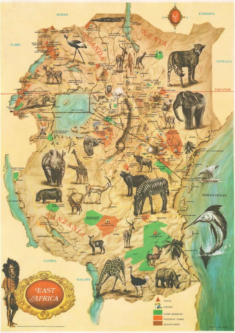
East Africa.
sold
This is a c. 1970 Hameed Moghul pictorial map of East Africa, including Kenya, Tanzania, and Uganda. Wonderful color illustrations of iconic African wildlife, including a cheetah, rhinoceros, elephant, zebra, and giraffe. These portraits provide a framework for the map, which highlights national parks (orange) and game reserves (green). The Rift Valley Lakes, such as Lake Victoria, Lake Tanganyika, and Lake Malawi, are illustrated and labeled. Icons mark lodges, hotels, and campsites (tents), and are explained in a legend in the lower right. Yellow lines trace major road networks. (more details)
Pictorial Florida in the 1930s.
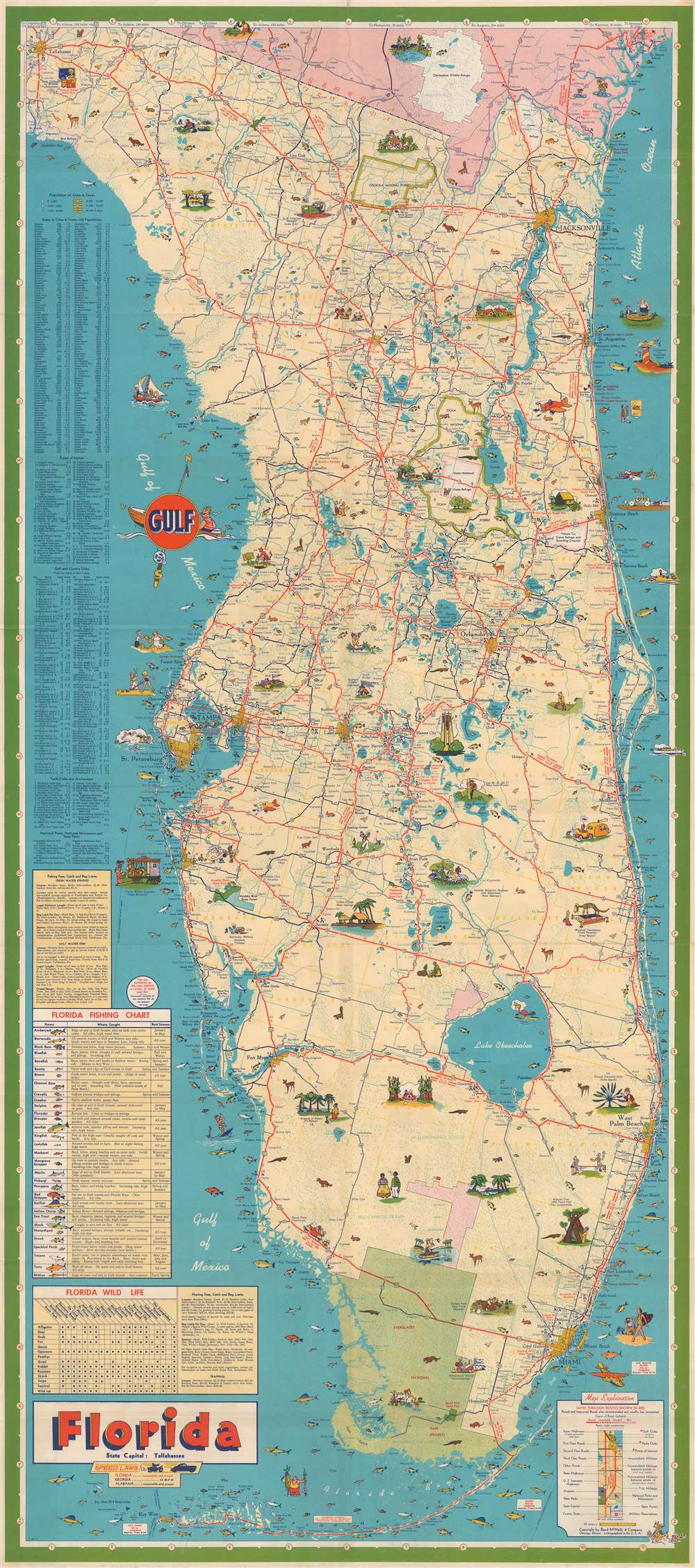
Florida.
sold
- Digital Map Information
- Suitable for large format printing
- Full resolution TIFF file
- ICC color profile embedded
- Delivered instantly via download link
This is a 1938 Rand McNally and Company pictorial tourist map of Florida. Pictorial vignettes highlight tourist activities, modern conveniences (airplanes and automobiles), and tourist sites, including Bok Tower and Silver Springs. Everglades National Park (which would not be officially established until 1949) is labeled as a 'project'. Red lines highlight state and federal highways. A table containing illustrations of thirty-two different fish that can be caught off Florida's coast occupies the left border. It provides potential fishermen with information on where each species is caught and what time of year is best for each one. Nineteen of these fish have a number associated with them, which is used as an identifier for the small illustrations along the coastline. A hunter's guide appears along the left border as well. (more details)
Brooklyn in da house!
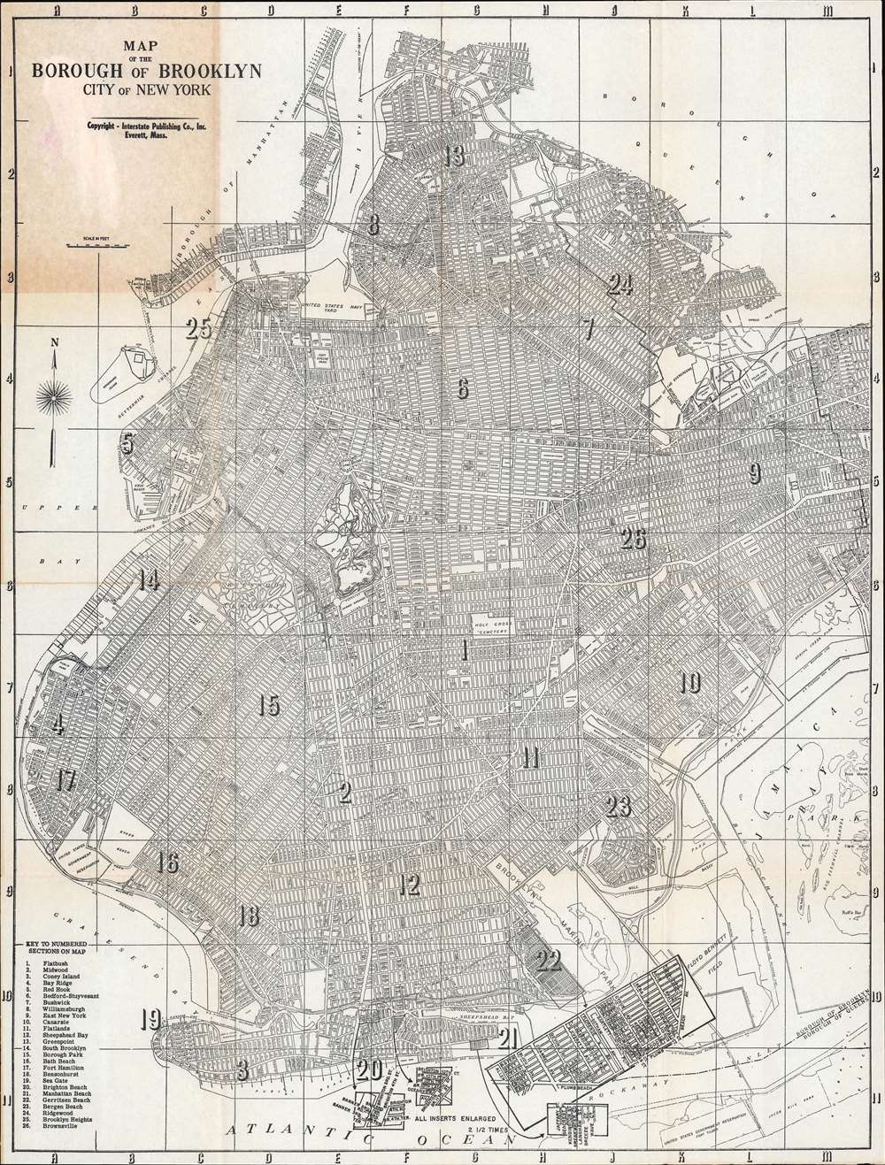
Map of the Borough of Brooklyn City of New York.
sold
This is a 1955 Interstate Publishing Company city plan or map of Brooklyn, New York. Depicting the entirety of the borough, twenty-six neighborhoods are numerically identified (although not delineated with 'borders') and correspond to a key situated in the lower left corner. Among these neighborhoods are Flatbush, Coney Island, Bedford-Stuyvesant, Greenpoint, Bay Ridge, Williamsburg, and Brooklyn Heights. Streets are labeled throughout the borough, as are parks, including Prospect Park and Fort Green Park. 'Inserts' near the bottom border detail two sections of Brighton Beach and a section of Manhattan Beach. (more details)
19th century railroad network in the southeast.

Savannah Fast Freight Line via the Ocean Steamship Company and Central Railroad of Georgia.
sold
- Digital Map Information
- Suitable for large format printing
- Full resolution TIFF file
- ICC color profile embedded
- Delivered instantly via download link
A remarkable bit of ephemera, this is an 1885 People's Line of Steamers railroad map of the southeastern United States. Depicting from Memphis, Tennessee, south to Manatee, Florida, and east to the Atlantic Ocean, the map focuses on the region's railroad network and how it joined with the Ocean Steamship Company's route connecting Savannah with New York and Philadelphia. The Central Railroad of Georgia, connecting Atlanta and Savannah, acts as the focal point. Other railroads, including the Southwestern Georgia and the Port Royal and Augusta Railroad, are also illustrated. Stops are marked from Selma east to the coast and from Chattanooga south to Albany. Thinner black lines further fill out the region's railroad network, but must not have been affiliated with the Georgia Central Railroad or the Ocean Steamship Company. (more details)
Summer fun on Casco Bay.
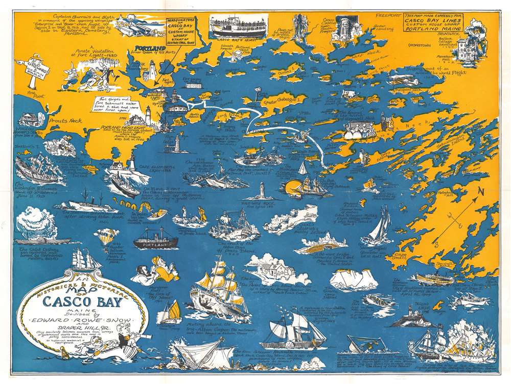
An Historical and Pictorial Map of Casco Bay Maine.
sold
- Digital Map Information
- Suitable for large format printing
- File Size: 24.48 MB
- File Type: ZIP / TIFF
- ICC color profile embedded
- Delivered instantly via download link
This is a charming c. 1950 pictorial and historical map of Casco Bay, Maine by Edward Rowe Snow and Draper Hill, Jr. It covers Casco Bay, an inlet of the Gulf of Maine on the southern coast of Maine, from Prouts Neck (Scarborough Beach State Park) east as far as the southern portion of Georgetown Island, including the city of Portland. Throughout, the map notes towns, islands, capes, points and other topographical features. (more details)
The fate of a popular steamship on the San Francisco - Panama Route.

Burning of the Steamship 'Golden Gate' July 27, 1862.
sold
- Digital Map Information
- Suitable for large format printing
- File Size: 12.9 MB
- File Type: ZIP / TIFF
- ICC color profile embedded
- Delivered instantly via download link
This is a c. 1862 Currier and Ives chromolithograph view of the burning of the S.S. Golden Gate off the coast of Mexico on July 27, 1862. Debris is visible exploding into the sky. Passengers crowd the bow and the stern in an attempt to escape their fate, while a small percentage watch the carnage from lifeboats adrift in the sea. (more details)
Remarkable log book of the China Station flagship during and after the Boxer Rebellion.

Logbook for use of Junior Officers Afloat. C. V. L. N. / Log Book. Mr. C. V. L. Norcock / H.M.S. Hannibal Glory.
sold
An exceptional and important 1900 – 1902 British naval logbook penned by Charles Vernon Lowcay Norcock (1884 - 1963), an officer in the Royal Navy, recording his experience as a Midshipman on the HMS Glory, flagship of the China Station, in the years of and immediately following the Boxer Rebellion (1899 - 1901). The full logbook covers three ships, recording the voyages of the HMS Hannibal from May to November of 1900; Norcock's subsequent service on the HMS Glory, flagship of the China Station from October of 1900 to January of 1902; and his return voyage to England on the HMS Aurora, from January to February of 1902 - thus covering Norcock's full tour of duty. The content of this volume is exceptionally rich, surpassing most other logbooks, with numerous original manuscript maps of important East Asian ports including Hong Kong, Shanghai, Singapore, Kowloon, Nagasaki, Suez, Valetta, Wusong (Shanghai), Nagasaki, and more. (more details)
Quite simply the largest, most beautiful, and most important early map of Hawaii ever published.

Carte des Iles Sandwich d'apres la reconnoissance qui en a ete faite dans les differentes relaches de la corvette La Decouverte et de sa conserve Le Chatham commandes par le Capt. Vancouver en 1792, 1793 et 1794.
sold
- Digital Map Information
- Suitable for large format printing
- Full resolution TIFF file
- ICC color profile embedded
- Delivered instantly via download link
This is a beautiful example of George Vancouver's seminal 1799 map of the Hawaiian Islands, considered the largest, most important, and most beautiful map of Hawaii to appear in the 18th century. George Vancouver first sighted Hawaii on January 18, 1778, as a midshipman on the HMS Discovery, consort ship to Captain James Cook's HMS Resolution, becoming one of the first Europeans to see the idyllic island group. Despite Cook's having been killed by angry Hawaiian natives, Vancouver formed a good opinion of the both the archipelago and the Hawaiian people. Fourteen years later and captain of his own ship, George Vancouver chose the Hawaiian Islands as a winter base while exploring the Northwest Coast of America in search of the elusive Northwest Passage. During his three seasonal visits to the Hawaiian Islands, Vancouver and his Lieutenant Joseph Baker completed this, the first complete map of the archipelago. His route, which zigzags around and between the islands, is carefully noted and includes visits in 1792, 1793, and 1794. (more details)
A Beautiful example of a Classic Dutch Map of the Arctic Regions.
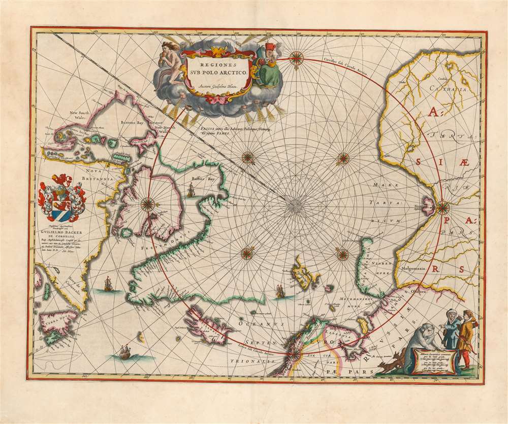
Regiones Sub Polo Arctico.
sold
- Digital Map Information
- Suitable for large format printing
- DPI: 600
- File Size: 22.42 MB
- File Type: ZIP / TIFF
- ICC color profile embedded
- Delivered instantly via download link
This is Willem Blaeu's 1640 map of the Arctic, in a beautiful original-color example of the 1644 second state (with the superb dedicatory cartouche). The map covers from the North Pole south as far as Nova Scotia, James Bay, Iceland, and Norway. Blaeu has here abandoned the fanciful cartographic ideas of Mercator and Ortelius to produce an entirely new map based largely upon exploration and discovery. Those unexplored arctic lands surrounding the pole are left blank, rather than filled with the quartet of speculative land masses characterizing the maps of the 16th century; the fraudulent 'Frisland' has also been dispensed with. Greenland and the lands to the north of Baffin Bay and to the west of James Button Bay fade away. Even the eastern shores of Nova Zembla, and the northern shores of Spitzbergen, are left unmapped. By contrast, explored lands are shown in relative detail. The discoveries of James, Barentsz, Baffin, Frobisher, Hall, Davis, and others are noted. In particular, this map incorporates the discoveries of James along the southern and western shore of Hudson's Bay in 1631-32, and promotes the expectation that the Northwest Passage across northern North America did not exist. (more details)
Scatological map of England and France.
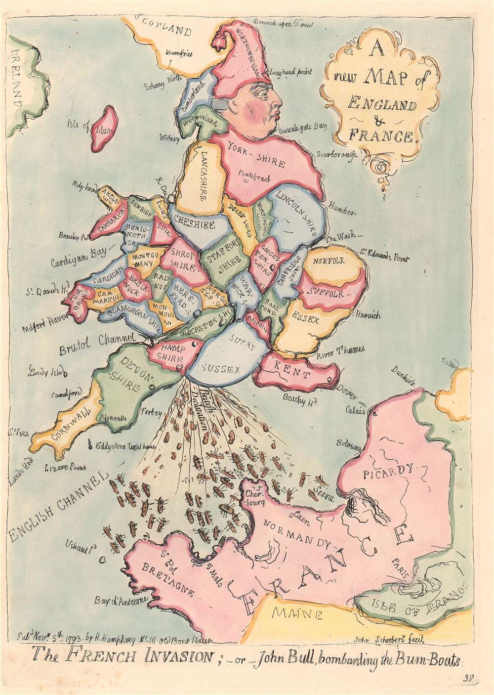
A New Map of England and France. / The French Invasion; or John Bull, bombarding the Bum-Boats.
sold
- Digital Map Information
- Suitable for large format printing
- DPI: 300
- File Size: 1.97 MB
- File Type: ZIP / TIFF
- ICC color profile embedded
- Delivered instantly via download link
A wonderful example of the 1851 George Bohn restrike of James Gillray's 1793 satirical caricature map of England, Wales, and France. An expression of the political tensions of the era, this map takes the form of George III of England, facing to the right and boldly raising his right foot (Kent), to stamp on France, itself taking the form of a face. The King is wearing a fool's cap composed of 'Northumberland.' Wales represents the king's flying coattails. The map illustrates, in the words of a Tate London Cataloger, George III
crapping vigorously on the coast of France, dispersing a number of tiny gunboats (…) The image is gross, but the King’s evacuations are heroic, patriotic and contemptuous, expressing the feelings of the brutish but uncensored John Bull, whom he here embodies.The map of course illustrates the pervading fear in England of a Napoleonic invasion. Among George III's expulsions are the words 'British Declaration', referring to George's promise to return Toulon (held by Royalists aided by British and Spanish forces) to the French on the restoration of the Bourbon monarchy. (more details)
Illustrates the vital trade link between Calcutta, Singapore, and Hong Kong.
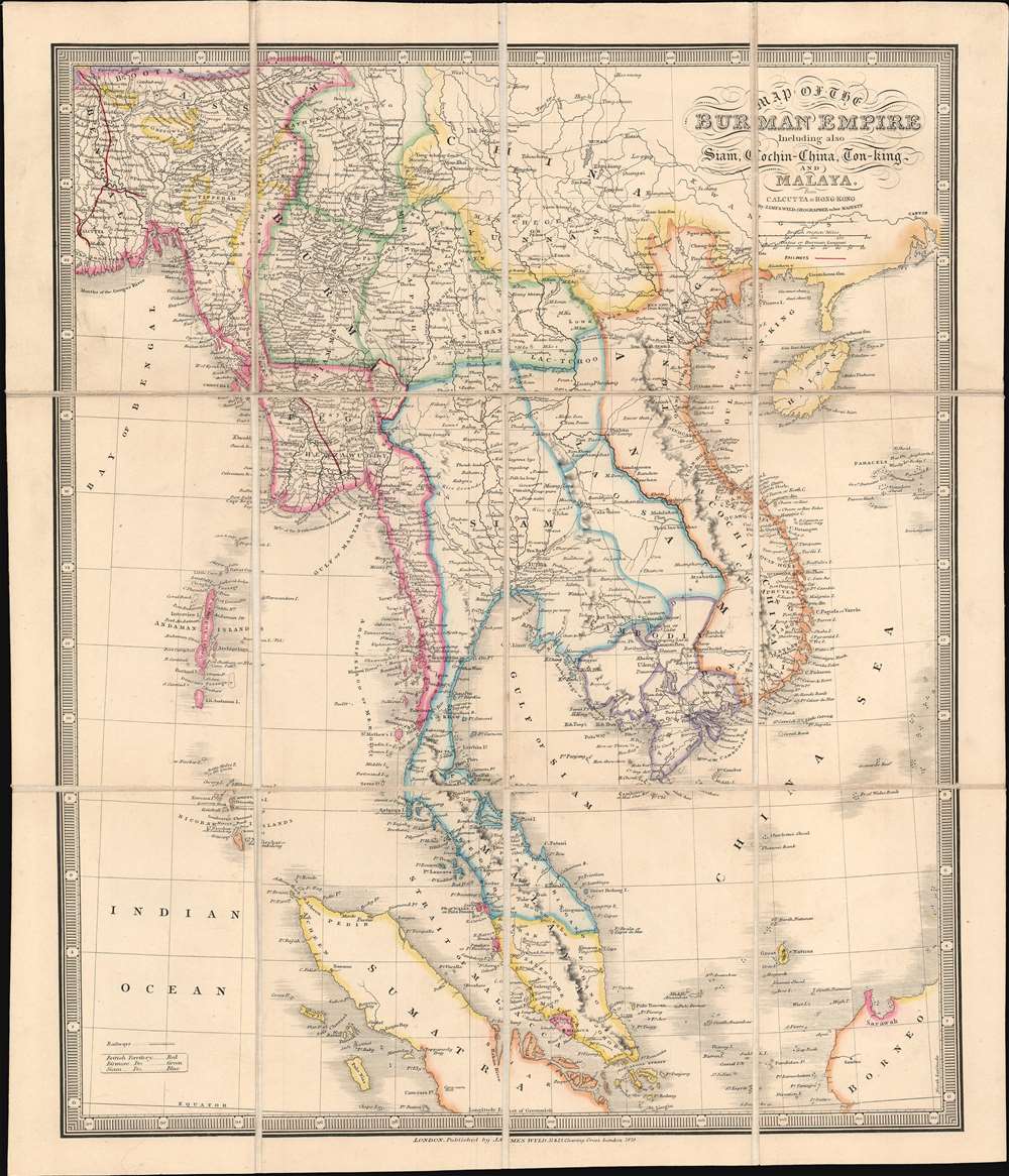
Map of the Burman Empire Including also Siam, Cochin-China, Ton-king and Malaya from Calcutta to Hong Kong.
sold
- Digital Map Information
- Suitable for large format printing
- File Size: 14.9 MB
- File Type: ZIP / TIFF
- ICC color profile embedded
- Delivered instantly via download link
This 1879 James Wyld map of Southeast Asia highlights a vital section of the British Empire's 19th-century global trade network known as the 'Maritime Silk Road'. Depicting from Calcutta to Hong Kong and from Darjeeling to Singapore, Sumatra, and Borneo, this trade network operated for most of the 19th century, but, after the British moved the capital of British India to New Delhi in the early 20th century, Calcutta's importance gradually faded. (more details)
Early map showing landholders throughout the Cape.
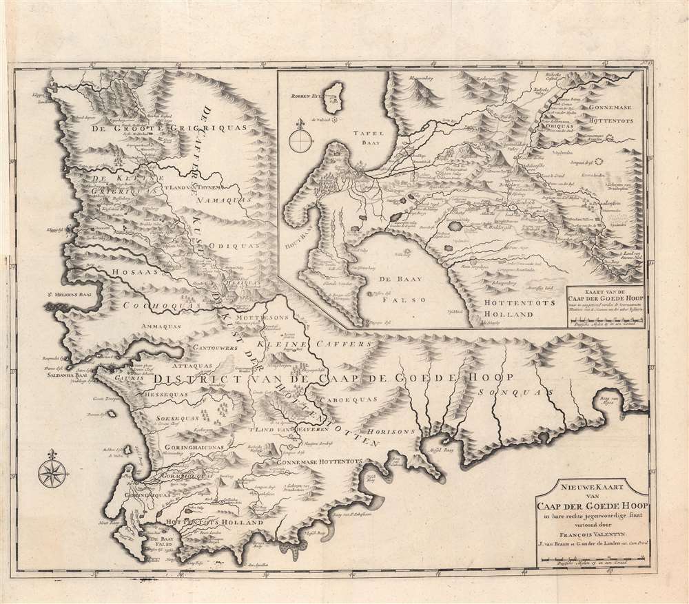
Nieuwe Kaart van Caap der Goede Hoop in hare rechte jegenwoordige staaat vertoond door Francois Valentyn.
sold
- Digital Map Information
- Suitable for large format printing
- DPI: 600
- File Size: 126.67 MB
- File Type: ZIP / TIFF
- ICC color profile embedded
- Delivered instantly via download link
A beautiful and remarkable 1726 Francois Valentijn map of the Cape of Good Hope, South Africa. This piece comprises two important maps printed on a single sheet. The primary map details the Cape of Good Hope from the Doornbosch River to the Baay van Algoa (Algoa Bay). The second map, appearing in the upper right quadrant, offers a more detailed depiction of the modern day Cape Town region from Robben Island to False Bay and east as far as Draakenstein. Both maps offer exceptional inland detail with landholders noted throughout - an exceptionally valuable resource for anyone studying the early development of the Cape. Being one of the earliest sophisticated maps of the region, Valentijn's chart was used as a model by numerous subsequent cartographers. (more details)
Bill of Lading for an early Florida business titan on the verso!

Map of the Plant System of Railway, Steamer, and Steamship Lines. And Connections.
sold
- Digital Map Information
- Suitable for large format printing
- Full resolution TIFF file
- ICC color profile embedded
- Delivered instantly via download link
This is an 1896 New England and Savannah Steamship Company railroad map of Florida and the southeastern United States. Thick black lines highlight the railroad and steamship network known as the Plant System, covering from Charleston, South Carolina and Montgomery, Alabama to Punta Gorda and Titusville, Florida. Nearly every stop along the Plant System's network is identified by name. A dashed line in the Gulf of Mexico illustrates the Plant Steamship Line from Mobile, Alabama to Tampa, Key West, and Havana, Cuba. Thinner black lines trace railways that connect with the Plant System. A mileage table is situated in the lower-left below the title. Advertising for the 'Savannah Line' appears along all four sides, promoting the line's 'careful handling' and 'quick time guaranteed'. (more details)
Japanese WWII POW camps.

Japanese Prisoner of War Camps During World War II, 1941 - 1945. Known locations of camps where American, British, Dutch, Australian, Canadian, Indian, and other Allied Military and Civilian Personnel were imprisoned by the Japanese.
sold
This is a 1980 Frances Worthington Lipe map of East Asia highlighting World War II Japanese Prisoner of War Camps. Coverage extends from the Soviet Union south to Portuguese Timor and the Timor Sea and from Rangoon, Burma, and western China east to Japan. Maroon overprinting identifies prison camp locations, naming most, save in areas where multiple camps were concentrated. For example, the camps in and around Manila are not individually identified. 'Manila Area' appears in block lettering and is followed by the number thirty-one. Other cities follow the same model, including Hong Kong, Singapore, Beijing (Peking), and Shanghai. A line of triangles (marking the camps) stretches from Bangkok to Moulmein following the infamous Burma Railway. Some camps, including those on Guam and Wake Island, are noted, but appear outside the map's geographical scope. A short text along the right border provides a compelling summary of the history of Japanese prisoner of war camps. (more details)
Vacation along Florida's east coast!
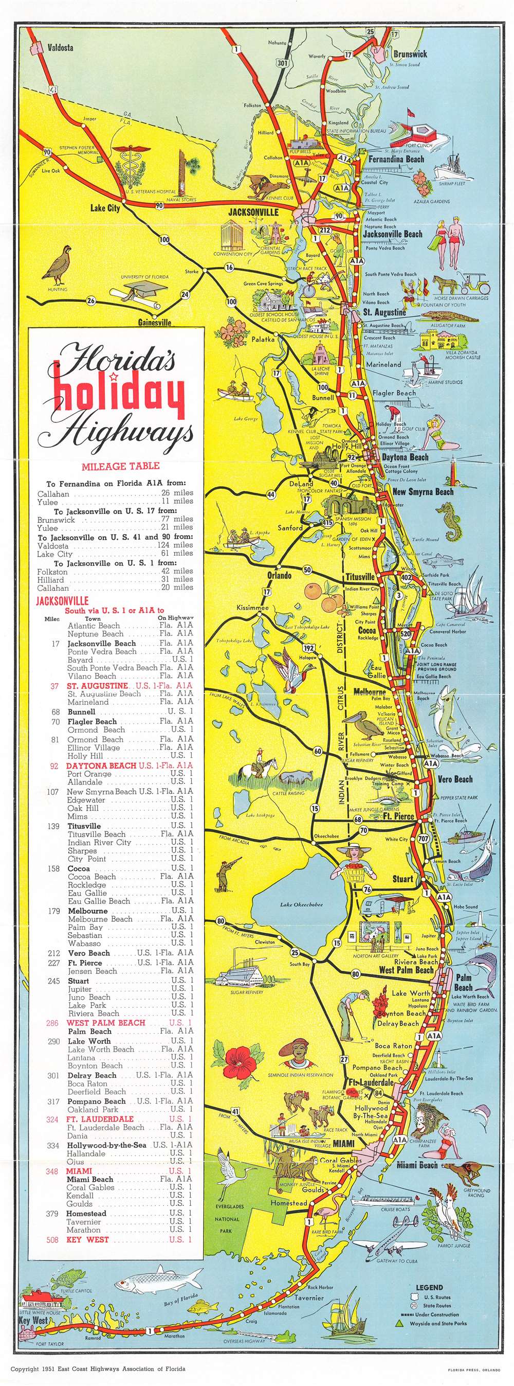
Florida's Holiday Highways for all of Florida's Famous East Coast.
sold
- Digital Map Information
- Suitable for large format printing
- Full resolution TIFF file
- ICC color profile embedded
- Delivered instantly via download link
This is a 1951 East Coast Highways Association pictorial tourist highway map of Florida. Thick red lines highlight U.S. Highways 1 and 90 and Florida State Highway A1A from the Georgia-Florida border south to Key West. White dots mark cities and towns along the highways. Black lines trace connecting state and federal highways, allowing for a better understanding of the complete road network. Pictorial vignettes add charm and underscore popular tourist activities along Florida's coast, such as deep-sea fishing, sunbathing, and golfing. Popular tourist attractions, including Marine Studios, Parrot Jungle, and the Little White House, appear as vignettes. A heron underscores the natural beauty of the recently established Everglades National Park. A mileage table from Jacksonville south to Key West occupies the left. (more details)
Copper Boom on the Keweenaw! Wellge's last work!

Panoramic View of the Keweenaw Peninsula, The Great Copper Country of Northern Michigan Population near 100,000, including the towns of Houghton, Hancock, Calumet, Lake Linden, Etc.
sold
- Digital Map Information
- Suitable for large format printing
- File Size: 41.33 MB
- File Type: ZIP / TIFF
- ICC color profile embedded
- Delivered instantly via download link
One of only 3 surviving examples of the rare Henry Wellge 1913 bird's-eye view of the Keweenaw Peninsula, Upper Peninsula, Michigan, at the height of the early 20th century copper mining boom. The view looks northeast along the peninsula from a fictive highpoint above Houghton and Portage Lake. Towns are labeled and important buildings noted, including the industrial smelting operations along Torch Lake and Bay. This view was issued by Albert Kennedy Houghton, a bookshop owner in Houghton, shortly before he left town for Minneapolis. (more details)
Propaganda for Spotswood's settlement of Germans in Virginia.

Virginia Marylandia et Carolina in America Septentrionali Britannorum industria excultae…
sold
- Digital Map Information
- Suitable for large format printing
- Full resolution TIFF file
- ICC color profile embedded
- Delivered instantly via download link
A very handsome example of Johann Baptist Homann's c. 1715 map of Virginia, Carolina, Maryland, and New Jersey; considered one of the most important and decorative maps of this region to appear in the 18th century. Homann drew this map to advocate for Virginia Lieutenant-Governor Alexander Spotswood's 1714 - 1717 plan to settle the little-known interior of Virginia with German immigrants. Shown here is the first mapping of 'Germantown Teutsche Statt' (Germanna) on the Rapidan River, a fork of the Rappahanock River, Fort Christanna (Christ Anna Fort) on the Makharing River, and 'Miester Krugs Plantasie' on the James River. Omission of Spotswood's connection to this map have long led it to being misunderstood or outright dismissed by scholars. Coverage extends from New York City and Long Island south along the Atlantic Cost as far as modern-day Georgia, and as far west as Lake Erie. (more details)
Ephemeral Indiana Company Colony in modern day West Virginia.
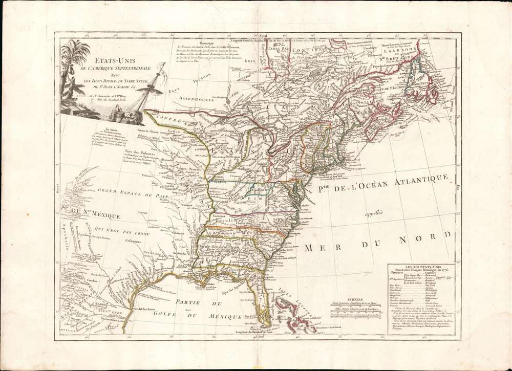
Etats-Unis de L'Amérique Septentrionale Avec Les Isles Royale, de Terre Neuve, de st. Jean, L'Acadie et c.
sold
- Digital Map Information
- Suitable for large format printing
- Full resolution TIFF file
- ICC color profile embedded
- Delivered instantly via download link
An uncommon and important 1785 - 88 Charles Delamarche and Charles Dien map of the fledgling United States shortly after the American Revolutionary War. This map is important as the first to describe the 1784 Jeffersonian Ordinance, in doing so the first to apply the term Michigan to a land area, and for its detailed illustration of the new international borders ratified under the 1783 Treaty of Paris. It is also the first to show the mercantile concession 'Indiana' in the vicinity of modern-day West Virginia. Geographically the map covers from James Bay and Labrador to Florida and the Bahamas, as well as from the Rio de Norte (Rio Grande) to the Atlantic seaboard and Newfoundland. (more details)
One of the first specific Russian maps of eastern Siberia.
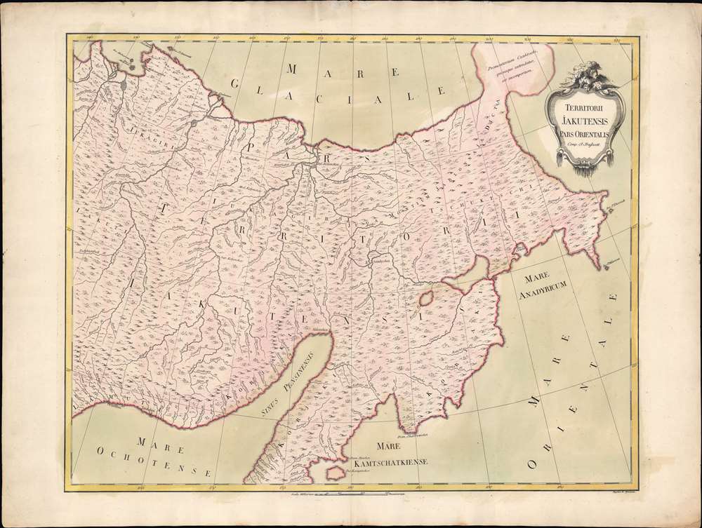
Territorii Jakutensis pars orientalis.
sold
- Digital Map Information
- Suitable for large format printing
- Full resolution TIFF file
- ICC color profile embedded
- Delivered instantly via download link
An exceptional separately issued 1771 Ivan Fomic Treskot map of Siberia, part of the Treskot-Schmidt effort to map Siberia between 1770 and 1776. This map represents one of the earliest specific published maps of northeastern Siberia. Coverage extends from the Kolyma River to the Bearing Strait and from the bulbous Tschtuki Peninsula to Penzhin Bay and Shielikhov Gulf (northern Sea of Okhotsk), and northern Kamchatka. The map is a composite of the finest cartographic knowledge then available to the Russian Academy at St. Petersburg. The treatment of the complex inland river systems in particular represents a major step forward in regional cartography. (more details)
St. Petersburg at the end of Catherine the Great's reign.

Plan der Kayserlichen Residenz Stadt St. Petersburg.
sold
- Digital Map Information
- Suitable for large format printing
- DPI: 600
- File Size: 18.61 MB
- File Type: ZIP / TIFF
- ICC color profile embedded
- Delivered instantly via download link
This is a 1790 Efim Maksimovič Chudjakov city map or plan of St. Petersburg. The map depicts the city from the Bolshaya Nevka Neva south past the Reka Bol'shaya River and from Neva Bay, also known as the Gulf of Kronstadt, to the Neva River. Highly detailed, over one hundred twenty locations are numerically identified, though unfortunately the corresponding index is not present. The Peter and Paul Fortress is illustrated in detail along the Neva River. (more details)