
A beautiful engraving of the Hudson River at West Point, New York.

West Point (Hudson).
sold
- Digital Map Information
- Suitable for large format printing
- Full resolution TIFF file
- ICC color profile embedded
- Delivered instantly via download link
This is a c. 1850 view of West Point, New York. The view appears to be looking south down the Hudson River from the famous bend where the United States Military Academy stands. Sailboats dot the river from the foreground to the background, while a steamer (then a technological marvel) appears alone at center and heads upriver. A stone bridge occupies the lower right corner, and two people can be seen standing at the middle of the bridge. The hills along both riverbanks are heavily forested and several trees appear in the foreground. (more details)
The First Printed Map of the Western Hemisphere, and the First America Map Naming the Strait of Magellan
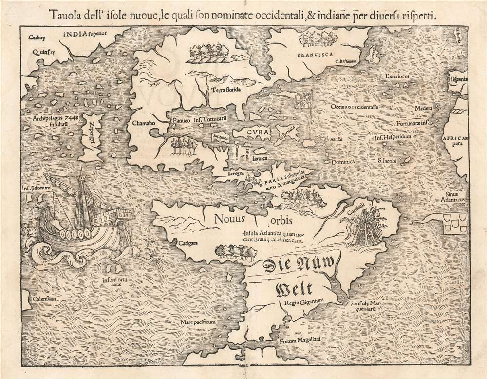
Tavola dell'isole nuoue, le quali son nominate accidentali, et indiane per diuersi rispetti.
sold
- Digital Map Information
- Suitable for large format printing
- Full resolution TIFF file
- ICC color profile embedded
- Delivered instantly via download link
This is a bold, sharp strike of an 1558 Italian edition of Sebastian Münster's map of America or the New World, the earliest printed map of the Western Hemisphere. That is to say, this is the first specific printed map to reveal all of North and South America in clear continental form. It was originally published by Münster in his 1540 Basel edition of Ptolemy's Geographia. Münster would include this map, along with the other modern maps appearing in the work, in his 1544 Cosmographia. This ambitious tome, intended to reveal to the lay reader the wonders of the whole world in one volume, proved popular, appearing in some 40 editions over the subsequent century. The popularity of Munster's Cosmographia and this map in particular made this map highly influential, naming the Straits of Magellan, the Pacific Ocean (Mare Pacificum), the presumed insular form of the Yucatan, and the speculation of Verazanno's Sea. It is one of the earliest maps to identify Japan as well, here presented according to Marco Polo as 'Zipangri'. (more details)
The important first plan of New York City's Central Park - predates Olmsted and Vaux.
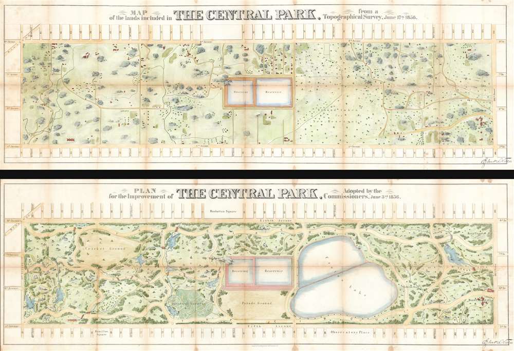
Map of the Lands Included in The Central Park, from a Topographical Survey, June 17th 1856. Plan for the Improvement of The Central Park, Adopted by the Commissioners, June 3rd 1856.
sold
- Digital Map Information
- Suitable for large format printing
- File Size: 60.03 MB
- File Type: ZIP / TIFF
- ICC color profile embedded
- Delivered instantly via download link
Two extremely rare 1856 pre-Design Competition plans of Central Park drawn by the park project's first engineer-in-Chief Egbert Ludovicus Viele. Both plans extend from 59th street to 106th street, taking in the original grounds reserved for Central Park, as well as some of the adjacent streets and avenues. Viele's printed signature appears in the lower right quadrant of both maps. (more details)
One of the first official Chinese city plans to use western survey and printing techniques.
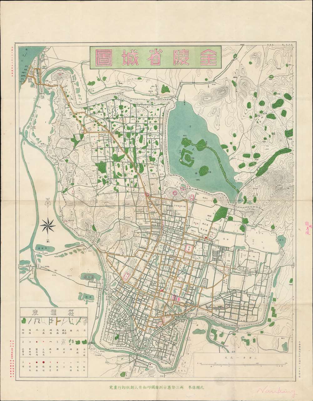
金陵省城圖 / 金陵省城图 / Jinling Provincial City Map.
sold
- Digital Map Information
- Suitable for large format printing
- File Size: 25.08 MB
- File Type: ZIP / TIFF
- ICC color profile embedded
- Delivered instantly via download link
A rare 1907 (Guangxu 33) map of Nanjing (Nanking), China during the late Qing period, issued by the Nanyang Land Survey Department (南洋陸地測量司). This chromolithograph is one of the first Chinese produced and issued official city maps to incorporate western-style surveying methodologies and printing technology. Coverage extends from the Yangtze River (upper left) and the Jiajiang River to Purple Mountain (Zijin Shan; 紫金山) and the Ming Xiaoling Mausoleum (明孝陵). (more details)
Whimsical tribute to the oddities of New York.

Wonders of New York.
sold
- Digital Map Information
- Suitable for large format printing
- Full resolution TIFF file
- ICC color profile embedded
- Delivered instantly via download link
A production of the utmost weirdness, this is a fun-fact-filled dramatic 1953 pictorial map of New York City by the flamboyant Swedish-American artist, Nils Birger Hansell. Covering the Manhattan from roughly the Battery to 96th street, the map presents a scene of bustling modernity with a humorous twist. Nils illustrates the architectural and entertainment wonders, and general curiosities, of New York City, successfully evoking the city's inspiring creative spirit. The map was perhaps inspired by the work of Charles Vernon Farrow, who made a similar map of New York in 1927 entitled, A Map of the Wondrous Isle of Manhattan. While cartographically similar, Nils' map is far more playful and flamboyant. The map is surrounded by a whimsical pictorial order illustrating day-to-day life scenes from 1950 s New York. Some 301 sites, individuals, and events, are located throughout and referenced numerically. (more details)
'Let us satisfy our eyes...'
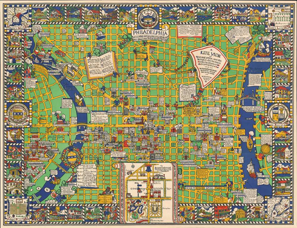
A Kite View of Philadelphia and the Sesqui Centennial International Exposition.
sold
- Digital Map Information
- Suitable for large format printing
- Full resolution TIFF file
- ICC color profile embedded
- Delivered instantly via download link
This is Edwin Birger Olsen and Blake Everett Clark's 1926 pictorial map of Philadelphia, one of the first separately issued pictorial maps published in the United States. Centered historic downtown area, the map colorfully depicts Philadelphia from Gipard Avenue in the north, to Washington Avenue in the south, and between the University of Pennsylvania and the Delaware River. (more details)
Dramatic Islands of the Gulf of Venice
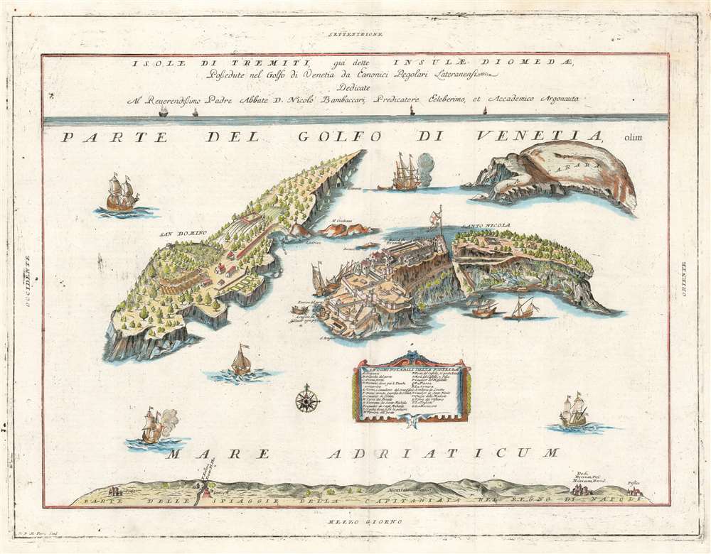
Isole di Tremiti, giá dette Insulae Dionedae, Possedute nel golfo di Venetia da Eanonici Regolari Lateranensi.
sold
- Digital Map Information
- Suitable for large format printing
- Full resolution TIFF file
- ICC color profile embedded
- Delivered instantly via download link
This is the 1697 Vincenzo Coronelli map of the Isole Tremiti. These rocky islands have a long history of settlement, despite the frequent earthquakes that give the islands their name. The map shows both of the main islands - San Domino, and San Nicola - but also the uninhabited La Carara (Capraia) Credazza (Cretaccio) and the diminuitive La Vecchia (an island so small that while its name appears on digital maps the island itself seldom does.) San Domino is shown with cultivated fields, terraces, a church, and neatly ordered dwellings. San Nicola is dominated by its great, fortified monastery. At the bottom of the map is shown 'Part of the Beach of the Capitaniata of the Kingdom of Naples,' 'Capitaniata' being an early term for the Province of Foggia. (more details)
Rare Tehran imprint.
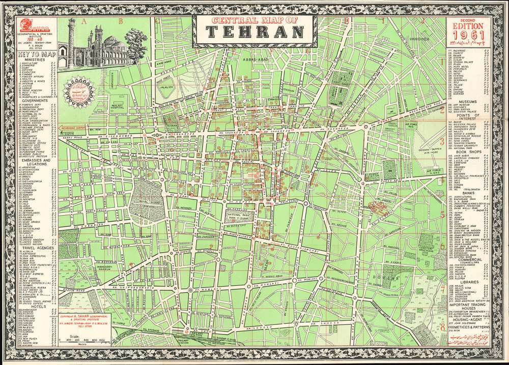
Central Map of Tehran.
sold
- Digital Map Information
- Suitable for large format printing
- Full resolution TIFF file
- ICC color profile embedded
- Delivered instantly via download link
This is a 1961 Abbas Sahab city plan or map of central Tehran, Iran. Composed almost entirely in English, streets throughout the area are labeled using Latin characters. A handful of locations around the city are identified on the map as well, including the Sahab Geographical and Drafting Institute, Air Force Headquarters, the Doshan-Tappeh Airport, Pahlavi Hospital, and the U.S. and Soviet Embassies. Red numbers incised in red circles mark 218 other locations, including book shops, travel agencies, hotels, museums, banks, government ministries and departments, and embassies. These correspond with indexes along the left and right borders. (more details)
Luxury railroad dinners and sleepers.
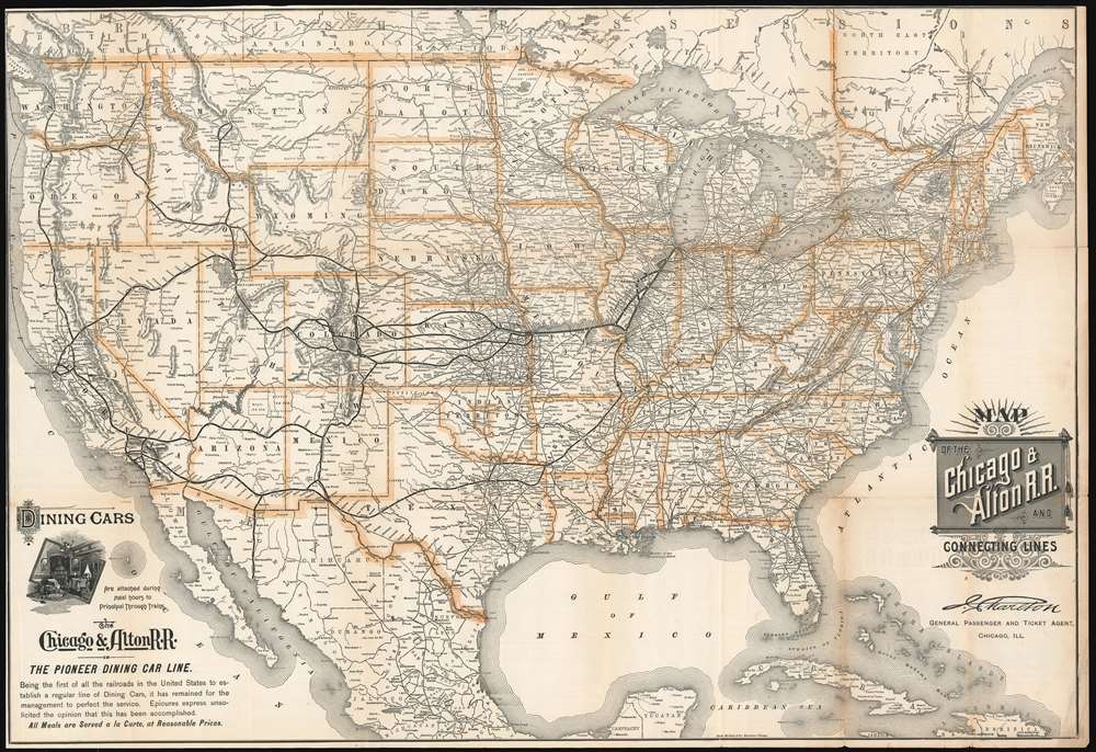
Map of the Chicago and Alton R.R. and Connecting Lines.
sold
- Digital Map Information
- Suitable for large format printing
- File Size: 56.1 MB
- File Type: ZIP / TIFF
- ICC color profile embedded
- Delivered instantly via download link
This is an 1898 Rand McNally map of the United States published for the Chicago and Alton Railroad. The Chicago and Alton's main line from Chicago to Alton, Illinois (on the Missouri River) and its extensions to St. Louis and Kansas City are boldly highlighted in black. Each stop along these lines are labeled. The major stops, Springfield, Bloomington, Peoria, St. Louis, and Kansas City, are identified. Connection on the Union Pacific, Missouri Pacific, Atchison, Topeka, and Santa Fe, and Southern Pacific Railroads are highlighted in bold. Innumerable other railroads are also illustrated. (more details)
'Almost heaven! West Virginia.' - John Denver

Recreational Map of West Virginia.
sold
- Digital Map Information
- Suitable for large format printing
- File Size: 57.48 MB
- File Type: ZIP / TIFF
- ICC color profile embedded
- Delivered instantly via download link
This is a 1941 Sterling B. Smeltzer pictorial map of West Virginia. Pictorial vignettes highlight West Virginia's many state parks, state forests, game refuges, and historical sites in the hopes of enticing tourists to visit. Pictorial icons also illustrate the state's natural resources, which include coal, natural gas, and oil, along with livestock. Idyllic views surround the central map and depict people fishing, playing tennis, practicing archery, horseback riding, and West Virginia's picturesque landscapes. A round inset in the upper right quadrant provides distances between West Virginia and many surrounding cities, including New York City, Washington D.C., Chicago, Columbia, and Nashville. A pictorial border, drawn and colored to resemble a carved wooden frame, encircles the map and consists of illustrations of West Virginia's wildlife alongside its countryside, scenes of outdoor activities, and references to historic events. (more details)
Scarce, Richly Detailed Map of Mexico Showing the Republic of Texas.
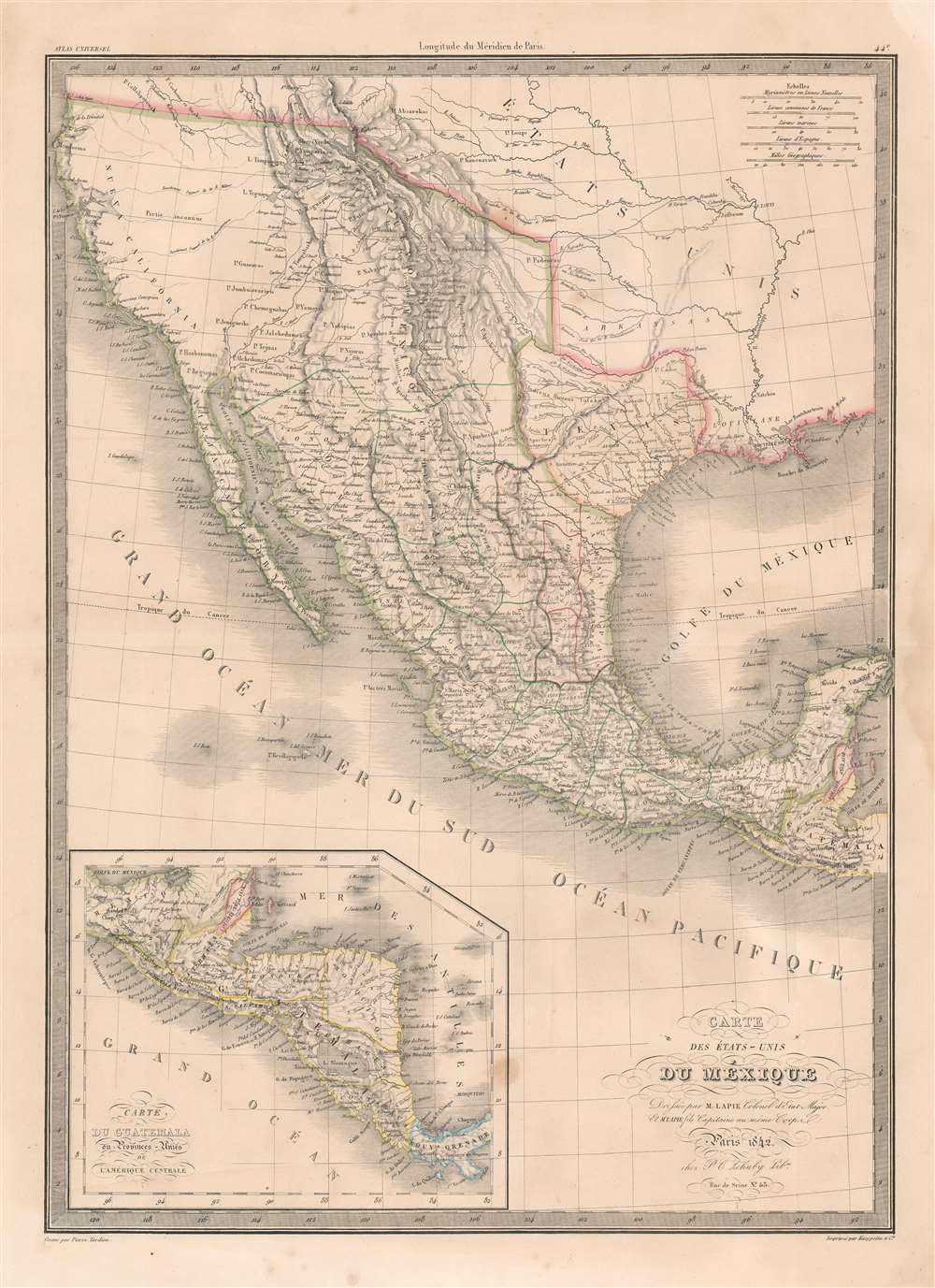
Carte Des États-Unis du Méxique.
sold
- Digital Map Information
- Suitable for large format printing
- DPI: 600
- File Size: 22.39 MB
- File Type: ZIP / TIFF
- ICC color profile embedded
- Delivered instantly via download link
This is an 1842 Pierre and Alexandre Lapie map of Mexico and the southwestern United States, one of the earliest non-American maps to include the Republic of Texas. The map depicts the region from the Pacific Ocean to the Mississippi River and from the Oregon Territory to the Yucatan Peninsula and the Pacific Ocean. The Republic of Texas is bordered in yellow, highlighting its existence. The map’s Texas detail is not limited to this superficial change, however: the whole Texas portion of the copperplate has been entirely reworked over earlier editions. Not only have the borders of the erstwhile nation been added, but also the whole area updated nomenclature, including Austin, Houston and Nashville. (more details)
Proposal for a to-be-built religious center at Inter-American University, Puerto Rico.

Religious Center - Inter-American University - San German, Puerto Rico
sold
This is a c. 1964 Alfonso Alvarez painting of a proposed religious center on the campus of the Inter-American University in San German, Puerto Rico. Alvarez's proposed design is impressive, although it was ultimately not the design selected. Alvarez's chapel dominates the site and employs an aesthetic reminiscent of the Sydney Opera House. Palm trees and other greenery dot the center, while buildings for classrooms and other purposes spread out in front of the chapel. A parking lot appears at the far right. Today, the Paul A. Wolfe Memorial Chapel (Capilla Paúl A. Wolfe Memorial in Spanish) stands on Inter-American University's campus. Construction began on the chapel and its related religious center in 1967 with a groundbreaking ceremony on January 29. (more details)
Sri Lanka, as a Dutch Entrepôt.
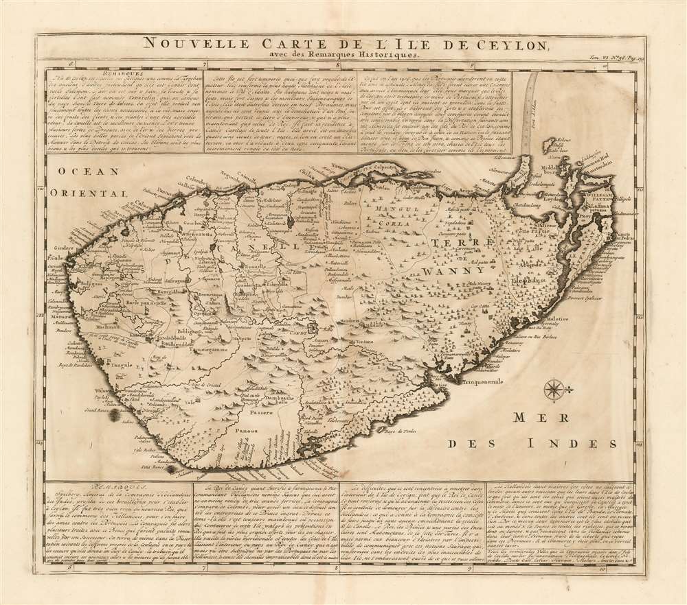
Nouvelle Carte Carte De L'Ile de Ceylon avec des remarques historiques.
sold
- Digital Map Information
- Suitable for large format printing
- Full resolution TIFF file
- ICC color profile embedded
- Delivered instantly via download link
A superbly engraved 1719 Chatelain map of Sri Lanka, presenting to Chatelain's Francophone audience the distant island during the period after the Dutch wrested control of its trade from the Portuguese. The map is accompanied by seven boxes of French text describing the island's history and government, with a particular focus on the current state of affairs:
The Dutch, being masters of the coasts, do not allow any vessel other than theirs to dock on the island of Ceylon, which means that they are the only ones who are also masters of trade. Thus they are the ones who provide cinnamon to the rest of the universe, as well as cloves, nutmeg and mace which grow in the islands of Bantam, Ternate, and Amboyna...(more details)
Vignettes of Florida's tourist attractions.

When You are in Florida See These Outstanding Attractions.
sold
- Digital Map Information
- Suitable for large format printing
- File Size: 35.55 MB
- File Type: ZIP / TIFF
- ICC color profile embedded
- Delivered instantly via download link
This is a 1941 American Automobile Association pictorial road map of Florida. (more details)
One of the Finest and Most Detailed Woodcut World Maps.
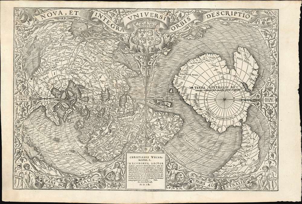
Nova, et Integra Universi Orbis Descriptio.
sold
- Digital Map Information
- Suitable for large format printing
- Full resolution TIFF file
- ICC color profile embedded
- Delivered instantly via download link
This the rare and influential 1531 Oronce Fine map of the world, portrayed using a double cordiform polar projection. This intricate woodcut map was both influential and - especially compared to other printed maps of its era - remarkably reflective of state-of-the-art cartographic detail. Rodney Shirley proclaimed it 'a rendering considerably in advance of any others printed earlier.' Many areas of significant interest are addressed in detail for the first time. The peninsular shape of Florida is clearly presented for the first time, and both Pineda and Cortez' mapping of the Gulf of Mexico are recorded here. This is the first printed map to refer to Magellan's voyage, naming a 'Mare Magellanicum' west of South America. The map breaks from Martin Waldseemüller's convention of presenting North America as separate from Asia: Fine's map incontrovertibly presents Labrador, Florida and the Gulf Coast as part of the Asian mainland; South America itself is depicted as taking the place of the Ptolemaic Great Promontory, or 'Dragon's Tail' that appeared on earlier maps like the 1507 Waldseemüller and the 1490 Martellus. Although including (but not naming) Magellan's strait, the map fails to account for the size of the ocean that circumnavigator revealed (despite naming that ocean - Mare Magellanicum.) (more details)
First Full Map of Australia, and the First to name Sydney
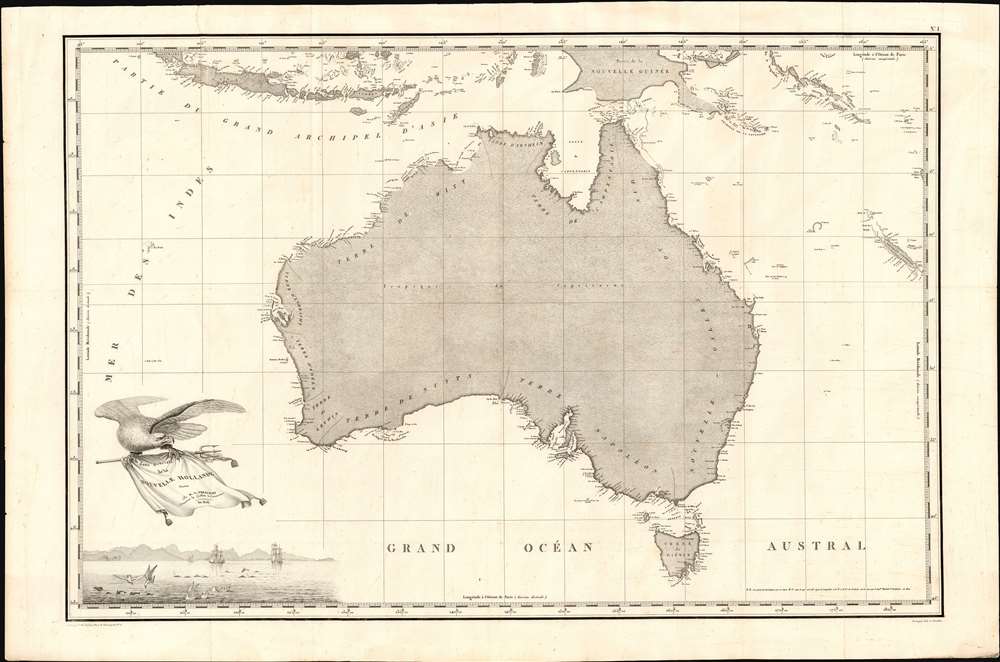
Carte Generale de la Nouvelle Hollande dressee par M L Freycinet Commandant La Goelette, Le Casuarina an 1808.
sold
- Digital Map Information
- Suitable for large format printing
- Full resolution TIFF file
- ICC color profile embedded
- Delivered instantly via download link
This is Louis de Freycinet's 1811 map of Australia, summing up French surveys of the continent undertaken between 1801 and 1808. Freycinet's mapping was executed as part of voyages under the command of Nicolas Baudin, which took place at the same time as Flinders made his surveys of the same region. (more details)
One-of-a-kind Ottoman Serio-Comic WWI Propaganda Map.

A Háborús Európa Térkép-Karikatúrája. / [A Cartoon War Map of Europe].
sold
- Digital Map Information
- Suitable for large format printing
- File Size: 16.22 MB
- File Type: ZIP / TIFF
- ICC color profile embedded
- Delivered instantly via download link
The only known example of the Ottoman Turkish edition of Varga Imre's important 1914 serio-propaganda map of Europe at the outset of World War I (1814 - 1918), A Háborús Európa Térkép-Karikatúrája. The map is essentially propaganda for the Central Powers wherein Russia appears as an obnoxious drunk and Hungary is illustrated charging fiercely into battle - note, this is the only WWI Era serio-comic map to illustrate Hungary independently. In this Ottoman edition, released in Istanbul by Khaireya and Co. Press, all the text has been translated into Ottoman Turkish. (more details)
A rare and wonderfully colored city plan or map of St. Petersburg in Cyrillic.
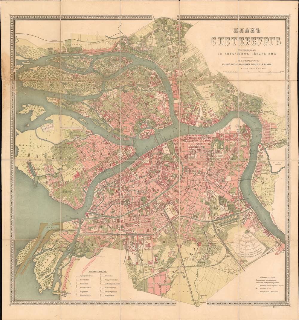
ПЛАНЬ С. ПЕТЕРБЧРГА. / Plan S. Petersburg.
sold
- Digital Map Information
- Suitable for large format printing
- Full resolution TIFF file
- ICC color profile embedded
- Delivered instantly via download link
This is a beautiful c. 1887 Alexey Ilyin city plan or map of St. Petersburg, Russia. Brilliant red and green hues shade urban and open spaces, wonderfully blending the two. With all text in Cyrillic, St. Petersburg's streets, canals, bridges, and other structures are labeled. The Peter and Paul Fortress, the Mikhailovskoy Palace, St. Petersburg State University, and the Winter Palace (today home to the Hermitage Museum) are all identifiable. Railways and railway stations, industrial sites, horse-drawn trams, and special lands leased by the imperial crown to private individuals add even more detail to this fantastic piece. (more details)
Early 18th century birds-eye view of Malta.

D'Oude Schets Van Het Eyland Malta, alwaer, Paulus Na Zyn Schipbreuk Aenlandde. Act. XXVII. 1.
sold
- Digital Map Information
- Suitable for large format printing
- Full resolution TIFF file
- ICC color profile embedded
- Delivered instantly via download link
A scarce and visually stunning Augustin Calmet 1729 topographical map and view of Malta. The map / view is oriented to the southwest and illustrates the island from a bird's-eye perspective, with mountains, buildings, trees, and fortifications rendered in profile. The fortifications of Valletta are clearly visible as are various small towns, fortifications, and lookout towers. A key in the upper right quadrant corresponds to numerical references found throughout the map. (more details)
A rare pictorial map of New Hampshire's seacoast, the birthplace of the U.S. Navy.
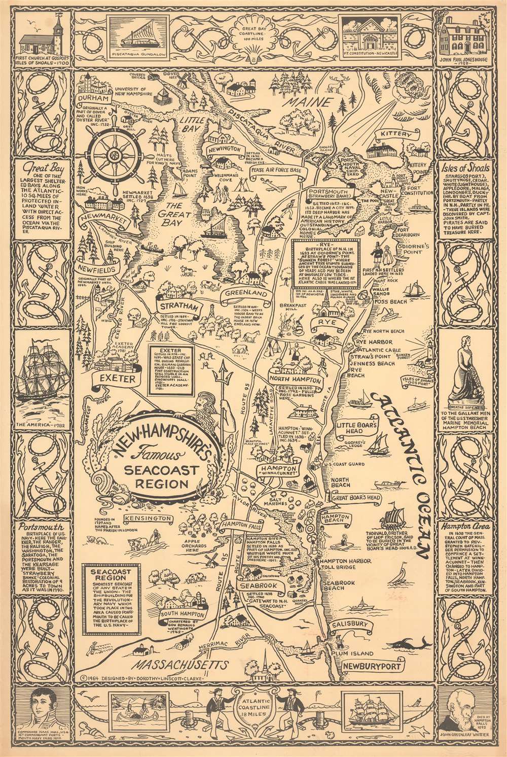
New Hampshire's Famous Seacoast Region.
sold
This 1964 Dorothy Linscott Clarke pictorial map of New Hampshire's seacoast region celebrates its nautical heritage. Portsmouth, the area's cultural and commercial center, is remembered as the 'birthplace of the U.S. Navy' during the American Revolution. Clarke uses this to her advantage, employing a ship's wheel as the compass rose and adorning the title cartouche with Poseidon, seaweed, and seashells. Several ships ply the waters of the Atlantic and the Great Bay, one of the largest sheltered bays along the Atlantic coast. This map also highlights the commercial and recreational aspects of this thirteen-mile stretch of the Atlantic coast. Beachgoers enjoying themselves in bathing suits and umbrellas dot the coastline around Hampton Beach and Hampton Harbor. Banners and illustrations of buildings mark towns and villages, including Portsmouth, Durham, Exeter, Rye, Hampton, and Greenland. Textboxes provide short histories of Rye and Exeter, and the founding dates of other towns are noted. The region's landmarks, such as the Weeks House in Greenland and Exeter Academy in Exeter, are referenced. The whole is surrounded by a nautical-themed pictorial border, where illustrations of ropes and anchors separate text boxes filled with historical information, views of historic buildings and ships, and portraits of important historical figures. (more details)