
A chart comparing the worl'ds monuments and its monumental trees.

Die Riesen der Pflanzenwelt und die Riesengebilde der Baukunst. / (The Giants of the Plant World and the Giant Structures of Architecture.)
sold
- Digital Map Information
- Suitable for large format printing
- File Size: 4.93 MB
- File Type: ZIP / TIFF
- ICC color profile embedded
- Delivered instantly via download link
This is an 1863 Eduard Mielck comparative chart of the world's monumental trees and buildings. The chart depicts the comparative heights of eighteen of the world's 'monumental buildings' and eighteen of the world's tallest plants. The buildings, which include the Great Pyramid at Giza, the dome of St. Peter's Basilica in Rome, St. Paul's in London, St. Michael's Tower in Hamburg, and the Luxor Obelisk in Paris, are all numerically identified. The plants, however, are labeled alphabetically, and include a California sequoia, a Norfolk Spruce from New South Wales, a German pine, a baobab from Senegal, and a Lebanese cedar. To provide a scale for the piece, an elephant is illustrated standing next to a man in the lower left corner, allowing the viewer some idea of the monumental nature of these buildings and plants. (more details)
An 18th century French map of Mexico City as it appeared after the Spanish conquest of Tenochtitlán.
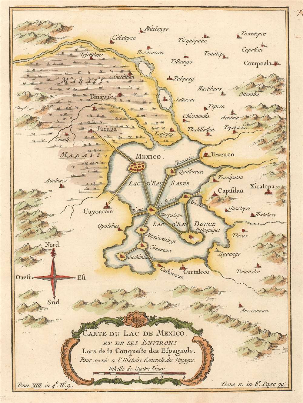
Carte du Lac de Mexico, et de ses Environs Lors de la Conqueste des Espangols.
sold
- Digital Map Information
- Suitable for large format printing
- DPI: 600
- File Size: 3.05 MB
- File Type: ZIP / TIFF
- ICC color profile embedded
- Delivered instantly via download link
This is a 1757 Jacques-Nicolas Bellin map of Mexico City as it appeared shortly after the Spanish conquest of the Aztec capital Tenochtitlán. Situated on an islet in Lake Texcoco, Tenochtitlán grew through the creation of artificial islands connected by causeways, which also connected the city with the mainland. After the Spanish conquistadors captured the city, Spanish officials razed the city and rebuilt it in a Spanish manner, with the express desire of rebuilding the city as a way of exercising their power over the native Aztecs, and Cortés and his men used the materials from the destroyed temples to build cathedrals and government buildings. Here, numerous settlements throughout the region are labeled with a large swamp occupying the upper left quadrant. (more details)
A map of the region around Hudson Bay with several notations commenting on how little is known about the region.
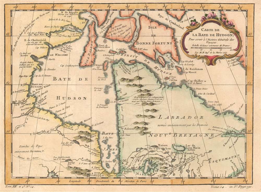
Carte de La Baye de Hudson
sold
- Digital Map Information
- Suitable for large format printing
- DPI: 600
- File Size: 6.43 MB
- File Type: ZIP / TIFF
- ICC color profile embedded
- Delivered instantly via download link
This is a 1757 Jacques-Nicolas Bellin map of Hudson Bay. The map depicts the region from Manitoba and Nunavut to Newfoundland and Labrador and from Southampton Island to Ontario. Myriad locations throughout the region are labeled, mostly rivers, bays, and islands. Notes about the region are also included, such as the west coast of Labrador, which reads, 'All of this coast is almost completely unknown'. Another, in Manitoba / Nunavut states, 'The English are looking for a [Northwest] Passage in this area but it doesn't exist,' while Ontario is 'entirely unknown'. (more details)
Illustrates Guam, a U.S. Territory, and Tinian and Saipan, two critical locations in the Pacific War.
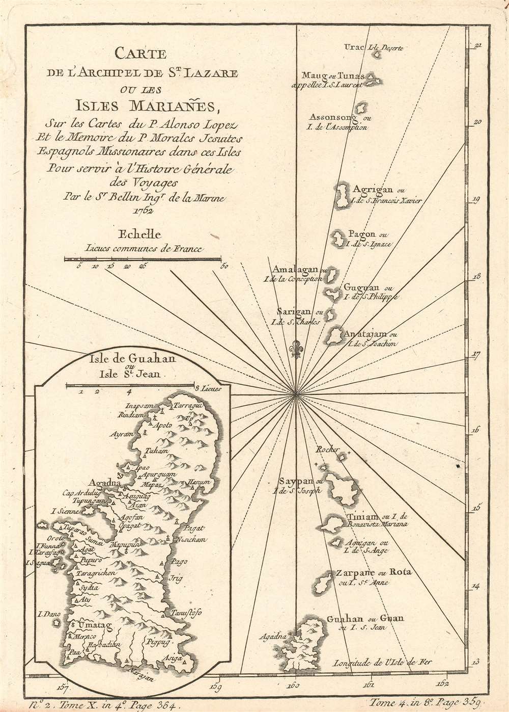
Carte de l'Archipel de St. Lazare ou les isles Mariañes.
sold
- Digital Map Information
- Suitable for large format printing
- DPI: 600
- File Size: 3.14 MB
- File Type: ZIP / TIFF
- ICC color profile embedded
- Delivered instantly via download link
This is a 1752 Jacques-Nicolas Bellin map of the Marianas Islands, a crescent-spaped archipelago in the western North Pacific Ocean. The map depicts the archipelago from Farallon de Pajaros (Urac) to Guam and illustrates fourteen islands including the Maug Islands, Asuncion Island (Assonsong), Pagan (Pagon), Saipan, Tinian, and Guam. A fairly detailed inset map of Guam is situated in the lower left corner and labels villages and a handful of coastal sites. Agadna is labeled as a safe port by the inclusion of an anchor emblem. (more details)
An updated version of Muller's iconic map of the discoveries of Vitus Bering.
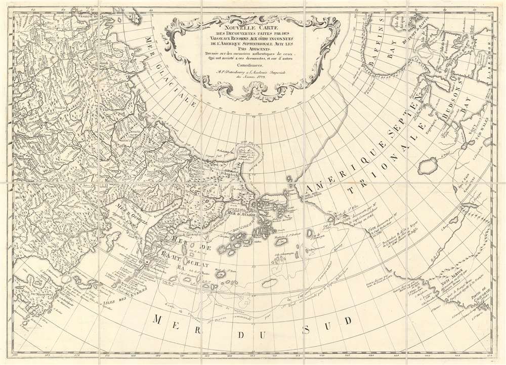
Nouvelle Carte des Decouvertes Faites par des Vaisseaux Russiens aux Cotes Inconnues de l'Amerique Septentrionale avec les Pais Adiacents. Dressée sur des memoires authentiques de ceux Qui ont assisté a ces decouverts, et sur d'autres Connoissances.
sold
- Digital Map Information
- Suitable for large format printing
- DPI: 600
- File Size: 27.6 MB
- File Type: ZIP / TIFF
- ICC color profile embedded
- Delivered instantly via download link
This is a 1773 Jacob von Staehlin map of the Pacific Northwest, the Arctic, and Siberia, which has been updated from Fredrick Muller's iconic 1754 map of the same region illustrating the findings of Vitus Bering's Great Northern Expedition. The map depicts from eastern Novaya Zemlya (Nowaja Semlja) to Hudson Bay and from the Arctic Ocean to California and Honshu, Japan. Von Staehlin's map includes a depiction of an archipelago in the place of Muller's namesake peninsula, which, although inaccurate, is closer to the real geography of the region. The Aleutians are illustrated as a string of islands emitting from a larger island which, although not connected to North America, certainly appears to be a proto-Alaska. (more details)
Map of Hankou at the height of the Second Sino-Japanese War.
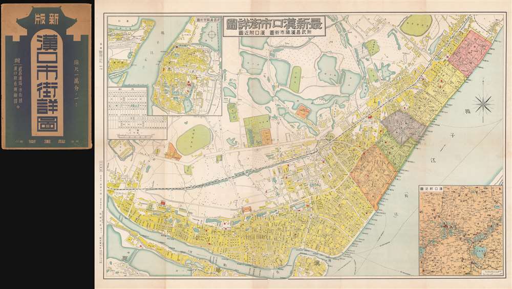
最新漢口市街詳圖 / New Detailed Street Map of Hankou. / 附武昌漢陽市街圖 / Annexed Street Map of Hangyang, Wuchang. / 漢口附近圖 / Map of Hankou's Surroundings.
sold
- Digital Map Information
- Suitable for large format printing
- File Size: 46.54 MB
- File Type: ZIP / TIFF
- ICC color profile embedded
- Delivered instantly via download link
This is a scarce 1939 or Showa 14 Taro Nishizawa (西澤, 太郎) city map or plan of Hankou (Wuhan), China issued during the Second Sino-Japanese War (1937 - 1945, 抗日战争) shortly following the fall of Wuhan and Hankou in 1938. In addition to this map's importance to the war, it is noteworthy that it represents Hankou emergence from roughly 15 years of urban redesign, renewal, and redevelopment as a 'garden city' under the progressive mayors Liu Wen-Tao (1929 - 1931) and Wu Kuo-Chen (1932 - 1936). (more details)
By Michigan's most famous map publisher.
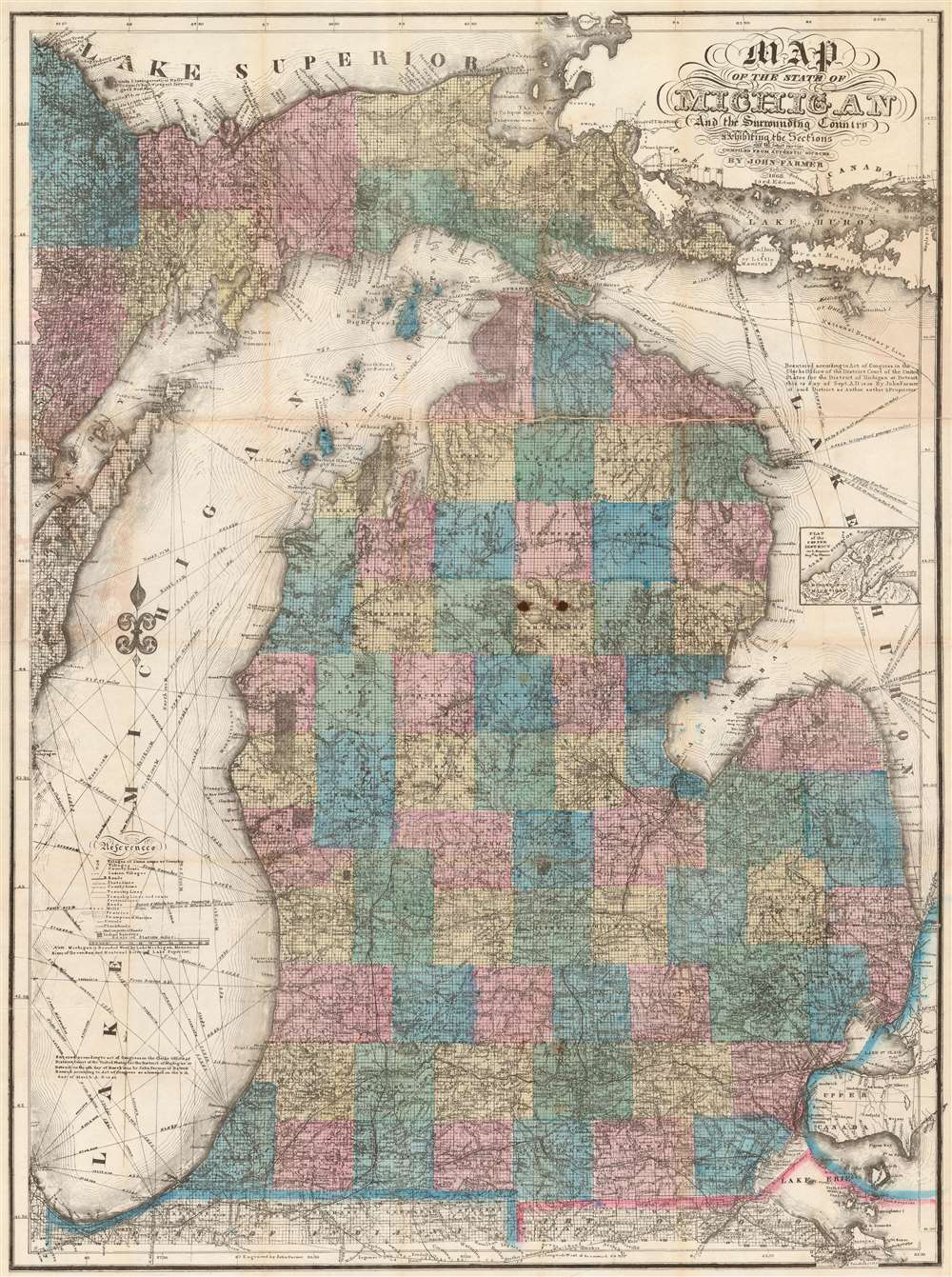
Map of the State of Michigan and the Surrounding Country.
sold
- Digital Map Information
- Suitable for large format printing
- File Size: 73.46 MB
- File Type: ZIP / TIFF
- ICC color profile embedded
- Delivered instantly via download link
An attractive example of John Farmer's 1868 separate issue map of Michigan. This is an iconic map of Michigan and was published in many editions from 1844. Based upon county land office survey work, the map covers all of Michigan including the Upper Peninsula. It also includes most of Lake Michigan and the western half of Lake Huron. The Great Lakes are full of rhumb lines illustrating sailing directions between important points. In its day, this map was considered indispensable for emigrating to, doing business in, or simply traveling around Michigan. (more details)
A rare map of Michigan's Upper Peninsula at the height of its mining industry.
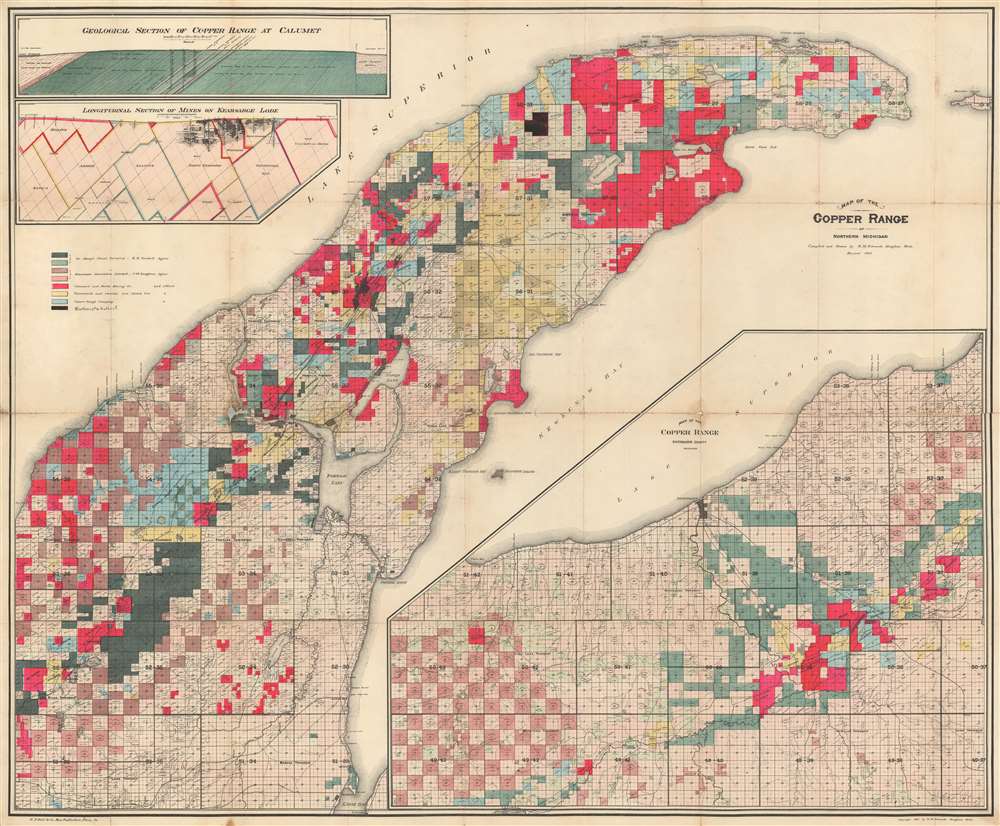
Map of the Copper Range of Northern Michigan.
sold
- Digital Map Information
- Suitable for large format printing
- File Size: 88.1 MB
- File Type: ZIP / TIFF
- ICC color profile embedded
- Delivered instantly via download link
This is a 1905 Richard M. Edwards map of the copper range of Michigan's Upper Peninsula. The map depicts the region from Elm River Township to Manitou Island and from Lake Superior to L'Anse Bay. Created to illustrate the mining claims throughout the Keweenaw Peninsula, eight different colors are used to differentiate between the claims of eight different mining companies. One such mining company, Winthrop and Hulbert, has been added in manuscript. Unfortunately, we have been unable to trace any history on this particular company. Others noted here, such as the Calumet and Hecla Mining Company, mined the Kearsage Lode, a deposit of amygdaloid copper that was mined by various companies from 1882 until 1925. A longitudinal section of the mines on the Kearsage Lode is situated on the upper left, just below an insert of a geological section of the copper range at Calumet. (more details)
The decisive American Civil War naval battle that allowed the Union to capture New Orleans, Louisiana

The Battle of New Orleans.
sold
- Digital Map Information
- Suitable for large format printing
- File Size: 10.27 MB
- File Type: ZIP / TIFF
- ICC color profile embedded
- Delivered instantly via download link
This is an 1862 Thomas S. Sinclair lithograph view of the Battle of Forts Jackson and St. Philip during the American Civil War. In the view, Fort Jackson is on the left and Fort St. Philip is on the right and the Confederate soldiers stationed in the forts are trying in vain to turn back a Union fleet heading up the Mississippi River toward New Orleans. Situated on either side of a bend in the Mississippi, the forts were remnants of the age of sail. By placing the forts along a riverbend, a ship propelled by sails would have been rendered effectively stationary as it attempted to navigate the bend, placing it at the mercy of the 177 guns within the two forts. By 1862, however, steam power had arrived, which allowed the Union Navy to run between the two forts while still maintaining power, making them much less easy targets. The Union force is illustrated here making its way up the river between the two forts and firing as its advances. Nearly all the illustrated ships are flying the United States flag. (more details)
A lovely 18th century French map of Bali.
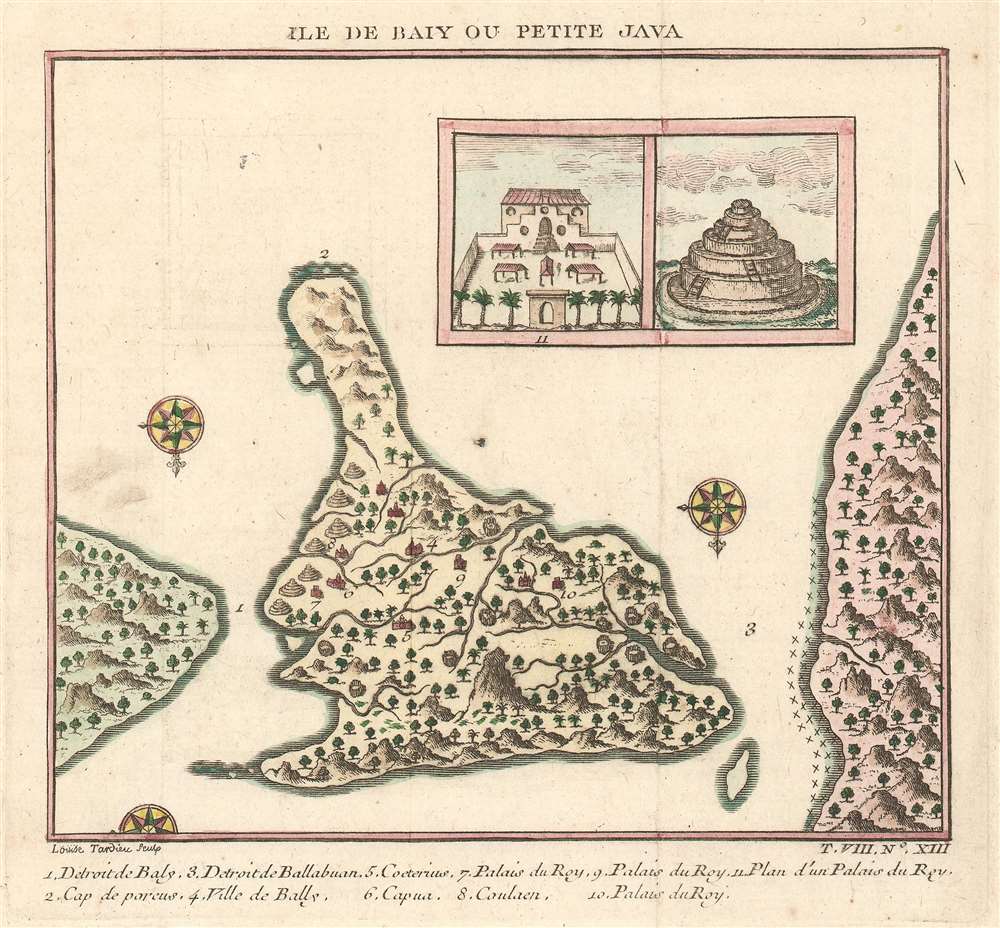
Ile de Baly ou Petite Java.
sold
- Digital Map Information
- Suitable for large format printing
- DPI: 600
- File Size: 2.04 MB
- File Type: ZIP / TIFF
- ICC color profile embedded
- Delivered instantly via download link
This is an extremely attractive 1751 Jacques-Nicolas Bellin map of Bali, Indonesia. The map depicts the island from the north with Java to the right and Lombok to the left. Wonderful detail of inland rivers and villages is illustrated along with an inset of the Royal Palace and a Balinese temple is situated in the upper right corner. Two and a half compass roses decorate the image. An index of eleven numerically identified locations throughout the island is situated along the bottom border. The cartography is based on a 17th century map created by Willem Lodewijcksz, a member of Cornelius de Houtman's pioneering 1595-97 voyage to the East Indies. (more details)
A charming map of the Cape Verde Islands.
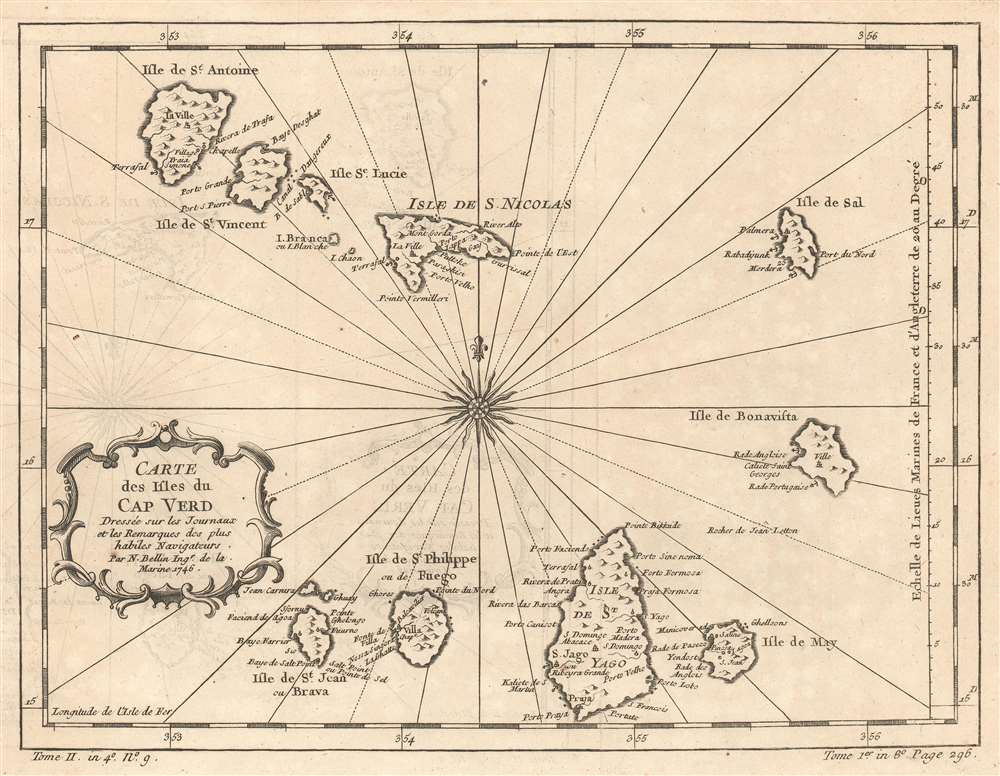
Carte des Isles du Cap Verd.
sold
- Digital Map Information
- Suitable for large format printing
- DPI: 600
- File Size: 5.77 MB
- File Type: ZIP / TIFF
- ICC color profile embedded
- Delivered instantly via download link
This is a 1746 Jacques-Nicolas Bellin map of the Cape Verde Islands. The map depicts all ten islands in the archipelago, which is located 350 miles off the northwest coast of Africa. Beautifully engraved, each island is labeled, as are settlements on the islands ... (more details)
Japanese map promoting the timber trade in Washington, Oregon, and Vancouver.

米國材產地鳥瞰地圖 / Bird’s-Eye View of U.S. Lumber Production Areas.
sold
- Digital Map Information
- Suitable for large format printing
- DPI: 600
- File Size: 43.21 MB
- File Type: ZIP / TIFF
- ICC color profile embedded
- Delivered instantly via download link
This is a stunning 1938 or Showa 13 Japanese map of the American Pacific Northwest issued for the Osaka timber industry. In a manner reminiscent of Japanese panoramic railroad maps in the Yoshida school, this map covers the Pacific Coasts of Oregon, Washington, and British Columbia, including Vancouver Island and city. The region's rich pine forests are represented pictorially. A smaller inset map near Vancouver Island highlights the Queen Charlotte Islands further north - definitely a valuable source for timber resources. A table in the lower left breaks down regional timber production by month from 1908 - 1912. A larger table, in white, defines tree types and imports to Japan.
The map folds into an interesting cover wherein a large eagle carries an edge shaped globe. Imperial Japan, including Korea and Taiwan is highlighted in red while the eagle itself appears to be eating the Pacific Northwest. Advertisements for Japanese business appear in the border. (more details)
The map folds into an interesting cover wherein a large eagle carries an edge shaped globe. Imperial Japan, including Korea and Taiwan is highlighted in red while the eagle itself appears to be eating the Pacific Northwest. Advertisements for Japanese business appear in the border. (more details)
Modestly sized wall map illustrating the westward expansion.
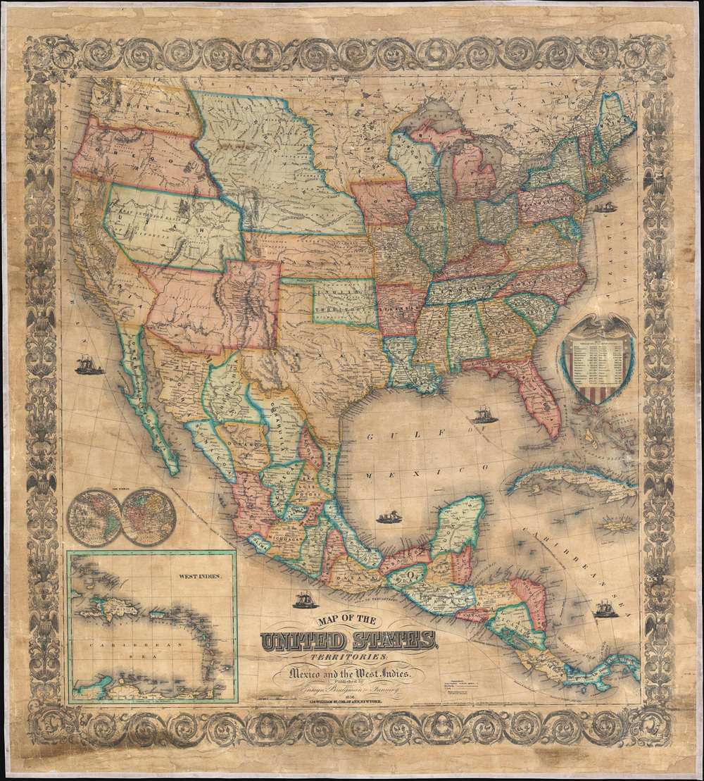
Map of the United States, with its Territories; also Mexico and the West Indies.
sold
- Digital Map Information
- Suitable for large format printing
- File Size: 120.99 MB
- File Type: ZIP / TIFF
- ICC color profile embedded
- Delivered instantly via download link
A scarce American wall map of the United States and Mexico issued by Ensign, Bridgeman and Fanning in 1856. As the title suggests, the map covers all of the United States as well Mexico, Cuba, and Central America as far as Panama. Inset maps in the lower left illustrate the world and the Lesser Antilles. The focus of the map is westward expansion in the United States. Updates accordingly focused in administrative changes west of the Mississippi. Here, Texas configures to the Compromise of 1850 borders and the Gadsden Purchase has added new territory to New Mexico. The borders of Kansas and Nebraska adhere to the Kansas-Nebraska Act of May 30, 1854 in which Nebraska stretches to the Canadian border. The gold region in the Sacramento Valley is highlighted in California. The map noes emigrant and exploration routes to the west, including Fremont's Route, The Oregon Trail, and the Santa Fe Caravan route. American Indian lands are rigorously identified throughout, as if to remind emigrants that the land is not completely free and uninhabited. (more details)
Undoubtedly the first large scale map to treat railways as the primary subject in terms of content and presentation…' - Shirley
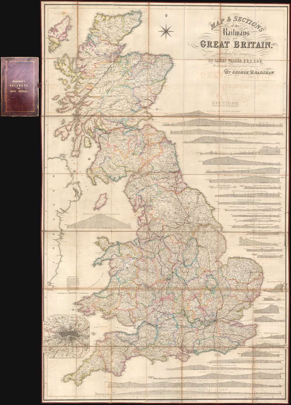
Map and Sections of the Railways of Great Britain.
sold
- Digital Map Information
- Suitable for large format printing
- Full resolution TIFF file
- ICC color profile embedded
- Delivered instantly via download link
Here in its rare first edition, this 1839 map of Great Britain by George Bradshaw is considered to be the first comprehensive railroad map. The map covers all of Great Britain as well as parts of the Hebrides and Ireland. Complete railroad lines are identified in strong red, while lines under construction or proposed, such as the 'Northern and Eastern Railway' and the 'Manchester and Birmingham Extension', appear in yellow. It is of note that, while this my no means the first map to show a railroad, it is, in the words of map historian Rodney Shirley,
undoubtedly the first large scale map to treat railways as the primary subject in terms of content and presentation.… and indeed the map is magnificent in size and presentation, comprehensive in scope, and extensive it is meticulous attention to detail. In addition to the map proper, there are 32 profile sections illustrating elevation for each major railway. An inset map of London and vicinity appears in the lower left quadrant. (more details)
An extremely rare German view of the Holy Land.
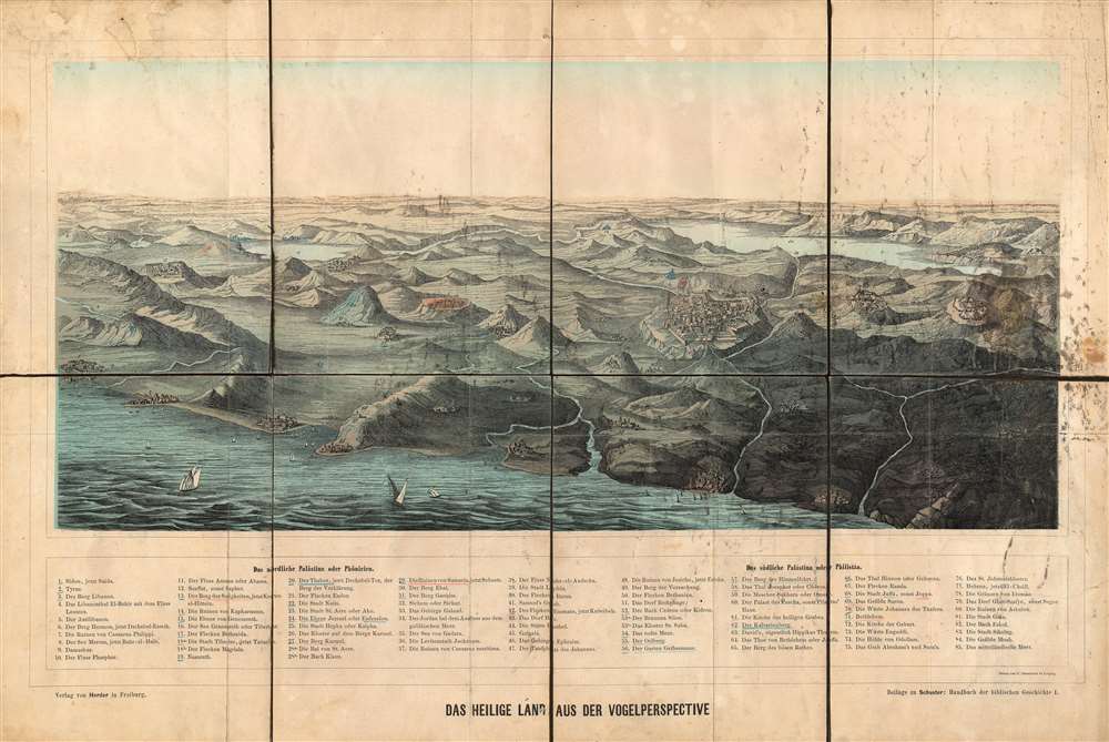
Das Heilige Land Aus der Vogelperspective.
sold
- Digital Map Information
- Suitable for large format printing
- File Size: 20.27 MB
- File Type: ZIP / TIFF
- ICC color profile embedded
- Delivered instantly via download link
This is an extremely rare c. 1890 chromolithograph view of the Holy Land drawn by C. Grumbach in Leipzig and published by Hermann Herder in Freiburg. The view depicts the region from Sidon, Lebanon to Hebron, a Palestinian city located in the West Bank, and from Mt. Moab to the Mediterranean Sea. Beautifully engraved and colored, eighty-five different locations are numerically identified and correspond to an index situated along the bottom of the view. Some of these locations include the Dome of the Rock in Jerusalem, Haifa, and Nazareth. (more details)
One of the great National Parks.

Union Pacific System Map of Rocky Mountain National (Estes) Park Denver Mountain Parks.
sold
- Digital Map Information
- Suitable for large format printing
- File Size: 62.27 MB
- File Type: ZIP / TIFF
- ICC color profile embedded
- Delivered instantly via download link
An uncommon 1924 map of Estes Park and the Rocky Mountain region west of Denver and Fort Collins issued by Poole Brothers on behalf of the Union Pacific Railroad. The map promotes travel to Denver on the Union Pacific Railroad as a means of accessing Rocky Mountain National Park (Estes Park) via car. Red overprinting illustrates potential auto routes past noteworthy town and natural wonders.
This historical significance of this map is reflected in the transition from railroad to automobile travel and the era of commercial exploitation of our National Parks. Maps such as this provide a marvelous ephemeral look at the use and development of the region and often reflect roads and commercial uses (hotels, tourist attractions, etc.) which were later closed and abandoned as the management of the park system evolved away from tourist uses and became increasingly focused on the preservation and conservation of the natural resource element of the parks. (more details)
This historical significance of this map is reflected in the transition from railroad to automobile travel and the era of commercial exploitation of our National Parks. Maps such as this provide a marvelous ephemeral look at the use and development of the region and often reflect roads and commercial uses (hotels, tourist attractions, etc.) which were later closed and abandoned as the management of the park system evolved away from tourist uses and became increasingly focused on the preservation and conservation of the natural resource element of the parks. (more details)
Illustrates the Palace of Versailles and its magnificent gardens.
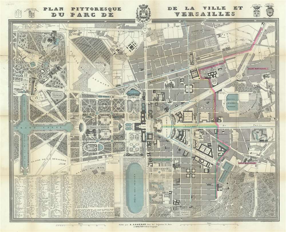
Plan Pittoresque de la Ville et du Parc du Versailles.
sold
- Digital Map Information
- Suitable for large format printing
- DPI: 600
- File Size: 59.91 MB
- File Type: ZIP / TIFF
- ICC color profile embedded
- Delivered instantly via download link
This is an 1854 Auguste Logerot city map of plan of Versailles, France. The map depicts the region from the Grand Trianon to the Butte de Montbauron and from the Boulevard St. Antoine to the Bois de Satory. Highly detailed, myriad locations throughout are labeled. The Gardens of Versailles are illustrated in detail and identifies the paths, pools, and fountains, as well as the Grand and Petit Trianon. Parts of the palace are also labeled, although in not as much detail. Both the Senate and the National Museum are identified as occupying parts of the chateau itself. Outside the Domain of Versailles, the city is also shown in some detail, labeling numerous buildings, including the prefecture, the city hall, the hospital, and the market. The view of Versailles from the Place d'Armes is illustrated in profile, as is the Church of Notre-Dame and the train station that greets visitors from Paris. An index of locations throughout the map is situated in the lower left corner and lists streets, boulevards, and squares, among others. (more details)
A broadside memorializing the Titantic disaster and those that lost their lives.

S.S. Titanic. Sunk in the Greatest Maritime Disaster in History. April 15, 1912.
sold
- Digital Map Information
- Suitable for large format printing
- File Size: 29.62 MB
- File Type: ZIP / TIFF
- ICC color profile embedded
- Delivered instantly via download link
This is a 1912 Tichnor Brothers view of the S.S. Titanic memorializing her tragic sinking and the more than 1500 lives that were lost. The view illustrates the entirety of Titanic as she steams out of harbor. People are illustrated on each of her decks as are the woefully inadequate number of lifeboats. When she left Southampton, Titanic was the largest and most luxurious steamship in the world. She was equipped with myriad modern furnishings, including state-of-the-art incandescent lightbulbs, shipboard telephones, and a wireless transmitter. A brief summary of the Titanic's ill-fated voyage appears below the view of the magnificent steamship and chronicles the events of May 13-15, 1912. A map, situated on the lower left, traces the Titanic's route across the Atlantic and marks the approximate location where she hit the infamous iceberg that sealed her demise. (more details)
The first published representation of the Duke's Plan of New Amsterdam (New York), 1664.

(The Duke's Plan.) A Description of the Towne of Mannados or New Amsterdam as it was in September 1661.
sold
- Digital Map Information
- Suitable for large format printing
- File Size: 39.54 MB
- File Type: ZIP / TIFF
- ICC color profile embedded
- Delivered instantly via download link
This is the 1859 Valentine reissue of the magnificent 'Duke's Plan' of New York City. The original Duke's Plan, a fine illustrated manuscript prepared in 1664 currently resides in the British Library in London. The map was discovered in 1858 by George H. Moore, Librarian of the New York Historical Society after being all but forgotten in the stores of the British Library. Thus, this present example, published by Valentine in 1859, represents the first time this plan was revealed to the general public. (more details)
Striking pictorial 'monumental' map of London!
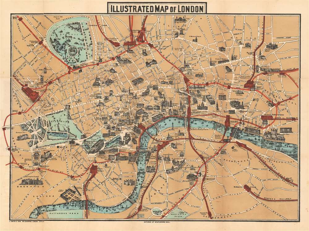
Illustrated Map of London.
sold
- Digital Map Information
- Suitable for large format printing
- File Size: 33.52 MB
- File Type: ZIP / TIFF
- ICC color profile embedded
- Delivered instantly via download link
An uncommon 1887 pictorial map of London by Charles Smith and Son. Centered on the Royal Courts of Justice, the map extends from Kensington Palace to the Tower of London and from Islington Green to Kennington Oval and Park. London's developing transportation network is highlighted in red. Important monuments and even parks are highlighted with vignette illustrations of the buildings themselves, including Buckingham Palace, St. Paul's Cathedral, and the Tower of London. (more details)