
From lost Russian sources.
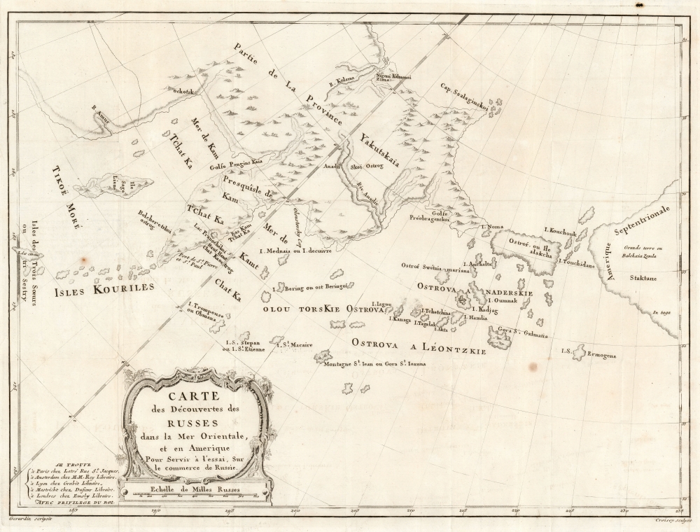
Carte des Découvertes des Russes dans la Mer Orientale, et en Amerique Pour Servir à L'essai, Sur le commerce de Russie.
sold
- Digital Map Information
- Suitable for large format printing
- DPI: 600
- File Size: 38.36 MB
- File Type: ZIP / TIFF
- ICC color profile embedded
- Delivered instantly via download link
This is a rare and unusual 1777 map of the North Pacific in the vicinity of Alaska, the Bering Strait, and northeastern Siberia based upon Russian Promyshlenniki (trader) exploration. It appeared accompanying one of the earliest works on Russian commerce, the M. de Marbault's Essai sur le Commerce de Russie, avec l'Histoire de ses Decouvertes. (more details)
Souvenirs of Venice.

[Venice Lithographs].
$2,000.00
Acquire
- Digital Map Information
- Suitable for large format printing
- File Size: 66.57 MB
- File Type: ZIP / TIFF
- ICC color profile embedded
- Delivered instantly via download link
This is a set of 11 c. 1890 lithographs of Venice, Italy, after the photography of Carlo Naya. All 11 images are lithographed versions of photographs taken by Carlo Naya, an Italian photographer known for his work relating to Venice. (more details)
First Printed Modern Map of Asia.

Die Laender Asie nach ihrer gelegenheit biss in India werden in diser Tafel verzeichnet.
$2,000.00
Acquire
- Digital Map Information
- Suitable for large format printing
- Full resolution TIFF file
- ICC color profile embedded
- Delivered instantly via download link
This is a 1574 strike of Sebastian Münster's 1540 map of Asia, the first printed map of that continent based on contemporary data and the earliest obtainable map of the continent overall. The map depicts the Asian continent from the Caspian Sea and the Persian Gulf to the Pacific Ocean and from the Arctic Ocean to the Indian Ocean. Although the interior detail is based heavily on Ptolemy, Münster also blends in information gleaned from recent discoveries by Portuguese traders and adventurers, including Vasco da Gama (c. 1460 - 1624). Both the Portuguese outposts of Goa and Calicut, on the Indian subcontinent, are labeled, and the depiction of India is improved, moving closer to a truly accurate depiction, although still undersized. The inclusion of Sri Lanka (Zaylon) as an island is also an improvement; Münster applies Ptolemy's historical name for Sri Lanka - Taprobana - to Sumatra, which is placed correctly to the west of the Malay peninsula. (more details)
Reaffirming Coptic identity in an era of rising pan-Arabism.
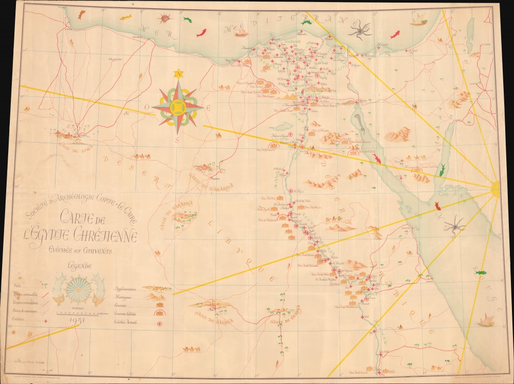
Carte de l'Égypte Chrétienne Evêchés et Couvents.
sold
- Digital Map Information
- Suitable for large format printing
- File Size: 36.86 MB
- File Type: ZIP / TIFF
- ICC color profile embedded
- Delivered instantly via download link
This is a 1951 first edition Société d'Archéologie Copte pictorial map of Christian Egypt. This map can be seen in the context of a growing need to assert Coptic identity in the wake of rising Islamist power and pan-Arab nationalism. (more details)
Kansas City's moment of most expansive growth.
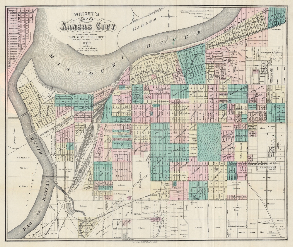
Wright's Map of Kansas City.
$950.00
Acquire
- Digital Map Information
- Suitable for large format printing
- Full resolution TIFF file
- ICC color profile embedded
- Delivered instantly via download link
This is a rare 1882 Carl Gothe de Grote and Harry T. Wright city map of Kansas City, Missouri - published in Kansas City! The map captures Kansas City in its moment of most explosive growth, illustrating the engines of said growth, including urban development plans, railroads, and the Kansas City Stockyards. (more details)
From Singapore to China.
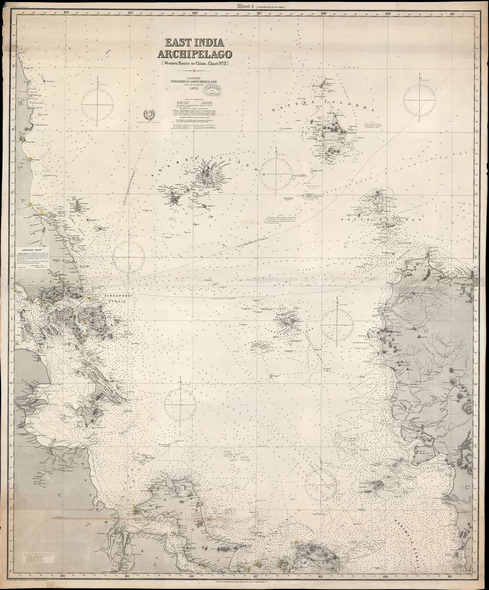
East India Archipelago [Western Route to China Chart no. 2]
sold
- Digital Map Information
- Suitable for large format printing
- File Size: 108.53 MB
- File Type: ZIP / TIFF
- ICC color profile embedded
- Delivered instantly via download link
A large and impressive 1891/1894 nautical chart by James Imray covering eastern Malaya (Malaysia), Singapore, the South China Sea, and parts of Borneo and Sumatra. This is part of a nine-map series Imray issued to illustrate trade routes between Singapore, China, and Japan. It corresponds to Chart no. 2 in the 'East India Archipelago' series and chart no. 4 in the 'Western Route to China' series. This is the most desirable map of the series due to ints inclusion of Singapore. (more details)
Among the First Maps of Sri Lanka from Contemporary Report.
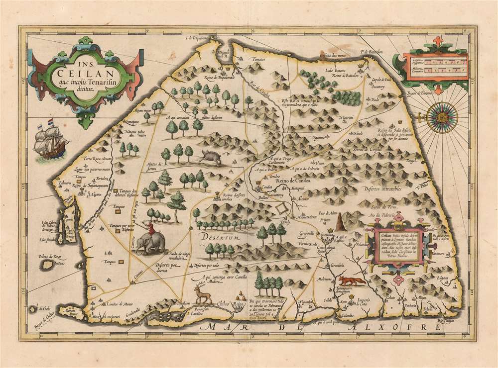
Ins. Ceilan quae incolis Tenarisin dicitur.
sold
- Digital Map Information
- Suitable for large format printing
- DPI: 600
- File Size: 43.05 MB
- File Type: ZIP / TIFF
- ICC color profile embedded
- Delivered instantly via download link
This is an attractive edition of the 1606 Jodocus Hondius map of Ceylon of Sri Lanka. As one of the maps introduced to Mercator's Atlas after Hondoius acquired the work, it is among the first maps to address the island from first-hand contemporary reports. (more details)
Paris is Voltaire, Voltaire is Paris.

François Marie Arouet - Voltaire.
sold
This is a 1975 Orosz István pictorial map and view of Paris, France, reimagining the city in Voltaire's image. Paris is recognizable because of its shape and the Seine River - and so is Voltaire's skull-like visage. (more details)
Rise of Sport Skiing in America.

Map of New Hampshire Ski Trails 1936-7.
sold
- Digital Map Information
- Suitable for large format printing
- Full resolution TIFF file
- ICC color profile embedded
- Delivered instantly via download link
This is a 1937 New Hampshire State Planning and Development Commission and General Drafting map of New Hampshire ski trails for the 1936-37 ski season. (more details)
Operation Barbarossa and Nazi Defeat in the Caucasus.

Marschweg der Enzien-Division. [Marching route of the Enzian Division.]
sold
- Digital Map Information
- Suitable for large format printing
- File Size: 5.77 MB
- File Type: ZIP / TIFF
- ICC color profile embedded
- Delivered instantly via download link
This is a July 1945 World War II route map of the Nazi 4th Mountain Division in Eastern Europe. The map depicts from southeastern Germany to the Caucasus and follows the Division's movements through the Balkans and during Operation Barbarossa, the invasion of the Soviet Union. Illustrations mark the Division's farewell in southern Germany and also depict tanks, soldiers, and views across southern Ukraine and the Caucasus. (more details)
First issue of an early depiction of Quebec.

Plan du Bassin de Quebec et de ses Environs.
sold
- Digital Map Information
- Suitable for large format printing
- DPI: 600
- File Size: 5.06 MB
- File Type: ZIP / TIFF
- ICC color profile embedded
- Delivered instantly via download link
A scarce 1744 first state first issue of Bellin's map of the vicinity of Quebec City, Canada, illustrating the shallows of the St. Lawrence River. When this map was issued, Quebec dominated the French fur trade with its strategic position on a vital St. Lawrence artery. (more details)
One of the Earliest Acquirable Views of New York City.

The South Prospect of the City of New York, in North America.
sold
- Digital Map Information
- Suitable for large format printing
- Full resolution TIFF file
- ICC color profile embedded
- Delivered instantly via download link
This is a superb example of the 1761 London Magazine edition of the famous Burgis view of New York City, one of the earliest generally acquirable dedicated views of the city. The bustling, nautical view shows the city as viewed from Brooklyn Heights. It illustrates from the battery in the south to the stockade of Wall Street. The East River teems with sailing ships, including three great warships. Fort George, the Exchange, City Hall, and a variety of churches can be seen, along with a shipyard. The Long Island terminus of the ferry across the East River is visible in the foreground. (more details)
Map In Transition.
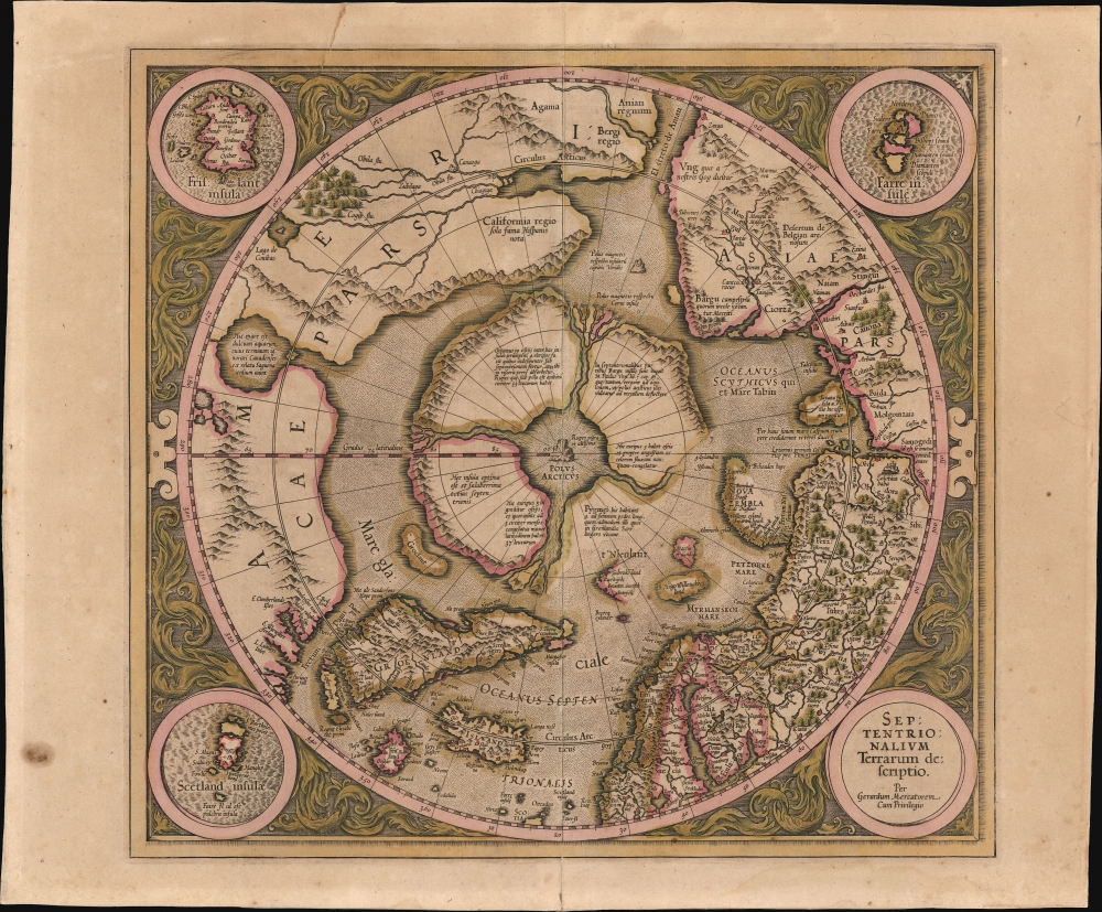
Septentrionalium Terrarum descriptio.
sold
- Digital Map Information
- Suitable for large format printing
- Full resolution TIFF file
- ICC color profile embedded
- Delivered instantly via download link
This is the 1606 second Hondius state of Gerard Mercator's map of the North Pole or Arctic, one of the great cartographer's most interesting and important maps. This map marks a significant step forward in the cartographic understanding of the high Arctic, representing the transition between medieval and modern cosmographical perspectives. (more details)
One of the first accurate maps of the interior of Thailand (Siam).

De Groote Siamse Rievier Me-Nam ofte Moeder der Wateren inharen loop met de in vallende Spruyten Verbeeld.
sold
- Digital Map Information
- Suitable for large format printing
- File Size: 21.25 MB
- File Type: ZIP / TIFF
- ICC color profile embedded
- Delivered instantly via download link
This is a rare 1726 Francois Valentijn map of the Chao Phraya River, Thailand. This is among the earliest published maps to offer first-hand information on the interior of Siam. (more details)
First authenticated European Contact with Australia; best Philippine Mapping to date.

Indiae Orientalis Nova Descriptio.
sold
- Digital Map Information
- Suitable for large format printing
- Full resolution TIFF file
- ICC color profile embedded
- Delivered instantly via download link
This is a gorgeous, original color example of Jan Jansson's 1630 map of the East Indies - the first printed map to present Willem Janszoon's European 1606 contact with Australia. It also represents a milestone in the mapping of the Philippines, containing a markedly more precise depiction of the archipelago than any prior printed map. (more details)
'High water mark' of the Confederacy and turning point of the Battle of Gettysburg.

Gettysburg. Repulse of Longstreet's Assault.
sold
- Digital Map Information
- Suitable for large format printing
- File Size: 83 MB
- File Type: ZIP / TIFF
- ICC color profile embedded
- Delivered instantly via download link
A stunning 'India Proof' first edition example of John Badger Bachelder and James Walker's 1876 steel-engraved view of the American Civil War Battle of Gettysburg. The view is derived from James Walker's incredible 20-foot-wide painting of Pickett's Charge, identified here as Longstreet's Assault, considered the 'high water mark' of the Confederacy and the turning point not only of the battle, but of the American Civil War (1861 - 1865). The term 'India Proof' does not denote a pre-publication test sheet, rather it is a special, higher-end, issue of what is, in this case, also the first edition. (more details)
Man-O'-War, the great warships of the Age of Sail.

Neue Tafel vor alle Liebhabers und see-fahrende Personen Stellet vor ein Orlog oder Kriegs-Schiff mit seinen volligen Two od Seil Werk Sampt einen Durchgeschnittnen Schiff, auch Vor und Hindertheil Desgleichen Booten, Chaloupen un Schiff-Heber, nebst noch mehr anderer Schiffs Gereth-Schafft und zugehörungen.
sold
- Digital Map Information
- Suitable for large format printing
- File Size: 26.65 MB
- File Type: ZIP / TIFF
- ICC color profile embedded
- Delivered instantly via download link
This is a fascinating 1716 J. B. Homann diagram of a three-masted, 96-gun Man-o'-War - the workhorse warship of 18th-century European navies. Such ships, also called Ships of the Line, dominated the recently-ended War of Spanish Succession (1701 - 1714), making this diagram a subject of great interest to the educated European populace. (more details)
Habitable world as known to the ancients.
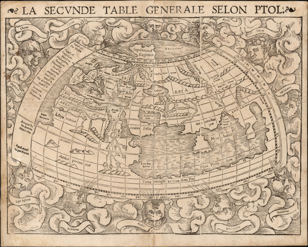
La Seconde Table Generale Selon Ptol.
sold
- Digital Map Information
- Suitable for large format printing
- Full resolution TIFF file
- ICC color profile embedded
- Delivered instantly via download link
An attractive example of Sebastian Münster's 1540 map of the world, according to Claudius Ptolemy, in a 1568 French text edition. The map details the Oikumene, the inhabited world as it was known to the Roman Empire of the second century, well before the Age of Discovery. It covers only the 'Old World' from the Atlantic (Pillars of Hercules) to Indochina, and from the Arctic to the Tropic of Capricorn. The map is surrounded by aeoli and clouds. (more details)
Coffee and the route to Mecca.
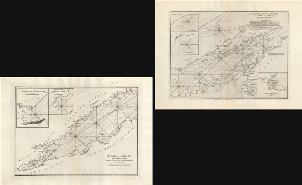
A Chart of the Red Sea from Geddah to Suez. / A Chart of the Red Sea from Moka to Geddah.
sold
- Digital Map Information
- Suitable for large format printing
- Full resolution TIFF file
- ICC color profile embedded
- Delivered instantly via download link
A set of 1794 nautical maps of the Red Sea by the British publishers Laurie and Whittle illustrating the nautical route to Mecca as well as the Mocha Route (coffee anyone?). The maps are oriented to the east. The first covers from Mocha to Jeddah, the more lively southern part of the Red Sea. The second covers the northern portions from Jeddah to Suez. (more details)
Ayutthaya's Golden Age.
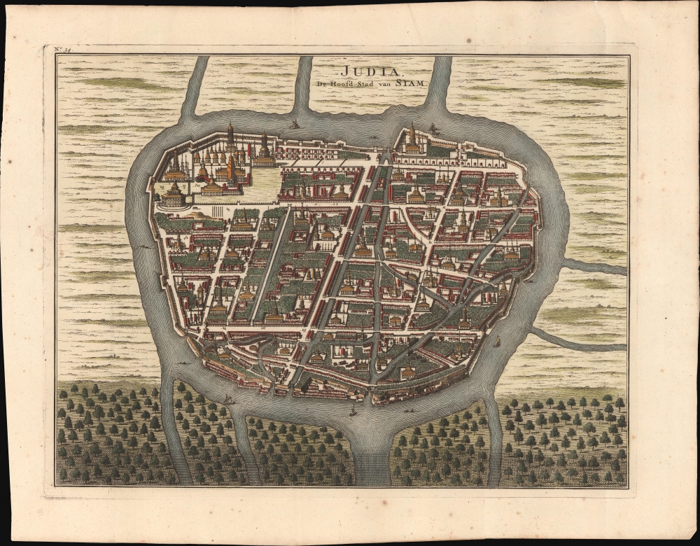
Judia, de Hoofd-Stad van Siam.
sold
- Digital Map Information
- Suitable for large format printing
- File Size: 13.8 MB
- File Type: ZIP / TIFF
- ICC color profile embedded
- Delivered instantly via download link
This is a striking 1726 Francois Valentijn view and map of Ayutthaya, capital of Siam (Thailand), under the aptly named Ayutthaya Kingdom (1351 - 1767), considered a golden age for Thailand. The map illustrates the city at its peak when it was one of the world's largest and wealthiest. At this time, few Europeans had contact with Ayutthaya, as the French and other Europeans were banned from the Kingdom in 1688, leaving only the Dutch with a tenuous presence. (more details)