
Illustrates the defensive line built around Cincinnati, Covington, and Newport before the Confederate Heartland Offensive of 1862 during the American Civil War.
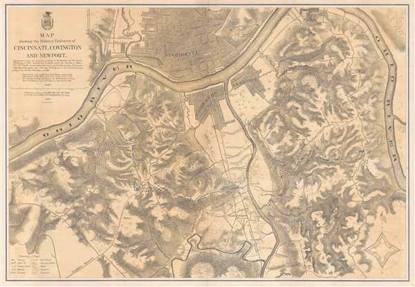
Map showing the Military Defences of Cincinnati, Covington and Newport.
sold
- Digital Map Information
- Suitable for large format printing
- File Size: 31.9 MB
- File Type: ZIP / TIFF
- ICC color profile embedded
- Delivered instantly via download link
This is a separate issue 1877 U.S. Army Corps of Engineers map of the defenses of Cincinnati, Ohio, and Covington and Newport, Kentucky, along with the immediate vicinity during the American Civil War. The map depicts the region from the Ohio River west of ... (more details)
The Battle of Fort Blakely was the final major battle of the American Civil War.
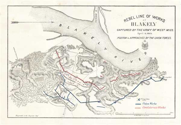
Rebel Line of Works at Blakely Captured by the Army of West Miss. April 9, 1865.
sold
- Digital Map Information
- Suitable for large format printing
- File Size: 3.77 MB
- File Type: ZIP / TIFF
- ICC color profile embedded
- Delivered instantly via download link
This is a separate issue 1865 U.S. Army Corps of Engineers map of the American Civil War Battle of Fort Blakely, the last major battle of the war. Centered on the town of Blakely, Alabama, the map depicts both Union and Confederate fortified positions on ... (more details)
Identifies all the major capitals of Europe, including Paris, Rome, London, Madrid, and Berlin.
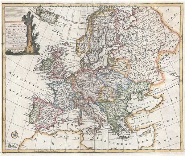
A New and Accurate Map of Europe.
sold
- Digital Map Information
- Suitable for large format printing
- Full resolution TIFF file
- ICC color profile embedded
- Delivered instantly via download link
This is a beautiful 1747 decorative map of Europe by the English cartographer Emmanuel Bowen. The map depicts the continent from Iceland to Tartary (Central Asia) and from the Arctic Ocean to North Africa. The entire region is illustrated in ... (more details)
Depicts one of the more calamitous Confederate defeats of the American Civil War - it is sometimes referred to as the 'Pickett's Charge of the West'.
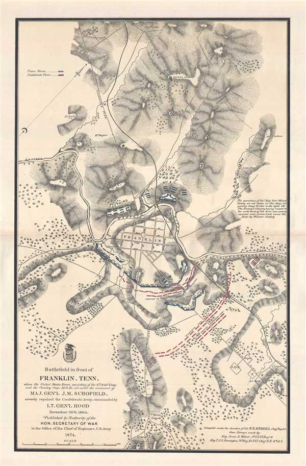
Battlefield in front of Franklin, Tenn. where the United States Forces, consisting of the 4th and 23rd Corp and the Cavalry Corps M.D.M., all under the command of Maj. Gen'l J.M. Schofield, severely repulsed the Confederate Army, commanded by Lt. Gen'l Hood November 30th 1864.
sold
- Digital Map Information
- Suitable for large format printing
- File Size: 12.92 MB
- File Type: ZIP / TIFF
- ICC color profile embedded
- Delivered instantly via download link
This is a separate issue 1874 William Emery Merrill map of the Battle of Franklinduring the American Civil War. Founded in a bend of the Harpeth River, Franklin, Tennessee and its environs are depicted here in incredible detail. Stretching ... (more details)
A beautifully colored city map of Buenos Aires that identifies individual districts within this vibrant city.
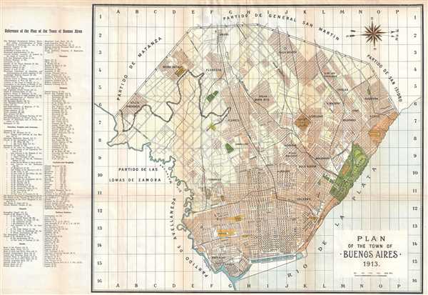
Plan of the Town of Buenos Aires.
sold
- Digital Map Information
- Suitable for large format printing
- File Size: 10.1 MB
- File Type: ZIP / TIFF
- ICC color profile embedded
- Delivered instantly via download link
This is a 1913 Johan de Roos city map or plan of Buenos Aires, Argentina. Situated toward the west, the map depicts the city from the Partido de Matanza, the Partido de las Lomas de Zamora, and the Partido de Avellaneda to the Rio de la ... (more details)
A German military map of Odessa created during Operation Barbarossa - the Axis invasion of the Soviet Union.

Mil.-Geo.-Plan von Odessa.
sold
- Digital Map Information
- Suitable for large format printing
- File Size: 18.68 MB
- File Type: ZIP / TIFF
- ICC color profile embedded
- Delivered instantly via download link
This is a special edition 1941 German Army and Air Force General Staff city map or plan of Odessa, Ukraine. Germany launched its invasion of Russia in June 1941, meaning that this map surely was created for use during Operation ... (more details)
HIghlights all of New York City's landmarks: the Empire State Building, the Chrysler Building, and Times Square.
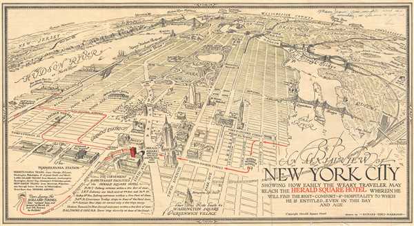
An Aeril View of New York City Showing How Easily the Weary Traveler May Reach the Herald Square Hotel Wherein He Will Find the Rest - Comfort - and Hospitality to Which He is Entitled, Even in this Day and Age.
sold
- Digital Map Information
- Suitable for large format printing
- File Size: 3.68 MB
- File Type: ZIP / TIFF
- ICC color profile embedded
- Delivered instantly via download link
This is a 1931 Richard Edes Harrison pictorial bird's eye view of New York City. Oriented towards the north, the map depicts the city from the Hudson River to Queens and from Westchester County to Thirtieth Street. Wonderfully ... (more details)
Depicts the movements of General William Tecumseh Sherman and his armies in 1863, 1864, and 1865, which includes the Battle of Vicksburg, the Atlanta Campaign, and the March to the Sea.
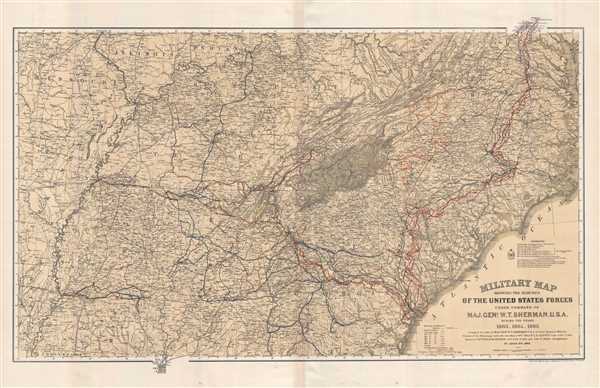
Military Map Showing the Marches of the United States Forces Under Command of Maj. Gen. W. T. Sherman. U.S.A. During the Years 1863, 1864, 1865.
sold
- Digital Map Information
- Suitable for large format printing
- File Size: 23.29 MB
- File Type: ZIP / TIFF
- ICC color profile embedded
- Delivered instantly via download link
This is a separate issue 1865 William Kossak and United States Corps of Engineers map of the southeastern United States tracing the movements of Union Army forces under the command of Major General William Tecumseh Sherman in ... (more details)
Rare Civil War map of the Battle of Vicksburgh from Spangenberg manuscript.
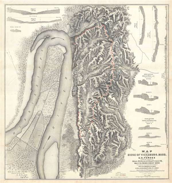
Map of the Siege of Vicksburg, Miss. By the U.S. Forces Under the Command of Genl. U.S. Grant, U.S. Vls. Maj. F.E. Prime, Chief Engr. Surveyed and constructed under the direction of Capt. C.B. Comstock, U.S. Engr.s and Lt. Col. Js. H. Wilson . . . Drawn by Chs. Spangenberg.
sold
- Digital Map Information
- Suitable for large format printing
- File Size: 36.14 MB
- File Type: ZIP / TIFF
- ICC color profile embedded
- Delivered instantly via download link
This is a rare c. 1863 separate issue Charles Spangenberg Civil War map of the Siege of Vicksburg (May 18, 1863 - July 4, 1863). This map, considered one of the most attractive Civil War maps, is based upon a manuscript map ... (more details)
Probably the first detailed map of Harper's Ferry, West Virginia, since West Virginia had only officially been a state since June 1863.
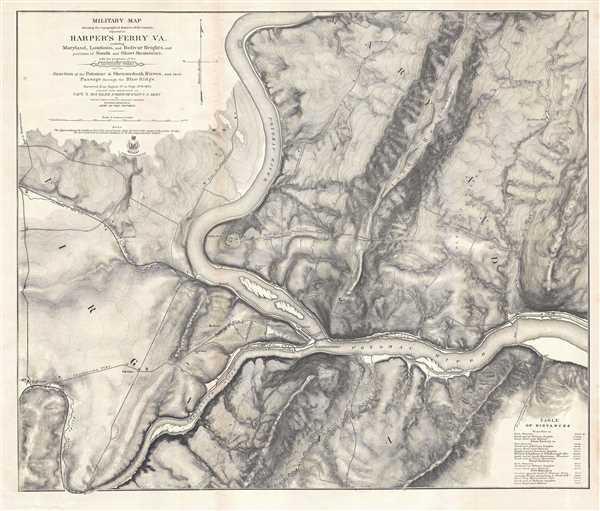
Military Map showing the topographical features of the country adjacent to Harper's Ferry VA. Including Maryland, Loudoun, and Bolivar Heights, and portions of South and Short Mountains, with the positions of the Defensive Works also the Junction of the Potomac and Shenandoah Rivers, and their Passage through the Blue Ridge.
sold
- Digital Map Information
- Suitable for large format printing
- File Size: 32.06 MB
- File Type: ZIP / TIFF
- ICC color profile embedded
- Delivered instantly via download link
This is an extraordinary separate issue 1863 John E. Weyss map of Harper's Ferry, West Virginia, created during the American Civil War. One of the best maps of the region created at the time, particularly from a topographic ... (more details)
The site of the most decisive battle of the American Civil War fought in North Carolina.
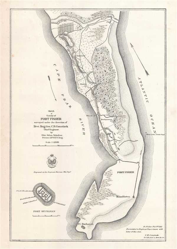
Sketch of Vicinity of Fort Fisher.
sold
- Digital Map Information
- Suitable for large format printing
- File Size: 3.02 MB
- File Type: ZIP / TIFF
- ICC color profile embedded
- Delivered instantly via download link
This is an 1865 separate issue Otto Julian Schultze map of Fort Fisher and the immediate vicinity, a Confederate fort situated along the Cape Fear River on Federal Point, now Pleasure Island, North Carolina. The Battle of ... (more details)
A map of the Allied invasion of the Balkans - that never happened.
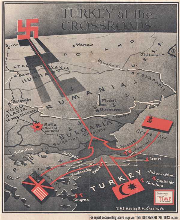
Turkey at the Crossroads.
sold
- Digital Map Information
- Suitable for large format printing
- File Size: 46.64 MB
- File Type: ZIP / TIFF
- ICC color profile embedded
- Delivered instantly via download link
This is an enlarged, separate issue version of a 1943 R. M. Chapin, Jr. map of the Balkans and eastern Europe created for TIME Magazine. The map depicts the region from Germany and Poland to Turkey and from Berlin and ... (more details)
Nautical Chart depicting Alabama's Mobile Bay.

H No. 10 Preliminary Sketch of Mobile Bay.
sold
- Digital Map Information
- Suitable for large format printing
- DPI: 300
- File Size: 5.03 MB
- File Type: ZIP / TIFF
- ICC color profile embedded
- Delivered instantly via download link
This is an uncommon 1851 U.S. Coast Survey Chart or Map of Mobile Bay, Alabama. The map depicts the region from Grand Bay and the mouths of the Alabama and Apalachee Rivers south to Mobile Point, Dauphine Island, and ... (more details)
Captures the wonder and sense of adventure felt by all at the advent of space exploration.

The Amoco Map of Space Mysteries.
sold
This is a 1958 Rudy de Reyna pictorial map of speculative space exploration. Created within a year of the launch of the Soviet satellite Sputnik 1 , the map proposes that many of the mysteries of the universe that, up ... (more details)
Rare separate issue nautical chart centered on Hilton Head Island.

Coast Chart No. 55 Coast of South Carolina and Georgia from Hunting Island to Ossabaw Island Including Port Royal Sound and Savannah River
sold
- Digital Map Information
- Suitable for large format printing
- File Size: 46.29 MB
- File Type: ZIP / TIFF
- ICC color profile embedded
- Delivered instantly via download link
This is a scarce separate issue 1873 working nautical chart or maritime map of the U.S. coast between Savannah and Port Royal. Oriented with northwest at the top and centered on Hilton Head Island, the chart covers ... (more details)
A game which was included with a purchase of Weston's English Quality Biscuits in 1933.

The Tarzan Jungle Map and Treasure Hunt
sold
- Digital Map Information
- Suitable for large format printing
- File Size: 49.71 MB
- File Type: ZIP / TIFF
- ICC color profile embedded
- Delivered instantly via download link
This is a 1933 Weston's Quality English Biscuits fantasy game map of Tarzan's Jungle. The map functions as a game board and depicts from the start, which is off the coast of Tarzan's homeland, to the finish, which ... (more details)
Illustrates the Washington Territory at its largest, from the Pacific Ocean to Wyoming.
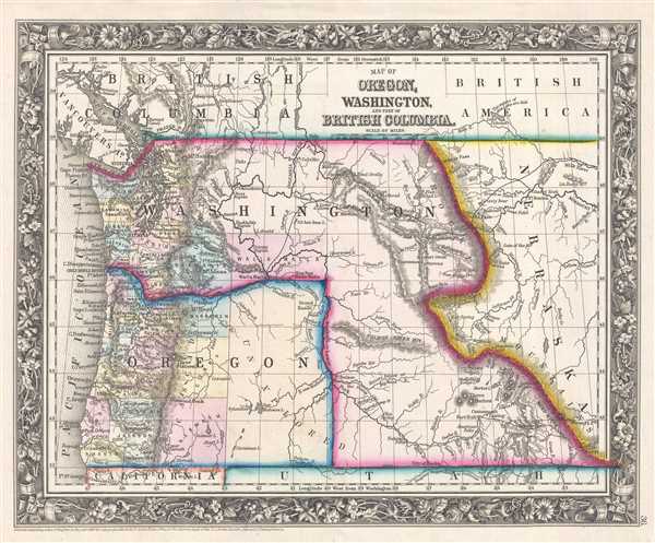
Map of Oregon, Washington, and Part of British Columbia.
sold
- Digital Map Information
- Suitable for large format printing
- File Size: 4.56 MB
- File Type: ZIP / TIFF
- ICC color profile embedded
- Delivered instantly via download link
This is an 1861 Samuel Augustus Mitchell, Jr. map of the Washington Territory and Oregon. The map depicts the region from the Pacific Ocean to the Nebraska Territory and from Canada to California and the Utah ... (more details)
Depicts the Pembina Region - the portion of the Minnesota Territory that fell unorganized after Minnesota's statehood in 1858.
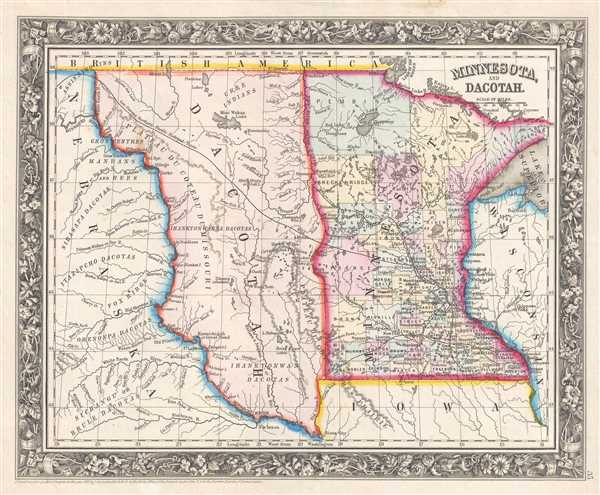
Minnesota and Dacotah.
sold
- Digital Map Information
- Suitable for large format printing
- File Size: 4.85 MB
- File Type: ZIP / TIFF
- ICC color profile embedded
- Delivered instantly via download link
This is an 1861 Samuel Augustus Mitchell, Jr. map of Minnesota and part of Wisconsin, Iowa, and the Nebraska Territory, as well as the Pembina Region, the portion of the Minnesota Territory between the Missouri River and the Red River that remained unorganized after Minnesota joined the Union in 1858. The map depicts the region from the Nebraska Territory to Wisconsin and from Canada (British America) to Iowa and the Nebraska Territory. (more details)
One of the more attractive 19th century commercial atlas maps of Boston.

Plan of Boston.
sold
- Digital Map Information
- Suitable for large format printing
- File Size: 3.53 MB
- File Type: ZIP / TIFF
- ICC color profile embedded
- Delivered instantly via download link
This is an 1861 Samuel Augustus Mitchell, Jr. map of Boston, Massachusetts. The map depicts Boston along with parts of East Cambridge, Charlestown, East Boston, and South Boston. Parks, individual streets, ... (more details)
Illustrates the vital rail network in Georgia that supplied the Confederate war effort.
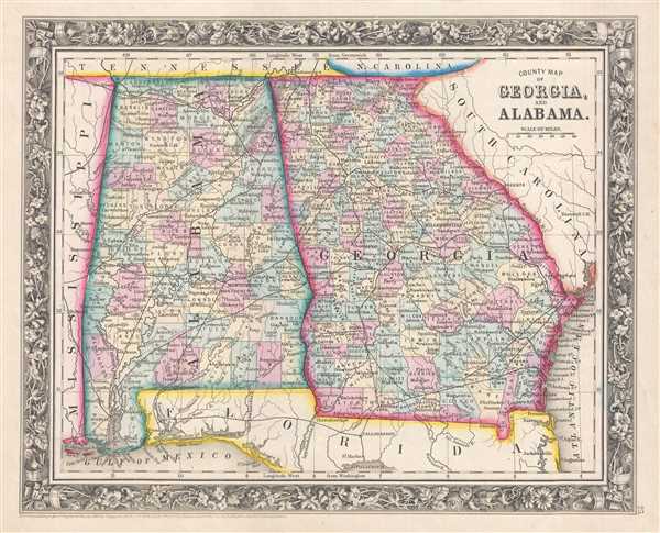
County Map of Georgia, and Alabama.
sold
- Digital Map Information
- Suitable for large format printing
- File Size: 4.74 MB
- File Type: ZIP / TIFF
- ICC color profile embedded
- Delivered instantly via download link
This is an 1861 Samuel Augustus Mitchell, Jr. map of Georgia and Alabama. The map depicts the region from Mississippi to the Atlantic Ocean and South Carolina and from Tennessee, North Carolina, and South ... (more details)