
One of the most decorative maps of Southern California.

Ride the Roads to Romance along the Golden Coast and thru the Sunshine Empire of Southern California.
sold
- Digital Map Information
- Suitable for large format printing
- File Size: 38.56 MB
- File Type: ZIP / TIFF
- ICC color profile embedded
- Delivered instantly via download link
This is an attractive 1963 bird’s eye view map of southern California issued by the Southern California Tourist Association, Inc. It covers from Malibu Beach to Ensenada in Mexico and includes the counties of Los Angeles, Orange, Riverside, San Diego, Imperial ... (more details)
Exceptionally rare wall map of Slovenia.
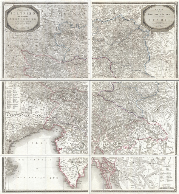
Königreich Illyrien und Herzogthum Steyermark… / Carte du Royaume d'Jllyrie et du Duché de Styrie.
sold
- Digital Map Information
- Suitable for large format printing
- DPI: 300
- File Size: 73.43 MB
- File Type: ZIP / TIFF
- ICC color profile embedded
- Delivered instantly via download link
An exceptional and rare 1819 wall map of Slovenia and Croatia by Georg Adam Zürner and Artaria. Centered on Ljubljana (Laibach), the map covers all of Slovenia along with parts of neighboring Croatia, Venice, and Austria It extends from Venice (Venezia, ... (more details)
Rare edition of the New York Herald on the lead up to the Battl eof Bull Run.

The New York Herald: Theatre of the Grand Army of the Potomac.
sold
- Digital Map Information
- Suitable for large format printing
- File Size: 13.27 MB
- File Type: ZIP / TIFF
- ICC color profile embedded
- Delivered instantly via download link
A rare 1861 Civil War era full issue of the New York Herald newspaper with front page woodcut map illustrating the theater of war in the vicinity of Washington D.C. This issue details the historic events leading up to the Battle of Bull Run. The front page ... (more details)
Vividly illustrated pictorial map of the Spanish Protectorate in Morocco.
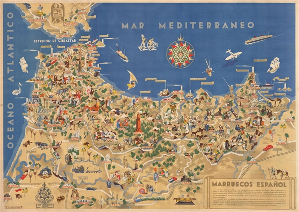
Marruecos Español.
sold
- Digital Map Information
- Suitable for large format printing
- File Size: 28.52 MB
- File Type: ZIP / TIFF
- ICC color profile embedded
- Delivered instantly via download link
A c. 1940 graphically rich pictorial map of the Spanish protectorate in Morocco (1912 - 1956) by Francisco López Rubio. The map covers roughly from Gibraltar to Fes, and from Kenitra to Berkane. The whole is richly illustrated in López Rubio's 'less is ... (more details)
Rare nautical chart illustrating Mount Desert Island and Acadia National Park.

Frenchmans Bay and Eastern Part of Mt. Desert Island.
sold
- Digital Map Information
- Suitable for large format printing
- File Size: 31.23 MB
- File Type: ZIP / TIFF
- ICC color profile embedded
- Delivered instantly via download link
This is an uncommon U.S Coast and Geodetic Survey nautical chart or maritime map of Frenchman's Bay and the eastern part of Mount Desert Island. Centered on Bar Harbor, the map covers from Hancock, Maine to Great Gotts Island and from Echo Lake to the ... (more details)
Very rare promotional piece advertising the fine sail cloth cloth J. Spencer Turner Company.

J. Spencer Turner Co.
sold
A rare promotional piece advertising the quality sail cloth of the J. Spencer Turner Company. The J. Spencer Turner Company, founded in 1906, was a dry goods commission business best known for its production of top notch sail cloth. The company was ... (more details)
Important government survey conduced by the order of Jefferson Davis to ascertain the Southern Route of the Pacific Railroad.
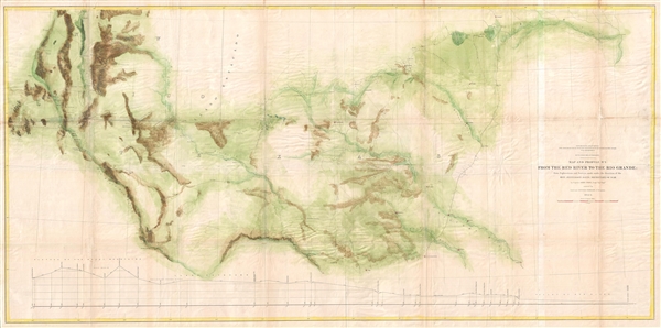
Map and Profile No. 2. From the Red River to the Rio Grande; from Explorations and Surveys made under the direction of the Hon. Jefferson Davis, Secretary of War by Captain John Pope, Corps Topl. Engrs.
sold
- Digital Map Information
- Suitable for large format printing
- File Size: 21.43 MB
- File Type: ZIP / TIFF
- ICC color profile embedded
- Delivered instantly via download link
A large and interesting 1861 government map illustrating surveys performed by John Pope to ascertain the most efficient route for the Southern Pacific Railroad. As the title suggests, the map covers in some detail the lands between the Red River ... (more details)
Wonderful dramatic view of the Holy Land.

Das Heilige Land aus der Vogelschau.
sold
- Digital Map Information
- Suitable for large format printing
- Full resolution TIFF file
- ICC color profile embedded
- Delivered instantly via download link
An impressive 1858 bird's-eye view of the Holy Land, Israel, or Palestine by J. J. Weber. Drawn looking eastward form a position far above the Mediterranean, the mview is roungly centered on Jerusalem, which is oversized and prominently rests on ... (more details)
The earliest known example of the 'Paris Monumental' plan.

Plan monumental de Paris en 1898.
sold
- Digital Map Information
- Suitable for large format printing
- File Size: 15.23 MB
- File Type: ZIP / TIFF
- ICC color profile embedded
- Delivered instantly via download link
A stunning and most unusual monumental map of Paris issued in 1898 by Henri Geffroy. The map is similar is content and style to similar and far more common monument maps of Paris published from about 1899 to 1840 by Leconte, Guillemin, Hachette, ... (more details)
Unusual and rare pictorial map illustrating the life and times of Abraham Lincoln.
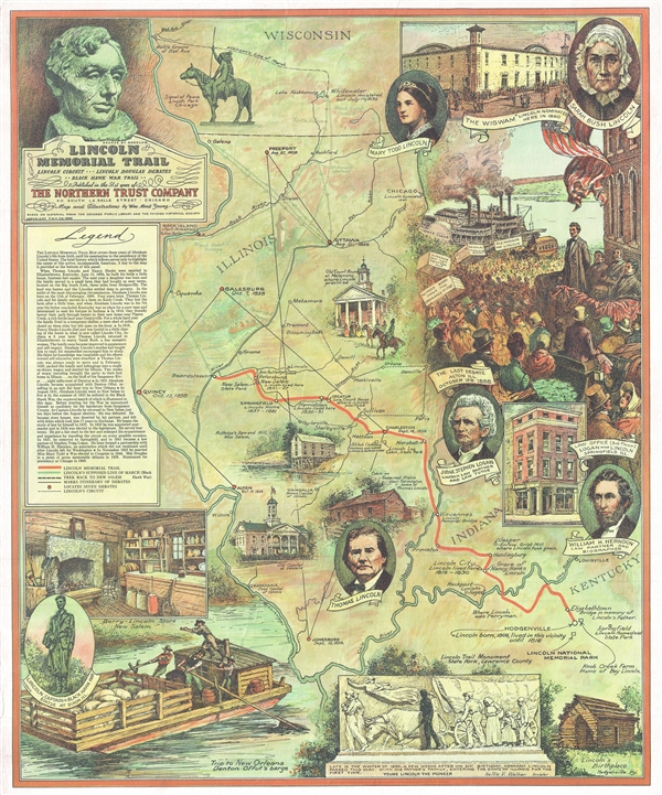
Lincoln Memorial Trail. Lincoln Circuit *** Lincoln Douglas Debates ** Black Hawk War Trail **
sold
- Digital Map Information
- Suitable for large format printing
- File Size: 15.54 MB
- File Type: ZIP / TIFF
- ICC color profile embedded
- Delivered instantly via download link
A rare 1940 pictorial map of Illinois by William Mark Young illustrating the travels and life of Abraham Lincoln. The map covers from Wisconsin's Bad Axe River to the confluence of the Ohio and Mississippi Rivers and Quincy, Illinois to ... (more details)
Scarce map of Brooklyn on a vertical projection.
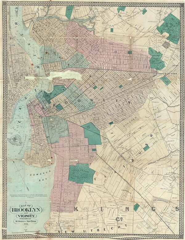
Map of Brooklyn and Vicinity.
sold
- Digital Map Information
- Suitable for large format printing
- File Size: 16.82 MB
- File Type: ZIP / TIFF
- ICC color profile embedded
- Delivered instantly via download link
An uncommon 1862 map of Brooklyn, New York, by Matthew Dripps. Presented on a north-south axis, which for Brooklyn was uncommon at the time, this map covers form Newtown Creek to New Utrecht and from Manhattan to East New York. ... (more details)
Interesting thematic map illustrating the events of the WWII Philippines Campaign of 1945.

Philippine Campaign.
sold
- Digital Map Information
- Suitable for large format printing
- File Size: 8.06 MB
- File Type: ZIP / TIFF
- ICC color profile embedded
- Delivered instantly via download link
An unusual 1945 World War II era thematic map of the Philippine Islands illustrating the events of the Philippine Campaign (1944 – 1945). The map covers the entirety of the Philippine archipelago with sinuous arrows indicating military activity. Blue arrows detail the Eighth Army Operation, green arrows indicate the Sixth Army operation, and little parachute drawings in either color represent airborne landing sites. (more details)
Shows Eastern Hemisphere.

Globe Terrestre. Globe Celeste.
sold
- Digital Map Information
- Suitable for large format printing
- DPI: 300
- File Size: 12.91 MB
- File Type: ZIP / TIFF
- ICC color profile embedded
- Delivered instantly via download link
This is a beautiful 1786 map or chart by French cartographer Louis Brion de la Tour. The chart depicts a terrestrial and a celestial globe. The terrestrial globe on the left is set showing Asia and Europe, while the celestial ... (more details)
Armillary spheres according to Ptolemy and Copernicus.

Sphere de Copernic. Sphere de Ptolemee.
sold
- Digital Map Information
- Suitable for large format printing
- DPI: 300
- File Size: 17.36 MB
- File Type: ZIP / TIFF
- ICC color profile embedded
- Delivered instantly via download link
This is an attractive 1786 chart by French cartographer Louis Brion de la Tour depicting two armillary spheres. The sphere in the left shows an armillary sphere according to Copernicus while the one of the right is a sphere ... (more details)
One of only 2 known examples of this rare bird's eye view of Stonington, Maine.

Green's Landing, ME.
sold
- Digital Map Information
- Suitable for large format printing
- File Size: 12.55 MB
- File Type: ZIP / TIFF
- ICC color profile embedded
- Delivered instantly via download link
An extremely rare George E. Norris Bird's-Eye view and map of Stonington, then Greens Landing, Deer Isle, Maine. The view presented Stonington seen as if looking northeast from a position high above Green Head. The view ... (more details)
Rare Chinese issued guidebook published for American servicemen on furlough in Shanghai.

Map of Shanghai. Where to go and How to get there.
sold
- Digital Map Information
- Suitable for large format printing
- File Size: 4.8 MB
- File Type: ZIP / TIFF
- ICC color profile embedded
- Delivered instantly via download link
A rare c. 1930 map of Shanghai, China and accompanying guidebook for American marines and other servicemen on furlough in Shangahi. The map covers the central part of Shanghai from the conflux of the Soochow Creek ... (more details)
Scarce map of Shanghai with view of the Bund.

The New Map of Shanghai. /上海最新地圖 / Shànghǎi zuìxīn dìtú.
sold
- Digital Map Information
- Suitable for large format printing
- File Size: 17.73 MB
- File Type: ZIP / TIFF
- ICC color profile embedded
- Delivered instantly via download link
This is a rare and beautiful bilingual 1933 Fusazō Sugie city plan or map of Shanghai, China. Published only two years after the Second Sino-Japanese War began, the map depicts cebtrak Shanghai including the Chinese Quarter, the French Concession, the International Settlement, and the English Quarter (along the Bund), among many other sites. Shanghai's cosmopolitan International Settlement is highlighted in orange (USA), pink (Great Britain), and yellow (France). Nineteen important buildings along the Bund are carefully noted and can be referenced via a table to the right of the view. These include the first HSBC Bank, the British Club, the Peace Hotel, and the Customs House. A lovely vintage panoramic photograph of the Bund adorns the map's bottom border. Of note, a large inset in the lower right corner illustrates the greater Shanghai area and three smaller insets detail Nanking (Nanjing) Hanchow Shiwoo (Hangzhou), and Soochow (Suzhou). (more details)
Fine early map showing the Mughal empire under the reign of Shah Jahan.
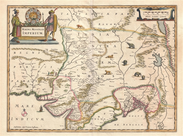
Magni Mogolis Imperium.
sold
- Digital Map Information
- Suitable for large format printing
- Full resolution TIFF file
- ICC color profile embedded
- Delivered instantly via download link
A fine c. 1640 Jan Jansson map of the Mughal Empire of Northern India. Centered on the Mughal capital of Agra, the map covers, roughly, from Kabul to Orissa and Deccan, and from Persia to Bengal. It depicts the ... (more details)
Beautifully engraved large format map of Victorian London.
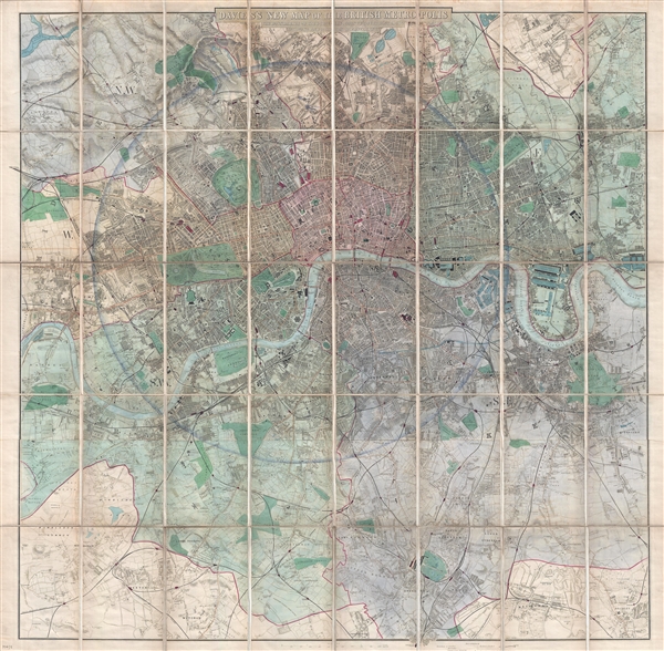
Davies's New Map of the British Metropolis. The Boundaries of the Boroughs, County Court Districts, Railways, and Modern Improvements.
sold
- Digital Map Information
- Suitable for large format printing
- File Size: 50.4 MB
- File Type: ZIP / TIFF
- ICC color profile embedded
- Delivered instantly via download link
A fine 1885 example of Davies's fine large scale map of London. Roughly centered on Charing Cross the Thames River, the map covers from Brent Reservoir to Bromley, and from New Wanstead to Cottenham Park. A ... (more details)
An iconic set of American World War II propaganda broadside maps 'targeting' Berlin and Tokyo.
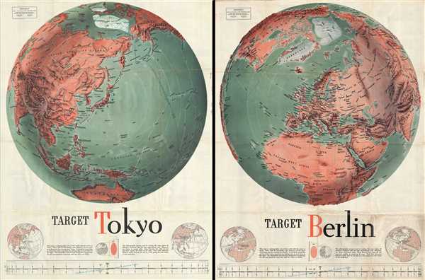
Target Tokyo; Newsmap. Monday, October 18, 1943. / Target Berlin; Newsmap. Monday, October 25, 1943.
sold
- Digital Map Information
- Suitable for large format printing
- File Size: 133.54 MB
- File Type: ZIP / TIFF
- ICC color profile embedded
- Delivered instantly via download link
Two of the most iconic American World War II propaganda maps, these are F. E Manning's 1943 propaganda broadsides 'Target Berlin' and 'Target Tokyo'. The focus of the broadsides are dramatic shaded panoptic ... (more details)