
Beautiful mapping of the Lake Xarayes, supposed gateway to El Dorado.
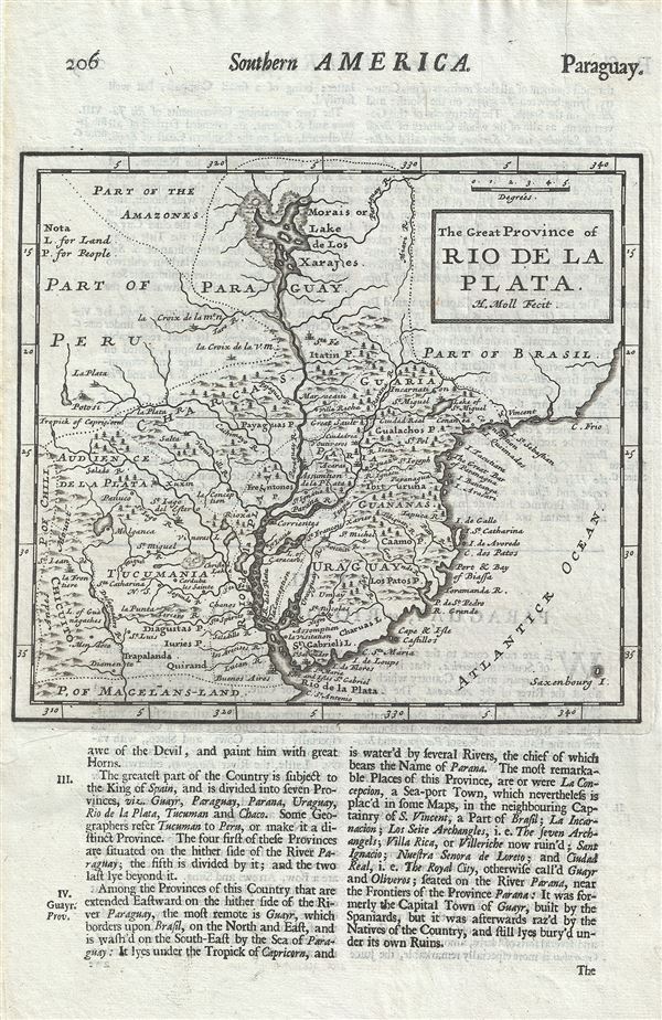
The Great Province of Rio de la Plata.
sold
- Digital Map Information
- Suitable for large format printing
- Full resolution TIFF file
- ICC color profile embedded
- Delivered instantly via download link
This is a beautiful 1701 map of Uruguay, Paraguay, northern Argentina and southern Brazil by Herman Moll. It covers from the Rio de la Plata north well into Brazil and the Amazon. Includes the modern day nations of Uruguay, Paraguay, and parts of adjacent Brazil ... (more details)
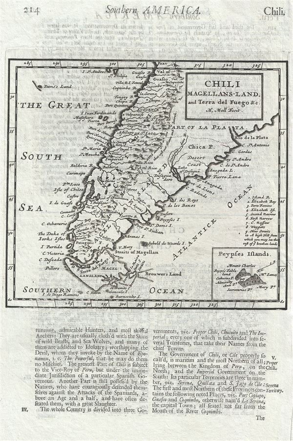
Chili Magellans-Land, and Terra del Fuego etc.
sold
- Digital Map Information
- Suitable for large format printing
- Full resolution TIFF file
- ICC color profile embedded
- Delivered instantly via download link
This is a beautiful 1701 map of southern South America by Herman Moll. It covers from Paraguay south to the Strait of Magellan and Tierra del Fuego, and includes the modern day nations of Paraguay, Chile, Uruguay and Argentina, with the southern portions of ... (more details)
Map of the Battle of Saratoga with rare flap.
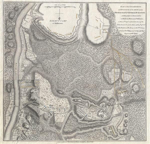
Plan of the Encampment and Position of the Army under His Excelly. Lt. General Burgoyne at Braemus Heights on Hudson's River near Stillwater, on the 20th of Setpr, with the Position of the Detachment & c. in the Action of the 7th, of Octr, & Position of the Army on the 8th, Octr 1777.
sold
- Digital Map Information
- Suitable for large format printing
- DPI: 300
- File Size: 10.99 MB
- File Type: ZIP / TIFF
- ICC color profile embedded
- Delivered instantly via download link
This is a scarce 1780 American Revolutionary War Map illustrating the Battle of Saratoga, a decisive engagement in the favor of the Colonial armies. Oriented to the south, this map covers an region roughly 9 miles south of Saratoga, New York. The map ... (more details)
Scarce map of New York City.
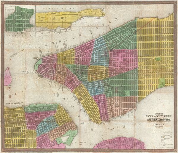
Map of the City of New York, with the adjacent Cities of Brooklyn & Jersey City, and the Village of Williamsburg.
sold
- Digital Map Information
- Suitable for large format printing
- DPI: 300
- File Size: 13.32 MB
- File Type: ZIP / TIFF
- ICC color profile embedded
- Delivered instantly via download link
This scarce 1845 map of New York City and adjacent parts of Brooklyn was published by Humphrey Phelps. Oriented to the west, this map covers the lower parts of Manhattan from the Battery to 32nd Street. It additionally covers adjacent parts of ... (more details)
Extremely rare English map of the Philippines.
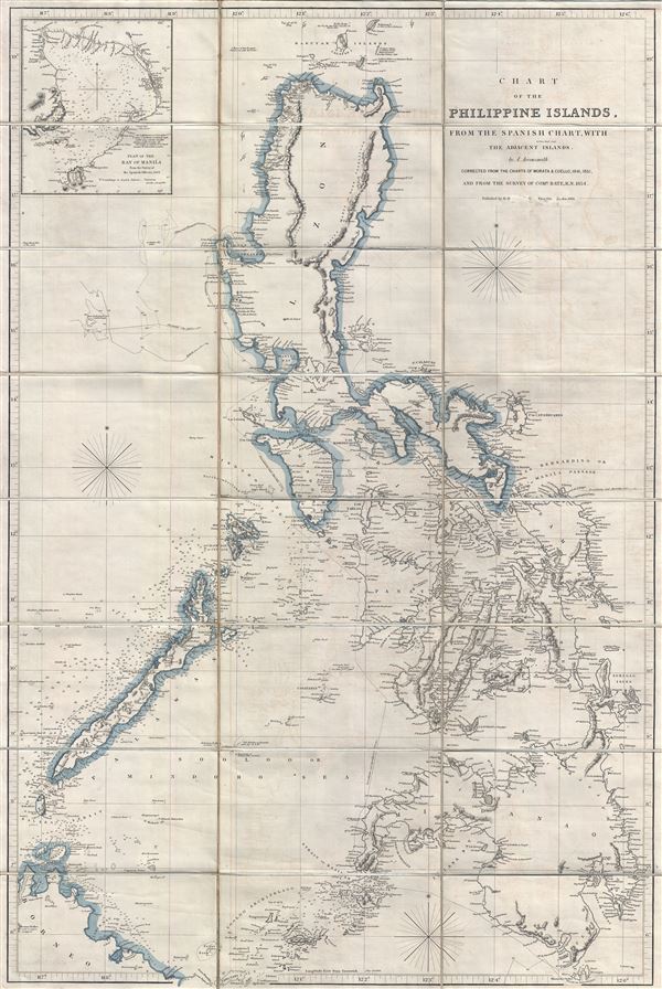
Chart of the Philippine Islands, from the Spanish Chart, witht Adjacent Islands.
sold
- Digital Map Information
- Suitable for large format printing
- File Size: 33.24 MB
- File Type: ZIP / TIFF
- ICC color profile embedded
- Delivered instantly via download link
An attractive example of Aaron Arrowsmith's scarce 1862 map of the Philippine Islands (Philippines). Centered on Manila, Arrowsmith's map covers the entirety of the Philippine Islands from northern Luzon to the southern tip of Mindano. An ... (more details)
One of the earliest known recognizable maps of Malay and Sumatra.
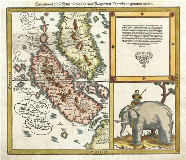
Sumatra ein grosse Insel so von den alten Geographen Taprobana genennt worden.
sold
- Digital Map Information
- Suitable for large format printing
- DPI: 300
- File Size: 7.52 MB
- File Type: ZIP / TIFF
- ICC color profile embedded
- Delivered instantly via download link
A spectacular 1588 Sebastian Munster map of Malay and Sumatra and one of the one of the earliest to specifically illustrate this region. Munster issued this map in the 1588 edition of his Cosmographia , an expansion upon the classical ... (more details)
A remarkable early map of New England showing advanced boundaries.
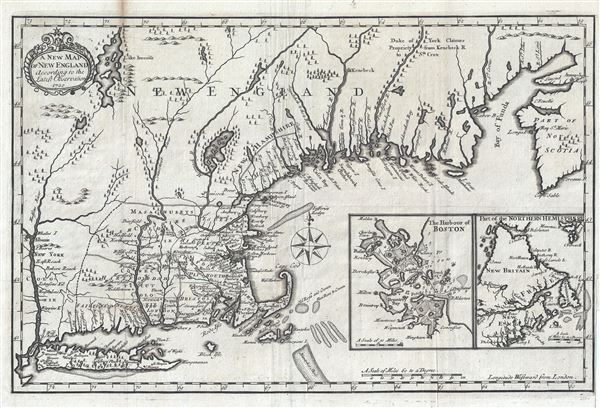
A New Plan of New England According to the Latest Observations 1720.
sold
- Digital Map Information
- Suitable for large format printing
- DPI: 300
- File Size: 4.1 MB
- File Type: ZIP / TIFF
- ICC color profile embedded
- Delivered instantly via download link
This is Daniel Neal's important and scarce 1720 map of New England. Centered on th colony of Massachusetts, Neal's map covers from the Hudson River and New York City east to Nova Scotia, it extend north to Lake Champlain (Lake ... (more details)

Plan of Improvements of Canal St. Park.
sold
- Digital Map Information
- Suitable for large format printing
- Full resolution TIFF file
- ICC color profile embedded
- Delivered instantly via download link
This is a scarce 1871 map of Canal Park or Canal St. Park, New York City by Kellogg and Pilat. It shows the plan of improvements of Canal Street Park, located between Canal Street and West Street above Holland Tunnel. The map ... (more details)
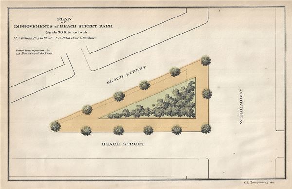
Plan of Improvements of Beach Street Park.
sold
- Digital Map Information
- Suitable for large format printing
- Full resolution TIFF file
- ICC color profile embedded
- Delivered instantly via download link
This is a scarce 1871 map of Tribeca Park or Beach Street Park, New York City by Kellogg and Pilat. It shows the plans of improvements of Beach Street Park, located between Beach Street and West Broadway. The location of ... (more details)
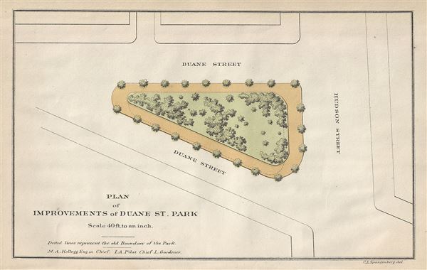
Plan of Improvements of Duane St. Park.
sold
- Digital Map Information
- Suitable for large format printing
- Full resolution TIFF file
- ICC color profile embedded
- Delivered instantly via download link
This is a scarce 1871 map of the Duane St. Park of Duane Park in New York City by Kellogg and Pilat. It shows the plans of improvements to the park located between Duane Street and Hudson St. The location of trees and ... (more details)
Later edition of Lewis Evans' map, considered a milestone both for its political significance and expansion of cartographic knowledge.
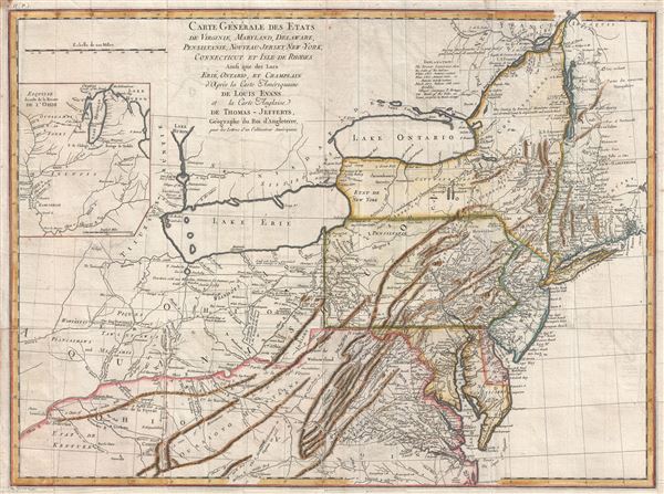
Carte Generale des Etats de Virginie, Maryland, Delaware, Pensilvanie, Nouveau-Jersey, New-York, Connecticut et Isle de Rhodes Ainsi que des Lacs Erie, Ontario, et Champlain. D'Apres la Carte Ameriquaine de Louis Evans et la Carte Anglaise de Thomas-Jefferys.
sold
- Digital Map Information
- Suitable for large format printing
- DPI: 300
- File Size: 16.54 MB
- File Type: ZIP / TIFF
- ICC color profile embedded
- Delivered instantly via download link
A scarce French edition of Louis Evans' highly influential map of the Middle British Colonies, one of the most important maps of the British Colonies to appear in the 18th century. The map covers Louisville on the Ohio ... (more details)
Surrealism inspired world map showing Air France routes.

Air France Reseau Aerien Mondial.
sold
- Digital Map Information
- Suitable for large format printing
- File Size: 14.92 MB
- File Type: ZIP / TIFF
- ICC color profile embedded
- Delivered instantly via download link
A remarkable 1947 original Lucien Boucher comic map of the world showing the routes of Air France. Boucher started producing maps for Air France as early as 1933. Most are inspired by the surrealist ethic and feature ... (more details)

Esso Pictorial Map of Washington Our Nation's Capital.
sold
- Digital Map Information
- Suitable for large format printing
- File Size: 11.05 MB
- File Type: ZIP / TIFF
- ICC color profile embedded
- Delivered instantly via download link
This is a beautiful 1930s map or plan of Washington D.C. by the General Drafting Company. It covers the nation's capital from Arlington Cemetery and the Washington National Airport north to Soldiers' home (Armed ... (more details)
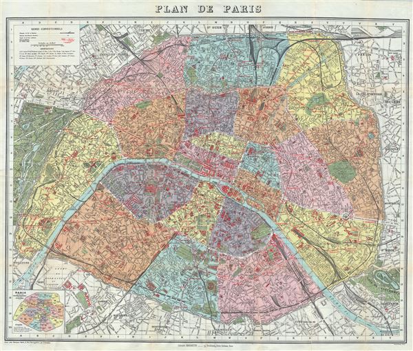
Plan de Paris.
sold
- Digital Map Information
- Suitable for large format printing
- Full resolution TIFF file
- ICC color profile embedded
- Delivered instantly via download link
This is an extremely appealing c.1924 tourist pocket map or plan of Paris, France, by the Librarie Hachette. Centered on the Seine River, it covers embastilled Paris as contained in the Thiers Wall, and its ... (more details)
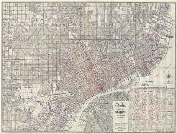
New National Authentic Map of Detroit and Environs.
sold
- Digital Map Information
- Suitable for large format printing
- Full resolution TIFF file
- ICC color profile embedded
- Delivered instantly via download link
This is a fine c.1935 map or city plan of Detroit, Michigan by the National Lithograph Company. It covers Detroit from Grand Lawn Cemetery east to Lake St. Clair and from the Rackham Municipal Golf Course ... (more details)
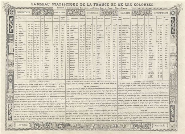
Tableau Statistique De La France Et De Ses Colonies. Donnant la nomenclature des Cartes contenues dans le Nouvel Atlas illustre.
sold
- Digital Map Information
- Suitable for large format printing
- DPI: 300
- File Size: 7.15 MB
- File Type: ZIP / TIFF
- ICC color profile embedded
- Delivered instantly via download link
This is an 1852 statistical table of France by V. Levasseur. It lists the various departments of France and their corresponding statistics including population, distances, area, distance from Paris, etc. ... (more details)

Partie Septentrionale du Royaume de Portugal.
sold
- Digital Map Information
- Suitable for large format printing
- Full resolution TIFF file
- ICC color profile embedded
- Delivered instantly via download link
This is an attractive 1751 map of the northern portion of Portugal by Robert de Vaugondy. It covers northern Portugal from Tui in Spain southward to Santarem and inland as far as Coria, Spain. The map ... (more details)
An attractive pictorial map of Colorado's many historic railways.

Colorado Railroads.
sold
- Digital Map Information
- Suitable for large format printing
- Full resolution TIFF file
- ICC color profile embedded
- Delivered instantly via download link
This is a dramatic 1943 pictorial map of Colorado intended to glorify and illustrate that state's many historic railroads. The map was drawn by Linn H. Westcott for Train Magazine. The map covers the ... (more details)
Uncommon map showing Jefferson's proposed states and the first map to name Michigan as a body of land.
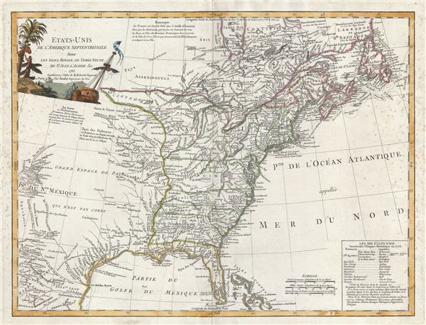
Etats-Unis De L'Amerique Septentrionale Avec Les Isles Royale, De Terre Neuve, De St. Jean, L'Acadie.
sold
- Digital Map Information
- Suitable for large format printing
- Full resolution TIFF file
- ICC color profile embedded
- Delivered instantly via download link
An uncommon and important first edition first state 1785 Antoine Boudet map of the fledgling United States shortly after the end of the American Revolutionary War. This map is important as one of the ... (more details)
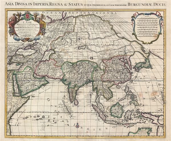
L' Asie divisee en ses principales regions, et ou se peuvent voir l'estendue des empires, monarchies, royaumes, et estats qui partagent presentement L'Asie / Asia divisa in imperia, regna & status in quae distributur.
$950.00
Acquire
- Digital Map Information
- Suitable for large format printing
- Full resolution TIFF file
- ICC color profile embedded
- Delivered instantly via download link
An attractive and large map of Asia issued by the Dutch firm of Covens and Mortier c. 1730. Covens and Mortier based this map upon an earlier map by Guillaume Delisle, which was in turn based upon ... (more details)