
Rare Polar Projections.

[Untitled Planispheres.]
sold
- Digital Map Information
- Suitable for large format printing
- DPI: 600
- File Size: 33.37 MB
- File Type: ZIP / TIFF
- ICC color profile embedded
- Delivered instantly via download link
These are Isaac Habrecht's rare 1628 north and south polar projection maps, in their Fürst edition of 1666. These were prepared for inclusion in Habrecht's 1628 instructional booklet on the construction of globes to present the dominant geography of the first part of the 17th century. Decorated with ships and sea monsters, the maps evoke the Age of Discovery, while presenting several of the fascinating geographical hallmarks of the period; these mainly draw on Dutch geographers, notably Plancius and van der Keere. The planispheres incorporate lines of latitude and longitude, and the ecliptic, including the zodiacal symbols. In addition to the geographic north and south poles, Habrecht has included both the north and south magnetic poles. (more details)
Greatest map of Tasmania - period.
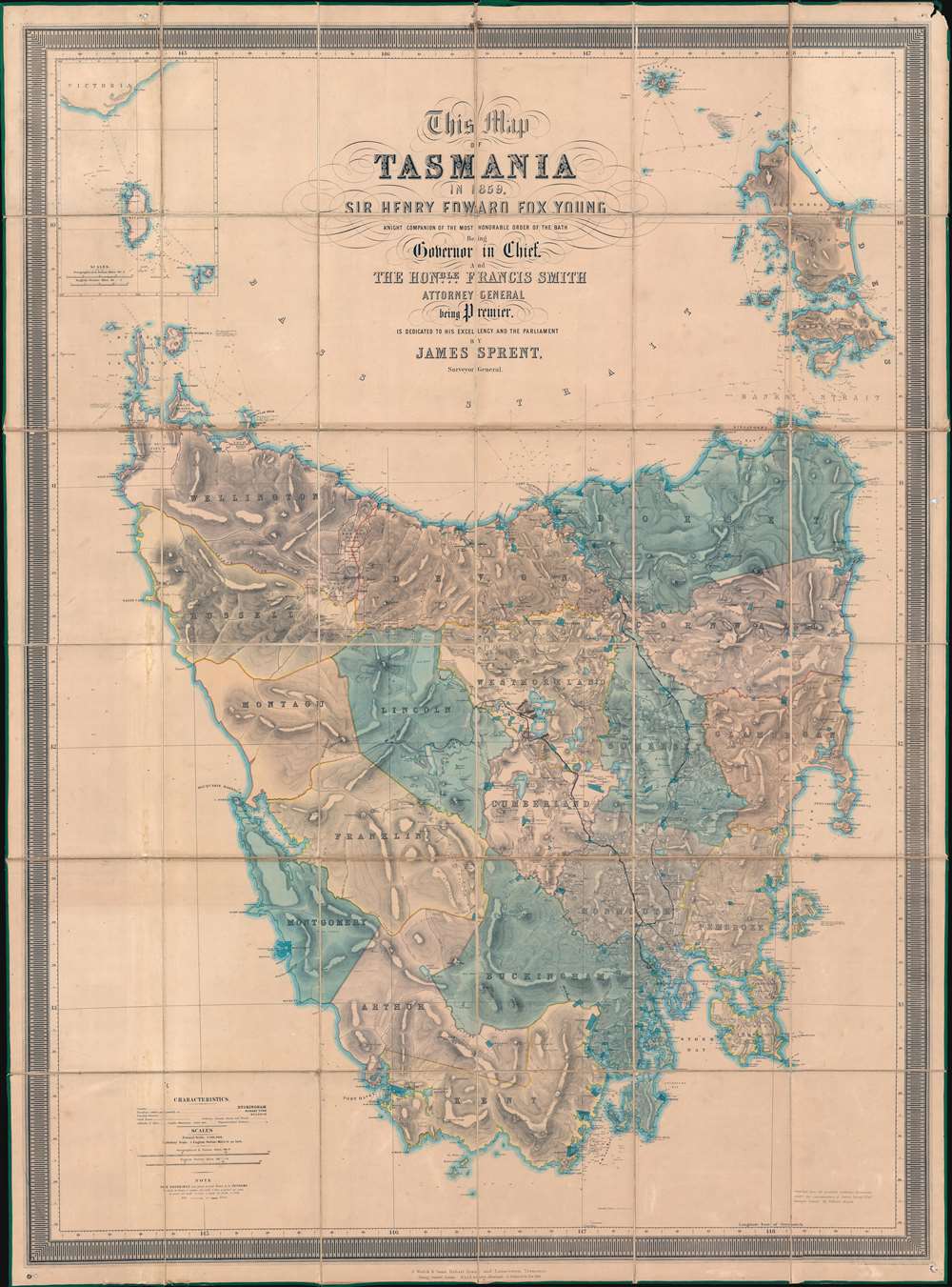
This Map of Tasmania in 1859, Sir Henry Edward Fox Young Knight Companion of the Most Honorable Order of the Bath Being Governor in Chief, and teh Honble. Francis Smigh Attorney General being Premier is dedicated to his Excellency and the Parliament by James Sprent, Surveyor General.
sold
- Digital Map Information
- Suitable for large format printing
- File Size: 202.12 MB
- File Type: ZIP / TIFF
- ICC color profile embedded
- Delivered instantly via download link
The first, largest, and best colonial and settlement era map of Tasmania. This is the James Sprent / William Hogan 1859 map of Tasmania in its deluxe large-format presentation edition. It is the product of nearly 20 years of meticulous trigonometrical survey work and covers Tasmania with unprecedented precision. The map features manuscript annotation of several voyages dating to the 1920s, underscoring its enduring significance as the best reconnaissance of Tasmania more than 70 years after its issue. (more details)
First Map of Jamaica Estates.

Jamaica Estates Queens Borough New York City.
sold
- Digital Map Information
- Suitable for large format printing
- File Size: 48.63 MB
- File Type: ZIP / TIFF
- ICC color profile embedded
- Delivered instantly via download link
This 1911 map by Metropolis Engineering is the earliest map of Jamaica Estates, Queens, New York - the childhood home of former U.S. President Donald Trump. Today, as intended, Jamaica Estates, designed in the Garden City Ethic, remains one of the most attractive planned communities in New York. The map is signed by Albert Thomson, the architect behind many of the houses of Jamaica Estates, as well as the 71st Regiment Armory in Manhattan. (more details)
Striking map of Asia offering the best cartography of the period.
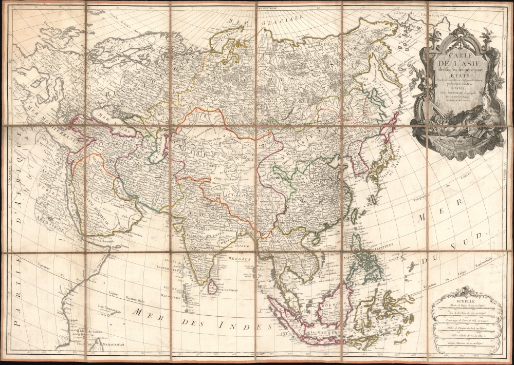
Carte de L'Asie divisée en ses principaux Etats.
$2,250.00
Acquire
- Digital Map Information
- Suitable for large format printing
- Full resolution TIFF file
- ICC color profile embedded
- Delivered instantly via download link
An exceptional large-format separate-issue c. 1779 map of Asia issued by Rigobert Bonne and Charles-François Delamarche. The map is a compilation of the best cartographic information regarding Asia available at the time of publication. (more details)
Mao's support of African American civil rights.

美国黑人抗暴斗争形势简图 / [Sketch Map of Black Americans' Struggle against Oppression].
sold
A fascinating example of transnational persuasive cartography from the Cold War era, this is a Chinese propaganda piece touting support for the American Civil Rights Movement in the wake of Martin Luther King's 1968 assassination. The lettersheet was issued following the assassination of Martin Luther King, Jr. on April 4 of that year. Directed at a domestic audience, it reflects the wider political and geopolitical context in which it was produced. (more details)
Silicon Valley in the mid-1980s.

Silicon Valley.
sold
This is the 1986 Stephanie Russell and City Graphics pictorial map of Silicon Valley. The map captures the rise of Silicon Valley, with new and established tech firms sprawling across the landscape. (more details)
Native American settlements in Florida, the Carolinas, and Georgia.
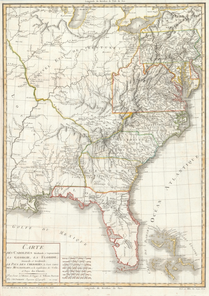
Carte des Carolines Meridionale et Septentrionale, La Georgie, La Floride, Orientale et Occidentale, Le Pays des Cherokees, la Vaste Contree des Muscogulges, ou la Confederation des Creks et Pays des Chataws.
sold
- Digital Map Information
- Suitable for large format printing
- DPI: 600
- File Size: 27.45 MB
- File Type: ZIP / TIFF
- ICC color profile embedded
- Delivered instantly via download link
A beautiful 1799 example of Jean Baptiste Poirson's map of the American Southeast. This map was engraved to illustrate the 1799 first French edition of the naturalist William Bertram's travel narrative describing his explorations in the American Southeast. (more details)
Prophecy, Atlantis, Lemuria, Sea of the West.
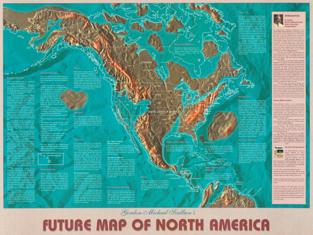
Gordon-Michael Scallion's Future Map of North America.
sold
A striking example of Gordon-Michael Scallion's 1996 doomsday map of North America. This is Scallion's only map to cover all of North America. Scallion (1942 - ?) is a futurist, spiritualist, and 'prophet' who predicted a series of cataclysmic astronomical and seismic events would occur between the issue date of this map, 1998 and 2001. This map offers a granular breakdown of Scallion's predictions for North America and a newly extended timeline to 2012 - somewhat necessary as some of his predicted events were not occurring. (more details)
Japan's Historic Capital.

いろは引早わかり 最新京都市街地圖 / [Basic and Easily Comprehensible Latest Street Map of Kyoto].
sold
- Digital Map Information
- Suitable for large format printing
- Full resolution TIFF file
- ICC color profile embedded
- Delivered instantly via download link
A scarce and detailed map of Kyoto, produced by Oobuchi Zenkichi in 1924 (Taisho 13). Along with text on the verso, it provides a comprehensive guide for visitors and tourists, who were then flocking to the city in increasing numbers. (more details)
Blueprint for a Colonial Empire.

兵要日本地理小誌全圖 / [Outline Map of Japanese Geography for Military Use].
sold
- Digital Map Information
- Suitable for large format printing
- File Size: 90.64 MB
- File Type: ZIP / TIFF
- ICC color profile embedded
- Delivered instantly via download link
A large and visually striking c. 1874 early Meiji map of Japan issued by the Imperial Army Academy. It highlights Japan's territorial and imperial ambitions, including claims over the Ryukyu Kingdom, the Kuril Islands, and Sakhalin. (more details)
Seeking a Path through the Southern Seas.
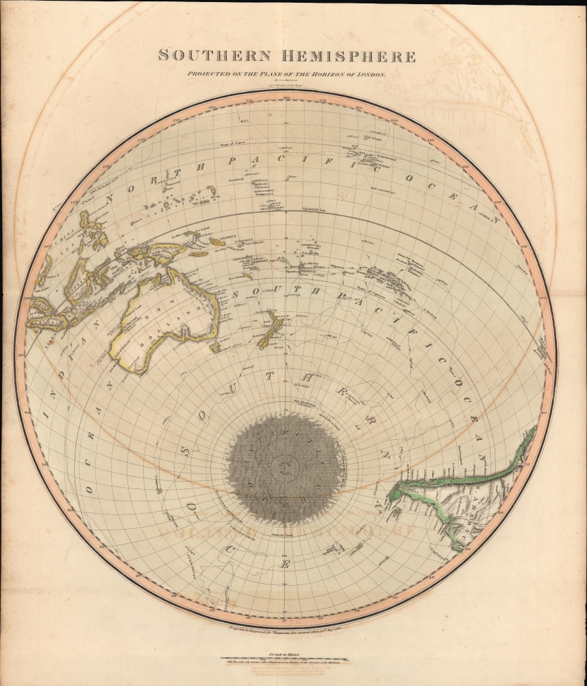
Southern Hemisphere Projected on the Plane of the Horizon of London.
sold
- Digital Map Information
- Suitable for large format printing
- DPI: 600
- File Size: 567.38 MB
- File Type: ZIP / TIFF
- ICC color profile embedded
- Delivered instantly via download link
An unusual offset polar projection map of the Southern Hemisphere, drawn and engraved in 1816 for the 1817 Dublin printing of John Thomson's New General Atlas. Among other features, it highlights the relatively recent voyages of Captain James Cook, including discoveries along the coasts of New Zealand and Australia. (more details)
Unusal polar projection.

Northern Hemisphere Projected on the Plane of the Horizon of London.
$500.00
Acquire
- Digital Map Information
- Suitable for large format printing
- DPI: 600
- File Size: 581.8 MB
- File Type: ZIP / TIFF
- ICC color profile embedded
- Delivered instantly via download link
A lovely 1816 offset polar projection map of the Northern Hemisphere that appeared in Edinburgh cartographer John Thomson's New General Atlas. (more details)
Key West, Poised to Take Off.
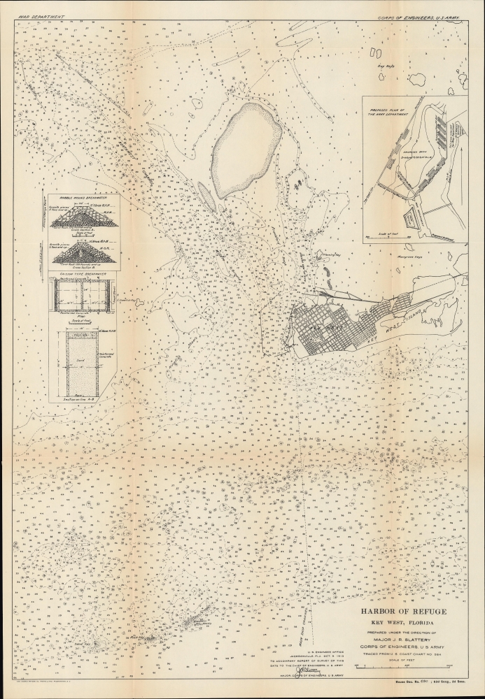
Harbor of Refuge Key West, Florida... Traced from U. S. Coast Chart No 584.
sold
- Digital Map Information
- Suitable for large format printing
- File Size: 40.54 MB
- File Type: ZIP / TIFF
- ICC color profile embedded
- Delivered instantly via download link
A fascinating nautical map, including a city plan of Key West, Florida, and technical schematics of a breakwater, produced in 1913 by Major J. R. Slattery of the U.S. Army Corps of Engineers. It displays the city and island at the start of a boom, brought about by the completion of the Florida East Coast Railway. (more details)
Beautiful view of Lake Winnipesaukee, New Hampshire.

Lake Winnipesaukee New Hampshire.
sold
- Digital Map Information
- Suitable for large format printing
- Full resolution TIFF file
- ICC color profile embedded
- Delivered instantly via download link
This is a beautiful 1909 chromolithograph bird's-eye view pocket map of Lake Winnipesaukee, New Hampshire by the George H. Walker and Company, Boston. This view was published for distribution at George W. Armstrong's railroad newsstands. (more details)
Predicting the Kennedy-Nixon election.
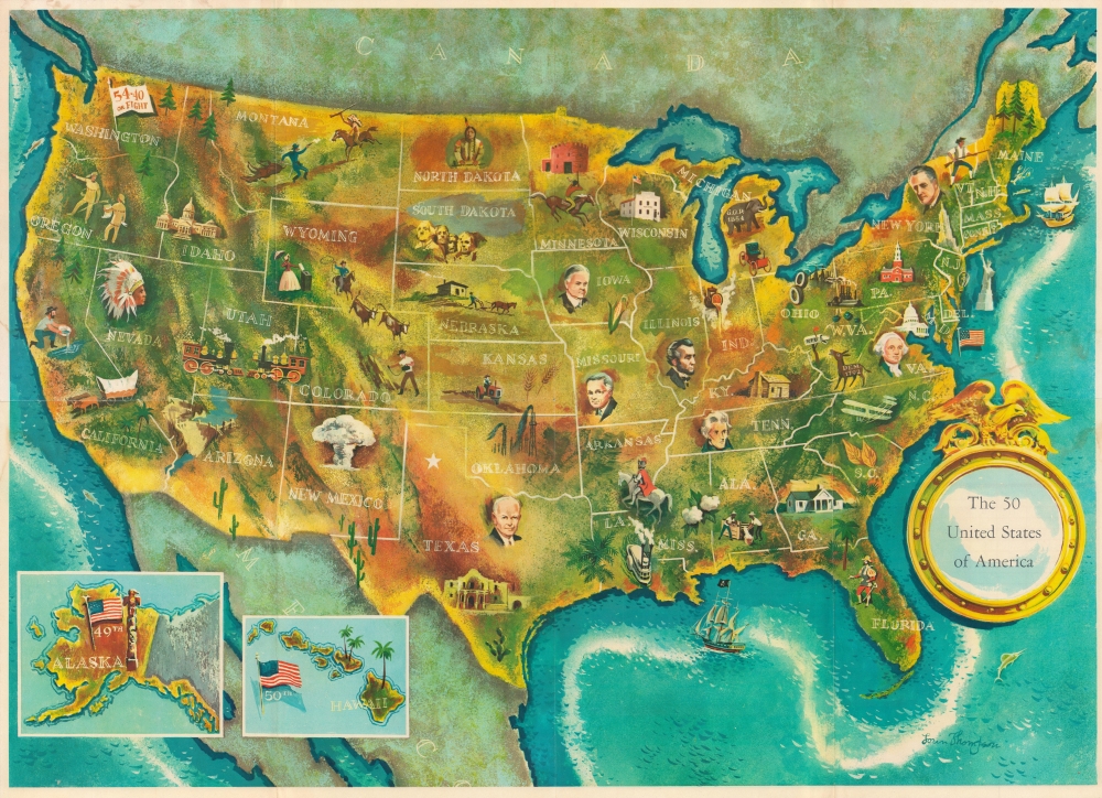
The 50 United States of America. / Election Map and 1960 Presidential Fact Sheet.
sold
This is a 1960 Lorin Thompson pictorial map of the United States issued just before the 1960 presidential election. It is one of the earliest pictorial maps of the United States to include all 50 states - following the August 1959 admission of Hawaii. (more details)
Spring training home of the Detroit Tigers.
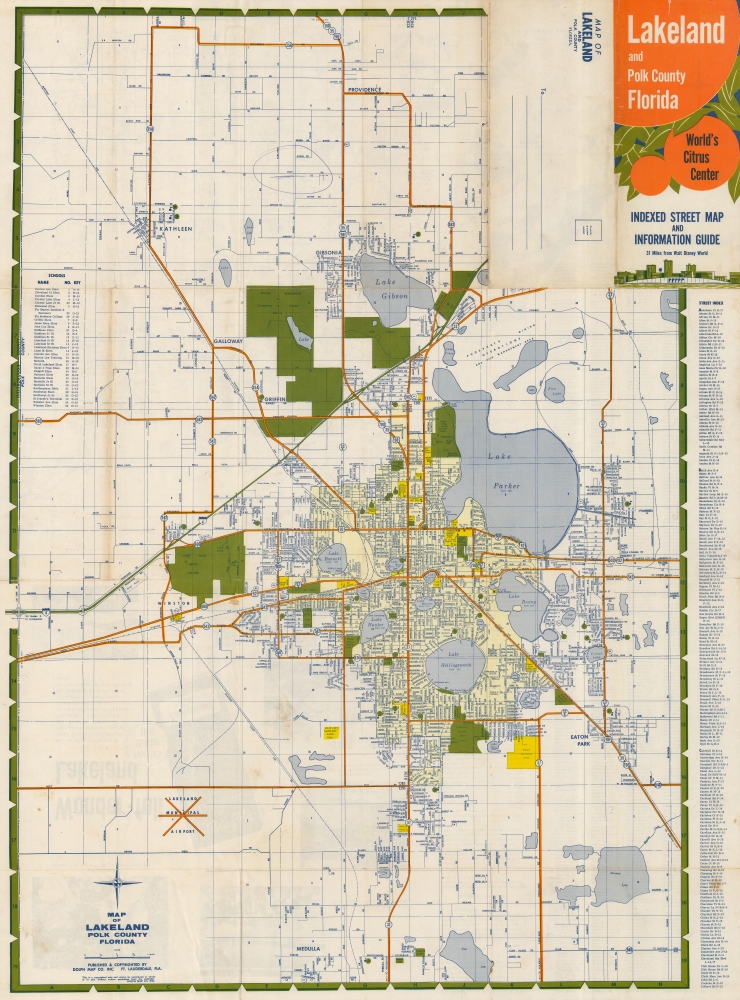
Lakeland and Polk County Florida Indexed Street Map and Information Guide.
sold
This is a c. 1969 Dolph Map Company city plan or map of Lakeland, Florida. (more details)
Roots of Russian Revanchism.
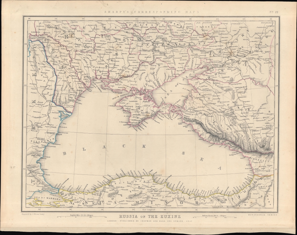
Russia on the Euxine. Sharpe's Corresponding Maps No. 22.
sold
- Digital Map Information
- Suitable for large format printing
- DPI: 600
- File Size: 296.83 MB
- File Type: ZIP / TIFF
- ICC color profile embedded
- Delivered instantly via download link
This is J. Sharpe's 1847 map of the Black Sea region issued for Sharpe's Corresponding Atlas. It presents 'The Eastern Question', reflecting political tensions related to ongoing wars between the Ottoman and Russian empires. (more details)
Created by one of the most innovative tourism companies in history : Thomas Cook and Son.

Cook's Plan of the Foreign Settlement of Shanghai. / Information for Travellers Landing at Shanghai.
sold
- Digital Map Information
- Suitable for large format printing
- File Size: 3.78 MB
- File Type: ZIP / TIFF
- ICC color profile embedded
- Delivered instantly via download link
This is a c. 1920 Thomas Cook city plan or map of the International Settlement and part of the French Concession in Shanghai, China. This is one of the earliest Thomas Cook Shanghai Guides and illustrates the gradual development of the International Settlement and the Bund. (more details)
Unique French perspective on the French and Indian War.
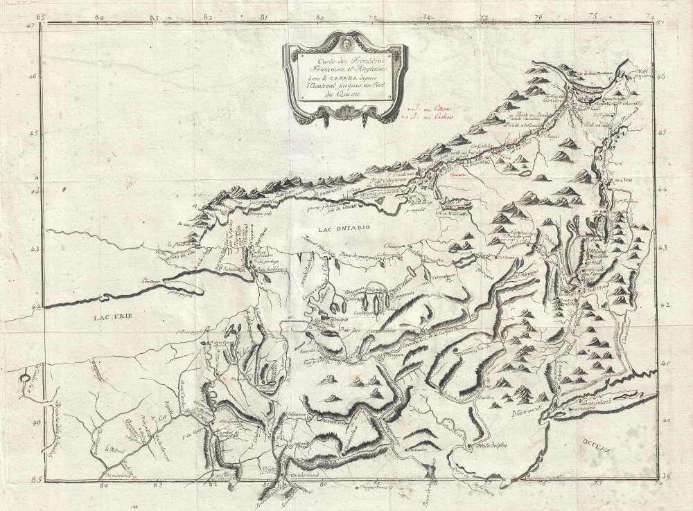
Carte des Frontieres Francoises, et Angloises dens le Canada depuis Montreal jusques au Fort du Quesne.
$2,900.00
Acquire
- Digital Map Information
- Suitable for large format printing
- DPI: 300
- File Size: 7.05 MB
- File Type: ZIP / TIFF
- ICC color profile embedded
- Delivered instantly via download link
A remarkable 1758/1781 idiosyncratically engraved map offering a uniquely French perspective on the French and Indian War (1754 - 1763). It is based on the first-hand experiences of French engineer Pierre Pouchot de Maupas. (more details)
The Southern Railway and the Florida Central and Peninsular Railroad.

Birds Eye View of the Southern Railway and the Florida Central and Peninsula Systems and Their Connections.
sold
- Digital Map Information
- Suitable for large format printing
- Full resolution TIFF file
- ICC color profile embedded
- Delivered instantly via download link
A rare find, this is the c. 1894 American Bank Note bird's-eye view railroad map of the eastern United States published by the Southern Railway. It cleverly employs the view perspective to focus on the Southern States, particularly Florida, while still showing connections to networks to the north. (more details)