
Finley, Anthony (sold)

Anthony Finley (August 25, 1784 - June 9, 1836) was an American book and map publisher based in Philadelphia, Pennsylvania. Finley was born in Philadelphia in 1784. He opened a bookshop and publishing house at the Northeast corner of Fourth and Chestnut Street, Philadelphia in 1809. His earliest known catalog, listing botanical, medical and other scientific works, appeared in 1811. His first maps, engraved for Daniel Edward Clarke’s Travels in Various Countries of Europe, Asia, and Africa also appear in 1811. His first atlas, the Atlas Classica, was published in 1818. He soon thereafter published the more significant A New American Atlas and the New General Atlas…, both going through several editions from 1824 to 1834. Although most of Finley's cartographic material was borrowed from European sources, his atlases were much admired and favorably reviewed. In addition to his work as a printer, Finley ran unsuccessfully on the 1818 Democratic ticket for Philadelphia Common Council. He was a founding officer of the Philadelphia Apprentices’ Library, and a member of both the American Sunday-School Union and the Franklin Institute. He was also an ardent supporter of the American Colonization Society, an organization dedication to returning free people of color to Africa - which led to the founding of Liberia. Much of his wealth was dedicated to supporting this cause. Finley was active as a publisher until his 1836 death, apparently of a 'lingering illness.' Shortly thereafter advertisements began appearing for his map business and plates, most of which were acquired by Samuel Augustus Mitchell.
Schoolgirl Map of Early Illinois.
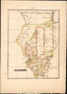
Illinois.
sold
- Digital Map Information
- Suitable for large format printing
- Full resolution TIFF file
- ICC color profile embedded
- Delivered instantly via download link
An engrossing example of an early 19th-century schoolgirl map, this manuscript work presents 1824 Illinois. It is based on Anthony Finley's map of the state, which demonstrates its rapid territorial evolution in the early years of statehood. (more details)
First map to show U.S. claims to British Columbia.
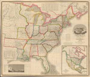
Map of the United States of North America Compiled from the Latest and most Authentic Information by David H. Vance.
sold
- Digital Map Information
- Suitable for large format printing
- DPI: 600
- File Size: 277.94 MB
- File Type: ZIP / TIFF
- ICC color profile embedded
- Delivered instantly via download link
This is the first edition of David Vance and Anthony Finley's outstanding wall map of the United States, published in 1825, here in a remarkable fresh state. This map is significant with regard to its early date, contemporaneous with Amos Lay's map, but more ambitions and predating the 1829 Tanner map by 4 years, as well as its detailed coverage of historic developments. Converge encompasses the Untitled States as it appeared at the time, extending from roughly the Texas Border (100° West of Greenwich / 27° West of Washington) to the Pacific and from the Saint Lawrence River to the Florida Keys. A large inset map appears in the lower right quadrant, illustrating the whole of North America. This is the first map to illustrate American claims to British Columbia that would later spark the 54°40' Debate. (more details)
Settling the great northern wilderness.
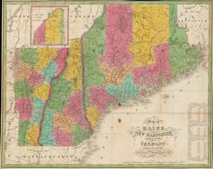
Map of Maine, New Hampshire and Vermont, Compiled From The Latest Authorities.
sold
- Digital Map Information
- Suitable for large format printing
- Full resolution TIFF file
- ICC color profile embedded
- Delivered instantly via download link
This is an attractive 1826 folding map of Maine, New Hampshire, and Vermont produced by Anthony Finley, James H. Young, and David H. Vance. Though originally engraved for Finley's A New American Atlas, this is a rare separate issue. It portrays northern New England as the region was undergoing a population boom in the decades after independence. (more details)
One of the best comparative mountain charts of the 19th century.
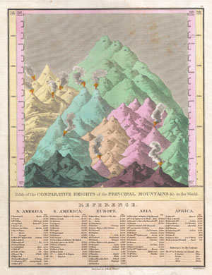
Table of the Comparative Heights of the Principal Mountains & c. in the World.
sold
- Digital Map Information
- Suitable for large format printing
- DPI: 300
- File Size: 4.88 MB
- File Type: ZIP / TIFF
- ICC color profile embedded
- Delivered instantly via download link
This is Finley's highly sought after c. 1827 map of the comparative heights of the principal mountains of the world. Details the world's great mountains in relative proximity to one another and divided by continent. Each mountain is numbered and refers to a ... (more details)
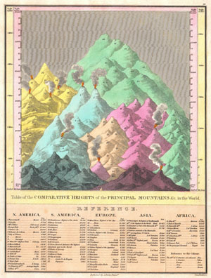
Table of the Comparative Heights of the Principal Mountains & c. in the World.
sold
- Digital Map Information
- Suitable for large format printing
- DPI: 300
- File Size: 3.06 MB
- File Type: ZIP / TIFF
- ICC color profile embedded
- Delivered instantly via download link
This is Finley's attractive c. 1826 map of the comparative heights of the principal mountains of the world. Details the world's great mountains in relative proximity to one another and divided by continent. Each mountain is numbered and refers to a ... (more details)
Florida on the cusp of the Second Seminole War.
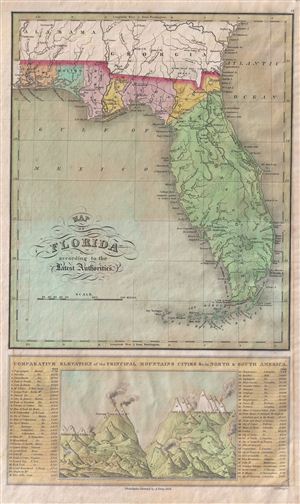
Map of Florida according to the Latest Authorities. Comparative Elevation of thePrincipal Mountas Cities & C. in North and South America.
sold
- Digital Map Information
- Suitable for large format printing
- DPI: 300
- File Size: 6.58 MB
- File Type: ZIP / TIFF
- ICC color profile embedded
- Delivered instantly via download link
An extremely rare map of Florida issued by A. Finley in his 1826 New American Atlas . The map depicts territorial Florida just five years after the region was annexed by the United States. Color coding defines Florida's early county development with ... (more details)
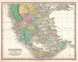
Greece.
sold
- Digital Map Information
- Suitable for large format printing
- Full resolution TIFF file
- ICC color profile embedded
- Delivered instantly via download link
A beautiful example of Finley's important 1827 map of Greece. Depicts from Macedonia to Greece and includes many of the Greek Islands. Shows cities, river ways, roads, monasteries, and some topographical features. Offers color coding at the regional ... (more details)
Scarce map of southeast predating Indian Removal Act.
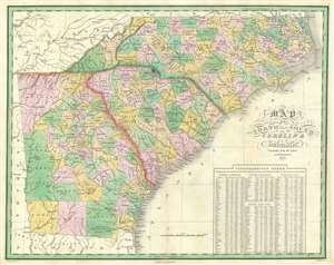
Map of North and South Carolina and Georgia.
sold
- Digital Map Information
- Suitable for large format printing
- DPI: 600
- File Size: 23.74 MB
- File Type: ZIP / TIFF
- ICC color profile embedded
- Delivered instantly via download link
A finely executed 1827 map of North Carolina, South Carolina, and Georgia published by Anthony Finley. The map predates the Indian Removal Act of 1830, and so Creek, Seminole, and Cherokee lands in western Georgia and northern Florida Features population statistics by state from the census of 1820. (more details)
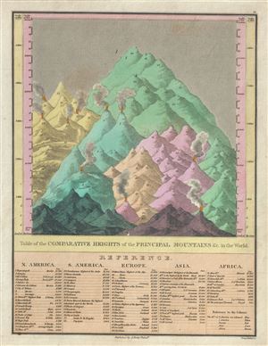
Table of the Comparative Heights of the Principal Mountains etc. in the World.
sold
- Digital Map Information
- Suitable for large format printing
- DPI: 300
- File Size: 4.2 MB
- File Type: ZIP / TIFF
- ICC color profile embedded
- Delivered instantly via download link
This is Finley's highly sought after c. 1827 map of the comparative heights of the principal mountains of the world. It details the world's great mountains in relative proximity to one another and divided by continent. Each mountain is numbered and ... (more details)
Africa on the cusp of European exploration into the interior.
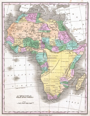
Africa.
sold
- Digital Map Information
- Suitable for large format printing
- DPI: 300
- File Size: 3.49 MB
- File Type: ZIP / TIFF
- ICC color profile embedded
- Delivered instantly via download link
A beautiful example of Finley's important 1827 map of Africa. This uncommon map predates the explosion of African exploration that occurred in the mid 19h century. Much of the interior remains unknown. The Ptolemaic Mountains of the Moon are ... (more details)
Showing Creek and Cherokee territory prior to the Trail of Tears.
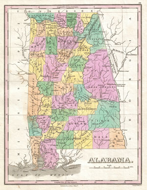
Alabama.
sold
- Digital Map Information
- Suitable for large format printing
- DPI: 300
- File Size: 3.29 MB
- File Type: ZIP / TIFF
- ICC color profile embedded
- Delivered instantly via download link
A beautiful example of Finley's important 1827 map of Alabama. Depicts the state with moderate detail in Finley's classic minimalist style. Shows river ways, roads, canals, and some topographical features. Offers color coding at the county ... (more details)
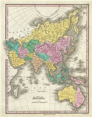
Asia.
sold
- Digital Map Information
- Suitable for large format printing
- DPI: 300
- File Size: 3.9 MB
- File Type: ZIP / TIFF
- ICC color profile embedded
- Delivered instantly via download link
This is a beautiful example of Finley's important 1827 map of Asia. Depicts from the Black Sea and Arabia eastward to the Behring Strait and Papua New Guinea. Includes Australia (New Holland) and the East India Islands with Asia, as was ... (more details)
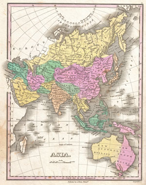
Asia.
sold
- Digital Map Information
- Suitable for large format printing
- DPI: 300
- File Size: 3.78 MB
- File Type: ZIP / TIFF
- ICC color profile embedded
- Delivered instantly via download link
A beautiful example of Finley's important 1827 map of Asia. Depicts from the Black Sea and Arabia eastward to the Behring Strait and Papua New Guinea. Includes Australia (New Holland) and the East India Islands with Asia, as was common ... (more details)
Includes the Great Lakes.
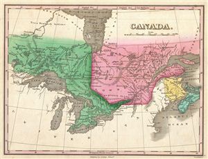
Canada.
sold
- Digital Map Information
- Suitable for large format printing
- DPI: 300
- File Size: 3.35 MB
- File Type: ZIP / TIFF
- ICC color profile embedded
- Delivered instantly via download link
This is Finley's desirable 1827 map of Canada. Covers the Upper Canada (Ontario) and Lower Canada (Quebec), New Brunswick, Nova Scotia, and all five of the Great Lakes. Names numerous American Indian Nations throughout. Also identifies ... (more details)
Rare singular map of Connecticut.
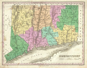
Connecticut.
sold
- Digital Map Information
- Suitable for large format printing
- DPI: 300
- File Size: 3.59 MB
- File Type: ZIP / TIFF
- ICC color profile embedded
- Delivered instantly via download link
A beautiful example of Finley's important 1827 map of Connecticut. Depicts the state with moderate detail in Finley's classic minimalist style. Shows river ways, roads, canals, and some topographical features. Offers color coding at the ... (more details)
Remarkable detail of the Delaware Bay.
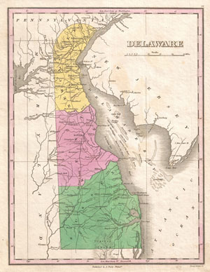
Delaware.
sold
- Digital Map Information
- Suitable for large format printing
- DPI: 300
- File Size: 3.05 MB
- File Type: ZIP / TIFF
- ICC color profile embedded
- Delivered instantly via download link
A beautiful example of Finley's important 1827 map of Delaware. This rare map plate configuration depicts the state individually rather than bundled with Maryland - as is more common. Depicts the state with moderate detail in Finley's ... (more details)
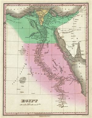
Egypt.
sold
- Digital Map Information
- Suitable for large format printing
- DPI: 300
- File Size: 3.12 MB
- File Type: ZIP / TIFF
- ICC color profile embedded
- Delivered instantly via download link
This is a beautiful example of Finley's important 1827 map of Egypt. It depicts Egypt, centered on the Nile River, and extending south as far as Aswan and names numerous settlements and villages along the course of the river, including ... (more details)
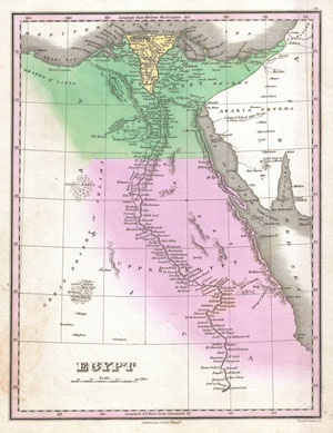
Egypt.
sold
- Digital Map Information
- Suitable for large format printing
- DPI: 300
- File Size: 3.22 MB
- File Type: ZIP / TIFF
- ICC color profile embedded
- Delivered instantly via download link
A beautiful example of Finley's important 1827 map of Egypt. Depicts Egypt, centered on the Nile River, and extending south as far as Aswan. Names numerous settlements and villages along the course of the river, including a number of ... (more details)
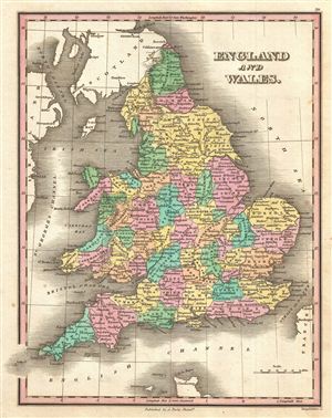
England and Wales.
sold
- Digital Map Information
- Suitable for large format printing
- DPI: 300
- File Size: 4.63 MB
- File Type: ZIP / TIFF
- ICC color profile embedded
- Delivered instantly via download link
A beautiful example of Finley's 1827 map of England. In Finley's classic minimalist style, this map identifies cities, forests, river systems, swamps and mountains. Color coded according to regional political boundaries. Title and ... (more details)
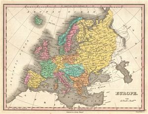
Europe.
sold
- Digital Map Information
- Suitable for large format printing
- DPI: 300
- File Size: 3.62 MB
- File Type: ZIP / TIFF
- ICC color profile embedded
- Delivered instantly via download link
A beautiful example of Finley's 1827 map of Europe. Covers the continent in its entirety from the Atlantic to the Caspian Sea and from the Arctic Ocean to the Mediterranean. Notes the legendary and semi-mythical whirlpool known as ... (more details)
Showing Creek and Cherokee territory prior to the Trail of Tears.
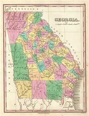
Georgia.
sold
- Digital Map Information
- Suitable for large format printing
- DPI: 300
- File Size: 3.49 MB
- File Type: ZIP / TIFF
- ICC color profile embedded
- Delivered instantly via download link
A beautiful example of Finley's important 1827 map of Georgia. Depicts the state with moderate detail in Finley's classic minimalist style. Shows river ways, roads, canals, and some topographical features. Offers color coding at ... (more details)
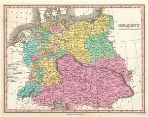
Germany.
sold
- Digital Map Information
- Suitable for large format printing
- DPI: 300
- File Size: 4.38 MB
- File Type: ZIP / TIFF
- ICC color profile embedded
- Delivered instantly via download link
A beautiful example of Finley's important 1827 map of Germany. Depicts from the North and Baltic Seas south to the Gulf of Venice. This is a map of 'Greater Germania,' including the disparate German republics, Prussia, Poland, ... (more details)
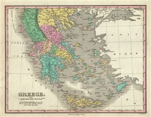
Greece.
sold
- Digital Map Information
- Suitable for large format printing
- DPI: 300
- File Size: 3.86 MB
- File Type: ZIP / TIFF
- ICC color profile embedded
- Delivered instantly via download link
This is a beautiful example of Finley's important 1827 map of Greece. Depicts from Macedonia to Greece and includes many of the Greek Islands. Shows cities, river ways, roads, monasteries, and some topographical features. ... (more details)
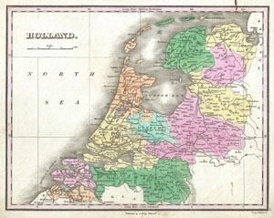
Holland.
sold
- Digital Map Information
- Suitable for large format printing
- DPI: 300
- File Size: 3.27 MB
- File Type: ZIP / TIFF
- ICC color profile embedded
- Delivered instantly via download link
A beautiful example of Finley's important 1827 map of Holland or the Netherlands. Covers the region Friesland south to Dutch Flanders and Brabant. Identifies numerous cities, river systems, swamps and canals. Title and ... (more details)
An Early American Atlas Map of the Low Countries.
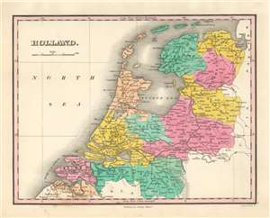
Holland.
sold
- Digital Map Information
- Suitable for large format printing
- DPI: 600
- File Size: 5.53 MB
- File Type: ZIP / TIFF
- ICC color profile embedded
- Delivered instantly via download link
A beautiful example of Finley's important 1827 map of Holland, or the Netherlands. The map embraces the region Friesland south to Dutch Flanders and Brabant. Identifies numerous cities, including Amsterdam, Antwerp, and Bergen op Zoom. The map also shows and names river systems, swamps and canals. A simple, elegant title and scale appear in the upper left quadrant. (more details)
Important American Indian westward migration map.
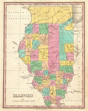
Illinois.
sold
- Digital Map Information
- Suitable for large format printing
- DPI: 300
- File Size: 3.16 MB
- File Type: ZIP / TIFF
- ICC color profile embedded
- Delivered instantly via download link
A beautiful example of Finley's important 1827 map of Illinois. Depicts the state with moderate detail in Finley's classic minimalist style. Shows rivers, roads, canals, and some topographical features. Offers color coding ... (more details)
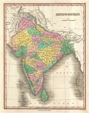
Hindoostan.
sold
- Digital Map Information
- Suitable for large format printing
- Full resolution TIFF file
- ICC color profile embedded
- Delivered instantly via download link
A beautiful example of Finley's important 1827 map of India or Hindoostan. Covers the subcontinent from Luddock south to Ceylon (Sri Lanka). Identifies numerous cities, river systems, deserts, and mountain ranges. ... (more details)
Important American Indian westward migration map.
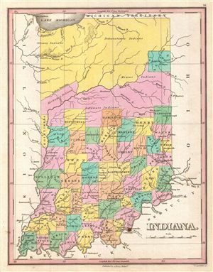
Indiana.
sold
- Digital Map Information
- Suitable for large format printing
- DPI: 300
- File Size: 3.45 MB
- File Type: ZIP / TIFF
- ICC color profile embedded
- Delivered instantly via download link
A beautiful example of Finley's important 1827 map of Indiana. Depicts the state with moderate detail in Finley's classic minimalist style. Shows river ways, roads, canals, and some topographical features. Offers ... (more details)
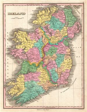
Ireland.
sold
- Digital Map Information
- Suitable for large format printing
- DPI: 300
- File Size: 3.88 MB
- File Type: ZIP / TIFF
- ICC color profile embedded
- Delivered instantly via download link
This is Finley's desirable 1827 map of Ireland. Shows river ways, roads, canals, and some topographical features. Color coding defines all four provinces as well as the numerous traditional county divisions. ... (more details)
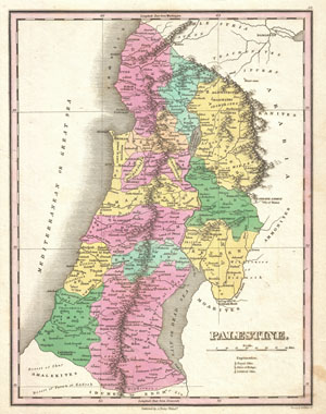
Palestine.
sold
- Digital Map Information
- Suitable for large format printing
- DPI: 300
- File Size: 3.38 MB
- File Type: ZIP / TIFF
- ICC color profile embedded
- Delivered instantly via download link
A beautiful example of Finley's important 1827 map of Palestine, Israel or the Holy Land. Covers the region from Sidon and Damascus in the north to the southern tip of the Dead Sea or Zoar. Includes the ... (more details)
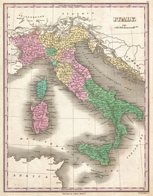
Italy.
sold
- Digital Map Information
- Suitable for large format printing
- DPI: 300
- File Size: 3.75 MB
- File Type: ZIP / TIFF
- ICC color profile embedded
- Delivered instantly via download link
This is Finley's desirable 1827 map of Italy. Depicts the Italian peninsula from Austria and Switzerland to Sicily and Malta. Includes the Islands of Sardinia and Corsica as well as Dalmatia across the ... (more details)
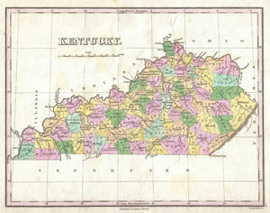
Kentucky.
sold
- Digital Map Information
- Suitable for large format printing
- DPI: 300
- File Size: 2.92 MB
- File Type: ZIP / TIFF
- ICC color profile embedded
- Delivered instantly via download link
A beautiful example of Finley's important 1827 map of Kentucky. Depicts the state with moderate detail in Finley's classic minimalist style. Shows river ways, roads, canals, and some topographical ... (more details)
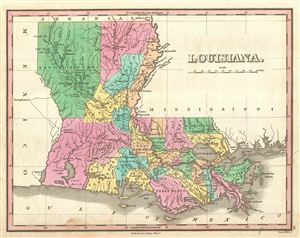
Louisiana
sold
- Digital Map Information
- Suitable for large format printing
- DPI: 300
- File Size: 3.27 MB
- File Type: ZIP / TIFF
- ICC color profile embedded
- Delivered instantly via download link
A beautiful example of Finley's important 1827 map of Louisiana. Shows early county configuration. Depicts the state with moderate detail in Finley's classic minimalist style. Shows river ways, ... (more details)
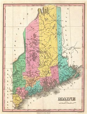
Maine.
sold
- Digital Map Information
- Suitable for large format printing
- DPI: 300
- File Size: 3.25 MB
- File Type: ZIP / TIFF
- ICC color profile embedded
- Delivered instantly via download link
A beautiful example of Finley's important 1827 map of Maine and possibly the most interesting of the this series. Shows early county configuration. Depicts the state with moderate detail in ... (more details)
Rare exclusive depiction of Maryland.
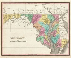
Maryland.
sold
- Digital Map Information
- Suitable for large format printing
- DPI: 300
- File Size: 3.63 MB
- File Type: ZIP / TIFF
- ICC color profile embedded
- Delivered instantly via download link
A beautiful example of Finley's important 1827 map of Maryland. This rare map plate configuration depicts the state individually rather than bundled with Delaware or Virginia - as is more ... (more details)
Unusal configuration of pre-Republic Texas.
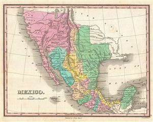
Mexico.
sold
- Digital Map Information
- Suitable for large format printing
- DPI: 300
- File Size: 3.5 MB
- File Type: ZIP / TIFF
- ICC color profile embedded
- Delivered instantly via download link
A scarce and important 1827 map of Mexico by Anthony Finley. Covers from upper California and New Albion south to Guatemala, including the modern day regions of California, New Mexico, ... (more details)
Depicts Chickasaw and Choctaw Territory just prior to Trail of Tears.
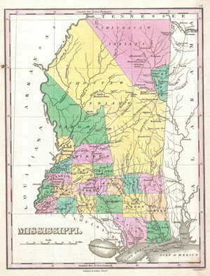
Mississippi.
sold
- Digital Map Information
- Suitable for large format printing
- DPI: 300
- File Size: 3.07 MB
- File Type: ZIP / TIFF
- ICC color profile embedded
- Delivered instantly via download link
A beautiful example of Finley's important 1827 map of Mississippi. Depicts the state with moderate detail in Finley's classic minimalist style. Shows river ways, roads, canals, and some ... (more details)
One of the first obtainable maps of Missouri.
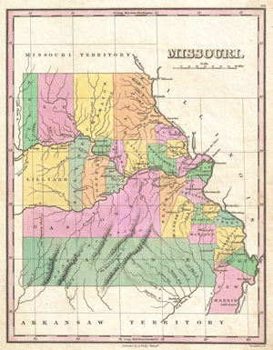
Missouri.
sold
- Digital Map Information
- Suitable for large format printing
- DPI: 300
- File Size: 3.02 MB
- File Type: ZIP / TIFF
- ICC color profile embedded
- Delivered instantly via download link
A beautiful example of Finley's important 1827 map of Missouri shortly following statehood. This is one of the earliest obtainable maps of the State of Missouri. Depicts a very early ... (more details)
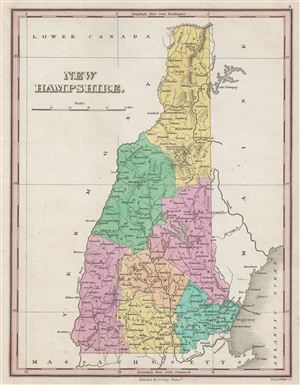
New Hampshire.
sold
- Digital Map Information
- Suitable for large format printing
- DPI: 300
- File Size: 3.53 MB
- File Type: ZIP / TIFF
- ICC color profile embedded
- Delivered instantly via download link
A beautiful example of Finley's important 1827 map of New Hampshire. Depicts the state with moderate detail in Finley's classic minimalist style. Shows river ways, roads, canals, and ... (more details)
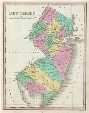
New Jersey.
sold
- Digital Map Information
- Suitable for large format printing
- DPI: 300
- File Size: 3.81 MB
- File Type: ZIP / TIFF
- ICC color profile embedded
- Delivered instantly via download link
A beautiful example of Finley's important 1827 map of New Jersey. Depicts the state with moderate detail in Finley's classic minimalist style. Shows river ways, roads, canals, and ... (more details)
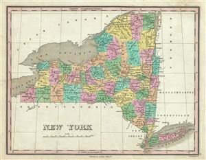
New York.
sold
- Digital Map Information
- Suitable for large format printing
- DPI: 300
- File Size: 3.43 MB
- File Type: ZIP / TIFF
- ICC color profile embedded
- Delivered instantly via download link
A beautiful example of Finley's important 1827 map of New York. Includes Long Island and Lake Ontario. Depicts the state with moderate detail in Finley's classic minimalist style. ... (more details)
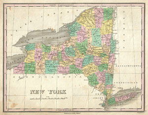
New York.
sold
- Digital Map Information
- Suitable for large format printing
- DPI: 300
- File Size: 3.45 MB
- File Type: ZIP / TIFF
- ICC color profile embedded
- Delivered instantly via download link
A beautiful example of Finley's important 1827 map of New York. Includes Long Island and Lake Ontario. Depicts the state with moderate detail in Finley's classic minimalist style. ... (more details)
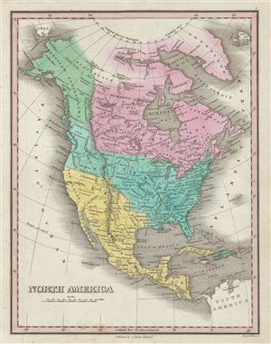
North America.
sold
- Digital Map Information
- Suitable for large format printing
- DPI: 300
- File Size: 4.34 MB
- File Type: ZIP / TIFF
- ICC color profile embedded
- Delivered instantly via download link
This is Finley's desirable 1827 map of the North America. Covers the continent from Panama to the Arctic Circle, including Greenland, Iceland, and the northwestern tip of Asia. ... (more details)
Rare exclusive depiction of North Carolina.
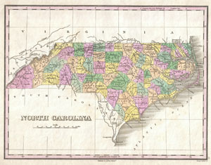
North Carolina
sold
- Digital Map Information
- Suitable for large format printing
- DPI: 300
- File Size: 3.01 MB
- File Type: ZIP / TIFF
- ICC color profile embedded
- Delivered instantly via download link
A beautiful example of Finley's important 1827 map of North Carolina. This rare map plate configuration depicts the state individually rather than bundled with South Carolina - ... (more details)
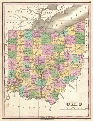
Ohio.
sold
- Digital Map Information
- Suitable for large format printing
- DPI: 300
- File Size: 3.43 MB
- File Type: ZIP / TIFF
- ICC color profile embedded
- Delivered instantly via download link
A beautiful example of Finley's important 1827 map of Ohio. Includes much of Lake Erie. Depicts the state with moderate detail in Finley's classic minimalist style. Shows ... (more details)
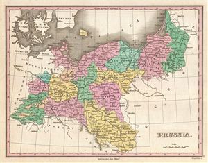
Prussia.
sold
- Digital Map Information
- Suitable for large format printing
- Full resolution TIFF file
- ICC color profile embedded
- Delivered instantly via download link
A beautiful example of Finley's 1827 map of Prussia. Details the Kingdom of Prussia, the most powerful state of the Germanic Confederation, as it was under King Friedrich ... (more details)
Rare singular map of Rhode Island.
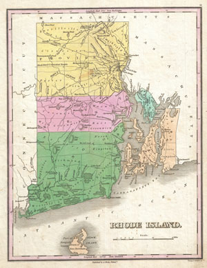
Rhode Island.
sold
- Digital Map Information
- Suitable for large format printing
- DPI: 300
- File Size: 2.96 MB
- File Type: ZIP / TIFF
- ICC color profile embedded
- Delivered instantly via download link
A beautiful example of Finley's important 1827 map of Rhode Island. Includes Block Island. Depicts the state with moderate detail in Finley's classic minimalist style. ... (more details)
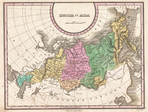
Russia in Asia.
sold
- Digital Map Information
- Suitable for large format printing
- DPI: 300
- File Size: 3.64 MB
- File Type: ZIP / TIFF
- ICC color profile embedded
- Delivered instantly via download link
A beautiful example of Finley's important 1827 map of Russia in Asia. Depicts from the Black Sea and Arabia eastward to the Behring Strait, northwards to the Arctic, ... (more details)
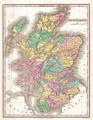
Scotland.
sold
- Digital Map Information
- Suitable for large format printing
- DPI: 300
- File Size: 3.95 MB
- File Type: ZIP / TIFF
- ICC color profile embedded
- Delivered instantly via download link
This is Finley's desirable 1827 map of Scotland. Shows river ways, roads, canals, and some topographical features. Color coding defines traditional county divisions. ... (more details)
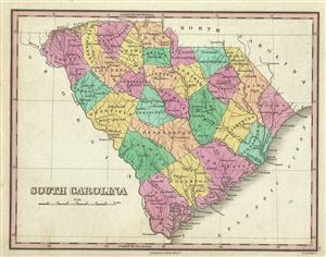
South Carolina.
sold
- Digital Map Information
- Suitable for large format printing
- DPI: 300
- File Size: 3.14 MB
- File Type: ZIP / TIFF
- ICC color profile embedded
- Delivered instantly via download link
This is a beautiful example of Finley's important 1827 map of South Carolina. This rare map plate configuration depicts the state individually rather than bundled ... (more details)