
Japanese Maps (sold)
First Japanese Printed Map to show European geographical information with Buddhist world-view.
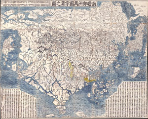
Nansenbushu Bankoku Shoka No Zu (Outline Map of All Countries of the Universe)
sold
- Digital Map Information
- Suitable for large format printing
- Full resolution TIFF file
- ICC color profile embedded
- Delivered instantly via download link
A seminal map. This is the first Japanese printed map to depict the world, including Europe and America, from a Buddhist cosmographical perspective. Printed by woodblock in 1710 (Hoei 7), this map was composed by the Buddhist monk Rokashi Hotan. Inspired by ... (more details)
The first Japanese map of the world from a Buddhist cosmographical perspective - a seminal map.
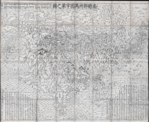
Nansenbushu Bankoku Shoka No Zu (Outline Map of All Countries of the Universe)
sold
- Digital Map Information
- Suitable for large format printing
- DPI: 300
- File Size: 91.94 MB
- File Type: ZIP / TIFF
- ICC color profile embedded
- Delivered instantly via download link
A seminal map of extreme significance. This is the first Japanese printed map to depict the world, including Europe and America, from a Buddhist cosmographical perspective. Printed by woodblock in 1710 (Hoei 7), this map was composed by the Buddhist monk ... (more details)
Ming cartographic heritage.
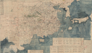
大明一統二京十三省図 / Great Ming Unification Two Capitals and Thirteen Provinces Map / Da Ming Yi Yong Er Jing Shi San Shen Tu
sold
- Digital Map Information
- Suitable for large format printing
- Full resolution TIFF file
- ICC color profile embedded
- Delivered instantly via download link
This previously unknown 1769 Chinese-language manuscript map of Ming China and Korea is among the most important East Asian cartographic discoveries to emerge in recent years. Monumental in scale and exceptionally detailed, it preserves official Ming Dynasty geographic knowledge long thought lost, likely produced in Tokugawa Japan by descendants of Chinese scholars who fled the fall of the Ming Dynasty in 1644. Rich with elegant calligraphy, extensive topographical and political detail, and numerous textual annotations, the map offers an unparalleled window into the geography, historical memory, and intellectual traditions of the Ming loyalist diaspora. As a unique manuscript with no known counterpart, it represents a once-in-a-lifetime opportunity to acquire an extraordinary artifact of Chinese cartography, Sino-Japanese cultural exchange, and the enduring legacy of the Great Ming. (more details)
Nansenbushu: First Japanese Printed Map to show European geographical information with Buddhist world-view.
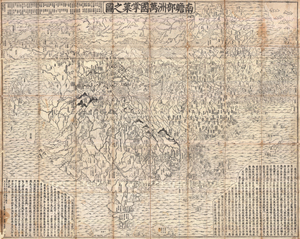
Nansenbushu Bankoku Shoka No Zu (Outline Map of All Countries of the Universe)
sold
- Digital Map Information
- Suitable for large format printing
- DPI: 300
- File Size: 330.31 MB
- File Type: ZIP / TIFF
- ICC color profile embedded
- Delivered instantly via download link
A seminal map of extreme significance. This is the first Japanese printed map to depict the world, including Europe and America, from a Buddhist cosmographical perspective. Printed by woodblock in 1710 (Hoei 7), this map was composed by the Buddhist monk ... (more details)
Enormous map of China identifying roads and bridges. Shows early Chinese claim to Senkaku / Diaoyu Islands .
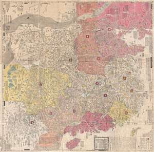
大淸廣輿圖 : 經天合地 : 境域 / Dai Shin kōyozu : keiten gōchi : nikyō jūshishō shii kyōiki. / Enlarged Terrestrial Map of the Great Qing: The Two Capitals, 14 Provinces, and 4 Provinces.
sold
- Digital Map Information
- Suitable for large format printing
- Full resolution TIFF file
- ICC color profile embedded
- Delivered instantly via download link
A rare and important Tenmei 5, Qianlong 50 or 1785 woodblock map of Qing Dynasty China printed in woodblock. This enormous Chinese language map covers from the Tibet and the Kunlun Mountains in western China to Taiwan and the East China Sea, and from ... (more details)
One of the Most Influential Maps of the Tokugawa.
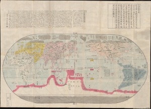
改正地球萬國全圖 / [Revised Map of the Myriad Countries of the World].
sold
- Digital Map Information
- Suitable for large format printing
- Full resolution TIFF file
- ICC color profile embedded
- Delivered instantly via download link
A stunning and influential work, possibly in its earliest edition, this large c. 1790 Japanese world map was issued by Nagakubo Sekisui, the premier Japanese geographer of the late 18th century. It is Nagakubo's interpretation of the 1602 'Matteo Ricci Map', the first map to integrate East Asian and European cartographic knowledge. It includes significant updates over the Ricci, most notably the addition of Australia and islands north of Japan (Hokkaido and the Kurils). (more details)
First Buddhist map of the world.
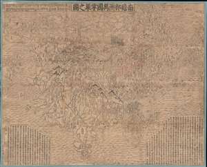
Nansenbushu Bankoku Shoka No Zu (Outline Map of All Countries of the Universe).
sold
- Digital Map Information
- Suitable for large format printing
- DPI: 600
- File Size: 168.79 MB
- File Type: ZIP / TIFF
- ICC color profile embedded
- Delivered instantly via download link
A seminal map of extreme significance. This is the first Japanese printed map to depict the world, including Europe and America, from a Buddhist cosmographical perspective. Printed by woodblock in 1710 (Hoei 7), this map was composed by the Buddhist monk Rokashi Hotan. Inspired by the 1653 publication of Si-yu-ki, a pilgrimage narrative of the Chinese monk Hsuang-Tsang's (602-604) travels to India in search of sacred Sanskrit writings. (more details)
Diplomatic ploy that may have contributed the Qing cession of Taiwan/Formosa to Japan.
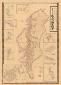
Detailed Map of Taiwan Field Survey. / 實地踏測台灣詳密地圖
sold
- Digital Map Information
- Suitable for large format printing
- File Size: 63.22 MB
- File Type: ZIP / TIFF
- ICC color profile embedded
- Delivered instantly via download link
This 1895 Nakamura Yoshimatsu map of Taiwan is one of the most unsung but influential examples of persuasive cartography ever published. The large-scale map of Taiwan appeared at the end of the First Sino-Japanese War (August 1, 1894 - April 17, 1895), just prior to the Treaty of Shimonoseki (April 17, 1895) and the Japanese invasion of Taiwan (May 29, 1895 - October 21, 1895). The map, attributed to a likely fictional British naval officer named John Waters, employs creative cartography to reshape Taiwan, while retaining the overall area, effectivley reducing the size of Qing controlled Formosa and increasing the size of the ungoverned 'savage zones' - a ploy that played into the Japanese position that the Qing did not truly possess the island. It was likely presented at the Shimonoseki negotiations, where the Japanese were able to take advantage of Qing China's infamous lack of cartographic knowledge about Formosa to formally seize the island. (more details)
A previously unknown manuscript map of Tokugawa era trade routes between Japan, Taiwan, and China.
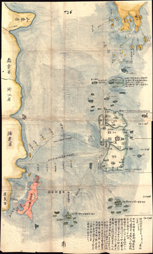
Satsuma Daimyo
sold
- Digital Map Information
- Suitable for large format printing
- DPI: 300
- File Size: 20.78 MB
- File Type: ZIP / TIFF
- ICC color profile embedded
- Delivered instantly via download link
This extraordinary discovery is a previously unknown 1781 (Temmei 1 ) manuscript map of Taiwan and the Satsuma Daimyo. This rare map covers from the southern shores of Kyushu south along the Ryukyu Islands (including Okinawa) to Taiwan and the ... (more details)
Diplomatic ploy that may have contributed the Qing cession of Taiwan/Formosa to Japan.
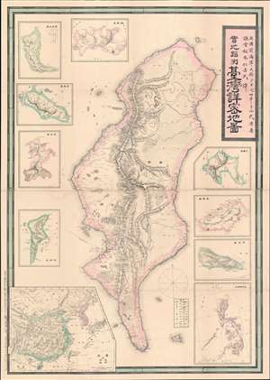
Detailed Map of Taiwan Field Survey. / 實地踏測台灣詳密地圖
sold
- Digital Map Information
- Suitable for large format printing
- Full resolution TIFF file
- ICC color profile embedded
- Delivered instantly via download link
The first Japanese printed map of Taiwan and the birth certificate of Japanese-occupied Formosa. An extremely scarce and important 1895 or Meiji 28 large-scale map of Taiwan or Formosa issued near the end of the First Sino-Japanese War (August 1, 1894 - April 17, 1895), prior to the Treaty of Shimonoseki (April 17, 1895) and the Japanese invasion of Taiwan (May 29, 1895 - October 21, 1895). This map was likely a diplomatic and propaganda ploy prepared in anticipation of the Shimonoseki treaty negotiations, which included an Imperial Japanese demand for the Qing cession of Formosa/Taiwan. The map illustrates Taiwan/Formosa with a striking malformed shoreline and inaccurate interior, expanding Tainan and Hsinchu harbors into vast bites, adding corresponding projections to eastern Formosa, and shifting the Central mountains west. The deviations from established Formosa cartography, much of which was available to the Japanese, indicate an insidious intent - a diplomatic deception intended to diminish the territorial significance of Qing administered Formosa, then limited to the coastal lowlands west of the Central Mountain Range, while at the same time exaggerating the eastern ungoverned tribal regions and retaining the island's overall area. (more details)
Japan sets its sights on Korea.
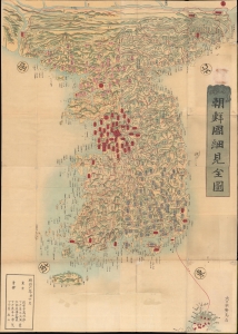
朝鮮國細見全圖 / [Complete Map of Korea].
sold
- Digital Map Information
- Suitable for large format printing
- Full resolution TIFF file
- ICC color profile embedded
- Delivered instantly via download link
A stunning 1873 large-scale map of Korea edited by Somezaki Nobufusa (染崎延房). It was produced in the wake of Japan's Meiji Restoration, as ambitious empire builders were eyeing their neighbor to the west for imperial expansion. (more details)
First modern map of China.
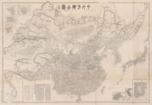
中外方輿全圖 / [Complete Map of China and Neighboring Countries].
sold
- Digital Map Information
- Suitable for large format printing
- File Size: 259.51 MB
- File Type: ZIP / TIFF
- ICC color profile embedded
- Delivered instantly via download link
A remarkable find, this scarce, huge map of China and East Asia was prepared in 1894 by Kishida Ginkō at the start of the First Sino-Japanese War (1894 - 1895). This is Kishida's masterwork, being his largest and most detailed map, significant on many levels. It is the first modern map of China, a sophisticated composite of Western and Chinese maps augmented by Kishida's own survey work. When issued, it was the largest, most accurate, and most comprehensive map of China and East Asia. As the best regional map of its period, this work's influence on both the First Sino-Japanese War and its aftermath cannot be overstated. In all, the map marks a transformative moment in East Asian history, upending the traditional Sino-centric order and establishing Japan as a world power. (more details)
First printed map of the Western Hemisphere.
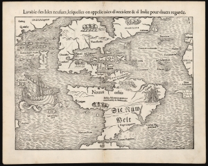
La table des Isles neufues, lesquelles on appelle isles d'occident et d Indie pour divers regardz.
sold
- Digital Map Information
- Suitable for large format printing
- Full resolution TIFF file
- ICC color profile embedded
- Delivered instantly via download link
This is an excellent 1552 French-text edition of Sebastian Münster's 1540 map of America, the first printed map of the Western Hemisphere. From 1544, this map was included in Münster's Cosmographia. The 1552 editions are the last published in Münster's lifetime - after which production quality significantly declined. Cosmographia long outlasted Münster, remaining the best source for over 40 years for anyone who wished to know about the world. Consequently, this map had a disproportionate impact, providing the first glimpse of the New World to Europeans for nearly half a century. (more details)
Japanese war propaganda.
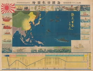
海國日本圖繪 紀元二千六百年紀念 / [Depiction of Maritime Japan, to Commemorate the 2600th Anniversary of the Imperial Family].
sold
- Digital Map Information
- Suitable for large format printing
- File Size: 477.31 MB
- File Type: ZIP / TIFF
- ICC color profile embedded
- Delivered instantly via download link
A rare, huge, and brilliantly-colored propaganda work issued by the Imperial Japanese Navy (IJN) on the eve of the Pearl Harbor attack, this 1940 map celebrates the history of Japan's maritime ventures and the strength of the IJN. It also celebrates the 2600th anniversary of the Japanese imperial family that year, which was accompanied by an outpouring of hypernationalist propaganda. (more details)
A previously undiscovered Japanese Serio-Comic Map! Possibly the first!
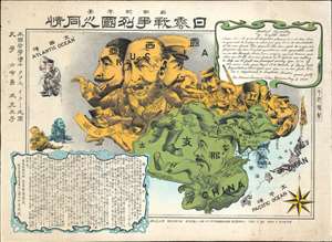
New Commemorative Print of Various Countries Sympathies in the Russo Japanese War. / 崭新纪念画 日露戰爭列國义同情
sold
- Digital Map Information
- Suitable for large format printing
- Full resolution TIFF file
- ICC color profile embedded
- Delivered instantly via download link
The only known example of a 1904 (Meiji 37) Japanese serio-comic style map of Asia illustrating foreign perspectives on the Russo-Japanese War (1904 - 1905). Although previously unknown, if the May 3rd 1904 date is to be believed, this is the second Japanese serio-comic map in the Russo-Japanese War series. The map covers all of Asia and although it does not include Europe, illustrates several western European powers, including France, England, and Germany. (more details)
The only known example of Japan's second Serio-Comic map.
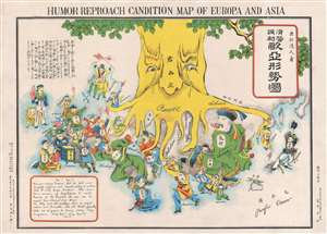
Humor Reproach Candition Map of Europa and Asia. / 滑稽諷刺歐亞形勢圖
sold
- Digital Map Information
- Suitable for large format printing
- File Size: 6.6 MB
- File Type: ZIP / TIFF
- ICC color profile embedded
- Delivered instantly via download link
A previously unknown Meiji 37 or 1904 Japanese broadsheet serio-comic map relating to the Russo-Japanese War. This map was issued in May 28 of 1904, immediately following Japan's successful siege and bombardment Russian held Port Arthur (Dalian). Of the four Japanese serio-comic maps associated with the Russo-Japanese war, this is the second, predated only by Kisaburō Ohara's April 1904 A Humorous Diplomatic Atlas of Europe and Asia. (more details)
Previously unknown Japanese serio-comic map.
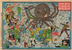
外交的滑稽露蜘蛛退治の圖 / [Image of the Diplomatic Hilarity of Exterminating the Spider].
sold
- Digital Map Information
- Suitable for large format printing
- File Size: 125.97 MB
- File Type: ZIP / TIFF
- ICC color profile embedded
- Delivered instantly via download link
This is a 1904 serio-comic tour de force, with vivid colors and rich symbolism, made by Enomoto Matsunosuke, satirizing the geopolitics of the day in the opening phase of the Russo-Japanese War. While cheering on Japan in the conflict, Enomoto is also having a laugh at the alliances and efforts required to exterminate the 'spider' of Tsarist Russia. This comic was part of an outpouring of popular patriotic images, poetry, songs, and other cultural production in Japan after the start of the war. Enomoto was prescient in his portrayal of the Russian Empire as tottering, beset by domestic unrest and surrounded by unfriendly powers. (more details)
The only known example of Japan's second Serio-Comic map.
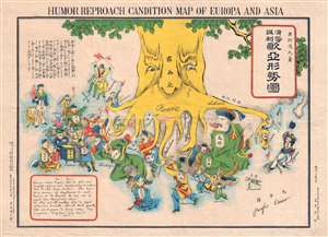
Humor Reproach Candition Map of Europa and Asia. / 滑稽諷刺歐亞形勢圖
sold
- Digital Map Information
- Suitable for large format printing
- File Size: 7.78 MB
- File Type: ZIP / TIFF
- ICC color profile embedded
- Delivered instantly via download link
A previously unknown Meiji 37 or 1904 Japanese broadsheet serio-comic map relating to the Russo-Japanese War. This map was issued in May 28 of 1904, immediately following Japan's successful siege and bombardment Russian held Port Arthur (Dalian). Of the four Japanese serio-comic maps associated with the Russo-Japanese war, this is the second, predated only by Kisaburō Ohara's April 1904 A Humorous Diplomatic Atlas of Europe and Asia. (more details)
Rarest and most poignant Russo-Japanese War serio-comic map!
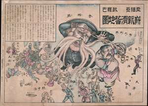
New Funny Map Asia Europa. / 亞細亞歐羅巴嶄新滑稽地圖
sold
- Digital Map Information
- Suitable for large format printing
- File Size: 31.38 MB
- File Type: ZIP / TIFF
- ICC color profile embedded
- Delivered instantly via download link
The holy grail of Japanese Russo-Japanese War (1904 - 1905) chromolithograph serio-comic maps, this is Haru EiDō's July 1904 map lionizing Japanese victories and staging Japan as a major world power and the 'protector' of Asia. This is one of four serio-comic style maps issued sequentially from April through July, 1904, to illustrate and propagandize Japan's near-continuous victories over Russian forces. Unlike some of the others, which also included English content, and therefore were presumably intended for distribution both within and without Japan, this map was intended exclusively for Japanese audiences. (more details)
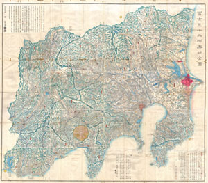
Fujimi Junsanshu Yochi No Zenzu [Map of the 13 Provinces from which Mt. Fiji is Visible]
sold
- Digital Map Information
- Suitable for large format printing
- File Size: 37.52 MB
- File Type: ZIP / TIFF
- ICC color profile embedded
- Delivered instantly via download link
This extraordinary item is a hand colored 1843 (Tienpo 14) Edo or Tokugawa Period woodcut map of the thirteen states form which Mt. Fuji is Visible. Staggering size and detail, this map was produced in the mid-19th century Japanese woodcut ... (more details)
First specific map to reveal America as separate continent. First map to identify the Pacific Ocean.
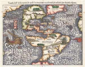
Tavola dell'isole nuove, le quali son nominate occidentali, et indiane per diversi rispetti.
sold
- Digital Map Information
- Suitable for large format printing
- DPI: 300
- File Size: 4.95 MB
- File Type: ZIP / TIFF
- ICC color profile embedded
- Delivered instantly via download link
This is a scarce 1558 Italian edition of Sebastian Münster's map of America, the first printed map of the Western Hemisphere. The map first appeared in Münster’s 1540 edition of Ptolemy's Geographia, one of the earliest versions of the classical work to systematically include maps showing contemporary geographical knowledge. Beginning in 1544 it would be included in Münster’s magnum opus, Cosmographia Universalis, which for over forty years would be the primary source of information for anyone who wished to know about the rest of the world: consequently this map would have had a disproportionate impact, providing the first glimpse of the New World to literate laypeople in Europe nearly half a century. (more details)
Important map reafirming Qing Unity and dominance following Jahangir's Holy War on the Turkestan Frontier.
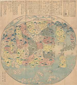
清朝一統之圖 / The unification of the Qing Dynasty. / Shinchō ittō no zu. / Chōi ichiran.
sold
- Digital Map Information
- Suitable for large format printing
- DPI: 300
- File Size: 16.52 MB
- File Type: ZIP / TIFF
- ICC color profile embedded
- Delivered instantly via download link
Ostensibly a天保 Tenpō 6 map of China under the Qing Dynasty, this map in fact covers from India to Japan, inclusive of all of China and Korea, reflecting a pan-Buddhist perspective. The Great Wall is evident at the top of the map and ... (more details)
One of only 2 Japanese serio-comic maps illustrating World War I.
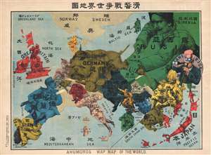
Kokkei Sensou Sekai Chizu. / Ahumoros Wap Map of the World. / 滑馨戰争世界地圖
sold
- Digital Map Information
- Suitable for large format printing
- File Size: 17.14 MB
- File Type: ZIP / TIFF
- ICC color profile embedded
- Delivered instantly via download link
A very rare Japanese broadsheet serio-comic map of Europe and Asia drawn just following the outbreak of World War I. This map was drawn by Ryōzō Tanaka and published by the Shobido Company of Tokyo. The map covers all of Europe and ... (more details)
Important map reafirming Qing Unity and dominance following Jahangir's Holy War on the Turkestan Frontier.
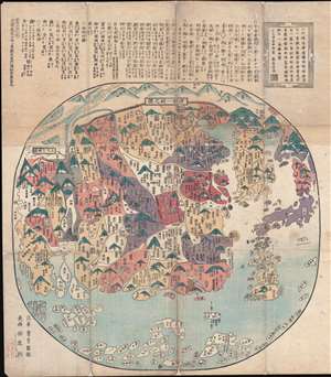
清朝一統之圖 / The unification of the Qing Dynasty. / Shinchō ittō no zu. / Chōi ichiran.
sold
- Digital Map Information
- Suitable for large format printing
- DPI: 300
- File Size: 22.29 MB
- File Type: ZIP / TIFF
- ICC color profile embedded
- Delivered instantly via download link
A 天保 Tenpō 6 map of China under the Qing Dynasty, covering from India to Japan, inclusive of all of China and Korea, reflecting a pan-Buddhist perspective. The Great Wall is evident at the top of the map and in fact forms part of ... (more details)
Rare map illustrating Japanese concerns over Russian and American expansionism.
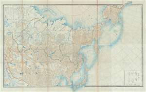
[Russia, China, Japan, Korea, Alaska]
sold
- Digital Map Information
- Suitable for large format printing
- File Size: 50.29 MB
- File Type: ZIP / TIFF
- ICC color profile embedded
- Delivered instantly via download link
This is a highly unusual 1867 or Keiō 3 Japanese lithograph map of Asia and Alaska. The map covers from the Caspian Sea and Nova Zembla to Alaska as far as Prince of Wales Island and Sitka. It embraces most of the Russian Empire in ... (more details)
The Shanghai of tomorrow envisioned!
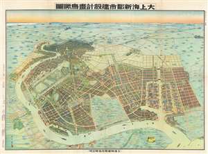
Aerial View of the Construction Design of the New City of Shanghai. / 大上海新都市建設計畫鳥瞰圖
sold
- Digital Map Information
- Suitable for large format printing
- File Size: 97.14 MB
- File Type: ZIP / TIFF
- ICC color profile embedded
- Delivered instantly via download link
An outstanding 1941 / Minguo 30 / Showa 16 bird's-eye view map of 'Greater Shanghai', a massive-scale redevelopment of Shanghai proposed between 1927 and 1945. The view by Yoshida Feng (吉田豐) looks southward on Shanghai from an assumed highpoint above modern day Binjaing Forest Park, near where the Huangpu River empties into the Baoshan Waterway. The original intention of 'Greater Shanghai' was to replace the foreign-run concession zone with a larger spectacular new Chinese-governed city that would act as Shanghai's economic and political hub. In line with these values, Greater Shanghai, appearing in the foreground, presents a well laid out and commodious modern city, with an enormous port, monumental architecture, spacious gardens, and comfortable residential areas. By contract, the foreign concession area, appearing in the distance, seems diminished, small, and crowded. (more details)
Upending the Sino-Centric Order.
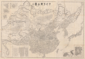
中外方輿全圖 / [Complete Map of China and Neighboring Countries].
sold
- Digital Map Information
- Suitable for large format printing
- File Size: 248.43 MB
- File Type: ZIP / TIFF
- ICC color profile embedded
- Delivered instantly via download link
A remarkable find, this scarce, huge map of China and East Asia was prepared in 1894 by Kishida Ginkō at the start of the First Sino-Japanese War (1894 - 1895). This was the largest and most detailed map of China, and East Asia in general, available during the war - a transformative moment in East Asian history that upended the traditional Sino-centric order and established Japan as a world power. Its influence on both the First Sino-Japanese War and its aftermath cannot be understated. (more details)
Opening of Yokohama.
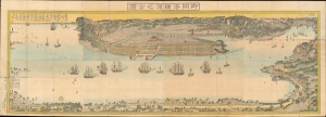
御開港横濱之全圖 / [Complete Map of the Open Port of Yokohama].
sold
- Digital Map Information
- Suitable for large format printing
- File Size: 125.22 MB
- File Type: ZIP / TIFF
- ICC color profile embedded
- Delivered instantly via download link
An epic work by one of Japan's master woodblock printers of the era, this is Utagawa Sadahide's 1859 very large panorama of the port of Yokohama - considered the first and finest early map of Yokohama. Packed with fascinating details, it depicts the city during a period of frenetic development, soon after opening as a treaty port, after which it quickly became the locus of trade and intellectual exchange with the outside world. (more details)
Controversial and consequential.
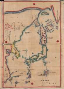
三國通覽圖 / [Overview Map of the Three Kingdoms].
sold
- Digital Map Information
- Suitable for large format printing
- DPI: 600
- File Size: 51.75 MB
- File Type: ZIP / TIFF
- ICC color profile embedded
- Delivered instantly via download link
A banned and controversial map, this is the is the rarest and most important of the five c. 1785 maps issued by Hayashi Shihei (林子平) in his work Sangoku Tsūran Zusetsu (三国通覧図說). The present map is a separate issue manuscript of Hayashi's 1785 map, with some minor changes. This example is significant as, despite being an inherently Japanese production, it unambiguously grants the both the disputed Dokdo Islands (Takeshima / Liancourt Rocks) to Korea, and the disputed Diaoyu (Senkaku Islands) to China. (more details)
Unusual woodblock map of Korea w/history.
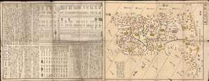
[Eight Counties of Korea] / 朝鮮八道之圖
sold
- Digital Map Information
- Suitable for large format printing
- Full resolution TIFF file
- ICC color profile embedded
- Delivered instantly via download link
This is a rare Tamiya Kitsuan / Hayashi Shihei xylographic or woodblock map of Korea, with accompanying tables, and a history of Korea, dating to 1806. The map is a stand-alone piece, divorced from Shihei's earlier work, and covers all of Korea as well as the adjacent islands, including the disputed Dokdo and a vastly oversized Ulleungdo. Jeju is not present. Cartographically the map is derived from the work Hayashi Shihei (林子平), but has here been revised with additional historical information on Korea and tables comparing Korea, China, and Japan, compiled by Tamiya Kitsuan (田宮橘菴). (more details)
Tokugawa Japan looks west.
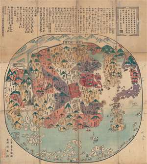
清朝一統之圖 / [Map of the Unified Qing Dynasty].
sold
- Digital Map Information
- Suitable for large format printing
- Full resolution TIFF file
- ICC color profile embedded
- Delivered instantly via download link
This is an 1835 Japanese xylographic map of the Qing Empire and much of Asia - a curiosity issued in Japan despite the isolationist Tokugawa policies. It is further notable for recognizing and praising the Manchu-led Qing Dynasty, whereas many Japanese maps of the era ignored or even denigrated the Manchus. Yet it retains common elements of Tokugawa-era maps of China, such as historical and religious (Buddhist) references as well as cartographic anachronisms, rooted in Japan's admiration for and fascination with ancient Chinese culture. (more details)
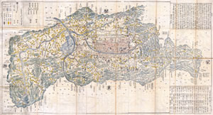
YAMASHIRO KUNI or KYOTO.
sold
- Digital Map Information
- Suitable for large format printing
- File Size: 31.81 MB
- File Type: ZIP / TIFF
- ICC color profile embedded
- Delivered instantly via download link
This extraordinary item is a hand colored woodcut map of YAMASHIRO KUNI or ancient Kyoto, and the vicinity, Japan. When this map was made Kyoto was the Imperial Capital of Japan. Staggering size and detail. This is a very early ... (more details)