
Feuille, Daniel de La (sold)

Daniel de La Feuille (1640 - 1709) was born of Huguenot stock in Sedan (L'Ardennes), France. As a young man he apprenticed as a watchmaker. In 1663 La Feuille married Charlette Marlet, the daughter of a local carpenter. Twenty years later, in 1683, facing religious prosecution of Huguenots in France, the family fled to Amsterdam. By 1686 Daniel had become a burgher (citizen) of the city and established himself as an engraver, publisher, and art dealer. Not long after, in 1691, he was admitted into the Booksellers Guild. Though we are primarily concerned with his cartographic work here, his masterpiece is considered to be Devises et emblems, a collection of symbols and designs mostly likely intended as templates for silversmiths, engravers, and watchmakers. His cartographic work includes numerous individual maps and atlases, many of which continued to be published and republished well after his death in 1709. He was succeeded by his sons Jacob de la Feuille (1668 - 1719) and Paul de La Feuille (1688 - 1727).
Scarce map showing Insular California.
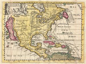
l'Amerique Septentrionale.
sold
- Digital Map Information
- Suitable for large format printing
- DPI: 300
- File Size: 1.71 MB
- File Type: ZIP / TIFF
- ICC color profile embedded
- Delivered instantly via download link
This is a very scarce example of Daniel de La Feuille's 1702 map of North America. It covers all of North America from the Hudson Bay to the Gulf of Panama. The Rio Grande (Rio Bravo ou de Nort) and the Mississippi Rivers are the only two major rivers depicted, ... (more details)
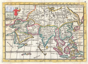
Asia.
sold
- Digital Map Information
- Suitable for large format printing
- Full resolution TIFF file
- ICC color profile embedded
- Delivered instantly via download link
A very scarce, c. 1706, map of Asia issued by Daniel de La Feuille. Extends from the Mediterranean to Alaska and as far south as Java. Depicts the Mogol Empire in India, the kingdoms of Siam and Chochine, China, Arabia and Tartary. In China, the Great wall is ... (more details)
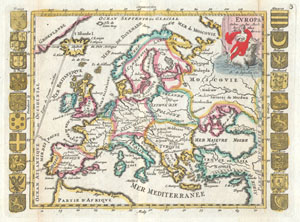
Europa Selon les Auth. les plus Modernes.
sold
- Digital Map Information
- Suitable for large format printing
- Full resolution TIFF file
- ICC color profile embedded
- Delivered instantly via download link
A very scarce, c. 1706, example of a map of Europe first issued by Daniel de La Feuille in 1702. Features the continent of Europe as far west as Greenland (Groenlande) and as far east as the Black Sea and Asia Minor. Extends north to include Lapland and the ... (more details)
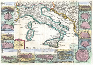
Nouvelle Carte D’Itlaie / Nieuwe Kaart van Italien.
sold
- Digital Map Information
- Suitable for large format printing
- Full resolution TIFF file
- ICC color profile embedded
- Delivered instantly via download link
A very scarce, c. 1706, map of Italy issued by Daniel de La Feuille. Extends from Provence in the west to Serbia and the Island of Corfu in the east. Extends north as far as Switzerland and south as far as Sicily. Includes the islands of Corsica and ... (more details)
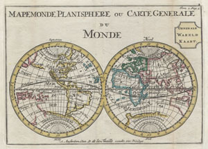
Mapemonde Planisphere ou Carte Generale du Monde / Generale Wareld Kaart.
sold
- Digital Map Information
- Suitable for large format printing
- Full resolution TIFF file
- ICC color profile embedded
- Delivered instantly via download link
A very scarce later, c. 1706, edition of a map of the world on a hemisphere projection first issued by Daniel de La Feuille in 1702. Much of the coastlines are plotted conjecturally at best. Features a massive California in Island form. Further ... (more details)
Scarce minature map of London.
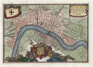
Londres Ville Capitalle de l'Angleterre.
sold
- Digital Map Information
- Suitable for large format printing
- DPI: 300
- File Size: 1.53 MB
- File Type: ZIP / TIFF
- ICC color profile embedded
- Delivered instantly via download link
An extremely attractive and finely engraved 1706 Daniel de La Feuille miniature map of London, England. Centered on the Thames River, La Feuille's map covers London from Shoreditch to Shadwell and from Lambeth to St. James Park. Saint Paul's ... (more details)
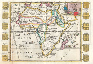
Africa Selon les Autheurs les plus Modernes.
sold
- Digital Map Information
- Suitable for large format printing
- Full resolution TIFF file
- ICC color profile embedded
- Delivered instantly via download link
A very scarce, c. 1710, map of Africa by Daniel de la Feuille. Depicts the continent of Africa form an early 18th century perspective. The Niger River is mapped with surprising accuracy, especially considering its highly inaccurate mappings ... (more details)
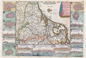
Carte Generale des 17 Provinces des Pais Bas Ave Leurs Capitales.
sold
- Digital Map Information
- Suitable for large format printing
- Full resolution TIFF file
- ICC color profile embedded
- Delivered instantly via download link
A very scarce, c. 1710, map of Belgium, the Netherlands and Luxembourg by Daniellede la Feuille. The main map is surrounded by seventeen plans and views of major cities in the region: Namur, Bruxelles (Brussels), Arras, Campen, Limbourg, ... (more details)
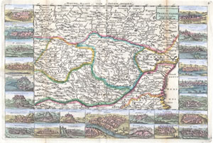
Carte Nouvelle de Transilvanie Avec ses Consins
sold
- Digital Map Information
- Suitable for large format printing
- Full resolution TIFF file
- ICC color profile embedded
- Delivered instantly via download link
A very scarce, c. 1710, map of Transylvania and Moldova by Daniel de la Feuille. Depicts the region of eastern Europe just west of the Black Sea, south of the Ukraine, and north of Bulgaria. Features inset views of 25 important regional ... (more details)
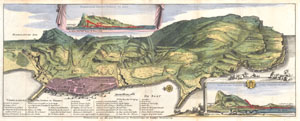
Gibraltar met alle zyne fortificatien en Verbeeteringen tot desselus Verzeekering.
sold
- Digital Map Information
- Suitable for large format printing
- Full resolution TIFF file
- ICC color profile embedded
- Delivered instantly via download link
A very scarce, c. 1720, view format map of Gibraltar most likely prepared and issued by the De La Feuille family. Depicts the peninsula and town of Gibraltar from an east facing view perspective. The town of Gibraltar is well laid out ... (more details)
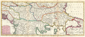
Nieuwe Kaart van Bosnien, Servien, Bulgarien, Romanien; Graeciae enz..
sold
- Digital Map Information
- Suitable for large format printing
- Full resolution TIFF file
- ICC color profile embedded
- Delivered instantly via download link
This is a rare and unusual 1738 map of the Balkans by J. Ratelband. Likely revised and updated from earlier charts by the De La Feuille family. Depicts from modern day Albania (Dalmatia) eastward through Bosnia, Serbia, Bulgaria and ... (more details)
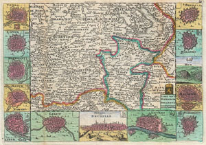
Kaart Van't Hertogdom Brabant.
sold
- Digital Map Information
- Suitable for large format printing
- DPI: 300
- File Size: 4.29 MB
- File Type: ZIP / TIFF
- ICC color profile embedded
- Delivered instantly via download link
A stunning map of Brabant, Belgium first drawn by Daniel de la Feuille in 1706. Depicts from Brussels in the south west eastward as far as Limburg and Roermont. Surrounded by thirteen maps and views of important villages and ... (more details)
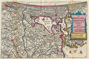
La Rhinlande Amstellande et Terres Circo uosines.
sold
- Digital Map Information
- Suitable for large format printing
- DPI: 300
- File Size: 2.83 MB
- File Type: ZIP / TIFF
- ICC color profile embedded
- Delivered instantly via download link
A stunning map of southern Holland (The Netherlands) and the vicinity of Amsterdam first drawn by Daniel de la Feuille in 1706. Based upon an earlier map by Balthazaro Florentio a Berkenrode who is credited in the title ... (more details)
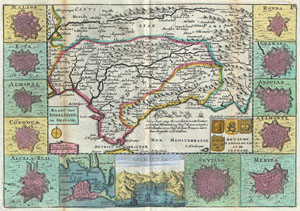
Kaart van Andalusien en Granade. / Royaume D'Andalousie et de Grenade.
sold
- Digital Map Information
- Suitable for large format printing
- Full resolution TIFF file
- ICC color profile embedded
- Delivered instantly via download link
A stunning map of Andalusia and Grenada, Spain first drawn by Daniel de la Feuille in 1706. Surrounded by thirteen city plans and one city view. From top right in an anti-clockwise fashion these include Malaga, Ecya, ... (more details)
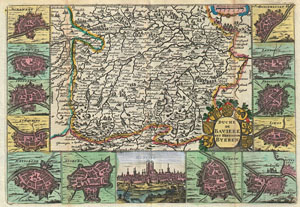
Duche de Baviere. / Het Hertogdom Byeren.
sold
- Digital Map Information
- Suitable for large format printing
- DPI: 300
- File Size: 4.15 MB
- File Type: ZIP / TIFF
- ICC color profile embedded
- Delivered instantly via download link
A stunning map of Bavaria, Germany first drawn by Daniel de la Feuille in 1706. Includes Munich and Augsburg. Surrounded by thirteen maps and views of important villages and fortresses in this region. From top ... (more details)
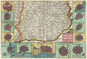
Principaute de Catalogne et Partie du Rous sillon Echelle de Lieux. / Kaart van Catalonien.
sold
- Digital Map Information
- Suitable for large format printing
- DPI: 300
- File Size: 3.62 MB
- File Type: ZIP / TIFF
- ICC color profile embedded
- Delivered instantly via download link
A stunning map of Catalonia, Spain first drawn by Daniel de la Feuille in 1706. Surrounded by thirteen city plans. From top right in an anti-clockwise fashion these include Perpignan, Vich, Roses, Irgel, ... (more details)
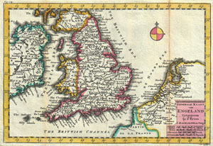
Generale Kaart van Engeland.
sold
- Digital Map Information
- Suitable for large format printing
- DPI: 300
- File Size: 3.15 MB
- File Type: ZIP / TIFF
- ICC color profile embedded
- Delivered instantly via download link
A stunning map of England first drawn by Daniel de la Feuille in 1706. Depicts the entirety of England with parts of Ireland, Scotland and the Netherlands. Dutch language title in lower right ... (more details)
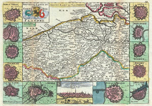
Nouvelle Carte Du Comte de Flandre. / Nieuwe Kaart van Vlaanderen.
sold
- Digital Map Information
- Suitable for large format printing
- DPI: 300
- File Size: 3.42 MB
- File Type: ZIP / TIFF
- ICC color profile embedded
- Delivered instantly via download link
A stunning map of Flanders, Italy first drawn by Daniel de la Feuille in 1706. This region includes portions of what is today Belgium and Holland. Surrounded by thirteen views and plans of ... (more details)
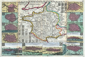
La France Moderne avec ses 12 anciens Gouvernement. / Generale Kaart van Vrankryk.
sold
- Digital Map Information
- Suitable for large format printing
- DPI: 300
- File Size: 3.82 MB
- File Type: ZIP / TIFF
- ICC color profile embedded
- Delivered instantly via download link
A stunning map of France first drawn by Daniel de la Feuille in 1706. Depicts all of France as well as parts of Italy, England, Spain, Switzerland, Belgium and Germany. Flanked on either ... (more details)
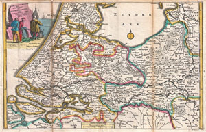
Kaart van Zuyd Holland met Aanwyzing der Overstrooming, door eys en Dykbraaken, in den Jaare 1726 omtrent de Maanden Jan:en Febr.
sold
- Digital Map Information
- Suitable for large format printing
- DPI: 300
- File Size: 4.8 MB
- File Type: ZIP / TIFF
- ICC color profile embedded
- Delivered instantly via download link
A stunning map of Holland first drawn by Daniel de la Feuille in 1706. Depicts Holland south of Amsterdam focusing and the delta and course of the Rhine River. A title cartouche in the ... (more details)
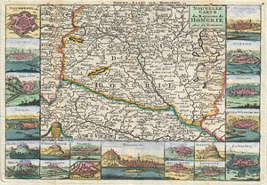
Nouvelle Carte du Royaume de Hongrie Avec ses Forteresses. / Nieuwe Kaart van Hongarien.
sold
- Digital Map Information
- Suitable for large format printing
- DPI: 300
- File Size: 3.8 MB
- File Type: ZIP / TIFF
- ICC color profile embedded
- Delivered instantly via download link
A stunning map of Hungary first drawn by Daniel de la Feuille in 1706. Covers from Moravia in the northwest south to Bosnia and east as far as Belgrade. Surrounded by twenty maps and ... (more details)
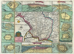
Caart van Languedoc.
sold
- Digital Map Information
- Suitable for large format printing
- DPI: 300
- File Size: 3.82 MB
- File Type: ZIP / TIFF
- ICC color profile embedded
- Delivered instantly via download link
A stunning map of Languedoc, France first drawn by Daniel de la Feuille in 1706. This province in southeastern France roughly corresponds with the modern day departments of Gévaudan, ... (more details)
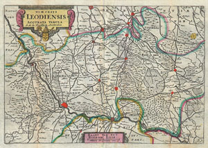
Dioecesis Leodiensis Accurata Tabula.
sold
- Digital Map Information
- Suitable for large format printing
- DPI: 300
- File Size: 3.44 MB
- File Type: ZIP / TIFF
- ICC color profile embedded
- Delivered instantly via download link
A stunning map of Leodiensis or the vicinity of Liege, Belgium first drawn by Daniel de la Feuille in 1706. Depicts from Hoey in the west eastward as far as Peer, southward as far as ... (more details)
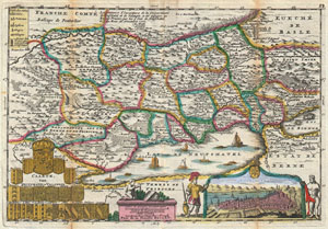
Caarte, van Neufchatel et Valangin.
sold
- Digital Map Information
- Suitable for large format printing
- DPI: 300
- File Size: 3.98 MB
- File Type: ZIP / TIFF
- ICC color profile embedded
- Delivered instantly via download link
A stunning map of Neuchâtel, Switzerland first drawn by Daniel de la Feuille in 1706. Depicts the stunning Lake of Neuchâtel and the surrounding region. Neuchâtel, located in the ... (more details)
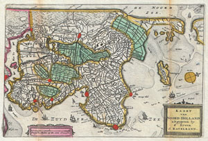
Kaart van Noord-Holland.
sold
- Digital Map Information
- Suitable for large format printing
- DPI: 300
- File Size: 2.99 MB
- File Type: ZIP / TIFF
- ICC color profile embedded
- Delivered instantly via download link
A stunning map of the northern part of Holland or the Netherlands first drawn by Daniel de la Feuille in 1706. Oriented to the west. Covers from Amsterdam at the far right northward ... (more details)
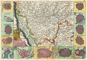
Nouvelle Carte du Piemont. / Nieuwe Kaart van Piemont.
sold
- Digital Map Information
- Suitable for large format printing
- DPI: 300
- File Size: 4.35 MB
- File Type: ZIP / TIFF
- ICC color profile embedded
- Delivered instantly via download link
A stunning map of Piedmont, Italy first drawn by Daniel de la Feuille in 1706. This province in northwestern Italy extends north from Milan to the border with Switzerland. ... (more details)
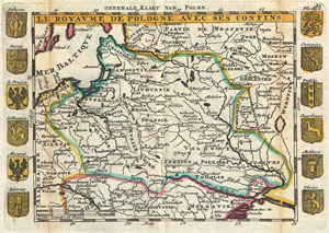
Le Royaume de Pologne avec ses Confins. / Generale Kaart van Polen.
sold
- Digital Map Information
- Suitable for large format printing
- Full resolution TIFF file
- ICC color profile embedded
- Delivered instantly via download link
A stunning map of Poland first drawn by Daniel de la Feuille in 1706. Covers the entire territory of Poland as well as parts of Latvia, Prussia, Hungary, Transylvania, ... (more details)
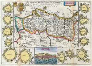
Le Royaume de Portugal et Algarve. / Kaart van Portugaal en Algarve.
sold
- Digital Map Information
- Suitable for large format printing
- Full resolution TIFF file
- ICC color profile embedded
- Delivered instantly via download link
A stunning map of Portugal first drawn by Daniel de la Feuille in 1706. Covers the entire territory of Portugal with the Algarve shown as a separate kingdom. Also ... (more details)
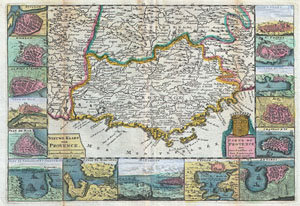
Nieuwe Kaart van Provence. / Carte de Provence Avec ses Confins et Ses Fortereses.
sold
- Digital Map Information
- Suitable for large format printing
- Full resolution TIFF file
- ICC color profile embedded
- Delivered instantly via download link
A stunning map of Provence ( Provençal ), France first drawn by Daniel de la Feuille in 1706. Flanked on either side by views and plans of important Provençal ... (more details)
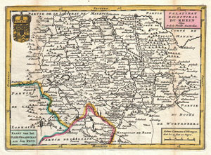
Palatinat Eslectoral du Rhein. Kaart van het Palts Graafschap aan den Rhyn.
sold
- Digital Map Information
- Suitable for large format printing
- DPI: 300
- File Size: 2.67 MB
- File Type: ZIP / TIFF
- ICC color profile embedded
- Delivered instantly via download link
A stunning map of GermanyÂ's Rhineland first drawn by Daniel de la Feuille in 1706. Depicts from Alsace and Lorraine eastward to Württemberg ad northwards ... (more details)
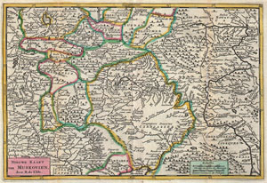
Nieuwe Kaart van Muskovien.
sold
- Digital Map Information
- Suitable for large format printing
- DPI: 300
- File Size: 10.94 MB
- File Type: ZIP / TIFF
- ICC color profile embedded
- Delivered instantly via download link
A stunning map of central Russia or Moscovie (Muskovien). Drawn by Daniel de la Feuille in 1706 based upon an earlier map by De L'Isle, who is credited in the ... (more details)
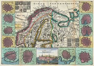
Royaume de Suede. / Kaart van Sweden.
sold
- Digital Map Information
- Suitable for large format printing
- DPI: 300
- File Size: 4.27 MB
- File Type: ZIP / TIFF
- ICC color profile embedded
- Delivered instantly via download link
A stunning map of Scandinavia first drawn by Daniel de la Feuille in 1706. Covers all of Norway, Sweden and Finland along with parts of modern day Latvia, ... (more details)
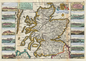
Carte Nouvelle D'Ecosse. / Nieuwe Kaart van Schotland.
sold
- Digital Map Information
- Suitable for large format printing
- DPI: 300
- File Size: 4.03 MB
- File Type: ZIP / TIFF
- ICC color profile embedded
- Delivered instantly via download link
A stunning map of Scotland first drawn by Daniel de la Feuille in 1706. Depicts the entirety of Scotland surrounded by views of fourteen Scottish cities, ... (more details)
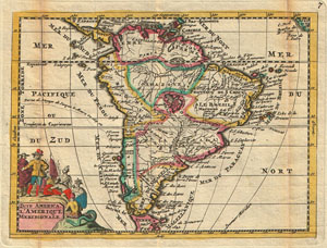
Zuyd America/ / L'Amerique Meridionale.
sold
- Digital Map Information
- Suitable for large format printing
- DPI: 300
- File Size: 2.01 MB
- File Type: ZIP / TIFF
- ICC color profile embedded
- Delivered instantly via download link
A stunning map of South America first drawn by Daniel de la Feuille in 1706. Continent is represented according to the 18th century political geography. ... (more details)
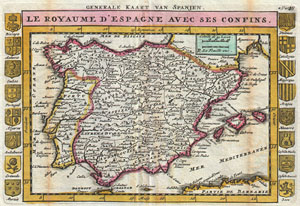
Generale Kaart van Spanjen. / Le Royaume D'Espagne avec ses Confins.
sold
- Digital Map Information
- Suitable for large format printing
- DPI: 300
- File Size: 2.65 MB
- File Type: ZIP / TIFF
- ICC color profile embedded
- Delivered instantly via download link
A stunning map of Spain and Portugal first drawn by Daniel de la Feuille in 1706. Depicts the entirety of Iberia including the Balearic Islands, parts of ... (more details)
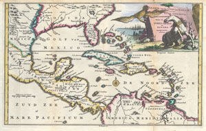
Kaarte Van de Golf van Mexico en het Zuyd-America waar in Porto-Bello en Panama aangewezen warden.
sold
- Digital Map Information
- Suitable for large format printing
- Full resolution TIFF file
- ICC color profile embedded
- Delivered instantly via download link
Engraved by Balthasar Ruyter, this is an extremely rare and highly unusual 1747 map of Mexico, the Caribbean, the West Indies and Florida. Covers from ... (more details)