
Schenk, Petrus (sold)
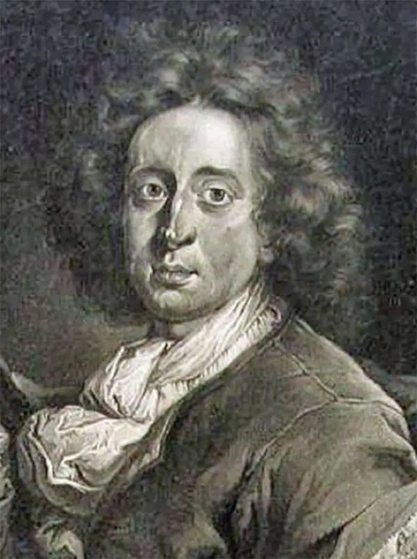
Petrus Schenk (Pieter Schenck) the Elder (December 26, 1660 - 1711) was a Dutch engraver, globe maker, and map publisher active in Amsterdam and Leipzig in the latter half of the 17th century. Schenk, was born in Elberfield, Germany. He moved in Amsterdam in 1675, becoming the apprentice to Gerard Valk (Valck). In 1687, Schenk married Agatha Valk, Gerard Valk's sister and went into partnership with his brother-in-law under the imprint of 'Valk and Schenk'. Initially they focused on maps and atlases, acquiring the map plates of Jan Jansson and Jodocus Hondius in 1694. Later, in 1701 they moved into the former Hondius offices where they began producing globes. Valk and Schenk quickly became known for producing the best globes in the Netherlands, a business on which they held a near monopoly for nearly 50 years. Schenk's three sons, Pieter Schenk the Younger, Jan Schenk, and Leonard Schenk, all became engravers in their own right. Pieter Schenk the Younger inherited the business and ran his father's shop in Leipzig. His daughter, Maria Schenk, married Leonard Valk, the son of Gerard Valk, and continued to run the Valk and Schenk map engraving workshop in Amsterdam.
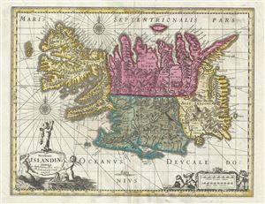
Novissima Islandiae Tabula.
sold
- Digital Map Information
- Suitable for large format printing
- Full resolution TIFF file
- ICC color profile embedded
- Delivered instantly via download link
This is a beautiful c.1680 map of Iceland by Gerard Valk and Pieter Schenk. It covers the entire north Atlantic Island of Iceland and notes the four primary provinces in color. Iceland had been fairly well mapped since the late 16th century. This map notes ... (more details)
A beautiful and some would say underappreciated map of central Mexico.
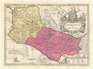
Nova Hispania et Nova Galicia.
sold
- Digital Map Information
- Suitable for large format printing
- DPI: 300
- File Size: 8.78 MB
- File Type: ZIP / TIFF
- ICC color profile embedded
- Delivered instantly via download link
This is a scarce and often underappreciated c. 1690 Petrus Schenk and Gerard Valk map of Mexico or New Spain. Depicting the viceroyalty granted to Hernan Cortez following his conquest of the Aztec Empire, this map details, roughly, from Mexico City westward ... (more details)
The scarce last derivative of Smith's map of Virginia.
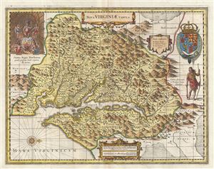
Nova Virginiae Tabula.
sold
- Digital Map Information
- Suitable for large format printing
- DPI: 300
- File Size: 13.81 MB
- File Type: ZIP / TIFF
- ICC color profile embedded
- Delivered instantly via download link
A fine example of the scarce c. 1694 Schenk and Valk map of Virginia and the Chesapeake Bay. Oriented to the west, this map covers from Cape Henry to the Susquehanna River and inland as far as the Appalachian Mountains. The Chesapeake Bay is shown in full ... (more details)
Rare, High Baroque Double Hemisphere World Map, with Allegorical Vignettes.
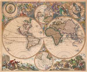
Haemisphaeriorum Tabula Carthesiana P. Schenkii.
sold
- Digital Map Information
- Suitable for large format printing
- Full resolution TIFF file
- ICC color profile embedded
- Delivered instantly via download link
Rare. This is a c. 1700 Pieter Schenk map of the world in a double hemisphere projection. The map draws on a number of 17th century sources - the insular California and the tentative coastline of the Pacific Northwest derive from Sanson; the depiction of Abel Tazman's discoveries in Australia and the South Pacific resembles that of Blaeu and De Wit; there is considerable influence from Carel Allard's map of 1696 as well, particularly in the inclusion of the Great Lakes in North America, and a Hennepin-type Mississippi River with its outlet in the vicinity of Galveston Bay. The map includes the La Salle expedition Fort Prudhomme on the Mississippi, the first French settlement in what would become Tennessee. Unlike Allard's map (and Schenk's own 1706 world map), the present composition contains considerable decorative flourish. There are putti nestled in the cruxes of the two hemispheres: the southern one puffing a flowery wind, and the northern one brandishing a star, which may be the North Star. Above and below the cruxes of the main hemispheres are a pair of polar projections illustrating the parts of the globe least understood until well into the 19th century. (more details)
Gorgeous map of the Lesser Antilles that labels St. Lucia, Barbados, and Puerto Rico.
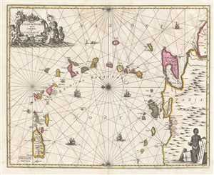
Insula S. Juan de Puerto Rico Caribes; Vel Canibasum Insulae.
sold
- Digital Map Information
- Suitable for large format printing
- DPI: 300
- File Size: 8.88 MB
- File Type: ZIP / TIFF
- ICC color profile embedded
- Delivered instantly via download link
This is an attractive c. 1700 map of the Lesser Antilles by Petrus Schenk and Gerard Valk based on a 1650 map by Jan Jansson. Oriented toward the east, the map depicts the region from Puerto Rico to Venezuela and from the Atlantic Ocean and Barbados to ... (more details)
The First Major Innovation in the mapping of Italy since Magini.
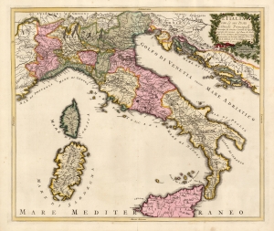
L'Italia con Le sue Poste e Strade Principali descritta da Giacomo Cantelli da Vignola Geografo del Serenis. Sigr. Duca di Moda. Data in luce d Pietro Schenk Intagliator in Rame in Amsterdam con Privilegio delli miei Seci: S le Seci: S: Stati di Hollanda et di West Frisia, il primo di Settembre 'l Anno 1701.
sold
- Digital Map Information
- Suitable for large format printing
- Full resolution TIFF file
- ICC color profile embedded
- Delivered instantly via download link
This is a beautiful example of a scarce, 1701 Peter Schenk map of Italy, focusing specifically on the country's post roads. It is derived from, and credits, the similarly-titled 1695 map produced by the Italian mapmaker Giacomo Cantelli da Vignola. Cantelli's map, printed in the year of that mapmaker's death, was the first significantly updated map of Italy to appear since Magini's 1608 Italia Nuova, which provided the basis for most maps of Italy issued in 17th and early 18th centuries. (more details)
Correcting the Caspian.
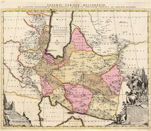
Imperii Persici delineatio ex scriptis potissimum geographicis Arabum et Persarum tentata ab Adriano Relando.
sold
- Digital Map Information
- Suitable for large format printing
- DPI: 600
- File Size: 68.44 MB
- File Type: ZIP / TIFF
- ICC color profile embedded
- Delivered instantly via download link
This is a beautiful, original-color example of Adrian Reland's map of the Persian Empire, in its 1705 first printing, engraved and published by Peter Schenk. It is one of the most detailed maps of Persia of the turn of the 18th century, reconciling Persian mapping with existing Dutch maps. It is one of the first maps to correct the orientation of the Caspian Sea along its proper north-south axis. It is also the first map to accurately present Persian toponymy to the European audience. (more details)
A milestone in the history of cartography marking a transition to the more `rational' 18th century approach.
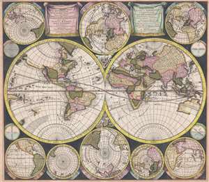
Diversa Orbis Terrae. Visu Incedente per Coluros Tropicorum, Ambos Ejus Polos, Et Particularis Sphaerae Zenithm In Planum Orthographica Projectio. / Pla Ontwer van verschey de Aert-Klooten…
sold
- Digital Map Information
- Suitable for large format printing
- DPI: 300
- File Size: 15.44 MB
- File Type: ZIP / TIFF
- ICC color profile embedded
- Delivered instantly via download link
This is a 1706 Pieter Schenk map of the world in a double hemisphere projection, with the western hemisphere on the left and the eastern hemisphere on the right. Based on Carel Allard's map of 1696, this map, along with the Allard map, represent a noteworthy shift away from the traditional decorative margins populated by mythological figures and references toward a much more scientific appearance. Here we find only two small groups of cherubs placed in between the two largest hemispheres, with the decorative border replaced by eight smaller projections depicting the world from different angles and four even smaller diagrams.
Several intriguing aspects of cartography are present here, including California as an island and Terra Esonis, a vestige from the previous century believed to be a continuous land bridge from the semi-mythical Strait of Anian to Asia. It is also important to note the presence of the mythical Laguna de Xarayes and the fact that Australia, depicted in the lower right portion of the Eastern Hemisphere, is not complete. This incomplete depiction of Australia also appears in the smaller map in the upper left corner, and the map in the middle of series of five maps along the bottom border. In the latter two, New Zealand is illustrated and labeled, though only partially. It is also of note that no Great Southern Continent is included, as it was believed that the existence of a large southern continent was necessitated by Asia to balance the globe. (more details)
Several intriguing aspects of cartography are present here, including California as an island and Terra Esonis, a vestige from the previous century believed to be a continuous land bridge from the semi-mythical Strait of Anian to Asia. It is also important to note the presence of the mythical Laguna de Xarayes and the fact that Australia, depicted in the lower right portion of the Eastern Hemisphere, is not complete. This incomplete depiction of Australia also appears in the smaller map in the upper left corner, and the map in the middle of series of five maps along the bottom border. In the latter two, New Zealand is illustrated and labeled, though only partially. It is also of note that no Great Southern Continent is included, as it was believed that the existence of a large southern continent was necessitated by Asia to balance the globe. (more details)
Bringing the Baroque into the Scientific Age: Precursor to Zurner's famous map.
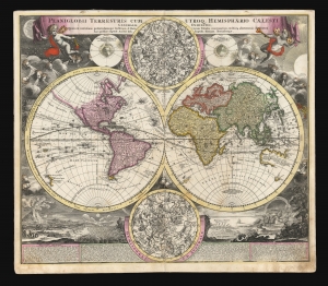
Planiglobii Terrestris Cum Utroq. Hemisphaerio Caelesti Generalis Exhibitio.
sold
- Digital Map Information
- Suitable for large format printing
- DPI: 600
- File Size: 77.87 MB
- File Type: ZIP / TIFF
- ICC color profile embedded
- Delivered instantly via download link
This is the scarce first plate of Johann Baptist Homann's 1707 map of the world in a double hemisphere projection. It is both long misunderstood and mis-identified: it was a novel and influential adaptation of up-to-date cartographic information (including the explorations of Dampier and the studies of Edmund Halley). Moreover, the present example is the first plate, engraved by or for the elder Homann in 1707. Most examples of the map of this title appearing on the market are a different plate, engraved by Homann's son no earlier than 1724 (identified by the Imperial privilege.) Thus the present example is the most desirable of Homann's world maps. (more details)
Presenting the obsolete, geocentric, model of the universe
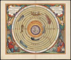
Planisphaerium Ptolemaicum, sive Machina Orbium Mundi Ex Hypothesi Ptolemaica in Plano Disposita.
sold
- Digital Map Information
- Suitable for large format printing
- File Size: 28.06 MB
- File Type: ZIP / TIFF
- ICC color profile embedded
- Delivered instantly via download link
This beautiful work is Andreas Cellarius' celestial chart, in its 1708 Valk and Schenk edition, illustrating the geocentric solar system imagined by Claudius Ptolemy in the 2nd century, and which remained the standard model of the universe until the 16th century and the discoveries of Nicolas Copernicus. It is among the most beautiful depictions of the Earth-centered solar system produced in the 17th century. (more details)
Ptolemy's Earth-Centered Universe.
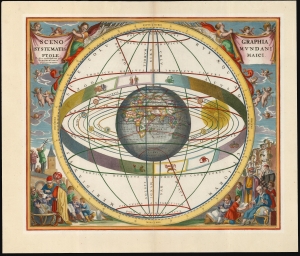
Scenographia Systematis Mundani Ptolemaici.
sold
- Digital Map Information
- Suitable for large format printing
- File Size: 22.18 MB
- File Type: ZIP / TIFF
- ICC color profile embedded
- Delivered instantly via download link
This beautiful work is Andreas Cellarius' celestial chart, in its 1708 Valk and Schenk edition, illustrating the geocentric solar system theorized by the 2nd-century astronomer Claudius Ptolemy. One of Cellarius' most visually engaging celestial charts, it centers on a beautifully engraved hemisphere and depicts the orbits around it of the Moon, Mercury, Venus, the Sun, Mars, Jupiter, and Saturn. Surrounding the orbiting planets is the celestial sphere, divided into circles. Cellarius' lush, baroque presentation frames the chart with a sky filled with putti while on the ground, scholars, astronomers, and their students measure the sky and confer over books and globes. (more details)
Lavishly illustrated celestial chart.
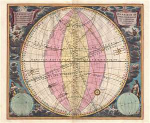
Haemisphaeria Sphaerarum Rectae Et Obliquae Utriusque Motus Et Longitudines Tam Coelestes Quam Terrestres Ac Stellarum Affectiones Monstrantia.
sold
- Digital Map Information
- Suitable for large format printing
- DPI: 300
- File Size: 10 MB
- File Type: ZIP / TIFF
- ICC color profile embedded
- Delivered instantly via download link
A fine 1708 Andreas Cellarius celestial chart illustrating the motions of the upright (the Equatorial Coordinate System) and oblique spheres (the Ecliptic Coordinate System), the Celestial and Terrestrial Longitudes, and the influence of the stars. The surround is lavishly decorated with finely engraved and colored images of clouds, putti, and two sub-diagrams. It is of note that this is a beautifully colored example with giltwork incorporated into the color. (more details)
The lunar theories of Claudius Ptolemy in stunning old color.
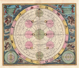
Theoria Lunae, eius Motum per Eccentricum et Epicyclum Demonstrans.
sold
- Digital Map Information
- Suitable for large format printing
- DPI: 300
- File Size: 9.22 MB
- File Type: ZIP / TIFF
- ICC color profile embedded
- Delivered instantly via download link
A fine 1708 Andreas Cellarius celestial chart illustrating the Claudius Ptolemy model of lunar motion. The chart illustrates the lunar epicycles as the moon revolves along various orbits. The central chart is bordered zodiacal iconography. The ... (more details)
Stunningly beautiful old color.
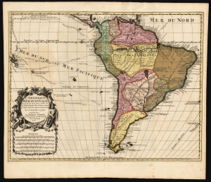
L' Amerique Meridionale, Dressée sur les Observations de Mrs. de l'Academie Royale des Sciences, et quelques autres, et sur les Memoires les plus recens Par G. De l'Isle Geographe. a Amsterdam chez Pierre Schenk sur le vygendam, a l' Atlas de Sanson. Avec Privilege 1708.
sold
- Digital Map Information
- Suitable for large format printing
- File Size: 21.18 MB
- File Type: ZIP / TIFF
- ICC color profile embedded
- Delivered instantly via download link
This is a magnificent example of Peter Schenk's 1708 edition of De L'Isle's 1700 map of South America, with striking rich original color. The map embraces South America from Barbados southwards to just beyond Tierra del Fuego. Although derivative of De L'Isle, the map is richly decorative with a wealth of intriguing cartographic anomalies and tidbits. (more details)
The most beautiful old color example of Zurner's transitional map of America we have seen!
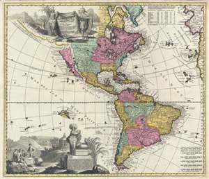
Americae tam Septentrionalis quam Meridionalis in Mappa Geographica Delineatio…
sold
- Digital Map Information
- Suitable for large format printing
- DPI: 300
- File Size: 18.42 MB
- File Type: ZIP / TIFF
- ICC color profile embedded
- Delivered instantly via download link
Probably the most beautiful old color example of Adam Friedrich Zurner and Pieter Schenk's 1709 map of the Americas. The map covers all of North America and South America, with California as an island, as well as much of the Pacific and the ... (more details)
Incudes the New England Globe Flag - one of the earliest illustrations of a purely American flag.
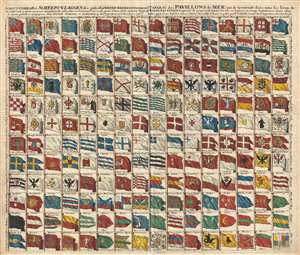
Schouw-park aller Scheeps-Vlaggen des geheelen Water-Waerelds . . . / Tableau des Pavillons de Mer, qui se trouvent dans tous les lieux du Monde Aquatique Augmente de 50 aui n ont jamais ete mis en lumiere . . . 1711.
sold
- Digital Map Information
- Suitable for large format printing
- DPI: 300
- File Size: 17.19 MB
- File Type: ZIP / TIFF
- ICC color profile embedded
- Delivered instantly via download link
A rare and exceptional 1711 flag chart by Petrus Schenk illustrating the ephemeral Globe Flag of New England, as well as the flags of various trading companies, including the Dutch East India Company (VOC, Verenigde Oostindische Compagnie ) ... (more details)
Grandest, Most Beautiful Map of Switzerland of the 18th Century.
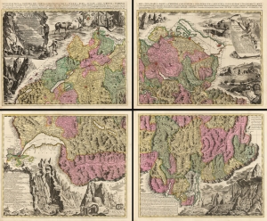
Nova Helvetiae Tabula Geographica Illustrissimis et Potentissimis Cantonibus et Rebuspublicis Reformatae Religionis Tigurinae, Bernensi Scaphusianae, Abbatis Cellanae...
sold
- Digital Map Information
- Suitable for large format printing
- Full resolution TIFF file
- ICC color profile embedded
- Delivered instantly via download link
This is Johann Jacob Scheuchzer's four-sheet map of Switzerland in its spectacular 1715 Pieter Schenk Amsterdam edition. Map historian Tony Campbell wrote, 'Its borders make it probably the most handsome map ever produced of Switzerland; yet the carefully labeled tableaux were intended as scientific illustrations, not just decoration.' Schenk's edition is brighter and more legible than the Zurich edition. (more details)