
Sherman and Smith (sold)

Sherman and Smith (fl. c. 1829 - 1855), sometimes working as Stiles, Sherman & Smith, were American engravers active in New York City during the middle part of the 19th century. The firm including John Calvin Smith (surveyor and engraver), George E. Sherman, and sometimes, Samuel Stiles. Their work primarily focused on government publications, including the maps and engravings prepared to illustrate the official records of the 1838-42 United States Exploring Expedition (U.S. Ex. Ex.), maps issued for the Army Corps of Topographical Engineers, and various U.S. Coast Survey Charts. They also engraved privately for Thomas Bradford and John Disturnell, among others. Sherman and Smith maintained offices at the corner of Broadway and Liberty Street in New York City and were highly regarded as the finest cartographic engravers in the city. Their non-cartographic legacies include George Inness, who apprenticed with them for two years before going on to become a well regarding American landscape painter of the Hudson River School.
The first and finest scientific map of the Fiji Islands.
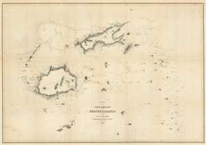
Chart of the Viti Group or Feejee Islands by the U.S. Ex. Ex.
sold
- Digital Map Information
- Suitable for large format printing
- DPI: 600
- File Size: 30 MB
- File Type: ZIP / TIFF
- ICC color profile embedded
- Delivered instantly via download link
A beautiful example of Wilkes' 1840 map of the Fiji Islands. Considered to be the first accurate scientifically produced map of the Fiji Islands, this map includes three main islands, Vanua Levu, Viti Levu, and Taveuni as well as the Yasawa Group and countless lesser islands. Topography is rendered by hachure and shoals, reefs, and other undersea dangers are indicated with shading. (more details)
The first accurate map of the Fiji Islands.
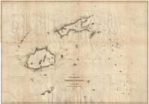
Chart of the Viti Group or Feejee Islands by the U.S. Ex. Ex.
sold
- Digital Map Information
- Suitable for large format printing
- Full resolution TIFF file
- ICC color profile embedded
- Delivered instantly via download link
A beautiful example of Wilkes' 1840 map of the Fiji Islands. Considered to be the first accurate map of the Fiji Islands, this map includes three main islands, Vanua Levu, Viti Levu, and Taveuni as well as the Yasawa Group and countless lesser islands. Topography ... (more details)
The first and finest scientific map of the Fiji Islands.
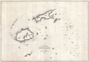
Chart of the Viti Group or Feejee Islands by the U.S. Ex. Ex.
sold
- Digital Map Information
- Suitable for large format printing
- Full resolution TIFF file
- ICC color profile embedded
- Delivered instantly via download link
A beautiful example of Wilkes' 1840 map of the Fiji Islands. Considered to be the first accurate scientifically produced map of the Fiji Islands, this map includes three main islands, Vanua Levu, Viti Levu, and Taveuni as well as the Yasawa Group and countless ... (more details)
The map that definitively established Antarctica's continental nature.
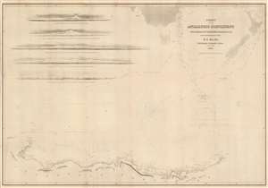
Chart of the Antarctic Continent Shewing the Icy Barrier Attached to It Discovered by the U.S. Ex. Ex.
sold
- Digital Map Information
- Suitable for large format printing
- Full resolution TIFF file
- ICC color profile embedded
- Delivered instantly via download link
This important and extraordinary production is Commodore Wilkes's 1840 U.S. exploring expedition map of Antarctica. Of extraordinary importance to Antarctica collectors, the surveying of this coast and this resulting map are the first to definitively prove Antarctica's continental nature. Among the many great achievements of the U.S. exploring expedition, and Wilkes specifically, the surveying of the Antarctic coast now known as Wilkes Land, stands out as the most significant. The chart covers that portions of Antarctica now known as Wilkes Land, located due south of New Zealand and Australia (ghosted in at the top of this chart), roughly from Cape Hordern (100°31' e) to Point Alden (142°02' e). Five profile charts in the upper left quadrant offer views of the Antarctic shoreline. (more details)
1871 Reissue of a seminal 1841 map.
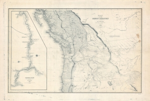
Map of the Oregon Territory by the U.S. Ex. Ex.
sold
- Digital Map Information
- Suitable for large format printing
- File Size: 113.73 MB
- File Type: ZIP / TIFF
- ICC color profile embedded
- Delivered instantly via download link
This is the 1871 U.S.H.O. reissue of Commodore Wilkes' 1841 U.S. exploring expedition map of Oregon Territory, the finest and most important map of Oregon of the 19th century. The reissue was prepared from the original copper plate and is on higher quality paper than the original 1841 report issue. (more details)
The first geometrically constructed map of any significant portion of Hawaii. - Fitzpatrick
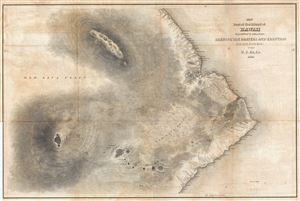
Map of Part of the Island of Hawaii Sandwich Islands Shewing the Craters and Eruption of May and June 1840.
sold
- Digital Map Information
- Suitable for large format printing
- DPI: 300
- File Size: 16.9 MB
- File Type: ZIP / TIFF
- ICC color profile embedded
- Delivered instantly via download link
This extraordinary production is Commodore Wilkes' 1841 U.S. Exploring Expedition map of the island of Hawaii. An incredibly important work, this is, according to Fitzpatrick, the 'first geometrically constructed map of any significant portion of Hawaii.' ... (more details)
The 'first geometrically constructed map of any significant portion of Hawaii.' - Fitzpatrick
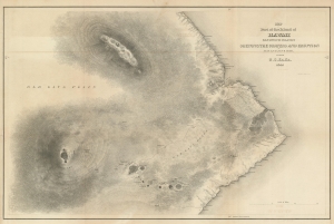
Map of Part of the Island of Hawaii Sandwich Islands Shewing the Craters and Eruption of May and June 1840.
sold
- Digital Map Information
- Suitable for large format printing
- DPI: 600
- File Size: 28.81 MB
- File Type: ZIP / TIFF
- ICC color profile embedded
- Delivered instantly via download link
This extraordinary production is Commodore Wilkes' 1841 U.S. Exploring Expedition map of the island of Hawaii. An incredibly important work, this is, according to Fitzpatrick, the 'first geometrically constructed map of any significant portion of Hawaii.' Wilkes' map covers the vicinity of the volcanoes Mauna Loa, Mauna Kea, and Kilauea as well as the Hawaiian shoreline roughly between Laupahoehoe and Kahaualea, including Hilo Bay and city. Topography is rendered in striking hachure. (more details)
Seminal Map of the Pacific Northwest.
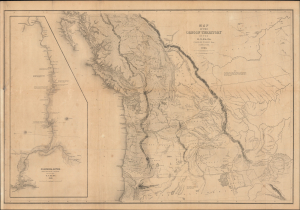
Map of the Oregon Territory by the U.S. Ex. Ex.
sold
- Digital Map Information
- Suitable for large format printing
- Full resolution TIFF file
- ICC color profile embedded
- Delivered instantly via download link
This Commodore Wilkes' rare large-format 1841 U.S. Exploring Expedition (U.S. Ex. Ex.) map of Oregon Territory, which appeared in the expedition Atlas. Wilkes' map was the finest and most detailed map of this largely unknown Oregon-Washington-Vancouver-Idaho region yet published and is considered by map historian Carl I. Wheat to be 'really quite extraordinary'. (more details)
A definitive map of the Pacific Northwest, considered by Wheat, 'really quite extraordinary.'
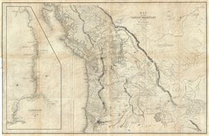
Map of the Oregon Territory by the U.S. Ex. Ex.
sold
- Digital Map Information
- Suitable for large format printing
- DPI: 300
- File Size: 29.57 MB
- File Type: ZIP / TIFF
- ICC color profile embedded
- Delivered instantly via download link
This important and extraordinary production is Commodore Wilkes' 1841 U.S. Exploring Expedition map of Oregon Territory. The map covers roughly from the 50th parallel to Mount Shasta, the upper Sacramento River, and Great Salt Lake (labeled Youta Lake) ... (more details)
A definitive map of the Pacific Northwest, considered by Wheat, 'really quite extraordinary.'
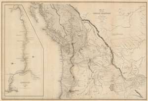
Map of the Oregon Territory by the U.S. Ex. Ex.
sold
- Digital Map Information
- Suitable for large format printing
- DPI: 600
- File Size: 59.51 MB
- File Type: ZIP / TIFF
- ICC color profile embedded
- Delivered instantly via download link
This important and extraordinary production is Commodore Wilkes' 1841 U.S. exploring expedition map of Oregon Territory, the finest and most important map of Oregon of the 19th century. The map covers roughly from the 50th parallel to Mount Shasta, the upper Sacramento River, and Great Salt Lake (Youta Lake) and from the Pacific to the Black Hills. It includes, either in part or full, modern day Washington, Oregon, British Columbia, Vancouver, Idaho, Utah, Nevada, Montana, Wyoming, and California. A large inset occupying the left quadrants focuses on the Columbia River where the United States exploring expedition lost one of its ships, the Peacock, on the infamous Columbia Bar. Topography is rendered by hachure and the engravers even made some attempt to illustrate the vast pine forests of the Pacific Northwest. (more details)
The first world map to show any significant portion of the Antarctic Coast.
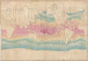
Chart of the World Shewing the tracks of the U.S. Exploring Expedition in 1838, 39, 40, 41 & 42.
sold
- Digital Map Information
- Suitable for large format printing
- DPI: 300
- File Size: 24.35 MB
- File Type: ZIP / TIFF
- ICC color profile embedded
- Delivered instantly via download link
This important and extraordinary production is Commodore Wilkes's 1840 U.S. exploring expedition map of the World. Presented on a Mercator Projection, this chart covers the globe from the high arctic to the Antarctic Coast. The map is color coded to represent isothermal lines, with variances in shading representing 5 degrees of temperature difference. In addition, Wilkes also shows currents and winds. Wilkes intended this map to present a general overview of the accomplishments of the U.S. Exploring Expedition (1838 - 1842). (more details)
First world map to show any significant portion of the Antarctic Coast.
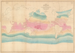
Chart of the World Shewing the tracks of the U.S. Exploring Expedition in 1838, 39, 40, 41 and 42.
sold
- Digital Map Information
- Suitable for large format printing
- DPI: 600
- File Size: 36.36 MB
- File Type: ZIP / TIFF
- ICC color profile embedded
- Delivered instantly via download link
This important production is Commodore Wilkes's 1840 U.S. Exploring Expedition map of the World. Presented on a Mercator Projection, this chart covers from the high Arctic to the Antarctic, with unique color coding illustrating isothermal lines, with variances in shading representing 5 degrees of temperature difference. In addition, Wilkes also shows currents and winds. Wilkes intended this map to present a general overview of the accomplishments of the U.S. Exploring Expedition (1838 - 1842). (more details)
Seminal map of Georgia.
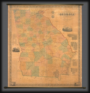
Map of the State of Georgia compiled under the direction of His Excellency George W. Crawford by Wm. G. Bonner, Civil Engineer.
sold
- Digital Map Information
- Suitable for large format printing
- DPI: 600
- File Size: 122.68 MB
- File Type: ZIP / TIFF
- ICC color profile embedded
- Delivered instantly via download link
An excellent example of William G. Bonner's rare, important, and monumental 1847 map of Georgia, here in its first edition, first state. When issued, this was the first major map of the state to appear in almost 20 years, and thus the first to represent Georgia with some approximation of its modern borders. It is, moreover, the first major map to illustrate the westward expansion of Georgia in the 1830s and 40s, with the annexation of Creek and Cherokee territory. It is also one of the few maps to clearly delineate the Georgia-Florida border dispute. (more details)
Highly decorative map promoted as the 'largest best, and most detaled' map fo the United States to appear as of 1849.
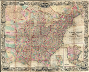
Map of the United States of America Including Canada, and a large portion of Texas, Showing Base Meridian and Township Lines of the U.S. Surveys, Including Lands alotted to the Indian Tribes west of the Mississippi, The various internal improvements.
sold
- Digital Map Information
- Suitable for large format printing
- DPI: 300
- File Size: 147.52 MB
- File Type: ZIP / TIFF
- ICC color profile embedded
- Delivered instantly via download link
A striking large format 1849 case map of the United States by J. Calvin Smith. The map covers from Austin Texas to the eastern seaboard and from Lake Superior to the Gulf of Mexico. When it was introduced, this map was hailed as the largest, best, and ... (more details)
Important Gold Rush map detailing the California Gold Region and showing Texas at its largest.
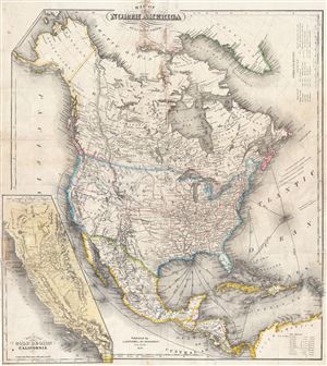
Map of North America by J. Calvin Smith.
sold
- Digital Map Information
- Suitable for large format printing
- DPI: 300
- File Size: 17.84 MB
- File Type: ZIP / TIFF
- ICC color profile embedded
- Delivered instantly via download link
An extremely scarce 1850 map of North America by J. Calvin Smith. Published to capitalize on the mass westward migrations associated with the 1849 California Gold Rush, this map covers all of North American and Central America from Panama to the Arctic ... (more details)
Important Gold Rush map detailing the California Gold Region and showing Texas at its largest.

Map of North America by J. Calvin Smith.
sold
- Digital Map Information
- Suitable for large format printing
- DPI: 300
- File Size: 22.62 MB
- File Type: ZIP / TIFF
- ICC color profile embedded
- Delivered instantly via download link
An extremely scarce 1850 map of North America by J. Calvin Smith. Published to capitalize on the mass westward migrations associated with the 1849 California Gold Rush, this map covers all of North American and Central America from Panama to the Arctic ... (more details)
By stage, canal, and railroad from Ohio to Iowa.
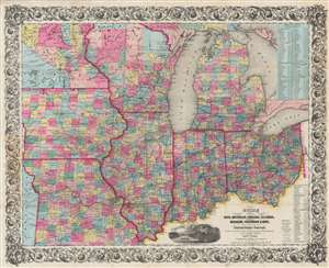
Guide Through Ohio, Michigan, Indiana, Illinois, Missouri, Wisconsin, and Iowa. Showing the Township lines of the United States Surveys, Location of Cities, Towns, Villages, Post Hamlets, Canals, Rail and Stage Roads.
sold
- Digital Map Information
- Suitable for large format printing
- DPI: 600
- File Size: 101.01 MB
- File Type: ZIP / TIFF
- ICC color profile embedded
- Delivered instantly via download link
This is an 1854 John Calvin Smith and John H. Colton map of Ohio, Michigan, Indiana, Illinois, Missouri, Wisconsin, and Iowa, along with part of Minnesota. Counties are shaded and township grids are illustrated where they have been surveyed. Cities and towns are labeled throughout, along with rivers, lakes, and creeks. (more details)
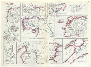
Troja. Thermopylae. Marathon. Plataea. Mantinea. Leuctra. Route of Xenophon and the Ten Thousand Greeks. Granicus. Issus. Arbela. Thracian Bosporus. Alexandria.
sold
- Digital Map Information
- Suitable for large format printing
- File Size: 3.64 MB
- File Type: ZIP / TIFF
- ICC color profile embedded
- Delivered instantly via download link
This is a fascinating 1867 map by William Hughes featuring topographical maps of ancient cities and battle sites. The map essentially contains twelve maps on a single sheet, each focusing on a different city or town, where important ancient battles ... (more details)
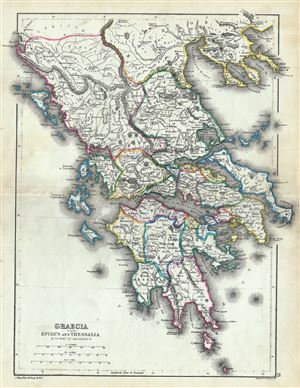
Graecia including Epirus and Thessalia with part of Macedonia.
sold
- Digital Map Information
- Suitable for large format printing
- File Size: 4.51 MB
- File Type: ZIP / TIFF
- ICC color profile embedded
- Delivered instantly via download link
This is a fine 1867 map of ancient Greece by William Hughes. The map focuses on Greece in antiquity, covering from Cythera to Thessaloniea in Macedonia. Ancient Epirus and Thessalia are also included. The map notes several towns and cities and ... (more details)
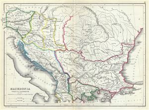
Macedonia Thracia, Illyricum and the Provinces on the Middle and Lower Danube.
sold
- Digital Map Information
- Suitable for large format printing
- File Size: 3.85 MB
- File Type: ZIP / TIFF
- ICC color profile embedded
- Delivered instantly via download link
This is an attractive 1867 map of Macedonia and the Balkans in antiquity by William Hughes. The map depicts Macedonia, Thrace, Illyricum and the provinces on the middle and lower Danube, covering parts of modern day Greece, Macedonia, Albania, ... (more details)
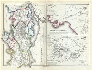
Part of Attica with Boeotia, Phocis Locris, Megaris etc.
sold
- Digital Map Information
- Suitable for large format printing
- File Size: 3.99 MB
- File Type: ZIP / TIFF
- ICC color profile embedded
- Delivered instantly via download link
This is a fascinating 1867 map of Athens along with parts of Attica, including Boeotia and Phocis in ancient Greece, by William Hughes. Essentially three maps on a single sheet, the first map covers Attica in ancient Greece from the Malian ... (more details)
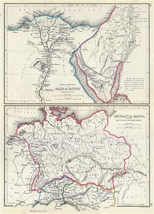
Arabia Petraea and Part of Egypt including the Delta. Germania Magna with the Provinces on the Upper Danube.
sold
- Digital Map Information
- Suitable for large format printing
- File Size: 3.63 MB
- File Type: ZIP / TIFF
- ICC color profile embedded
- Delivered instantly via download link
This is an unusual 1867 map by William Hughes featuring Egypt and Germany in antiquity. Essentially two maps on a single sheet, the top map focuses on Egypt, including the Sinai Peninsula. This map, centered on the Nile Valley, identifies ... (more details)
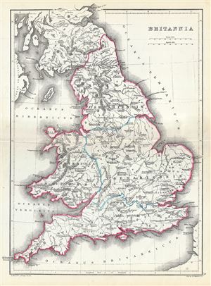
Britannia.
sold
- Digital Map Information
- Suitable for large format printing
- File Size: 3.86 MB
- File Type: ZIP / TIFF
- ICC color profile embedded
- Delivered instantly via download link
This is a scarce 1867 map of England by William Hughes. The map depicts England under Roman rule and covers all of England (Province of Britannia) as well as parts of Scotland. It features contemporary and ancient place names (Londinium ... (more details)
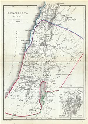
Palaestina with Part of Syria.
sold
- Digital Map Information
- Suitable for large format printing
- File Size: 3.57 MB
- File Type: ZIP / TIFF
- ICC color profile embedded
- Delivered instantly via download link
A scarce 1867 William Hughes Map of Palestine, Israel or the Holy Land in antiquity. Centered on the Jordan River, the map covers the regions between modern day Israel and Lebanon along with parts of Jordan and Syria. An inset in the ... (more details)
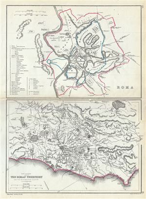
Roma. Part of Italy showing the Roman Territory and the neighbouring country.
sold
- Digital Map Information
- Suitable for large format printing
- File Size: 3.58 MB
- File Type: ZIP / TIFF
- ICC color profile embedded
- Delivered instantly via download link
This is a beautiful 1867 map by William Hughes depicting Rome and the Roman territory in Italy during ancient Roman times. Essentially two maps on a single sheet, the map on top depicts Rome during ancient Roman period. The Wall of ... (more details)
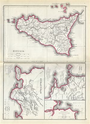
Sicilia. Syracusae. The Bay of Naples and adjacent Part of Campania. The Two Ports of Brundusium (Brindisi).
sold
- Digital Map Information
- Suitable for large format printing
- File Size: 3.68 MB
- File Type: ZIP / TIFF
- ICC color profile embedded
- Delivered instantly via download link
This is a beautiful 1867 map by William Hughes depicting Sicily, Syracuse and important ports in Italy during the Roman period. Essentially four maps on the single sheet, the largest map of Sicily depicts the island during ancient ... (more details)
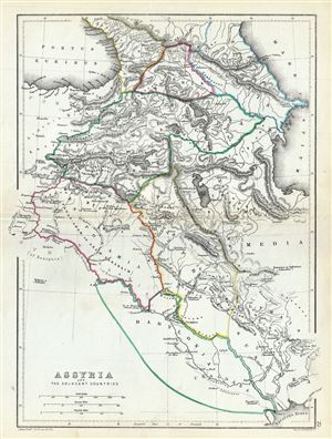
Assyria and the Adjacent Countries.
sold
- Digital Map Information
- Suitable for large format printing
- File Size: 3.85 MB
- File Type: ZIP / TIFF
- ICC color profile embedded
- Delivered instantly via download link
An uncommon 1867 map of ancient Assyria and its neighboring countries by William Hughes. The map focuses on the lands between the Black Sea and the Caspian, commonly known as the Caucuses. It covers the modern day countries of ... (more details)
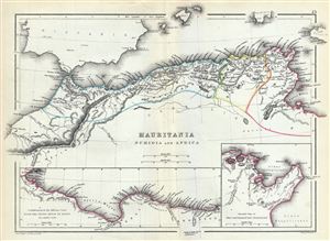
Mauritania Numidia and Africa.
sold
- Digital Map Information
- Suitable for large format printing
- File Size: 3.72 MB
- File Type: ZIP / TIFF
- ICC color profile embedded
- Delivered instantly via download link
This is a beautiful 1867 map of the Barbary Coast or northern Africa in antiquity by William Hughes. The map depicts the ancient empires of Mauritania, Carthage and Numidia or what is today the Barbary Coast. It covers from ... (more details)
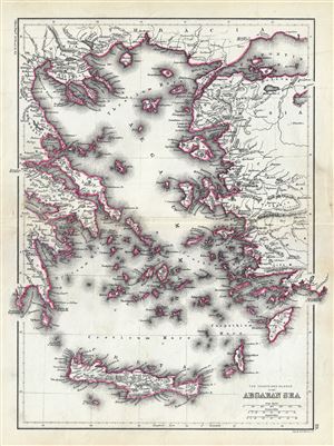
The Coasts and Islands of the Aegean Sea.
sold
- Digital Map Information
- Suitable for large format printing
- File Size: 4.6 MB
- File Type: ZIP / TIFF
- ICC color profile embedded
- Delivered instantly via download link
This is an unusual 1867 map of the islands of the Aegean Sea and the Greek Archipelago, by William Hughes. The map covers the Greek Isles from Thrace south as far as Crete and from the Gulf of Corinth east as far as Lake ... (more details)
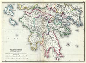
Peloponnesus with Attica and Part of Boeotia.
sold
- Digital Map Information
- Suitable for large format printing
- File Size: 4.41 MB
- File Type: ZIP / TIFF
- ICC color profile embedded
- Delivered instantly via download link
This is a scarce 1867 map of southern Greece during ancient times by William Hughes. The map covers the entire Peloponnese Peninsula including ancient Attica and parts of ancient Boeotia. The map notes several roads, ... (more details)
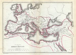
The Provinces of the Roman Empire (A.D. 119).
sold
- Digital Map Information
- Suitable for large format printing
- File Size: 3.5 MB
- File Type: ZIP / TIFF
- ICC color profile embedded
- Delivered instantly via download link
This is a beautiful 1867 map of the Roman Empire by William Hughes. The map shows the extent of the Roman Empire in AD 119, covering most of Europe, the Middle East, Asia Minor and parts of North Africa, including ... (more details)
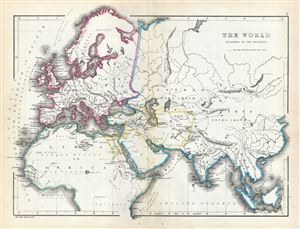
The World as known to the Ancients.
sold
- Digital Map Information
- Suitable for large format printing
- File Size: 3.79 MB
- File Type: ZIP / TIFF
- ICC color profile embedded
- Delivered instantly via download link
This is an interesting 1867 map of the ancient World by William Hughes. The map covers Europe, Asia and Africa during the time of the Ancient Roman Empire. It depicts the world of antiquity from the Atlantic ... (more details)
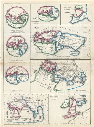
The World According to Homer (B.C. 900). The World According to Hecataeus (about B.C. 500). The World According to Herodotus (about B.C. 440). The World According to Democritus about B.C. 300. The World According to Eratosthenes and Strabo (from about B.C. 200 to A. D. 20). Western Europe According to Strabo. The World According to Ptolemy (about A.D. 160). India According to Ptolemy. Great Britain According to Ptolemy.
sold
- Digital Map Information
- Suitable for large format printing
- File Size: 3.55 MB
- File Type: ZIP / TIFF
- ICC color profile embedded
- Delivered instantly via download link
A fascinating 1867 map by William Hughes featuring the world according to ancient Greek astronomers, poets, historians and geographers. This map includes nine maps on a single sheet, each illustrating the ... (more details)
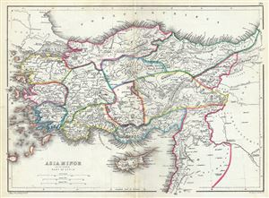
Asia Minor and the Northern Part of Syria.
sold
- Digital Map Information
- Suitable for large format printing
- File Size: 3.97 MB
- File Type: ZIP / TIFF
- ICC color profile embedded
- Delivered instantly via download link
This is a beautiful 1867 map of Turkey or Asia Minor in antiquity by William Hughes. It covers from the Aegean Sea to Mesopotamia and from the Black Sea (Pontus Euxinus) to Cyprus and Lebanon. The map ... (more details)