
Valentine, David T. (sold)
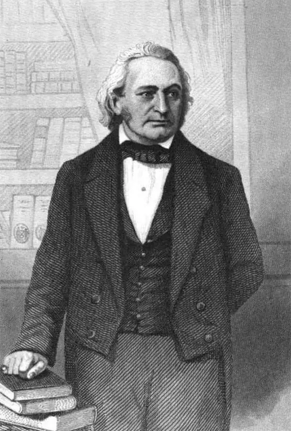
David T. (Thomas) Valentine (1801 - 1869) served as the Clerk of the Common Council of New York City. He edited and published a series of New York City almanacs and fact books entitled Manual of the Corporation of The City of New York. Valentine's Manual, as it came to be called, included facts about the City of New York, City Council information, city history, and reported on the progress of public works such as Central Park. The production of this annual manual was the responsibility of the Clerk of the City of New York, a position held at different times by D. Valentine and by Joseph Shannon (fl. c. 1850 - 1869), who also produced a similar manual. Valentine used his manual to reproduce some of the rarest and most important maps of New York City ever created.
The first published representation of the Duke's Plan of New Amsterdam (New York), 1664.
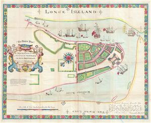
(The Duke's Plan.) A Description of the Towne of Mannados or New Amsterdam as it was in September 1661.
sold
- Digital Map Information
- Suitable for large format printing
- File Size: 20.55 MB
- File Type: ZIP / TIFF
- ICC color profile embedded
- Delivered instantly via download link
This is the 1859 Valentine reissue of the magnificent 'Duke's Plan' of New York City. The original Duke's Plan, a fine illustrated manuscript prepared in 1664 currently resides in the British Library in London. The map was discovered in 1858 by George H. Moore, ... (more details)
The first published representation of the Duke's Plan of New Amsterdam (New York), 1664.
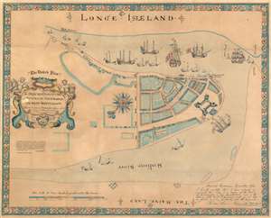
(The Duke's Plan.) A Description of the Towne of Mannados or New Amsterdam as it was in September 1661.
sold
- Digital Map Information
- Suitable for large format printing
- File Size: 39.54 MB
- File Type: ZIP / TIFF
- ICC color profile embedded
- Delivered instantly via download link
This is the 1859 Valentine reissue of the magnificent 'Duke's Plan' of New York City. The original Duke's Plan, a fine illustrated manuscript prepared in 1664 currently resides in the British Library in London. The map was discovered in 1858 by George H. Moore, Librarian of the New York Historical Society after being all but forgotten in the stores of the British Library. Thus, this present example, published by Valentine in 1859, represents the first time this plan was revealed to the general public. (more details)
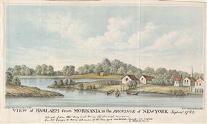
View of Harlaem from Morisania in the Province of New York Septemr 1765.
sold
- Digital Map Information
- Suitable for large format printing
- File Size: 2.98 MB
- File Type: ZIP / TIFF
- ICC color profile embedded
- Delivered instantly via download link
This is a beautiful view of an impressively bucolic Harlem, New York City, in 1765, as seen from Morisania (Morrisania), in the Bronx. Originally the estate of the Morris family in the Westchester County, Morissania Village (formed in 1840 after the railroad was ... (more details)
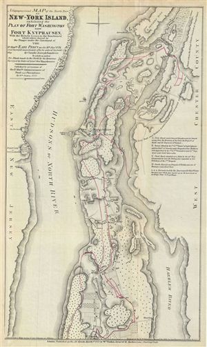
A Topographical Map of the North Part of New-York Island, exhibiting the Plan of Fort Washington, now Fort Knyphausen, With the Rebels Lines to the Southward, which were forced by the Troops under the Command of the Rt. Honble. Earl Percy on the 16th Novr. 1776, and Survey'd immediately after by order of his Lordship. By Claude Joseph Sauthier.
sold
- Digital Map Information
- Suitable for large format printing
- File Size: 7.09 MB
- File Type: ZIP / TIFF
- ICC color profile embedded
- Delivered instantly via download link
This is an uncommon of the northern part of New York City issued 1860 for Valentine's Manual of the Corporation of New York . Originally prepared in 1777 by William Faden to illustrate the struggle for control of New York City during the American Revolutionary ... (more details)
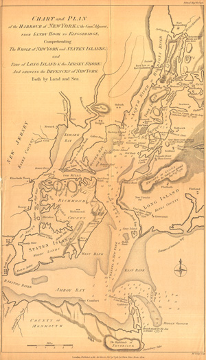
Chart of the Harbour of New York & the Counties Adjacent, from Sandy Hook to Kingsbridge, Comprehending thw Whole of New York and Staten Island and Part of Long Island & the Jersey Shore and Shewing the Defences of New York both by Land and Sea.
sold
- Digital Map Information
- Suitable for large format printing
- File Size: 7.11 MB
- File Type: ZIP / TIFF
- ICC color profile embedded
- Delivered instantly via download link
The title of this fine work says it all: 'Chart of the Harbour of New York & the Counties Adjacent, from Sandy Hook to Kingsbridge, Comprehending the Whole of New York and Staten Island and Part of Long Island & the Jersey Shore and Shewing the Defences of New ... (more details)
Mangin's idealized plan of New York.
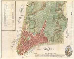
Plan of the City of New York, Drawn from Actual Survey by Casimir Th. Goerck and Joseph Fr. Mangin, City Surveyor.
sold
- Digital Map Information
- Suitable for large format printing
- File Size: 4.73 MB
- File Type: ZIP / TIFF
- ICC color profile embedded
- Delivered instantly via download link
An interesting and unusual map, this is an 1856 reissue of the 1801 Mangin-Goerck Plan. Those who know New York's shoreline will pause at the perfect blocks and ridged angles of this plan no more accurate today than it was in 1801 when Joseph Mangin first ... (more details)
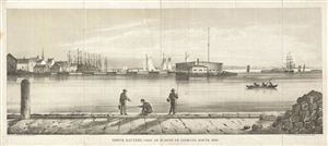
North Battery, Foot of Hubert St. Looking South, 1820.
sold
- Digital Map Information
- Suitable for large format printing
- File Size: 4.24 MB
- File Type: ZIP / TIFF
- ICC color profile embedded
- Delivered instantly via download link
This is a beautiful 1820 view of North Battery, New York City. The North Battery was built at the foot of Hubert Street in 1808, following the 1807 British attack on the American Frigate Chesapeake . Four other forts including Fort Wood on Bedloes ... (more details)
Beautiful view of George Washington's headquarters at the end of the Revolutionary War.
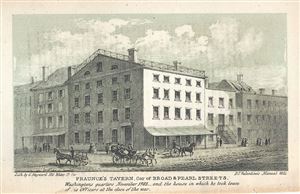
Fraunce's Tavern, Cor of Broad and Pearl Streets.
sold
- Digital Map Information
- Suitable for large format printing
- Full resolution TIFF file
- ICC color profile embedded
- Delivered instantly via download link
This is a beautifully drawn view of Fraunce’s Tavern located on the corner of Broad St. and Pearl St. in Lower Manhattan. The view features Fraunces Tavern, the headquarters for George Washington during the Revolutionary War while negotiating ... (more details)
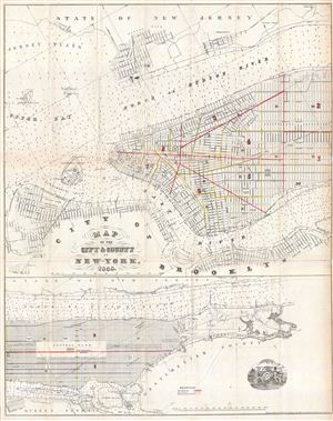
Map of the City & County of New-York 1858.
sold
- Digital Map Information
- Suitable for large format printing
- File Size: 18.43 MB
- File Type: ZIP / TIFF
- ICC color profile embedded
- Delivered instantly via download link
An uncommon 1858 map of New York City by D. T. Valentine. This map is divided into two sections. The primary map, located in the upper quadrants, details Manhattan from 38th street to the Battery, including parts of Brooklyn, Governors Island, ... (more details)
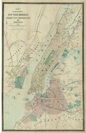
Map of the Cities of New york brooklyn Jersey City Hudson City and Hoboken.
sold
- Digital Map Information
- Suitable for large format printing
- File Size: 8.83 MB
- File Type: ZIP / TIFF
- ICC color profile embedded
- Delivered instantly via download link
This is a fine example of the 1859 Dripps map of the cities of New York, Brooklyn, Jersey City, and Hoboken, issued for Valentine's Manual of the Corporation of New York . The map covers the entirety of New York City, including Governors ... (more details)
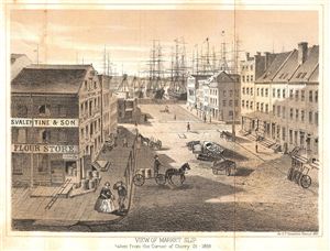
View of Market Slip. Taken from the Corner of Cherry St - 1959.
sold
- Digital Map Information
- Suitable for large format printing
- File Size: 2.43 MB
- File Type: ZIP / TIFF
- ICC color profile embedded
- Delivered instantly via download link
An exquisitely detailed view of Market Slip in 1859, from the corner of Cherry St. Features S. Valentine & Son Flour Stores, a man touching the brim of his cap in deference to a lady, horses and buggies. Today Market Slip is located ... (more details)
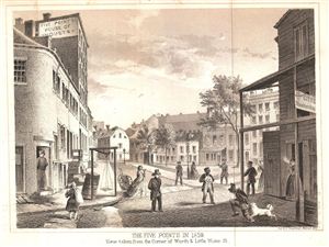
The Five Points in 1859. View taken from the Corner of Worth & Little Water St.
sold
- Digital Map Information
- Suitable for large format printing
- File Size: 2.22 MB
- File Type: ZIP / TIFF
- ICC color profile embedded
- Delivered instantly via download link
An exquisitely detailed view of New York City's Five Points slum in 1859, from the corner of Worth and Little Water St. The drawing is done from street level, and shows the Five Points House of Industry, a woman smoking, a dog biting a ... (more details)
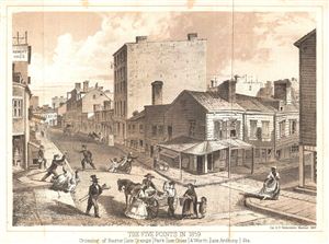
The Five Points in 1859. Crossing of Baxter (late Orange) Park (late Cross) & Worth (late Anthony) Sts.
sold
- Digital Map Information
- Suitable for large format printing
- File Size: 2.16 MB
- File Type: ZIP / TIFF
- ICC color profile embedded
- Delivered instantly via download link
An exquisitely detailed view of New York City's Five Points slum in 1859, showing the crossing of Baxter, Park and Worth, (Orange, Cross and Anthony Streets). The drawing is done from street view and hints at the slum-like conditions ... (more details)
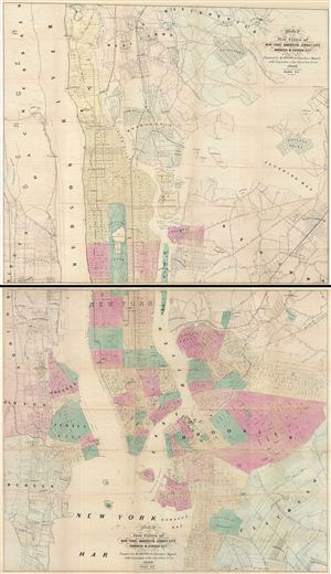
Map of the Five Cities of New York, Brooklyn, Jersey City, Hoboken & Hudson City.
sold
- Digital Map Information
- Suitable for large format printing
- File Size: 46.93 MB
- File Type: ZIP / TIFF
- ICC color profile embedded
- Delivered instantly via download link
This is an uncommon example of Matthew Dripps' two panel 1860 map of New York, Brooklyn, Jersey City, and Hoboken. Issued as a set of two maps (plate 1 and 2), with plate 1 covering from Westchester to 63nd street in Manhattan and ... (more details)
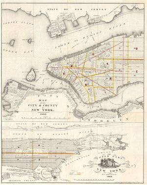
Map of the City & County of New York. Upper Part of the City and County of New York, on a reduced Scale.
sold
- Digital Map Information
- Suitable for large format printing
- Full resolution TIFF file
- ICC color profile embedded
- Delivered instantly via download link
An attractive map of New York City issued in 1860 for Valentine's Manual of the Corporation of New York . Essentially two maps in one. The upper map covers the populous southern part of Manhattan as well as the adjacent parts of ... (more details)
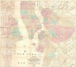
Map of the Five Cities of New York, Brooklyn, Jersey City, Hoboken & Hudson City.
sold
- Digital Map Information
- Suitable for large format printing
- File Size: 19.52 MB
- File Type: ZIP / TIFF
- ICC color profile embedded
- Delivered instantly via download link
A beautiful example of M. Dripps' map of New York City, Brooklyn, Jersey City, Hoboken and Hudson County, published as plate 2 in the 1860 edition of Valentine's Manual. A great source for understanding what Brooklyn and Jersey ... (more details)
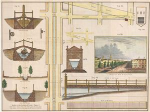
Perspective View of Canal Street. Scales to the Section of Canal.
sold
- Digital Map Information
- Suitable for large format printing
- File Size: 12.05 MB
- File Type: ZIP / TIFF
- ICC color profile embedded
- Delivered instantly via download link
An unusual 1860 map illustrating the evolution of New York City's Canal Street. Canal Street, located in lower Manhattan, takes its name from a canal that was constructed in the early 19th century to drain the Collect Pond into ... (more details)

Plan of the Central Park, City of New York, 1860.
sold
- Digital Map Information
- Suitable for large format printing
- File Size: 3.73 MB
- File Type: ZIP / TIFF
- ICC color profile embedded
- Delivered instantly via download link
This is an attractive hand colored map of New York City's Central Park issued in 1860 for Valentine's Manual of the Corporation of New York . Depicts the park as a whole and includes pathways, lakes, buildings, individual trees ... (more details)
A charming map of British New York from Manhattan to Lake Ontario.
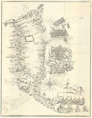
[untitled].
sold
- Digital Map Information
- Suitable for large format printing
- File Size: 3.23 MB
- File Type: ZIP / TIFF
- ICC color profile embedded
- Delivered instantly via download link
A charming map of British New York from Manhattan to Lake Ontario, featuring the British Crest, a hunter shooting a deer, British soldiers in battle formation, towns along the Hudson River and the Mohawk River, all the way to ... (more details)
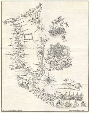
[untitled]
sold
- Digital Map Information
- Suitable for large format printing
- File Size: 3.08 MB
- File Type: ZIP / TIFF
- ICC color profile embedded
- Delivered instantly via download link
A charming map of British New York from Manhattan to Lake Ontario, featuring the British Crest, a hunter shooting a deer, British soldiers in battle formation, towns along the Hudson River and the Mohawk River, all the way to ... (more details)
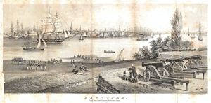
New-York. Taken from Fort Columbus, Governors Island. 1816.
sold
- Digital Map Information
- Suitable for large format printing
- File Size: 5.99 MB
- File Type: ZIP / TIFF
- ICC color profile embedded
- Delivered instantly via download link
An attractive view of New York Harbor as it was in 1816. This view, which shows New York City as it appears from Fort Columbus on Governor's Island, was issued in the 1860 edition of Valentine's Manual . Ships fill the ... (more details)
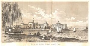
House of Refuge, Randals Island, N.Y. 1860.
sold
- Digital Map Information
- Suitable for large format printing
- File Size: 2.87 MB
- File Type: ZIP / TIFF
- ICC color profile embedded
- Delivered instantly via download link
A beautifully drawn view of the House of Refuge on Randal's Island [sic], N.Y. in 1860. The drawing features the House of Refuge in the background, sailboats in a river in the middle ground, and cows grazing in what is ... (more details)
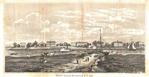
Ward's Island Building, N.Y. 1860.
sold
- Digital Map Information
- Suitable for large format printing
- File Size: 2.67 MB
- File Type: ZIP / TIFF
- ICC color profile embedded
- Delivered instantly via download link
A beautifully drawn view of the Ward's Island, N.Y. The island is situated in the east River in New York City, and is now joined to Randall's Island to the north by landfill. When Dutch settlers appropriated the island ... (more details)
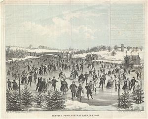
Skating Pond, Central Park, N.Y. 1861.
sold
- Digital Map Information
- Suitable for large format printing
- File Size: 2.17 MB
- File Type: ZIP / TIFF
- ICC color profile embedded
- Delivered instantly via download link
This is a beautiful 1861 view of the Skating Pond in New York's Central Park. The aquatint view features beautifully dressed Victorians ice-skating with Central Park's Bow Bridge in the background. This view was ... (more details)
The first published representation of the 1668 Nicolls Map of Manhattan.
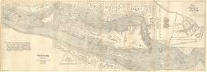
The Nicolls Map.
sold
- Digital Map Information
- Suitable for large format printing
- File Size: 51.09 MB
- File Type: ZIP / TIFF
- ICC color profile embedded
- Delivered instantly via download link
An attractive example of D. T. Valentine and George Hayward's 1863 reissue of the 1668 Nichols Plan or Map of Manhattan and New York City. When the English conquered New Amsterdam in 1664, they were ill equipped to administer their new colony - renamed New York after James, the Duke of York. English New York's first governor, Richard Nicolls, commissioned the first reasonably accurate survey of Manhattan and New York. The survey covers from the northernmost tip of Manhattan to Staten Island and incorporates parts of Long Island, modern day Westchester, and New Jersey. (more details)
The first published representation of the 1668 Nicolls Map of Manhattan.
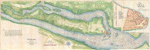
The Nicolls Map.
sold
- Digital Map Information
- Suitable for large format printing
- File Size: 27.14 MB
- File Type: ZIP / TIFF
- ICC color profile embedded
- Delivered instantly via download link
An attractive example of D. T. Valentine and George Hayward's 1863 reissue of the 1668 Nichols Plan or Map of Manhattan and New York City. When the English conquered New Amsterdam in 1664, they were ill equipped to administer their new colony - renamed New York after James, the Duke of York. English New York's first governor, Richard Nicolls, commissioned the first reasonably accurate survey of Manhattan and New York. The survey covers from the northernmost tip of Manhattan to Staten Island and incorporates parts of Long Island, modern day Westchester, and New Jersey. (more details)
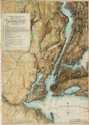
A sketch of the operations of His Majesty's fleet and army : under the command of Vice Admiral the Rt. Hble. Lord Viscount Howe and Genl. Sr. Wm. Howe, K.B., in 1776.
sold
- Digital Map Information
- Suitable for large format printing
- File Size: 22.02 MB
- File Type: ZIP / TIFF
- ICC color profile embedded
- Delivered instantly via download link
A rare and stunning reissue of the Des Barres famous 1777 Map of New York City and Harbor prepared for the 1864 issue of Valentine's Manual of New York. Covers from Sandy Hook northward as far as Haverstraw and ... (more details)
Uncommon map illustrating all of Manhattan in 1864.
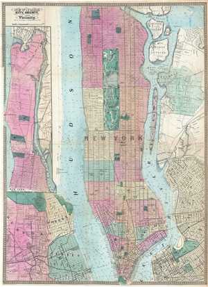
New-York City County, and Vicinity.
sold
- Digital Map Information
- Suitable for large format printing
- File Size: 14.75 MB
- File Type: ZIP / TIFF
- ICC color profile embedded
- Delivered instantly via download link
This is an uncommon large format 1864 map of New York City by Matthew Dripps. The map covers the entire island of Manhattan as well as parts of Brooklyn, Queens, Hoboken and Jersey City. The whole is rendered in ... (more details)

New York City, County, and Vicinity.
sold
- Digital Map Information
- Suitable for large format printing
- File Size: 18.1 MB
- File Type: ZIP / TIFF
- ICC color profile embedded
- Delivered instantly via download link
This is a rare large format 1864 map of New York City by Matthew Dripps. The map covers the entire island of Manhattan as well as parts of Brooklyn, Queens, Hoboken and Jersey City. The whole is rendered in ... (more details)
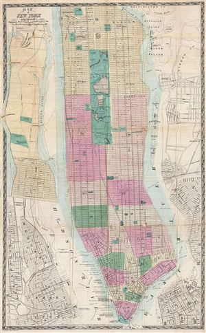
Map of New York and Vicinity.
sold
- Digital Map Information
- Suitable for large format printing
- File Size: 21.76 MB
- File Type: ZIP / TIFF
- ICC color profile embedded
- Delivered instantly via download link
This is a rare large format 1865 folding map of New York City by Matthew Dripps. Covers the entire island of Manhattan as well as parts of Brooklyn, Queens, Hoboken and Jersey City. Shows the city in ... (more details)
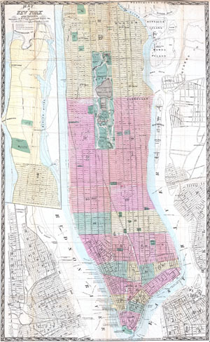
Map of New York and Vicinity.
sold
- Digital Map Information
- Suitable for large format printing
- File Size: 18.41 MB
- File Type: ZIP / TIFF
- ICC color profile embedded
- Delivered instantly via download link
This is a rare large format 1865 folding map of New York City by Matthew Dripps. Covers the entire island of Manhattan as well as parts of Brooklyn, Queens, Hoboken and Jersey City. Shows the city in ... (more details)
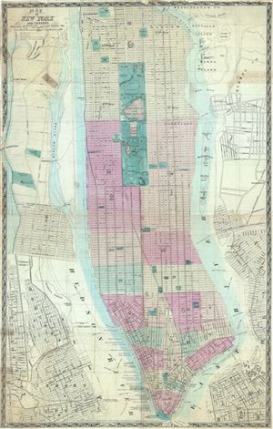
Map of New York and Vicinity.
sold
- Digital Map Information
- Suitable for large format printing
- File Size: 21.47 MB
- File Type: ZIP / TIFF
- ICC color profile embedded
- Delivered instantly via download link
This is a rare large format 1865 map or plan of New York City by Matthew Dripps. It covers the entire island of Manhattan as well as parts of Brooklyn, Queens, Hoboken and Jersey City. Shows the ... (more details)
An exceptionally detailed map of New York City just after the Civil War.
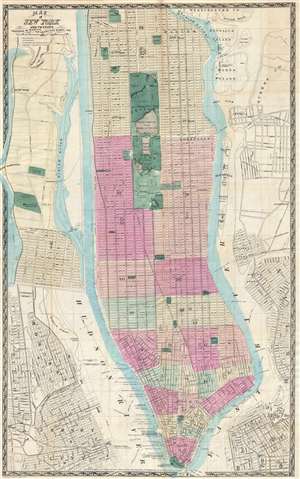
Map of New York and Vicinity.
sold
- Digital Map Information
- Suitable for large format printing
- File Size: 14.94 MB
- File Type: ZIP / TIFF
- ICC color profile embedded
- Delivered instantly via download link
This is a scarce large format 1865 map or plan of New York City by Matthew Dripps. It covers the entire island of Manhattan as well as parts of Brooklyn, Queens, Hoboken and Jersey City. The map ... (more details)
New York City just after the Civil War.
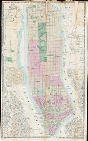
Map of New York and Vicinity.
sold
- Digital Map Information
- Suitable for large format printing
- File Size: 42.73 MB
- File Type: ZIP / TIFF
- ICC color profile embedded
- Delivered instantly via download link
This is a scarce large format 1865 map or plan of New York City by Matthew Dripps. It depicts the island of Manhattan as well as parts of Brooklyn, Queens, Hoboken, and Jersey City. The map illustrates the city in considerable detail with all streets and, in Manhattan, block numbers clearly identified. An inset along the left border details the northern portion of Manhattan. The map labels most of the piers in lower Manhattan and shows numerous individual buildings with identifying numbers. Where Columbia University now stands, this map reveals a 19th century Lunatic Asylum. In Queens, Dripps labels Hunters Point and shows the beginnings of the Long Island Railroad. Astoria is delineated. Central Park is mapped in detail exhibiting the fully glory of Olmsted's plan. (more details)
New York City just after the Civil War.
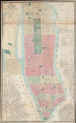
Map of New York and Vicinity.
sold
- Digital Map Information
- Suitable for large format printing
- File Size: 48.1 MB
- File Type: ZIP / TIFF
- ICC color profile embedded
- Delivered instantly via download link
This is a scarce large format 1865 plan or map of New York City by Matthew Dripps. It depicts the island of Manhattan as well as parts of Brooklyn, Queens, Hoboken, and Jersey City. The map illustrates the city in considerable detail with all streets and, in Manhattan, block numbers clearly identified. An inset along the left border details the northern portion of Manhattan. The map labels most of the piers in lower Manhattan and shows numerous individual buildings with identifying numbers. Where Columbia University now stands, this map reveals a 19th century Lunatic Asylum. In Queens, Dripps labels Hunters Point and presents the beginnings of the Long Island Railroad. Astoria is delineated. Central Park is mapped in detail exhibiting the fully glory of Olmsted's plan. (more details)
Uncommon map illustrating all of Manhattan in 1866.
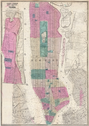
New-York City County, and Vicinity.
sold
- Digital Map Information
- Suitable for large format printing
- File Size: 10.87 MB
- File Type: ZIP / TIFF
- ICC color profile embedded
- Delivered instantly via download link
This is an uncommon large format 1866 map of New York City by Matthew Dripps. The map covers the entire island of Manhattan as well as parts of Brooklyn, Queens, Hoboken and Jersey City. The whole ... (more details)
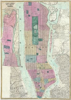
New - York City County, and Vicinity.
sold
- Digital Map Information
- Suitable for large format printing
- File Size: 14.7 MB
- File Type: ZIP / TIFF
- ICC color profile embedded
- Delivered instantly via download link
This is a rare 1866 map or plan of New York City by Matthew Dripps. It covers the entire island of Manhattan as well as parts of Brooklyn, Queens, Hoboken and Jersey City. Shows the city in ... (more details)
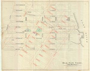
Old New York. 'The Bouwery.'
sold
- Digital Map Information
- Suitable for large format printing
- File Size: 8.31 MB
- File Type: ZIP / TIFF
- ICC color profile embedded
- Delivered instantly via download link
This is a fascinating example of the 1868 map of the Bowery, New York City. The map overlays the pre 1811 street grid with the modern street grid as laid out by the Commissioner's Plan. The ... (more details)
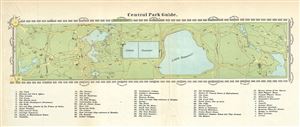
Central Park Guide.
sold
- Digital Map Information
- Suitable for large format printing
- File Size: 1.62 MB
- File Type: ZIP / TIFF
- ICC color profile embedded
- Delivered instantly via download link
A rare hand-colored map of New York City's Central Park prepared and printed for inclusion in the 1869 edition of Valentine's Manual of the Corporation of the City of New York . It depicts ... (more details)