

Americae Mappa Generalis.
sold
- Digital Map Information
- Suitable for large format printing
- DPI: 300
- File Size: 7.24 MB
- File Type: ZIP / TIFF
- ICC color profile embedded
- Delivered instantly via download link
A stunning 1746 Homann Heirs hand colored map of both North and South America. This is the second issue of this important map following the earlier edition by J. B. Homann. Map reflects a considerable advancement in American cartography of the time as well as a ... (more details)
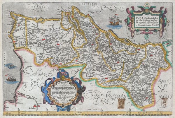
Portvgalliae que olim Lusitania, novissima & exactissima descriptio, Aucto re Vernando Aluaro Secco (A very new & exact depiction of Portugal, once called Lusitania, by Vernandus Alvarus Secco).
sold
- Digital Map Information
- Suitable for large format printing
- Full resolution TIFF file
- ICC color profile embedded
- Delivered instantly via download link
A rare and beautiful 1579 Abraham Ortelius map of the Kingdom of Portugal. Follows the extremely rare two sheet Alavaraz Secco map published by Michele Tramezzino in 1561. North oriented to the right. Sea decorated with monsters and sailing ships. Bottom right ... (more details)

Virginia.
sold
- Digital Map Information
- Suitable for large format printing
- DPI: 300
- File Size: 5.47 MB
- File Type: ZIP / TIFF
- ICC color profile embedded
- Delivered instantly via download link
A fine example of J Greenleaf's 1848 map of Virginia. This map covers all of what is today Virginia and West Virginia as well as the entire Chesapeake Bay and adjacent parts of Ohio, Pennsylvania North Carolina and Maryland. Greenleaf's cartographically ... (more details)

Nouvelle Carte de l' Amerique Septentrionale Dressee sur les plus Nouvelles Observations de Messieurs de l' Academie
sold
- Digital Map Information
- Suitable for large format printing
- DPI: 300
- File Size: 6.68 MB
- File Type: ZIP / TIFF
- ICC color profile embedded
- Delivered instantly via download link
Offered here is a stunning map of North America published by Henry Chatelain for the 1720 edition of his seminal Atlas Historique. Offers some of the first well developed cartography of the Great Lakes region and considerable detail along the eastern ... (more details)
Sunning early American mapping of Virginia.
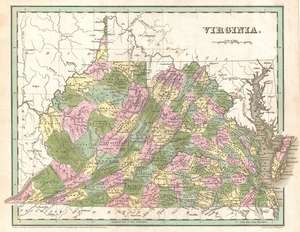
Virginia.
sold
- Digital Map Information
- Suitable for large format printing
- DPI: 300
- File Size: 6.43 MB
- File Type: ZIP / TIFF
- ICC color profile embedded
- Delivered instantly via download link
A fine example of T. G. Bradford's c. 1838 map of Virginia. This map covers all of what is today Virginia and West Virginia as well as the entire Chesapeake Bay and adjacent parts of Ohio, Pennsylvania North Carolina and Maryland. Cartographically ... (more details)
Astoundingly complex and monumentally proportioned German map of the world.
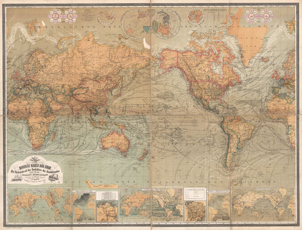
Neueste Karte Der Erde Mit Rucksicht auf das Bedurfniss des Handelstandes sowie fur den Unterricht an Leher-Anstalten.
sold
- Digital Map Information
- Suitable for large format printing
- File Size: 58 MB
- File Type: ZIP / TIFF
- ICC color profile embedded
- Delivered instantly via download link
A vastly complex and enormously proportioned c. 1870 German map of the world by C. F. Baur and Traugott Bromme. Printed in c. 1870 in a multi-toned lithographic process this extraordinary map presents the world on a Mercator Projection. Designed ... (more details)

Map of the New York Wilderness.
sold
- Digital Map Information
- Suitable for large format printing
- File Size: 5.33 MB
- File Type: ZIP / TIFF
- ICC color profile embedded
- Delivered instantly via download link
A rare first edition (1867) of William Watson Ely's map of New York's Adirondack Mountains. Covers from the St. Lawrence River to Lake Champlain inclusive of the counties of St. Lawrence, Clinton, Essex, Hamilton, Warren, Herkimer, Jefferson, ... (more details)
First map to depict the Spottswood plan for German settlement in the Virginia interior.
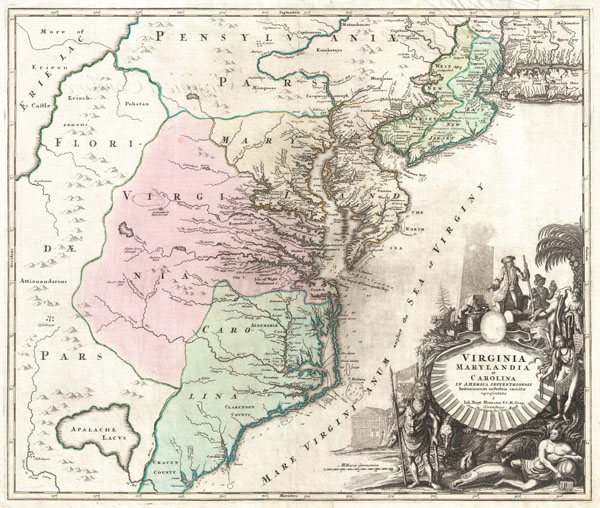
Virginia Marylandia et Carolina In America Septentrionali Britannorum industria excultae…
sold
- Digital Map Information
- Suitable for large format printing
- Full resolution TIFF file
- ICC color profile embedded
- Delivered instantly via download link
An exceptionally beautiful example of J. B. Homann's c. 1715 map of Virginia, Carolina, Maryland, and New Jersey; considered one of the most important and decorative maps of is region to appear in the 18th century. This fine decorative map ... (more details)

Map Of The Country Thirty Three Miles Around The City Of New York.
sold
- Digital Map Information
- Suitable for large format printing
- File Size: 12.08 MB
- File Type: ZIP / TIFF
- ICC color profile embedded
- Delivered instantly via download link
This is the extremely rare 1879 edition of one of the most beautiful pocket maps of New York made in the 19th century: Colton's Thirty Three Miles Around the City of New York. Covers New York City and vicinity as far south as Ocean County, ... (more details)
Extremely scarce Colton pocket map of the United States.
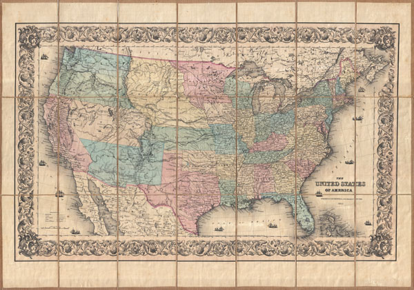
The United States of America.
sold
- Digital Map Information
- Suitable for large format printing
- File Size: 31.31 MB
- File Type: ZIP / TIFF
- ICC color profile embedded
- Delivered instantly via download link
This is an extremely scarce separately issued 1855 pocket map of the United States by J.H. Colton. Covers the United States from coast to coast revealing a very early configuration of the Transmississippi. While many modern states had ... (more details)
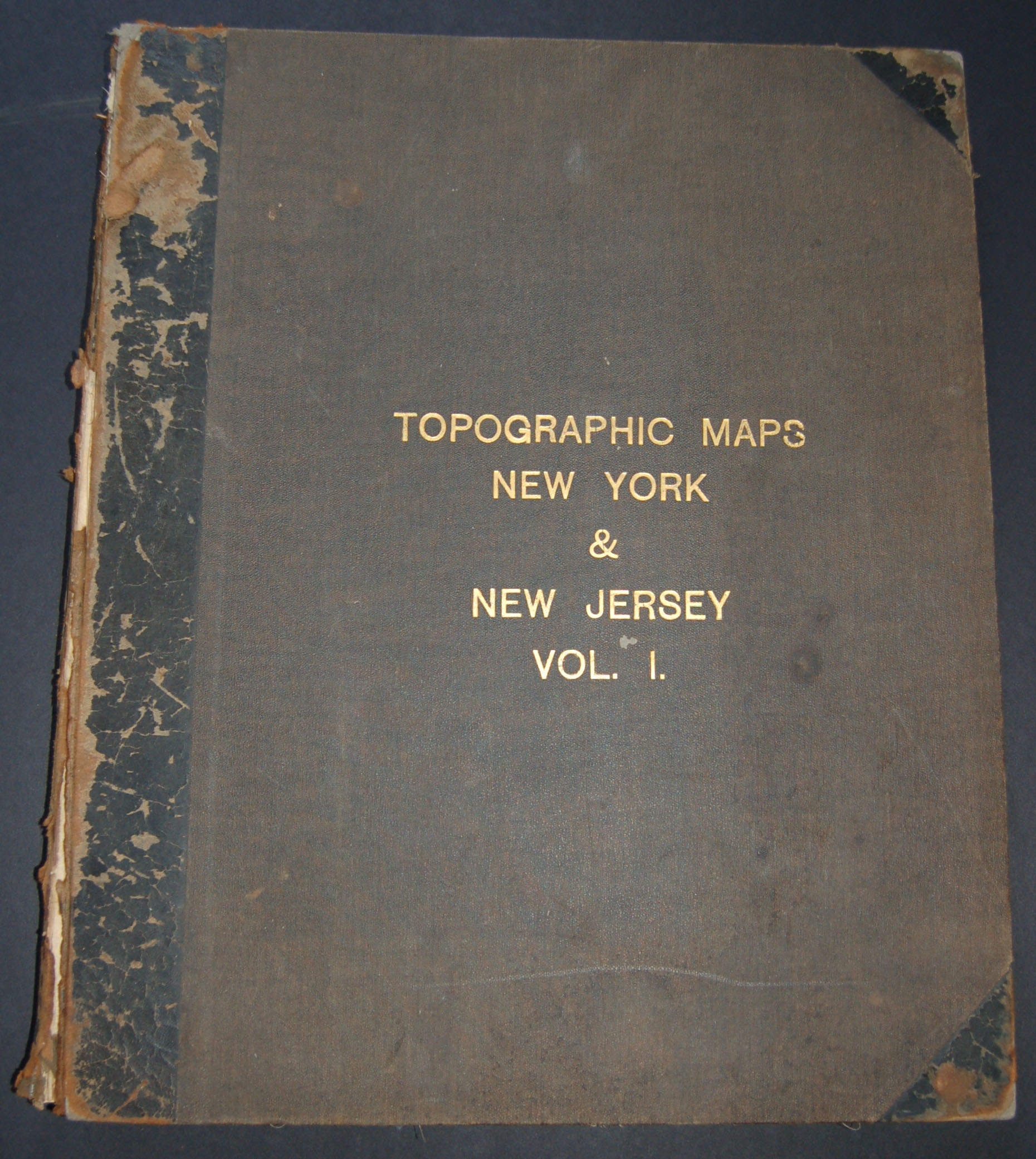
Topographic Maps New York & New Jersey Vol. 1
sold
This rare find is a c. 1915 atlas of parts of New York and New Jersey produced by the U.S. Geological Survey. Contains some seventy linen backed maps of New York State and Northern New Jersey including the highly desirable New York City ... (more details)
One of the rarest and most desriable U.S. Coast Survey report maps of the Chesapeake Bay.

Sketch C Showing the Progress of the Survey in Section No. III From 1843 to 1851.
sold
- Digital Map Information
- Suitable for large format printing
- DPI: 300
- File Size: 19.24 MB
- File Type: ZIP / TIFF
- ICC color profile embedded
- Delivered instantly via download link
This is an exceptional example of the 1851 U.S. Coast Survey's progress chart of the Chesapeake Bay. The map covers from the mouth of the Susquehanna River southwards as far as Cape Henry and Norfolk. This chart includes both the ... (more details)
An early map of Central Park and the first specific map of the Upper West Side.
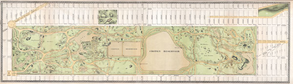
Central Park.
sold
- Digital Map Information
- Suitable for large format printing
- File Size: 5.17 MB
- File Type: ZIP / TIFF
- ICC color profile embedded
- Delivered instantly via download link
An altogether extraordinary hand colored map of New York City's Central Park and the Upper West Side prepared and printed for inclusion in the Thirteenth Annual Report of the Board of Commissioners of the Central Park. This is an ... (more details)

Partie Meridonale De L'Ancien Mexique Ou De La Nouvelle Espagne
sold
- Digital Map Information
- Suitable for large format printing
- DPI: 300
- File Size: 4.58 MB
- File Type: ZIP / TIFF
- ICC color profile embedded
- Delivered instantly via download link
A fine example of Rigobert Bonne and Guillaume Raynal's 1780 map of southern Mexico. Includes the area stretching from Panama in the south, to the Tropic of Cancer in the north. Includes the modern day nations of Mexico, ... (more details)

Colton’s Map of the States of New England and New York with parts of Pennsylvania, New jersey, the Canadas & co. showing the rail roads, canals and stage roads with distances from place to place.
sold
- Digital Map Information
- Suitable for large format printing
- File Size: 5.56 MB
- File Type: ZIP / TIFF
- ICC color profile embedded
- Delivered instantly via download link
An extraordinarily scarce 1856 Colton pocket map of New York and New England. This beautifully rendered pocket map depicts all of the New York and the New England states as well as with much of Pennsylvania, New Jersey, ... (more details)

Chapman’s Township Map of the Northwest Compiled from the United States Surveys and other authentic Sources.
sold
- Digital Map Information
- Suitable for large format printing
- File Size: 24.58 MB
- File Type: ZIP / TIFF
- ICC color profile embedded
- Delivered instantly via download link
Offered is an exceedingly rare pocket issue map of the states of Illinois, Iowa, and Wisconsin, with parts of Michigan, Minnesota, Nebraska and Kansas. Printed in 1857 by Silas Chapman and his successors, Dyer & ... (more details)
Shows Parima, the site of El Dorado, and the Xarayes, the gate of Paradise.

Amerique Meridionale
sold
- Digital Map Information
- Suitable for large format printing
- DPI: 300
- File Size: 4.91 MB
- File Type: ZIP / TIFF
- ICC color profile embedded
- Delivered instantly via download link
A fine example of Rigobert Bonne and Guillaume Raynal's 1780 map of South America. Highly detailed, showing towns, rivers, some topographical features, and political boundaries. Names a number of speculative ... (more details)

Colton's New Sectional Map of the State of Illinois. Complied from the United States Surveys. Also exhibiting the Internal Improvements, distances between Towns, Villages, & Post Offices: the outlines of Prairies, woodlands, Marshes & the lands donated to the State by the Genl. Govt for the purpose of Internal Improvement.
sold
- Digital Map Information
- Suitable for large format printing
- DPI: 300
- File Size: 28.42 MB
- File Type: ZIP / TIFF
- ICC color profile embedded
- Delivered instantly via download link
This is an extremely scarce 1852 pocket issue map of the state of Illinois by published by J. H. Colton and prepared by J. M Peck, John Messinger, and A. J. Mathewson. Depicts the whole of Illinois with inset ... (more details)
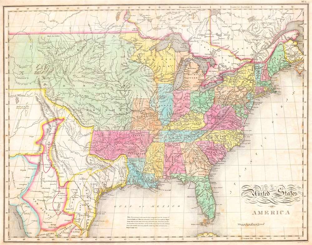
United States of America
sold
- Digital Map Information
- Suitable for large format printing
- Full resolution TIFF file
- ICC color profile embedded
- Delivered instantly via download link
One of the most important American maps of the United States to appear in the early 19th century. Depicts the United States and Mexico roughly from the Atlantic to the region immediately west of the Rocky ... (more details)

Carte Du Chili Depuis Le Sud Du Perou Jusqu'au Cap Horn Avec Partie Des Regions Qui En Sont A L'Est
sold
- Digital Map Information
- Suitable for large format printing
- DPI: 300
- File Size: 4.24 MB
- File Type: ZIP / TIFF
- ICC color profile embedded
- Delivered instantly via download link
A fine example of Rigobert Bonne and Guillaume Raynal's 1780 map of Chile. Covers modern day Chile, Argentina, Uruguay, the Falkland Islands, Tierra del Fuego, and Cape Horn. Shows numerous fictional ... (more details)