
Earliest modern map to clearly depict Poland and Hungary.
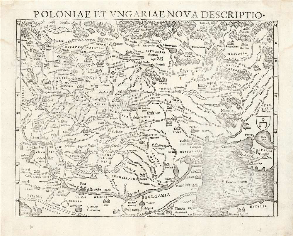
Polonia et Ungariae Nova Descriptio.
sold
- Digital Map Information
- Suitable for large format printing
- Full resolution TIFF file
- ICC color profile embedded
- Delivered instantly via download link
This is the 1559 Latin edition of Sebastian Münster's map of Poland and Hungary, the first acquirable map to focus on the region using contemporary place names and geographical knowledge. The only earlier printed maps to focus at all on the region were iterations of Ptolemy's maps of Sarmatia in Europe; the nearest surviving contender for an earlier modern map of the region is Waldseemüller's 1513 Tabula moderna Sarmatie which was of broader scope (reaching as far west as Germany and the Bavarian Alps) and whose geography for the region is far more primitive. Bernard Wapowski's c. 1526 map of Sarmatia informed Münster's ma, but only fragments of it have survived. Münster's map is thus the first of this region available to the collector with a largely recognizable depiction of Poland and Hungary. (more details)
City within a city.
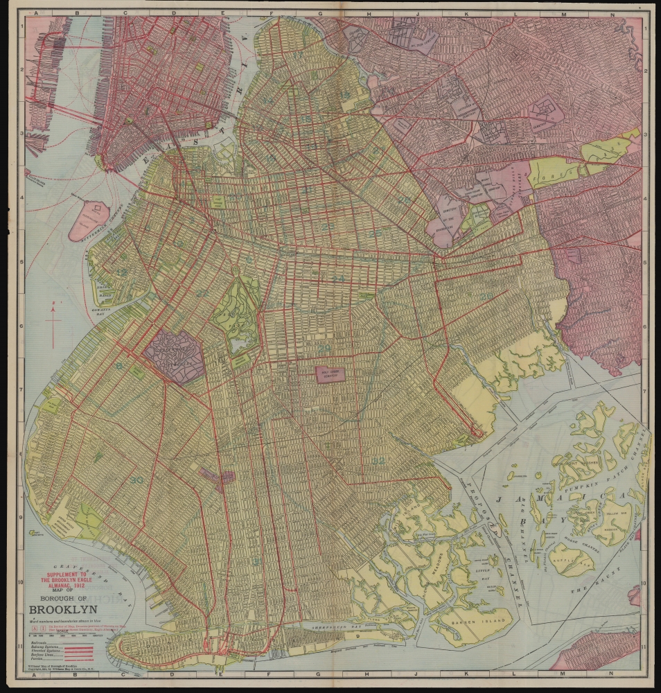
Supplement to the Brooklyn Eagle Almanac 1912, Map of Borough of Brooklyn / Map of Borough of Richmond.
sold
- Digital Map Information
- Suitable for large format printing
- Full resolution TIFF file
- ICC color profile embedded
- Delivered instantly via download link
A colorful, richly detailed 1912 two-sided indexed map of the Brooklyn and Richmond (Staten Island) produced by the William Map and Guide Co. and published in the Supplement to the Brooklyn Eagle Almanac. It depicts Brooklyn fully-formed, reaching roughly its current street grid and extent of development. (more details)
Linking the Mid-Atlantic.

Maryland.
sold
- Digital Map Information
- Suitable for large format printing
- DPI: 600
- File Size: 23.36 MB
- File Type: ZIP / TIFF
- ICC color profile embedded
- Delivered instantly via download link
Thomas G. Bradford's 1846 map of Maryland. It presents the state at a time when multiple transportation infrastructure projects (canals and railroads) were underway, linking the state, especially Baltimore, more closely with other coastal cities and the Appalachian region. (more details)
First edition of the earliest printed map of Amsterdam available to the collector.

[Untitled Bird's Eye View of Amsterdam].
sold
- Digital Map Information
- Suitable for large format printing
- Full resolution TIFF file
- ICC color profile embedded
- Delivered instantly via download link
This is Sebastian Münster's 1550 view / map of Amsterdam, the earliest acquirable printed map of that city. It was preceded only by the 1544 wall map of Cornelis Anthonisz, Münster's source for this view. Anthonisz's wall map - which survives in fewer than ten examples - represented the best (and only) firsthand depiction of Amsterdam of its time. Its depiction in 1550 by Münster and in 1572 by Braun and Hogenberg established as the dominant 16th century image f what would become the chief economic engine of the seventeenth century. (more details)
Aesthetic pinnacle of the skyscraper era.
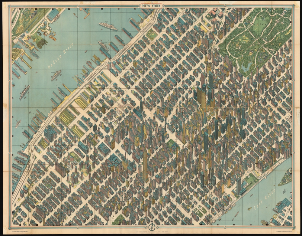
New York.
sold
This is the 1962 Bollmann axonometric map of midtown Manhattan, in its 1963 issue. This distinctive view presents the heart of New York City at the stylistic peak of the skyscraper era: over half of the world's skyscrapers standing at the time appear within the bounds of this view. (more details)
When California Had More Cows than People.
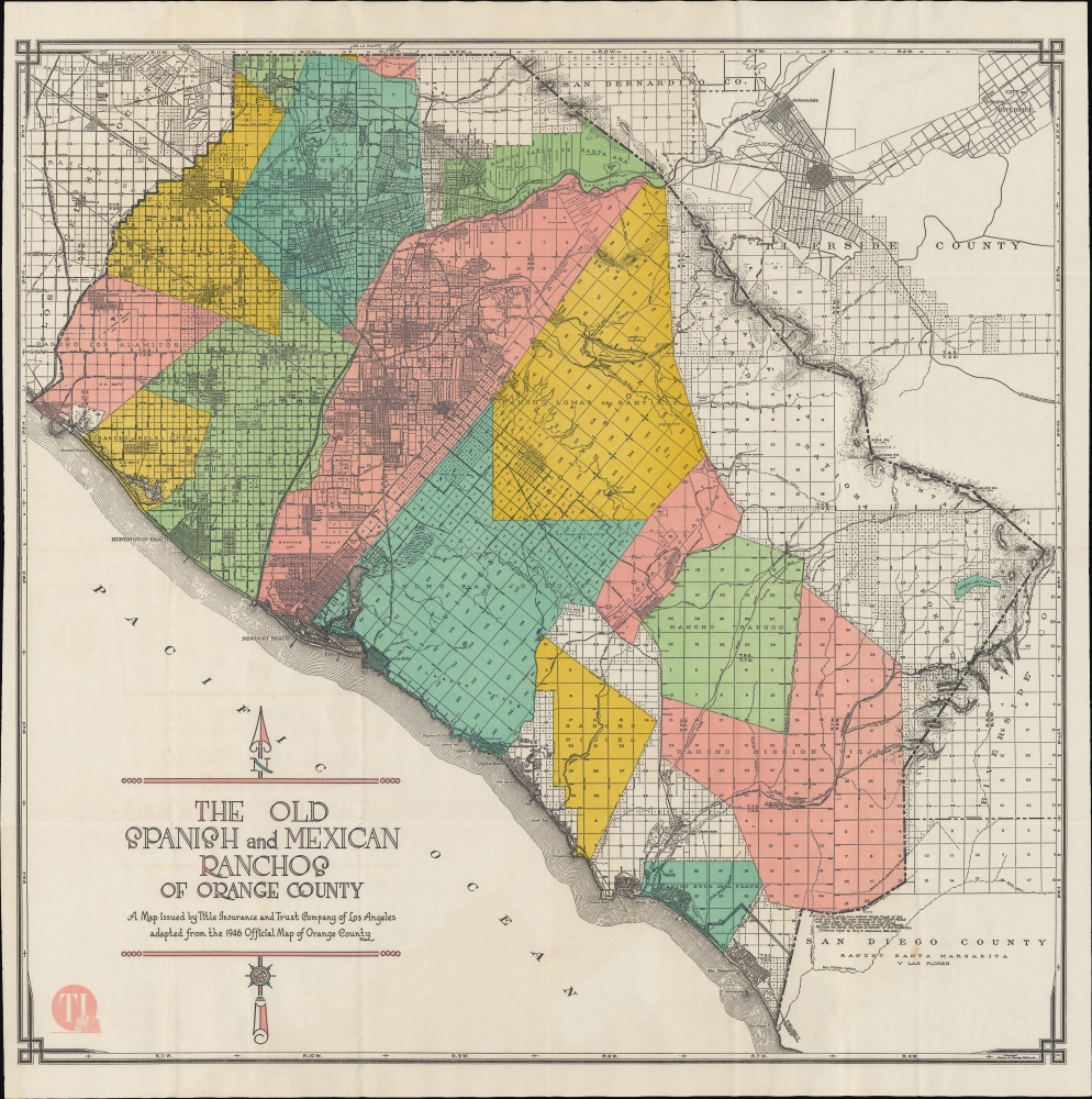
The Old Spanish and Mexican Ranchos of Orange County.
sold
- Digital Map Information
- Suitable for large format printing
- Full resolution TIFF file
- ICC color profile embedded
- Delivered instantly via download link
A curious c. 1946 map of Orange County, with the area's historic ranchos superimposed on a contemporary map. It was published by the Title Insurance and Trust Company, which had a penchant for producing similar maps related to Southern California's history and culture. (more details)
Information-dense.

A Poster of Illinois.
sold
This is an information-dense 1982 Robert Waldmire pictorial map of Illinois. It provides a fascinating study of Illinois' nature, history, and culture, with particular attention Route 66, one Waldmire's specializations. (more details)
Tourism to Minnesota's lakes.

The Minnesota Spotlight Region In the Land of 10,000 Lakes.
sold
- Digital Map Information
- Suitable for large format printing
- Full resolution TIFF file
- ICC color profile embedded
- Delivered instantly via download link
This is a c. 1940 Lacher pictorial tourist map of central Minnesota that promotes 'the Minnesota Spotlight Region'. (more details)
Unrecorded Venetian map of the Morea War.
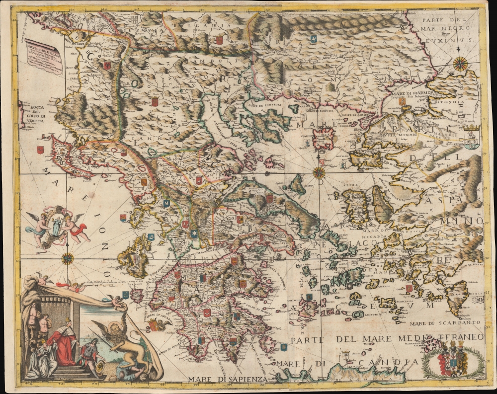
Grecia, et Arcipelago Descrizzione Topografica di P.Pier Anto. Pacifico di S. Toma Consecrata All'Altezze Serenissime de Carlo Filippi, e Christiano Lodovio Marchesi di Brandemburg, e c.
sold
- Digital Map Information
- Suitable for large format printing
- DPI: 600
- File Size: 107 MB
- File Type: ZIP / TIFF
- ICC color profile embedded
- Delivered instantly via download link
A spectacular map c. 1694 Pietro Antonio Pacifico map of Greece and the Balkans issued in Venice during the Morea War (1684 - 1699). The map is uncatalogued, this being only the 2nd known example, but exhibits the extensive Venetian contribution to the mapping of Greece in during the Second Venation Occupation of Greece, part of the larger Great Turkish War (1683 - 1699). (more details)
Building a Modern Uruguay.
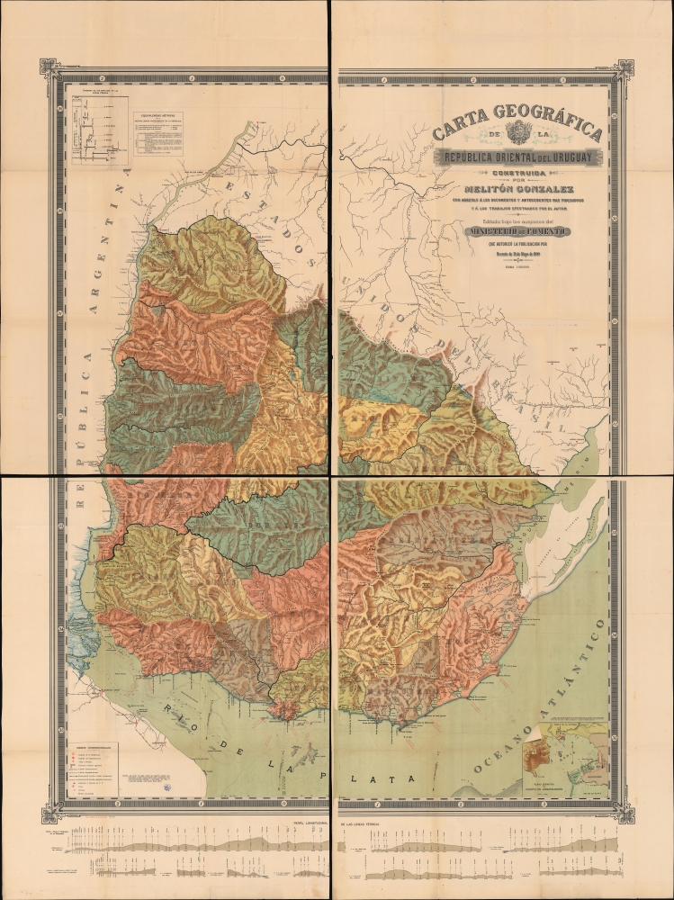
Carta Geográfica de República Oriental del Uruguay.
sold
- Digital Map Information
- Suitable for large format printing
- Full resolution TIFF file
- ICC color profile embedded
- Delivered instantly via download link
This is a spectacular, four sheet chromolithograph map of the Republic of Uruguay, published in 1900 in Montevideo by Melitón Gonzalez, Uruguay's Director of Public Works. This grand work captures Uruguay's push for modernization that characterized the end of the 19th century. (more details)
New York under the Iroquois.

Map of Ho-De'-No-Sau-Nee-Ga or the Territories of the People of the Long House in 1720. Exhibiting the Home Country of the Iroquois with the Aboriginal Names of their Villages, Lakes, River, Streams and Ancient Localities, and the courses of their principal Trails.
sold
- Digital Map Information
- Suitable for large format printing
- DPI: 600
- File Size: 478.64 MB
- File Type: ZIP / TIFF
- ICC color profile embedded
- Delivered instantly via download link
This is the rare 1851 first edition of 'Father of American Anthropology' Lewis Henry Morgan and Seneca Sachem Ely S. Parker's map of New York as it existed under the Iroquois League c. 1720. This novel work is one of the few maps published in the 19th century to directly detail American Indian lands, routes of travel, and language. It is considered the first scientific representation of an American Indian Tribe on a map. (more details)
Best general map of the Southeast of the 18th Century.
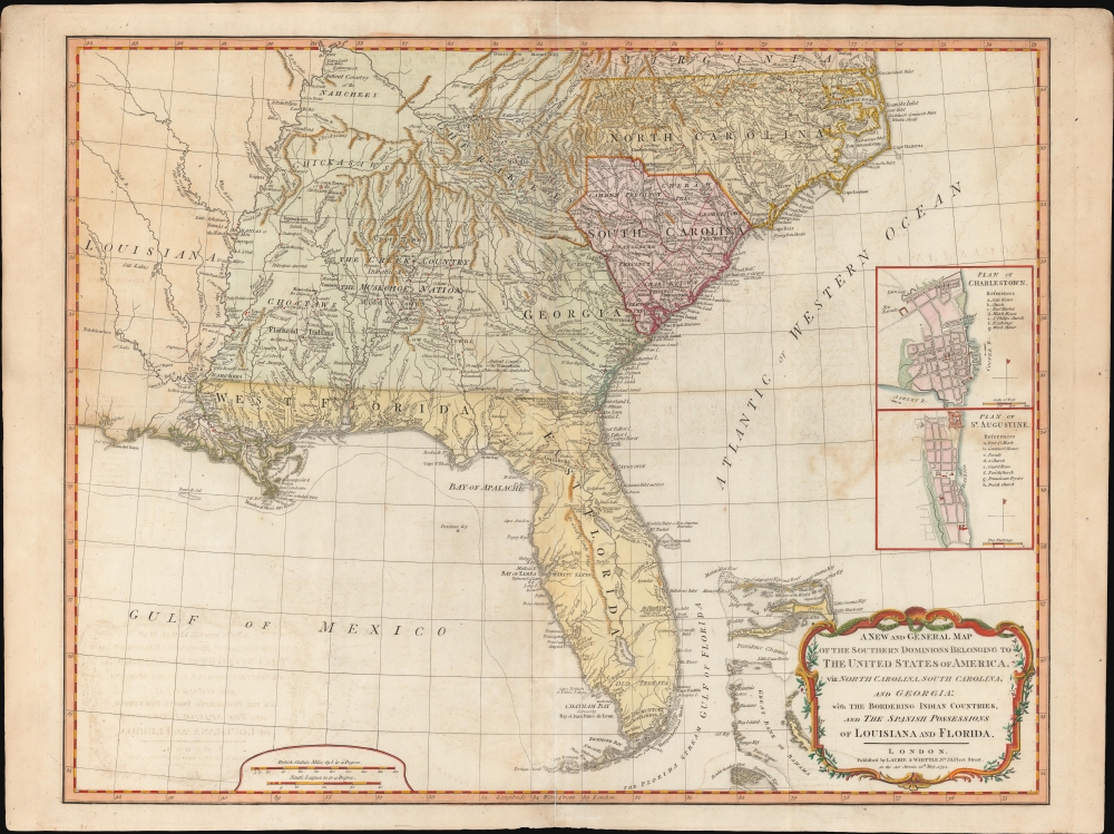
A New and General Map of the Southern Dominions Belonging to the United States of America, viz: North Carolina, South Carolina, and Georgia: with the Bordering Indian Countries and The Spanish Possessions of Louisiana and Florida.
sold
- Digital Map Information
- Suitable for large format printing
- DPI: 600
- File Size: 723.14 MB
- File Type: ZIP / TIFF
- ICC color profile embedded
- Delivered instantly via download link
A scarce 1794 Laurie and Whittle / Sayer map of the southeastern part of the United States and Florida. This is the second edition of Sayer's map of the southeast, and the first to recognize the United States as an independent nation. At the time of initial publication, it represented the finest general cartography of the southeast obtainable. (more details)
Indian Wars, gold and silver discoveries, and the construction of the Northern Pacific Railroad.
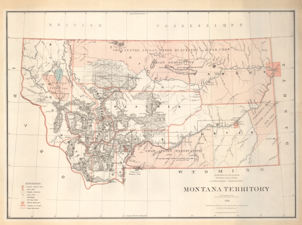
Montana Territory.
sold
- Digital Map Information
- Suitable for large format printing
- File Size: 77.64 MB
- File Type: ZIP / TIFF
- ICC color profile embedded
- Delivered instantly via download link
An impressive large scale 1879 map of Montana during its territorial period. It is one of the earliest obtainable maps of Montana Territory, covering its formative period during various Indian Wars, gold and silver discoveries, and the construction of the Northern Pacific Railroad. (more details)
On the cusp of the Westward Expansion.
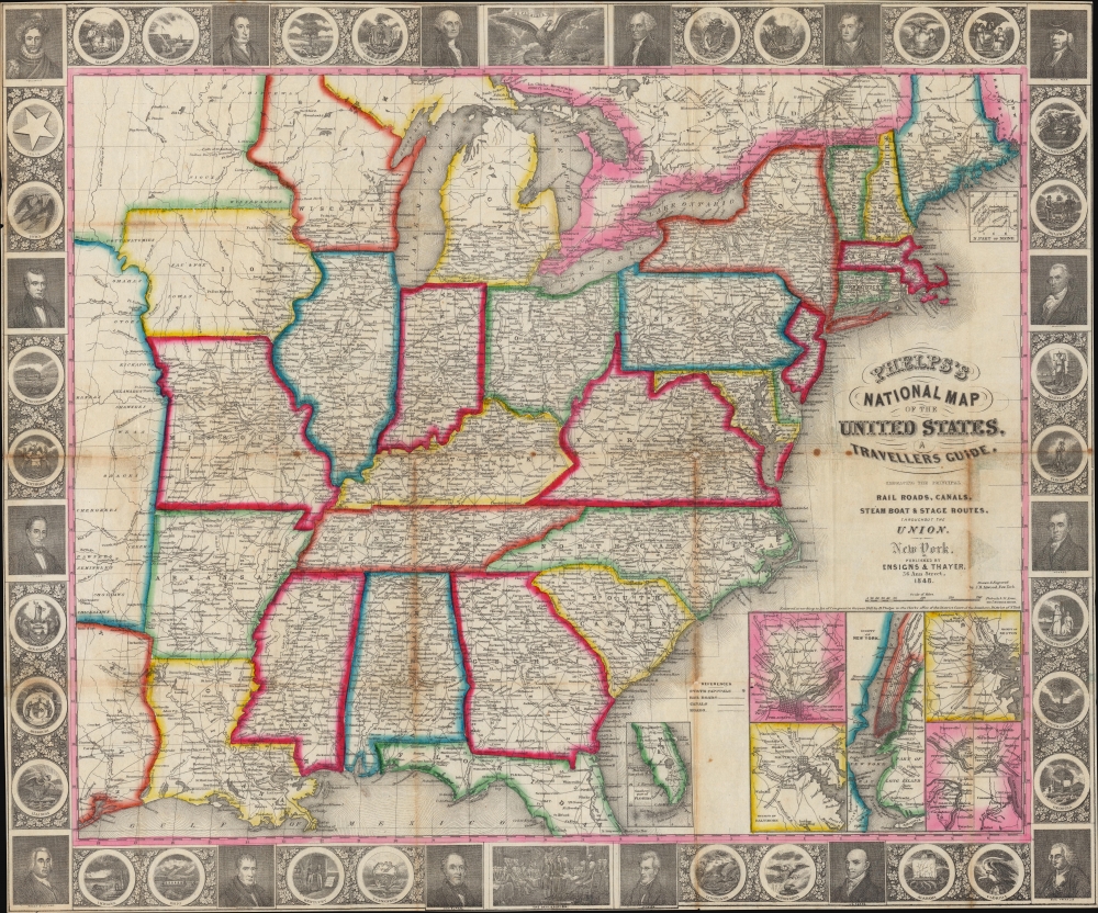
Phelps’s National Map of the United States, A Travellers Guide. Embracing the Principal Rail Roads, Canals, Steam Boat and Stage Routes throughout the Union.
sold
- Digital Map Information
- Suitable for large format printing
- DPI: 600
- File Size: 45.75 MB
- File Type: ZIP / TIFF
- ICC color profile embedded
- Delivered instantly via download link
This is the 1848 issue of the first state of Phelps's map of the United States. The map was issued during the Mexican-American War (1846 - 1848), and as such captures an ephemeral moment in American history: after Texas joined the Union, but before the Treaty of Guadeloupe-Hidalgo and the annexation of Upper California. (more details)
Panama Canal during the 'second' planning phase.
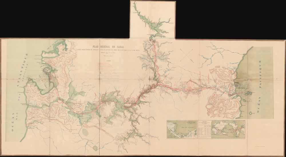
Plan Général Du Canal Avec Indication Du Projet Avec Plafond Du Bief De a La Partage A La Cote 20,75.
sold
- Digital Map Information
- Suitable for large format printing
- Full resolution TIFF file
- ICC color profile embedded
- Delivered instantly via download link
This is a scarce and detailed c. 1895 French topographical map of the Panama Canal in its planning stages issued by the French Compagnie Nouvelle du Canal de Panama. (more details)
First lithograph map of Baluchistan and the Punjab.
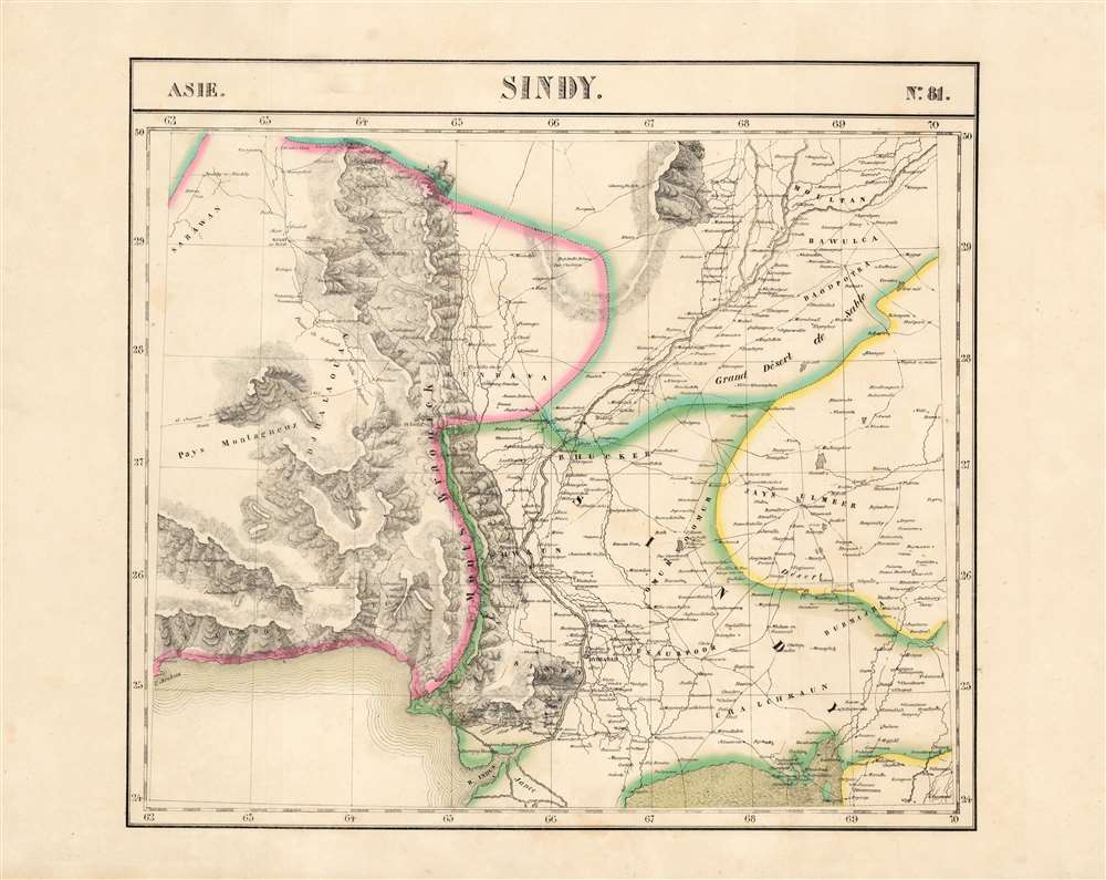
Sindy. Asie no. 81.
sold
- Digital Map Information
- Suitable for large format printing
- DPI: 600
- File Size: 54.64 MB
- File Type: ZIP / TIFF
- ICC color profile embedded
- Delivered instantly via download link
This is the 1827 Vandermaelen map of the lower Indus River valley and the Pakistani province of Sindh. It is the first large-scale atlas map to focus on the area, and the first to be executed in lithography. It includes parts of the Punjab, Balochistan, and Rajasthan in northwestern India, as well as the coast of the Arabian Sea from Omara to modern-day Karachi. Topography is pictorial, illustrating the mountains of the province with vigorous hachuring. The River Indus is shown as far north as Moultan, including its juncture with the River Chinnab. (more details)
Cartography for Zionism.

Jerusalem / ירושלים.
sold
- Digital Map Information
- Suitable for large format printing
- Full resolution TIFF file
- ICC color profile embedded
- Delivered instantly via download link
A striking pictorial view of Jerusalem produced in 1953 by Maximilian Romanoff for the Zionist organization Keren Hayesod. An archetypal work of persuasive cartography, it provides information on Zionist institutions throughout the city with an extensive text accompaniment discussing Jerusalem's history, contemporary political situation, points of interest, and more. (more details)
Jacksonville Expressways.
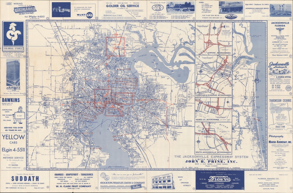
The Jacksonville Expressway System. A Limited Access Facility. John B. Prine, Inc.
sold
A large and impressive 1960 John B. Prine map of Jacksonville, Florida, detailing they city's expressway system. (more details)
Detailed maps along The United States' Ohio-Pennsylvania Frontier.
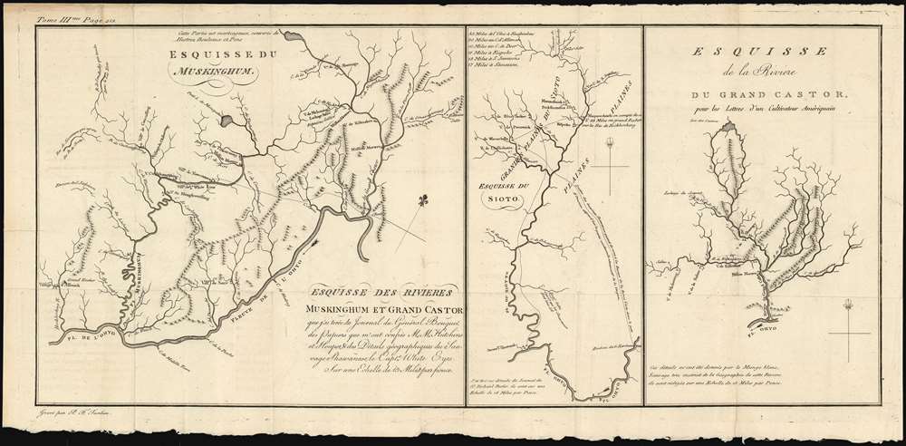
Esquisse des rivieres Muskinghum et Grand Castor que j'ai tiree du Journal du General Bouquet.
sold
- Digital Map Information
- Suitable for large format printing
- DPI: 600
- File Size: 11.03 MB
- File Type: ZIP / TIFF
- ICC color profile embedded
- Delivered instantly via download link
This is a scarce 1787 map of the Ohio River and its tributaries by Pierre Tardieu. Divided into three maps, this is one of the earliest maps of the region. The large map in the left depicts the course of the Ohio River from western Pennsylvania to the confluence of the Hockhoking River. The Sandusky River, which flows north into Lake Erie, appears at the top of the map. Its primary focus is the course of the Muskinghum River, the largest of the Ohio's tributaries in the region and the site of many indigenous and European settlements.
The center map depicts the Scioto River and its various tributaries, showing many indigenous settlements in the future location of Columbus, Ohio. The third map features the River Grand Castor - now known as the Beaver River, in Western Pennsylvania - and its tributaries. As in the other two maps, native and European settlements are noted throughout, with mountains beautifully rendered in profile. All three maps note sources for salt, trails between settlements, and native warpaths. (more details)
The center map depicts the Scioto River and its various tributaries, showing many indigenous settlements in the future location of Columbus, Ohio. The third map features the River Grand Castor - now known as the Beaver River, in Western Pennsylvania - and its tributaries. As in the other two maps, native and European settlements are noted throughout, with mountains beautifully rendered in profile. All three maps note sources for salt, trails between settlements, and native warpaths. (more details)
Little Red Riding Hood, Cinderella, and Snow White.

With the German Federal Railroad Through the Land of Fairytales.
sold
This is a c. 1960 reissue of the 1937 Leo Faller pictorial map of Germany illustrating and geographically contextualizing a rich tapestry of fairy tales. (more details)