
German-made map of Central America.
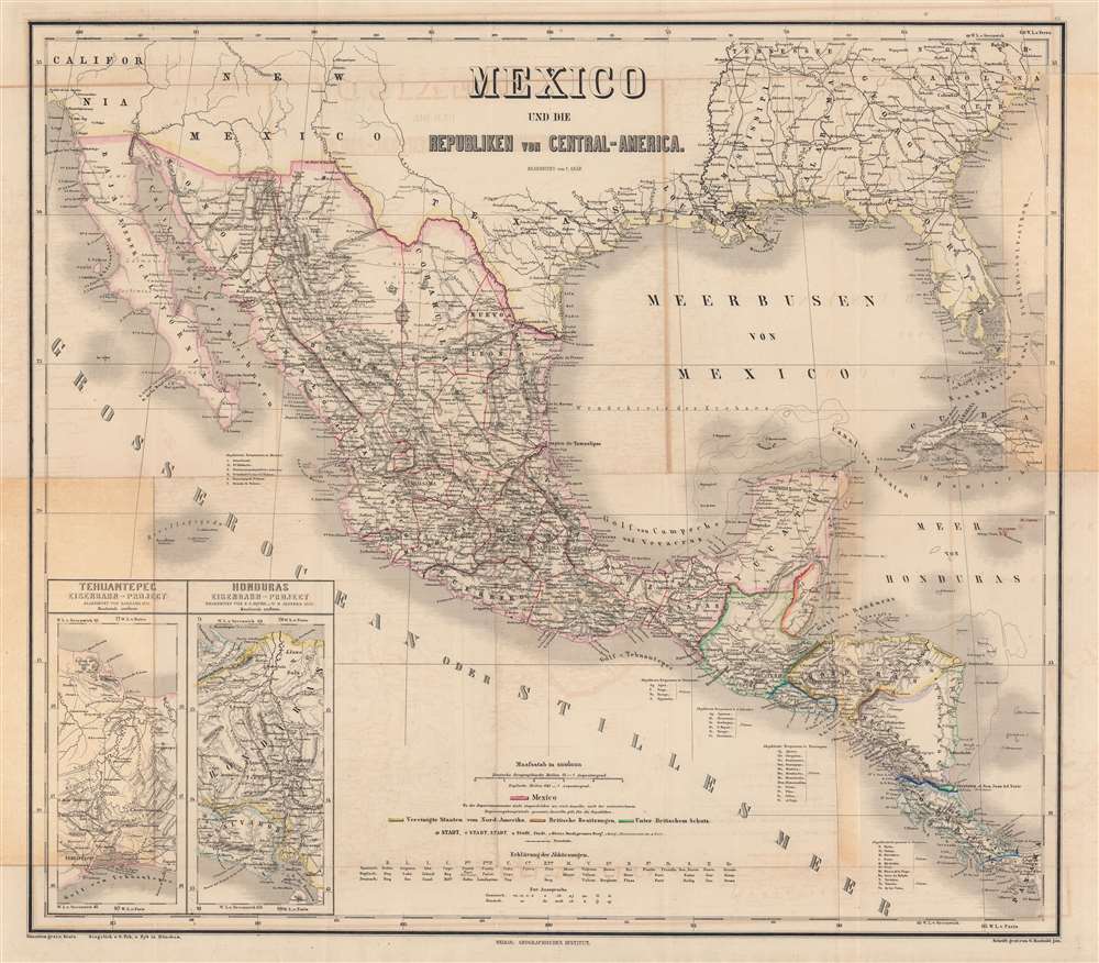
Mexico und die Republiken von Central-America.
sold
- Digital Map Information
- Suitable for large format printing
- Full resolution TIFF file
- ICC color profile embedded
- Delivered instantly via download link
This is a beautifully engraved and colored c. 1879 map of Mexico and Central America, edited by Carl Gräf and published by the Weimar Geographisches Institut. It shows the Mexico region stretching from the southern United States to Panama and includes a wealth of information on geography, administrative divisions, and infrastructure. (more details)
Bird's-eye view of Boston Harbor.
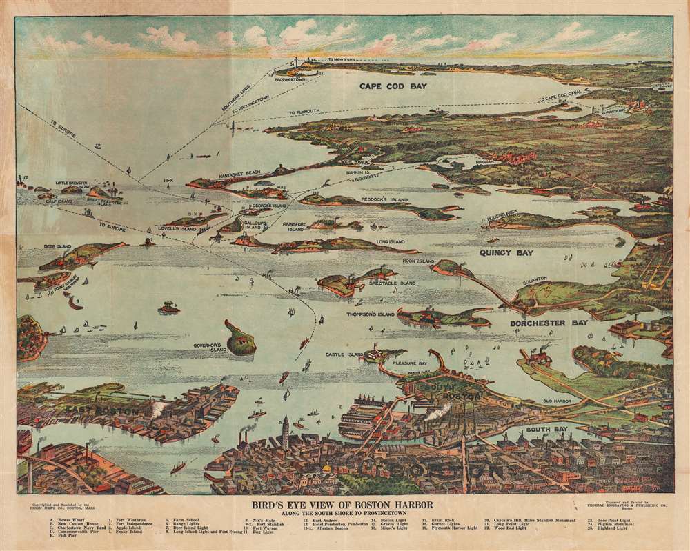
Bird's Eye View of Boston Harbor Along the South Shore to Provincetown.
sold
- Digital Map Information
- Suitable for large format printing
- Full resolution TIFF file
- ICC color profile embedded
- Delivered instantly via download link
This is a remarkable 1920 chromolithograph map and view of the Boston Harbor from Boston to Provincetown. It covers all of Cape Cod Bay, Quincy Bay, and Dorchester Bay with the communities of Boston, East Boston, South Boston, Dorchester, Quincy, Hough's Neck, Mingham, Nantucket, Duxbury, Plymouth, Cohasset, Scituate, and Provincetown noted. Many of the islands in Boston Harbor, including Moon Island, Spectacle Island, Thomson's Island, Long Island, Governor's Island, and others are also identified. An index in the bottom margin lists several other important places identified on the map. Ferry and steamboat routes are noted throughout. (more details)
Reddy Kilowatt as a conquistador.
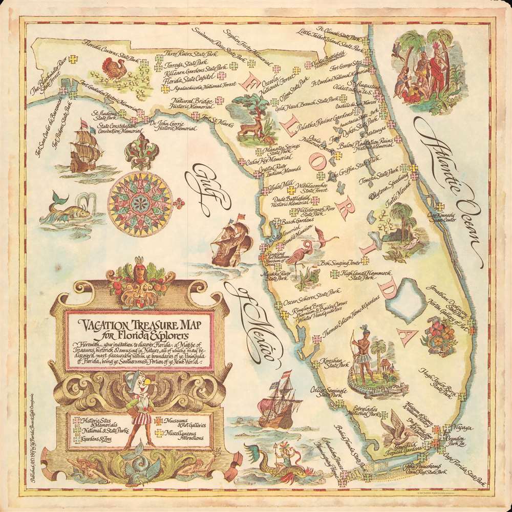
Vacation Treasure Map for Florida Explorers.
sold
This is a 1968 Florida Power and Light Company pictorial tourist map of Florida. 'X's present on pirate treasure maps mark 'treasures, historick and amusing in Nature' from Florida's northern border south to Ernest Hemingway's home in the Florida Keys. Shaded five different colors, the 'X's identify historic sites and memorial, national, and state parks, gardens and zoos, museums and art galleries, and miscellaneous attraction, including Everglades National Park, the Ringling Brothers Barnum and Bailey Circus winter headquarters, Cape Kennedy Space Center, Busch Gardens, and Daytona Speedway. Pictorial vignettes of mermaids, sea monsters, large sailing ships, and wildlife native to Florida add charm. A decorative title cartouche, designed in the style of 17th and 18th-century maps, adorns the lower-left and includes a key to the map's color-coding. Reddy Kilowatt, a mascot used by electric companies worldwide for over sixty years and first created in 1926 for the Alabama Power Company, stands at the cartouche's center, dressed as a Spanish conquistador. A pastedown on the verso details many of the sites identified. (more details)
Fishing in Corpus Christi Bay.

Gulf Oil Corp. Fishgide Corpus Christi.
sold
- Digital Map Information
- Suitable for large format printing
- Full resolution TIFF file
- ICC color profile embedded
- Delivered instantly via download link
This is a c. 1950 Gulf Oil Company fishing map of Corpus Christi, Texas, and its vicinity. Corpus Christi Bay dominates the center with areas for trout, redfish, and flounder highlighted. Depth soundings ('at mean low water') in the Corpus Christi and Enginal Channel, are marked, although text along the bottom states the map is not to be used for navigation. Laguna Madre and the Gulf of Mexico (separated by Mustang Island, St. Joseph Island, and Padre Island) occupy the bottom portion of the map. More areas known for fishing are highlighted and causeways connecting Mustang Island and Padre Island with the mainland are illustrated. Since this is a fishing map, very little inland detail is included. Major roads are emphasized by bold black lines, and Corpus Christi, Aransas Pass, Port Aransas, and Rockport are illustrated by street grids. An inset in the upper left focuses on the mouth of Baffin Bay and part of Laguna Madre. (more details)
Map and Menu.
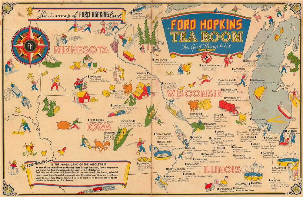
This is a map of Ford Hopkinsland. Ford Hopkins Tea Room For Good Things to Eat.
sold
- Digital Map Information
- Suitable for large format printing
- Full resolution TIFF file
- ICC color profile embedded
- Delivered instantly via download link
This is a 1940 Ford Hopkins pictorial map of Illinois, Iowa, Minnesota, and Wisconsin, along with part of Indiana. The map is the cover of a Ford Hopkins Drug Store and Tea Room food menu and highlights Ford Hopkins locations throughout the five states. Black boxes mark these cities and towns and include a brief description of each. Mankato, Minnesota, for instance, is said to be an 'Ideal Haunt for Sportsmen (Wild Fowl)' and a hunter with a shotgun sits nearby aiming at a flying duck. Iowa City, Iowa is known simply as the 'home of University of Iowa'. The two other universities, the University of Illinois (in Urbana Champaign, Illinois) and Purdue University (in Lafayette Indiana, where this menu is from), are marked by football stadiums as well. Purdue even has a boilermaker next to their stadium. Chicago, the home of the Ford-Hopkins Company, is identified by its skyline. Pictorial vignettes of farmers, livestock, and crops (mostly corn but some wheat) decorate the map. (more details)
Golden Age of Canals.
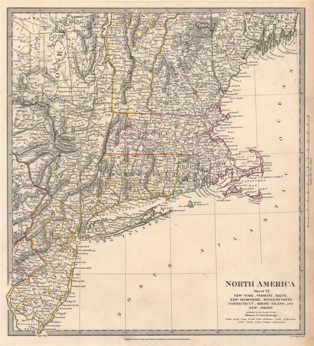
North America. Sheet VI. New-York, Vermont, Maine, New-Hampshire, Massachusetts, Connecticut, Rhode-Island, and New Jersey.
sold
- Digital Map Information
- Suitable for large format printing
- DPI: 600
- File Size: 33.47 MB
- File Type: ZIP / TIFF
- ICC color profile embedded
- Delivered instantly via download link
This is an 1832 Society for the Diffusion of Useful Knowledge (S.D.U.K.) map of New England, New York, and New Jersey. Created with impressive attention to detail, important towns, lakes, mountains, and other topographical features are noted throughout, with elevation rendered by hachure. The road network is illustrated in detail as well, along with canals, including the Morris Canal in New Jersey, the Farmington Canal (labeled Parmington here) in Connecticut, and the Hampden Canal in Massachusetts. An unlabeled railroad traverses Massachusetts from Boston west to New York and continues into New York toward Albany. (more details)
First Acquirable Map of the British Colonies from Virginia to New England.

Costes et Rivieres de Virginie de Mariland et de Nouvelle Angletere.
sold
- Digital Map Information
- Suitable for large format printing
- Full resolution TIFF file
- ICC color profile embedded
- Delivered instantly via download link
This is the 1674 Justel edition of Richard Blome's map of Virginia, Maryland, and New England. Blome's rare 1672 edition of this work was the first English map to focus on the British colonies in North America, Virginia up through New England; it just preceded the explosion of geographical knowledge represented by the works of Herrman (1673) and Seller (1676.) This French edition of the map is also scarce, but more acquirable to the collector than the Blome, and is a faithful copy of its precursor. It is a valuable addition to any collection pertaining to colonial Virginia and New England, in that it depicts the starting point for the expansion of those colonies that followed in the late seventeenth century. (more details)
Building a monumental capital.
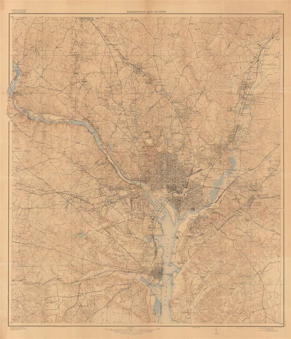
Washington and Vicinity.
sold
- Digital Map Information
- Suitable for large format printing
- File Size: 387.88 MB
- File Type: ZIP / TIFF
- ICC color profile embedded
- Delivered instantly via download link
This is a large and intricately detailed 1917 U.S. Geological Survey map of Washington, D.C., and surrounding areas. It depicts the city in the midst of a rapid expansion in the early 20th century, when it benefitted from an increased focus on public services and the growing writ of the federal government, in part due to World War I. (more details)
A comprehensive global guide.
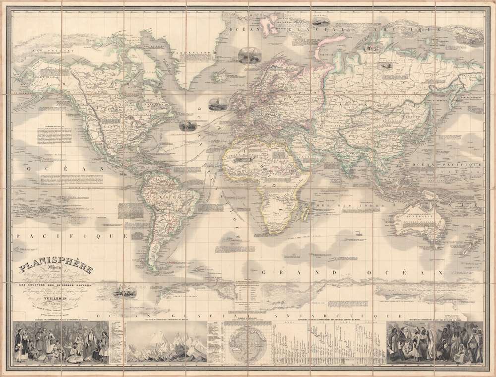
Planisphère illustré présentant la description géographique des parties connues de la terre...
sold
- Digital Map Information
- Suitable for large format printing
- DPI: 600
- File Size: 280.16 MB
- File Type: ZIP / TIFF
- ICC color profile embedded
- Delivered instantly via download link
This is a scarce and beautifully engraved 1853 'planisphere' world map by Alexandre Vuillemin and Langevin. It illustrates known global geography along with vignettes and explanatory notes on the history of navigation, natural resources, and the cultures of various parts of the world. (more details)
Anticipating the Great Exposition.
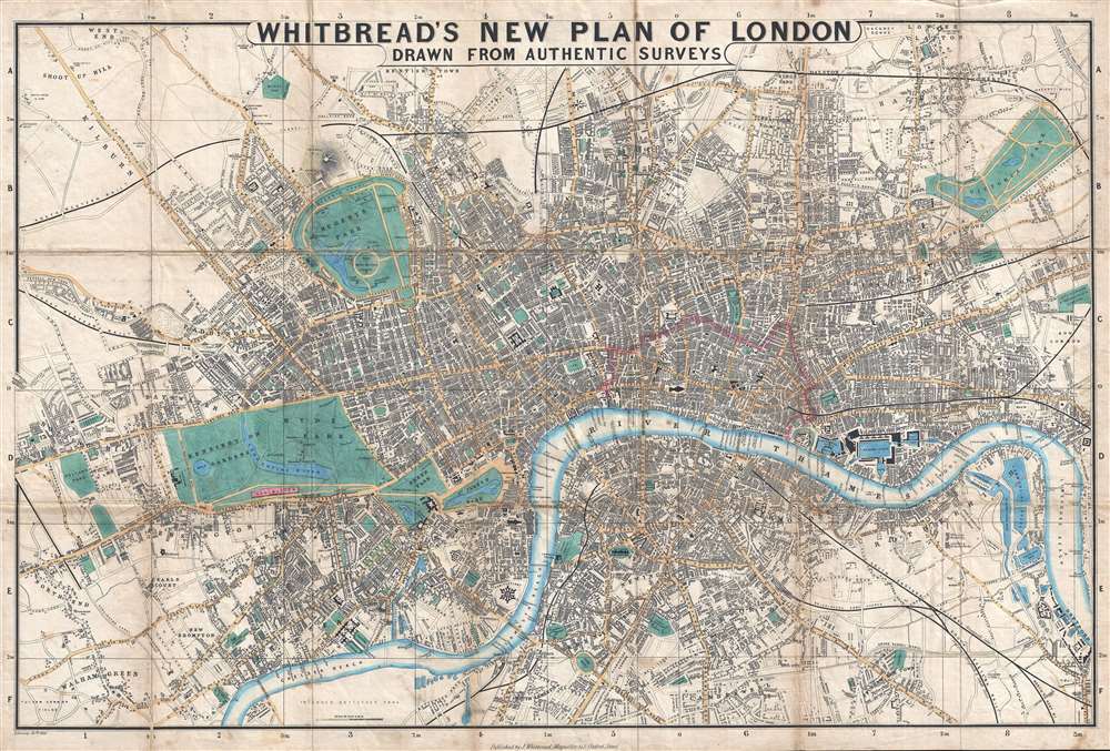
Whitbread's New Plan of London.
sold
- Digital Map Information
- Suitable for large format printing
- DPI: 300
- File Size: 13.63 MB
- File Type: ZIP / TIFF
- ICC color profile embedded
- Delivered instantly via download link
This is the 1851 first edition, second state of Josiah Whitbread's New Plan of London. The map is dated February 26, 1851, a little over two months before the May 1st opening of London's 'Great Exhibition of the Works of Industry of All Nations,' or simply the Great Exhibition. The Great Exhibition was the first of many World's Fairs, which became important venues for trade and nationalistic advancement. The exhibition space, known as the 'Crystal Palace', is depicted in Hyde Park. The Exhibition was planned by Prince Albert, Queen Victoria's husband, and became a spectacular financial success. The surplus funds were used to found the Victoria and Albert Museum, the Science Museum, and the Natural History Museum, all of which are located in South Kensington near Hyde Park. (more details)
Florida's navigable inland waterway craze.
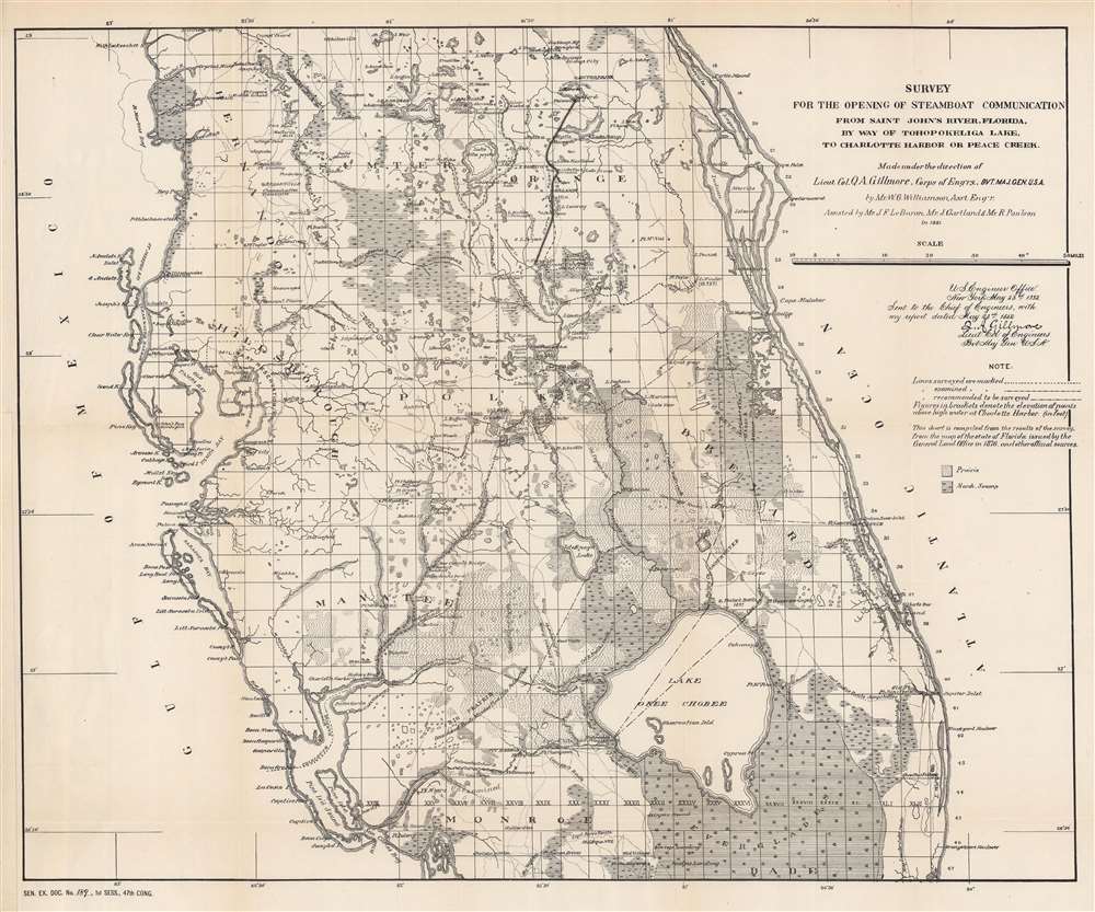
Survey for the Opening of Steamboat Communication from Saint John's River, Florida, by Way of Tohopokeliga Lake, to Charlotte Harbor or Peace Creek.
sold
- Digital Map Information
- Suitable for large format printing
- File Size: 53.63 MB
- File Type: ZIP / TIFF
- ICC color profile embedded
- Delivered instantly via download link
This is an 1882 W. G. Williamson map of central Florida canal surveys. After the American Civil War (1861 - 1865), as the population of Florida increased, demand for navigable inland waterways to transport goods and people rose. The present map was part of this phenomenon. Dashed lines illustrate canal surveys from the St. Johns River (near Merrits Island on the east coast) to Charlotte Harbor (on the west coast). These surveyed routes traversed Lake Tohopokeliga and connected Orlando, the South Florida Railroad, Lake Kissimmee, Fort Meade, and several other lakes with Florida's Gulf Coast at Charlotte Harbor. Other possible routes are marked, along with routes that were recommended to be surveyed. (more details)
Illustrates both Wrigley Field and Comiskey Park!

Pictorial Map of Chicago.
sold
- Digital Map Information
- Suitable for large format printing
- Full resolution TIFF file
- ICC color profile embedded
- Delivered instantly via download link
This is an attractive 1926 Clason Map Company pictorial city plan or map of Chicago, Illinois. Depicting from Howard Street south to East and West 87th Street, important buildings throughout are illustrated in profile, including the Field Museum, The Art Institute, the Museum of Natural History, Wrigley Field (labeled as Cubs Ball Park), and Comiskey Park (labeled White Sox Ball Park). Similar vignettes illustrate hotels, schools, hospitals, office buildings, churches, and numerous other buildings. The city's parks, cemeteries, and golf and polo clubs are illustrated and colored green. Pink, green, and red lines trace the motor coach routes through the North Site, West Side, and South Side, respectively. (more details)
Blazed Auto Trail map for Children.

Rand McNally Junior Auto Trails Map Florida.
sold
- Digital Map Information
- Suitable for large format printing
- Full resolution TIFF file
- ICC color profile embedded
- Delivered instantly via download link
This is a fascinating and rare c. 1923 Rand McNally road map of Florida created for children promoting the 'Blazed Trail' system. The 'child-sized' map allows child passengers to mimic the navigational process. Fifteen 'auto trails' are here numerically identified and correspond with a key in the upper right. Road quality and mileage between cities are provided along each route. An inset of the Florida Panhandle occupies the Gulf of Mexico. Named and blazed auto-trails appear in the upper right. (more details)
'Buy War Bonds. Remember Pearl Harbor. Help Set the Rising Sun!'

Loew's U.S. Pacific War Map.
sold
- Digital Map Information
- Suitable for large format printing
- File Size: 100.98 MB
- File Type: ZIP / TIFF
- ICC color profile embedded
- Delivered instantly via download link
This is a c. 1942 Loew's 'Remember Pearl Harbor' pictorial map of the Pacific Theater of World War II (1939 - 1945). The map was composed to inspire both patriotic outrage and fear that the 'American way of life' was under threat - and thus to encourage the purchase of 'War Bonds'. (more details)
The early days of British Australia.
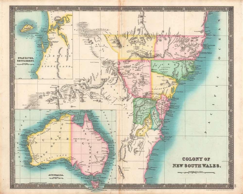
Colony of New South Wales, Swan River Settlement, Australia.
sold
- Digital Map Information
- Suitable for large format printing
- DPI: 600
- File Size: 34.8 MB
- File Type: ZIP / TIFF
- ICC color profile embedded
- Delivered instantly via download link
This is the Teesdale / John Dower's brilliantly colored 1831 map of Australia, with a focus on the Colony of New South Wales. It illustrates the territory as it was rapidly developing and transitioning from a penal colony to a society of free settlers. (more details)
U.S. President William McKinley's assassination.

Plan of the Pan American Exposition to the Held at Buffalo New York May 1 - Nov. 1, 1901.
sold
- Digital Map Information
- Suitable for large format printing
- File Size: 42.37 MB
- File Type: ZIP / TIFF
- ICC color profile embedded
- Delivered instantly via download link
This is a 1900 Gies and Company map of the Pan-American Exposition in Buffalo, New York. Buildings, exhibition galleries, walkways, and other attractions are identified throughout, including the Electricity Building, the Agriculture Building, and the U.S. Government Building. Extensive gardens occupy the lower portion of the map along with a large lake. Several lakes, fountains, and canals also adorn the exposition grounds. Today, the exposition is remembered as the location of the assassination of U.S. President William McKinley. (more details)
The Heart of Portuguese Power in the East.
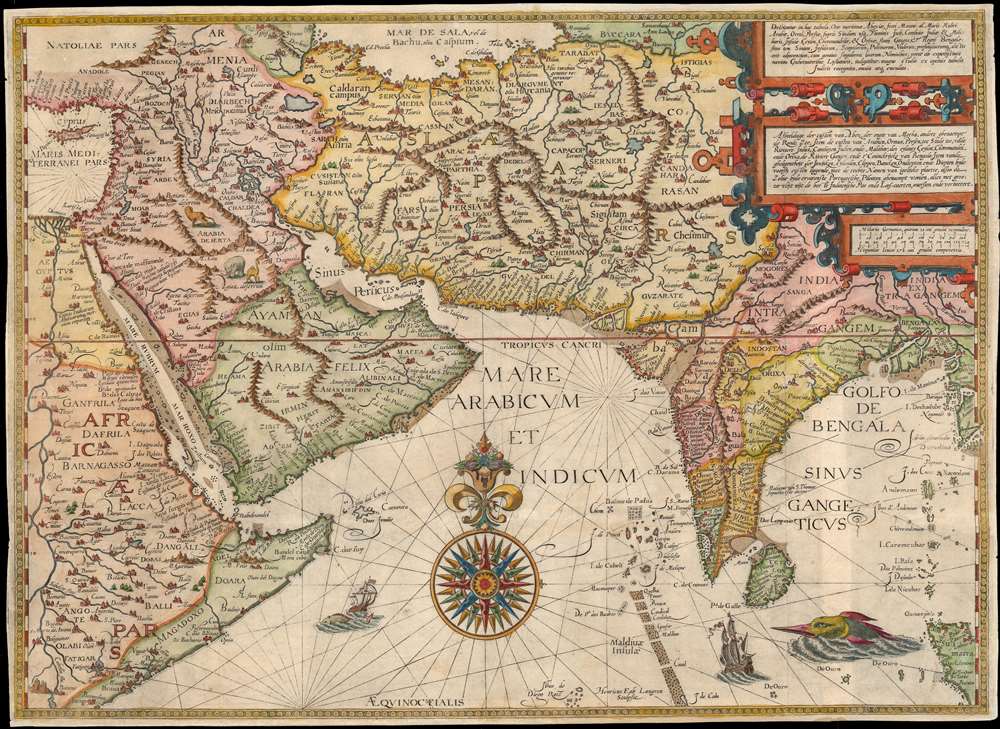
Deliniantur in hac tabula, Orae maritimae Abexiae, freti Mecani. al. Marís Rubri, Arabiae, Ormi, Persiae...
sold
- Digital Map Information
- Suitable for large format printing
- DPI: 600
- File Size: 59.14 MB
- File Type: ZIP / TIFF
- ICC color profile embedded
- Delivered instantly via download link
This is Jan van Linschoten's seminal 1596 map of the lands abutting the Indian Ocean, with coverage extending from the Arabian Peninsula to Sumatra. This map represents a significant advancement in accuracy and detail over any prior printed map of the region, setting the standard for most subsequent maps of the near east and south Asia for the remainder of the 16th and throughout the 17th century. Moreover, it exposed preciously guarded secrets of Portuguese maritime geography, paving the way for the Dutch seizure of the East India trade, thus spurring the Dutch Golden Age. (more details)
Among the earliest composite mountains and rivers charts.
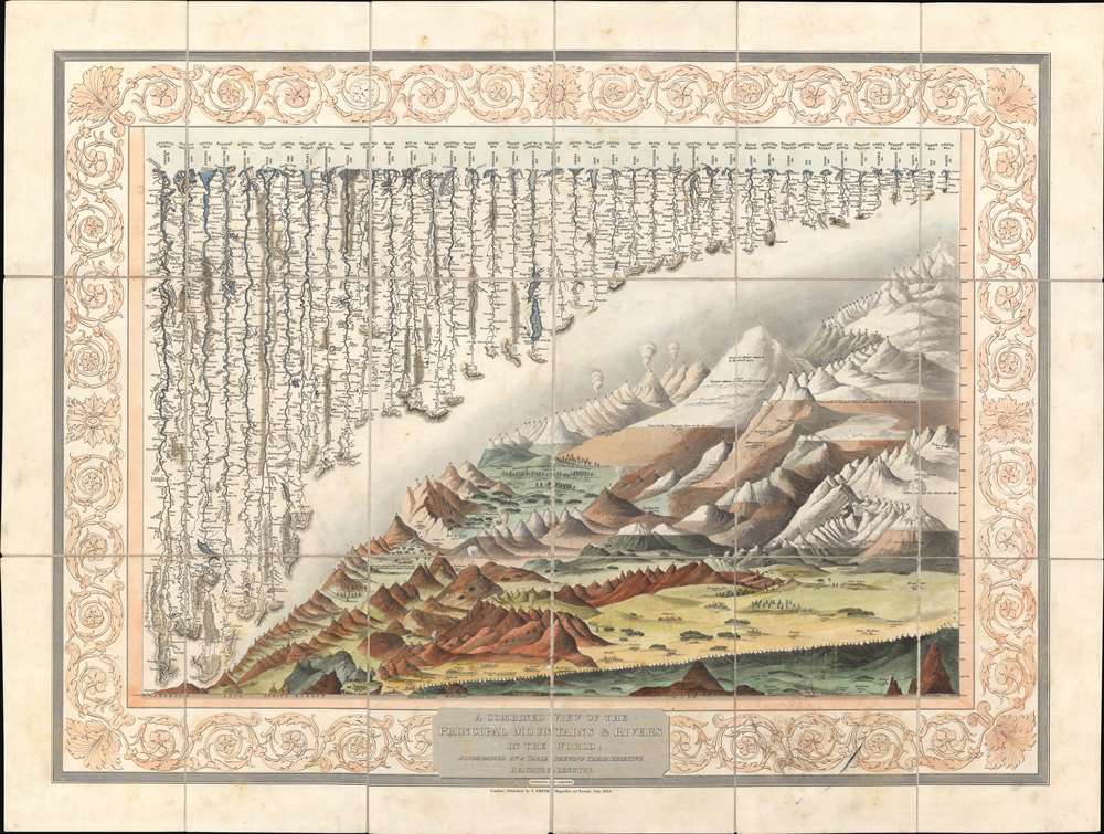
A Combined View of the Principal Mountains and Rivers in the World; accompained by a table shewing their relative Heights and Lengths.
sold
- Digital Map Information
- Suitable for large format printing
- DPI: 600
- File Size: 110.56 MB
- File Type: ZIP / TIFF
- ICC color profile embedded
- Delivered instantly via download link
A groundbreaking convention establishing map of extreme scarcity, this is Charles Smith and W. R. Gardner's 1824 comparative mountains and rivers of the world chart. It is the second known iteration of a comparative chart to depict both mountains and rivers in the same plate, preceded only by the Gardner/Darton chart of 1823 – thus defining a cartographic style that would flourish throughout the remainder of the 19th century. (more details)
Central Park - nearly complete!

Map of the Central Park Showing the progress of the Work up to January 1st 1864.
sold
- Digital Map Information
- Suitable for large format printing
- File Size: 38.64 MB
- File Type: ZIP / TIFF
- ICC color profile embedded
- Delivered instantly via download link
A very attractive 1864 map of New York City's Central Park. This map was issued for the 1864 Seventh Annual Report to the commissioners on the construction of the park. By 1864, most of the park had been completed, with only the northernmost sections above 103rd street remaining a work in progress. This is here indicated through the lack of wash coloring in the incomplete parts - generally embracing the Great Hill, the North Woods, the Conservatory Garden, Nutter's Battery, and the Harlem Meer.
This extraordinary map reveals Central Park as conceived by the landscape architects, and indeed 'artists,' Calvert Vaux and Frederick Law Olmsted. Vaux and Olmsted were awarded the task of designing Central Park in 1853 by the City Common Council. Olmsted's vision drove the overall design while Vaux concentrated his attentions on bridges, buildings, and other structures within the park. The creation of Central Park, which was to consist of some 800 acres of public forest, pathways, promenades, lakes, bridges, and meadows, was a seminal moment in civic urban design. The park itself was designed as a whole with every tree, pond, and bench meticulously planned. Olmsted wrote: 'Every foot of the Park's surface, every tree and bush, as well as every arch, roadway, and walk has been fixed where it is with a purpose.'
Historian Gloria Deak writes,
This extraordinary map reveals Central Park as conceived by the landscape architects, and indeed 'artists,' Calvert Vaux and Frederick Law Olmsted. Vaux and Olmsted were awarded the task of designing Central Park in 1853 by the City Common Council. Olmsted's vision drove the overall design while Vaux concentrated his attentions on bridges, buildings, and other structures within the park. The creation of Central Park, which was to consist of some 800 acres of public forest, pathways, promenades, lakes, bridges, and meadows, was a seminal moment in civic urban design. The park itself was designed as a whole with every tree, pond, and bench meticulously planned. Olmsted wrote: 'Every foot of the Park's surface, every tree and bush, as well as every arch, roadway, and walk has been fixed where it is with a purpose.'
Historian Gloria Deak writes,
There was a staggering amount of work to be done to transform the area into a blend of pastoral and woodland scenery. This involved the design and construction of roadways, tunnels, bridges, arches, stairways, fountains, benches, lamp posts, gates, fences and innumerable other artifacts. It also involved the supervision of an army of about five thousand laborers…Olmsted, to whom most of the credit goes, insisted on seeing the multidimensional project as a single work of art, which he was mandated to create. For this purpose, he ventured to assume to himself the title of ‘artist.'Today, because of Vaux and Olmsted's efforts, New York Yorkers, ourselves included, have the privilege of enjoying what is, perhaps, the finest example of a planned urban public recreation area in the world. (more details)
Early work by important women cartographers.
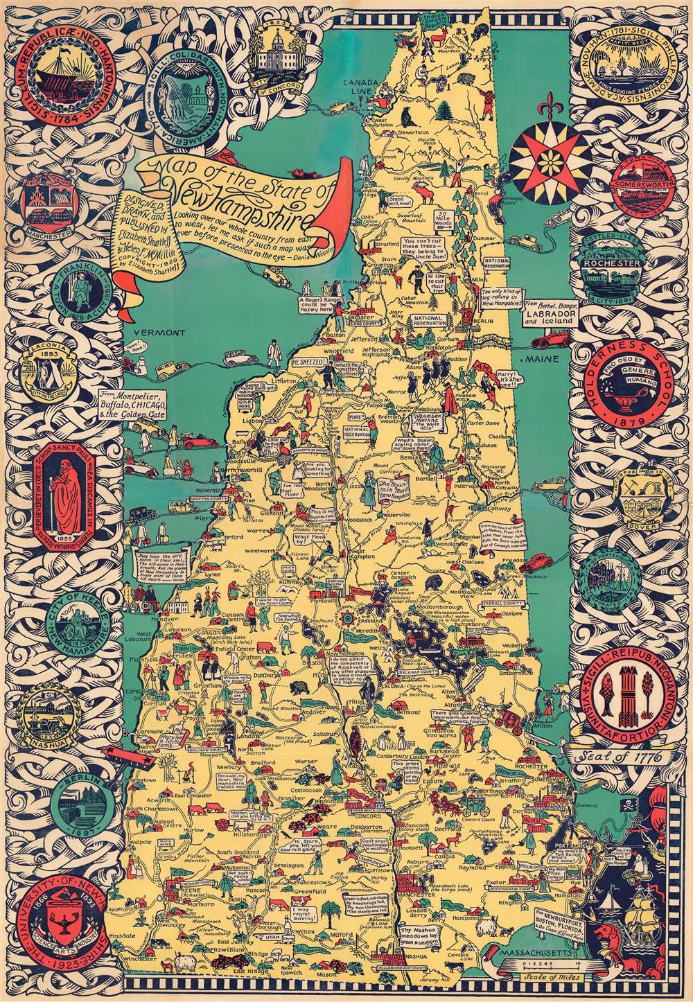
Map of the State of New Hampshire.
sold
- Digital Map Information
- Suitable for large format printing
- File Size: 109.37 MB
- File Type: ZIP / TIFF
- ICC color profile embedded
- Delivered instantly via download link
This is a 1926 Elizabeth Shurtleff and Helen F. McMillin pictorial map of New Hampshire. Shurtleff and McMillin were among the most prominent of the pioneering female artists who influenced the Golden Age of American Pictorial Cartography - from the 1920s - 1940s. Shurtleff was a New Hampshire native, and this map represents some of her earliest formative work - and as such offers both scarcity and significance. (more details)