
Asia, from America's first atlas.
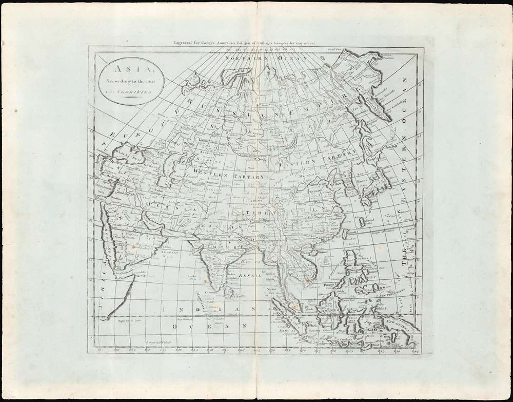
Asia, according to the best authorities.
$200.00
Acquire
- Digital Map Information
- Suitable for large format printing
- Full resolution TIFF file
- ICC color profile embedded
- Delivered instantly via download link
This is an uncommon c. 1796 map of Asia from Carey's General Atlas, the first atlas published in the United States after Independence. The map stretches from Asia Minor and Arabia across to Japan, the Philippines, and Indonesia, and from the arctic north of Siberia south to the Indian Ocean. (more details)
Visit the Florida Keys!

Teall's Guide to the Florida Keys.
sold
This is a c. 1986 Teall's Guide map of the Florida Keys. Created as a tourist guide to the Keys, individual Keys are labeled from Old Rhodes Key south to Key West. A red dashed line marks the Overseas Highway and red overprinting indicates mile markers every ten miles. Red overprinted 'diver down' flags mark scuba diving sites along the ocean side of the Keys, including at Carysfort Reef, John Pennekamp Coral Reef State Park, and Alligator Reef. Everglades National Park, Biscayne National Park, and the Great White Heron National Wildlife Refuge are identified. An inset map in the upper left corner situates the Florida Keys regionally, with a black box indicating exactly where the area depicted by the map is located. (more details)
Playful map of California wine country.
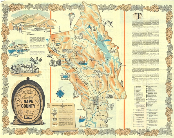
Beautiful Napa County.
sold
This is a beautiful 1963 pictorial map of Napa County, California, by Weld Wilkie. It covers Napa County, one of the world's premier wine regions, in beautiful detail. It notes several landmarks and places of interest, such as The Old Bale Mill, Breathing Geysers (Geysers Geothermal Field, typo on map as 'Ceysers'), and Robert Louis Stevenson State Park, with a location key in the lower right quadrant. Fifteen principal wineries, including Charles Krug Winery, Beringer Bros. Inc., Inglenook Vineyard Company, and Schramsberg Winery, are also marked with a key in the lower right quadrant. The map is adorned with several illustrations throughout, depicting activities like dining, fishing, horseback riding, trekking, camping, golfing, and water sports, as well as illustrations of animals, trees, and other landmarks. Roads, rivers, lakes, towns, and other topographical features are also noted. (more details)
The most iconic view of the Battle of Gettysburg.

Gettysburg Battle-Field.
sold
- Digital Map Information
- Suitable for large format printing
- File Size: 43.53 MB
- File Type: ZIP / TIFF
- ICC color profile embedded
- Delivered instantly via download link
A remarkable and scarce 1863 proof state of the most iconic view of the American Civil War Battle of Gettysburg printed. This bird's eye view of the Battle of Gettysburg was issued by John Bachelder just months after the actual event. Within days of the battle, Bachelder arrived in Gettysburg where he spent the subsequent 84 days completing a meticulous study of both the battle and the battlefield. Bachelder walked the field daily, interviewed thousands of recovering soldiers on both sides, both commanders and enlisted men, and reconstructed all three days of the battle. (more details)
Colonial Wars, Gold Mining, and Political Intrigue!
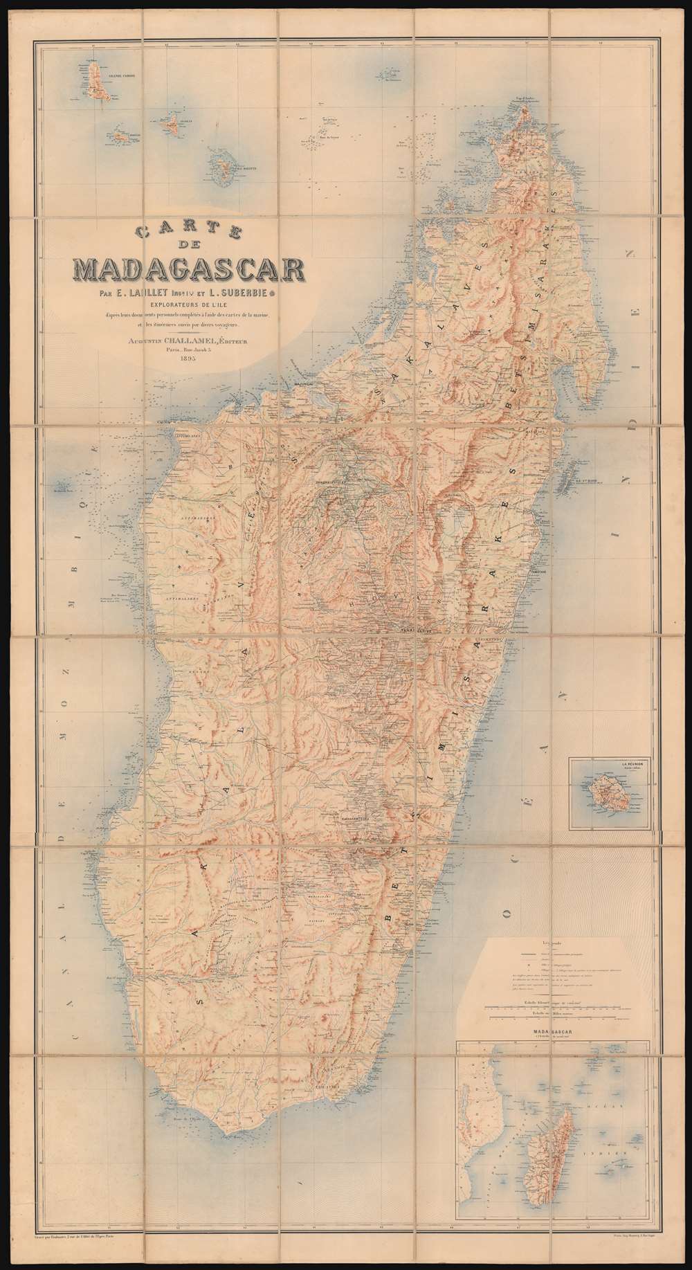
Carte de Madagascar.
sold
- Digital Map Information
- Suitable for large format printing
- Full resolution TIFF file
- ICC color profile embedded
- Delivered instantly via download link
This large, magnificently detailed, and rare map of Madagascar is the first modern, scientific survey of the island. This map is significant not only for its groundbreaking cartography, but also for its support of insights into the complex and often conflicting loyalties and motivations that unpinned colonial life: loyalties to self, to company, to countryman, to nation, and to the adopted nation. (more details)
The 1755 Great Earthquake of Lisbon.
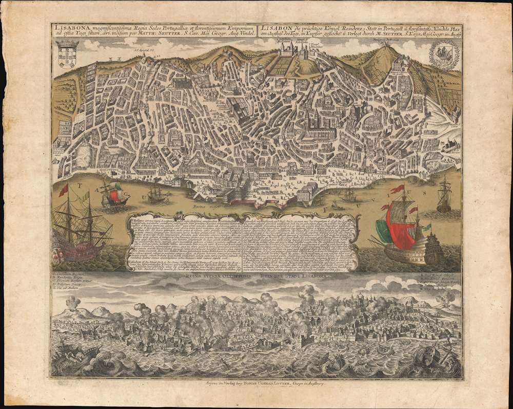
Lisabona magnificentissima Regia Sedes Portugalliae et florentissimum Emporium ad ostia Tagi situm... / Lisabon die prächtige Konigl. Residenz. Statt in Portugall ù florisanteste Handels Plaz am Ausfluss des Tagi.../ Ruinae eversae olysipponis. / Ruin der Stadt Lisabona.
sold
- Digital Map Information
- Suitable for large format printing
- Full resolution TIFF file
- ICC color profile embedded
- Delivered instantly via download link
An extraordinary 1756 Seutter / Lotter map and view of Lisbon, Portugal, in the wake of its near total destruction by the Great Lisbon Earthquake of 1755. The map is divided into two sections. The upper section features a view and map of Lisbon as it appeared in 1735, 20 years prior. The lower section, entitled 'Ruinae Eversae Olysipponis' is a dramatic bird's eye view of Lisbon being consumed by the Great Earthquake and related fires. (more details)
A rare set of eight full-color early twentieth century anatomical charts.

W. and A.K. Johnston's Charts of Anatomy and Physiology.
sold
This is a set of eight c. 1903 William and Alexander Keith Johnston charts of human anatomy and physiology. Designed by renowned English anatomist Dr. William Turner, this set includes charts depicting the bones, ligaments, muscles, heart and arteries, veins and lungs, organs of digestion, nervous system, and organs of sense and voice. Each chart is charmingly illustrated with a human figure at center demonstrating how these systems fit together. Surrounding the central drawing are several smaller illustrations that relate to the subject of each chart. The eighth chart, concerning to organs of sense and voice, does not include the central human figure, but is a collection of fifteen smaller illustrations depicting the organs necessary for sight, smell, hearing, taste, and speech. (more details)
Wonderful pictorial map illustrating the Beatles' early career in Liverpool.
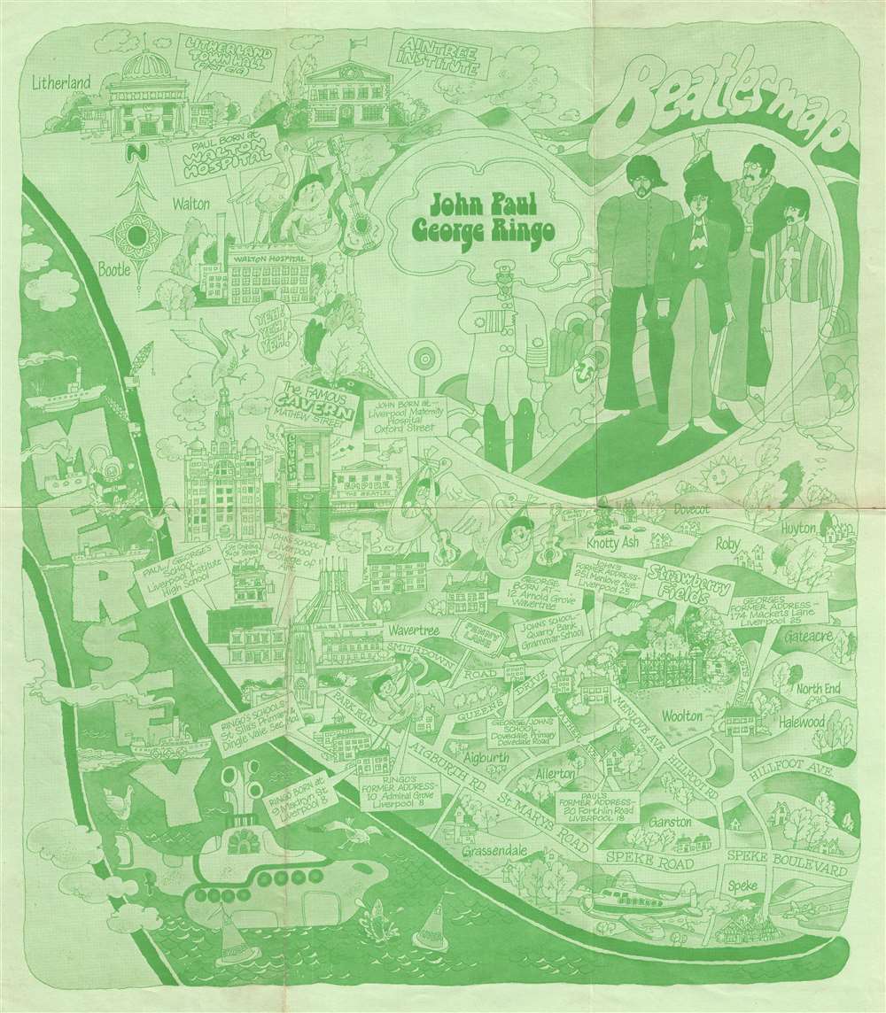
Beatles Map.
sold
This is a 1974 Beatles map of Liverpool. Created in the style of The Beatles animated film Yellow Submarine, the Beatles pictorial map of Liverpool labels numerous places throughout the city significant in the lives of The Fab Four. Per the National Museums of Liverpool, this is 'one of the first Beatles maps of Liverpool that was ever produced.' It marks the locations where John, Paul, George, and Ringo were each born, the addresses where they lived, the schools they attended, and the locations of some of their first gigs. Streets throughout Liverpool are labeled, including signposts for Penny Lane and Strawberry Fields. John, Paul, George, and Ringo are illustrated just as they are on some Yellow Submarine posters on the upper right, along with two other characters from the film. The Yellow Submarine itself is depicted in the River Mersey, along with numerous other boats, fish, and seagulls. (more details)
Geology is SoCal.
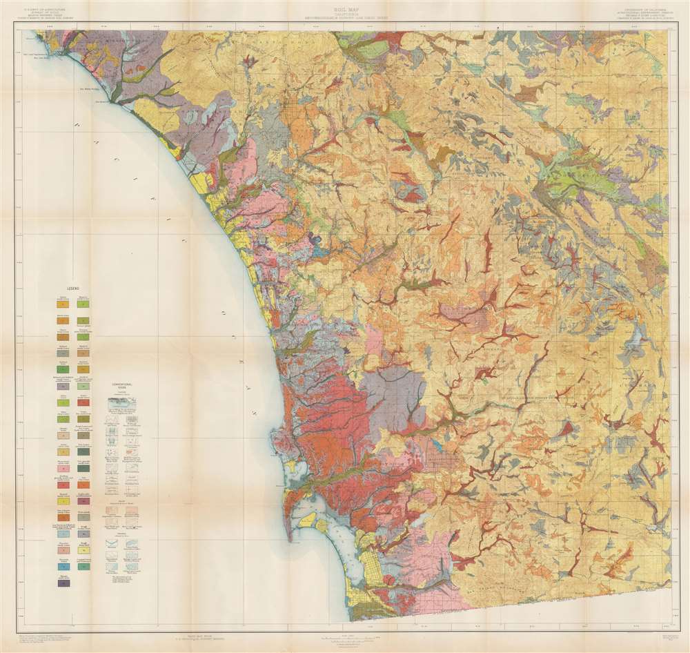
Soil Map. California. Reconnoissance Survey - San Diego Sheet.
sold
- Digital Map Information
- Suitable for large format printing
- File Size: 82.1 MB
- File Type: ZIP / TIFF
- ICC color profile embedded
- Delivered instantly via download link
This is a 1915 U.S. Department of Agriculture soil map of southern California, depicting from Dana Point and Mussel Cove to San Diego Bay, and from the Pacific Ocean to the San Felipe Valley. As a geological map, some thirty-five color and pattern combinations mark soil types and terrain is illustrated by hachure. Cities and towns are noted (including San Diego, Oceanside, and Carlesbad) and major roads appear. The region's Indian Reservations are delineated. (more details)
First edition of Visscher II's Portugal.
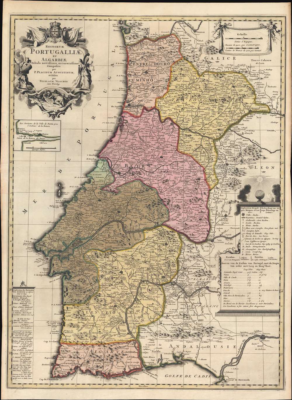
Regnorum Portugalliae et Algarbiae Tabula Novissima accuratissime Composita per P. Placidium Augustinum, et Edita par Nicolaum Visscher.
sold
- Digital Map Information
- Suitable for large format printing
- Full resolution TIFF file
- ICC color profile embedded
- Delivered instantly via download link
A striking c. 1700 old-color Nicholas Visscher II and Placide de Sainte Hélène map of Portugal, published at the height of Portugal's Golden Age, before the disastrous 1755 Great Lisbon Earthquake. The map depicts all of Portugal, including the Algarve and adjacent parts of Galicia, Leon, and Andalucía. An inset in the upper left quadrant illustrates the Duero River and Porto. Due to the contribution of the Augustinian geographer Placide de Sainte Hélène, this map is larger and considerably updated from previous Dutch maps of Portugal, including Visscher family maps. (more details)
Pictorial view of San Francisco.

San Francisco.
sold
This is a large-scale loosely cartographical 1978 Barbara Spurll 'city character view' map of San Francisco, California. The map looks south on San Francisco, with the Golden Gate Bridge taking pride of place in the foreground. The Presidio marks the farthest point west, and the Bay Bridge, the farthest point east - although the East Bay appears in the distance. The San Francisco International Airport appears in the distance as well. Some of San Francisco's most iconic buildings are evident, including the Transamerica Pyramid, Palace of Fine Arts, City Hall, Grace Cathedral, and the Painted Ladies, among many others. Comparatively dry annotations throughout offer historical facts. The whole is surrounded by a floral border. (more details)
Planning for an attack on Fortress Singapore.

シンガポール要塞鳥瞰圖 / [Birds Eye View of Singapore Fortifications].
sold
- Digital Map Information
- Suitable for large format printing
- Full resolution TIFF file
- ICC color profile embedded
- Delivered instantly via download link
This is an extremely rare c. 1941 Japanese-issued bird's-eye view of Singapore, emphasizing fortifications, oil facilities, and airfields. Soon after its publication, Singapore fell to Japanese forces in a single day. The defeat was considered by Winston Churchill, 'the worst disaster and largest capitulation in British history...' (more details)
Track James Bond around the world as he spies in Ian Fleming's novels.

The Ian Fleming Thriller Map.
sold
This is a 1987 John Zeleznik and Susan Lewis pictorial map of the world highlighting locations in Ian Fleming's James Bond novels. A generic portrait of James Bond (that admittedly bears a striking resemblance to Sean Connery) dominates the sheet. A portrait of a 'Bond Girl' wearing sparkling diamonds and holding an open bottle of champagne appears as well. An Aston Martin appears in the lower left, while a Japanese inspired temple occupies the upper right. The entire map is superimposed on a gigantic Union Jack meant to illustrate the Earth. Crosshairs mark 117 locations in North America, the Caribbean, Europe, and Asia. Each location corresponds with a numerical index at the bottom of the map. Locations within the index are divided by novel, which are listed in chronological order from Casino Royale (1953) through Octopussy (1965). Each book's title appears in bold red capital letters, and the locations, cars, drinks, villains, women, and guns that appear in each book are listed. Completing the Bond aesthetic, the index is superimposed over illustrations of lounging women. (more details)
Summer Theater in New England.

The Stage's Own Motor Map of Summer Broadway. Revised Edition.
sold
- Digital Map Information
- Suitable for large format printing
- File Size: 13.02 MB
- File Type: ZIP / TIFF
- ICC color profile embedded
- Delivered instantly via download link
This is a 1933 Frank Eaton pictorial map of New England highlighting the region's playhouses. Black stars mark towns where playhouses host summer Broadway troupes, including Stockbridge (Berkshire Players), Dennis (The Cape Playhouse), Provincetown (Wharf Theatre), and Peterborough (Mariarden Stage). Interesting facts accompany some of these places, such as Hyde Park (home of Franklin D. Roosevelt - then President of the United States). Pictorial vignettes continue the map's charm and very from the comedic ('More Moose Than Actors This Way' in Maine) to informative ('Beware of Deer on the Roads' or 'Don't Hesitate to Ask Directions'). Dotted lines mark highways, old post roads, and even 'presumed' locations of Native American trails. An inset along the left border details the coast of New Jersey from Sandy Hook to Cape May, with illustrations of Atlantic City. A second inset in the lower right depicts from Pennsylvania to Delaware along the Delaware River and highlights Moylan and Arden. (more details)
First major engagement of the Second Sino-Japanese War.

大上海之毀滅 / [The Destruction of Greater Shanghai].
sold
- Digital Map Information
- Suitable for large format printing
- File Size: 7.08 MB
- File Type: ZIP / TIFF
- ICC color profile embedded
- Delivered instantly via download link
This is a c. 1937 map of Shanghai illustrating the destruction wrought on the city by the Battle of Shanghai. That battle was the first major battle of the Second Sino-Japanese War (1937 - 1945) and raged from August through November 1937. (more details)
Visit St. Petersburg!

Pleasure Map of St. Petersburg Florida.
sold
- Digital Map Information
- Suitable for large format printing
- Full resolution TIFF file
- ICC color profile embedded
- Delivered instantly via download link
This is a c. 1937 Griffith Advertising Agency pictorial tourist map of St. Petersburg, Florida. Pictorial vignettes highlight the city's golf courses, beaches, and tropical flora. Fishing and sailing boats ply the waters of Tampa Bay, Boca Ciega Bay, and the Gulf of Mexico. Illustrations of fish and seabirds add charm, while airplanes reinforce the modern era of 'easy' transportation and travel. Printed photographs frame the map on three sides and underscore St. Petersburg's attractiveness as a vacation destination. A map of downtown St. Petersburg occupies half the verso. (more details)
Arkansas townships.

Arkansas.
sold
- Digital Map Information
- Suitable for large format printing
- Full resolution TIFF file
- ICC color profile embedded
- Delivered instantly via download link
This is an 1845 William Pelham map of Arkansas illustrating state has platted into neat square townships. The township was created as the measure of the Public Land Survey System, which was first widely implemented to survey the Northwest Ordinance. The Public Land Survey System allowed for the systematic surveying and mapping of any territory gained by the United States. Cities and towns are labeled, including Little Rock, Hot Springs, and Pine Bluff. Rivers and creeks are illustrated and labeled. (more details)
Countryside- a new real estate development in Clearwater.
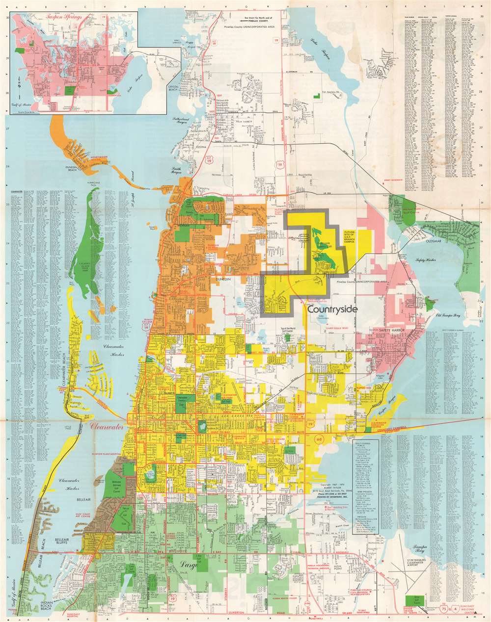
Clearwater Largo Dunedin Area map and street guide.
sold
This is a 1974 Robert Taylor map of Clearwater, Largo, and Dunedin, Florida, published as a promotional piece for the new Countryside real estate development (highlighted here in yellow bordered by thick gray lines). The map depicts from Lake Tarpon to the St. Petersburg Clearwater Airport and Indian Rocks Beach. Golf courses, country clubs, and parks throughout the region are shaded green. Cities in the area are shaded different colors. Clearwater is yellow, Largo is teal, Dunedin is orange, and Safety Harbor is pink. Streets are illustrated and labeled as well, along with the Amtrak Seaboard Coast Line Railroad and several lakes. An inset of Tarpon Springs occupies the upper left, while street indexes for Clearwater, Dunedin, Safety Harbor, Largo, and other towns occupy the other three corners. (more details)
First complete survey of the Maldives.
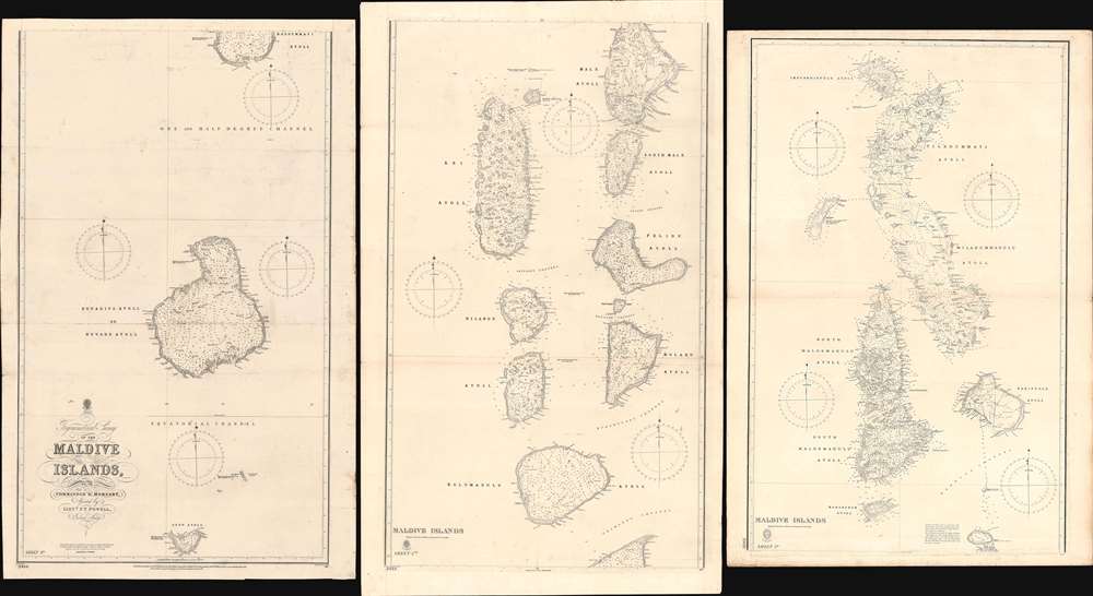
Trigonometrical Survey of the Maldive Islands.
sold
- Digital Map Information
- Suitable for large format printing
- Full resolution TIFF file
- ICC color profile embedded
- Delivered instantly via download link
The largest and most important 1904 chart of the Maldives, compiled by Indian Navy Commander Robert Moresby and Frederick Thomas Powell. The map consists of three joinable panels embracing the Maldive Islands in full, rich with soundings, details about available water supply, tide notes, and a wealth of other practical data for the mariner. This map, the result of meticulous hydrographic work in the mid-19th century, opened the Maldives to steam navigation and was essential to establishing viable steam navigation routes between the Red Sea and the East Indies. It remained the definitive mapping of the Maldives until the 1900s, when it was at last superseded by satellite hydrography. This map also reveals the extent to which the Maldives are at risk form sea-level rise and Global Warming, which is predicted to make the archipelago unhabitable by 2050. (more details)
Japan's changing self-conception as it opened up to the world.

新撰日本全圖 / [New and Complete Map of Japan].
sold
- Digital Map Information
- Suitable for large format printing
- File Size: 68.41 MB
- File Type: ZIP / TIFF
- ICC color profile embedded
- Delivered instantly via download link
This is a noteworthy 1875 (Meiji 8) Urabe Seiichi map of Japan, including Sakhalin and the Kuril, Ogasawara, and Ryukyu Islands. It was made early in the Meiji period and reflects the tremendous territorial, technological, and cultural changes underway in Japan at that time. (more details)