
Protecting Washington, D.C. against a potential Confederate attack.

General Birds-Eye View of Washington and the Vicinity, Showing the Forts, Camps, Railroads, Rivers, etc.
sold
- Digital Map Information
- Suitable for large format printing
- File Size: 31.87 MB
- File Type: ZIP / TIFF
- ICC color profile embedded
- Delivered instantly via download link
This is a stunning 1862 birds-eye view or map of Washington D. C. and vicinity, published nine months after the outbreak of the American Civil War, in the January 4, 1862 issue of Harper's Weekly. The view overlooks Washington from the north, placing the U.S. capital firmly in the foreground. Occupied Virginia (and several Union forts protecting Washington, D.C.) lies just across the Potomac. Fredericksburg, Virginia, the site of the Battle of Fredericksburg on December 13, 1862, appears in the background, labeled with the number twenty-six. (more details)
Unrecorded state of a rare map of Lake Winnipesaukee.
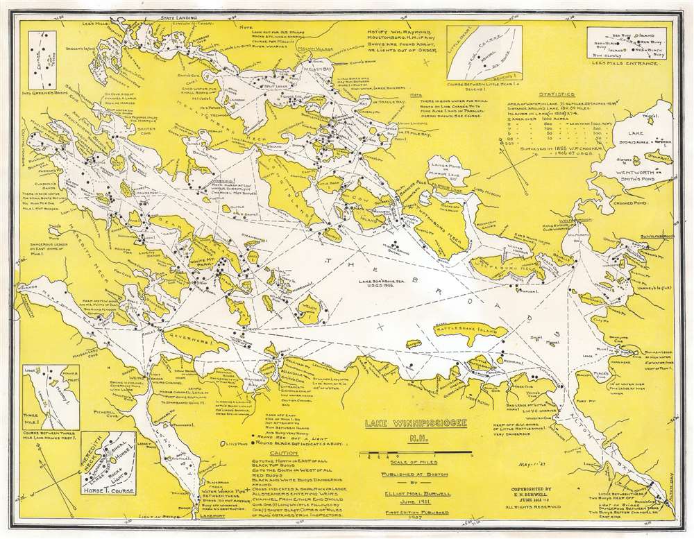
Lake Winnipissiogee N.H.
sold
- Digital Map Information
- Suitable for large format printing
- File Size: 22.35 MB
- File Type: ZIP / TIFF
- ICC color profile embedded
- Delivered instantly via download link
This is a 1927 Elliot Noël Burwell map of Lake Winnipesaukee, New Hampshire. Burwell marks islands, rocks, shoals, coves, points, and other landmarks and navigation hazards throughout the lake. Black dots mark buoys. Dashed lines illustrate good channels for ferries and private vessels. Information about the lake, including unmarked channels, good places to use small boats, and advice about dangerous spots appear around the lake's banks. Five small insets situated near the border detail difficult courses in certain areas of the lake. (more details)
The Wash and the Humber.
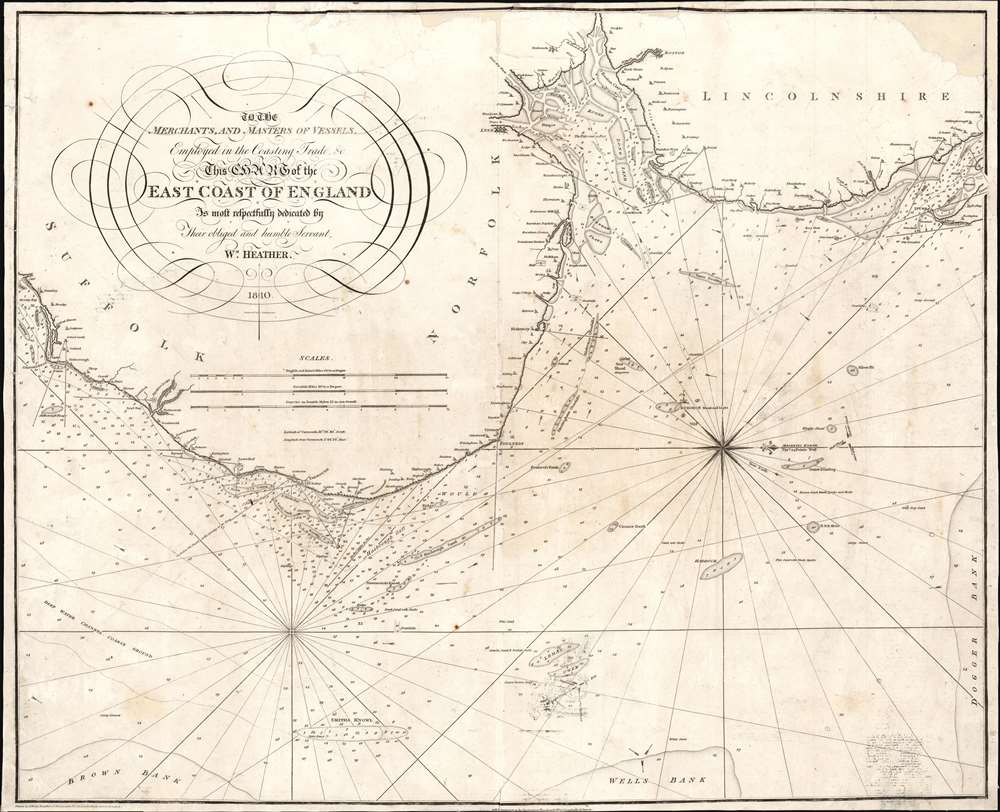
To the Merchants and Masters of Vessels Employed in the Coasting Trade etc. This Chart of the East Coast of England is most respectfully dedicated by their obliged and humble servant Wm. Heather.
$350.00
Acquire
- Digital Map Information
- Suitable for large format printing
- Full resolution TIFF file
- ICC color profile embedded
- Delivered instantly via download link
This is an 1810 William Heather and John Norie nautical chart or maritime map of the east coast of England, including parts of Suffolk, Norfolk, and Lincolnshire. The coasts are illustrated in astonishing detail. Numerous depth soundings appear along the coast, with the greatest concentrations off the coast of Yarmouth, in The Wash (the rectangular estuary/bay between Norfolk and Lincolnshire) and the Humber, a tidal estuary in Lincolnshire. Sands, overfalls, shoals, and other hazards are marked, and depth soundings state the difference in depth above those hazards. Coastal towns are identified, and river mouths are illustrated, but no other inland detail is provided. A beautiful compass rose appears in the North Sea. (more details)
Region around the first pitched battle of the Peninsula Campaign during the American Civil War.
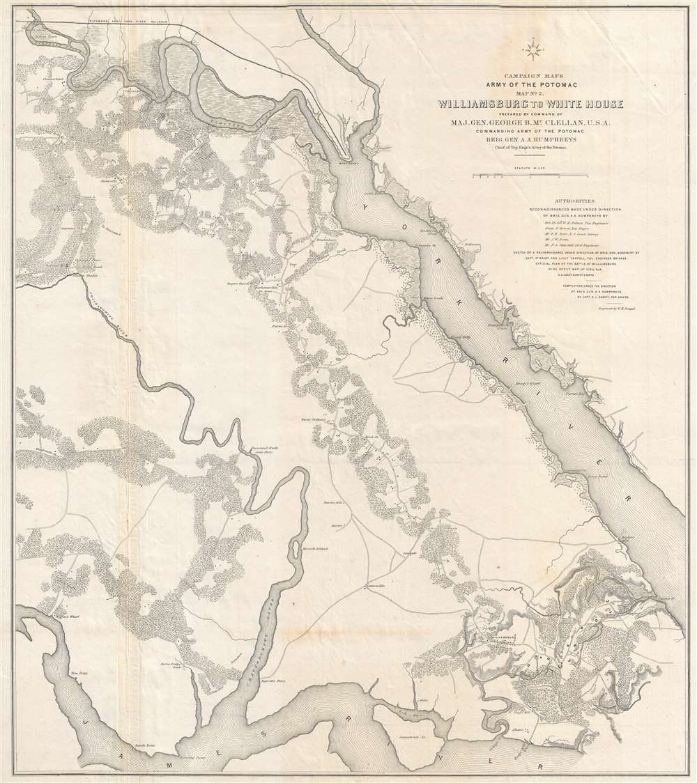
Campaign Maps Army of the Potomac Map No. 2 Williamsburg to White House Prepared by Command of Maj. Gen. George B. McClellan, U.S.A.
sold
- Digital Map Information
- Suitable for large format printing
- File Size: 16.56 MB
- File Type: ZIP / TIFF
- ICC color profile embedded
- Delivered instantly via download link
This is an 1862 separate-issue Henry Larcom Abbot map of part of the Virginia Peninsula during the American Civil War (1861 - 1865) commissioned by Union Major General George B. McClellan to illustrate the Peninsula Campaign. The map depicts from the James River to the York River, and from White House and the Richmond and York River Railroad to Williamsburg and the James River. This is the second in a series of three maps. Williamsburg, Virginia, the site of the first major pitched battle of the Peninsula Campaign, is located in the lower part of the map just right of center. Although the theater of war is illustrated, very few notations are present to indicate the state of war between Union and Confederate forces. Earthworks along the roads southeast of Williamsburg, known as Fort Magruder, are the only features that denote war. Roads, rivers, forests, and individual buildings however, are illustrated. (more details)
Travel the Northeast and stay at great hotels.

A.C.A. Associated Tours.
sold
- Digital Map Information
- Suitable for large format printing
- File Size: 36.84 MB
- File Type: ZIP / TIFF
- ICC color profile embedded
- Delivered instantly via download link
This is a 1929 Automobile Club of America road map of the northeastern United States. Depicting from Illinois to the Atlantic Ocean and from Quebec, Canada, to Raleigh, North Carolina, prominent black lines trace highways and other routes recommended by the Automobile Club of America. Potentially these routes correspond with the tours promoted by the A.C.A.. Bold labels identify major cities and offer hotel recommendations. Per the map 'The Motorist will find on this map some Three Hundred Hotels which have been carefully inspected from every standpoint and have received the recommendation of the Clubs Touring Bureau.' Numerous other highways are illustrated, with cities and towns identified throughout. An inset in the lower right depicts from Nashville and Raleigh south to Key West in much the same fashion. A list of tours promoted by the A.C.A. appears to the left of this inset. (more details)
Visit New Mexico - the Land of Enchantment.
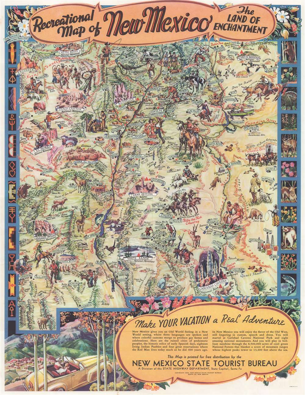
Recreational Map of New Mexico The Land of Enchantment.
sold
- Digital Map Information
- Suitable for large format printing
- Full resolution TIFF file
- ICC color profile embedded
- Delivered instantly via download link
This is a 1948 Wilfred Stedman pictorial map of New Mexico. The map depicts the state of New Mexico from Shiprock to El Paso. Many recreational areas, national monuments, and various points of interest are identified including Chaco Canyon, Gran Quivira, Acoma the sky city, Aztec Ruins, White Sands, and Carlsbad Caverns National Park. Stedman's map also identifies Billy the Kid country, the Grave of Billy the Kid, Apache country, several fossil beds, lava beds, caves, rivers, and lakes. Fantastically illustrated with cowboys, Native American Indians, vacationers, birds, animals, and Spanish dancers, Stedman uses stereotypes of the American Southwest to appeal to potential tourists. In the upper right, Stedman marks the 'Four Corners', the only point in the United States common to four states, where the boundaries of Utah, New Mexico, Arizona and Colorado meet. The lower right features a short note entitled 'Make Your Vacation a Real Adventure.' Information about monuments, parks, sports, climate, and other topics appears on the verso. (more details)
The western Florida Keys from Conch Key to Key West.
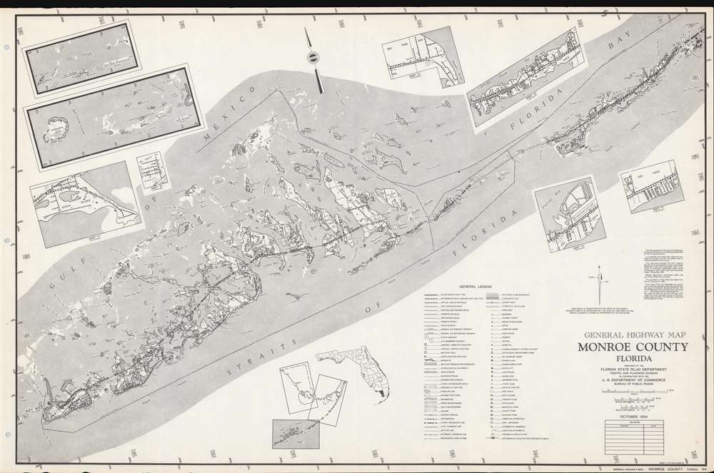
General Highway Map Monroe County, Florida.
sold
This is a 1954 Florida State Road Department map the Florida Keys in Monroe County. Depicting from Conch Key to Key West, the Florida Overseas Highway acts as the main focal point. Keys, bays, points, banks, channels, shoals, sounds, and other features are illustrated and labeled. Eight inset maps provide additional focused detail. These include Stock Island, Big Coppitt Key, the Marquesas Keys west of Key West, Dry Tortugas, and Big Pine Key. Three insets focus on Key Vaca, including Marathon. A key situated in the lower right summarizes notations and sources. (more details)
Massachusetts coast from Newburyport to Plymouth.

Map of Massachusetts Bay and Shore From Plymouth to Newburyport.
sold
- Digital Map Information
- Suitable for large format printing
- Full resolution TIFF file
- ICC color profile embedded
- Delivered instantly via download link
This is a scarce 1902 George Walker map of the bay and shore of Massachusetts from Plymouth to Newburyport. One of Walker's more uncommon pieces, the map depicts Boston and its vicinity, including the North Shore and South Shore, from Salisbury south to Plymouth and inland as far as Raynham and North Reading, including Cape Ann. The city of Boston is beautifully rendered. Cities and towns are labeled throughout, along with lakes, rivers, and islands off the coast. Roads crisscross the region, many of which are identified by name. The route of the New York, New Haven, and Hartford Railroad is traced, along with several branches of the Boston and Maine Railroad. (more details)
Waterway delineating the U.S. and Canadian border.
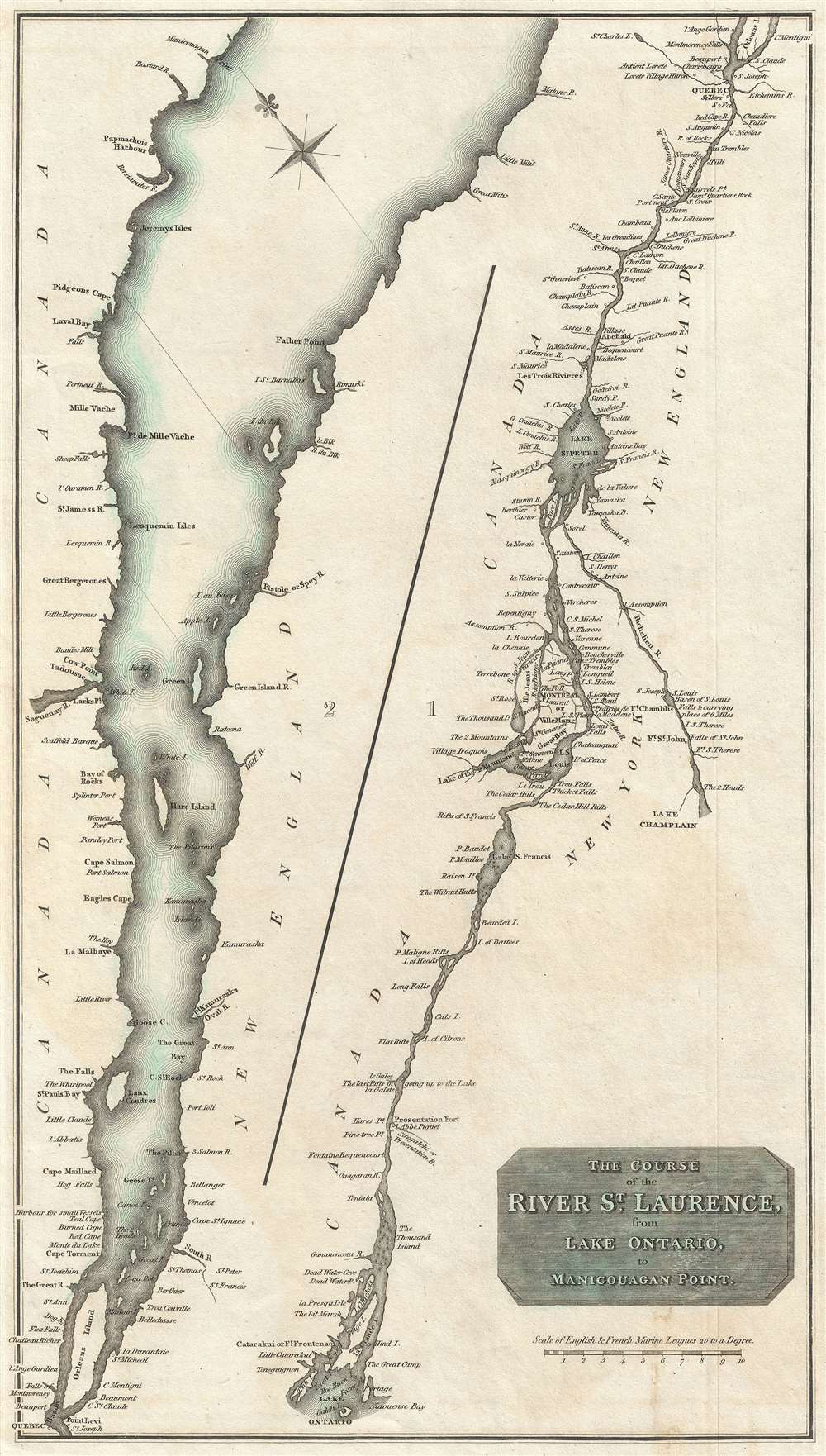
The Course of the River St. Laurence, from Lake Ontario to Manicouagan Point.
sold
- Digital Map Information
- Suitable for large format printing
- Full resolution TIFF file
- ICC color profile embedded
- Delivered instantly via download link
A fine example of John Thomson's 1814 map of the St. Lawrence River from Lake Ontario to Manicouagan Point, Quebec, Canada. Divided into two sections, the left covers the river from Manicouagan Point to Quebec City while the right section continues along the course of the river from Quebec City to Lake Ontario. The Richelieu River, which connects the St. Lawrence to Lake Champlain is also included in this section. Includes both Quebec City and Montreal. (more details)
The Great Pyramid predicts the End of Days.

Passage System of the Great Pyramid of Giza in the Land of Egypt June - July 1909.
sold
- Digital Map Information
- Suitable for large format printing
- File Size: 109.48 MB
- File Type: ZIP / TIFF
- ICC color profile embedded
- Delivered instantly via download link
This is a c. 1910 monumental waxed linen banner illustrating the interior of the Great Pyramid of Giza, Egypt. The banner results from the 1909 studies of Morton Edgar and his brother John Edgar. Bother Edgars were dedicated pyramidologists who believed they could, through studies of the Great Pyramid, discern essential theological truths. Morton was obsessed with the theories of Jehovah's Witness founder Charles Taze Russell (1852 - 1916), who advocated the theory that the Great Pyramid was a mystical artifact deeply connected to the End of Days and the events predicted in Revelations. (more details)
Scarce 19th century image of the great Cape Ann Fishing Port.

View of Gloucester. From Rocky Neck. 1876.
sold
- Digital Map Information
- Suitable for large format printing
- File Size: 35 MB
- File Type: ZIP / TIFF
- ICC color profile embedded
- Delivered instantly via download link
A fine 1876 George Douglas / F. Kimball Rogers low-perspective view of Gloucester, Massachusetts. The view looks northeast towards Gloucester from Rocky Neck, an outcropping near Smith's Cove. Coverage extends from Fort Point (at left), to Harbor Cove (at center), and Duncan Point (at right). Several churches, notable for their tall steeples, are recognizable and labeled, including the Universalist Church, at left, the Orthodox and Unitarian Church, at center, and the Catholic, Baptist, and Methodist churches at right. The Sawyer School (far right), Collins School (just left of center) and City Hall (just right of center) are also recognizable. (more details)
Most authoritative Map of Armenia, Kurdistan and Azerbaijan of the 19th Century.
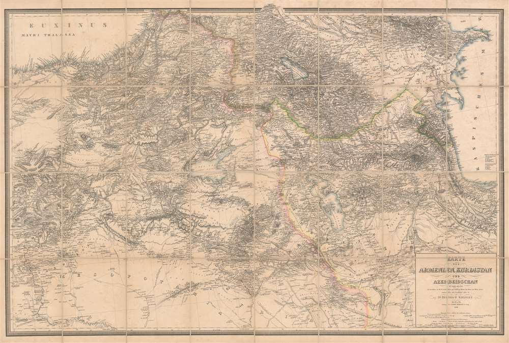
Karte von Armenien, Kurdistan und Azerbeidschan in vier blatt im Anschluss an die IV westlichen und mittleren Blätter der Karte von Klein-Asien, entworfen und bearbeitet 1852-55.
sold
- Digital Map Information
- Suitable for large format printing
- File Size: 93.53 MB
- File Type: ZIP / TIFF
- ICC color profile embedded
- Delivered instantly via download link
A seminal production, this is Heinrich Kiepert's 1858 map of Armenia, Kurdistan, and Azerbaijan, the definitive map of the region for more than 50 years. This map was used for treaty negotiation, military activity, and administration. In order to create it, Kiepert travelled the region many times - constantly sketching maps. His own observations were supplemented by diligent scholarship, resulting in a deep understanding local exploratory history and earlier survey work - note how throughout are noted, and dated, the tracks of earlier voyagers. The result is the finest area map available for most of the second half of the 19h century. The dense hachuring testifies to the areas daunting topography, underscoring the greatness of Kiepert's achievement. (more details)
A beautifully engraved case map highlighting all of Rome's ancient and modern sites.
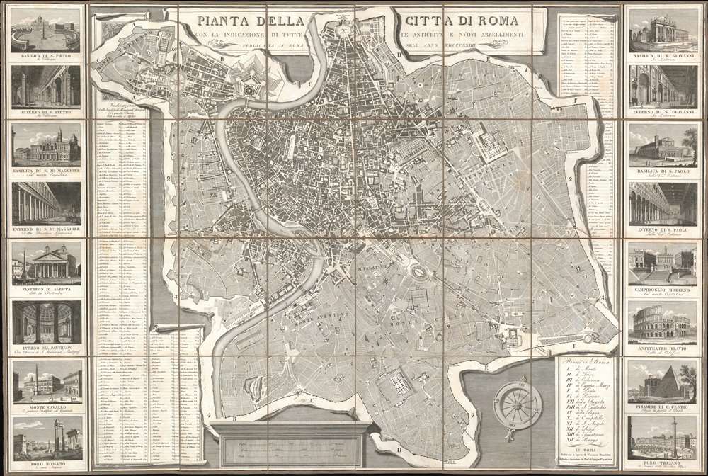
Pianta della Citta di Roma con la Indicazione di Tutte le Antichita e Nuovi Abbellimenti.
sold
- Digital Map Information
- Suitable for large format printing
- DPI: 600
- File Size: 128 MB
- File Type: ZIP / TIFF
- ICC color profile embedded
- Delivered instantly via download link
This is a strikingly engraved 1824 Pietro Ruga folding city plan or map of Rome, Italy. The map depicts Rome from the Vatican to the Basilica of the Holy Cross in Jerusalem (Bas. di S. Croce in Gerusaleme) and from the Piazza del Popolo to the San Sebastiano Gate. A spectacularly detailed masterpiece, Ruga's map is an ichnographic plan. This means that large historic sites, like the Colosseum, the Baths of Caracalla, and the Pantheon, and others are illustrated as horizontal cross-sections, revealing detailed floor plans. Numerous churches and basilicas, including St. Peter's, are illustrated thus. All fourteen of Rome's Rioni are identified by Roman numerals and correspond with an index in the lower right. An extensive index of the city's monuments occupies part of both the left and right side panels. Sixteen detailed monument views create the left and right borders. These include a mélange of ancient and modern sites, among them St. Peter's Basilica, the Pantheon of Agrippa, the Roman Forum, the Colosseum, and the Basilica of St. Paul. (more details)
American history.
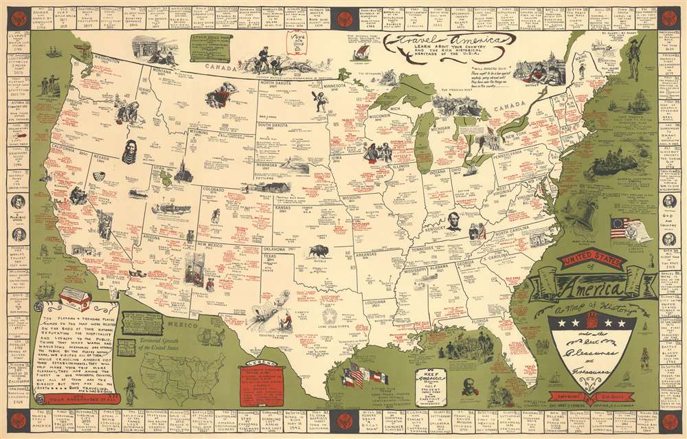
United States of America. A map of History and the Best Pleasures and Treasures.
sold
- Digital Map Information
- Suitable for large format printing
- File Size: 26.4 MB
- File Type: ZIP / TIFF
- ICC color profile embedded
- Delivered instantly via download link
This is a rare c. 1953 Garner Parker Dicus pictorial map of the continental United States. Created to encourage tourism, red text marks resorts, hotels, restaurants, and other modern attractions. Black text marks major cities, provides historical information, and identifies other important locations, such as national parks. Many locations are marked with small red circles, indicating Dicus and his wife's personal recommendation. Per a text in the lower left, Mr. and Mrs. Dicus claim to have visited every location labeled in red. Pictorial vignettes scattered throughout the map add charm to the piece and focus on American history. Stagecoaches, covered wagons, gold miners, explorers, and fur trappers are among these vignettes, alongside a portrait of Abraham Lincoln and George Washington crossing the Delaware River. References to eighty-one historical events create the map's border. Corresponding numbers appear across the map, allowing viewers to place each event. (more details)
The Soviet Red Army advancing in eastern Europe.
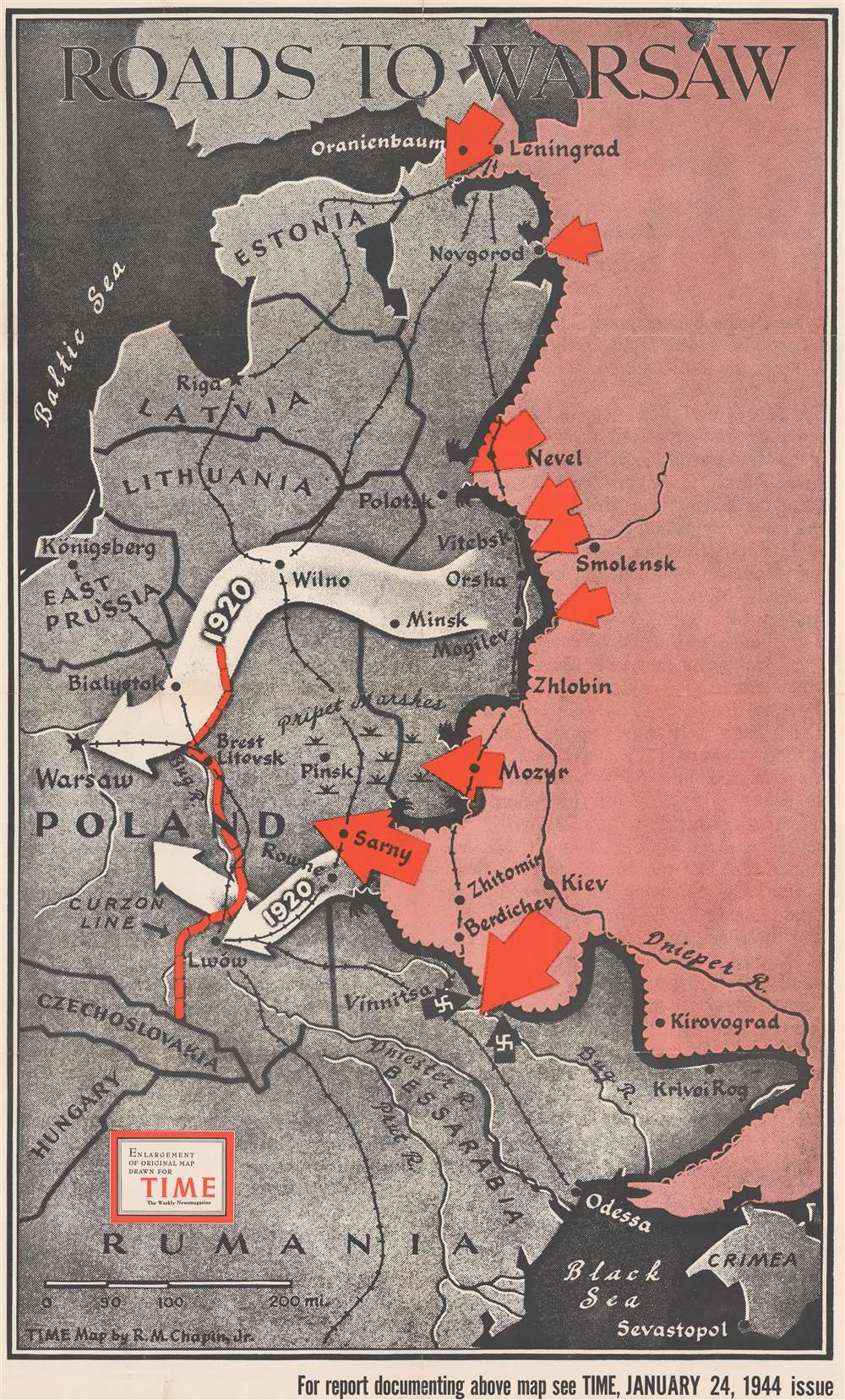
Roads to Warsaw.
sold
- Digital Map Information
- Suitable for large format printing
- File Size: 83.4 MB
- File Type: ZIP / TIFF
- ICC color profile embedded
- Delivered instantly via download link
This is a separately issued large format 1944 Robert M. Chapin Jr. map of eastern Europe and Russia illustrating the Soviet Red Army's advance. Large red arrows highlight combat areas. The largest arrows at Sarny, Vinnitsa, and Mozyr highlight important Soviet successes in breaking through the German lines. At the time of publication, a massive battle was underway at Vitebsk and the army near Mozyr was pushing through the Pripet Marshes toward Pinsk. The army at Sarny had just cut an important north-south rail line and was quickly advancing on the Lwow-Konigsberg rail line. The large white arrows reference the Red Army's 1920 march on Warsaw, when they reached the city but failed to defeat the Polish army. (more details)
The Vendôme Column before it was toppled during the Paris Commune.

Colonne de la Place Vendôme.
sold
- Digital Map Information
- Suitable for large format printing
- Full resolution TIFF file
- ICC color profile embedded
- Delivered instantly via download link
This is a c. 1845 Jules Arnout view of the Vendôme Column (Colonne Vendôme) in the Place Vendôme in Paris, France. From the front, the statue of Napoleon in a military officer's coat adorning the top of the column is clearly visible. While not legible, the detailed relief work on the column is evident. Parisians promenade through the square on foot and in horse-drawn carriages. The buildings surrounding the north side of the square appear in the background. (more details)
Buffalo, New York, Lake Erie, and the Niagara River.

Map of Buffalo Including Cheektowaga - West Seneca - Lackawanna - City of Tonawanda - Town of Tonawanda - North Tonawanda - Amherst - Grand Island - Niagara Falls, U.S.A. and Canada Fort Erie, Canada.
sold
- Digital Map Information
- Suitable for large format printing
- Full resolution TIFF file
- ICC color profile embedded
- Delivered instantly via download link
This is a c. 1940 Interstate Publishing Company city plan or map of Buffalo, New York. With the Niagara River and Lake Erie on the left, Buffalo and its suburbs spread out across the sheet. Streets are illustrated and labeled, and major thoroughfares are highlighted in yellow. Parks are shaded green and identified. Cemeteries are labeled and shaded a lighter shade of green. Hospitals, city buildings, and the University of Buffalo are also identified. An alphabetical street index for Buffalo and its suburbs appears outside the border on the left and right sides and along the bottom. An inset map of Niagara Falls, New York and Niagara Falls, Canada is situated in the upper right and is accompanied by an alphabetical street index. A second inset map of downtown Buffalo is included in the lower left. (more details)
Japanese World War II map of eastern Australia.
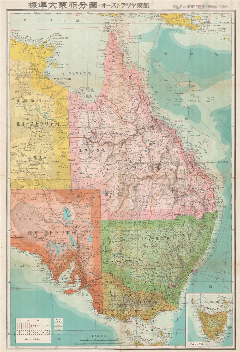
標準大東亞分圖 オーストラリア東部. / Greater East Asia Co-Prosperity Sphere. Eastern Australia.
sold
- Digital Map Information
- Suitable for large format printing
- Full resolution TIFF file
- ICC color profile embedded
- Delivered instantly via download link
This is a stunning 1943 or Showa 18 large format map of eastern Australia. Issued by the Japanese during World War II, this map is part of a series of maps promoting the Japanese imperialist concept of the Greater East Asia Co-Prosperity Sphere. It covers the eastern half of Australia and includes Queensland, New South Wales, Victoria and the eastern parts of South Australia and Northern Territory. An inset of Tasmania is included in the lower right. The map offers superb detail regarding both topographical and political elements. Cities, roads, and air, sea, and land trade routes are illustrated. Shading indicates oceanic depths. While Allied World War II maps of this region are fairly common, it is extremely rare to come across their Japanese counterparts. All text is in Japanese. (more details)
Small town identity.

Historical Sandwich, Carrol County, New Hampshire.
sold
This is a 1976 Robert Gale 'Bob' Dustin pictorial map of Sandwich, New Hampshire. Houses throughout Center Sandwich are illustrated, identified by their original owner and their owner in 1976. Also, the house's original construction date is provided. Other buildings, including the elementary school, the old Town Hall (which was converted into the Sandwich Historical Society), and the Baptist church, are illustrated and labeled. Streets throughout town are labeled by the name used around town and the official route name bestowed by the state. A numerical index of eighty houses around the original grant is situated in the upper left corner. All eighty are marked on an inset map of the town grant in the lower left corner, which has Center Sandwich in its bottom left quadrant. (more details)
Cartographic Historical Digest of Casco Bay.

Birds Eye View of Casco Bay: Portland, Maine and Surroundings.
sold
- Digital Map Information
- Suitable for large format printing
- Full resolution TIFF file
- ICC color profile embedded
- Delivered instantly via download link
This is a beautiful 1950 bird’s eye-view map of Casco Bay, Portland, Maine. It is the last edition of the George Walker view of the same title, first issued in 1906. The view covers Casco Bay, from Port Elizabeth and South Portland with Rangeley Lakes and Mount Washington evident on the horizon. The city of Portland is beautifully rendered. Throughout, the map notes towns, islands, capes, points, and a few other topographical features. The bustling bay is full of ships and ferries traveling between its various islands. As distinct from the original 1906 issue, the title of this edition has been moved from the bottom of the map to the top, and the bottom has been filled with a tour of the region marking such highlights as John Smith's visit in 1614, a hiding spot of Captain Kidd's treasure, and the excellent hotel and cottage accommodations on the principal islands. (more details)