
Below 40 degrees latitude, there is no law; below 50, there is no God... - Old Sailor Adage.
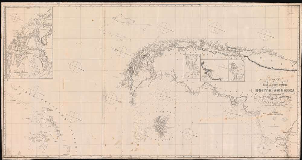
Chart of the East and West Coasts of South America Extending from teh River Platte Round Cape Horn to Valparaiso with Plans of the Principal Harbours.
sold
- Digital Map Information
- Suitable for large format printing
- File Size: 56.28 MB
- File Type: ZIP / TIFF
- ICC color profile embedded
- Delivered instantly via download link
A rare 1874 Imray and Son blueback nautical chart illustrating the southern part of South America, the Straits of Magellan, Cape Horn, Patagonia, and the South Shetland Islands. The map includes pencil annotations recording Captain Robert Jack and the Clipper Indiana particularly harrowing 1879 transit around Cape Horn, where the ship was repeated driven south by the notorious williwaw winds, before eventually exiting the treacherous conjunction of oceans. Jack himself was a known Maine sea captain whose letters have been preserved and offer priceless insights into seaman life in the late 19th century. The map is oriented to the east, and coverage extends from the Rio de La Plata to the South Shetland Islands, and covers Cape Horn on both the Atlantic and Pacific. Detailed insets detail important ports, as well as the Strait of Magellan - with charming place names such as 'Useless Harbor'. (more details)
First promotion of Miami Beach as 'resort' property.

Geographically Correct Indexed Township Map of Florida, Middle and Southern Georgia, and Southern South Carolina, Showing the complete system of Florida Central and Peninsular R.R.. The shortest and Quickest Route to all Points in Florida extending directly through the Great Phosphate and Fruit Belt.
sold
- Digital Map Information
- Suitable for large format printing
- Full resolution TIFF file
- ICC color profile embedded
- Delivered instantly via download link
A rare 1894 map of Florida and Georgia illustrating the Florida Central and Peninsular Railroad at its peak, with provenance to Florida real-estate pioneer Elnathan T. Field. The map was issued not only to highlight the FCP achievements in reaching Tampa and St. Petersburg, but also to promote and sell the extensive properties straddling the railroad grant. These are shaded bright orange and are unmistakable. Intriguingly, the map also exhibits magenta overprinting promoting beachfront property from Jupiter to Miami Beach - in particular Hypoluxo Beach, near Lake Worth, which is further promoted on the verso. This is the earliest known printed map of Hypoluxo Beach, issued just after the barrier island was lotted out for sale and the earliest known promotion of Miami Beach as 'resort property'. (more details)
The FEC reaches Key West!

Map of the Peninsula of Florida and Adjacent Islands.
sold
- Digital Map Information
- Suitable for large format printing
- File Size: 46.97 MB
- File Type: ZIP / TIFF
- ICC color profile embedded
- Delivered instantly via download link
A highly decorative 1914 map of Peninsular Florida issued by the Mathews-Northrup Company for the Henry Morrison Flagler’s (1830 – 1913) Florida East Coast Railway. The map covers from the Georgia Border to Key West and Cuba, and from Cedar Key to the Bahamas. The route of the railroad is illustrated in red overprinting extending from Jacksonville to Key West, with major stops, and the grand hotels available there, including the Royal Palm, the Breakers, the Ponce de Leon, and the Ormond, noted. The map also identifies drainage canals from Lake Okeechobee constructed by J. O. Wright to grade the Everglades. (more details)
Fun in the sun.

Florida.
sold
This is a striking 1971 pictorial map of Florida by the artist Howard Weinstock. The map illustrates the state via its many delights, ranging from Walt Disney World in Orlando, to pirate treasure near Cocoa, and beachgoers in Miami. This was part of a series of posters issued by Weinstock's 'United States Map Co.' in 1971 and 1972. Other maps in the series includes Weinstock's home Los Angeles, California, and the United States. (more details)
The end of WWII - from the Japanese perspective.

日本陸軍戰力喪失一覽圖 / Map of the Japanese Army's loss of combat power during the Pacific War.
sold
- Digital Map Information
- Suitable for large format printing
- File Size: 194.38 MB
- File Type: ZIP / TIFF
- ICC color profile embedded
- Delivered instantly via download link
A rare piece, this is Showa 22 or 1947 separate-issue Ueno Rokuo map is one of the few maps issued in Japan following the World War II Pacific War (1941 - 1945) to specifically illustrate Japan's defeat. The map reflects the combat history between Allied forces and the Japanese in East Asia, Southeast Asia, and the Pacific during the counter-offensive phase of World War II, including the Soviet offensive route in the northeast, the counter-offensive route in China, and the offensive route of American troops in Southeast Asia and the Pacific Islands. Red arrows illustrate Allied movements, and blue, Japanese movement. The table includes statistics related to Japanese army deployment and losses in China, Southeast Asia, and East Indies. An additional, 'Flying Aircraft Production Table', shows the production Japanese fighter aircraft throughout the war. We have heard reports that this map was referenced in the McArthur Report - a breakdown of the Pacific War from the Japanese perspective made for General Douglass McArthur with the assistance of Japanese officers. (more details)
Recruiting map for Aramco's Saudi Arabian operations.
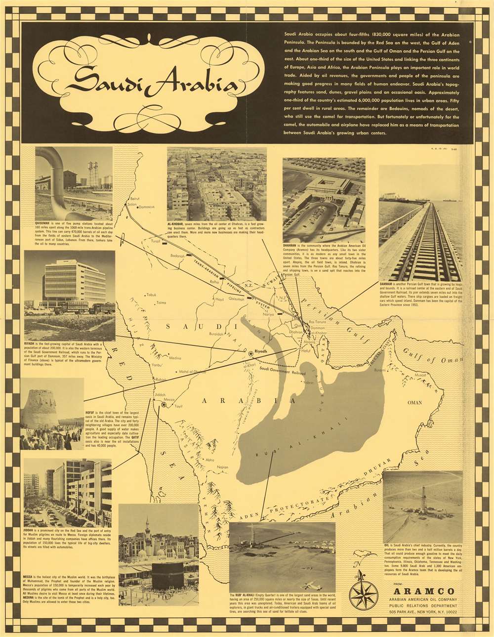
Saudi Arabia.
sold
This is a rare, May 1968 map of Saudi Arabia published by the Arabian American Oil Company (Aramco) Public Relations Department. The map was produced to promote business in Saudi Arabia, specifically the Aramco oil business. (more details)
Theatre of the Eighty Years' War.

Tabula Ducatus Brabantiae continens Marchionatum Sacri Imperii et Dominium Mechliniense.
sold
- Digital Map Information
- Suitable for large format printing
- Full resolution TIFF file
- ICC color profile embedded
- Delivered instantly via download link
This is Frederic De Wit's 1666 map of the Duchy of Brabant, in present-day Netherlands and Belgium. Oriented to the west-north-west, the map embraces the lands from Rotterdam to Namur, extending to include part of western Germany. The Meuse River provides the limits for the bottom and right-hand portions. The map is exceedingly well detailed, including the cities of Antwerp, Rotterdam, Liege, Brussels, Bergen op Zoom, Venlo, and Maastricht along with countless smaller towns. It includes rich topographical detail showing forests and wetlands, with a great many roads included. There is an attractive cartouche featuring the Lion of Brabant; the scale cartouche is embellished with putto playing with a surveyor's compass. (more details)
Social Realism and Zionism.
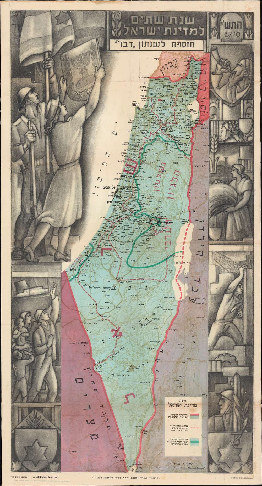
Second Year of the State of Israel. / שנת שתיים למדינת ישראל
sold
- Digital Map Information
- Suitable for large format printing
- File Size: 54.84 MB
- File Type: ZIP / TIFF
- ICC color profile embedded
- Delivered instantly via download link
A rare and striking 1950 Joseph Szapiro (Shapiro) Zionist map of Israel in Hebrew, with striking Social Realist imagery, celebrating the second anniversary of Israel's 1948 founding. The map depicts the region from the Mediterranean Sea to Jordan (Transjordan) and Syria and from Lebanon to Egypt and the Gulf of Eilat (Gulf of Aqaba). Highly detailed, cities, towns, and villages are labeled throughout, with Jerusalem and Tel Aviv given prominence. (more details)
Playground of the gilded.
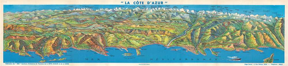
La Côte d'Azur.
sold
- Digital Map Information
- Suitable for large format printing
- Full resolution TIFF file
- ICC color profile embedded
- Delivered instantly via download link
This is a stunning 1947 Jean-Honoré Cresp bird's-eye view map of the Côte d'Azur, the French Riviera. Overlooking the region from an imaginary perspective high above the Mediterranean, the most recognizable cities appear in the foreground along the coast, including Nice, St. Tropez, Cannes, Monte-Carlo, Toulon, and Monaco. Red lines highlight routes between sun-drenched playgrounds of the elite and stretch into a mountainous backdrop. Numerous mountain peaks are identified, with elevations noted. A line of small black 'x's mark the Franco-Italian border. (more details)
Botanical excursion through Central Asia.
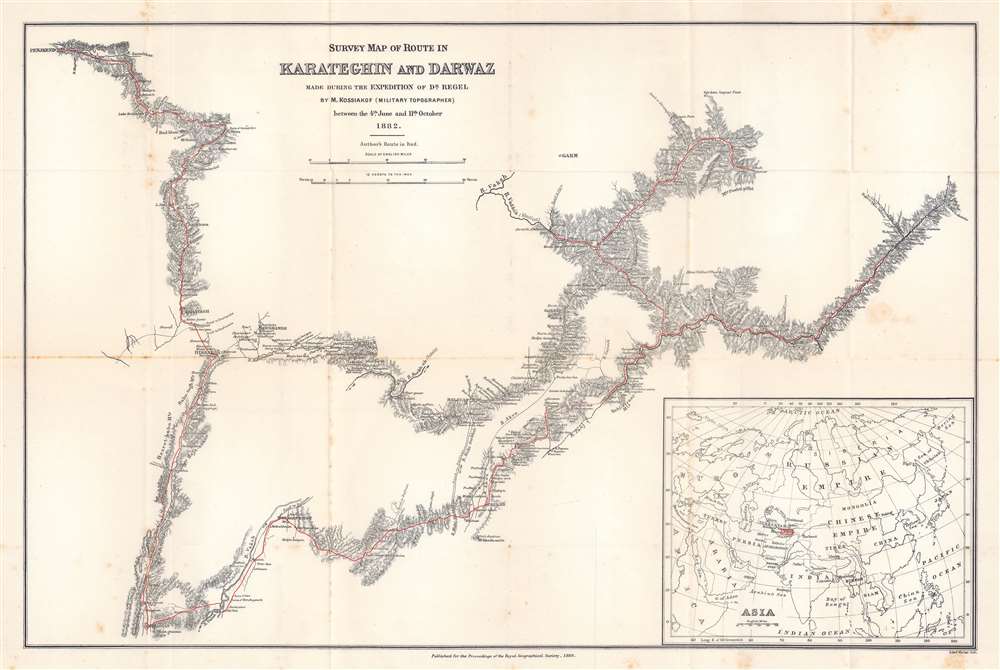
Survey Map of Route in Karateghin and Darwaz Made During the Expedition of Dr. Regel.
$375.00
Acquire
- Digital Map Information
- Suitable for large format printing
- File Size: 17.72 MB
- File Type: ZIP / TIFF
- ICC color profile embedded
- Delivered instantly via download link
This is an 1886 M. Kossiakof map of Turkestan in Central Asia. Red lines trace Kossiakof's route through the Rasht Valley (Karateghin) and Darvaz (Darwaz) regions with the 1881 Regel Expedition. The primarily botanically focused 1881 expedition was led by Johann Albert von Regel (1845 - 1909), a Swiss-Russian physician and botanist. Nonetheless, the Regel Expedition was one of the first European penetrations into the area. Kossiakof was a military topographer attached to the mission. He mapped the region, labeling cities, towns, and villages through which the group passed. Rivers are illustrated. In the lower right corner, an inset map of Asia and eastern Europe situates the depicted area in a continental manner. The map covers only the actual path followed, along with the observable surrounds, underscoring Kossiakof's integrity in illustrating only scientifically confirmed geography. (more details)
Decorative Florida.
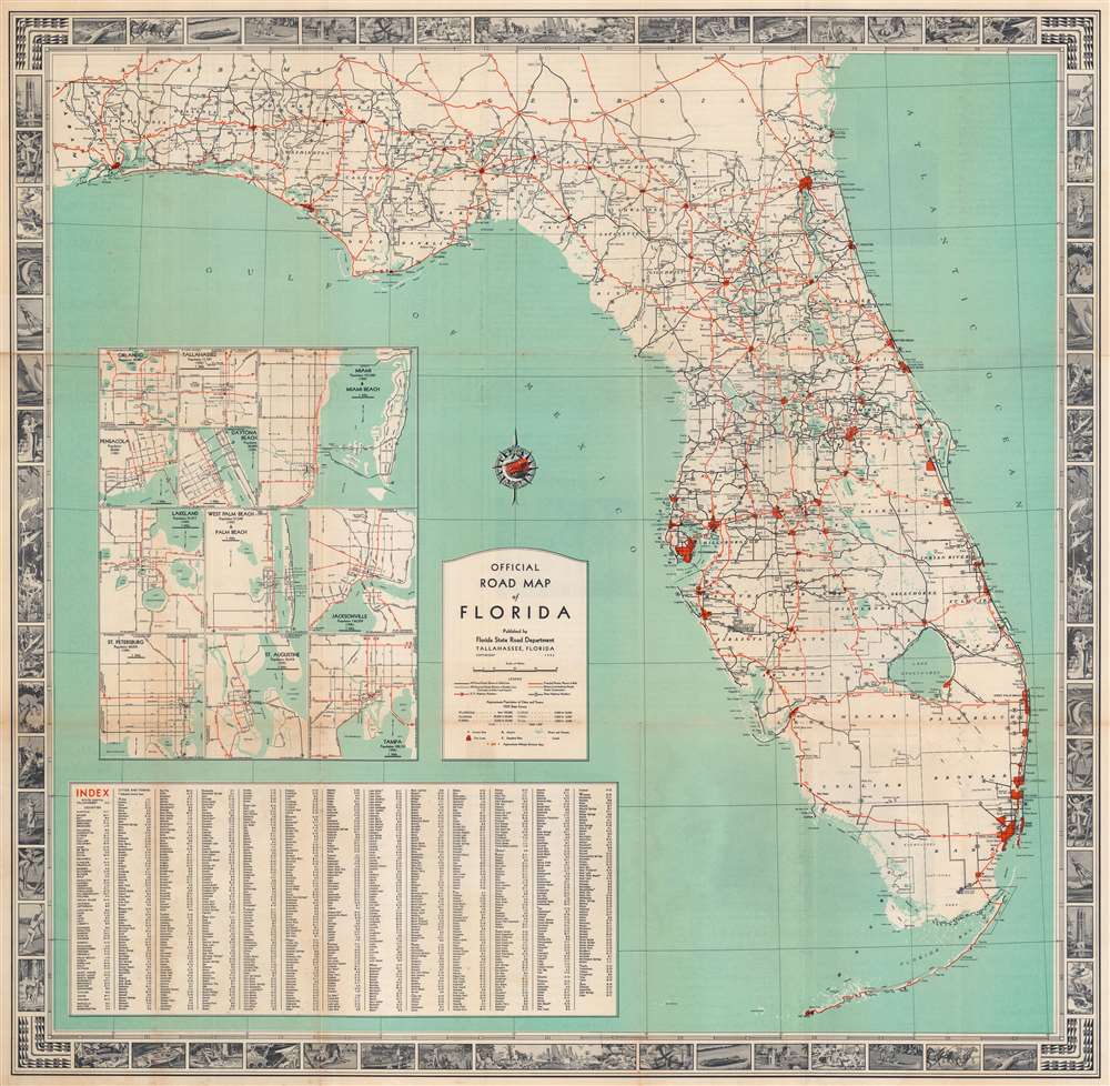
Official Road Map of Florida.
sold
- Digital Map Information
- Suitable for large format printing
- Full resolution TIFF file
- ICC color profile embedded
- Delivered instantly via download link
This is a 1936 Florida State Road Department map of Florida. Red lines highlight U.S. highway routes and solid black lines mark paved roads. Eleven inset city plans detail various cities, including Orlando, Tallahassee, Daytona Beach, Tampa, St. Petersburg, and Miami. An index of counties, cities, and towns appears in the lower left. The whole is surrounded by a pictorial border consisting of vignette views. Among these are the Bok Tower, beaches, hunters, and athletes playing tennis and golf. Florida wildlife, such as alligators, deer, and a puma, also appear. (more details)
Montana's frontier history.

Montana. Frontier. Pioneer.
sold
- Digital Map Information
- Suitable for large format printing
- Full resolution TIFF file
- ICC color profile embedded
- Delivered instantly via download link
This is a 1937 Irvin Shope pictorial map of Montana. The map depicts the state from Idaho to the Dakotas and from Canada to Wyoming, including Yellowstone National Park. The map is highly detailed, with captions, vignettes, and other illustrations populating it, offering a rich visual representation of Montana's history. Most captions recount tales of the Wild West. Outlaws, vigilantes, and frontier violence and vigilante 'justice' abound. Others inform on more conventional milestones, such as the location of the first Territorial Legislature, or that Virginia City was the first capital of the Montana Territory. Numerous cities and towns appear, including Helena, Missoula, and Bozeman. Vignettes frame the map, illustrating 'the major frontier industries: trapping, mining, cattle and sheep raising, and lumbering'. (more details)
Key West tourism.

Welcome to Our Island. Key West - 1st Island of the Caribbean.
sold
This is a c. 1984 Norma Renner pictorial map of Key West, Florida. Throughout, important buildings are illustrated in profile including Fort Zachary Taylor and Ernest Hemingway's house. The marker at the southernmost point in the United States appears as well, along the right side of the island just above Fort Taylor. Several Conch Tour trains appear, including one on Roosevelt Boulevard near U.S. 1 at the top of the island. A short history of Key West is included along the right, while an index naming points of interest occupies the left side. (more details)
Civil War manuscript map / letter naming 'Rebbaldom'.

[Plan of Fort Powhatan.]
sold
- Digital Map Information
- Suitable for large format printing
- Full resolution TIFF file
- ICC color profile embedded
- Delivered instantly via download link
This is an 1865 American Civil War manuscript letter and map of Fort Powhatan, Virginia, written by Abraham Slack, a member of the 38th Regiment, New Jersey Infantry. Consisting of three handwritten pages and a map on a single folded sheet. Slack wrote the letter to his son, John William Slack (1850 - c. 1910). In the letter, Slack describes Fort Powhatan in detail, expresses sympathy for desperate condition of the Confederate forces (and families) across the river, details recent military actions, and advises his son on matters of household management. (more details)
Dominant 16th century mapping of Paris.

Lutetia vulgari Nomine Paris, Urbs Galliae Maxima, Sequana Navigabili Flumine Irrigatur...
sold
- Digital Map Information
- Suitable for large format printing
- Full resolution TIFF file
- ICC color profile embedded
- Delivered instantly via download link
A handsome example of the Braun and Hogenberg's 1572 map and view of Paris, France. With the Seine flowing at center around the Île de la Cité, this view looks on Paris from the northwest, with the top oriented to the southeast. The city is presented from an equidistant bird's-eye perspective wherein all structures are rendered in view form, but from a uniform height and angle relative to all individual points. Fertile fields surround the city, and the river bustles with boats, suggesting richness and prosperity. In the bottom left corner, a man greets two women, all wearing clothing corresponding to the Spanish-influenced fashion norms of 1560 - 1570. The Bastille, a prison infamous even prior to the French Revolution, appears here at top center, surrounded by a moat. The 1550 bastion, appearing to the left of the main structure of the Bastille is also evident. The map's title 'Lutetia,' is the Latin name for Paris which, by the 16th century, had largely been phased out but still appeared in academic references. (more details)
One of the earliest maps of Iceland based on local information.
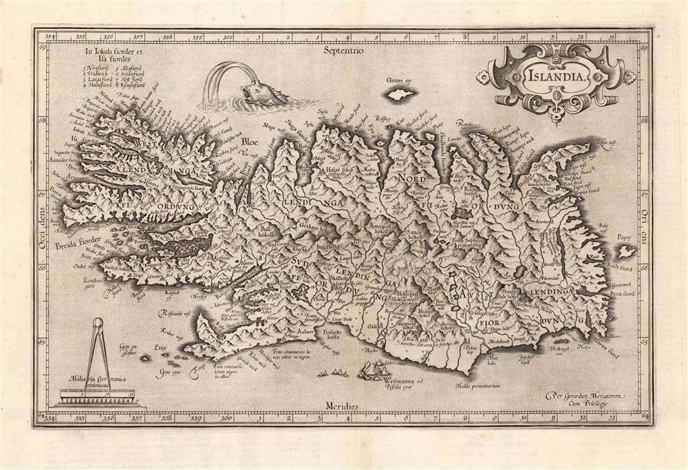
Islandia.
sold
- Digital Map Information
- Suitable for large format printing
- Full resolution TIFF file
- ICC color profile embedded
- Delivered instantly via download link
This is a beautiful strike of Gerhard Mercator's map of Iceland, included by Jodocus Hondius and his heirs in their Atlas sive Cosmographicae. It is the second map of Iceland to appear in a modern atlas, and the second map overall of Iceland based on data originating from an Icelander, placing it among the first accurate maps of the island. Mercator's map first appeared in 1595, only five years after Abraham Ortelius' famous map; both maps shared the same ultimate source: Guðbrandur Þorláksson, Bishop of Holar. (more details)
The First Major Innovation in the mapping of Italy since Magini.
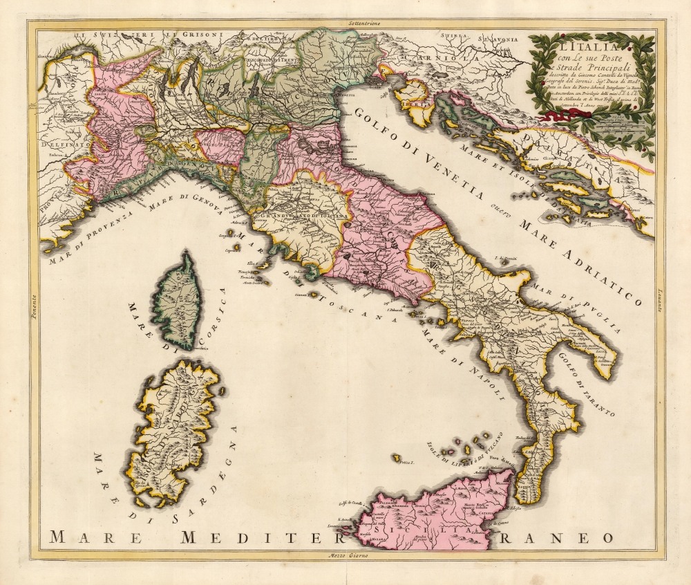
L'Italia con Le sue Poste e Strade Principali descritta da Giacomo Cantelli da Vignola Geografo del Serenis. Sigr. Duca di Moda. Data in luce d Pietro Schenk Intagliator in Rame in Amsterdam con Privilegio delli miei Seci: S le Seci: S: Stati di Hollanda et di West Frisia, il primo di Settembre 'l Anno 1701.
sold
- Digital Map Information
- Suitable for large format printing
- Full resolution TIFF file
- ICC color profile embedded
- Delivered instantly via download link
This is a beautiful example of a scarce, 1701 Peter Schenk map of Italy, focusing specifically on the country's post roads. It is derived from, and credits, the similarly-titled 1695 map produced by the Italian mapmaker Giacomo Cantelli da Vignola. Cantelli's map, printed in the year of that mapmaker's death, was the first significantly updated map of Italy to appear since Magini's 1608 Italia Nuova, which provided the basis for most maps of Italy issued in 17th and early 18th centuries. (more details)
Silk screen airline promotional.

Florida Delta Airlines.
sold
A striking c. 1960 John Hardy silk screen promotional poster advertising Delta Airlines service to Florida. The image is dramatically silkscreened in 5 colors (yellow, brown, purple, light blue, red, black). It highlights Delta destinations, including Tampa, Jacksonville, West Palm Beach, Fort Lauderdale, and Miami. The map of Florida is overlaid with images of scuba divers, sunbathing beauties, and a gentleman playing golf. (more details)
The Dominant Mapping of Italy of the 17th Century, Updated and Amended.
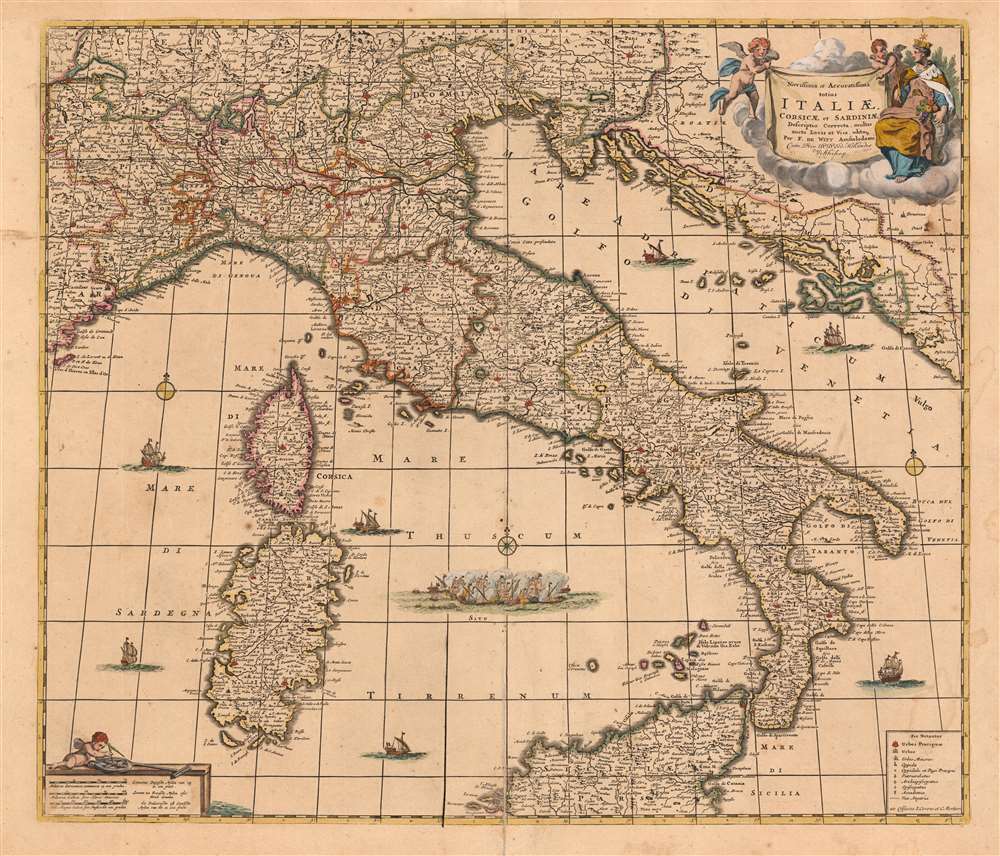
Novissima et Accuratissima totius Italiae, Corsicae et Sardiniae Descriptio Correcta, multis auct Locis et Viis editaque.
sold
- Digital Map Information
- Suitable for large format printing
- Full resolution TIFF file
- ICC color profile embedded
- Delivered instantly via download link
This is an attractive and scarce map of Italy, engraved c. 1680 by Frederik De Wit, but updated in 1721 by the Amsterdam publishers Covens and Mortier. Covens and Mortier added many place names and included the post road system first introduced on a 1695 map of Italy by Giacomo Cantelli da Vignola. The map covers the Italian Peninsula in its entirety including the Dalmatian coast, at the time controlled by the Republic of Venice, as well as the islands of Corsica, Sardinia, and part of Sicily. As with virtually every map of Italy produced in the seventeenth century, De Wit follows the model established by Magini's monumental 1608 Italia Nuova. Magini's map was justifiably influential, rendering the whole of Italy and its islands in magnificent detail with their river systems clearly presented and mountains shown pictorially. (more details)
Short-lived resort for the rich and famous.
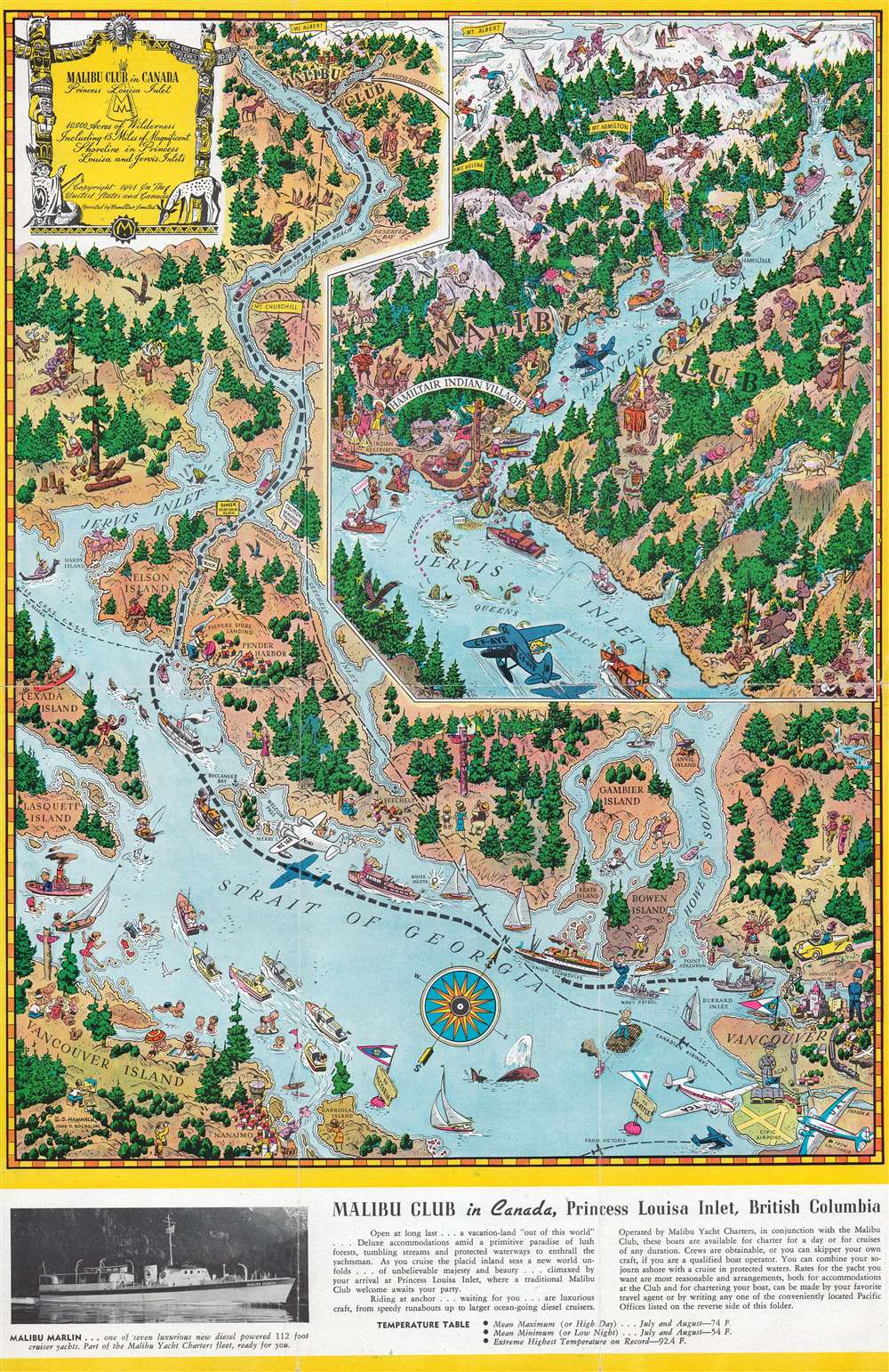
Malibu Club in Canada Princess Louisa Inlet.
sold
- Digital Map Information
- Suitable for large format printing
- Full resolution TIFF file
- ICC color profile embedded
- Delivered instantly via download link
This is a 1945 Edwin S. Hammack pictorial map of coastal British Columbia. Created to promote the Malibu Club in Canada, the map depicts from Vancouver north along the Strait of Georgia and Jervis Inlet to Princess Louisa Inlet. Cartoonish illustrations appear throughout and highlight locals and tourists enjoying the wonders of Vancouver Island and the Strait of Georgia. Vancouver appears in the lower right corner. Numerous smaller islands, including Gambier Island, Bowen Island, Anvil Island, Texada Island, and Nelson Island are all labeled. An inset in the upper right focuses on Princess Louisa Inlet and the Malibu Club. Vacationers frolic in in the inlet, hunt and hike in the surrounding forest, and ski. Information about the club and a photograph of one of its charter yachts, appears along the bottom border. (more details)