
Pictorial Jerusalem.

Jerusalem.
sold
- Digital Map Information
- Suitable for large format printing
- File Size: 23.25 MB
- File Type: ZIP / TIFF
- ICC color profile embedded
- Delivered instantly via download link
This is a 1935 Bernhard Gauer pictorial map of Jerusalem. The map depicts the city from the Greek Monastery of the Cross to the Chapel of Ascension and the Russian Tower and from the Grand Mufti's House to the German-American Cemetery. The walled Old City serves as the map's focal point with numerous sites illustrated pictorially, including the Dome of the Rock, the Al-Aqsa Mosque, and the Wailing. The Church of the Holy Sepulcher, the Tower of David, and the Hurva Synagogue are also illustrated. Outside the Old City, many other sites, such as the Syrian Orphanage (see below), Hebrew University and Library, the war cemetery, the Church of the Tomb of the Virgin, and the Garden of Gethsemane, are highlighted. Locations important to the visitor, such as hospitals, consulates, the Y.M.C.A., and hotels are also labeled. Three vignettes are situated along the bottom border and illustrate the interior of the Mosque of Omar, Dome of the Rock, Rachel's Tomb, and the interior of the St. Sepulchre. Manuscript notations in ink are present throughout the map and label the Mount of Olives and Gordon's Cavalry. (more details)
World War II to mid-1942.
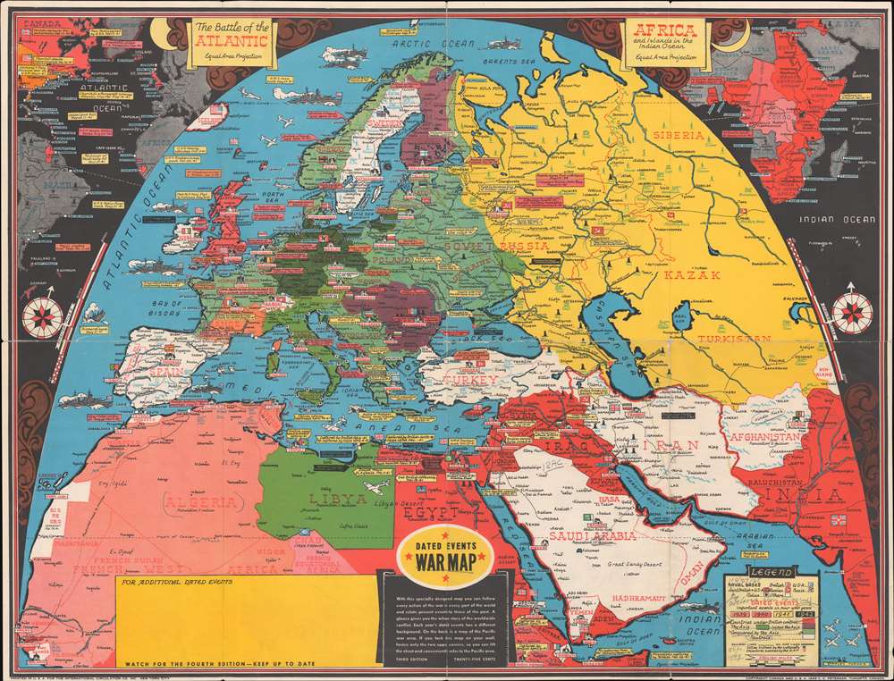
Dated Events War Map.
sold
- Digital Map Information
- Suitable for large format printing
- Full resolution TIFF file
- ICC color profile embedded
- Delivered instantly via download link
This is a 1942 Stanley Francis Turner pictorial map of Europe, North Africa, and the rest of the world during World War II. Created as a visual summary of the war, text boxes highlight and summarize the most important events between 1939 and 1942. Among the events cited are the declarations of war by both sides, the Nazi invasions of the Low Countries, France, and Russia, the evacuation at Dunkirk, and the fighting in North Africa between Rommel and Montgomery. Germany is shaded dark green and all of its conquests, including Occupied France, are identified using various shades of green. Hungary, Romania, Bulgaria, and Finland all appear in dark purple, signifying their alliance with the Axis powers. Nations shaded white, such as Iran, Afghanistan, Saudi Arabia, Turkey, Ireland, Switzerland, and Spain, are neutral. Vichy France, with its own special status, appears in orange. Icons mark capital cities, with Big Ben in London, the Eiffel Tower in Paris, and the Pantheon in Rome. Destroyers and battleships ply the waters of the Atlantic and Mediterranean. (more details)
Florida attractions - including a rocket launch!

Florida.
sold
This is a c. 1955 pictorial placemat map of Florida. A road map of Florida occupies the center, with the Sunshine Parkway traced in yellow and Federal highways marked in red. Blue lines trace state highways, and cities throughout the state are labeled in blue block lettering. Colorful vignettes surround the central map and highlight some of Florida's well-known attractions. A rocket launches on the lower right, while tourists go deep-sea fishing, frolic on the beach, and waterski along the bottom. Another vignette promotes Florida's other aquatic attractions, including 'exciting' dolphin shows. The Sunshine Skyway appears alongside a small flock of pink flamingos. The state capitol building and an orange tree occupy the upper right. (more details)
Florida travel.

Street Map of Miami and Vicinity.
sold
An uncommon 1973 H. M. Gousha travel map of Miami and Miami Beach, Florida. Printed on both recto and verso, this folding pamphlet map covers the area in detail, noting island, communities, causeways, roads, parks, lakes, municipal buildings, and more. The recto (front) covers from North Kendall Drive and Key Biscayne to the La Gorce Country Club. The verso (back) extends the map northward from La Gorce to the Dade / Broward border. (more details)
The rarest significant late 19th century map of Mobile.
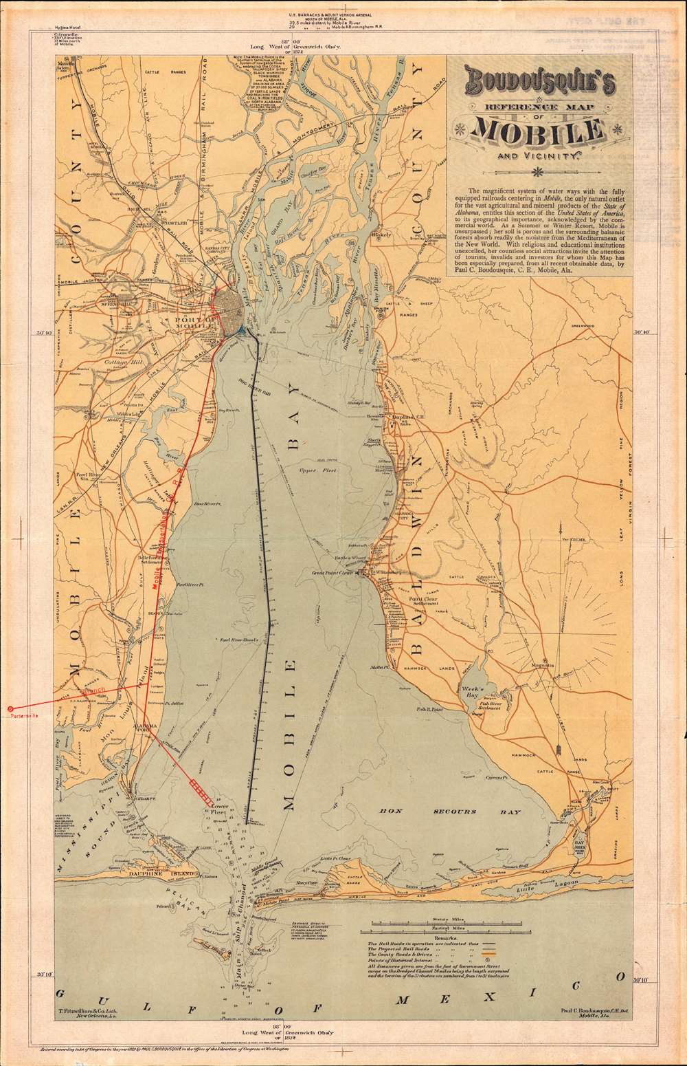
Boudousquie's Reference Map of Mobile and Vicinity.
sold
- Digital Map Information
- Suitable for large format printing
- File Size: 19.68 MB
- File Type: ZIP / TIFF
- ICC color profile embedded
- Delivered instantly via download link
A map of the utmost rarity, this is Paul Charles Boudousquie's map of Mobile Bay. It is considered by Mobile historian Caldwell Delaney, head of the Museum of the City of Mobile for 40 years and author of Howes' U.S.iana (1650 - 1950), the rarest of maps delineating Mobile. It is moreover, the only significant locally published map of Mobile Bay to appear in the 19th century. The map covers all of Mobile Bay as well as the Mobile River Delta, the city of Mobile, and much of the surrounding country. The newly dredged ship channel is boldly denoted through the center of the Bay. This map appeared during a period of revived optimism following years of social, political, and economic decline. (more details)
Cruise the Spanish Main with the Grace Line!
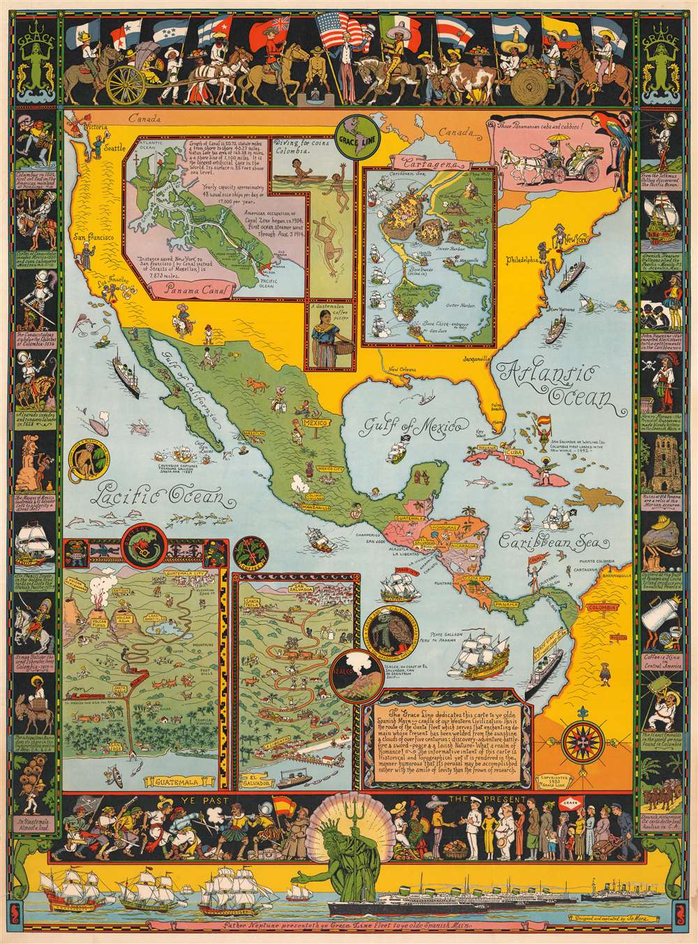
Father Neptune presenteth ye Grace Line fleet to ye olde Spanish Main.
sold
This is a rare 1933 Jo Mora pictorial map of Central America commissioned by the Grace Line to celebrate and advertise its newly-launched passenger service from New York City to Seattle via the Panama Canal. Focused on Central America, the map depicts North, Central, and South America and focuses on ports of call of the Grace Line. The whole map is dedicated to the memory of the Spanish Main, which is referred to as the 'cradle of our Western Civilization'. Mora also includes a disclaimer of sorts just below this dedication, stating
The informative intent of this carte is Historical and Topographical yet it is rendered in the manner humorous that its perusal may be accomplished rather with the smile of levity than the frown of research.(more details)
World War II Philippine 'RESTRICTED' Aviation Chart.

Northern Luzon No. 1 Sectional Aviation Chart. Philippine Aeronautical Chart. / No. 2 Southern Luzon and Northern Visayas.
sold
- Digital Map Information
- Suitable for large format printing
- Full resolution TIFF file
- ICC color profile embedded
- Delivered instantly via download link
This is a rare c. 1941 Philippine Bureau of Coast and Geodetic Survey World War II aeronautical chart or aviation map of Luzon and the northern Visayas. When it was issued, this map was top-secret information, critical to the U.S. defense of the Philippines. The word 'Restricted' appears in bold red lettering at bottom of the upper sheet. The first (northern), measuring 47.5 x 23.25 inches, sheet covers Luzon from the Batan Islands south to Corregidor Island and Manila Bay. The second sheet (southern), measuring 33.5 x 45.5 inches, covers southern Luzon from Manila Bay to Leyte, northern Cebu, Negros, and the Cuyo Islands. (more details)
First atlas issue of Mercator's map of the lands of the Crimean Tatars.
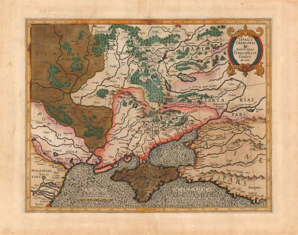
Taurica Chersonesus. Nostra aetate Przecopsca et Gazara dicitur.
sold
- Digital Map Information
- Suitable for large format printing
- Full resolution TIFF file
- ICC color profile embedded
- Delivered instantly via download link
This is the 1595 first state of Mercator's map of the Crimea, still known to geographers by its Ptolemaic name of Taurica Chersonesus. The engraving is bold and sharp - a product of the youth of the copperplate - and the rich hand color has aged to an attractive patina. Many recognizable place names can be found on this detailed map, including Moscow, Smolensk, Kiev, and Chernobyl. The primary focus of this map, however, is Russia’s extremely fluid southeastern border with the Crimean Tatars. The border garrisons of Ryazan (Rezan on the map) and the Crimea suffered yearly assaults from the steppes. Moscow’s response – the annual raising of an army of tens of thousands to patrol this border – was instrumental in developing the centralized power of the Tsar in the 16th and 17th centuries. (more details)
Oberlin's and the Underground Railroad.
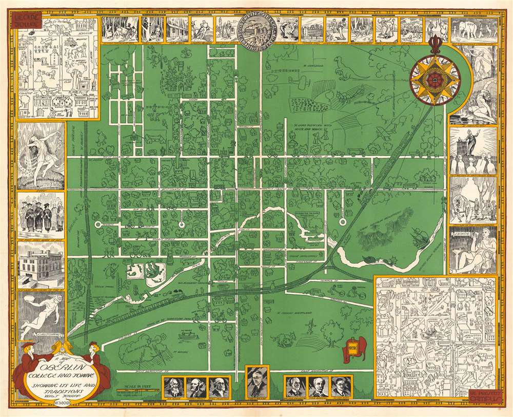
A Map of Oberlin College and Towne Showing Its Life and Traditions.
sold
- Digital Map Information
- Suitable for large format printing
- File Size: 57.72 MB
- File Type: ZIP / TIFF
- ICC color profile embedded
- Delivered instantly via download link
This is a 1929 Walter Howard Knapp map of Oberlin, Ohio and Oberlin College with fascinating 'Underground Railroad' and temperance references. The map depicts the town of Oberlin from the Lorain, Ashland, and Southern railroad line to North Crosby Street and from the football field to West Hamilton Street. Nearly all the streets are labeled, with private homes and other buildings illustrated throughout. Churches, inns, taverns, and the yacht club are labeled as well. Some of the labels, such as the haunted house and the mermaid next to the 'bridge of size' are charming and reflect local folklore and whimsy. For example, a dinosaur inhabits the top right corner of the map, near 'Ye land flowing with milk and honey.' The train for New York City cuts through town. (more details)
A Grand Tour destination.
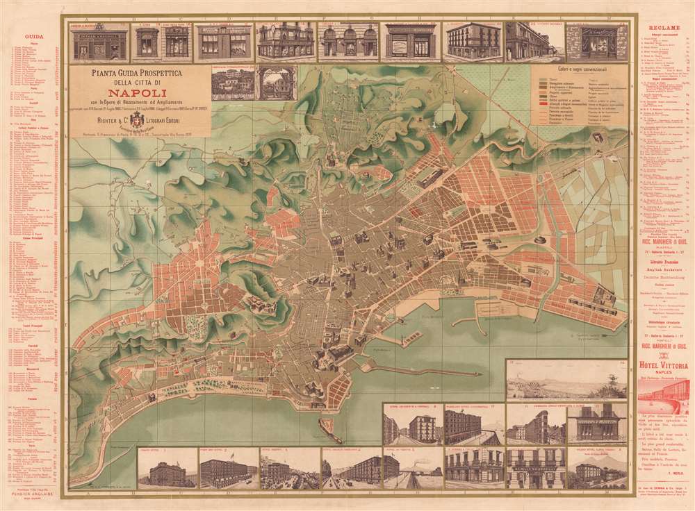
Pianta Guida Prospettica della citta di Napoli.
sold
- Digital Map Information
- Suitable for large format printing
- File Size: 65.01 MB
- File Type: ZIP / TIFF
- ICC color profile embedded
- Delivered instantly via download link
Drawn for the Grand Tour, this is a captivating 1886 Richter and Company large-scale chromolithograph pocket map of Naples (Napoli), Italy. The map depicts Naples and some of the surrounding hills. Topography is rendered with shading and important buildings and monuments and shown in profile, including the Palazzo San Giacomo, the National Museum, and the central train station. Twenty-four inset views of important buildings and businesses line the top and bottom borders, including important hotels, restaurants, and other businesses of interest to the traveler. A key, situated in the upper-right, identifies the colors and symbols used to mark theaters, churches, public buildings, palaces, and recommended hotels and shops. Railroads and tramways (both horse-drawn and steam-driven) are marked as well. A guide to the city appears outside the left border and lists plazas, castles, important streets, monuments, fountains, and more. Along the right side of the map, advertisements for various businesses, including the Hotel Vittoria, hope to attract a visitor's attention. (more details)
Florida's Phosphate Industry.
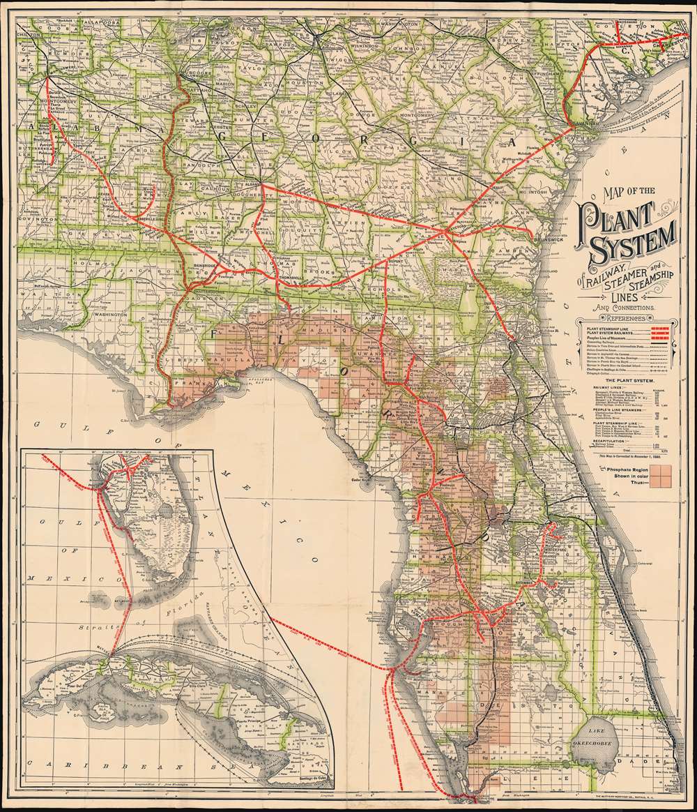
Map of the Plant System of Railway, Steamer and Steamship Lines and Connections.
sold
- Digital Map Information
- Suitable for large format printing
- File Size: 27.1 MB
- File Type: ZIP / TIFF
- ICC color profile embedded
- Delivered instantly via download link
A striking 1893 map of Florida, Georgia, and Alabama, illustrating the extent of the Plant system, a Tampa-based network of railroads and steamers traveling throughout the southeastern United States. The map also highlights Florida's rich phosphate mining region - a major source of revenue for the Plant system which was ideally suited to transport the valuable mineral. (more details)
Montana's frontier history.

Montana. Frontier. Pioneer.
sold
- Digital Map Information
- Suitable for large format printing
- Full resolution TIFF file
- ICC color profile embedded
- Delivered instantly via download link
This is a 1937 Irvin Shope pictorial map of Montana. The map depicts the state from Idaho to the Dakotas and from Canada to Wyoming, including Yellowstone National Park. Highly detailed, captions, vignettes, and other illustrations populate the map, offering a visual representation of Montana's history. Most captions recount tales of the Wild West. Outlaws, vigilantes, and frontier violence and 'justice' abound. Others inform the viewer of more conventional milestones, such as the location of the first Territorial Legislature, or that Virginia City was the first capital of the Montana Territory. Numerous cities and towns appear, including Helena, Missoula, and Bozeman. Vignettes frame the map, illustrating 'the major frontier industries: trapping, mining, cattle and sheep raising, and lumbering'. (more details)
Upper, Middle, and Lower Saranac Lakes.
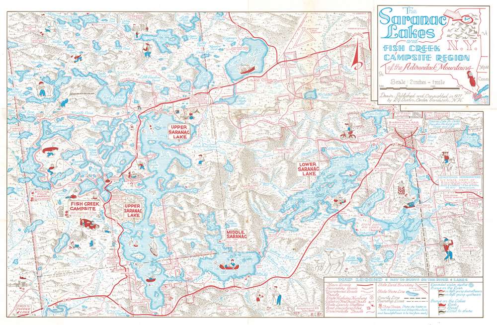
The Saranac Lakes and Fish Creek Campsite Region of the Adirondack Mountains.
sold
This is a delightful 1977 Robin G Dustin pictorial map of the Saranac Lakes and the Fish Creek campsite region in the Adirondack Mountains in New York State. The map depicts the region from Altamont Township to North Elba Township, and from Santa Clara Township to Harrietstown Township. Upper, Middle, and Lower Saranac Lake, along with numerous smaller ponds, brooks, lakes, and islands. Several campsites are noted, including Rollins Pond Campsite and Fish Creek Campsite. The Saranac Inn near Upper Saranac Island appears along with the town of Saranac Lake on the right. Numerous vignettes of outdoor enthusiasts, including fishermen, boaters, swimmers, and sunbathers, are playfully sketched. In the upper right, a hunter and a bear flee from one another. The hunter seems to have left behind his gun! Nearby deer bound through the forests. (more details)
Gas and oil deposits in Mexico City.

Terrenos con Manifestaciones de turba gas y petroleo, ubicados en el Estado de Mexico y D F.
sold
- Digital Map Information
- Suitable for large format printing
- File Size: 29.79 MB
- File Type: ZIP / TIFF
- ICC color profile embedded
- Delivered instantly via download link
This is a rare 1928 Ing. Mariano Alcerreca survey map of Mexico City, depicting from Tlalpam (Tlalpan) on the left to Temamatla on the right and from Ixtacalco on the top to Milpa Alta on the bottom. Presenting information about gas and oil deposits in the region, the map includes manuscript additions, such as color in two regions of the map, which a notation calls 'concessions'. The manuscript notations focus on the creation of a gas pipeline from Tlahuac into the center of Mexico City. All the manuscript notations are in English, whereas the rest of the map is in Spanish. The four different 'zones' on the map are listed on the upper right, giving size and a date. (more details)
West Point Military Academy and more.
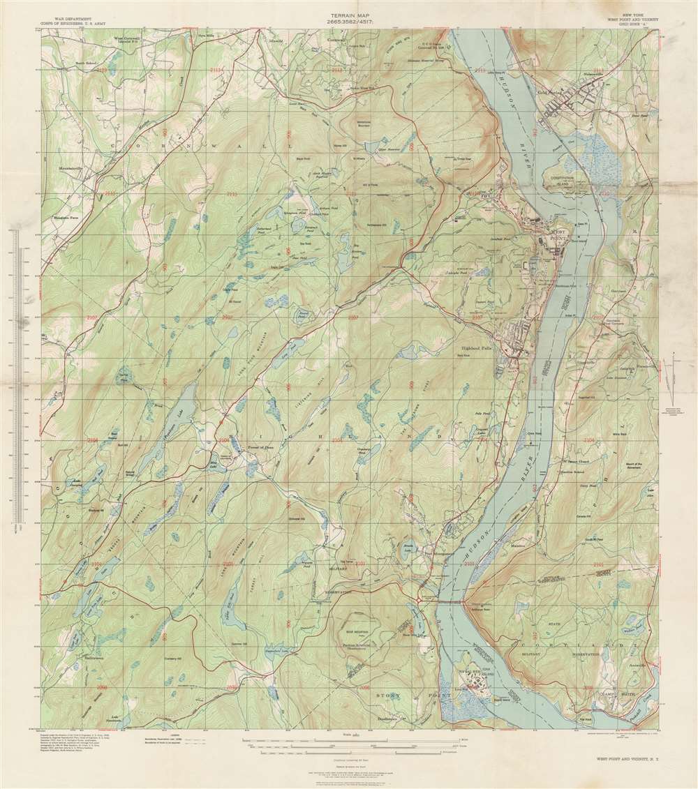
Terrain Map. New York West Point and Vicinity.
sold
- Digital Map Information
- Suitable for large format printing
- File Size: 49.08 MB
- File Type: ZIP / TIFF
- ICC color profile embedded
- Delivered instantly via download link
This is a 1939 U.S. Army Corps of Engineers’ terrain or topographical map of West Point and vicinity, New York. The map depicts the area from Storm King Mountain in Cornwall, along the Hudson River, south as far as Iona Island near Stony Point, and from Houghton Farm east to Forsonville. Details pertaining to the region's terrain, including important roads, camps, military reservations, hills, lakes, and a host of additional features, appear throughout. (more details)
Controversial Map.
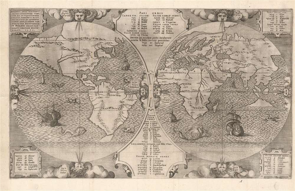
Benedict Arias Montanus Sacrae Geographiae Tabulam Ex Antiquissimorum Cultor.
sold
- Digital Map Information
- Suitable for large format printing
- Full resolution TIFF file
- ICC color profile embedded
- Delivered instantly via download link
This is a scarce and important 1571 map of the world by Benedict Arias Montanus. Finely engraved and prepared for the eight-volume Plantin Polyglot Bible, this elegant map was intended to bring the new discoveries of the Americas into a coherent religious context. It further established the Native American population as Hebrew descendants of Noah, and thus Children of God whom the dedicatee of the Polyglot, Philip II of Spain, was obliged to convert. Although its alleged revelations of Australian geography have long been the map's cause celebre, these are overshadowed by the map's actual significance as a cartographic justification of Spanish Imperialism. (more details)
The most striking commercial map of Australia during the Gold Rush Era.
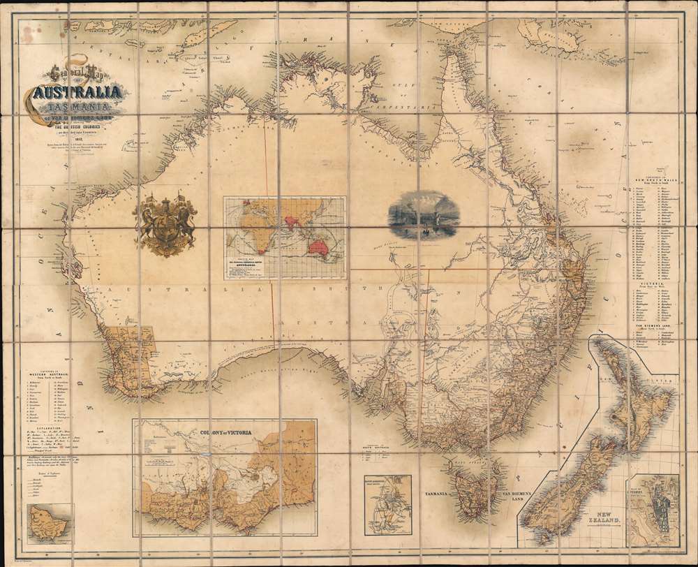
General Map of Australia and Tasmania or Van Diemen's Land shewing The British Colonies as divided into Counties.
sold
- Digital Map Information
- Suitable for large format printing
- File Size: 91.52 MB
- File Type: ZIP / TIFF
- ICC color profile embedded
- Delivered instantly via download link
A rare and striking first-edition chromolithograph gold rush era map of Australia issued by Ernst Georg Ravenstein in 1857 - without a doubt one of the largest and most decorative commercial maps of Australia to appear in the 19th century. The map covers the entire continent with insets detailing nearby New Zealand, the colony of Victory, Sydney, the Mount Alexander gold region, Norfolk Island, and commercial maritime routes to and from Australian ports. The first edition, as here, features two dramatic vignettes: the wharves at Melbourne and a curious British Royal crest modified to honor Prince Albert. The map depicts Australia in the midst of a continent-wide population explosion driven by a series of gold rushes lasting over half a century. Lest there be any doubt that this is a Gold Rush map, the map's striking chromolithograph color is awash with golden tones suggestive of prosperity and promise. (more details)
A Marriage of Astronomy and Geography.
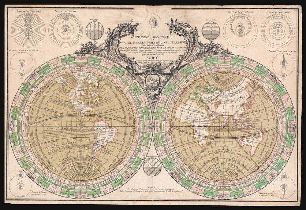
Mappe-Monde Geo Spherique ou Nouvelle Carte Ideale Du Globe Terrestre Pour servir d'Introduction a la Geographie, L'Hydrographie, et a la Sphere Armillaire . . . 1760.
sold
- Digital Map Information
- Suitable for large format printing
- Full resolution TIFF file
- ICC color profile embedded
- Delivered instantly via download link
This is a rare separate issue c. 1760 Louis Claude de Vézoue (Vezou) and Jean Lattré map of the world in hemispheres. This striking map combines the principles of geography with 18th century popular astronomical sciences and was intended as a pedagogical introduction to both. An informationally dense piece, it is replete with data and annotations explaining winds, currents, weather patterns, astronomy, and geography. Diagrams illustrating the four theories on the universe, solar and lunar eclipses, and the horizons surround the central map. Surmounting the map is an effigy of French King Louis XV, to whom the map is dedicated. (more details)
The best and rarest printed map of Middle Earth.

Middle Earth.
sold
A beautiful example of one of the rarest and most iconic J. R. R. Tolkien 'Middle Earth' maps ever issued - the 1969 map issued to promote the first American issue of the Lord of the Rings, featuring the illustrations of Barbara Remington. (more details)
Scottish Pre-WWII flag chart with Third Reich flags.
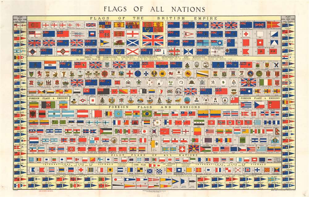
Flags of All Nations.
sold
- Digital Map Information
- Suitable for large format printing
- File Size: 33.91 MB
- File Type: ZIP / TIFF
- ICC color profile embedded
- Delivered instantly via download link
This is Brown, Son and Ferguson's c. 1934 chart of the flags of all nations. A dramatic large format chart illustrating the flags of the world's maritime nations with a focus on the British Empire and its various extensions. The chart is divided into four primary sections. The upper section focuses on the British Empire, featuring flags from England, Scotland, Ireland, and various British military, commercial, government and postal carriers. Below this there are a series of flags and badges associated with colonies, dominions, protectorates, dependencies, and mandated states. These include India, Hong Kong, Gibraltar, the Falklands, the Unfederated Malay States, New Zealand, Canada, and more. In addition to proper flags, there are also a series of badges medallions that were added to the Union Jack to identify client states. Foreign flags and ensigns appear below. Among these are the flags of the United States, 'Koweit', Korea, Japan, Colombia, the Papal States, the Soviet Union, and more. Germany has four flags, all bearing the swastika, firmly dating this chart to the pre-war period of the German Third Reich, roughly 1933 to 1939. (more details)