
First Edition of a Richly Detailed Map of the Visible Face of the Moon

General-Karte der sichtbaren Seite der Mond-oberflaeche zugleich als Übersichts-Blatt zur grössern Mondkarte von Wilh. Beer und Joh: Heinr.: Mädler.
sold
- Digital Map Information
- Suitable for large format printing
- DPI: 600
- File Size: 28.73 MB
- File Type: ZIP / TIFF
- ICC color profile embedded
- Delivered instantly via download link
A groundbreaking lunar map of considerable rarity and great significance. Sharply detailed, separately-issued map of the moon, produced in 1837 by the German astronomer Johann Heinrich Mädler. It is a reduced version of his 1834-6 four-sheet map of the moon, and represents just the second accurate, printed map of the lunar surface visible from Earth. It is abundantly detailed, naming 351 individual mountains and craters and using a number key to mark their locations on the map. The tables are broken into quarters, corresponding to the four parts of the original map. Where Mädler has been able to calculate them, the tables also provide the height and depth of the noted features. (more details)
Uncommon flag chart showing the flag for the Republic of Texas.

The Flags of the Principal Nations in the World.
sold
- Digital Map Information
- Suitable for large format printing
- DPI: 600
- File Size: 33.52 MB
- File Type: ZIP / TIFF
- ICC color profile embedded
- Delivered instantly via download link
A beautiful 1837 flag chart issued by Hinman and Dutton, and Samuel Augustus Mitchell Sr. including the maritime ensign of the Republic of Texas. The chart features a total of 98 flags associated with countries in Asia, Africa, America, and Europe. In some cases, both merchant and naval ensigns are included. The chart also includes the ensigns of merchant companies, including the British East India Company and the Russian-American Company. (more details)
First Atlas Issue of the Map of Europe by the Premier Mapmaker of his Age
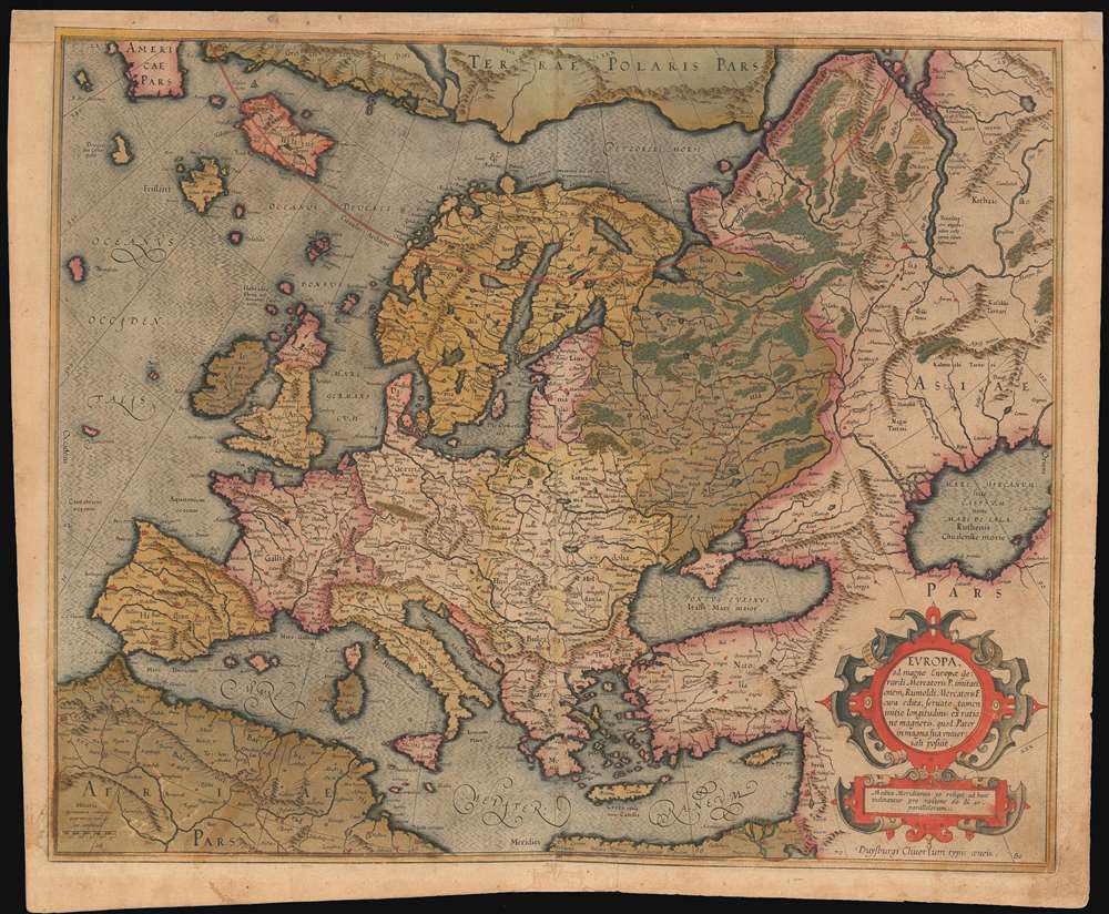
Europa, ad magnae Europae Gerardi Mercatoris P. imitationem, Rumoldi Mercatoris F. cura edita, servato tamen initio longitudinis ex ratione magnetis, quod Pater in magna sua universali posuit.
sold
- Digital Map Information
- Suitable for large format printing
- DPI: 600
- File Size: 24.98 MB
- File Type: ZIP / TIFF
- ICC color profile embedded
- Delivered instantly via download link
The 1595 first atlas issue of Mercator's general map of Europe. It appeared in his Atlas Sive Cosmographia, published in Duisberg. The map's geography is drawn from Mercator's wall map - likely not his lost 1554 Europe, but his 1569 World map. This map includes the ... (more details)
First Edition of a Delicately Engraved World Map Featuring the Sea of the West

Mappe-Monde Dressée pour l'Etude de la Géographie : rélativement aux Auteurs les plus Modernes.
sold
- Digital Map Information
- Suitable for large format printing
- DPI: 600
- File Size: 18.34 MB
- File Type: ZIP / TIFF
- ICC color profile embedded
- Delivered instantly via download link
An attractive example, with delicately-applied old wash and outline color, of this fascinating map of the world. The map is executed in two hemispheres, each suspended by a titan, one of which is presumably Atlas. Superbly engraved cartocuhes embellish the cusps of the hemispheres. Boasting the state-of-the-art astronomical observations of both Chirikof and Delisle, the map reveals a conjectural Northwest Passage and a massive Sea of the West dominating the northwest part of North America. Australia (Nouvelle Holland on this map) and New Zealand appear in their pre-Cook delineation, with indistinct eastern coastlines. It was engraved using two separate copperplates: one for the map itself, and another for the decorative rococo border. (this allowed for different borders to be employed in later editions of the atlas.) (more details)
Highlights over 200 college football teams, including LSU, Oregon, UCLA, Texas, and Wisconsin.

Albert Richard All-America Football Map.
sold
- Digital Map Information
- Suitable for large format printing
- File Size: 43.31 MB
- File Type: ZIP / TIFF
- ICC color profile embedded
- Delivered instantly via download link
This is a 1941 Albert Richard pictorial map of the United States highlighting the many American's passion for college football. The map depicts the continental United States from the Pacific Ocean to the Atlantic Ocean and from Canada to Mexico with thick teal lines creating the borders between the states. The map's focus, however, is on the tradition and fanfare associated with college football, a uniquely American past time. 239 different schools are referenced in some manner and correspond with an index along the bottom border which provides the school's location by city and state, nickname, and win-loss-tie record for 1940. Some schools are marked only by their names, while others are highlighted by pennants, seals, or caricatures of their mascot. The latter include LSU, Kentucky, Auburn, Duke (with the Blue Devil pointing its pitchfork at UNC's pennant), Wisconsin, Wyoming, UCLA, Oregon State, Oregon, and the University of Washington. Conference winners are highlighted by large blue stars bearing the college or university's name and conference affiliation, while All-Americans are recognized with red stars bearing their name, position, and college or university. Bowl games are also included, marked by small stadiums and the score of the 1940 game. Conference winners dating back to 1896 are listed along both borders. Small infographics on either side of the index along the bottom border include illustrations of official signals on the left side and rivalry trophies on the right. (more details)
An anti-Communist map of Eastern Europe promoting Soviet imperial ambitions.
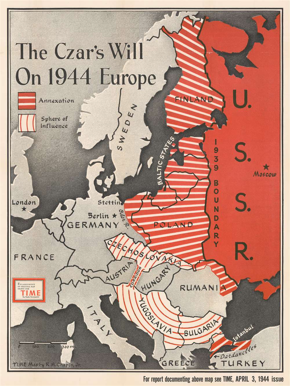
The Czar's Will on 1944 Europe.
sold
- Digital Map Information
- Suitable for large format printing
- File Size: 95.94 MB
- File Type: ZIP / TIFF
- ICC color profile embedded
- Delivered instantly via download link
Dating from an era when the United States was fighting a truly global war against Nazi Germany and Imperial Japan, this 1944 Robert M. Chapin Jr map of Eastern Europe takes aim at neither of America's two official enemy states, but one of its allies. The map depicts the region from England and Scotland to the U.S.S.R and from the Arctic Ocean to Turkey and warns of the 'czar's will' to annex and exert influence over vast swaths of Eastern Europe. The Soviet Union is shaded red, a color traditionally associated with Communism, and is illustrated within its 1939 borders, while western Europe is shaded gray. The space in between, the areas the Soviets are supposedly eyeing, are shaded with two different patterns of red and white stripes. Parts of Europe that are apparently going to be annexed, shaded with thick red stripes and thin white stripes, include Finland, all three of the Baltic states (Estonia, Latvia, and Lithuania), Poland, eastern Germany, and eastern Romania. The Bosporus and the Dardanelles are also going to be annexed (which means Istanbul would fall into Soviet hands), finally satiating Russian desires for a secure warm-water port along the Black Sea. This would effectively make the Soviet Union an imperial power in Eastern Europe, replacing the hegemony of the Nazis. It must not be forgotten, however, that direct control is not the only method referenced here. Czechoslovakia, (more details)
A wonderful metallic pictorial bird's eye view of Jerusalem published in Haifa.
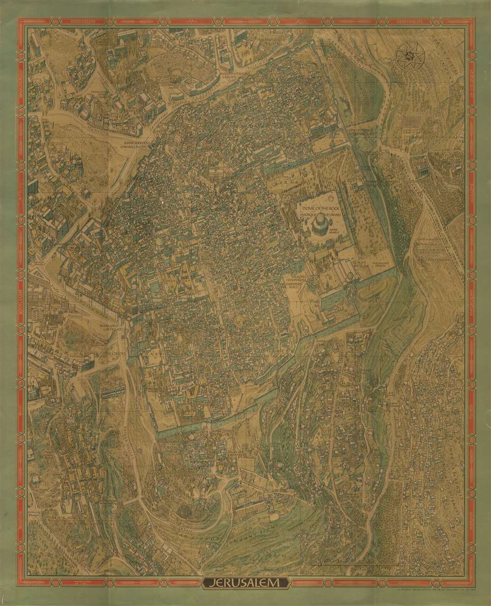
Jerusalem.
sold
- Digital Map Information
- Suitable for large format printing
- File Size: 60.93 MB
- File Type: ZIP / TIFF
- ICC color profile embedded
- Delivered instantly via download link
This is a stunning 1969 Herman Bollmann bird's eye view pictorial map of Jerusalem printed with an extraordinary metallic ink. The map depicts the city from Yemin Moshe to the Mount of Offense and from the Rockefeller Museum to Shim'a. Buildings throughout Jerusalem are illustrated in detail, including the Dome of the Rock, the Western Wall, the Al-Aqsa Mosque, the Church of the Redeemer, and the Church of the Holy Sepulcher in the Old City, which is surrounded by its ancient walls. Numerous gates in the walls are identified. Myriad small buildings are illustrated within the Old City, and the Jewish Quarter, Christian Quarter, Muslim Quarter, and Armenian Quarter are each labeled. Buildings and other sites outside the Old City are also illustrated and labeled, including the Church of the Tomb of the Virgin, Gethsemane, David's Tomb, the Church of Dormition, and the Yemin Moshe Synagogue. The Catholic, Prostestant, Jewish, and Muslim cemeteries are all identified. Numerous streets are identified. The whole is surrounded by a border bearing the name of Jerusalem translated into sixteen different languages. (more details)
Illustrates a hypothetical Pacific Ocean blockade of Japan - published nearly three years before the Japanese attack on Pearl Harbor.
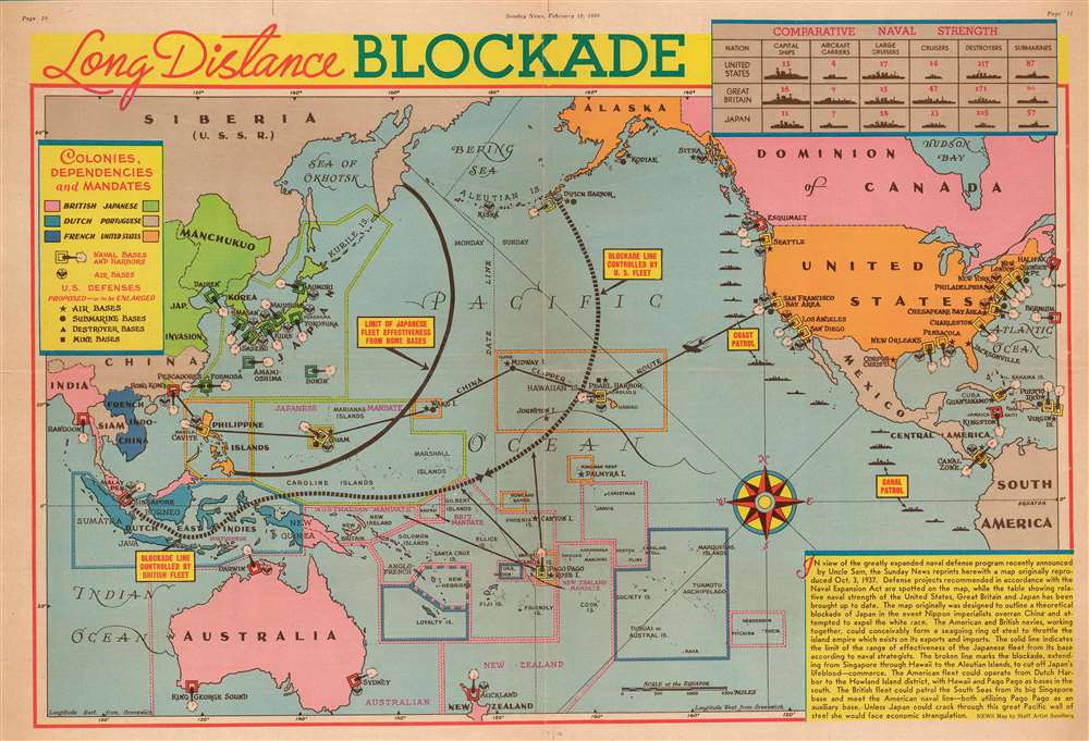
Long Distance Blockade.
sold
- Digital Map Information
- Suitable for large format printing
- File Size: 29.48 MB
- File Type: ZIP / TIFF
- ICC color profile embedded
- Delivered instantly via download link
This is a 1939 Edwin Sundberg pictorial map of a hypothetical Pacific Ocean blockade against Japan. The map depicts the region from central Asia to the Atlantic Ocean and from the Bering Sea to New Zealand. Originally published in 1937 by the New York Sunday News in connection with the Second Sino-Japanese War, then raging in Asia between China and Japan, the News elected to update the content and publish a second edition after the announcement of the Naval Expansion Act. (more details)
A post-Civil War era portrait of George Washington.

Washington.
sold
- Digital Map Information
- Suitable for large format printing
- File Size: 29.36 MB
- File Type: ZIP / TIFF
- ICC color profile embedded
- Delivered instantly via download link
This is a c. 1865 William Smith portrait of George Washington, likely based on paintings by Gilbert Stuart. Lithographs such as this would have been hung in offices and homes, and especially in schools. During the mid-19th century, which saw the crises of the 1850s, the Civil War, and Reconstruction, the memory of George Washington was heavily promoted because Washington spanned the gap between the two opposing forces in the United States at the time. He was a plantation and slave owner from Virginia (a southern state) who was also a Federalist who believed a strong central government and a balance of power between the three branches of the federal government. (more details)
Provides geographical context for the recently concluded Mexican-American War after the American capture of Mexico City.

Map of the Valley of Mexico.
sold
- Digital Map Information
- Suitable for large format printing
- DPI: 600
- File Size: 10.47 MB
- File Type: ZIP / TIFF
- ICC color profile embedded
- Delivered instantly via download link
Created just after the Mexican American War, this is an 1847 Edmund Hardcastle map of the Valley of Mexico, a highlands plateau in central Mexico containing present-day Mexico City and the eastern half of the State of Mexico. The map depicts the region from Toluca to Cuatlacingo and from Xaltocan to Popocatepetl. Meant to illustrate a portion of the theater of war, Mexico City is situated on the left side near Lake Texcoco (Laguna de Tezcuco), and settlements, roads, lakes, and mountains throughout the region are illustrated. The American army, und General Winfield Scott, landed a Veracruz on the Mexican coast of the Gulf of Mexico and marched west, and eventually assaulted and captured Mexico City. A profile of their march is situated in the upper right quadrant. (more details)
The First, Detailed Map Specifically of Sardinia

Sardinia Insula.
sold
- Digital Map Information
- Suitable for large format printing
- DPI: 600
- File Size: 6.61 MB
- File Type: ZIP / TIFF
- ICC color profile embedded
- Delivered instantly via download link
Issued in 1554 by Sebastian Munster, this is the earliest detailed map specifically of Sardinia, Italy. The cities Cagliari, Oristano, Bosa, Alghero, Sassari and others are shown pictorially. The map also shows the southern part of Corsica and the town of ... (more details)
Attractive Wood-Engraved Souvenir Map of the World's Columbian Exposition

Bird's Eye View of the World's Columbian Exposition, Chicago, 1893.
sold
- Digital Map Information
- Suitable for large format printing
- File Size: 22.22 MB
- File Type: ZIP / TIFF
- ICC color profile embedded
- Delivered instantly via download link
A delicately executed, wood-engraved bird’s-eye view of Chicago, Illinois, published to promote and celebrate the World’s Columbian Exposition of 1893. It shows the Exposition’s buildings in the foreground in Jackson Park along the shore of Lake ... (more details)
San Francisco as Yerba Buena! Mexican-American War! Texas at its fullest expression!
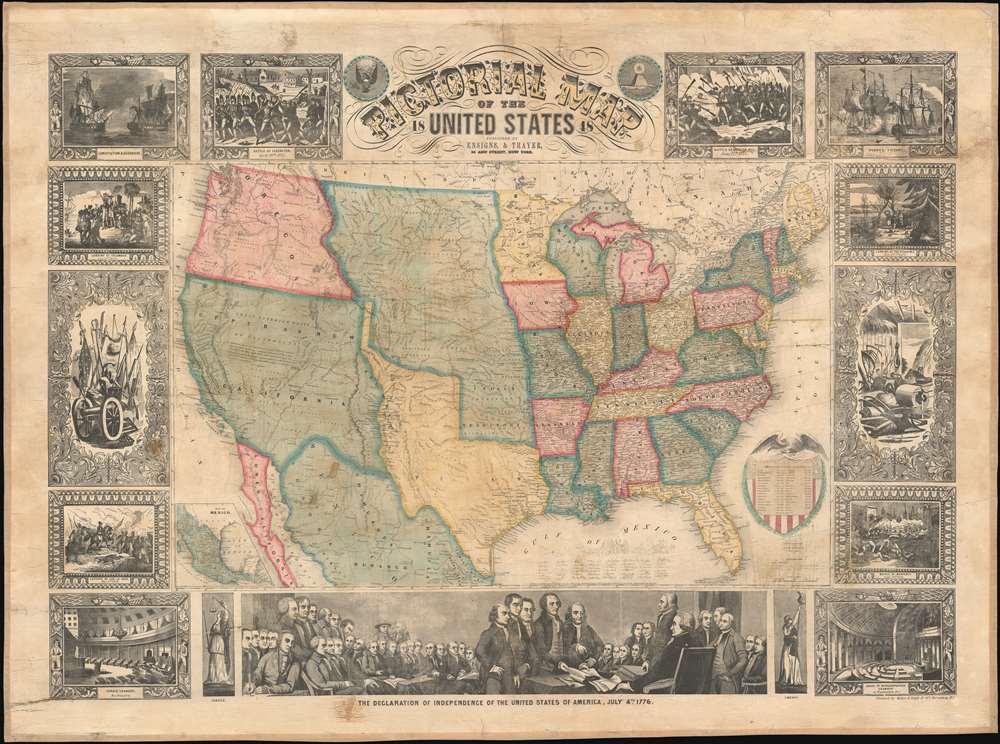
Pictorial Map of the United States.
sold
- Digital Map Information
- Suitable for large format printing
- DPI: 600
- File Size: 145.35 MB
- File Type: ZIP / TIFF
- ICC color profile embedded
- Delivered instantly via download link
A scarce American wall map of the United States and Mexico issued by Ensign and Thayer in 1848 - at the end of the Mexican American War (1846 - 1848). This is one of the few maps to identify San Francisco as Yerba Buena, exhibit Texas's fullest territorial claims, and show Upper California (California, New Mexico, Arizona, Utah, Nevada, Colorado, etc..) prior to its breakup into territories. As the title suggests, the map covers the United States in full and is one of the earliest examples of this map to extend from coast to coast - reflecting the new borders established claimed by the United States in 1846, and formalized by the 1848 Treaty of Guadeloupe-Hidalgo, which ended the Mexican-American War. At this time, no railroads extended west of the Mississippi. Predating the 1849 Gold Rush, Sacramento, founded in 1850, is not present, but the map notes John Sutter's colony of New Helvetica and nearby Sutter's Fort. Great Salt Lake is embryonically mapped, illustrative of the limited knowledge then amiable regarding the geographical disposition of the Great Basin. Nebraska extends northwards to the Canadian border and Washington/Oregon have their eastern terminus at the Rocky Mountains. (more details)
One of the only maps of the world produced in America during the 18th century by one of America's first mapmakers.
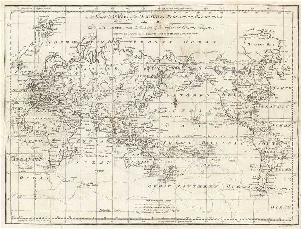
A General Chart of the World on Mercator's Projection, exhibiting all the New Discoveries and the Tracks of the different Circum-Navigators. Engraved for Spotswood's and Nancrede's Edition of Malham's Naval Gazetteer.
sold
- Digital Map Information
- Suitable for large format printing
- DPI: 600
- File Size: 17.76 MB
- File Type: ZIP / TIFF
- ICC color profile embedded
- Delivered instantly via download link
This 1797 map of the world by John Norman is one of the few printed in America prior to the 19th century. It was published in Boston for the first edition of Reverend John Malham's Naval Gazetteer. The map was engraved by John Norman, one of the first American mapmakers, of whose cartographic output virtually all ranks among the rarest and most sought-after nautical charts of the 18th century. It illustrates the routes of nautical explores, speculative routes through North America, names the Sea of Korea, and the legendary Chinese colony of Fusang. (more details)
Scramble for Africa: The founding of the British Central African Protectorate.
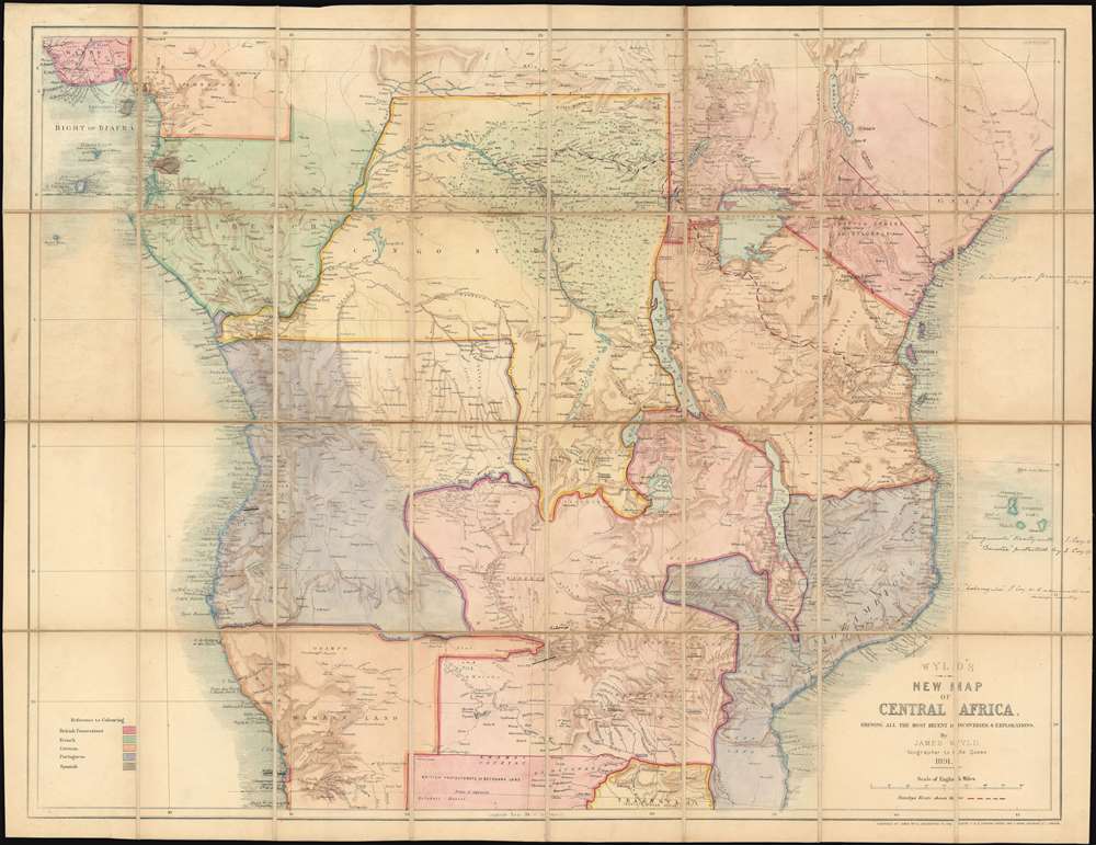
Wyld's New Map of Central Africa, shewing all the most recent discoveries and explorations.
sold
- Digital Map Information
- Suitable for large format printing
- Full resolution TIFF file
- ICC color profile embedded
- Delivered instantly via download link
An exceptional and rare find, this is Wyld's 1891 map of Central Africa, one of the few contemporaneous 'Scramble for Africa' maps to illustrate the Anglo-Portuguese conflict over Central Africa (1890 - 1891) and the founding of the British Central African Protectorate. Moreover, the present map features manuscript updates reflecting treaties and events that contributed to defining the Protectorate's borders. (more details)
Dutch language propaganda poster created by the Wehrmacht propaganda branch.

De zegebanier van Japan waait over den Grooten Oceaan. / [The victory banner of Japan blows over the Great Ocean.]
sold
- Digital Map Information
- Suitable for large format printing
- File Size: 74.14 MB
- File Type: ZIP / TIFF
- ICC color profile embedded
- Delivered instantly via download link
This is 1942 German Wehrmacht (German Army) broadside propaganda map of the Pacific promoting Japanese victories over the United States and Great Britain. The map, which occupies the center of the broadside depicts the Pacific Ocean from Asia to California and from the Bering Strait to New Zealand and highlight's Imperial Japan's many offensives and victories during 1942. Thick red arrows point to Japanese victories at Hong Kong, Singapore, the Philippines, throughout Indonesia, New Guinea, Guam and in the Solomon Islands, each of which are marked by small Japanese flags. Pearl Harbor, Midway, Samoa, Sydney, and Darwin are marked by American and British flags, and Japanese raids on these locations are shown by the same red arrows. An area filled with red lines marks Japan's every-expanding sphere of influence. A legend, situated along the left border, explains the various notations used.
Printed photographs and text surround the central map, all reinforcing the idea that the Japanese were unbeatable in the Pacific. A large Japanese flag is situated on the upper left, and, below the title to the right of the flag, the text of part of a speech by Hideki Tojo, the Prime Minister of Japan, stating Japan's desire to collaborate with Germany and Italy is included. The text in the lower left corner extolls Japanese victories, specifically citing the sinking of the British battleships Prince of Wales and Repulse. Photographs printed along the bottom and right borders illustrate the British surrender at Singapore, the Japanese landing at Corregidor, the last American stronghold in the Philippines, Japanese bombers on a mission, and Japanese tanks and other vehicles in Burma and Malaysia. (more details)
Printed photographs and text surround the central map, all reinforcing the idea that the Japanese were unbeatable in the Pacific. A large Japanese flag is situated on the upper left, and, below the title to the right of the flag, the text of part of a speech by Hideki Tojo, the Prime Minister of Japan, stating Japan's desire to collaborate with Germany and Italy is included. The text in the lower left corner extolls Japanese victories, specifically citing the sinking of the British battleships Prince of Wales and Repulse. Photographs printed along the bottom and right borders illustrate the British surrender at Singapore, the Japanese landing at Corregidor, the last American stronghold in the Philippines, Japanese bombers on a mission, and Japanese tanks and other vehicles in Burma and Malaysia. (more details)
A beautifully colored Zionist bird's eye view of the Holy Land.
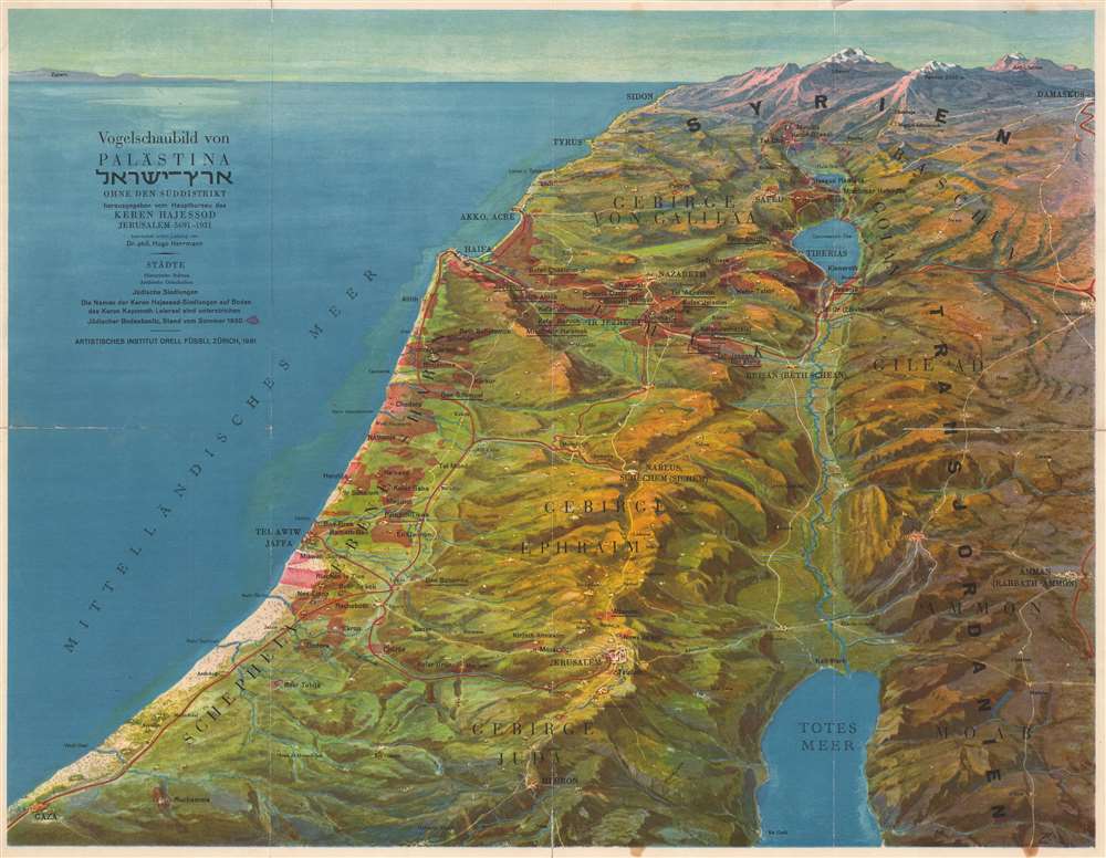
Vogelschaubild von Palästina ארץ - ישראל Ohne den Süddistrikt.
sold
- Digital Map Information
- Suitable for large format printing
- File Size: 21.2 MB
- File Type: ZIP / TIFF
- ICC color profile embedded
- Delivered instantly via download link
A brightly colored and wonderfully detailed piece, this 1931 Hugo Herrmann bird's eye view of Israel / Palestine illustrates the region from the south, stretching from Hebron and Gaza to Damascus and Sidon. The Mediterranean Sea is on the left and Amman, Jordan is included along the right border. Jerusalem and the Dead Sea are illustrated in the foreground. Tel Aviv, Jaffa, Haifa, Nazareth, Acre, and Tyre are all labeled. (more details)
World War II Era Japanese map of Hawaii!
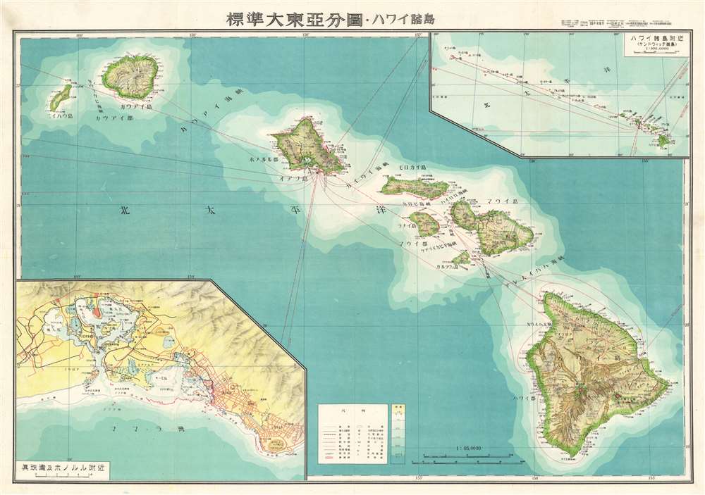
標準大東亞分圖 : ハワイ誻島 / Standard Map of the Great East Co-Prosperity Sphere. Hawaiian Islands.
sold
- Digital Map Information
- Suitable for large format printing
- File Size: 40.08 MB
- File Type: ZIP / TIFF
- ICC color profile embedded
- Delivered instantly via download link
This is a rare 1943 Showa 18 map Japanese World War II (WWII) map of Hawaii from the Greater East Asian Co-Prosperity Sphere series. The map details the major Hawaiian Islands with an inset of Honolulu and Pearl Harbor, and another detailing the farther Hawaiian Islands. Oceanic Depths are illustrated with blue shading. Flight and shipping routes appear in red. The inclusion of the map in the Greater East Asian Co-Prosperity Sphere series implies that the Japanese held imperial ambitions for the archipelago. (more details)
First map of the State of Maine
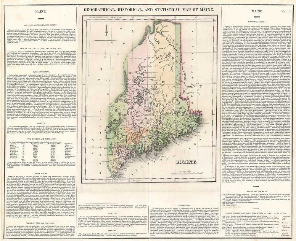
Geographical, Statistical, and Historical Map of Maine.
sold
- Digital Map Information
- Suitable for large format printing
- DPI: 600
- File Size: 21.69 MB
- File Type: ZIP / TIFF
- ICC color profile embedded
- Delivered instantly via download link
The first printed map of the State of Maine. This is the 1822 first edition example of Henry Charles Carey and Isaac Lea's map of Maine, engraved by Joseph Yeager, (1792-1859). As is typical of the Carey and Lea atlas, the map is presented in full wash color, surrounded by explicatory text. Nine counties are shown, and are distinguished from one another both by dotted lines and color coding. In addition to the towns, rivers, lakes and other such expected details, the map marks (by means of flags, also colored distinctly) 'Places Remarkable for Battles, Sieges' et cetera, which are described and dated in the text. These are predominantly conflicts with Native American tribes, though they include one Revolutionary War battle and five incidents from the War of 1812. (more details)
An Imperial Japanese map of Australia.

標準大東亞分圖 - オーストラリア全園 / [All of Australia.]
sold
- Digital Map Information
- Suitable for large format printing
- File Size: 42.81 MB
- File Type: ZIP / TIFF
- ICC color profile embedded
- Delivered instantly via download link
This is a beautiful 1943 or Showa 18 large format map of Australia, issued by the Japanese during World War II as part of a series of maps promoting the Japanese imperialist concept of the Greater East Asia Co-Prosperity Sphere. The map depicts the entire continent from southern New Guinea to northern Tasmania and from the Indian Ocean to the Coral Sea and the Tasman Sea. Australian states are shaded different colors to allow for easy differentiation. Numerous locations throughout Australia are identified. Shipping lanes around the continent and further afield are noted by solid red lines, while air routes are marked by dashed lines. An inset in the lower right corner details Tasmania and is mirrored by the map's key, which explains the various notations used. (more details)