
A lovely pictorial map of Nantucket Island's many charms.

Nantucket Island.
sold
- Digital Map Information
- Suitable for large format printing
- File Size: 10.66 MB
- File Type: ZIP / TIFF
- ICC color profile embedded
- Delivered instantly via download link
This is a charming c.1946 pictorial map of Nantucket Island by L. Parker. This beautiful tourist map depicts Nantucket Island including the smaller Tuckernuck and Muskeget Islands. An inset of Nantucket Town is included in the top left quadrant of the map. ... (more details)
Rare pictorial map of East Africa.
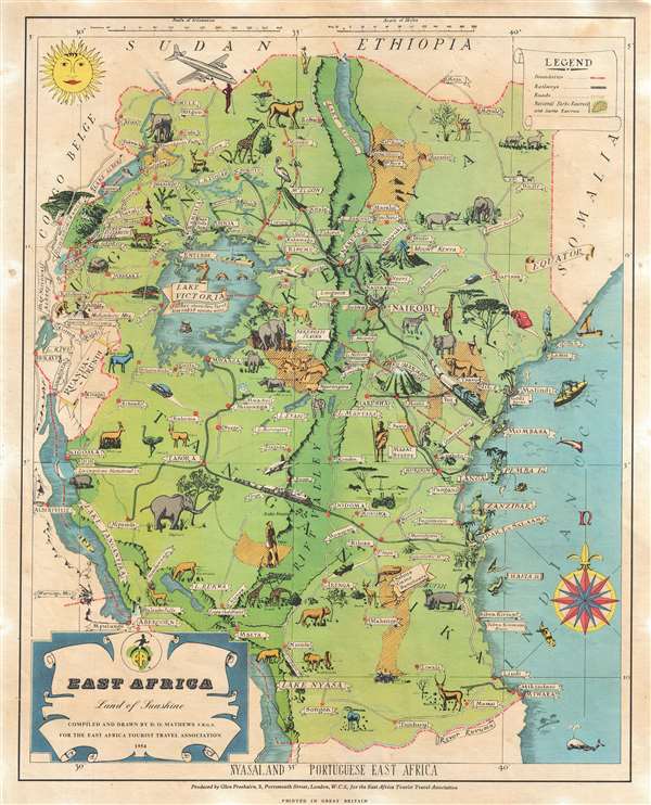
East Africa. Land of Sunshine.
sold
- Digital Map Information
- Suitable for large format printing
- File Size: 5.47 MB
- File Type: ZIP / TIFF
- ICC color profile embedded
- Delivered instantly via download link
This is a rare 1954 Dennis Owen Mathews pictorial map of East Africa, including modern day Kenya, Tanzania, Zanzibar, and Uganda. Centered on the Rift Valley, which is colored in a darker green, the map covers from Lake Tanganyika to the Indian Ocean and ... (more details)
Unusual center weighted comparative mountains and rivers chart declaring the Amazon to be the longest river in the world.
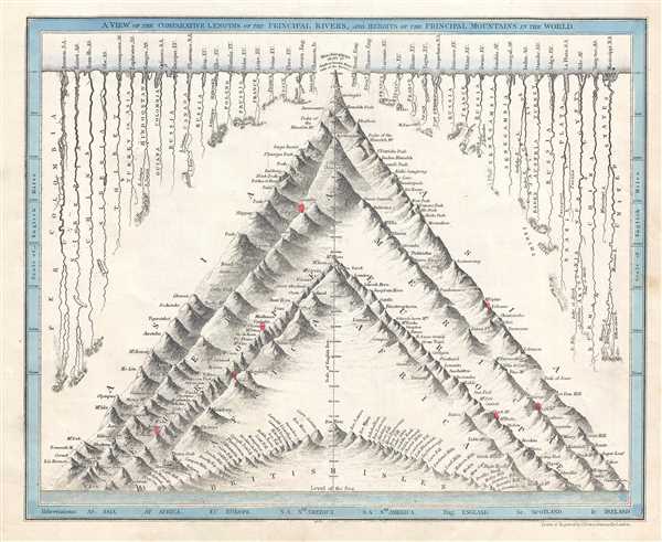
A View of the Comparative Lengths of the Principal Rivers, and Heights of the Principal Mountains in the World.
sold
- Digital Map Information
- Suitable for large format printing
- DPI: 300
- File Size: 2.35 MB
- File Type: ZIP / TIFF
- ICC color profile embedded
- Delivered instantly via download link
This is a c. 1844 John Crane Dower comparative map or chart of the world's mountains and rivers. Charts of this kind were first introduced in England around 1823 and became a common feature in atlases throughout the 19th century. The chart comparing the ... (more details)
Map with unusual coverage including Newfoundland and Charleston, South Carolina, on a single sheet.
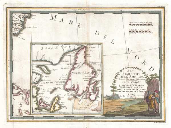
Gli Stati Uniti dell' America delineati sulle ultime Osservazioni, Sesto Foglio che comprende parte della Carolina ed inoltre l'Isola di Terra Nuova colle altre isole del Golfo di S. Lorenzo.
sold
- Digital Map Information
- Suitable for large format printing
- Full resolution TIFF file
- ICC color profile embedded
- Delivered instantly via download link
This is a 1797 Giovanni Maria Cassini unusually laid out stunning map of North and South Carolina, Newfoundland, and part of the Bahamas. The map is dominated by a large inset of Newfoundland that also depicts parts of Labrador and Cape Breton Island. ... (more details)
An incredible first edition example of Johnson's desirable folio map of Texas.
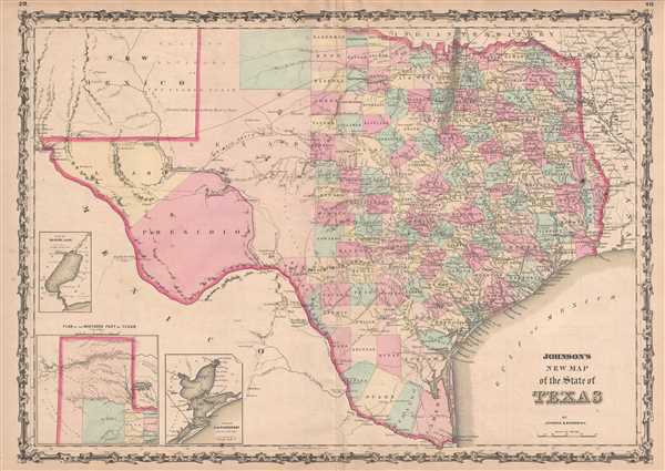
Johnson's New Map of the State of Texas.
sold
- Digital Map Information
- Suitable for large format printing
- File Size: 10.86 MB
- File Type: ZIP / TIFF
- ICC color profile embedded
- Delivered instantly via download link
This is an exceptional 1860 first edition second state example of A. J. Johnson and Ross C. Browning's highly desirable map of Texas. Created shortly before the American Civil War, this extraordinary folio map details the state of Texas New Mexico and ... (more details)
A panoramic tourist map of Havana.
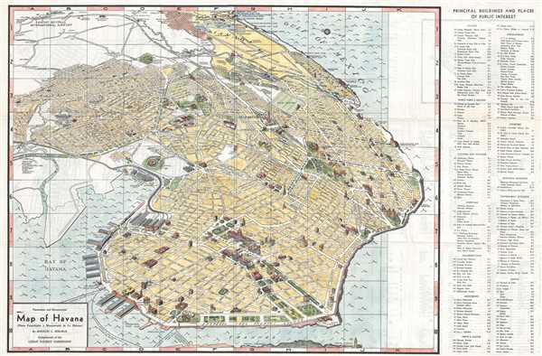
Panoramic and Monumental Map of Havana. (Plano Panoramico y Monumental de La Habana).
$450.00
Acquire
- Digital Map Information
- Suitable for large format printing
- File Size: 14.65 MB
- File Type: ZIP / TIFF
- ICC color profile embedded
- Delivered instantly via download link
This is a 1953 Rogelio L. Mirabal panoramic map of Havana, Cuba issued by the Cuban Tourist Commission, capturing the city at the height of its romantic literary period in the early fifties. The map depicts the city from Havana Bay to the Gulf of Mexico and from Rancho Boyeros International Airport to the Canal de Entrada. The Morro Castle, a fortress built at the entrance to Havana Bay, is partially illustrated in the lower right corner. Numerous buildings, monuments, and other locations throughout the city are depicted in profile, some of which, including the National Capitol building, police headquarters, Atares Castle, and Punta Castle, are identified by name. Other locations illustrated in this way are labeled numerically, and these numbers that correspond with a key situated along the map's right border, which also provides each site's grid location on the map. Neighborhoods throughout the city are labeled, as are major streets. An alphabetic street index is included along the left border. Piers along Havana's harbor are also illustrated and labeled, as are the routes of launches to Regla, Casa Blanca, and La Cabaña Fortress. (more details)
Rare map of Manhattan based on Viele showing c. 1606 American Indian settlements.
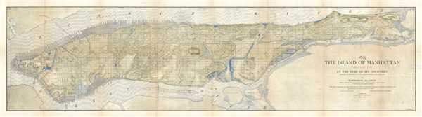
1609 The Island of Manhattan (Mannahtin) at the Time of its Discovery Showing its Elevations, Water-Courses, Marshes, and Shore Line.
sold
- Digital Map Information
- Suitable for large format printing
- File Size: 20.73 MB
- File Type: ZIP / TIFF
- ICC color profile embedded
- Delivered instantly via download link
A rare map of the island of Manhattan, New York City, as it presumably appeared in 1609, shortly after the Dutch began settling the island. This map was issued by Townsend MacCoun and is based, cartographically, on the great 1867 survey of Egbert ... (more details)
Traces important American Revolution sites throughout the island of Manhattan.
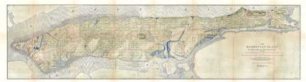
1783 Manhattan Island at the Close of the Revolution Showing the American City with its Landmarks and the Revolutionary Fortifications on the Island.
sold
- Digital Map Information
- Suitable for large format printing
- File Size: 23.94 MB
- File Type: ZIP / TIFF
- ICC color profile embedded
- Delivered instantly via download link
A rare map of the island of Manhattan, New York City, that combines parts of the burgeoning metropolis c. 1909 with those of the city just after the end of the American Revolution. This map was issued by Townsend MacCoun and is based, ... (more details)
Illustrates both the Rose Bowl and the Los Angeles Memorial Coliseum.
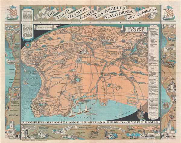
The Tenth Olympic Games Los Angeles California July 30 - Aug. 14 '32. A Complete Map of Los Angeles Area and Guide to Olympic Games.
sold
- Digital Map Information
- Suitable for large format printing
- File Size: 11.31 MB
- File Type: ZIP / TIFF
- ICC color profile embedded
- Delivered instantly via download link
This is a 1932 Mary Hall Atwood pictorial map of Los Angeles and vicinity created for attendees of the Tenth Olympic Games. Oriented toward the northeast, the map depicts the region from Ventura and Simi Valley to Basset, Covina, and ... (more details)
A comprehensive and detailed map of Oregon at the beginning of the 20th century - marks Crater Lake National Park four years after it was established.
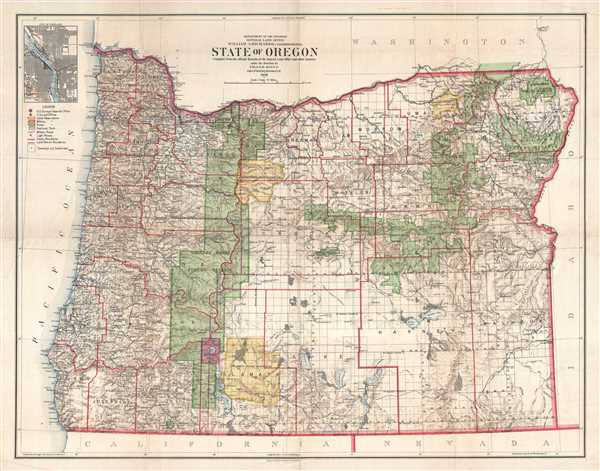
State of Oregon.
sold
- Digital Map Information
- Suitable for large format printing
- File Size: 30.8 MB
- File Type: ZIP / TIFF
- ICC color profile embedded
- Delivered instantly via download link
This is a 1906 Frank Bond and General Land Office map of Oregon. The map depicts the state from the Pacific Ocean to Idaho and from Washington to California. Meticulously detailed, the state's organization is presented at several ... (more details)
Features a vignette of the original design for the Washington Monument.
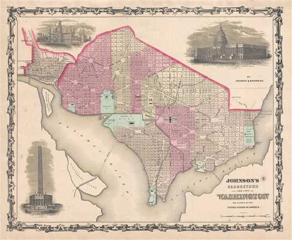
Johnson's Georgetown and the City of Washington the Capital of the United States of America.
sold
- Digital Map Information
- Suitable for large format printing
- File Size: 6.1 MB
- File Type: ZIP / TIFF
- ICC color profile embedded
- Delivered instantly via download link
This is the 1860 first edition of A. J. Johnson and Ross C. Browning's city map or plan of Washington, D.C. and Georgetown. The map depicts the city from Georgetown College (now part of Georgetown University) to the Anacostia ... (more details)
Unusual Pork advertising incorporated into a map.
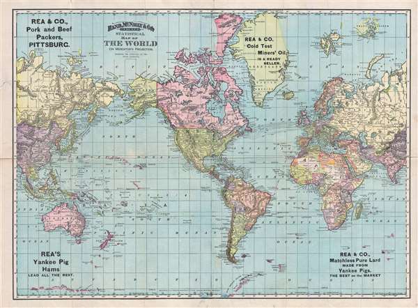
Rand, McNally and Co.'s Indexed Statistical Map of the World on Mercator's Projection. / Rea and Co., Pork and Beef Packers, Pittsburg.
sold
- Digital Map Information
- Suitable for large format printing
- File Size: 14.05 MB
- File Type: ZIP / TIFF
- ICC color profile embedded
- Delivered instantly via download link
An interesting separate issue example of Rand McNally's c. 1892 map of the world, here repurposed as promotional material for Rea and Company. The map covers the entire world centered on North and South America and offers a fascinating snapshot of the world during a period of rapid globalization and discovery. Antarctic exploration was still in its infancy, though parts of the Antarctic coast line are noted to the south of Australia and off the coast of Tierra del Fuego. Vast stretches of unmapped territory and speculative cartography fill central Asia, South America, Canada, Africa and Australia. (more details)
A charming pictorial map illustrating exploration through New Mexico.
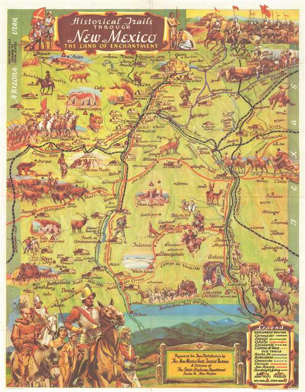
Historical Trails Through New Mexico The Land of Enchantment.
sold
- Digital Map Information
- Suitable for large format printing
- File Size: 14.24 MB
- File Type: ZIP / TIFF
- ICC color profile embedded
- Delivered instantly via download link
An extraordinary example of Wilfred Stedman's beautifully illustrated 1940 map of the historical trails through New Mexico. The map depicts New Mexico from Shiprock to El Paso and from Ft. Defiance to Texas. Illustrates the ... (more details)
One of the earliest European maps to Illustrate the Califorina Gold Region.
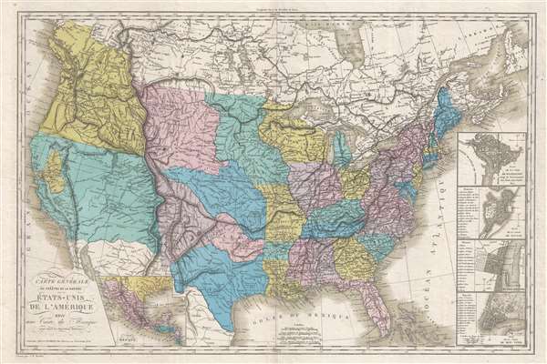
Carte Générale du Théâtre de la Guérre dans les États-Unis de L'Amérique avec une Carte du Mexique pour suivre les Opérations Militaires.
sold
- Digital Map Information
- Suitable for large format printing
- DPI: 300
- File Size: 18.58 MB
- File Type: ZIP / TIFF
- ICC color profile embedded
- Delivered instantly via download link
A fascinating Mexican-American War era map of the United States by Jean Baptiste Tardieu. The map covers the United States from Atlantic to Pacific including Texas and the new territory acquired by the United States during the Mexican American War (1846 – 1848), the discoveries of Lewis and Clark, American claims in British Columbia, and the California Gold Discovery. Inset submaps detail Mexico, Washington D.C., Boston, Philadelphia, and New York. The map is a bizarre amalgam of up-to-date details, cartographic speculation, outright myths, and political positioning. (more details)
Unusual early Japanese map of Oahu highlighting military installations.

布哇オァフ島防備略圖 / [Hawaii Oahu Defense Schematic Diagram]
sold
- Digital Map Information
- Suitable for large format printing
- File Size: 4.51 MB
- File Type: ZIP / TIFF
- ICC color profile embedded
- Delivered instantly via download link
A scarce 1913 (Taisho 2) Japanese map of Oahu, Hawaii, illustrating defensive positions. The map appears to have been adapted from an English language map with overprinting in Japanese to illustrate military installations, including Fort Shafter, Diamond Head, and the Schofield Barracks. In addition to the printed texted there are also manuscript updates expanding and revising the information contained with blue pencil markings highlighting Waialua Bay, Waianae Landing, Barper's Point, and Kāneʻohe Bay. (more details)
Rare highly detailed map of Senegal's Capital, Dakar!
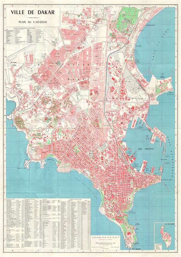
Ville de Dakar.
sold
- Digital Map Information
- Suitable for large format printing
- Full resolution TIFF file
- ICC color profile embedded
- Delivered instantly via download link
This is an uncommon first edition 1964 map of Dakar, capital of Senegal. The map was prepared by the Institut Géographique National, which maintained a West African office in Dakar. The map is beautiful produced on a ... (more details)
Early ptolemaic map of Central Asia!

[Title on Verso] Tabula Septima Asiae Complectitur Margianam, Bactrianam, Sogdianam, Sacas, & Scythiam, Intra Imaum Montem.
sold
- Digital Map Information
- Suitable for large format printing
- DPI: 300
- File Size: 5.73 MB
- File Type: ZIP / TIFF
- ICC color profile embedded
- Delivered instantly via download link
A fine example of the 1541 Vienne-in-the-Dauphane edition of Lorenz Fries' Ptolemaic map of central Asia. The map's coverage extends from the western Caspian Sea and the Central Asian Steppe, Afghanistan, including all or parts of modern day Kazakhstan, Turkmenistan, Iran, Afghanistan, Uzbekistan, and Iran. The Himalayas are evident at the base of the map and have a rope-like aspect. The map exhibits the typical trapezoidal projection common to early Ptolemaic maps. (more details)
Decorative Ptolemaic map of Spain and Portugal.
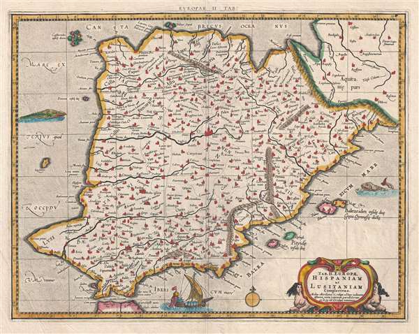
Tab. II. Europae, Hispaniam ac Lusitaniam Complectens.
sold
- Digital Map Information
- Suitable for large format printing
- DPI: 300
- File Size: 7.53 MB
- File Type: ZIP / TIFF
- ICC color profile embedded
- Delivered instantly via download link
This is an attractive example of the 1730 Witstein and Smith edition of the Mercator/Hondius Ptolemaic map of Spain and Portugal. The map covers the entire Iberian Peninsula according to the 2nd century Alexandrian cartographer Claudius Ptolemy, as interpreted by Gerard Mercator. (more details)
An incredible map of Peru clearly showing the unknown of the Amazon region.
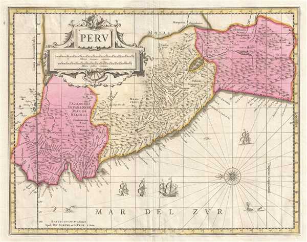
Peru.
$400.00
Acquire
- Digital Map Information
- Suitable for large format printing
- DPI: 300
- File Size: 8.73 MB
- File Type: ZIP / TIFF
- ICC color profile embedded
- Delivered instantly via download link
This is a c. 1700 Pieter Schenk and Gerard Valk map of Peru. The map, oriented towards the east, depicts the region from Los Pastos to Val Xuxuy and from an area east of Peru along the Omapalchas River and home to the ... (more details)
A beautifully engraved map of Mount Desert Island - the future site of Acadia National Park.
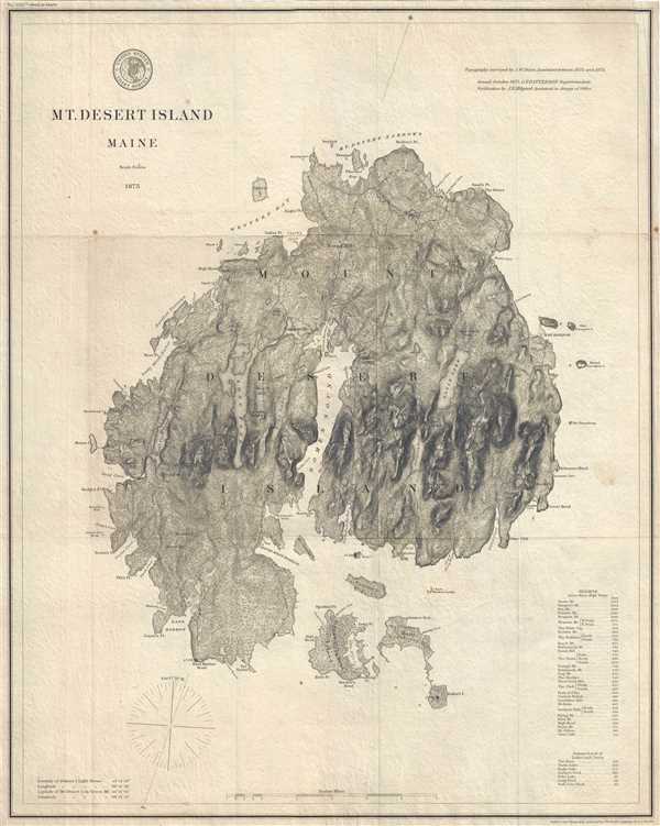
Mount Desert Island Maine.
sold
- Digital Map Information
- Suitable for large format printing
- File Size: 5.2 MB
- File Type: ZIP / TIFF
- ICC color profile embedded
- Delivered instantly via download link
This is an 1875 U.S. Coast Survey map of Mount Desert Island, Maine. An impressively clean and crisp imprint, the map depicts the entire island from Moose Island to Round Porcupine Island and from the Mount Desert Narrows to Baker's Island. Numerous locations throughout the island are labeled, including Bar Harbor, Seal Harbor, Seal Cove, Bass Harbor, Town Hill, and Somesville. Individual buildings are illustrated as black squares throughout the island, though only the lighthouses at Bass Harbor, Baker's Island, and Bear Island are labeled. Roads snake their way around the island, connecting each of the settlements and venturing into the island's interior. A table of heights above mean high water of mountains and other locations on the island is situated in the lower left corner.
(more details)
(more details)