
Illustrates Ocean Beach and Ocean Bay Park on Fire Island in detail - labels homes, businesses, and streets.
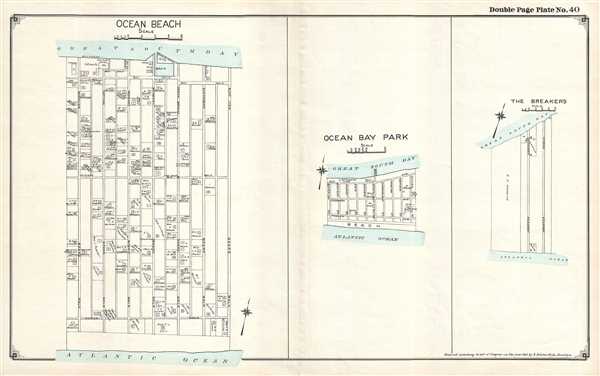
Ocean Beach. / Ocean Bay Park. / The Breakers.
sold
- Digital Map Information
- Suitable for large format printing
- File Size: 4.96 MB
- File Type: ZIP / TIFF
- ICC color profile embedded
- Delivered instantly via download link
This is a 1915 E. Belcher Hyde set of three maps of communities located on Fire Island, New York, printed on one sheet, depicting Ocean Beach, Ocean Bay Park, and The Breakers in their entirety. Each community is presented in detail, with the community's streets ... (more details)
Illustrates in detail the communities of Ocean Beach on Jones Beach Island and Lonelyville on Fire Island.
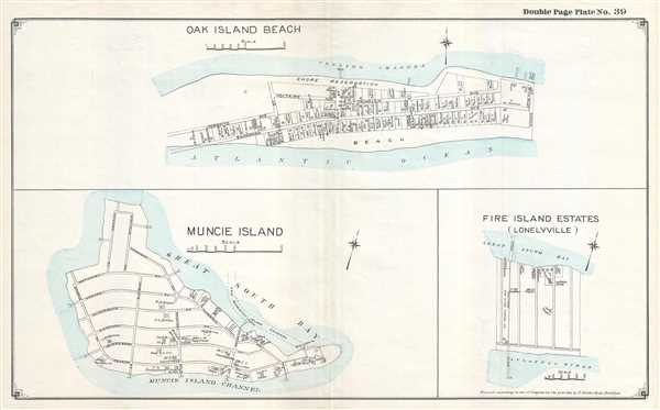
Oak Island Beach. / Muncie Island. / Fire Island Estates (Lonelyville).
sold
- Digital Map Information
- Suitable for large format printing
- File Size: 5.5 MB
- File Type: ZIP / TIFF
- ICC color profile embedded
- Delivered instantly via download link
This is a 1915 E. Belcher Hyde set of three maps of Jones Beach Island and Fire Island, New York, printed on one sheet and depicts the communities of Oak Beach (Oak Island Beach) and Lonelyville (Fire Island Estates – Lonelyville) and Muncie Island. The map ... (more details)
A set of two very charming celestial maps of the constellations as seen from the poles.
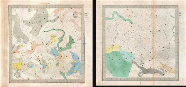
Circumjacent the North Pole. / Circumjacent the South Pole.
sold
- Digital Map Information
- Suitable for large format printing
- DPI: 300
- File Size: 5.5 MB
- File Type: ZIP / TIFF
- ICC color profile embedded
- Delivered instantly via download link
This is a set of two (2) 1845 Duncan Bradford celestial maps of the constellations as seen from the Northern and Southern Hemispheres, respectively. The Pole is situated at the center of each map, with lines of latitude illustrated in expanding concentric ... (more details)
Rare early Horsburgh chart of the waters around Hong Kong issued shortly after the Crown Colony's founding.
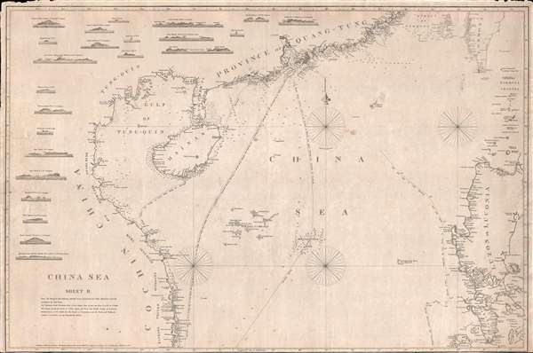
China Sea. Sheet II.
sold
- Digital Map Information
- Suitable for large format printing
- DPI: 300
- File Size: 18.5 MB
- File Type: ZIP / TIFF
- ICC color profile embedded
- Delivered instantly via download link
An attractive example of James Horsburgh's rare 1848 China Trade nautical chart or Maritime map of the South China Sea, including Hong Kong, Macao, Canton (Guangzhou), the Philippines, Hainan, the Paracel Islands, southern Taiwan (Formosa), and the ... (more details)
A nautical chart of the Huangpu River centered on Shanghai and the International Settlement.
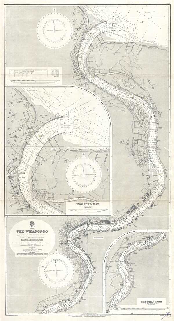
China The Whangpoo.
sold
- Digital Map Information
- Suitable for large format printing
- File Size: 39.23 MB
- File Type: ZIP / TIFF
- ICC color profile embedded
- Delivered instantly via download link
This is a 1929 British Admiralty nautical chart or maritime map of the Huangpu (Whangpoo) River. Centered on Shanghai and the International Settlement, the map depicts the region along the river from just south of Shanghai to the river's mouth, ... (more details)
Rare China Trade Charles Wilson nautical chart illustrating the East India Islands.
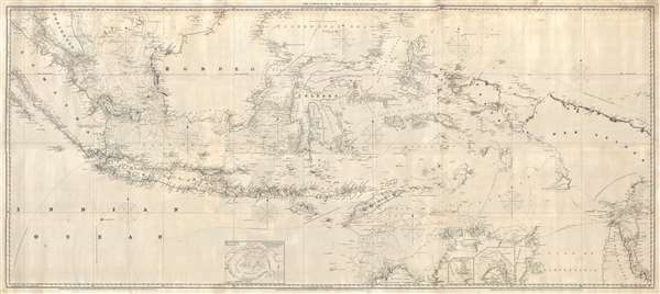
The Lower Part of the China Sea.
sold
- Digital Map Information
- Suitable for large format printing
- File Size: 60.47 MB
- File Type: ZIP / TIFF
- ICC color profile embedded
- Delivered instantly via download link
An extremely rare large format 1856 Charles Wilson nautical chart or maritime map covering most of the East Indies from Singapore, Malaya, and Sumatra to New Guinea and Cape York Peninsula (Queensland, Australia). And from Northern Borneo to ... (more details)
Rare chart of Singapore illustrating early development of the Singapore Strategy.

Preliminary Chart China Sea. Western Approaches to Singapore (Attention is called to Notice to Mariners No.1 of each year) From Surveys by Lieut. and Commr. F.A. Reyne R.N. 1912. Lieut. and Commr. R.I. Hancock R.N. 1910, and Leuitenant and Commander H.P. Douglas R.N. 1909. H.M. Surveying Ship 'Waterwitch' 1909-12.
sold
- Digital Map Information
- Suitable for large format printing
- File Size: 41.06 MB
- File Type: ZIP / TIFF
- ICC color profile embedded
- Delivered instantly via download link
A rare 1923 British Admiralty nautical chart illustrating southern coast of Singapore Island, the city of Singapore, and its western approaches. The chart properly covers from Singapore to Pulau Merambong. It is the result of Royal Navy ... (more details)
An admiralty chart with a detailed city map of Singapore City.
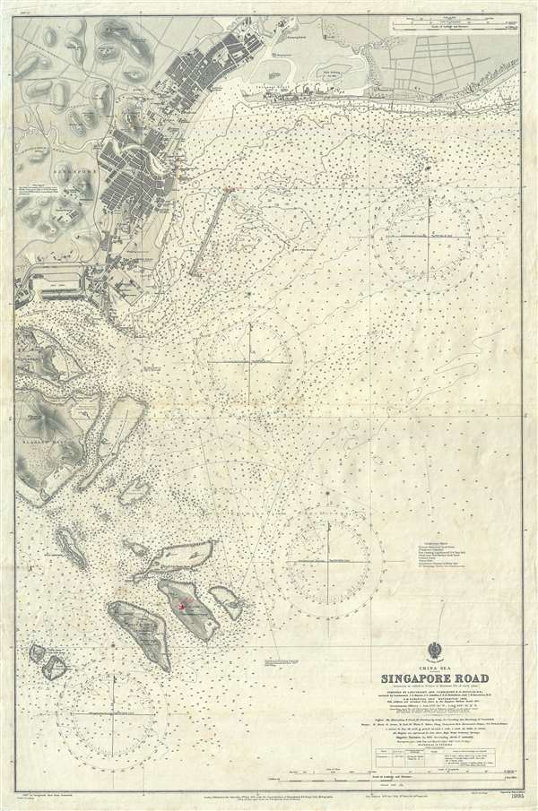
China Sea Singapore Road.
sold
- Digital Map Information
- Suitable for large format printing
- File Size: 24.45 MB
- File Type: ZIP / TIFF
- ICC color profile embedded
- Delivered instantly via download link
This is a 1915 British Admiralty nautical chart or maritime map of the city of Singapore and environs. Singapore Island occupies the upper portion of the map, with a highly detailed depiction of the city of Singapore situated in the upper ... (more details)
An incredible large format chart of the entire Singapore Strait.
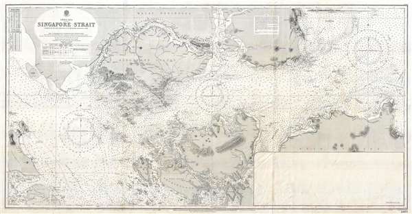
China Sea Singapore Strait.
sold
- Digital Map Information
- Suitable for large format printing
- File Size: 31.02 MB
- File Type: ZIP / TIFF
- ICC color profile embedded
- Delivered instantly via download link
This is a 1927 British Admiralty nautical chart or maritime map of the Singapore Strait. Centered Singapore city and the narrow strait between Singapore Island and Pulo Battam (Pulau Batam) the map extends west as far as the Malacca ... (more details)
Features numerous manuscript notations and updates, including a new depiction of part of the coastline.
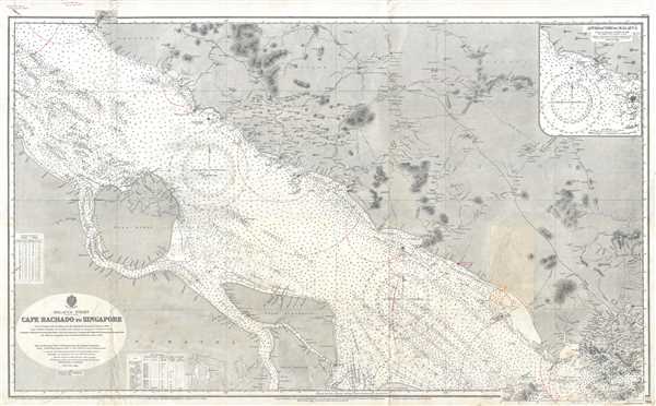
Malacca Strait Cape Rachado to Singapore.
sold
- Digital Map Information
- Suitable for large format printing
- File Size: 40.99 MB
- File Type: ZIP / TIFF
- ICC color profile embedded
- Delivered instantly via download link
This is a 1928 British Admiralty nautical chart or maritime map of the Malacca Strait. The map depicts the region from Sumatra to Singapore Island and from Malaysia to Great Karimun Island (Pulo Karimun). A unique piece, numerous ... (more details)
A U.S. Navy chart dating from two months before the end of World War II in the Pacific.
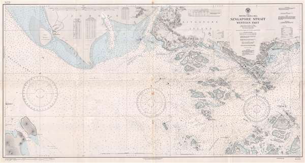
South China Sea Singapore Strait Western Part.
sold
- Digital Map Information
- Suitable for large format printing
- File Size: 21.61 MB
- File Type: ZIP / TIFF
- ICC color profile embedded
- Delivered instantly via download link
This is a 1945 U.S. Navy Hydrographic Office nautical chart or maritime map of the Singapore Strait. The map depicts the region from the Malacca Strait to the city of Singapore and from Johore and Singapore Island to Great ... (more details)
Bangka Island was the site of substantial tin production beginning in the mid-19th century.
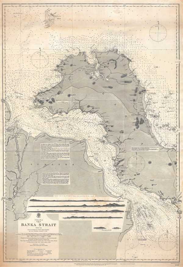
China Sea Banka Strait.
sold
- Digital Map Information
- Suitable for large format printing
- File Size: 26.91 MB
- File Type: ZIP / TIFF
- ICC color profile embedded
- Delivered instantly via download link
This is an 1893 British Admiralty nautical chart or maritime map of the Bangka (Banka) Strait, the strait which separates Bangka (Banka) Island from Sumatra in Indonesia. The map depicts the region from the mouth of the ... (more details)
Labels numerous Brooklyn neighborhoods, including Green Point, Bushwick, Flatbush, Bay Ridge, and Sheepshead Bay.
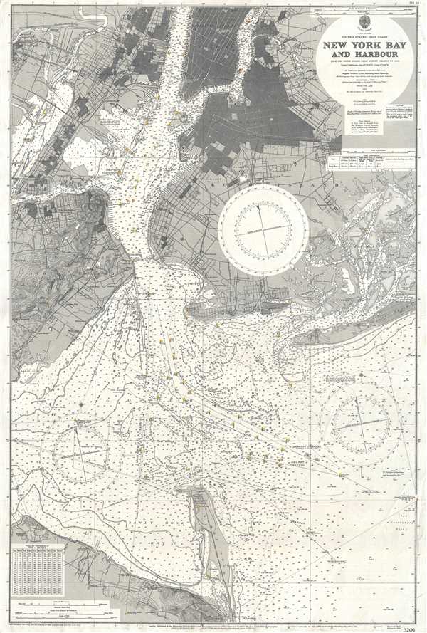
United States - East Coast New York Bay and Harbour.
sold
- Digital Map Information
- Suitable for large format printing
- File Size: 32.23 MB
- File Type: ZIP / TIFF
- ICC color profile embedded
- Delivered instantly via download link
This is a 1928 British Admiralty nautical chart or maritime map of New York Bay and Harbor. The map depicts the region from New Jersey and Staten Island the Long Island and from Manhattan Island, Long Island City, and ... (more details)
Stunning map of the Hamptons, Long Island's summer paradise.
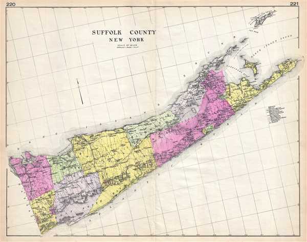
Suffolk County New York.
sold
- Digital Map Information
- Suitable for large format printing
- File Size: 13.16 MB
- File Type: ZIP / TIFF
- ICC color profile embedded
- Delivered instantly via download link
A highly appealing 1912 large format folio map of Suffolk County, Long Island, New York issued for the New Century Atlas of Counties of the State of New York . The map depicts from Oyster Bay to Montauk, including ... (more details)
A wonderful separate issue nautical chart of the entrance to the Potomac River.
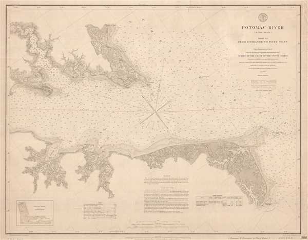
Potomac River Sheet No. 1 From Entrance to Piney Point.
sold
- Digital Map Information
- Suitable for large format printing
- File Size: 12.6 MB
- File Type: ZIP / TIFF
- ICC color profile embedded
- Delivered instantly via download link
This is a separate issue 1877 U.S. Coast Survey nautical chart or maritime map of the entrance to the Potomac River on Chesapeake Bay. The map depicts the region from Piney Point to the Chesapeake Bay and from ... (more details)
Amazing Civil War map depicting the Battles of Lookout Mountain and Missionary Ridge.
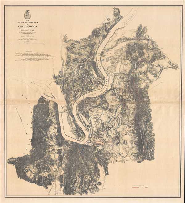
Map of the Battlefield of Chattanooga. Prepared to accompany Report of Maj. Gen. U.S. Grant by direction of Brig. Gen. W.F. Smith.
sold
- Digital Map Information
- Suitable for large format printing
- File Size: 20.42 MB
- File Type: ZIP / TIFF
- ICC color profile embedded
- Delivered instantly via download link
This is an 1875 William Farrar Smith map of the Chattanooga Campaign, a series of battles around Chattanooga, Tennessee in late November 1863. Centered on Chattanooga with the Tennessee River snaking its way ... (more details)
A beautifully engraved view of the full moon.

Telescopic View of the Moon At the Full.
sold
- Digital Map Information
- Suitable for large format printing
- DPI: 300
- File Size: 3.53 MB
- File Type: ZIP / TIFF
- ICC color profile embedded
- Delivered instantly via download link
This is an 1845 Duncan Bradford views of the full moon. Oriented toward the east, the view depicts the moon at its fullest. It detailes the maria and numerous craters on the moon's face. The whole is ... (more details)
Depicts the rail network of the Atchison, Topeka and Santa Fe railway - the second transcontinental rail route.
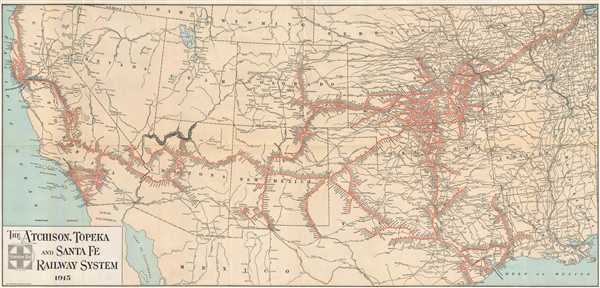
The Atchison, Topeka, and Santa Fe Railway System.
sold
- Digital Map Information
- Suitable for large format printing
- File Size: 14.51 MB
- File Type: ZIP / TIFF
- ICC color profile embedded
- Delivered instantly via download link
This is a 1915 M.B. Brown Printing and Binding Company map of the Atchison, Topeka and Santa Fe (ATSF) railway network in the Western United States. The map depicts the region from the Pacific Ocean ... (more details)
One of 3 known examples of Norris's view of Kennebunk.

Kennebunk, ME. 1895.
sold
- Digital Map Information
- Suitable for large format printing
- File Size: 10.66 MB
- File Type: ZIP / TIFF
- ICC color profile embedded
- Delivered instantly via download link
This is an extremely rare 1895 George E. Norris bird's-eye view of Kennebunk, Maine – one of Maine's most historic seaside towns. The view is oriented to the west with north to the right. Summer ... (more details)
Rare pictorial map of East Africa.

East Africa. Land of Sunshine.
sold
- Digital Map Information
- Suitable for large format printing
- File Size: 17.79 MB
- File Type: ZIP / TIFF
- ICC color profile embedded
- Delivered instantly via download link
This is a rare and stunning 1949 Dennis Owen Mathews pictorial map of East Africa, including modern day Kenya, Tanzania, Zanzibar, and Uganda. Centered on the Rift Valley, which is colored in a ... (more details)