
English map of North America with early Republic of Texas configuration.

Map of North America, Exhibiting the recent discoveries. Geographical and Nautical.
sold
- Digital Map Information
- Suitable for large format printing
- Full resolution TIFF file
- ICC color profile embedded
- Delivered instantly via download link
This is the scarce 1846 edition of James Wyld's map of North America including the Republic of Texas. The map covers all of North America from the Arctic to Panama and from Atlantic to Pacific, including Alaska, Greenland, and the West indies. The map includes a ... (more details)
A beautifully engraved map of England and Wales.
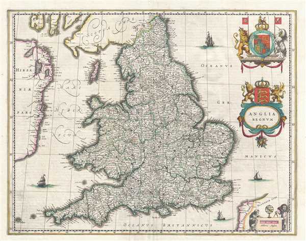
Anglia Regnum.
sold
- Digital Map Information
- Suitable for large format printing
- DPI: 300
- File Size: 10.98 MB
- File Type: ZIP / TIFF
- ICC color profile embedded
- Delivered instantly via download link
This is a c. 1645 Blaeu map of England and Wales. The map depicts the region from Ireland to the North Sea and from Scotland to the English Channel and Calais. Highly detailed, innumerable cities, towns, and villages are labeled throughout England and Wales, ... (more details)
Features an inset map of the Temple of Solomon.
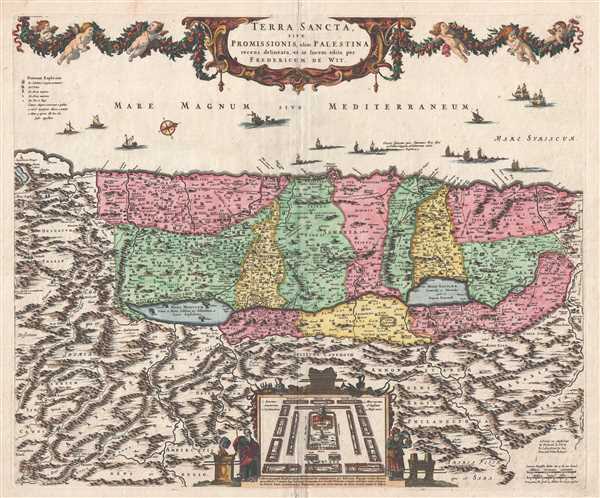
Terra Sancta, sive Promissionis, olim Palestina.
sold
- Digital Map Information
- Suitable for large format printing
- DPI: 300
- File Size: 11.73 MB
- File Type: ZIP / TIFF
- ICC color profile embedded
- Delivered instantly via download link
This is a c. 1670 Frederick de Wit map of the Holy Land, Israel, or Palestine. The map depicts the region from 'Arabia' to 'Syria' and from the Mediterranean Sea to Ammon, modern day Jordan. The Holy Land itself is divided into the regions occupied by the ... (more details)
References the 1596 Battle of Cadiz when British and Dutch troops sacked the city.
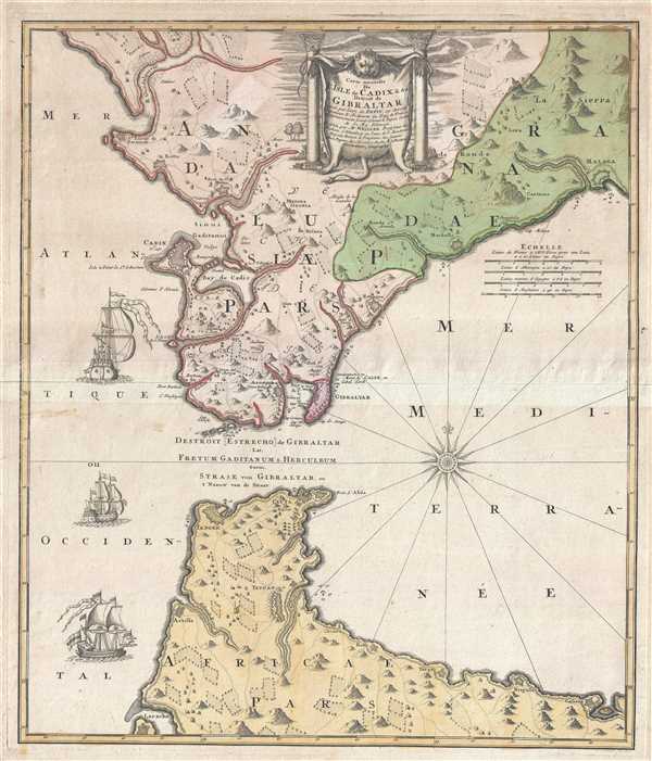
Carte nouvelle De L'Isle de Cadix et du Detroit de Gibraltar.
sold
- Digital Map Information
- Suitable for large format printing
- DPI: 300
- File Size: 11.7 MB
- File Type: ZIP / TIFF
- ICC color profile embedded
- Delivered instantly via download link
This is a 1730 Jean de Petit and Homann Heirs map of the Strait of Gibraltar and Cadiz. The map depicts the region from the Atlantic Ocean to the Alboran Sea (the westernmost part of the Mediterranean Sea) and from Spain and Gibraltar to Morocco. A ... (more details)
Bears an illustration of Mount Vesuvius spewing smoke.

Novissima et exactissima Totius Regni Neapolis.
sold
- Digital Map Information
- Suitable for large format printing
- DPI: 300
- File Size: 12.65 MB
- File Type: ZIP / TIFF
- ICC color profile embedded
- Delivered instantly via download link
This is a 1716 Johann Baptist Homann map of southern Italy. The map depicts the region from Terracina to the Adriatic Sea and from the Adriatic Sea to Sicily. Meticulously detailed, Italy is divided into different regions and political entities ... (more details)
Large attractive map of San Francisco.
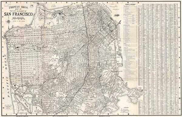
Thomas Bros Map of the City and County of San Francisco.
sold
- Digital Map Information
- Suitable for large format printing
- File Size: 19.61 MB
- File Type: ZIP / TIFF
- ICC color profile embedded
- Delivered instantly via download link
This is a c. 1938 pocket map or plan of the city of San Francisco by Thomas Bros. It depicts the city of San Francisco from the Golden Gate Bridge to Lake Merced and from the Pacific Ocean to Hunter's Point. Highly detailed, nearly all streets ... (more details)
The largest and best map of Poland following the Third Partition.
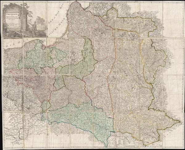
Grenzkarte der Preussischen Russischen und Oestreichischen Monarchien in XVI Blättern.
sold
- Digital Map Information
- Suitable for large format printing
- DPI: 300
- File Size: 61.83 MB
- File Type: ZIP / TIFF
- ICC color profile embedded
- Delivered instantly via download link
An exceedingly rare map of the great significance, this is Daniel Friedrich Sotzmann's 1796 large-format large-scale map of Poland prepared immediately after the 1775 Third Partition of the Polish-Lithuanian Commonwealth. When Sotzmann made ... (more details)
An original manuscript map detailing events during the first year of the Russo-Turkish War of 1735-1739 - most likely the template for several reduced atlas maps.
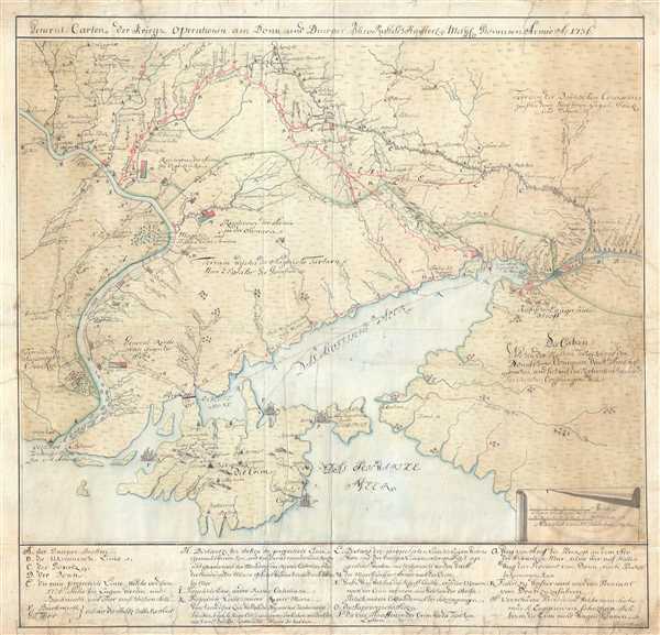
General-Carten der Kriegs Operationen am Donn und Dnieper, Irho Rußish Kayßerl: Merijl: Glorieusen Armée Ao. 1736.
sold
- Digital Map Information
- Suitable for large format printing
- DPI: 300
- File Size: 20.4 MB
- File Type: ZIP / TIFF
- ICC color profile embedded
- Delivered instantly via download link
This is the original 1736 manuscript map of Ukraine and the Crimean Peninsula that inspired reduced atlas editions by Joseph Nicolas de L'Isle and Matthäus Seutter, among others, and illustrates the events of the first year of the ... (more details)
An exceedingly rare anti-British collaborationist propaganda poster from Vichy France.

Confiance…Ses Amputations Se Poursuivent Méthodiquement. (Faith…[His] Amputations are Proceeding Methodically).
sold
- Digital Map Information
- Suitable for large format printing
- File Size: 31.88 MB
- File Type: ZIP / TIFF
- ICC color profile embedded
- Delivered instantly via download link
An exceedingly rare find, this c. 1942 collaborationist Vichy French propaganda poster demonizes Britain and her efforts to wrest control of French and Italian territorial possessions from Axis control. Per War Map , 'propaganda ... (more details)
Illustrates the night sky after four weeks of observation and survey work on the summit of Mont Blanc.
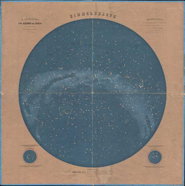
Himmelskarte.
sold
- Digital Map Information
- Suitable for large format printing
- File Size: 37.57 MB
- File Type: ZIP / TIFF
- ICC color profile embedded
- Delivered instantly via download link
This is an 1875 Dr. Wilhelm Pitschner celestial map of the night sky over central Europe as seen from the summit of Mont Blanc. Highly detailed, numerous constellations, stars, and other celestial bodies are illustrated, ... (more details)
Depicts the West Feliciana Railroad - the oldest standard-gauge line in the U.S. when it was abandoned in 1978.

Mississippi.
sold
- Digital Map Information
- Suitable for large format printing
- DPI: 300
- File Size: 4.68 MB
- File Type: ZIP / TIFF
- ICC color profile embedded
- Delivered instantly via download link
This is an 1846 Thomas G. Bradford map of Mississippi. The map depicts the region from Louisiana and Arkansas to Alabama and from Tennessee to Louisiana and the Gulf of Mexico. As is the case with the majority of the ... (more details)
Illustrates the Tuscumbia Railway - the first railroad west of the Appalachian Mountains.
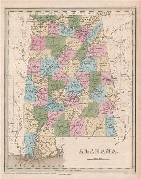
Alabama.
sold
- Digital Map Information
- Suitable for large format printing
- DPI: 300
- File Size: 4.81 MB
- File Type: ZIP / TIFF
- ICC color profile embedded
- Delivered instantly via download link
This is an 1846 Thomas G. Bradford map of Alabama. The map depicts the region from Mississippi to Georgia and from Tennessee to the Gulf of Mexico. As is the case with most maps in Bradford's A Universal Illustrated ... (more details)
Traces the American Revolutionary War in South Carolina - labels several battles, including Cowpens.
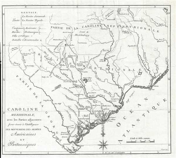
Caroline Meridionale avec les Parties adjacentes : pour servir à l'Intelligence des mouvemens des armées Américaines.
sold
- Digital Map Information
- Suitable for large format printing
- DPI: 300
- File Size: 5.3 MB
- File Type: ZIP / TIFF
- ICC color profile embedded
- Delivered instantly via download link
This is a 1787 Charles Picquet and David Ramsay map of South Carolina. The map depicts the region from Georgia to the Atlantic Ocean and from North Carolina to Savannah and the Atlantic Ocean. A visual summary of ... (more details)
Rare separately issued map of Bar Harbor by the United States Coast Survey.
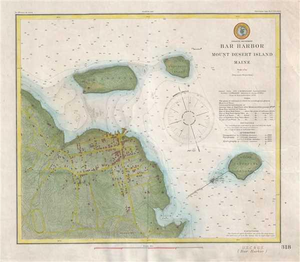
Bar Harbor Mount Desert Island Maine.
sold
- Digital Map Information
- Suitable for large format printing
- File Size: 6.01 MB
- File Type: ZIP / TIFF
- ICC color profile embedded
- Delivered instantly via download link
A scarce 1885 U.S Coast and Geodetic Survey nautical chart or maritime map of Bar Harbor, Mount Desert Island, Maine. Presented on a polyconic projection, this map is centered on the town of Bar Harbor, but ... (more details)
Scarce separate issue nautical chart of Ipswich and Annisquam harbors, Massachusetts.

Ipswich and Annisquam Harbors Massachusetts.
sold
- Digital Map Information
- Suitable for large format printing
- File Size: 19.26 MB
- File Type: ZIP / TIFF
- ICC color profile embedded
- Delivered instantly via download link
This is a scarce 1857 nautical chart of the Ipswich and Annisquam Harbors in Massachusetts. These two important ports are located just north Boston near Cape Ann. Both were centers for the cod fishing and ... (more details)
One of the rarest and most desriable U.S. Coast Survey maps of the Chesapeake Bay.

General Chart of Delaware and Chesapeake Bays and the Sea Coast from Cape May to Cape Henry.
sold
- Digital Map Information
- Suitable for large format printing
- File Size: 28.55 MB
- File Type: ZIP / TIFF
- ICC color profile embedded
- Delivered instantly via download link
An extraordinary 1866 U.S. Coast Survey nautical chart or maritime map of the Chesapeake Bay and Delaware Bay. This is one of the rarest and most desirable charts issued by the U.S. Coast Survey. The ... (more details)
An early map of the Wisconsin and Iowa Territories.
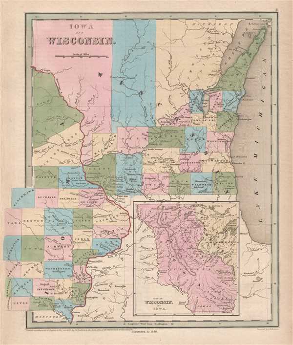
Iowa and Wisconsin.
sold
- Digital Map Information
- Suitable for large format printing
- DPI: 300
- File Size: 5.53 MB
- File Type: ZIP / TIFF
- ICC color profile embedded
- Delivered instantly via download link
This is an 1846 Thomas G. Bradford map of Wisconsin and Iowa. The map depicts the region from central Iowa to Lake Michigan and from Michigan to Illinois. Created only ten years after the creation of ... (more details)
Depicts the Michigan Central Railroad - originally founded as the Detroit and St. Joseph Railroad.
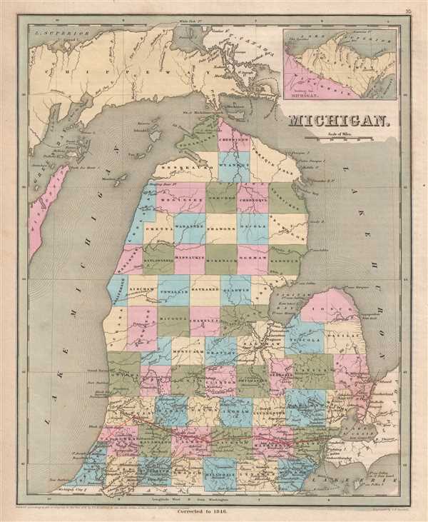
Michigan.
sold
- Digital Map Information
- Suitable for large format printing
- DPI: 300
- File Size: 5.3 MB
- File Type: ZIP / TIFF
- ICC color profile embedded
- Delivered instantly via download link
This is an 1846 Thomas G. Bradford map of Michigan. The map depicts the region from Lake Superior, Green Bay, and Wisconsin to Lake Huron and from Lake Superior to Indiana and Lake Erie. ... (more details)
Illustrates the immigrant population by percentage of each county and state in 1880.
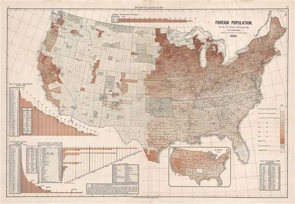
Foreign Population. Ration to Total Population, by Counties. (Based on the Returns of the Tenth Census.)
sold
- Digital Map Information
- Suitable for large format printing
- File Size: 10.11 MB
- File Type: ZIP / TIFF
- ICC color profile embedded
- Delivered instantly via download link
This is an 1883 Fletcher W. Hewes and Charles Scribner's Sons political / immigration map of the United States. The map depicts the continental United States from the Pacific Ocean to ... (more details)
Speculates on a possible German invasion of Sweden and Finland in the summer of 1943.
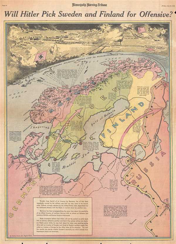
Will Hitler Pick Sweden and Finland for Offensive?
sold
- Digital Map Information
- Suitable for large format printing
- File Size: 11.93 MB
- File Type: ZIP / TIFF
- ICC color profile embedded
- Delivered instantly via download link
This is a Friday, June 25, 1943 Charles Hamilton Owens and Minneapolis Morning Tribune map of Scandinavia. The map depicts the region from the North Sea to Russia and from the Arctic ... (more details)