
Discovery Era World Revealed.

Typus Orbis Universalis.
sold
- Digital Map Information
- Suitable for large format printing
- Full resolution TIFF file
- ICC color profile embedded
- Delivered instantly via download link
This is Sebastian Münster's 1550 map of the world, one of the most distinctive maps produced during the Age of Discovery. In the mid-16th century, it was the best generally available summation of the rapidly expanding known world. The map was included in Münster's magnum opus, Cosmographia Universalis, which for over 40 years was the go-to volume for the literate European seeking knowledge of the world. Consequently, this map had a disproportionate impact, providing a broad audience with their first image of the post-Magellanic world. It was not challenged until the 1570 publication of Ortelius' Theatrum Orbis Terrarum. As important as its geographical revelations were, the map is also rich in the imagery of its era: it is bordered with billowing clouds and wind-heads marking the cardinal directions, puffing their breezes over the waters. Eight sea monsters prowl the oceans, and a sailing ship appears, crossing the Pacific and proudly firing its cannon. (more details)
Opening of The Nantucket.
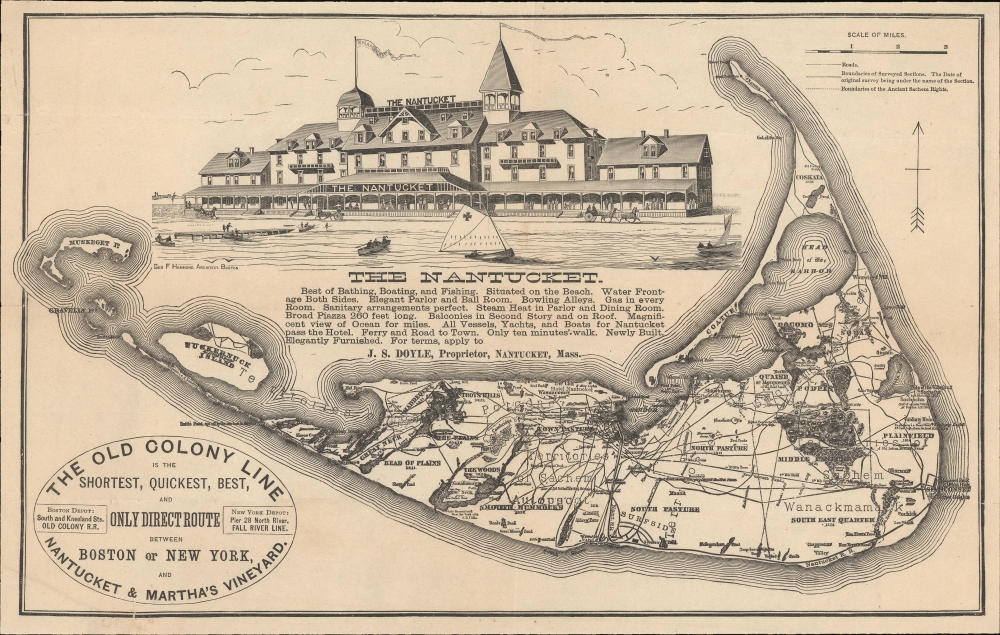
The Nantucket.
sold
- Digital Map Information
- Suitable for large format printing
- File Size: 145.01 MB
- File Type: ZIP / TIFF
- ICC color profile embedded
- Delivered instantly via download link
A most unusual c. 1886 variant on the Ewer map of Nantucket, published to jointly promote the opening of 'The Nantucket', the island's first grand hotel, and the Old Colony Line's Nantucket / Martha's Vineyard service. (more details)
Asia and America Conjoined.

Carta Marina Nuova Tavola.
sold
- Digital Map Information
- Suitable for large format printing
- Full resolution TIFF file
- ICC color profile embedded
- Delivered instantly via download link
This is a superb example of Girolamo Ruscelli's 1561 map of the world,Carta Marina Nuova Tavola. It was one of three maps in Ruscelli's edition of Ptolemy: one depicted the ancient world, while two - this, and a double-hemisphere map - were modern works. This striking work, with its array of rhumb lines, was an enlarged and improved version of Giacomo Gastaldi's 1548 Carta Marina Nova Tabula and shared with that earlier map an abundance of unusual features. (more details)
'A foundation map.' -Tooley
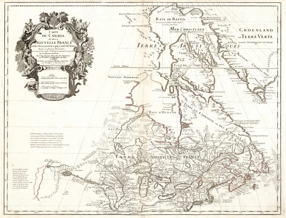
Carte du Canada ou de la Nouvelle France et des Decouverts qui y ont été faites...
sold
- Digital Map Information
- Suitable for large format printing
- DPI: 600
- File Size: 57.39 MB
- File Type: ZIP / TIFF
- ICC color profile embedded
- Delivered instantly via download link
This is Guillaume de l'Isle's groundbreaking map of Canada - one of the most important maps of the north parts of North America. When De l'Isle first issued this map in 1703, it was the most sophisticated cartographic representation of this region yet published, referencing various elements from the most recent explorations including the Jesuit Relations, Pierre Le Moyne d'Ibervile, Pierre Le Sour, and Baron de Lahontan. (more details)
Outstanding view of Osaka during an industrial boom.

大阪市パノラマ地図 / [Panoramic Map of Osaka City] / The Mock Painted Picture of the Great Osaka.
sold
- Digital Map Information
- Suitable for large format printing
- Full resolution TIFF file
- ICC color profile embedded
- Delivered instantly via download link
A beautifully detailed 1923 or Taisho 12 birds' eye view of Osaka, Japan from the vantage point of Osaka Bay, oriented towards the northwest. The level of detail is so meticulous that individual pedestrians are discernible. The map labels major landmarks such as the Osaka Station (upper-left), Osaka Castle (upper-right), and the Sumiyosi (or Sumiyoshi) Shrine, shown as an inset at bottom-right as it is outside the frame. It also notes the location of temples, pagodas, parks, streetcar stations, major bridges, schools, government offices, police stations, firehouses, post offices, bathhouses, theaters, entertainment halls (寄席), markets, and dining halls, all of which are named within color-coded boxes or marked with one of the symbols indicated in the legend. The characters in the large white circles signify city districts, and those in the small white circles signify neighborhoods. Given the title on the slipcase, Panoramic Map of Lively Osaka City, the information provided, and the description at top-right (under the title), this map would have been useful for both visitors and locals. Among the few post-publication annotations are a purple stamp at the far bottom-right with the name and address of the original owner, who looks to have been a resident of Osaka's Takatsu (高津) neighborhood. The owner has circled the Osaka Chamber of Commerce (商業會議所) towards the left-center of the map in pencil, and a small tower and cluster of buildings on the edge of the Takatsu and Uemachi (上町) neighborhoods. (more details)
Earliest obtainable modern map of Poland and Hungary.
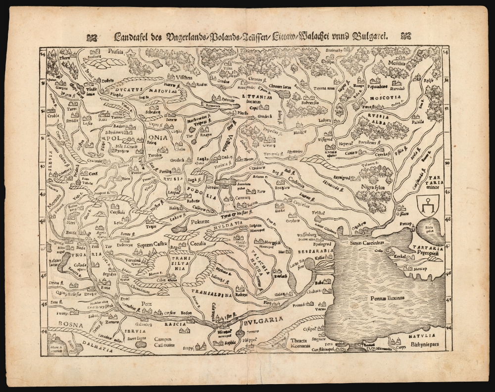
Landftafel des Ungerlands / Polands / Reüssen / Littaw / Walachei unnd Bulgarei.
sold
- Digital Map Information
- Suitable for large format printing
- Full resolution TIFF file
- ICC color profile embedded
- Delivered instantly via download link
This is the 1564 German edition of Sebastian Münster's map of Poland and Hungary, the first acquirable map to focus on the region using contemporary place names and geographical knowledge. (more details)
One of the Earliest Modern Maps of Sumatra.
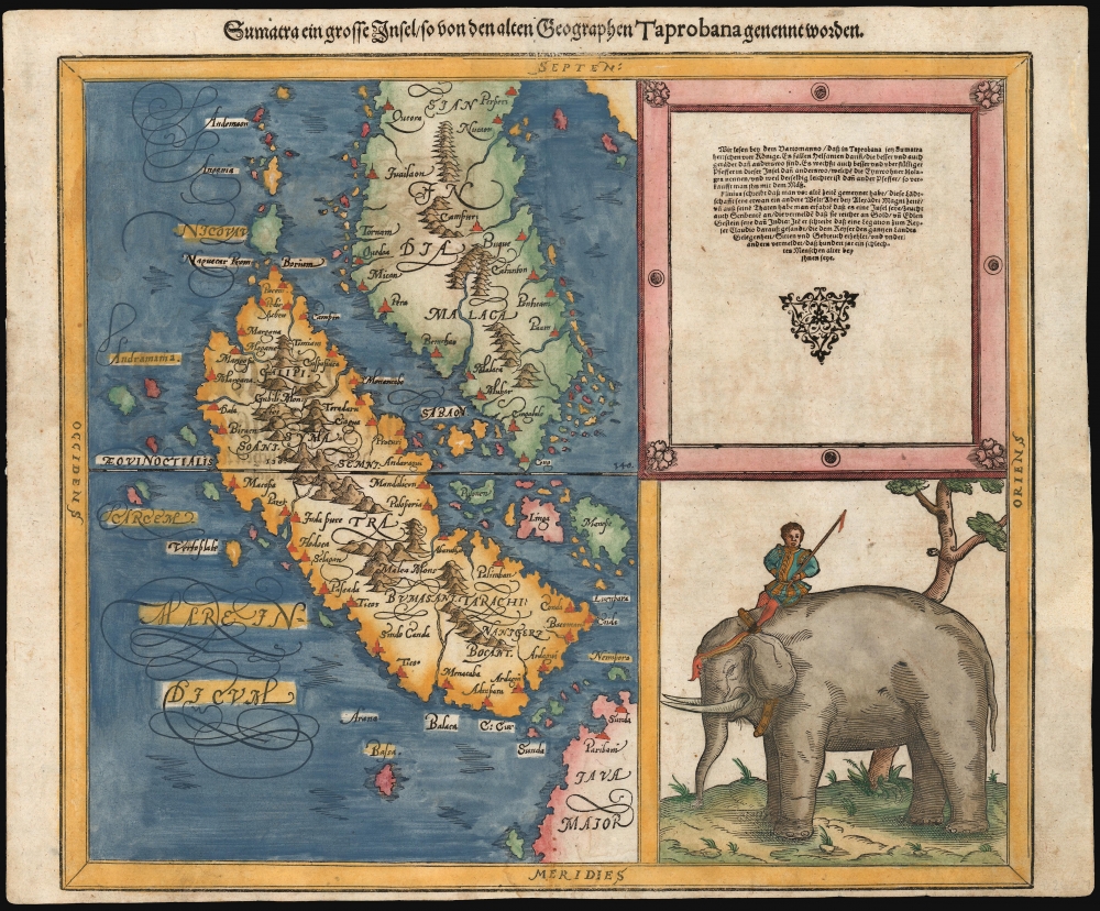
Sumatra ein grosse Insel so von den alten Geographen Taprobana genennt worden.
sold
- Digital Map Information
- Suitable for large format printing
- File Size: 12.43 MB
- File Type: ZIP / TIFF
- ICC color profile embedded
- Delivered instantly via download link
This woodcut map of Malay and Sumatra - one of the earliest maps to specifically illustrate this region using contemporaneous geography - was added to Münster's Cosmographia in 1588, as part of Sebastian Petri's extensive update of the work. (more details)
Brilliant, data rich depiction of mid-century New York.

The City of New York.
sold
- Digital Map Information
- Suitable for large format printing
- File Size: 51.01 MB
- File Type: ZIP / TIFF
- ICC color profile embedded
- Delivered instantly via download link
This 1939 Richard Edes Harrison map of New York City - published in conjunction with the New York World’s Fair - represents a triumph of the visual display of quantitative information. Its aesthetic impact is all the more impressive in its clear expression of municipal and demographic data, making this a map of the people of New York City, as much as of the physical city itself. All five boroughs are represented in the primary map. On it, Harrison’s masterful use of vivid color to distinguish between residential, commercial, industrial, and federal use of land is clear yet supple, able to make distinction (for example) of low-income housing projects using the same palette. Parks and cemeteries both appear as green spaces, with white spots - evoking headstones - indicating the difference between the two. The two major airports (Floyd Bennett Field and North Beach Airport) are given their own color as well. The city’s industrial areas, shown in black, dominate the East River and Hudson coastlines, a reminder of the centrality of trade to the city’s development and history. (more details)
Southern California's Airfields in the Early Jet Age.
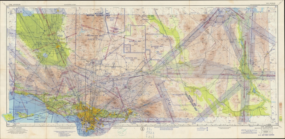
Los Angeles Sectional Aeronautical Chart. 43rd Edition. U. S. Air Force Edition.
sold
An impressive, large-format aeronautical chart of the Los Angeles metro area, prepared in 1957 by the U.S. Coast and Geodetic Survey for the U. S. Air Force. The map records Los Angeles' pioneering contributions to early American aviation. (more details)
Charting a Course for Tampa's Future.

Preliminary Examination Hillsboro River, Fla. Lafayette St to Michigan Ave.
sold
- Digital Map Information
- Suitable for large format printing
- File Size: 11.37 MB
- File Type: ZIP / TIFF
- ICC color profile embedded
- Delivered instantly via download link
A highly detailed chart of the Hillsboro (now spelled Hillsborough) River and street map of adjacent areas of Tampa, Florida, produced by the U.S. Army Corps of Engineers in 1917. It highlights dredging work in the river, which occurred over several decades, controlling the river's waters and allowing it to handle larger ships, a boon to the growing city's economy. (more details)
Bus the Big Apple!

Manhattan Sightseeing Bus Tours, Inc. Welcomes the Visitor to New York, the Fabulous City. / Sightseeing Official Tours New York 'The Manhattan Way'.
sold
A fun c. 1955 pictorial view of Manhattan produced by Manhattan Sightseeing Bus Tours. It captures the vibrancy and excitement of the city, which would be on full display at the sites visited by the tours. (more details)
Landmark of Cyrillic calligraphic printing.
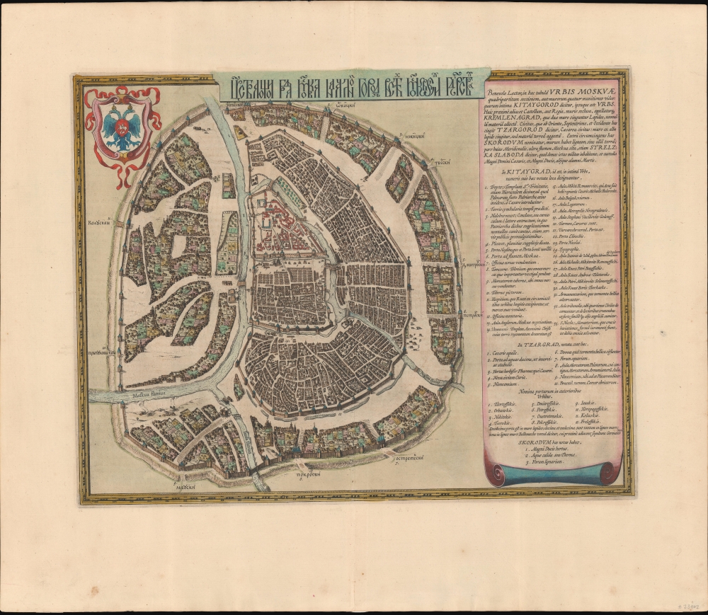
Царствающои град Москва началнои город всех московских государствах. / Carstvajuščoi grad Moskva načalo I gorod všeh Moskovech I carstvach. Urbis Moskvae.
$4,400.00
Acquire
- Digital Map Information
- Suitable for large format printing
- Full resolution TIFF file
- ICC color profile embedded
- Delivered instantly via download link
This is the 1662 Hessel Gerritsz and Willem Janszoon Blaeu city map or plan of Moscow, Russia. The map is significant as the dominant plan of Moscow in the 17th century. It is also significant for its innovative use of Cyrillic calligraphy to name both the city gates and in the map's titling - a first for non-Russian publishers. The Cyrillic calligraphy of the title is especially innovative, revealing the designer as a master of the style. (more details)
Atlanta as a center of African American Education.
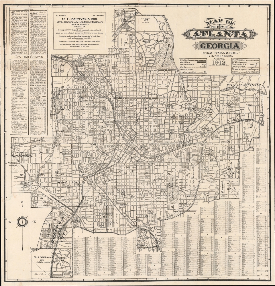
Map of the City of Atlanta Georgia.
sold
- Digital Map Information
- Suitable for large format printing
- File Size: 43.79 MB
- File Type: ZIP / TIFF
- ICC color profile embedded
- Delivered instantly via download link
This is the 1912 O. F. Kauffman map of Atlanta, Georgia, the earliest obtainable detailed map of that city. The map emerged during a period of growth and urbanization as Atlanta transformed into a manufacturing and transport hub. It is also significant for its delineation, for one of the first times on a commercial map, Atlanta's many historically black schools and universities. (more details)
China, meet the Iron Horse...
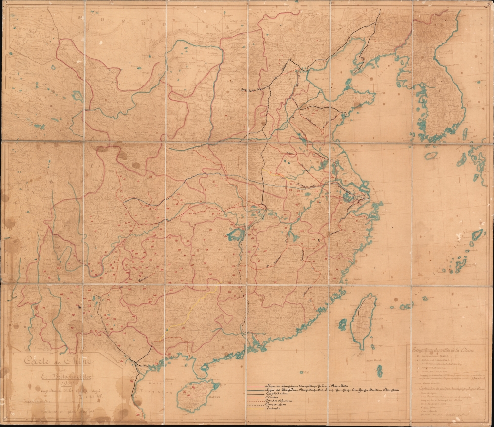
Carte de Chine par E. Bretschneider 1900.
sold
- Digital Map Information
- Suitable for large format printing
- File Size: 33.16 MB
- File Type: ZIP / TIFF
- ICC color profile embedded
- Delivered instantly via download link
A most intriguing discovery capturing the pivotal historical moment when China embraced the railroad, in the process, sacrificed much of its sovereignty to vast network of railroad concessions and foreign interests. This is a 1900 ferro-gallic transfer of Emilii Vasil'evich Bretschneider's original manuscript map of China, accompanied by extensive manuscript annotation in the author's hand regarding the development of China's railroad system in the late 19th century. (more details)
One of the only maps to name the proto-Texan freebooter 'Republic of Fredonia'. And it's in Greek.

Χαρτησ τησ Αμερικησ / [Map of America].
sold
- Digital Map Information
- Suitable for large format printing
- File Size: 29.47 MB
- File Type: ZIP / TIFF
- ICC color profile embedded
- Delivered instantly via download link
This is a rare hand-colored 1866 Greek-language map of the Americas, produced by Herakles Lazaridou. Although entirely in Greek, this map is fascinating as one of the few maps to name the 'Republic of Fredonia' (1826 - 1827), a short-lived freebooter state in Texas. (more details)
World's greatest urban park.

Map of the Central Park April 20th 1871.
sold
- Digital Map Information
- Suitable for large format printing
- File Size: 15.57 MB
- File Type: ZIP / TIFF
- ICC color profile embedded
- Delivered instantly via download link
This 1871 map of Central Park, a rare gem printed by Knapp, stands out for its unique depiction of the park in a completed state. It showcases the intricate pathways, serene lakes, majestic buildings, individual trees, rugged rocks, and varying elevations, offering a comprehensive overview of the park's design. (more details)
The Conch Republic!

Key West. The Conch Republic.
sold
This is a 1987 Ron Weaver pictorial map of Key West, Florida. The map celebrates Key West life shortly after the declaration of the Conch Republic. (more details)
Vaunting Venezia.

Venezia a volo d'uccello.
sold
- Digital Map Information
- Suitable for large format printing
- Full resolution TIFF file
- ICC color profile embedded
- Delivered instantly via download link
A c. 1888 chromolithographed bird's-eye view of Venice, Italy, printed by Litografia Veneziana. It was produced in the years after Venice was 'returned' to Italy following the 1866 Third Italian War of Independence. (more details)
In defiance of 'urban decline'
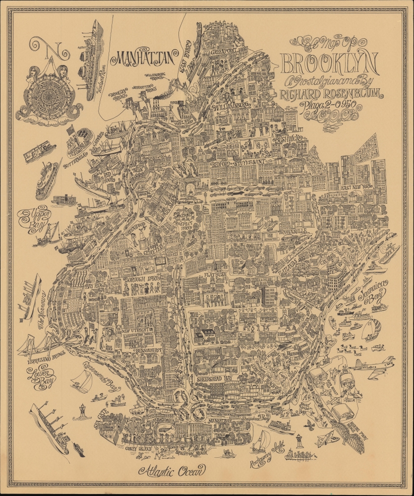
A Map of Brooklyn a Nostalgiarama.
sold
A rare, whimsical c. 1969 pictorial view of Brooklyn, New York, drawn by children's book illustrator Richard Rosenblum. It paints a rosy picture, a 'nostalgiarama' as the subtitle puts it, of Brooklyn and New York City at a time generally considered a nadir. (more details)
Jackson's photo of the Black Canyon.

No. 512. Black Canon of the Gunnison, Col. on the D. and R. G. R. R.
sold
- Digital Map Information
- Suitable for large format printing
- File Size: 32.05 MB
- File Type: ZIP / TIFF
- ICC color profile embedded
- Delivered instantly via download link
This is a c. 1905 Muller and Luchsinger colorized photolithographic view of Chipeta Falls and the Black Canyon of the Gunnison River, Colorado. (more details)