
One of the earliest known maps to identify the 'Sea of Korea'.
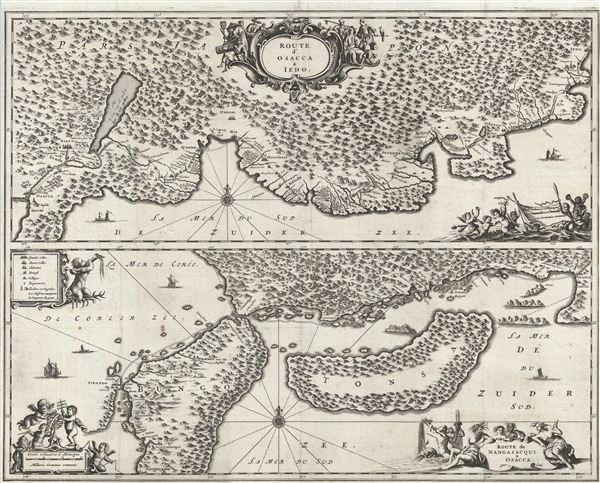
Route d'Osacca a Iedo. / Route de Nangasacqui a Osacca.
sold
- Digital Map Information
- Suitable for large format printing
- DPI: 300
- File Size: 16.01 MB
- File Type: ZIP / TIFF
- ICC color profile embedded
- Delivered instantly via download link
An extremely uncommon 1669 map of parts of Japan between Osaka and Yedo (Tokyo), and between Osaka and Nagasaki. This map was drawn by Arnoldus Montanus to illustrate the travel route taken by an official Dutch trade delegation to the emperor of Japan in the early ... (more details)
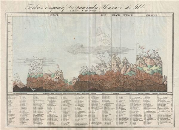
Tableau comparatif des principales hauteurs du globe.
sold
- Digital Map Information
- Suitable for large format printing
- DPI: 300
- File Size: 20.03 MB
- File Type: ZIP / TIFF
- ICC color profile embedded
- Delivered instantly via download link
An unusual, early, and interesting take on the comparative mountains of the world chart. This chart, drawn by Aristide Michel Perrot in 1827, compacts an incredible amount of information in very little space. Perrot's primary goal was to show the relative ... (more details)

Asie.
sold
- Digital Map Information
- Suitable for large format printing
- DPI: 300
- File Size: 5.17 MB
- File Type: ZIP / TIFF
- ICC color profile embedded
- Delivered instantly via download link
An uncommon and attractive 1852 map of Asia by J. G. Barbie du Bocage. Covers from the Arabian Peninsula and Turkey eastward as far as Kamchatka, Japan, the Philippines and New Guinea. Shows Arabia, Persia (Iran), Hindostan (India), the Chinese empire ... (more details)
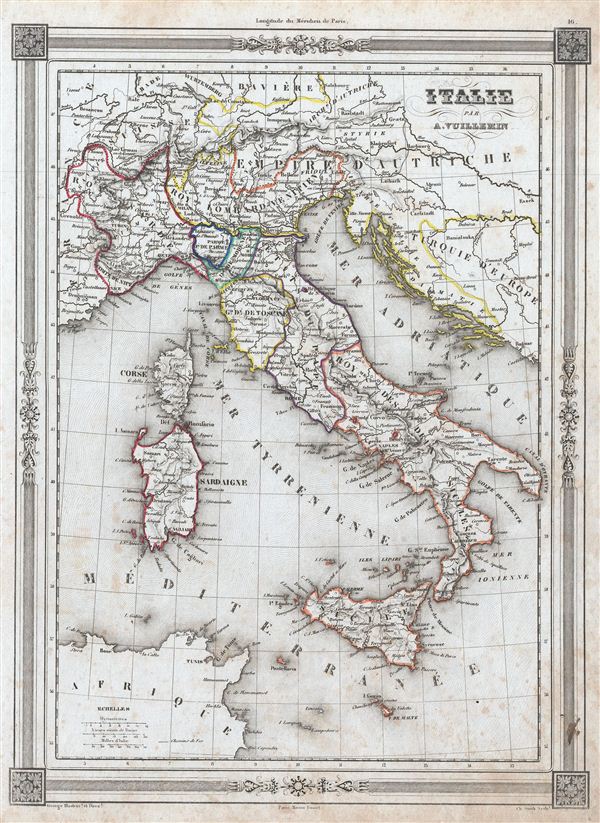
Italie.
sold
- Digital Map Information
- Suitable for large format printing
- DPI: 300
- File Size: 4.96 MB
- File Type: ZIP / TIFF
- ICC color profile embedded
- Delivered instantly via download link
An uncommon and extremely attractive 1852 map of Italy by A. Vuillemin. Covers the pre-Garibaldi Italy split into numerous small duchies and states from Venetian Lombardy south to Sicily and Malta. Also includes the islands of Sardinia and Corsica. ... (more details)
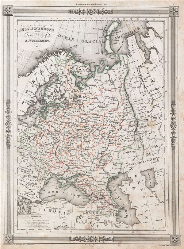
Russie d'Europe.
sold
- Digital Map Information
- Suitable for large format printing
- DPI: 300
- File Size: 5.4 MB
- File Type: ZIP / TIFF
- ICC color profile embedded
- Delivered instantly via download link
An uncommon and extremely attractive 1852 map of Russia in europe by A. Vuillemin. Covers the european portions of Russia from the Arctic Sea south to the Black Sea and Caspian Sea. Includes Poland, Lithuania, Latvia, estonia, Georgia and Armenia ... (more details)

Suede Norwege & Danemark.
sold
- Digital Map Information
- Suitable for large format printing
- DPI: 300
- File Size: 5.86 MB
- File Type: ZIP / TIFF
- ICC color profile embedded
- Delivered instantly via download link
An uncommon and extremely attractive 1852 map of Scandinavia by A. Vuillemin. The map covers from the Arctic Sea south to Denmark and east as far as the Gulf of Finland. Includes the modern day nations of Sweden, Norway and Denmark. Two inset ... (more details)
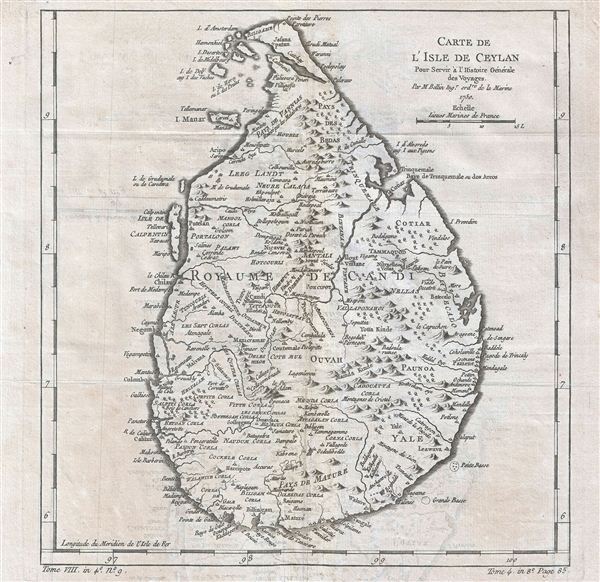
Carte de l'Isle de Ceylan Pour Servir a l'Histoire Generale des Voyages.
sold
- Digital Map Information
- Suitable for large format printing
- Full resolution TIFF file
- ICC color profile embedded
- Delivered instantly via download link
This is a 1750 Jacques-Nicolas Bellin map of Ceylon or Sri Lanka. The map depicts the entire island of from north to south, inclusive of the Isle de Calpetin, Isle Manar, and a group of small islands on the northwest shore. The well-defined ... (more details)

Plan de Paris et ses Fortifications.
sold
- Digital Map Information
- Suitable for large format printing
- DPI: 300
- File Size: 56.55 MB
- File Type: ZIP / TIFF
- ICC color profile embedded
- Delivered instantly via download link
This is an extremely attractive 1843 folding map of Paris and its fortifications by A. Logerot. The map covers the embastilled center of Paris as well as the immediate environs including the 14 ring forts. It also includes some of the ... (more details)

Le Nouveau Guide de l'Etranger Dans les 20 Arrondissements de Paris.
sold
- Digital Map Information
- Suitable for large format printing
- File Size: 29.99 MB
- File Type: ZIP / TIFF
- ICC color profile embedded
- Delivered instantly via download link
This is an extremely attractive 1878 tourist pocket map of Paris, France by A. Logerot. Centered on the Seine, this map covers central Paris as contained by the Thiers Wall. Reflects the transformation and modernization of Paris under ... (more details)
An unusual mapping of the unusual Niger Inland Delta.
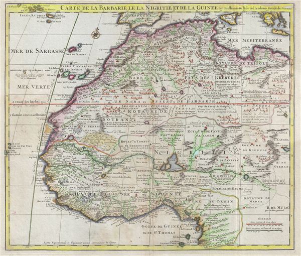
Carte de la Barbarie le la Nigrite et de la Guinee.
sold
- Digital Map Information
- Suitable for large format printing
- DPI: 300
- File Size: 18.85 MB
- File Type: ZIP / TIFF
- ICC color profile embedded
- Delivered instantly via download link
An excellent example of Guillaume De L'Isle's influential map of western Africa. The map covers The Barbary Coast and the Kingdoms of Fez, Tunis, and Tripoli southwards to the Gulf of Guinea and the Bight of Benin. The whole offers ... (more details)
A stunning overview of Africa on the cusp of European exploration into the interior.
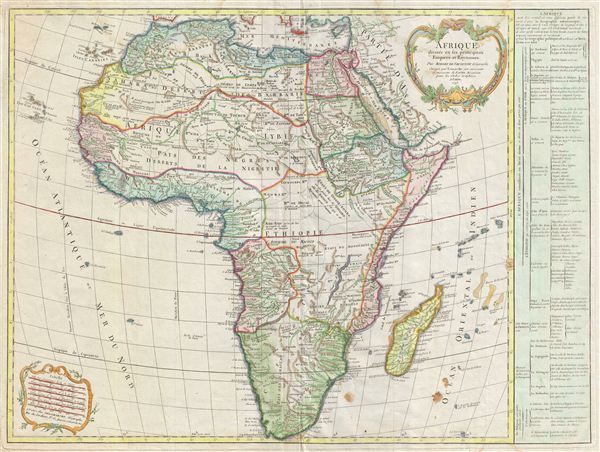
Afrique divisee en ses principaux Empires et Royaumes.
sold
- Digital Map Information
- Suitable for large format printing
- Full resolution TIFF file
- ICC color profile embedded
- Delivered instantly via download link
An important an unusual c. 1795 map of Africa by Robert de Vaugondy. Vaugondy frist issued this map in 1749 and it went through at least seven states with editions appearing as late as 1810. Issued on the cusp of Europe's great wave ... (more details)
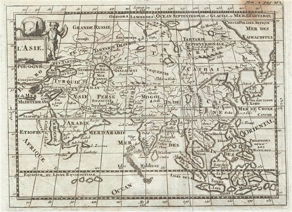
L'Asie.
sold
- Digital Map Information
- Suitable for large format printing
- DPI: 300
- File Size: 1.84 MB
- File Type: ZIP / TIFF
- ICC color profile embedded
- Delivered instantly via download link
An uncommon and unusual map of Asia issued for Martineau du Plessis in 1700. This map covers the entire continent of Asia from the Mediterranean to Japan and from the Arctic to the Indian Ocean and the east Indies. The Great Wall ... (more details)
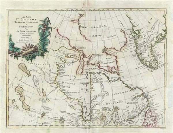
La Baja d'Hudson Terra di Labrador e Groenlandia con le Isloe Adiacenti di nuova Projezione.
sold
- Digital Map Information
- Suitable for large format printing
- DPI: 300
- File Size: 8.45 MB
- File Type: ZIP / TIFF
- ICC color profile embedded
- Delivered instantly via download link
This map is a hand colored 1778 A. Zatta map of the Hudson Bay. Centered on the Hudson Bay, it covers from Baffin Bay (North Atlantic Ocean) to James Bay. Includes the Hudson Bay, southern Greenland, Labrador and Newfoundland. ... (more details)

La Tartaria Chinese.
sold
- Digital Map Information
- Suitable for large format printing
- DPI: 300
- File Size: 9.72 MB
- File Type: ZIP / TIFF
- ICC color profile embedded
- Delivered instantly via download link
This map is a hand colored 1784 Antonio Zatta map of Chinese Tartary and Korea. Centered on Chinese Tartary, the map details Korea, Manchuria, Chinese Tartary and parts of adjacent Russian Tartary, Independent Tartary, Mongolia, ... (more details)

Africa.
sold
- Digital Map Information
- Suitable for large format printing
- File Size: 3.31 MB
- File Type: ZIP / TIFF
- ICC color profile embedded
- Delivered instantly via download link
This is a whimsical example of an 1890 Philip's schoolboy / schoolgirl map of Africa. Covers the continent from the Mediterranean Sea to the Cape of Good Hope and includes parts of Spain, France and Italy. The publishing group ... (more details)
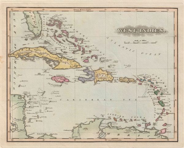
West Indies.
sold
- Digital Map Information
- Suitable for large format printing
- Full resolution TIFF file
- ICC color profile embedded
- Delivered instantly via download link
A fine example of the 1823 F. Lucas Jr.'s map of the West Indies and Caribbean. Centered on Hispaniola, covers from Florida and the Bahamas south through the Caribbean islands of Cuba and Hispaniola to the northern Part of ... (more details)
Shows the mythical Kingdom of Prester John in Abyssinia.
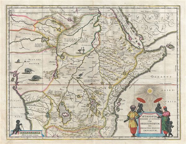
Aethiopia Superior vel Interior vulgo Abissinorum sive Presbiteri Joannis Imperium.
sold
- Digital Map Information
- Suitable for large format printing
- DPI: 300
- File Size: 15.11 MB
- File Type: ZIP / TIFF
- ICC color profile embedded
- Delivered instantly via download link
A fascinating map of central Africa issued by Willem Janszoon Blaeu in 1635. The map covers from the Bight of Benin to the Indian Ocean and from Arabia and the Red Sea to Mozambique. It includes two decorative cartouches ... (more details)
Scarce World War II Japanese Nautical Chart of the Panama Canal.
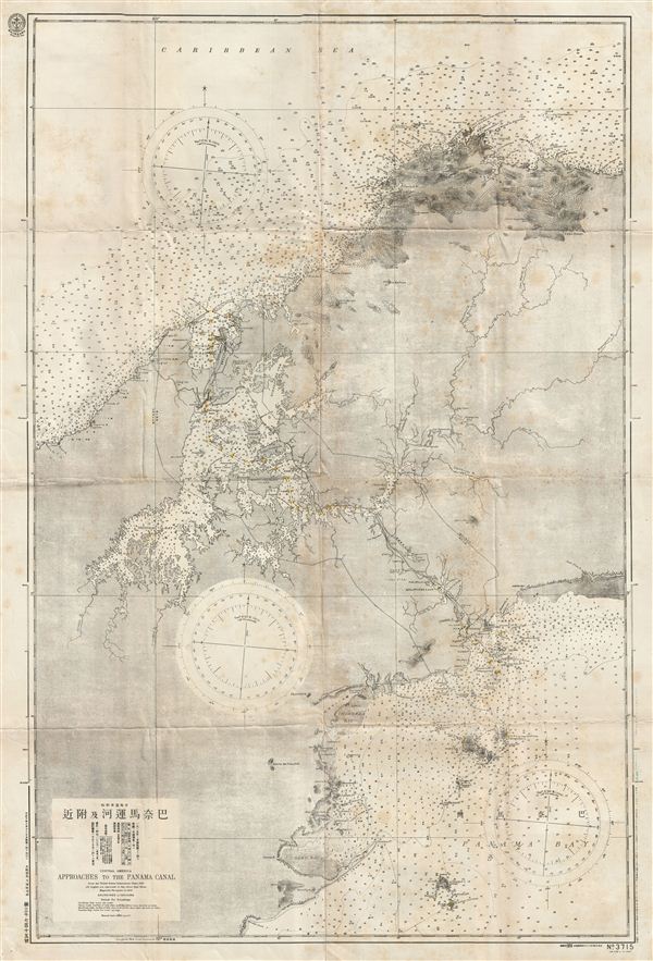
Central America Approaches to the Panama Canal.
sold
- Digital Map Information
- Suitable for large format printing
- File Size: 41.84 MB
- File Type: ZIP / TIFF
- ICC color profile embedded
- Delivered instantly via download link
A scarce Japanese World War II ear nautical chart or maritime map of the Panama Canal. The map covers the entire Canal Zone as well as the adjacent shores and islands on both the Pacific and Panama Bay sides of the ... (more details)
The most important and influential 18th century Colonial Era map of New England.

A Map of the most Inhabited part of New England containing the Provinces of Massachusets Bay and New Hampshire, with the Colonies of Connecticut and Rhode Island, divided into Counties and Townships: The whole composed form Actual Surveys and its Situation adjusted by Astronomical Observations.
sold
- Digital Map Information
- Suitable for large format printing
- Full resolution TIFF file
- ICC color profile embedded
- Delivered instantly via download link
A highly significant map, this is the 1774 'Jefferys' Map' of the Most Inhabited Part of New england . Centered on the Massachusetts Bay Colony, this map covers from Long Island to Lake Champlain and from the ... (more details)

San Pablo Bay, California.
sold
- Digital Map Information
- Suitable for large format printing
- File Size: 35.31 MB
- File Type: ZIP / TIFF
- ICC color profile embedded
- Delivered instantly via download link
A rare heavy stock issue of the 1898 edition of the U.S. Coast Survey nautical chart or map of San Pablo Bay, California. San Pablo Bay is the extension of San Francisco Bay that lies to the north of the ... (more details)