
Eastern Hemisphere (sold)
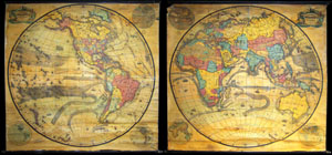
Pelton's Political & Physical Map of the Western Hemisphere. / Pelton's Political & Physical Map of the Eastern Hemisphere.
sold
A mammoth, extremely rare, and highly desirable set of hemisphere wall maps issued by C. Pelton in 1858. These spectacular wall maps rarely appear on the market and almost never as a set. Depicts the entire world on a hemisphere projection. On both maps, ... (more details)
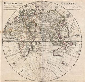
Hemisphere Oriental.
sold
- Digital Map Information
- Suitable for large format printing
- DPI: 300
- File Size: 13.73 MB
- File Type: ZIP / TIFF
- ICC color profile embedded
- Delivered instantly via download link
An attractive 1724 map of the Eastern Hemisphere by the well-regarded French cartographer Guillaume Delisle. The map covers the Eastern Hemisphere from Pole to Pole and, along the Equator, from Western Africa to Eastern Australia, including all of Africa, ... (more details)
Striking semi-manuscript school-girl map of the Eastern Hemisphere.
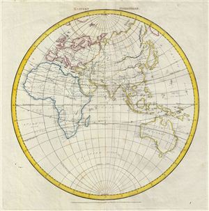
Eastern Hemisphere.
sold
- Digital Map Information
- Suitable for large format printing
- DPI: 300
- File Size: 7.63 MB
- File Type: ZIP / TIFF
- ICC color profile embedded
- Delivered instantly via download link
An unusual and beautiful semi-manuscript map of the eastern Hemisphere dating to 1823. The printed portions of this map follow the cartography of James Wyld and include the basic outlines of the continents, latitude and longitude lines, and the equator, ... (more details)
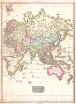
The World on Mercator's Projection Eastern Part.
sold
- Digital Map Information
- Suitable for large format printing
- DPI: 300
- File Size: 22.5 MB
- File Type: ZIP / TIFF
- ICC color profile embedded
- Delivered instantly via download link
A rare and important 1818 map of the Eastern Hemisphere by John Pinkerton. Depicts Asia, Europe, Africa and Australia. The routes of various important explores are noted, including Cook, Vancouver, Perouse, and the return route taken by Cook's ship, ... (more details)
1841 S.D.U.K. Subscriber's Edition Map of the Western Hemisphere and Eastern Hemisphere - set of 2 m
Beautiful two map set depicting the world according to hemispheres.
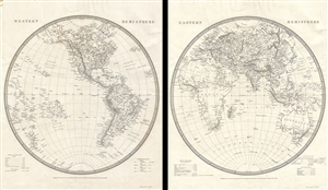
Eastern Hemisphere. Western Hemisphere.
sold
- Digital Map Information
- Suitable for large format printing
- DPI: 300
- File Size: 10.64 MB
- File Type: ZIP / TIFF
- ICC color profile embedded
- Delivered instantly via download link
This is a beautiful set of two 1841 first edition maps of the World on hemispherical projections by the Society for the Diffusion of Useful Knowledge or S.D.U.K. They depict the Western and Eastern Hemispheres offering a fascinating snapshot of the ... (more details)
Circling the Globe.
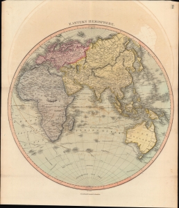
Eastern Hemisphere.
sold
- Digital Map Information
- Suitable for large format printing
- DPI: 600
- File Size: 61.44 MB
- File Type: ZIP / TIFF
- ICC color profile embedded
- Delivered instantly via download link
A lovely, hand-colored map of the Eastern Hemisphere, prepared by John Thomson for his New General Atlas. Among other features, it traces the voyages of exploration and circumnavigation of the late 18th century, including Cook, Vancouver, and La Perouse. (more details)
Shows Eastern Hemisphere.
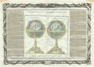
Globe Terrestre. Globe Celeste.
sold
- Digital Map Information
- Suitable for large format printing
- DPI: 300
- File Size: 12.91 MB
- File Type: ZIP / TIFF
- ICC color profile embedded
- Delivered instantly via download link
This is a beautiful 1786 map or chart by French cartographer Louis Brion de la Tour. The chart depicts a terrestrial and a celestial globe. The terrestrial globe on the left is set showing Asia and Europe, while the celestial globe shows various ... (more details)
A beautiful map of the Eastern Hemisphere.
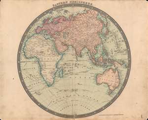
The Eastern Hemisphere.
sold
- Digital Map Information
- Suitable for large format printing
- DPI: 600
- File Size: 34.6 MB
- File Type: ZIP / TIFF
- ICC color profile embedded
- Delivered instantly via download link
This is a beautifully-colored 1831 Henry Teesdale / John Dower map of the Eastern Hemisphere published in their A New General Atlas of the World. It reflects the latest geographical knowledge available at that time and charts the voyages of Captain James Cook. (more details)
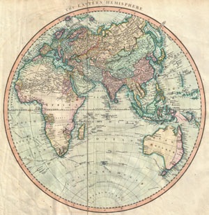
The Eastern Hemisphere
sold
- Digital Map Information
- Suitable for large format printing
- Full resolution TIFF file
- ICC color profile embedded
- Delivered instantly via download link
A very attractive example of John Cary's spectacular 1801 map of the Eastern Hemisphere. Covers the entirety of Europe, Africa and Asia, along with Australia, the Indian Ocean, and parts of Polynesia. Europe is mapped according to early 19th ... (more details)
Labels numerous world capitals.
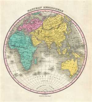
Eastern Hemisphere.
sold
- Digital Map Information
- Suitable for large format printing
- DPI: 300
- File Size: 2.3 MB
- File Type: ZIP / TIFF
- ICC color profile embedded
- Delivered instantly via download link
This is an 1828 Anthony Finley map of the Eastern Hemisphere. The map depicts the hemisphere from the eastern Atlantic Ocean across Africa and Europe to Asia and Australia and from the North Pole to the South Pole. Deserts, rivers, mountain ... (more details)

Eastern Hemisphere.
sold
- Digital Map Information
- Suitable for large format printing
- Full resolution TIFF file
- ICC color profile embedded
- Delivered instantly via download link
This is a fine 1835 map of the eastern hemisphere by the important American mapmaker T. G. Bradford. It covers the entirety of Asia, Europe and Africa as well as Australia and the East Indies and much of the Pacific. Important cities, ... (more details)
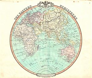
The Eastern Hemisphere.
sold
- Digital Map Information
- Suitable for large format printing
- DPI: 300
- File Size: 7.09 MB
- File Type: ZIP / TIFF
- ICC color profile embedded
- Delivered instantly via download link
A fascinating 1852 map of the Eastern Hemisphere issued by George Frederick Cruchley. It offers a fascinating snapshot of the world during a period of rapid globalization and discovery, and includes entirety of Asia, Europe and Africa ... (more details)
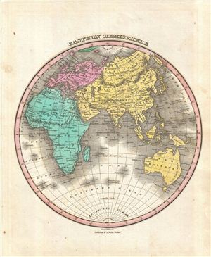
Eastern Hemisphere.
sold
- Digital Map Information
- Suitable for large format printing
- DPI: 300
- File Size: 3.86 MB
- File Type: ZIP / TIFF
- ICC color profile embedded
- Delivered instantly via download link
This is Finley's desirable 1827 map of the Eastern Hemisphere. Includes Africa, Europe, Asia and Australia. Identifies deserts, rivers, mountain rangers, lakes, and major cities. Color coded according to continent. Australia is ... (more details)
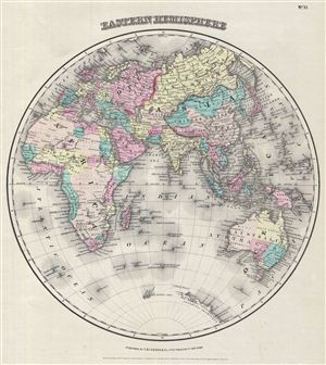
Eastern Hemisphere.
sold
- Digital Map Information
- Suitable for large format printing
- File Size: 3.04 MB
- File Type: ZIP / TIFF
- ICC color profile embedded
- Delivered instantly via download link
An excellent 1855 first edition example of Colton's map of the eastern Hemisphere. Offering a fascinating snapshot of the world during a period of rapid globalization and discovery, this map includes the entirety of Asia, europe ... (more details)
Identifies the 'Sea of Korea'.
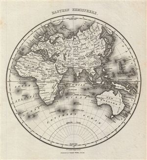
Eastern Hemisphere.
sold
- Digital Map Information
- Suitable for large format printing
- DPI: 300
- File Size: 3.23 MB
- File Type: ZIP / TIFF
- ICC color profile embedded
- Delivered instantly via download link
This is an attractive example of the 1828 Malte-Brun map of the eastern Hemisphere. It covers europe, Asia, Australia, Africa and the east Indies. Although 'New Holland' officially changed its name to Australia in 1824, it is ... (more details)
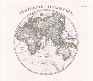
Oestliche Halbkugel
sold
- Digital Map Information
- Suitable for large format printing
- File Size: 3.87 MB
- File Type: ZIP / TIFF
- ICC color profile embedded
- Delivered instantly via download link
This is a beautiful example of Stieler's 1873 map of the Eastern Hemisphere. Includes the entirety of Asia, Europe and Africa as well as Australia and much of the Pacific. Also includes those parts of Antarctica, including ... (more details)