Authenticity Guaranteed — We sell only original antique maps.
Geographicus Rare Antique Maps
Authenticity Guaranteed — We sell only original antique maps.
Navigation
Shopping Cart
Sort By Price: highest first

Kevin J. Brown

Founder of Geographicus, drawn to maps that reveal the ideas and ambitions behind them — from allegorical worlds to propaganda and the wonderfully weird.


As the founder of Geographicus, my passion for cartography is rooted in a lifelong love of travel, history, and fantasy literature. I'm especially drawn to maps that reveal something beyond geography — the ideas, ambitions, beliefs, and motivations of their creators, whether subtly or overtly. Many of these maps are remarkably ephemeral, capturing a fleeting historical moment that was often already "old news" by the time it reached the press.

My interests range from allegorical and cosmographical maps to persuasive cartography, wartime propaganda, and entirely imaginary worlds — an eclectic taste spanning centuries, cultures, and cartographic traditions, united by a fascination with the unusual, the intellectually provocative, and the wonderfully weird.

Monthly Digest of Kevin's Picks

Portrait of Kevin J. Brown
Sort by
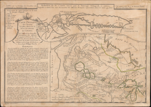
Auchagah Map, a unique synthesis of American Indian and European cartography.

Réduction de la Carte tracée par le Sauvage Ochagach et autres. / Carte Physique des Terreins les plus eleves de la Partie Occidentale du Canada.

1754 (dated)
10 x 14 in (25.40 x 35.56 cm)
SauvageOchagach-buache-1754

sold

A Closer Look
  • Digital Map Information
  • Suitable for large format printing
  • Full resolution TIFF file
  • ICC color profile embedded
  • Delivered instantly via download link
This is Philipe Buache's c. 1754 dual map of inland water routes west of Lake Superior extending, ostensibly, to the Pacific. It is an important and intellectually complex juxtaposition of two radically divergent cartographic conceptions of the North American interior: American Indian (Cree) geographic knowledge (known as the Auchagah Map) and Philippe Buache's speculative synthesis of French exploration, hydrographic theory, and the elusive dream of a navigable route to the Pacific. Within a decade of this map's issue, the route revealed here between Lake Superior and Winnipeg became the primary artery of the Canadian fur trade. (more details)
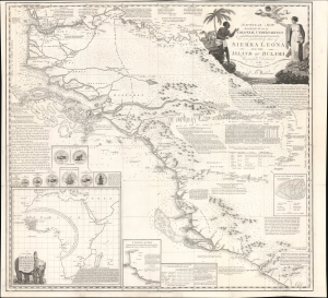
18th-century 'abolitionist colonialism' in West Africa.

Nautical Map Intended for the use of Colonial Undertakings on the W. Coast of Africa from Lat. 5°.30' to Lat. 14°.N. but more particularly those of Sierra Leona and the Island of Bulama. Respectfully Dedicated to the Humane and disinterested Promoters of those and similar Establishments by C. B. Wadstrom.

1795 (dated)
27 x 29.5 in (68.58 x 74.93 cm)
SierraLeone-wadstrom-1795

sold

A Closer Look
  • Digital Map Information
  • Suitable for large format printing
  • Full resolution TIFF file
  • ICC color profile embedded
  • Delivered instantly via download link
This is Swedish-British abolitionist Carl Bernhard Wadström's extraordinary 1795 map of Sierra Leone and the Upper Guinea Coast, extending from modern-day Senegal and The Gambia through Guinea-Bissau, Guinea, and Sierra Leone to northern Liberia. Rich in geographical, ethnographic, and commercial detail, the map promotes Wadström's ambitious scheme to transform one of West Africa's principal slave-trading regions into an abolitionist mercantile empire founded on agriculture, natural resources, free labor, and so-called 'legitimate commerce.' More than a map, it is a manifesto on Enlightenment abolitionism, experimental colonization, African exploration, and the effort to replace the Atlantic slave trade with a new - yet still deeply imperial and paternalistic - commercial order. (more details)
Cowboy Culture, by a cowboy.

I dedicate this Carte of Evolution to The California Rodeo of Salinas...

1933 (dated)
31.25 x 23.5 in (79.38 x 59.69 cm)
Cowboys-mora-1933-2

sold

A Closer Look
The legendarily rare 1933 first edition of Jo Mora's 'Evolution of the Cowboy' is considered his most iconic and influential work. The image celebrates all things cowboy, from the rodeo to saddles, steers, and chuckwagons. It is worth noting that Mora became a cowboy himself, and his depictions of cowboy life, the Salinas Rodeo, and the surrounding culture exhibit realism grounded in experience. (more details)
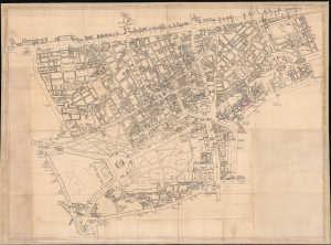
Unique record of Mayfair WWII nightlife at the height of the Blitz.

[Mayfair / Soho, London]

1941 (undated)
40.5 x 54.5 in (102.87 x 138.43 cm)
MayfairLondon-nightlifewwii-1941

sold

A Closer Look
  • Digital Map Information
  • Suitable for large format printing
  • Full resolution TIFF file
  • ICC color profile embedded
  • Delivered instantly via download link
An extraordinary artifact of wartime London, this unique 1941 manuscript map captures the theaters, nightclubs, restaurants, hotels, pubs, illicit establishments, and air-raid shelters of Mayfair, Soho, and the West End at the height of the Blitz. It documents London balanced precariously between pleasure and destruction: orchestras played, couples danced, and fashionable clubs welcomed servicemen, aristocrats, refugees, actors, diplomats, and intelligence officers even as blackout curtains smothered windows and German bombs fell overhead. Its remarkable annotations offer an intimate, street-level portrait of London nightlife under siege. (more details)
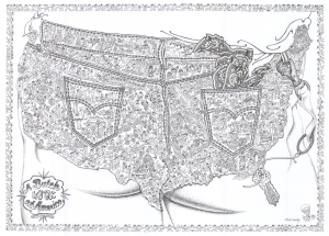
Mapping 'butchness' in America.

A Butch Look at America.

1982 (dated)
18.25 x 25 in (46.36 x 63.50 cm)
ButchMapUSA-henley-1982-2

sold

A Closer Look
A rare and humorous 1982 J. Clark Henley pictorial map of the United States as a 'butch' alli-GAY-der paradise. The map follows on Henley's 1976 'Alligator Oz' map of San Francisco (SanFranciscoAlligatorOz-henley-1976), in which he first introduced the alligator as a symbol of gay America. Here, homosexual alligators, some in drag, frolic and enjoy themselves, their notably salacious thoughts on clear display - and as such, it is one of the few maps picturing any aspect of gay life. The map emerged during a period of LGBTQ+ awakening, after the 1969 Stonewall Riots, but before the full extent of the AIDS Epidemic became evident. It was a period of positivity and widespread expectations of emerging acceptance. (more details)
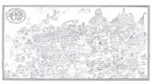
San Francisco as Ali'gay'tor heaven!

Tales of the City Alligator Oz The land of Make-Believe.

1976 (dated)
15.25 x 26.5 in (38.74 x 67.31 cm)
SanFranciscoAlligatorOz-henley-1976-2

sold

A Closer Look
A rare and most humorous 1976 J. Clark Henley pictorial map of San Francisco as the 'gay' paradise, 'Alligator Oz'. The cartography roughly mirrors the northern tip of the San Francisco Peninsula, with the San Francisco Bridge, Alcatraz Island, and the Bay Bridge clearly recognizable. Most structures have been transformed into penis-shaped towers, with the Transamerica Pyramid, the Palace of Fine Arts, the Painted Ladies, and City Hall recognizable. Throughout, homosexual alligators, some in drag, frolic and enjoy themselves, their notably salacious thoughts on clear display. In what would be Golden Gate Park, a parade of happy alli'gay'tors sing,
Oh happy day, we don't have wives who need their hair done, or children who need their stocking filled, so we can need Bill Blass, Vidal Sassoon, Elsa Peretti, and Wilkes Bashford, not to mention a complete collection of toys from Leather Forever…
(more details)

Stay Informed

First Look at New Acquisitions

New inventory updates delivered directly to your inbox.