Authenticity Guaranteed — We sell only original antique maps.
Geographicus Rare Antique Maps
Authenticity Guaranteed — We sell only original antique maps.
Navigation
Shopping Cart
Sort By Price: highest first

Kevin J. Brown

Founder of Geographicus, drawn to maps that reveal the ideas and ambitions behind them — from allegorical worlds to propaganda and the wonderfully weird.


As the founder of Geographicus, my passion for cartography is rooted in a lifelong love of travel, history, and fantasy literature. I'm especially drawn to maps that reveal something beyond geography — the ideas, ambitions, beliefs, and motivations of their creators, whether subtly or overtly. Many of these maps are remarkably ephemeral, capturing a fleeting historical moment that was often already "old news" by the time it reached the press.

My interests range from allegorical and cosmographical maps to persuasive cartography, wartime propaganda, and entirely imaginary worlds — an eclectic taste spanning centuries, cultures, and cartographic traditions, united by a fascination with the unusual, the intellectually provocative, and the wonderfully weird.

Monthly Digest of Kevin's Picks

Portrait of Kevin J. Brown
Sort by
First scientific survey of the Islamic holy city of Madinah.

حرم شريف ايله سائر اماكين مباركه وعسكريه وباشلوجه اسواقى كوسترر مدينه منوره شهرينك طپوغرافياى منظمه اصوليله اخذ اولنان خريطه سيدر. / [Map of the Prophet’s Mosque (Haram Sharif) with All Sacred Places, Military Buildings and Main Squares Showing Topography of the City of Medina Al-Munawwarah with a Legend]

1880 (dated)
28 x 41 in (71.12 x 104.14 cm)
Medina-abdalmuttalib-1880

$85,000.00

Acquire
A Closer Look
  • Digital Map Information
  • Suitable for large format printing
  • File Size: 35.58 MB
  • File Type: ZIP / TIFF
  • ICC color profile embedded
  • Delivered instantly via download link
A seminal map. This large-scale Arabic manuscript map is the first scientific survey of the Islamic holy city of Medina (المدينة المنورة / Madinah), in modern-day Saudi Arabia. The map was compiled for Abd al-Mutalib ibn Ghalib, Emir and Grand Sharif of Mecca, known for his pro-slavery anti-Ottoman positions, as well as for his modernization of infrastructure in both Mecca and Medina. (more details)
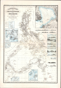
The Philippines mapped with unprecedented accuracy - the first large-scale synthesis of Malaspina and Aragón, and one of the rarest landmarks of Philippine cartography.

Reduzierte Karte von den Philippinen und den Sulu Inseln.

1832 (dated)
36 x 27 in (91.44 x 68.58 cm)
Philippinen-berghaus-1832-2

$28,000.00

Acquire
A Closer Look
  • Digital Map Information
  • Suitable for large format printing
  • Full resolution TIFF file
  • ICC color profile embedded
  • Delivered instantly via download link
This is a striking 1832 Heinrich Berghaus map of the Philippines. It was issued for Berghaus' loose-leaf Atlas von Asien, the best-informed general cartographic work on Asia to appear in the mid-19th century. It is the first large-scale map to comprehensively incorporate both the Malaspina hydrography and Ildefonso de Aragón's (c. 1826) geographical surveys. It thus offers unprecedented accuracy and the first substantial critical analysis of Philippine hydrography and cartography, making it a seminal chapter in the archipelago's mapping. (more details)
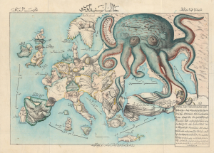
Iranian reaction to Russian Imperialism.

New Map of Europe. / خارطه جديده اوروپا

1880 (undated)
15 x 22 in (38.10 x 55.88 cm)
SerioComicMapPersian-fredrose-1880-2

$24,000.00

Acquire
A Closer Look
  • Digital Map Information
  • Suitable for large format printing
  • Full resolution TIFF file
  • ICC color profile embedded
  • Delivered instantly via download link
A rare c. 1880 Iranian-issued Ottoman Turkish / Farsi version of Englishman Fred Rose's iconic 1877 Serio Comic War Map, in which expansionist Imperial Russia is analogized as a menacing, grasping octopus. The map was issued in Qajar Iran (Persia), but for an Ottoman Turkish audience (there is also a Farsi variant). Both countries were then being menaced by Russia, Turkey in the recent Russo-Turkish War of 1877-1878, and Iran as a field of contention in the Great Game - so the work would have proved widely resonant with a possible hope of fostering mutual support. Text is partially in Turkish, partially in Farsi. (more details)
Most comprehensive and detailed mid-19th century map of Arabia.

A Map of Arabia and Syria Laid down chiefly from original Surveys Under the Supervision of Leiut. Colonel Chesney, R.A. F.R.S. and drawn by W. H. Plate, L.L.D.

1849 (dated)
27 x 26 in (68.58 x 66.04 cm)
Arabia-plate-1849

$22,000.00

Acquire
A Closer Look
  • Digital Map Information
  • Suitable for large format printing
  • Full resolution TIFF file
  • ICC color profile embedded
  • Delivered instantly via download link
This is William Henry F. Plate's important 1849 map of Arabia, the Persian Gulf, Syria, and Mesopotamia. The product of a wave of new exploration and surveys in the first half of the 19th century, this map is the most significant and detailed map of Arabia and the Persian Gulf to appear in the mid-19th century. (more details)
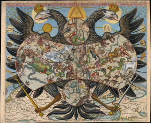
Quod est superius est sicut quod est inferius, et quod inferius est sicut quod est superius.

Speculum Uranico-Romanum S. Astroscopium Aquilae Romanae Sacrum Erhardi Weigelis Mathem. Prof. P. Jena.

1661 (undated)
12.5 x 14.75 in (31.75 x 37.46 cm)
Astroscopium-weigel-1661

$20,000.00

Acquire
A Closer Look
  • Digital Map Information
  • Suitable for large format printing
  • Full resolution TIFF file
  • ICC color profile embedded
  • Delivered instantly via download link
This is Erhard Weigel's rare and striking 1661 astroscopium, or allegorical chart of the constellations, framed by the janiform eagle of the Holy Roman Empire. The map is titled 'Speculum Uranico-Romanum', which translates to 'Roman Celestial Mirror', underscoring the mirroring of the celestial and political realms. As-above-so-below, the map presents Weigel's cosmographical framework, in which astronomy (mathematics) and politics were divinely sanctioned and mutually reinforcing: astronomy revealed God's mathematically ordered universe, while the Holy Roman Empire embodied His ordained Christian order. This fascinating image underwent several changes during its printing history: the present example is likely a proof state. (more details)
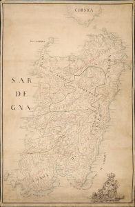
Sardinia becomes Italian.

[Sardegna.]

1720 (undated)
27 x 41.5 in (68.58 x 105.41 cm)
SardegnaTorri-anon-1720

$18,000.00

Acquire
A Closer Look
  • Digital Map Information
  • Suitable for large format printing
  • Full resolution TIFF file
  • ICC color profile embedded
  • Delivered instantly via download link
An exceptional and finely executed c. 1720 manuscript map of Sardinia (Sardegna), Italy. The map captures Sardinia as it transitioned from Spanish Habsburg to Savoyard rule following the War of the Quadruple Alliance (1718 - 1720). It was produced under the new Savoy rulers as an administrative and defensive tool to modernize the 16th-century Spanish tower system, cataloging existing towers and planning new ones. This transition marks the point when Sardinia became 'Italian'. (more details)
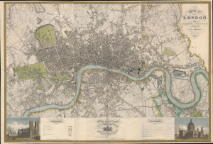
Grandest Cartographic Representation of Regency London.

Map of London, from An Actual Survey made in the Years 1824, 1824 and 1826 by C. an J. Greenwood.

1827 (dated)
50 x 74 in (127.00 x 187.96 cm)
London-greenwood-1827-2

$15,000.00

Acquire
A Closer Look
  • Digital Map Information
  • Suitable for large format printing
  • Full resolution TIFF file
  • ICC color profile embedded
  • Delivered instantly via download link
This is the rare first edition of Christopher and John Greenwood's large-scale 1827 map of London, produced at the height of the Regency period, during which the city was being crafted into a neoclassical metropolis, driven by the Prince Regent (George IV) himself but realized by his favored architect, John Nash. Greenwood's map, in its grand presentation and monumental scope, is the essential cartographic expression of the Regency, and it is considered the largest and finest plan of London to appear in the 19th century. (more details)
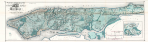
One of the most beautiful, important, and enduring maps of Manhattan ever published.

Sanitary and Topographical Map of the City and Island of New York Prepared for the Council of Hygine and Public Health, of the Citizens' Association.

1865 (dated)
17.5 x 63 in (44.45 x 160.02 cm)
NewYorkWaterways-viele-1865-8

$12,500.00

Acquire
A Closer Look
  • Digital Map Information
  • Suitable for large format printing
  • Full resolution TIFF file
  • ICC color profile embedded
  • Delivered instantly via download link
This is a beautiful example of Egbert L. Viele's 1865 topography and waterways map of Manhattan, one of the scarcest, most important, and most enduring maps of New York City ever published. Viele's map details the canals, swamps, rivers, ditches, ponds, meadows, and drainage basins of Manhattan as they existed prior to the city's urban development. A version of the Viele map remains in use today by architects and contractors who need to be certain they are not building over underground rivers and swamps that may destabilize a new construction's foundation. (more details)
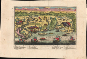
First published image of New Orleans.

Le Mississipi ou la Louisiane dans l'Amerique Septentrionale.

1720 (undated)
7.25 x 10.5 in (18.42 x 26.67 cm)
MississippiFlorida-chereau-1720

$9,500.00

Acquire
A Closer Look
  • Digital Map Information
  • Suitable for large format printing
  • Full resolution TIFF file
  • ICC color profile embedded
  • Delivered instantly via download link
This is a rare c. 1720 Chéreau broadside leaflet map-view of the Gulf of Mexico littoral, just a few years after New Orleans was founded. It is likely the earliest printed view of New Orleans - though admittedly, it is not an accurate representation of the city at the time. The map was issued as a propaganda leaflet to promote New Orleans and French Louisiana, and thus coverage extends east to encompass most of the Florida Panhandle. It is among the earliest maps to include a view of New Orleans and the indigenous peoples of the Gulf. The present example is the first state, with extraordinary period color. (more details)
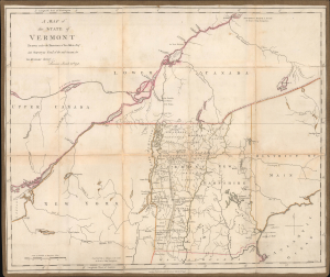
Ethan Allen's brother Ira: Mapping his way out of jail.

A Map of the State of Vermont Drawn under the Direction of Ira Allen Esq.

1798 (dated)
18.75 x 22.5 in (47.62 x 57.15 cm)
Vermont-iraallen-1798

$7,500.00

Acquire
A Closer Look
  • Digital Map Information
  • Suitable for large format printing
  • Full resolution TIFF file
  • ICC color profile embedded
  • Delivered instantly via download link
A remarkable 1798 Ira Allen map of Vermont, northern New England, New York, and southern Canada, engraved in London during Allen's detention by British authorities. Although titled simply A Map of the State of Vermont, it is less a conventional state map than a calculated political and commercial argument. Allen, the younger brother of Ethan Allen, emphasizes Vermont's strategic position between the Hudson-Champlain corridor and the St. Lawrence River, illustrates his proposed canal into British Canada, and presents the young state as both the natural center of a potentially lucrative international trade network and a vulnerable frontier requiring military protection. (more details)
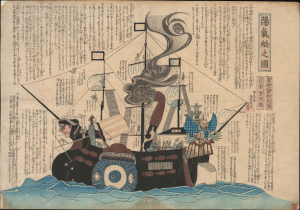
Making Light of Perry's Gunboat Diplomacy.

陽氣舩之圖 / [View of the Merry Ship].

1854 (undated)
14 x 20 in (35.56 x 50.80 cm)
BlackShipsKawaraban-kano-1854

$6,500.00

Acquire
A Closer Look
  • Digital Map Information
  • Suitable for large format printing
  • Full resolution TIFF file
  • ICC color profile embedded
  • Delivered instantly via download link
This is a rare c. 1854 kawaraban satirical woodblock print, produced by the pseudonymous Kanoka Mamaro (寒翁窠馬麿), depicting one of Commodore Matthew Perry's 'black ships.' It demonstrates that, even amid a strict regime of censorship, Japanese publishers sought to profit by informing and entertaining the public, including with irreverent takes on the historically significant events underway. (more details)
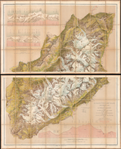
Greatest Map of Mont Blanc Ever Made.

Le Massif du Mont Blanc.

1876 (dated)
49.5 x 40.5 in (125.73 x 102.87 cm)
MontBlanc-violletleduc-1876

$5,500.00

Acquire
A Closer Look
  • Digital Map Information
  • Suitable for large format printing
  • Full resolution TIFF file
  • ICC color profile embedded
  • Delivered instantly via download link
This is Eugène Emmanuel Viollet-le-Duc's stunning chromolithographic 1876 map of Mont Blanc, produced after years of studying the massif's geography and geology. It is considered the greatest map of Mont Blanc ever produced, reflecting Viollet-le-Duc's artistic skills and unique experience as France's premier restorationist of historic sites. The map's production also coincided with territorial disputes between France and Italy (still unresolved) following the 'return' of Mont Blanc to France in 1860. (more details)
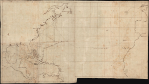
Manuscript record of the voyage that nearly transformed the American Civil War into a global conflict.

[Voyage of the HMS Rinaldo, 1861-1863]

1863 (undated)
17.5 x 30.75 in (44.45 x 78.10 cm)
CivilWarVoyage-rinaldo-1863

$5,000.00

Acquire
A Closer Look
  • Digital Map Information
  • Suitable for large format printing
  • Full resolution TIFF file
  • ICC color profile embedded
  • Delivered instantly via download link
A unique c. 1863 manuscript map documenting one of the most consequential British naval voyages of the early American Civil War (1861 - 1865): the 1861-63 Atlantic cruise of HMS Rinaldo. Operating along the North American and West Indian Station, the British warship visited Union and Confederate ports, protected British commercial and diplomatic interests, and carried the released Confederate commissioners James Murray Mason and John Slidell- central figures in the Trent Affair - from Provincetown, Massachusetts, to St. Thomas in the Danish West Indies. This manuscript unites two important episodes in Anglo-American Civil War diplomacy: the resolution of the Trent Affair and the confrontation between General Butler and British acting consul George Coppell. (more details)
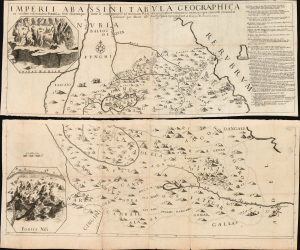
Earliest Acquirable Map showing the True Source of the Blue Nile.

Imperii Abassini tabula geographica ex sculatis relationibus patrum soc. Jesu aliorumque inter se comparatis and ad trutinam regulae geographicae examinatis rejectis iis quae concordi eorumdem historiae que mater est geographiae repugnabant

1674 (dated)
28 x 36.25 in (71.12 x 92.08 cm)
Ethiopia-eschinardi-1674

$5,000.00

Acquire
A Closer Look
  • Digital Map Information
  • Suitable for large format printing
  • Full resolution TIFF file
  • ICC color profile embedded
  • Delivered instantly via download link
This is Francesco Eschinardi's rare 1674 map of Abyssinia (Ethiopia) in Eastern Africa. It is the first detailed map focusing on the headwaters of the Blue Nile, informing regional cartography for a century. It is also the largest map to focus on this region for at least a century, being printed to four separate sheets, joined in upper and lower pairs. Its geographic detail is supplemented with pictorial mountains, depictions of the region's notable animals, settlements, ruins, and scenes of the martyrdom of Jesuit missionaries at the hands of both Abyssinian Christian 'heretics' and their Ottoman overlords. The map includes two inset views: one of the church complex of the Tadbaba Maryam and a bird's-eye view of the source of the Nile. (more details)
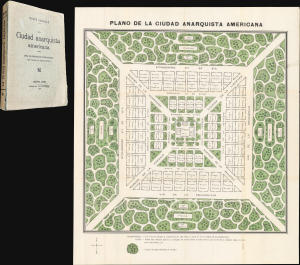
Futuristic city of Anarchy, with a death ray.

La Ciudad Anarquista Americana. / La Ciudad Anarquista Americana: Obra de Construcción Revolucionaria.

1914 (dated)
21 x 18.5 in (53.34 x 46.99 cm)
CiudadeAnarquista-quiroule-1914

$3,750.00

Acquire
A Closer Look
  • Digital Map Information
  • Suitable for large format printing
  • Full resolution TIFF file
  • ICC color profile embedded
  • Delivered instantly via download link
This is a rare 1914 color-printed folding plan of French-Argentine Pierre Quiroule's Ciudad Anarquista Americana, a cartographic vision of an ideal anarchist city. Conceived as the physical setting for Quiroule's revolutionary utopian novel, La Ciudad Anarquista Americana: Obra de Construcción Revolucionaria, the plan translates radical political and social philosophy into a rigorously ordered urban landscape of monumental avenues, communal institutions, gardens, schools, and public gathering places. (more details)
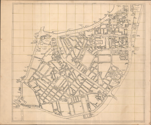
Pimlico's social geography at the outset of WWII.

[Pimlico, London.]

1939 (dated)
30 x 36.25 in (76.20 x 92.08 cm)
PimlicoLondon-wwii-1939

$3,500.00

Acquire
A Closer Look
  • Digital Map Information
  • Suitable for large format printing
  • Full resolution TIFF file
  • ICC color profile embedded
  • Delivered instantly via download link
This is an exceptional c. 1939 manuscript map of Pimlico, London, capturing the social geography of wartime London just before the Blitz, German aerial bombing campaign against London and the rest of the United Kingdom. Uniquely, rather than emphasizing civil defense, it meticulously identifies the pubs, clubs, theaters, and nightlife that sustained morale in the shadow of grim war. The map's remarkable precision, suggestive of a military hand, leads us to believe it was prepared as a recreation guide for soldiers on leave, preserving a vibrant urban landscape that would soon be devastated during the Blitz of 1940-1941. (more details)
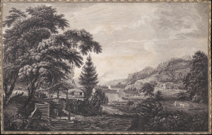
'the origin of the log cabin as a symbol of the American experience.' - Gilbron

A Design to Represent the Beginning and Completion of an American Settlement or Farm.

1761 (undated)
13.5 x 20.75 in (34.29 x 52.70 cm)
AmericanFarm-sandbypownall-1761

$3,250.00

Acquire
A Closer Look
  • Digital Map Information
  • Suitable for large format printing
  • Full resolution TIFF file
  • ICC color profile embedded
  • Delivered instantly via download link
This is Thomas Pownall and Paul Sandby's illustration of the evolution of an American farmstead, from log cabin to gentlemanly estate. It is arguably the most famous and impactful image from the 1761 Six Remarkable Views in the Provinces of New York, New Jersey and Pennsylvania, published in London. This view is not only one of the earliest illustrations of American settler life, but it has also been credited by Gilbron as 'the origin of the log cabin as a symbol of the American experience.' (more details)
Largest 19th century map of Malta - issued by an ex-Knight when the Order of St. John was nearly destroyed.

A New Sea and Land Chart of the Sovereign Principality of Malta; laid down from the best Authorities and the different Manuscript Maps communicated to the Chevr. Louis de Boisgelin under whose particular inspection this Chart has been planned.

1804 (dated)
23.5 x 52.25 in (59.69 x 132.72 cm)
MaltaGozo-neele-1804

$2,800.00

Acquire
A Closer Look
  • Digital Map Information
  • Suitable for large format printing
  • Full resolution TIFF file
  • ICC color profile embedded
  • Delivered instantly via download link
This 1804 production is the largest and most detailed map of Malta and Gozo to appear in the 19th century. The map was produced by Pierre Marie Louis de Boisgelin de Kerdu and Samuel John Neele based upon Boisgelin's life in Malta as a member of the knightly Order of St. John. The map is matched in dimensions and sophistication only by the Carte Generale de la Principaute Souveraine des Isles de Malte et du Goze (53.1 x 22.8 inches), made by Gervais de Palmeus in 1752. (more details)
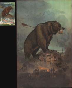
'A city undaunted by tragedy, audaciously innovative, rising to meet the challenges of the day.'

'Undaunted'.

1911 (dated)
20 x 12.75 in (50.80 x 32.38 cm)
SanFranciscoUndaunted-brittonrey-1911

$2,250.00

Acquire
A Closer Look
  • Digital Map Information
  • Suitable for large format printing
  • File Size: 62.39 MB
  • File Type: ZIP / TIFF
  • ICC color profile embedded
  • Delivered instantly via download link
This is a rare 1911 Britton and Rey chromolithograph view of San Francisco, issued to promote the city's resurgent spirit following the 1906 San Francisco Fire. A titanic grizzly bear represents the spirit of San Francisco, 'a city undaunted by tragedy, audaciously innovative, rising to meet the challenges of the day.' (more details)
California's most beautiful and iconic town.

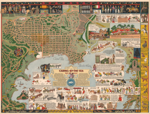
Carmel-by-the-Sea Past and Present.

1942 (dated)
18.75 x 24.75 in (47.62 x 62.86 cm)
CarmelbytheSea-mora-1942-5

$2,200.00

Acquire
A Closer Look
  • Digital Map Information
  • Suitable for large format printing
  • Full resolution TIFF file
  • ICC color profile embedded
  • Delivered instantly via download link
A beautiful example of the scarce 1942 Jo Mora pictorial map of Carmel, California. Located on the southern edge of the Monterey Peninsula, Carmel-by-the-Sea is widely regarded as one of California's most beautiful beach-front communities. (more details)
Earliest obtainable printing of the iconic Tolkien promotional map.

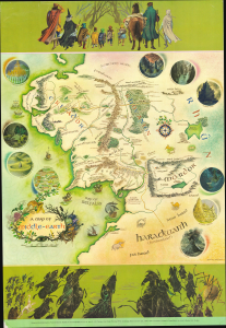
A Map of Middle-Earth.

1970 (dated)
31 x 22 in (78.74 x 55.88 cm)
MiddleEarth-baynes-1970-6

$1,800.00

Acquire
A Closer Look
This is the English 'George Allen and Unwin' first trade printing of the iconic 1970 poster map of J. R. R. Tolkien's Middle Earth drawn by Pauline Baynes to promote the Lord of the Rings. It is the earliest obtainable iteration of the map, with notably superior production quality and printing over all subsequent editions. Tolkien heaped praise upon Baynes' work, saying, 'They are more than illustrations, they are a collateral theme. I showed them to my friends whose polite comment was that they reduced my text to a commentary on the drawings.' (more details)
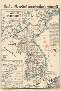
Thailand's Contribution to the Korean War.

เพื่อเป็นเครื่องระลึกถึงทหารไทยในประเทศเกาหลี [In Memory of the Thai Soldiers in Korea] / แผนที่ ประเทศเกาหลี [Map of Korea].

1950 (dated)
21.25 x 14.5 in (53.98 x 36.83 cm)
Korea-thai-1950

$1,500.00

Acquire
A Closer Look
  • Digital Map Information
  • Suitable for large format printing
  • Full resolution TIFF file
  • ICC color profile embedded
  • Delivered instantly via download link
This is a rare and perhaps unique November 1950 Thai-language map of Korea extolling Thai soldiers who would soon fight in the opening phase of the Korean War (1950 - 1953). The map was published in Bangkok to promote to the interested Thai public, Thailand's support for South Korea and the emerging U.S. alliance system in Asia, which included both South Korea and Thailand, in the early Cold War. Thailand was the first Asian power to participate in the Alliance. (more details)
Pioneering submarine geography.

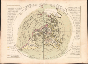
Planisphere Physique.

1781 (dated)
13.25 x 17.25 in (33.66 x 43.82 cm)
NorthernHemisphere-buache-1781-4

$1,200.00

Acquire
A Closer Look
  • Digital Map Information
  • Suitable for large format printing
  • Full resolution TIFF file
  • ICC color profile embedded
  • Delivered instantly via download link
A striking 1781 Philippe Buache map of the world, presented on an unusual polar projection rendered from the North Pole. This is the first work to attempt to map the ocean floor - a revolutionary work connecting submarine with surface geography. Although Buache's geography was speculative at best, the work is a landmark achievement in its attempt to illustrate and scientifically assess the unknowable oceanic depths. (more details)
Iconic Setting of Forgotten Realms.

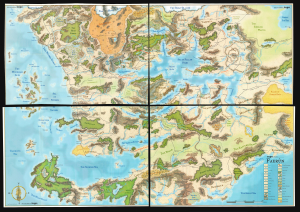
Faerûn.

2001 (dated)
44 x 61 in (111.76 x 154.94 cm)
Faerun-wizardsofthecoast-2001-2

$950.00

Acquire
A Closer Look
This is a scarce 2001 four-part wall map of the continent of Faerûn, the setting of numerous Forgotten Realms novels, video games, and related Dungeons and Dragons modules. (more details)
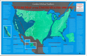
Doomed! Doomed I say!

Gordon-Michael Scallion's Future Map of North America: 1998 - 2001.

1993 (dated)
21 x 33 in (53.34 x 83.82 cm)
UnitedStates-scallion-1993

$850.00

Acquire
A Closer Look
This is Gordon-Michael Scallion's 1993 doomsday map of the United States. A self-styled prophet, Scallion here lays out what he sees as a series of imminent catastrophes that will reshape the map of the country. (more details)

Stay Informed

First Look at New Acquisitions

New inventory updates delivered directly to your inbox.