
Carey, Matthew (sold)
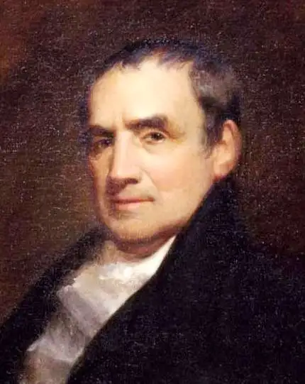
Matthew Carey (January 28, 1760 - September 16, 1839) was a Dublin born publisher who established himself in Philadelphia in the late 18th and early 19th century. A young man of socially progressive views, Carey's first known publication, produced when he was but 17 years old, was a pamphlet criticizing dueling. Another pamphlet, issued in the same year, attacked the Irish penal code. Shortly afterwards, in 1779, legal issues, possibly arising from his liberal political activism, forced Carey to flee to Paris. In Paris, Carey had the good fortune to befriend the visiting American diplomat and founding father, Benjamin Franklin (1706 - 1790). As an Irishman chafing under the rule of England, Carey sympathized with and admired the American revolutionary. The liberally minded pair struck up a lifelong friendship and Carey was hired to work at Franklin's press in Passy, France. A year later, Carey returned to Ireland and resumed his politically provocative publishing career with The Freemans's Journal and The Volunteer's Journal. It didn't take long for political pressure to once again force Carey from Ireland - this time to America (1784). Although largely without funds, Carey convinced Gilbert du Motier, Marquis de Lafayette (1757 - 1834), who he knew from Franklin's Paris circle, to lend him funds to establish a new publishing concern in Philadelphia. Despite this loan, Carey's firm remained under financed and opened on a shoestring budget. It was most likely his limited budget that led Carey to some of his most important publishing innovations. At the time cartographic publishing was dominated by large printing houses in London and Paris where most, if not all, of the work was completed in house. Without the finances to emulate this large publishing houses, Carey was forced to outsource much of his publishing work. This set the stage for subsequent American publishers who, in order to compete effectively with European firms, relied on an often bewildering network of alliances and collaborations. Carey was also a master of republishing many of his own maps in multiple different atlases and formats to maximize their profitability. His most important work is without a doubt the 1795 issue of the American Atlas the first atlas to be published in America. Carey died in 1839 but was succeeded by his son Henry Charles Carey (1793 - 1879) who, in partnership with his brother-in-law Isaac Lea (1792 - 1886), published numerous important maps and atlases under the Carey and Lea, Lea Brothers, and Lea and Blanchard imprints.
First map of Maine produced in the American Republic.
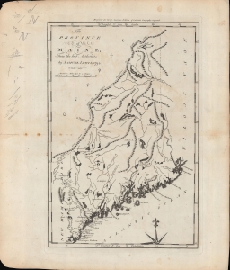
The province of Maine, from the best authorities.
sold
- Digital Map Information
- Suitable for large format printing
- Full resolution TIFF file
- ICC color profile embedded
- Delivered instantly via download link
A fascinating 1794 map of the 'Province of Maine' by Samuel Lewis and engraved by William Barker for Matthew Carey's American Edition of Guthrie's Geography improved, the first atlas published in the American Republic. It depicts the territory in the years just following independence, with borders that remained disputed and would later be shifted southwards as part of a compromise with Great Britain. (more details)
First map of the Granite State produced in the American Republic.
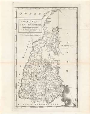
The state of New Hampshire, compared chiefly from actual surveys.
sold
- Digital Map Information
- Suitable for large format printing
- DPI: 600
- File Size: 32.14 MB
- File Type: ZIP / TIFF
- ICC color profile embedded
- Delivered instantly via download link
This is Samuel Lewis' 1794 map of New Hampshire, which appeared in Carey's General Atlas, the first atlas produced and published in the United States. It provides a wonderful snapshot of the state in the early days of the American Republic. (more details)
Earliest map of Georgia published in the American Republic.
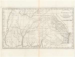
Georgia, from the latest authorities.
sold
- Digital Map Information
- Suitable for large format printing
- DPI: 600
- File Size: 24.43 MB
- File Type: ZIP / TIFF
- ICC color profile embedded
- Delivered instantly via download link
This is a significant map of Georgia from Carey's General Atlas, considered the first atlas published in the new American Republic. It demonstrates that much of the modern state of Georgia was still occupied primarily by Native Americans and little understood by white settlers. (more details)
One of the earliest obtainable maps of Kentucky.
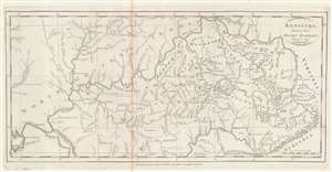
Kentucky, Reduced from Elihu Barker's Large Map.
sold
- Digital Map Information
- Suitable for large format printing
- Full resolution TIFF file
- ICC color profile embedded
- Delivered instantly via download link
An example of Matthew Carey's 1795 reduction of Elihu Barker's map of Kentucky - one of the earliest obtainable specific maps of Kentucky based upon actual observation and settlement. It also follows closely on Kentucky's admission to the Union. The map is a reduced version of the unobtainable Elihu Barker map of 1793, entitled A Map of Kentucky from Actual Survey, by Elihu Barker, also published by Carey in Philadelphia. The present map has less detail, given the reduced size, but closely adheres to Barker's important map, described as 'so well done it cold be used today with satisfaction'. Throughout, settlements, stations, salt licks, courthouses, furnaces, springs, planned settlements, and forts are noted - providing an invaluable insight into life in Kentucky when it was still the 'frontier'. (more details)
Poland and Lithuania, just after their partition.
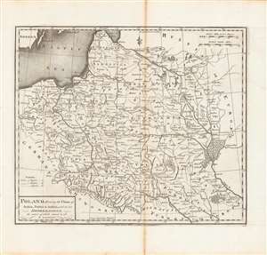
Poland, shewing the claims of Russia, Prussia and Austria until the late depredations, the extent of which cannot as yet be ascertained.
sold
- Digital Map Information
- Suitable for large format printing
- DPI: 600
- File Size: 33.06 MB
- File Type: ZIP / TIFF
- ICC color profile embedded
- Delivered instantly via download link
Here is Matthew Carey and William Barker's c. 1795 map, for Carey's General Atlas, of that lands that had composed the Polish-Lithuanian Commonwealth, which were broken up and distributed to Austria, Prussia, and Russia in the late 19th century. Aside from its cartographic qualities, this map is an instructive case study in knowledge production at a time of considerable change and instability. (more details)
Earliest Atlas Map of Vermont Published in the United States.
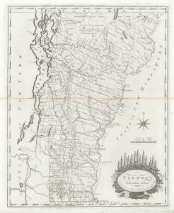
Vermont From Actual Survey.
sold
- Digital Map Information
- Suitable for large format printing
- DPI: 600
- File Size: 18.24 MB
- File Type: ZIP / TIFF
- ICC color profile embedded
- Delivered instantly via download link
The first map of Vermont published in the United States. This 1795 work was drawn and engraved by Amos Doolittle for Matthew Carey's Carey's American Edition of Guthrie's Geography Improved, the first atlas published in the United States. (more details)
Earliest Atlas Map of Vermont Published in the United States - here in striking old color.
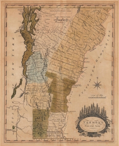
Vermont From Actual Survey.
sold
- Digital Map Information
- Suitable for large format printing
- File Size: 11.17 MB
- File Type: ZIP / TIFF
- ICC color profile embedded
- Delivered instantly via download link
This is the first map of Vermont published in the United States, here in striking original color. This 1795 work was drawn and engraved by Amos Doolittle for Matthew Carey's Carey's American Edition of Guthrie's Geography Improved, the first atlas published in the United States. (more details)
The earliest map of Pennsylvania published in the American Republic.
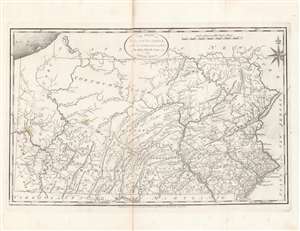
The State of Pennsylvania : reduced with permission from Reading Howell's map.
sold
- Digital Map Information
- Suitable for large format printing
- DPI: 600
- File Size: 35.23 MB
- File Type: ZIP / TIFF
- ICC color profile embedded
- Delivered instantly via download link
This is a fine first state example of Samuel Lewis’ 1795 map of Pennsylvania for Carey's General Atlas, the first atlas published in the young American Republic. It was an especially significant map as the producers of the atlas were based in Philadelphia, also the nation’s (temporary) capital at the time, which they used as the Prime Meridian throughout the atlas. (more details)
Earliest map of South Carolina published in the United States.
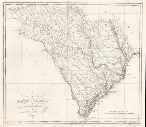
The state of South Carolina : from the best authorities.
sold
- Digital Map Information
- Suitable for large format printing
- DPI: 600
- File Size: 32.86 MB
- File Type: ZIP / TIFF
- ICC color profile embedded
- Delivered instantly via download link
This is a first state example of Samuel Lewis' 1795 map of South Carolina for Carey's General Atlas, the first atlas published in the American Republic. It illustrates the state's mountains, rivers, coastline, settlements, and infrastructure as they appeared soon after American Independence. (more details)
The earliest map of the North Pacific published in the American Republic.
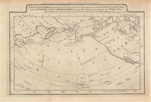
A map of the discoveries made by Capts. Cook and Clerke in the years 1778 and 1779...
sold
- Digital Map Information
- Suitable for large format printing
- DPI: 600
- File Size: 4.92 MB
- File Type: ZIP / TIFF
- ICC color profile embedded
- Delivered instantly via download link
This is a rare c. 1795 map of the northern Pacific Ocean from Carey's General Atlas, the first atlas published in the new American Republic. It highlights the three Pacific voyages of Captain James Cook and the overland route from Hudson's Bay to the Artic Ocean, 'discovered,' with critical help from indigenous guides, by Samuel Hearne. (more details)
Presenting Americans with the North Parts of the World.
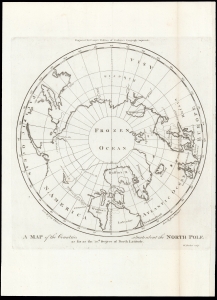
A Map of the Countries situate about the North Pole as far as the 50th Degree of North Latitude.
sold
- Digital Map Information
- Suitable for large format printing
- DPI: 600
- File Size: 13.01 MB
- File Type: ZIP / TIFF
- ICC color profile embedded
- Delivered instantly via download link
This is Mathew Carey's 1795 map of the North Pole and the surrounding seas. The map illustrates the extent of exploration, as well as the may uncertainties, of polar region to the date of publication. (more details)
First American map of North Carolina. Shows the Moravian Settlement of Wachovia.
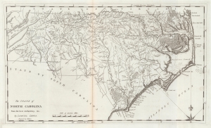
The State of North Carolina from the best Authorities etc.
sold
- Digital Map Information
- Suitable for large format printing
- Full resolution TIFF file
- ICC color profile embedded
- Delivered instantly via download link
This is a 1795 first state example of the Samuel Lewis map of North Carolina, the earliest specific map of that state printed in the United States. It is also one of the few maps to show the Moravian Settlement of Wachovia, near modern-day Winston-Salem. (more details)
A map of New Jersey from the first atlas produced in the American Republic.
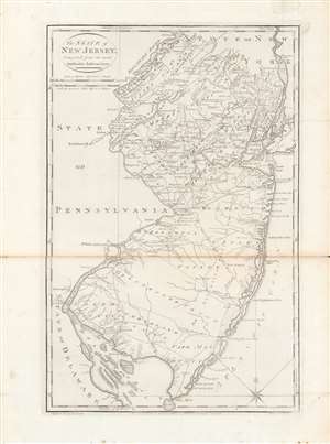
The state of New Jersey, compiled from the most authentic information.
sold
- Digital Map Information
- Suitable for large format printing
- DPI: 600
- File Size: 28 MB
- File Type: ZIP / TIFF
- ICC color profile embedded
- Delivered instantly via download link
Here is Mathew Carey and Samuel Lewis' c. 1796 map of New Jersey, made for Carey's General Atlas, the first atlas produced and published in the American Republic. It portrays the state in the years just after the American Revolution, in which it had played a central role. (more details)
First map of China published in the American Republic.
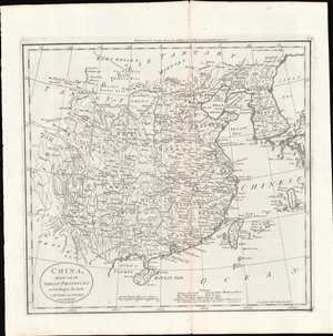
China, divided into its Great Provinces. According to the best Authorities.
sold
- Digital Map Information
- Suitable for large format printing
- Full resolution TIFF file
- ICC color profile embedded
- Delivered instantly via download link
This is a c. 1796 map of China from Carey's General Atlas, the first atlas published in the new American Republic. It depicts 'China proper,' roughly the territory covered by the Ming Dynasty, which had been conquered by the Manchu Qing Dynasty in 1644. (more details)
First map of India published in the American Republic.
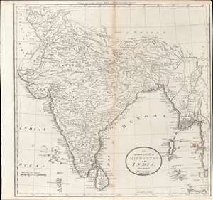
Map of Hindostan or India.
sold
- Digital Map Information
- Suitable for large format printing
- DPI: 600
- File Size: 10.77 MB
- File Type: ZIP / TIFF
- ICC color profile embedded
- Delivered instantly via download link
This is a rare c. 1796 map of South Asia from Carey's General Atlas, the first atlas published in the new American Republic. It shows the Indian subcontinent at a period of rapid transition towards the hegemony of the British East India Company (EIC). (more details)
From the first general atlas published in the United States.
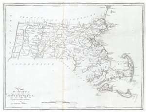
The State of Massachusetts.
sold
- Digital Map Information
- Suitable for large format printing
- Full resolution TIFF file
- ICC color profile embedded
- Delivered instantly via download link
This is a 1796 Mathew Carey and Samuel Lewis map of Massachusetts, published by Carey in the first general atlas of the United States. Cities, towns, and villages are labeled across the state, including Boston, Salem, Marblehead, and Plymouth. Major roads are depicted, along with rivers and lakes. Coastal bays and harbors, including Boston Harbor, Buzzards Bay, and Cape Cod Bay, are labeled. (more details)
One of the earliest specific maps of Tennessee.
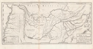
A Map of The Tennassee Government formerly Part of North Carolina taken Chiefly from Surveys by Genl. D. Smith and others.
sold
- Digital Map Information
- Suitable for large format printing
- Full resolution TIFF file
- ICC color profile embedded
- Delivered instantly via download link
This is a c. 1796 Mathew Carey map of the 'Tennessee Government', considered one of the earliest specific maps of Tennessee. (more details)
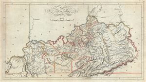
Kentucky.
sold
- Digital Map Information
- Suitable for large format printing
- Full resolution TIFF file
- ICC color profile embedded
- Delivered instantly via download link
This is an attractive 1814 map of the state of Kentucky by Matthew Carey. It covers the entire state noting counties and region in outline color. The map also notes rivers, creeks, towns, roads, mountains and a host of additional geographical features. The map ... (more details)
The Earliest Acquirable Map of the State of Louisiana
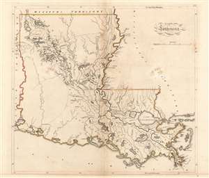
Louisiana.
sold
- Digital Map Information
- Suitable for large format printing
- DPI: 600
- File Size: 13.31 MB
- File Type: ZIP / TIFF
- ICC color profile embedded
- Delivered instantly via download link
This is 1814 Carey map of Louisiana is the first map of the state (apart from Carey’s own separately-issued, smaller, 1813 map.) It covers the entire state, highlighting the border in outline color. The map’ s best detail adheres to the course and ... (more details)
Tennessee just after the Creek War (1813 - 1814) and the War of 1812 (1812 - 1815).
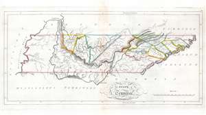
The State of Tennessee.
sold
- Digital Map Information
- Suitable for large format printing
- Full resolution TIFF file
- ICC color profile embedded
- Delivered instantly via download link
This is an 1814 Mathew Carey map of Tennessee issued at the height of the Creek Wars. This is one of the earliest maps of Tennessee to include an embryonic county structure - fine original outline color defines a handful of emerging counties. Nashville and Knoxville are both labeled. A handful of smaller towns are identified on the skeleton road network. Cherokee territory occupies all of western Tennessee and extends east along the southern border to Tennessee's border with North Carolina. (more details)
Rare second state!
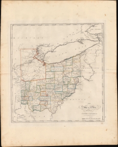
The State of Ohio with part of Upper Canada, etc.
sold
- Digital Map Information
- Suitable for large format printing
- DPI: 600
- File Size: 423.89 MB
- File Type: ZIP / TIFF
- ICC color profile embedded
- Delivered instantly via download link
This is the rare 1818 edition of Carey's map of Ohio. This second state is considerably rarer than the 1814 first state and notable for its significant updates, reflecting both corrections and Ohio's high-paced settlement. (more details)
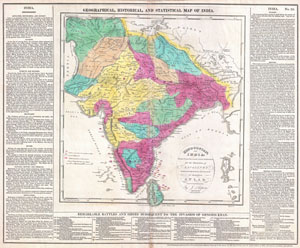
Geographical, Historical, and Statisitcal Map of India / Hindoostan; or India
sold
- Digital Map Information
- Suitable for large format printing
- DPI: 300
- File Size: 13.76 MB
- File Type: ZIP / TIFF
- ICC color profile embedded
- Delivered instantly via download link
This is an attractive 1821 map of India issued by Matthew Carey. Covers the subcontinent from Tibet Kashmir south to Sri Lanka or Ceylon. Color coded according to territory with British possessions or dependencies in red. Shows the locations and dates ... (more details)
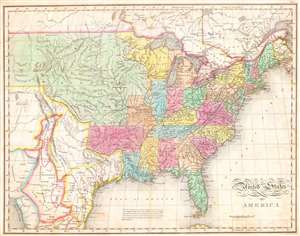
United States of America
sold
- Digital Map Information
- Suitable for large format printing
- Full resolution TIFF file
- ICC color profile embedded
- Delivered instantly via download link
One of the most important American maps of the United States to appear in the early 19th century. Depicts the United States and Mexico roughly from the Atlantic to the region immediately west of the Rocky Mountains, including the massive Missouri ... (more details)