
Hogenberg, Franz (sold)

Franz Hogenberg (1535 - 1590), often called 'Master Franz,' was a Flemish engraver active in the late 16th century. Hogenberg was born in Mechelen, the son of Nicolas Hogenberg, where he trained under the cartographer H. Terbruggen. He later relocated to Antwerp where he achieved success as an engraver, working with Abraham Ortelius, Hieronymus Cock, and others. In 1568, his name appeared on the list of those banned from the Netherlands by the Duke of Alva, forcing his family to flee to London. There he engraved for Christopher Saxon's Atlas of England and Wales. By 1570 he emigrated to Germany settling in Cologne. In Cologne he married his second wife, Agnes Lomar, with whom he had six children. In 1579 the couple were briefly imprisoned for holding illicit secret religious meetings, but were released in short order. Along with German cleric George Braun (1541 – March 10, 1622), Hogenberg issued the highly influential city atlas Civitates Orbis Terrarum. The six volume work, with some 546 views, was published between 1572 and 1617 and intended a companion to Abraham Ortelius' Thatrum Orbis Terrarum - thus certain obvious stylistic similarities. In compiling the Civitates Hogenberg took on the role of engraver while most of the editing was left to Georg Braun. Hogenberg died in Cologne, Germany, before the Civitates was completed. After his death, Hogenberg's work was continued by his son, Abraham Hogenberg, who, under the direction of Agnes, his mother, took over his father's enterprise at just 20.
First Atlas Map of the North Parts of the World.
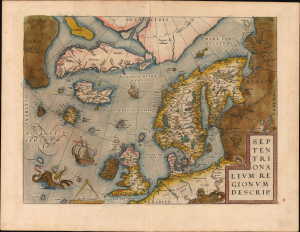
Septentrionalium Regionum Desrip.
sold
- Digital Map Information
- Suitable for large format printing
- Full resolution TIFF file
- ICC color profile embedded
- Delivered instantly via download link
A handsome example of one of Abraham Ortelius' most interesting maps, his 1570 map of Scandinavia and the Arctic. During the Age of Discovery, the Arctic was as remote and unfamiliar as the coasts of America, Africa, or Asia. This map played a role in propagating several cartographic fallacies, including the Zeno Fraud: Frisland, Estotiland, Drogeo. The present example features warm, original color. (more details)
Original color issue of one of the most influential maps of the 16th century.
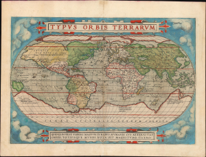
Typus Orbis Terrarum.
sold
- Digital Map Information
- Suitable for large format printing
- Full resolution TIFF file
- ICC color profile embedded
- Delivered instantly via download link
A superb old-color example of Abraham Ortelius' iconic 1570 map of the world, here in its 1579 edition. Of fundamental importance, this is the first world map to appear in an atlas and one of the most influential of the 16th century. (more details)
First Atlas Map of the North Parts of the World.
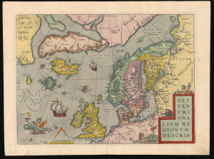
Septentrionalium Regionum Desrip.
sold
- Digital Map Information
- Suitable for large format printing
- Full resolution TIFF file
- ICC color profile embedded
- Delivered instantly via download link
A handsome example of one of Abraham Ortelius' most interesting maps, his 1570 map of Scandinavia and the Arctic. During the Age of Discovery, these northern parts of the world represented regions as remote and unfamiliar as the coasts of America, Africa, and Asia. (more details)
An unusual separate issue without verso text.
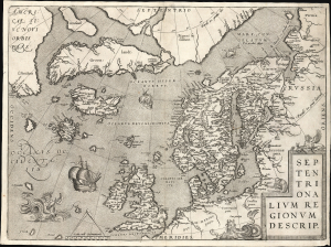
Septentrionalium Regionum Desrip.
sold
- Digital Map Information
- Suitable for large format printing
- File Size: 22.83 MB
- File Type: ZIP / TIFF
- ICC color profile embedded
- Delivered instantly via download link
A handsome example of one of Abraham Ortelius' most interesting maps, his 1570 map of Scandinavia and the Arctic. During the Age of Discovery, these northern parts of the world represented regions as remote and unfamiliar as the coasts of America, Africa, and Asia. (more details)
1641 Spanish Text Edition - only 25 printed.
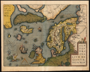
Septentrionalium Regionum Desrip.
sold
- Digital Map Information
- Suitable for large format printing
- Full resolution TIFF file
- ICC color profile embedded
- Delivered instantly via download link
One of Abraham Ortelius' most interesting maps, this is his 1570 map of Scandinavia and the Arctic. During the Age of Discovery, these northern parts of the world represented regions as remote and unfamiliar as the coasts of America, Africa, and Asia. (more details)
The Northern Limits of Geographical Knowledge in the Age of Discovery
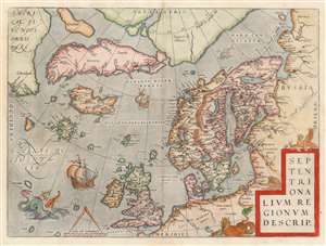
Septentrionalium Regionum Desrip.
sold
- Digital Map Information
- Suitable for large format printing
- DPI: 600
- File Size: 49.65 MB
- File Type: ZIP / TIFF
- ICC color profile embedded
- Delivered instantly via download link
One of Abraham Ortelius' most interesting maps, this is his 1570 map of Scandinavia and the Arctic. During the Age of Discovery, these north parts of the world represented regions as remote and unfamiliar as the coasts of America, Africa, and Asia. The map covers the northern regions from the English Channel to the just south of the North Pole and from America to Russia, including England, Scandinavia, Finland, Denmark, Iceland, and Greenland, as well as parts of America (Estotiland), the apocryphal island of Frisland, and Mercator's speculative Arctic islands. (more details)
The first map of the world in a standard Atlas - of fundamental importance to the history of cartography.
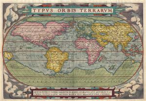
Typus Orbis Terrarum.
sold
- Digital Map Information
- Suitable for large format printing
- DPI: 300
- File Size: 10.46 MB
- File Type: ZIP / TIFF
- ICC color profile embedded
- Delivered instantly via download link
A fine first edition third printing example of Aberham Ortelius' iconic 1570 map of the world. This map is the first map of the world to appear in a standard atlas and is thus of fundamental importance to the history of cartography. Centered on the Atlantic ... (more details)
A double-view that create a connection between the Jerusalem of the 1570s and Biblical Jerusalem.
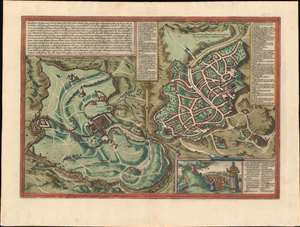
Hierosolyma, Clarrisima Totius Orientis Civitas ludaee Metropolis…
sold
- Digital Map Information
- Suitable for large format printing
- DPI: 600
- File Size: 26.03 MB
- File Type: ZIP / TIFF
- ICC color profile embedded
- Delivered instantly via download link
This is a 1572 Georg Braun and Frans Hogenberg double-view of Jerusalem depicts Biblical Jerusalem and the modern city during the 16th century. Biblical Jerusalem appears on the left 'in its full splendor'. In the lower left, the procession of Jesus to Golgotha ... (more details)
Old color first edition of Braun and Hogenberg's Dutch Golden Age view of Amsterdam.
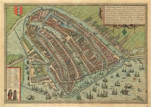
Amstelredamvm, nobile inferioris Germaniae oppidum ad recipiendos ex omnib. mundi partibus, mercatores, recenter natum genus hominum incolit mercimonijs deditum quae quidem, tum blanda populi comitate, ac sedula diligentiqu[ue] industria : tum portus comoditate permagna, vsq[ue]adeo incrementa sumpserunt vt vix vllum mercaturae genus excogitari possit quod heic non exerceatur : hinc fit vt opum lucrique cupiditas, ex remotissimis etiam terris, negotiatores, in hanc ciuitate inuitet qui varia hinc bona et maximè rem frumentaria in Brabantiam caeteraq[ue] longè dissita totius vniuersi loca, transferentes : ingentes ex eiuscemodi commertio opes consequuntur.
sold
- Digital Map Information
- Suitable for large format printing
- DPI: 600
- File Size: 25.26 MB
- File Type: ZIP / TIFF
- ICC color profile embedded
- Delivered instantly via download link
An attractive first edition old color example of George Braun and Franz Hogenberg's 1572 city view and map of Amsterdam. The map, presented in bird's-eye view form, looks on Dutch Golden Age Amsterdam from the northeast. On the left side the map illustrates the elaborate damming and redirection of the Amstel River into Amsterdam's famous canal network. Ships line the canals and fill the Zuiderzee both on the inside and outside of Amsterdam's defensive seawall - suggestive of Amsterdam's enormous commercial prosperity. At center, the old town hall (Stadhuis, 21) and the neighboring Nieue Kerk (23), are recognizable. In the lower right, at the edge of the map, is the gallows field with a total of 11 unfortunates. (more details)
Iconic and early view of Paris.
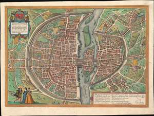
Lutetia vulgari Nomine Paris, Urbs Galliae Maxima, Sequana Navigabili Flumine Irrigatur ...
sold
- Digital Map Information
- Suitable for large format printing
- Full resolution TIFF file
- ICC color profile embedded
- Delivered instantly via download link
A fine full-color example of the Braun and Hogenberg's 1572 map and view of Paris, France. With the Seine flowing at center around the Île de la Cité, this view looks on Paris from the northwest, with the top of the map oriented to the southeast. The city is presented on from equidistant bird's-eye perspective wherein all structures are rendered in view form but from a uniform height and angle relative to all individual points. Fertile fields surround the city, and the rivers bustles with boats, suggesting richness and prosperity. In the bottom left corner, a man greets two women, all are wearing clothing corresponding to the Spanish influenced fashion norms of 1560 - 1570. The Bastille, an infamous as a prison prior to the French Revolution, appears here at top center, surrounded by a mat. The 1550 bastion, appearing to the left of the main structure of the Bastille is also evident. The map's title 'Lutetia' refers to the roman name for Paris which, by the 16th century, had largely been phased out. (more details)
The dominant 16th Century mapping of Paris.
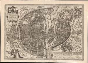
Lutetia vulgari Nomine Paris, Urbs Galliae Maxima, Sequana Navigabili Flumine Irrigatur...
sold
- Digital Map Information
- Suitable for large format printing
- Full resolution TIFF file
- ICC color profile embedded
- Delivered instantly via download link
A handsome example of the Braun and Hogenberg's 1572 map and view of Paris, France. With the Seine flowing at center around the Île de la Cité, this view looks on Paris from the northwest, with the top of the map oriented to the southeast. The city is presented on from equidistant bird's-eye perspective wherein all structures are rendered in view form but from a uniform height and angle relative to all individual points. Fertile fields surround the city, and the rivers bustles with boats, suggesting richness and prosperity. In the bottom left corner, a man greets two women, all wearing clothing corresponding to the Spanish influenced fashion norms of 1560 - 1570. The Bastille, an infamous prison prior to the French Revolution, appears here at top center, surrounded by a moat. The 1550 bastion, appearing to the left of the main structure of the Bastille is also evident. The map's title 'Lutetia' refers to the roman name for Paris which, by the 16th century, had largely been phased out but still appeared in academic references. (more details)
Dominant 16th century mapping of Paris.
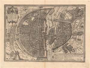
Lutetia vulgari Nomine Paris, Urbs Galliae Maxima, Sequana Navigabili Flumine Irrigatur...
sold
- Digital Map Information
- Suitable for large format printing
- Full resolution TIFF file
- ICC color profile embedded
- Delivered instantly via download link
A handsome example of the Braun and Hogenberg's 1572 map and view of Paris, France. With the Seine flowing at center around the Île de la Cité, this view looks on Paris from the northwest, with the top oriented to the southeast. The city is presented from an equidistant bird's-eye perspective wherein all structures are rendered in view form, but from a uniform height and angle relative to all individual points. Fertile fields surround the city, and the river bustles with boats, suggesting richness and prosperity. In the bottom left corner, a man greets two women, all wearing clothing corresponding to the Spanish-influenced fashion norms of 1560 - 1570. The Bastille, a prison infamous even prior to the French Revolution, appears here at top center, surrounded by a moat. The 1550 bastion, appearing to the left of the main structure of the Bastille is also evident. The map's title 'Lutetia,' is the Latin name for Paris which, by the 16th century, had largely been phased out but still appeared in academic references. (more details)
Dominant 16th century mapping of Paris.
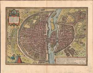
Lutetia vulgari Nomine Paris, Urbs Galliae Maxima, Sequana Navigabili Flumine Irrigatur...
sold
- Digital Map Information
- Suitable for large format printing
- Full resolution TIFF file
- ICC color profile embedded
- Delivered instantly via download link
A handsome example of the Braun and Hogenberg's 1572 map and view of Paris, France. With the Seine flowing at center around the Île de la Cité, this view looks on Paris from the northwest, with the top oriented to the southeast. The city is presented from an equidistant bird's-eye perspective wherein all structures are rendered in view form, but from a uniform height and angle relative to all individual points. Fertile fields surround the city, and the river bustles with boats, suggesting richness and prosperity. In the bottom left corner, a man greets two women, all wearing clothing corresponding to the Spanish-influenced fashion norms of 1560 - 1570. The Bastille, a prison infamous even prior to the French Revolution, appears here at top center, surrounded by a moat. The 1550 bastion, appearing to the left of the main structure of the Bastille is also evident. The map's title 'Lutetia,' is the Latin name for Paris which, by the 16th century, had largely been phased out but still appeared in academic references. (more details)
Stunning early view of Cairo expressing European fascination with oriental cultures.
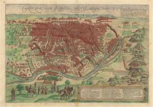
Cairus, quae olim Babylon; Aegypti Maxima Urbs.
sold
- Digital Map Information
- Suitable for large format printing
- DPI: 300
- File Size: 9.81 MB
- File Type: ZIP / TIFF
- ICC color profile embedded
- Delivered instantly via download link
This is a striking c. 1572 view map of Cairo, Egypt during the Ottoman Period issued by Braun and Hogenberg. The map presents Cairo from the right bank of the Nile, so looking towards the southeast with the Pyramids of Giza and the Great Sphinx appearing at right. Braun and Hogenberg's Cairo is a city of uniform rectilinearity interspaced with fortresses, gated gardens, and soaring minarets. The Great Pyramids of Giza, appearing at right, are highly stylized, presented on green hills, and clearly indicate that artist had never actually seen them. (more details)
Stunning early view of Cairo expressing European fascination with oriental cultures.
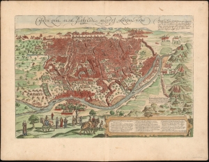
Cairus, quae olim Babylon; Aegypti Maxima Urbs.
sold
- Digital Map Information
- Suitable for large format printing
- DPI: 600
- File Size: 21.5 MB
- File Type: ZIP / TIFF
- ICC color profile embedded
- Delivered instantly via download link
This is a striking c. 1572 view map of Cairo, Egypt during the Ottoman Period issued by Braun and Hogenberg. The map presents Cairo from the right bank of the Nile, so looking towards the southeast with the Pyramids of Giza and the Great Sphinx appearing at right. Braun and Hogenberg's Cairo is a city of uniform rectilinearity interspaced with fortresses, gated gardens, and soaring minarets. The Great Pyramids of Giza, appearing at right, are highly stylized, presented on green hills, and clearly indicate that artist had never actually seen them. (more details)
First Atlas Map of the Western Hemisphere.
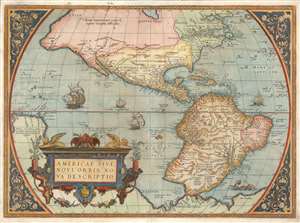
Americae Sive Novi Orbis Nova Descriptio.
sold
- Digital Map Information
- Suitable for large format printing
- Full resolution TIFF file
- ICC color profile embedded
- Delivered instantly via download link
This is Abraham Ortelius' map of the Western Hemisphere, considered to be the 'first map of the Americas to appear in a modern atlas' (Schwartz). Ortelius' success and the spread of his atlas made this fine map the standard - and best - representation of the Americas during the initial period its colonization. (more details)
One of the earliest maps to show Mercator's speculative Arctic islands, the apocryphal Friesland, and Zeno's fraudlent version of Labrador, Estotiland.
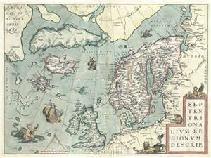
Septentrionalum Regionum Desrip.
sold
- Digital Map Information
- Suitable for large format printing
- DPI: 300
- File Size: 11.16 MB
- File Type: ZIP / TIFF
- ICC color profile embedded
- Delivered instantly via download link
One of Abraham Ortelius' most interesting maps, this is his 1570 map of Scandinavia and the Arctic. During the Age of Discovery, these northern parts of the world represented regions as remote and unfamiliar as the coasts of America, Africa, and Asia. (more details)
Early original color issue of one of the most influential maps of the 16th century.
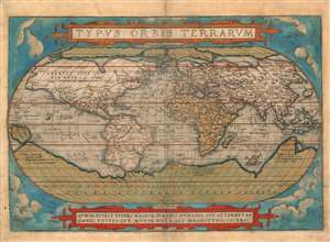
Typus Orbis Terrarum.
sold
- Digital Map Information
- Suitable for large format printing
- Full resolution TIFF file
- ICC color profile embedded
- Delivered instantly via download link
A superbly-colored example of Abraham Ortelius' iconic 1570 map of the world, here in a 1572 edition, still the first state of the first plate. This map is the first map of the world to appear in a standard atlas and is thus of fundamental importance to the history of cartography. It was one of the most widely-seen, and most influential printed maps of the world produced in the sixteenth century. (more details)
The first Atlas Map of the Western Hemisphere.
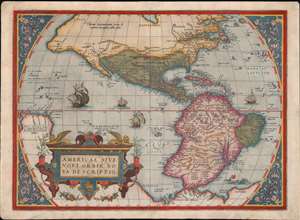
Americae Sive Novi Orbis Nova Descriptio.
sold
- Digital Map Information
- Suitable for large format printing
- Full resolution TIFF file
- ICC color profile embedded
- Delivered instantly via download link
This is Abraham Ortelius' map of the Western Hemisphere, 'first map of the Americas to appear in a modern atlas' (Schwartz). Ortelius' success and the spread of his atlas made this fine map the standard - and best - representation of the Americas during the initial period of the colonization of North America by Europeans. (more details)
North Part of the World Known to Europe in the Age of Discovery.
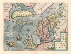
Septentrionalum Regionum Desrip.
sold
- Digital Map Information
- Suitable for large format printing
- Full resolution TIFF file
- ICC color profile embedded
- Delivered instantly via download link
One of Abraham Ortelius' most interesting maps, this is his 1570 map of the Arctic, here in a transitional example between the first and second states as recorded in van den Broecke. The map covers the northern regions from the English Channel to the just south of the North Pole and from America to Russia, including England, Scandinavia, Finland, Denmark, Iceland, and Greenland, as well as parts of America (Estotiland), the apocryphal island of Friesland, and Mercator's speculative Arctic islands. (more details)
Bird's Eye View of Alexandria in Superb Condition with a Bold Strike
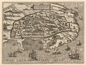
Alexandria, Vetustissimum Aegypti Emporium, Amplissima Civitas
sold
- Digital Map Information
- Suitable for large format printing
- DPI: 600
- File Size: 21.35 MB
- File Type: ZIP / TIFF
- ICC color profile embedded
- Delivered instantly via download link
This is a bold, sharp example of the 1575 view of Alexandria, produced by Braun and Hogenberg for inclusion in the second volume of the Civitates Orbis Terrarum. The view is oriented to the south, with the Mediterranean Sea in the foreground. City is presented both as a city of modern trade, and of ancient wonders, many ruined or lost. Within the walls are many ruins, but the center of the city is commanded by the Abu al-Abbas al-Mursi Mosque and the many houses, subordinate mosques and bazaar surrounding it indicate a thriving Muslim city. (Another structure is purported to have been the home of Alexander the Great, a nod to the founder of the city.) There are Christian elements shown as well: A church to St. Catherine (she of the Wheel) is present, and a note by one ruin informs the reader that 'under this stone was found the body of Saint Mark; it is reported to be in Venice. On a promontory to the west, Pompey's pillar is shown, and its 'incredible height and breadth' described. Canals are depicted bringing water from the Nile into the city year-round; another source of fresh water is noted in Lake Mariout: it is described as having abundant fresh water and many fish, being half an Italian mile distant from the city. (The adjective one now uses for Mariout is 'brackish.') Palm forests are noted as being used for fire, and for the sale of their wood. Overlooking the harbor can be seen the renowned Lighthouse of Pharos, one of the wonders of the ancient world. The harbor, and the Mediterranean Sea itself, teems with beautifully engraved sailing ships and rowing galleys. (more details)
Many-wondered city of Alexandria.
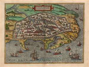
Alexandria, Vetustissimum Aegypti Emporium, Amplissima Civitas
sold
- Digital Map Information
- Suitable for large format printing
- Full resolution TIFF file
- ICC color profile embedded
- Delivered instantly via download link
This is a bold, sharp example of the 1575 view of Alexandria, produced by Braun and Hogenberg for inclusion in the second volume of the Civitates Orbis Terrarum. The view is oriented to the south, with the Mediterranean Sea in the foreground. City is presented both as a center of modern trade, and home of ancient wonders, many ruined or lost. (more details)
Bird's Eye View of Damascus in Sumptious Contemporary Color
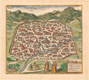
Damascus, urbs noblissima ad Libanum montem, Totius Sÿriae Metropolis
sold
- Digital Map Information
- Suitable for large format printing
- DPI: 600
- File Size: 14.78 MB
- File Type: ZIP / TIFF
- ICC color profile embedded
- Delivered instantly via download link
This is a superb example of the 1575 view of Damascus, produced by Braun and Hogenberg for inclusion in the second volume of their Civitates Orbis Terrarum, the first dedicated city book. The beautifully engraved view, illuminated with superb original color, is one of the earliest printed views of Damascus. It depicts the contemporaneous Muslim walled city; its mosques are prominently shown. Some churches illustrated as well, though one of these, The Church of Saint Paul, is in ruins. In the foreground, two noblemen in Ottoman styles converse; two footmen can be seen leading camels. (more details)
One of the most influential maps of the 16th century.
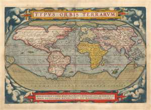
Typus Orbis Terrarum.
sold
- Digital Map Information
- Suitable for large format printing
- Full resolution TIFF file
- ICC color profile embedded
- Delivered instantly via download link
This is a beautiful example of Abraham Ortelius' iconic 1570 map of the world, here in a 1579 edition of the first plate. This map is the first map of the world to appear in a standard atlas and is thus of fundamental importance to the history of cartography. It was one of the most widely-seen, and most influential printed maps of the world produced in the sixteenth century. (more details)
Early view of an important Spanish port city in the Basque Region.
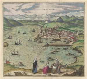
Santander.
sold
- Digital Map Information
- Suitable for large format printing
- DPI: 300
- File Size: 8.63 MB
- File Type: ZIP / TIFF
- ICC color profile embedded
- Delivered instantly via download link
This is a 1580 Georg Braun and Franz Hogenberg view of Santander, Spain. The view overlooks the town of Santander from one of the hills which presumably surrounds the city. The city and harbor are depicted in detail, illustrating individual buildings, the town ... (more details)
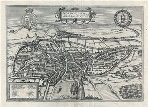
Nordovicum, Angliae Civitas.
sold
- Digital Map Information
- Suitable for large format printing
- DPI: 300
- File Size: 12.25 MB
- File Type: ZIP / TIFF
- ICC color profile embedded
- Delivered instantly via download link
A beautiful example of Braun and Hogenberg's 1581 view of Norwich, england. The view is based on William Cuningham's plan of 1558 and presented the city in an oblique view as seen from the northwest. Situated on the Wensum River, the city is shown with its ... (more details)
First Detailed, Dedicated Plan of London.
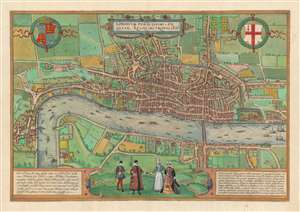
Londinum Feracissimi Angliae Regni Metropolis.
sold
- Digital Map Information
- Suitable for large format printing
- DPI: 600
- File Size: 46.69 MB
- File Type: ZIP / TIFF
- ICC color profile embedded
- Delivered instantly via download link
This is Georg Braun and Franz Hogenberg's plan of London, the first surviving, single-sheet, printed map of London. The significance of this seems not to have been lost on the authors, who made it the first plan in their Civitatis Orbis Terrarum, the first published collection of city plans and views. It is one of the few acquirable depictions of the city made before the Great Fire of 1666 (Howgego notes that it was the Great Fire itself, and the problems attendant to land ownership and rebuilding that led to proper surveys of the city in the first place.) (more details)
Earliest Acquirable Map of Denmark based on a Danish Source.
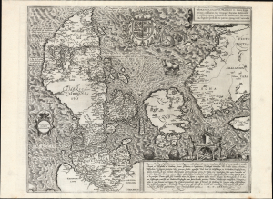
Danorum Marca, vel Cimbricum, aut Daniae Regnum...
sold
- Digital Map Information
- Suitable for large format printing
- Full resolution TIFF file
- ICC color profile embedded
- Delivered instantly via download link
This is a superb example of Marcus Jordan's map of Denmark. Printed in 1588 by Georg Braun and Franz Hogenberg, it is the only map to be included in their eight-volume city atlas (as distinct from the work's abundant city plans and views). It is the first full-sheet printed map of Denmark, and is the earliest surviving printed map of Denmark produced from Danish sources. For collectors of Denmark, it is an essential and scarce work. (more details)
Stunning Atlas, Old Color, Distinguished Provenance.

Fasciculus geographicus complectens praecipuarum totius orbis regionum tabulas circiter centum, unà cum earundem enarrationibus.
sold
This is Matthias Quad's geographical atlas in its expanded 1608 edition, with 87 maps in superb original color and a distinguished provenance connecting it to the Lord Wardington Collection. Quad's atlas provided, in a small folio, a compilation of the most state-of-the-art maps of his era - some engraved by Quad himself, the bulk having been engraved by publisher Johan Bussemacher. The richly-colored atlas is beautifully bound in contemporary vellum and is the finest example of this work known. (more details)
Rare Jansson variant of the Braun and Hogenberg Moscow.
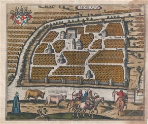
Moscavw.
sold
- Digital Map Information
- Suitable for large format printing
- File Size: 21.4 MB
- File Type: ZIP / TIFF
- ICC color profile embedded
- Delivered instantly via download link
The rare 1657 Jansson view and map of Moscow, Russia. The view depicts Moscow as seen from an elevated point just above the Moskva River. The Neglinnaya River forms a partial moat around he city. The Kremlin, built between 1485 and 1530 to house the ... (more details)
Largest and Best 17th century view of Krakow.
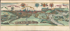
Cracovia Metropolis Regni Poloniae.
sold
- Digital Map Information
- Suitable for large format printing
- File Size: 934.03 MB
- File Type: ZIP / TIFF
- ICC color profile embedded
- Delivered instantly via download link
This is the largest and best 17th-century view of Krakow, Poland. The view was published in c. 1657 by Jan Jansson for his edition of Georg Braun and Franz Hogenberg's Civitatus Orbis Terrarum. (more details)