
Homann, Johann Baptist (sold)
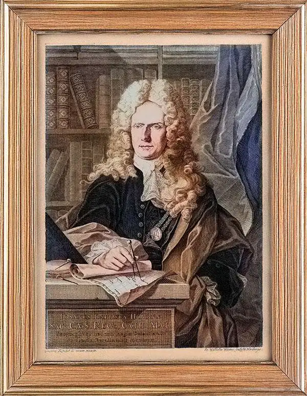
Johann Baptist Homann (March 20, 1664 - July 1, 1724) was the most prominent and prolific map publisher of the 18th century. Homann was born in Oberkammlach, a small town near Kammlach, Bavaria, Germany. As a young man, Homann studied in a Jesuit school and nursed ambitions of becoming a Dominican priest. Nonetheless, he converted to Protestantism in 1687, when he was 23. It is not clear where he mastered engraving, but we believe it may have been in Amsterdam. Homann's earliest work we have identified is about 1689, and already exhibits a high degree of mastery. Around 1691, Homann moved to Nuremberg and registered as a notary. By this time, he was already making maps, and very good ones at that. He produced a map of the environs of Nürnberg in 1691/92, which suggests he was already a master engraver. Around 1693, Homann briefly relocated to Vienna, where he lived and studied printing and copper plate engraving until 1695. Until 1702, he worked in Nuremberg in the map trade under Jacob von Sandrart (1630 - 1708) and then David Funck (1642 - 1709). Afterward, he returned to Nuremberg, where, in 1702, he founded the commercial publishing firm that would bear his name. In the next five years, Homann produced hundreds of maps and developed a distinctive style characterized by heavy, detailed engraving, elaborate allegorical cartouche work, and vivid hand color. Due to the lower cost of printing in Germany, the Homann firm could undercut the dominant French and Dutch publishing houses while matching their diversity and quality. Despite copious output, Homann did not release his first major atlas until the 33-map Neuer Atlas of 1707, followed by a 60-map edition of 1710. By 1715, Homann's rising star caught the attention of the Holy Roman Emperor Charles VI, who appointed him Imperial Cartographer. In the same year, he was also appointed a member of the Royal Academy of Sciences in Berlin. Homann's prestigious title came with several significant advantages, including access to the most up-to-date cartographic information as well as the 'Privilege'. The Privilege was a type of early copyright offered to very few by the Holy Roman Emperor. Though less sophisticated than modern copyright legislation, the Privilege offered limited protection for several years. Most all J. B. Homann maps printed between 1715 and 1730 bear the inscription 'Cum Priviligio' or some variation. Homann was also skilled at cultivated learned relationships throughout Europe, for example, in 1723, documents from the St. Petersburg Academy of Sciences identify him as an 'Agent of Muscovy', indicating an official connection to the cartographic circles in Russia. Following Homann's death in 1724, the firm's map plates and management passed to his son, Johann Christoph Homann (1703 - 1730). J. C. Homann, perhaps realizing that he would not long survive his father, stipulated in his will that the company would be inherited by his two head managers, Johann Georg Ebersberger (1695 - 1760) and Johann Michael Franz (1700 - 1761), and that it would publish only under the name 'Homann Heirs'. This designation, in various forms (Homannsche Heirs, Heritiers de Homann, Lat Homannianos Herod, Homannschen Erben, etc.) appears on maps from about 1731 onwards. The firm continued to publish maps in ever-diminishing quantities until the death of its last owner, Christoph Franz Fembo (1781 - 1848).
One of two earliest known maps engraved by Homann - long before he opened his own firm.
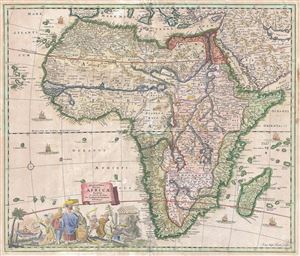
Accuratissima Totius Africae Tabula in Lucem producta per Iacobum de Sandrart Norimbergae.
sold
- Digital Map Information
- Suitable for large format printing
- DPI: 300
- File Size: 17.14 MB
- File Type: ZIP / TIFF
- ICC color profile embedded
- Delivered instantly via download link
An uncommon map, this is Jacob Sandrart's 1697 map of Africa. The map covers the continent in full as well as the adjacent parts of Araba, Europe, and the Cape Verde and Canary Islands. The Prime Meridian runs through Ferro Island. Cartographically Sandrart ... (more details)
A richly detailed debut work by one of the most prolific German mapmakers of the early 18th Century.
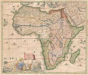
Accuratissima Totius Africae Tabula in Lucem producta per Iacobum de Sandrart Norimbergae.
sold
- Digital Map Information
- Suitable for large format printing
- Full resolution TIFF file
- ICC color profile embedded
- Delivered instantly via download link
This is Jacob Sandrart's scarce, separately published 1697 map of Africa. While cartographically derived from the influential 1670 Totius Africae Accuratissima Tabula by Frederic de Wit, this map is notable for being the first or second signed engraving by Johann Baptist Homann, who would become one of the most important German map publishers of the 18th century. (The other contender is Sandrart's map of the Americas, similarly derived from the work of De Wit.) These maps' production in 1697 just preceded the opening of Homann's own shop, in 1702. (more details)
First map of Homann - premier German cartographer of the 18th century.
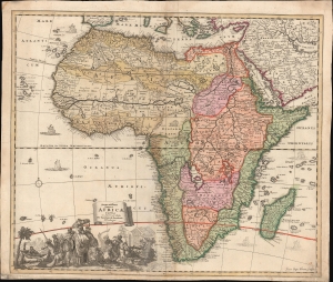
Accuratissima Totius Africae Tabula in Lucem producta per Iacobum de Sandrart Norimbergae.
sold
- Digital Map Information
- Suitable for large format printing
- DPI: 600
- File Size: 31.93 MB
- File Type: ZIP / TIFF
- ICC color profile embedded
- Delivered instantly via download link
This is Jacob Sandrart's scarce, separately published 1697 map of Africa. While cartographically derived from Frederic de Wit's influential 1670 Totius Africae Accuratissima Tabula, this map is notable for being the first or second signed engraving by Johann Baptist Homann, the most important German map publisher of the 18th-century. This map's production in 1697 just preceded the opening of Homann's Nuremberg publishing house in 1702. (more details)
Superb Original Color.
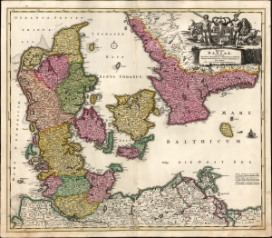
Regni Daniae in quo sunt Ducatus Holsatia et Slesvicum, Insulae Danicae Provinciae Iutia Scania Blekingia etc. Nova Tabula edita á Io. Baptista Homanno Noribergae.
sold
- Digital Map Information
- Suitable for large format printing
- File Size: 24.05 MB
- File Type: ZIP / TIFF
- ICC color profile embedded
- Delivered instantly via download link
A beautiful, original color example of Johann Baptist Homann's 1702 map of Denmark. One of Homann's earliest works, this was probably engraved by the Johann Baptist Homann himself during his brief apprenticeship under David Funcke. It is a bold and elegant engraving typical of the elder Homann. (more details)
Celebrating the Holy League's 1699 victory over the Ottoman Empire.
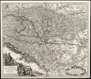
Regnorum Hungariae, Dalmatiae, Croatiae, Sclavoniae, Bosniae, Serviae et Principatus Transylvaniae novissima exhibiteo facta A Io. Bapt. Homann Norimb.
sold
- Digital Map Information
- Suitable for large format printing
- Full resolution TIFF file
- ICC color profile embedded
- Delivered instantly via download link
This is a first plate, first state example of Johann Baptist Homann's 1701 map of the Kingdoms of Hungary and the Balkans, produced in celebration of the 1699 victory of the Holy League following the Great Turkish War (1683 - 1699), concluded by the Ottoman Empire's surrender at the Treaty of Karlowitz. Consequently, this represented the new frontier with the Ottoman Empire following the treaty, spanning from the border of Poland in the north to Albania in the south. (more details)
Contest for Control of Northern Italy.
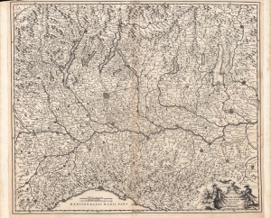
S.R.I. Feudum Ducatus Mediolanensis In Suas Principales Partes Exacte Divisus.
sold
- Digital Map Information
- Suitable for large format printing
- Full resolution TIFF file
- ICC color profile embedded
- Delivered instantly via download link
A scarce, early map by Johann Baptist Homann, published c. 1705, depicting a wide region around Milan, including Lombardy, Piedmont, Trentino-Alto Adige, and much of Switzerland. It was produced during the War of the Spanish Succession (1700 - 1715), when northern Italy was one of several battlefields contested by rival Habsburg and Bourbon forces. (more details)
First Plate - most desirable Homann Map of America.
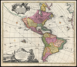
Totius Americae Septentrionalis et Meridionalis.
sold
- Digital Map Information
- Suitable for large format printing
- DPI: 600
- File Size: 54.51 MB
- File Type: ZIP / TIFF
- ICC color profile embedded
- Delivered instantly via download link
This is the scarce first plate of Johann Baptist Homann's 1707 map of America, in a beautiful original color example. It has been long misunderstood and miscataloged. The present example is the first plate, engraved by the elder Homann before 1707. Most examples of the map of this title appearing on the market are a different plate, engraved by Homann's son after 1724 (identified by the Imperial privilege). Thus, the present example is the most desirable Homann map of America. (more details)
The first comparative chart of the Moon from which the names of many lunar features have been derived.
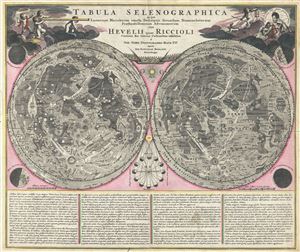
Tabula Selenographica in qua Lunarium Macularum exacta Descriptio secundum Nomenclaturam Praestantissimorum Astronomorum tam Hevelii quam Riccioli Curiosis Rei Sidereae Cultoribus exhibetur Joh. Babr. Doppelmajero Math. P.P. upera Joh. Baptistae Homanni Norinbergae.
sold
- Digital Map Information
- Suitable for large format printing
- Full resolution TIFF file
- ICC color profile embedded
- Delivered instantly via download link
A stunning full color example of J. B. Homann and Johann Gabriel Doppelmayr's important c. 1742 map of the Moon. Essentially a comparative chart, Doppelmayer constructed this map to illustrate the lunar mapping of Johannes Hevelius (left) and Giovanni ... (more details)
The first comparative chart of the Moon.
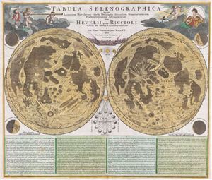
Tabula Selenographica in qua Lunarium Macularum exacta Descriptio secundum Nomenclaturam Praestantissimorum Astronomorum tam Hevelii quam Riccioli Curiosis Rei Sidereae Cultoribus exhibetur Joh. Babr. Doppelmajero Math. P.P. upera Joh. Baptistae Homanni Norinbergae.
sold
- Digital Map Information
- Suitable for large format printing
- DPI: 300
- File Size: 20.87 MB
- File Type: ZIP / TIFF
- ICC color profile embedded
- Delivered instantly via download link
A stunning full color example of J. B. Homann and Johann Gabriel Doppelmayr's important c. 1742 map of the Moon. Essentially a comparative chart, Doppelmayer constructed this map to illustrate the lunar mapping of Johannes Hevelius (left) and Giovanni ... (more details)
Homann's Depiction of Asia, with Elaborate Baroque Cartouches.
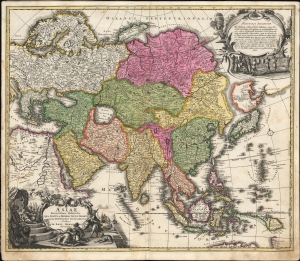
Asiae Receintissima Delineatio. Qua Status et Imperia Totius Orientis unacum Orientalibus Indiis exhibentur Authore Io. Bapt. Homanno Norimbergae.
sold
- Digital Map Information
- Suitable for large format printing
- File Size: 28.34 MB
- File Type: ZIP / TIFF
- ICC color profile embedded
- Delivered instantly via download link
This is Johan Baptist Homann's first map of Asia, in a bold, attractively-colored example of its 1707 first plate. It presents the state of the art of mapping the eastern extreme of the Asian continent, working to reconcile the geography of Nicolas Witsen with De Vries and other explorers of the Pacific. It incorporates the Dutch discoveries in Australia and the East Indies, as well as Dampier's explorations as recently as 1700. Its elaborate allegorical cartouches are executed with the skill and beauty associated with the earliest iterations of Homann's maps. (more details)
Bringing the Baroque into the Scientific Age: Precursor to Zurner's famous map.
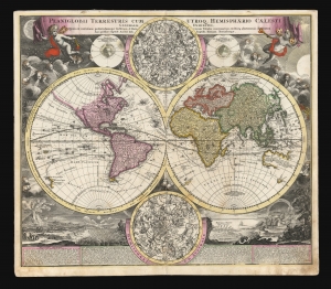
Planiglobii Terrestris Cum Utroq. Hemisphaerio Caelesti Generalis Exhibitio.
sold
- Digital Map Information
- Suitable for large format printing
- DPI: 600
- File Size: 77.87 MB
- File Type: ZIP / TIFF
- ICC color profile embedded
- Delivered instantly via download link
This is the scarce first plate of Johann Baptist Homann's 1707 map of the world in a double hemisphere projection. It is both long misunderstood and mis-identified: it was a novel and influential adaptation of up-to-date cartographic information (including the explorations of Dampier and the studies of Edmund Halley). Moreover, the present example is the first plate, engraved by or for the elder Homann in 1707. Most examples of the map of this title appearing on the market are a different plate, engraved by Homann's son no earlier than 1724 (identified by the Imperial privilege.) Thus the present example is the most desirable of Homann's world maps. (more details)
Homann's Depiction of Christian Europe Eclipsed by an Eclipse.
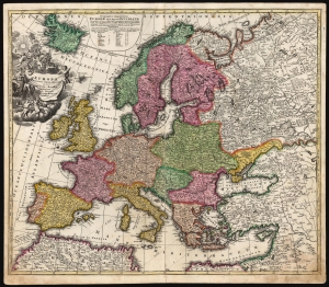
Europa Christiani Orbis Domina in sua Imperia, Regna, et Status exacte divisa per Johan Bapt. Homann Norimbergae.
sold
- Digital Map Information
- Suitable for large format printing
- DPI: 600
- File Size: 70.73 MB
- File Type: ZIP / TIFF
- ICC color profile embedded
- Delivered instantly via download link
This is a scarce early example of Johann Baptist Homann's 1707 map of Europe presenting, in collaboration with mathematician J. Gabriel Doppelmayr, the progress of the May 12, 1706 eclipse of the sun. (more details)
Homann Presents the Revelations of Christiaan Huygens.
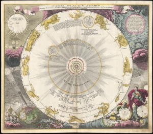
Systema Solare Et Planetarium ex hypothesi Copernicana secundum elegantissimas Illustrissimi quondam Hugenij deductiones novissime collectum et exhibitum.
sold
- Digital Map Information
- Suitable for large format printing
- DPI: 600
- File Size: 68.12 MB
- File Type: ZIP / TIFF
- ICC color profile embedded
- Delivered instantly via download link
This is a scarce, early example of Johann Baptist Homann's 1707 celestial chart displaying the solar system following the Copernican, sun-centered model - using the calculations appearing in Dutch astronomer and mathematician Christiaan Huygens' Cosmotheros, published posthumously in 1698. (more details)
Tabula Generalis Iutiae
sold
- Digital Map Information
- Suitable for large format printing
- Full resolution TIFF file
- ICC color profile embedded
- Delivered instantly via download link
This is a historically important and spectacular 1710 Homann map part of Denmark. Formally titled ''Tabula Generalis Iutiae.'' Features a decorative title cartouche including Poseidon and others. Johann Baptist Homann (1663-1724), his son, Christoph ... (more details)
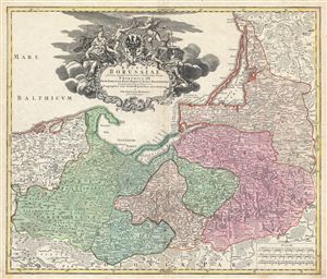
Regnum Borussiae Gloriosis auspicys Serenissimi et Potentissimi Prin Friderich III.
sold
- Digital Map Information
- Suitable for large format printing
- DPI: 300
- File Size: 20.59 MB
- File Type: ZIP / TIFF
- ICC color profile embedded
- Delivered instantly via download link
A stunning c. 1710 map of the Baltic coast consisting of northern Poland (Borussiae), Konigsburg (Kaliningrad), and parts of Lithuania, by the Nurmburg cartographer J. B. Homann. The map covers from German Pomerania eastward to Lithuania and Belarus ... (more details)
Twelve Tribes of Israel, with Exodus vignettes.

Judaea seu Palæstina ob Sacratissima Redemtoris vestigia hodie dicta Terra Sancta prout olim in duodecim tribus divisa, seperatis ab invicem Regnis Iuda et Israel expressis in super VI. ultimi temporis ejusdem Terræ Provinciis.
sold
- Digital Map Information
- Suitable for large format printing
- File Size: 24.11 MB
- File Type: ZIP / TIFF
- ICC color profile embedded
- Delivered instantly via download link
This is a beautiful example of J. B. Homann's 1707 map of the Holy Land. As Homann noted in the map's title, it is derived from the work of the French mapmaker Guillaume Sanson (1633 - 1703). (more details)
Eruption of a new island in the Santorini Caldera.
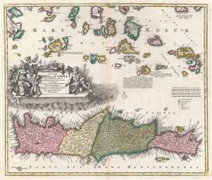
Insula Creta hodie Candia in sua IV Territoria divisa.
sold
- Digital Map Information
- Suitable for large format printing
- DPI: 600
- File Size: 25.53 MB
- File Type: ZIP / TIFF
- ICC color profile embedded
- Delivered instantly via download link
This dramatic c. 1710 map of Crete and the Greek Islands was engraved for inclusion in the atlases of J. B. Homann. In terms of the island's topography, it is largely based on the maps of Sanson from the prior century, but this older cartography frames fresh and astonishing information: the emergence of a new island, as part of the Santorini Archipelago. (more details)
Magnificent Allegorical Title Page.
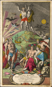
Atlas Novus Terrarum Orbis Imperia, Regna et Status exactis Tabulis Geographicè demonstrans, Operâ Iohannis Baptistae Homanni Norimbergae.
sold
- Digital Map Information
- Suitable for large format printing
- File Size: 18.69 MB
- File Type: ZIP / TIFF
- ICC color profile embedded
- Delivered instantly via download link
This is a beautiful example of the allegorical title page of Johann Baptist Homann's 1707 Atlas Novus, engraved by Amsterdam artist Caspar Luyken. Its classical themes connect Homann's modern cartography to the classical themes embraced by the map publishers of the previous century. (more details)
A fine decorative map depicting colonial America during the Spanish War of Succession.
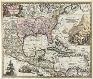
Regni Mexicani seu Novae Hispaniae, Floridae, Novae Angliae, Carolinae, Virginiae et Pensylvaniae, nec non Insularum, Archipelagi Mexicani in America Septentrionali.
sold
- Digital Map Information
- Suitable for large format printing
- DPI: 300
- File Size: 19.94 MB
- File Type: ZIP / TIFF
- ICC color profile embedded
- Delivered instantly via download link
A fine first state example of J. B. Homann's decorative 1712 map of Mexico, Florida, New england, the West Indies, and the Mississippi Valley (Louisiana). Centered on the Mississippi River Valley, Homann's map covers from Sinaloa (Mexico) eastwards ... (more details)
Propaganda for Spotswood's settlement of Germans in Virginia: First State.
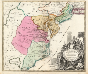
Virginia Marylandia et Carolina in America Septentrionali Britannorum industria excultae…
sold
- Digital Map Information
- Suitable for large format printing
- Full resolution TIFF file
- ICC color profile embedded
- Delivered instantly via download link
A striking example of Johann Baptist Homann's c. 1715 map of Virginia, Carolina, Maryland, and New Jersey, considered one of the most important maps of this region to appear in the 18th century, here in its first state. Homann drew this map to advocate for Virginia Lieutenant-Governor Alexander Spotswood's 1714 - 1717 plan to settle the little-known interior of Virginia with German immigrants. Shown here is the first mapping of 'Germantown Teutsche Statt' (Germanna) on the Rapidan River, a fork of the Rappahannock River, Fort Christanna (Christ Anna Fort) on the Makharing River, and 'Miester Krugs Plantasie' on the James River. The omission of Spotswood's connection to this map has long led it to be misunderstood and dismissed by scholars. (more details)
First map to depict the Spottswood plan for German settlement in the Virginia interior.
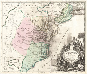
Virginia Marylandia et Carolina In America Septentrionali Britannorum industria excultae…
sold
- Digital Map Information
- Suitable for large format printing
- Full resolution TIFF file
- ICC color profile embedded
- Delivered instantly via download link
An exceptionally beautiful example of J. B. Homann's c. 1715 map of Virginia, Carolina, Maryland, and New Jersey; considered one of the most important and decorative maps of is region to appear in the 18th century. This fine decorative map covers ... (more details)
First map to depict the Spottswood plan for German settlement in the Virginia interior.
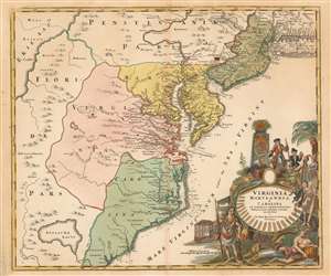
Virginia Marylandia et Carolina in America Septentrionali Britannorum industria excultae…
sold
- Digital Map Information
- Suitable for large format printing
- DPI: 600
- File Size: 27.81 MB
- File Type: ZIP / TIFF
- ICC color profile embedded
- Delivered instantly via download link
A very handsome example of Johann Baptist Homann's c. 1715 map of Virginia, Carolina, Maryland, and New Jersey; considered one of the most important and decorative maps of is region to appear in the 18th century. This fine map covers from New York City and Long Island south along the Atlantic Cost as far as modern day Georgia, and as far west as Lake Erie. Homann drew this map to support of Virginia Lieutenant-Governor Alexander Spotswood's plan to settle the little known interior of Virginia with German immigrants. Shown here is the first mapping of 'Germantown Teutsche Statt' on the Rappahanock River and Fort Christanna (Christ Anna Fort) on the Makharing River. Fort Christanna was built with the intention of defending the region against incursions from hostile American Indian groups such as the Tuscarora to the west. Christanna also acted as the headquarters of the Virginia Indian Company, a joint-stock venture founded in 1714 with the intention of trading with indigenous groups in the interior (more details)
Propaganda for Spotswood's settlement of Germans in Virginia.
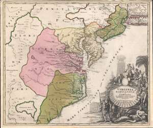
Virginia Marylandia et Carolina in America Septentrionali Britannorum industria excultae…
sold
- Digital Map Information
- Suitable for large format printing
- Full resolution TIFF file
- ICC color profile embedded
- Delivered instantly via download link
A very handsome example of Johann Baptist Homann's c. 1715 map of Virginia, Carolina, Maryland, and New Jersey; considered one of the most important and decorative maps of this region to appear in the 18th century. Homann drew this map to advocate for Virginia Lieutenant-Governor Alexander Spotswood's 1714 - 1717 plan to settle the little-known interior of Virginia with German immigrants. Shown here is the first mapping of 'Germantown Teutsche Statt' (Germanna) on the Rapidan River, a fork of the Rappahanock River, Fort Christanna (Christ Anna Fort) on the Makharing River, and 'Miester Krugs Plantasie' on the James River. Omission of Spotswood's connection to this map have long led it to being misunderstood or outright dismissed by scholars. Coverage extends from New York City and Long Island south along the Atlantic Cost as far as modern-day Georgia, and as far west as Lake Erie. (more details)
First map to depict the Spottswood plan for German settlement in the Virginia interior.
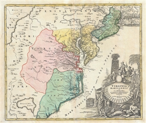
Virginia Marylandia et Carolina In America Septentrionali Britannorum industria excultae…
sold
- Digital Map Information
- Suitable for large format printing
- DPI: 300
- File Size: 18.63 MB
- File Type: ZIP / TIFF
- ICC color profile embedded
- Delivered instantly via download link
An exceptionally beautiful example of J. B. Homann's c. 1715 map of Virginia, Carolina, Maryland, and New Jersey; considered one of the most important and decorative maps of is region to appear in the 18th century. This fine decorative map covers ... (more details)
Propaganda for Spotswood's settlement of Germans in Virginia.
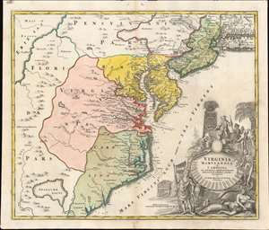
Virginia Marylandia et Carolina in America Septentrionali Britannorum industria excultae…
sold
- Digital Map Information
- Suitable for large format printing
- Full resolution TIFF file
- ICC color profile embedded
- Delivered instantly via download link
A very handsome example of Johann Baptist Homann's c. 1715 map of Virginia, Carolina, Maryland, and New Jersey; considered one of the most important and decorative maps of this region to appear in the 18th century. Homann drew this map to advocate for Virginia Lieutenant-Governor Alexander Spotswood's 1714 - 1717 plan to settle the little-known interior of Virginia with German immigrants. Shown here is the first mapping of 'Germantown Teutsche Statt' (Germanna) on the Rapidan River, a fork of the Rappahanock River, Fort Christanna (Christ Anna Fort) on the Makharing River, and 'Miester Krugs Plantasie' on the James River. Omission of Spotswood's connection to this map have long led it to being misunderstood or outright dismissed by scholars. Coverage extends from New York City and Long Island south along the Atlantic Cost as far as modern-day Georgia, and as far west as Lake Erie. (more details)
Propaganda for Spotswood's settlement of Germans in Virginia.
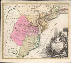
Virginia Marylandia et Carolina in America Septentrionali Britannorum industria excultae…
sold
- Digital Map Information
- Suitable for large format printing
- Full resolution TIFF file
- ICC color profile embedded
- Delivered instantly via download link
A very handsome example of Johann Baptist Homann's c. 1715 map of Virginia, Carolina, Maryland, and New Jersey; considered one of the most important and decorative maps of this region to appear in the 18th century. Homann drew this map to advocate for Virginia Lieutenant-Governor Alexander Spotswood's 1714 - 1717 plan to settle the little-known interior of Virginia with German immigrants. Shown here is the first mapping of 'Germantown Teutsche Statt' (Germanna) on the Rapidan River, a fork of the Rappahanock River, Fort Christanna (Christ Anna Fort) on the Makharing River, and 'Miester Krugs Plantasie' on the James River. Omission of Spotswood's connection to this map have long led it to being misunderstood or outright dismissed by scholars. Coverage extends from New York City and Long Island south along the Atlantic Cost as far as modern-day Georgia, and as far west as Lake Erie. (more details)
The Twelve Tribes of Israel, with vignettes of the Exodus.
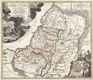
Judæa seu Palæstina ob sacratissima Redemtoris vestigia hodie dicta Terra Sancta prout olim in duodecim tribus divisa, seperatis ab invicem Regnis Iuda et Israel expressis in super VI. ultimi temporis ejusdem Terræ Provinciis.
sold
- Digital Map Information
- Suitable for large format printing
- Full resolution TIFF file
- ICC color profile embedded
- Delivered instantly via download link
This is a beautiful example of J. B. Homann's 1707 map of the Holy Land. As Homann noted in the map's title, it is derived from the work of the French mapmaker Guillaume Sanson (1633 - 1703). The map combines modern geographical information with place names drawn from Biblical history: specifically, the Exodus, and the settlement of the Twelve Tribes of Israel. It depicts the Mediterranean coast from Sidon (in modern-day Lebanon) to Alexandria (not named, but marked with Pompey's Pillar). The territories of the Tribes of Israel are marked, appearing on both sides of the Jordan. Mountains and forest regions are illustrated pictorially. Intriguingly, the Dead Sea contains the ruins of Sodom, Gomorrah, Adama, and Seboim - all destroyed for their sins. (more details)
Man-O'-War, the great warships of the Age of Sail.
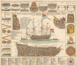
Neue Tafel vor alle Liebhabers und see-fahrende Personen Stellet vor ein Orlog oder Kriegs-Schiff mit seinen volligen Two od Seil Werk Sampt einen Durchgeschnittnen Schiff, auch Vor und Hindertheil Desgleichen Booten, Chaloupen un Schiff-Heber, nebst noch mehr anderer Schiffs Gereth-Schafft und zugehörungen.
sold
- Digital Map Information
- Suitable for large format printing
- File Size: 26.65 MB
- File Type: ZIP / TIFF
- ICC color profile embedded
- Delivered instantly via download link
This is a fascinating 1716 J. B. Homann diagram of a three-masted, 96-gun Man-o'-War - the workhorse warship of 18th-century European navies. Such ships, also called Ships of the Line, dominated the recently-ended War of Spanish Succession (1701 - 1714), making this diagram a subject of great interest to the educated European populace. (more details)
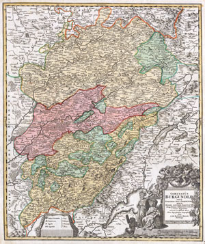
Comitatus Burgundiae tam in Primarias Ejus Praefecturas quam in Minores Earundem Balliviat aliasq, Ditiones Gubjacentes Eninfert a vicinis Regionibus accurate et diftinete divisi Nova Representation Geographic facta A Joh. Baptista Homano Noribergae..
sold
- Digital Map Information
- Suitable for large format printing
- DPI: 300
- File Size: 10.72 MB
- File Type: ZIP / TIFF
- ICC color profile embedded
- Delivered instantly via download link
A fine example of Homann's 1716 map of Burgundy, one of France's most important wine regions. Extends to include Lake Geneva in the southwest, Lorraine in the north, Champaigne (Champagne) and Angers to the northwest and Bourgogne to the west. ... (more details)
Labels Rome, Florence, and Pisa.
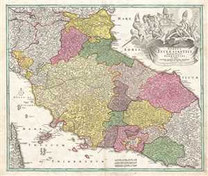
Status Ecclesiastici Magnique Ducatus Florentini.
sold
- Digital Map Information
- Suitable for large format printing
- DPI: 300
- File Size: 13.63 MB
- File Type: ZIP / TIFF
- ICC color profile embedded
- Delivered instantly via download link
This is a 1716 Johann Baptist Homann map of central Italy. The map depicts the region from Cremona and Corsica to the Adriatic Sea and from Mantua to the Gulf of Gaeta and the Tyrrhenian Sea. Meticulously detailed, Italy is divided into the ... (more details)
Iconic 18th century map of Ireland.
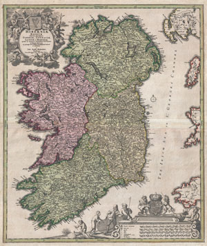
Hiberniae Regnum tam in Praecipuas Ultoniae, Connaciae, Laceniae et Momoniae quam in Minores Earundem Provincias
sold
- Digital Map Information
- Suitable for large format printing
- DPI: 300
- File Size: 20.41 MB
- File Type: ZIP / TIFF
- ICC color profile embedded
- Delivered instantly via download link
An iconic c. 1716 map of Ireland by Johann Baptist Homann. A fine example of Homann's work, this map bears all of the distinctive hallmarks of Homann's style at the height of his career: a strong dark impression, heavy yet detailed ... (more details)
The finest example of Homann's significant map of New England.
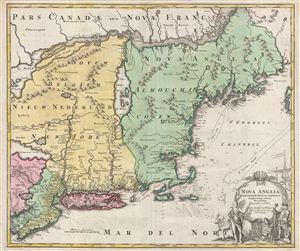
Nova Anglia Septentrionali Americae Implantata Anglorumque Coloniis Florentissima Geographice Exhibita a Joh. Baptista Homann.
sold
- Digital Map Information
- Suitable for large format printing
- DPI: 300
- File Size: 2.51 MB
- File Type: ZIP / TIFF
- ICC color profile embedded
- Delivered instantly via download link
A significant though often overlooked piece, this is J. B. Homann's c. 1716 map of New England, New York, and New Jersey. Though titled 'Nova Anglia,' (New England) Homann's map actually covers a much broader area from New France (Canada) to the Delaware Bay, and from Philadelphia to Nova Scotia, inclusive of all of New England, New York, and New Jersey, as well as parts of adjacent Canada and Pennsylvania. The map identifies both European and American Indian settlements, differentiating between the two by rendering indigenous settlements as pictorial villages, huts and all, and European towns as small circles, major cities like Philadelphia and Boston being the exception. (more details)
An iconic map of New York and New Engalnd!
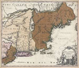
Nova Anglia Septentrionali Americae Implantata Anglorumque Coloniis Florentissima Geographice Exhibita a Joh. Baptista Homann.
sold
- Digital Map Information
- Suitable for large format printing
- DPI: 300
- File Size: 17.27 MB
- File Type: ZIP / TIFF
- ICC color profile embedded
- Delivered instantly via download link
Full Sale Price Donated to COVID-19 Relief.
A significant though often overlooked piece, this is J. B. Homann's c. 1716 map of New England, New York, and New Jersey. Though titled 'Nova Anglia,' (New England) Homann's map actually covers a much broader area from New France (Canada) to the Delaware Bay, and from Philadelphia to Nova Scotia, inclusive of all of New England, New York, and New Jersey, as well as parts of adjacent Canada and Pennsylvania. The map identifies both European and American Indian settlements, differentiating between the two by rendering indigenous settlements as pictorial villages, huts and all, and European towns as small circles, major cities like Philadelphia and Boston being the exception. (more details)
A significant though often overlooked piece, this is J. B. Homann's c. 1716 map of New England, New York, and New Jersey. Though titled 'Nova Anglia,' (New England) Homann's map actually covers a much broader area from New France (Canada) to the Delaware Bay, and from Philadelphia to Nova Scotia, inclusive of all of New England, New York, and New Jersey, as well as parts of adjacent Canada and Pennsylvania. The map identifies both European and American Indian settlements, differentiating between the two by rendering indigenous settlements as pictorial villages, huts and all, and European towns as small circles, major cities like Philadelphia and Boston being the exception. (more details)
Cartouche to the doomed Emperor Charles XII.
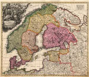
Scandinavia complectens Sueciae, Daniae et Norvegiae Regna ex tabula Joh Bapistae Homanni.
sold
- Digital Map Information
- Suitable for large format printing
- Full resolution TIFF file
- ICC color profile embedded
- Delivered instantly via download link
This is Johann Baptist Homann's 1716 map of Scandinavia, bringing the dominant 17th century mapping of the northern parts of Europe up-to-date with the events of the Great Northern War (1700 - 1721). The map is based primarily on Anders Bure's 1626 mapping of the region, which became the state of the art of the mapping of Scandinavia and was replaced as an authority for more than a century. In this regard, Bure is hailed as the Father of Swedish Cartography. The scope of the map includes Denmark, Norway, the greater Swedish Empire, the Baltic coasts of Germany, Poland and Livonia, and the Russian Empire - including 'Lapponia Moscovitica,' the portions of Lapland occupied by Russia. (more details)
Bears an illustration of Mount Vesuvius spewing smoke.
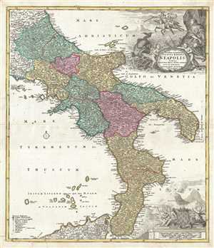
Novissima et exactissima Totius Regni Neapolis.
sold
- Digital Map Information
- Suitable for large format printing
- DPI: 300
- File Size: 12.65 MB
- File Type: ZIP / TIFF
- ICC color profile embedded
- Delivered instantly via download link
This is a 1716 Johann Baptist Homann map of southern Italy. The map depicts the region from Terracina to the Adriatic Sea and from the Adriatic Sea to Sicily. Meticulously detailed, Italy is divided into different regions and ... (more details)
Striking old-color example.
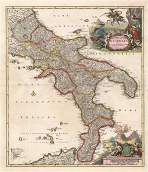
Novissima et exactissima Totius Regni Neapolis Tabula Praesentis Belli Statui Accomodata et Exhibita.
sold
- Digital Map Information
- Suitable for large format printing
- Full resolution TIFF file
- ICC color profile embedded
- Delivered instantly via download link
This is a beautiful, old-color example of Johann Baptist Homann's 1716 map of the Kingdom of Naples, which comprises southern Italy. The map depicts the region from Terracina to the Adriatic Sea, and from the Adriatic Sea to northern Sicily. Countless towns and villages are shown and named, including major cities such as Naples, Messina, and Capua. (more details)
Scarce early map of Asia offering a speculative Hokkaido.
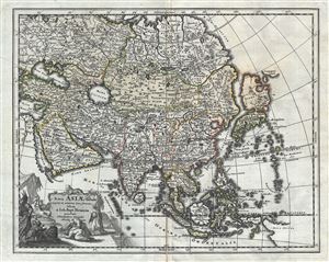
Nova Asiae Tabula e majori in minorem hanc formam reducta a Ioh. Bapt. Homann excudente Christophero Weigelio Noribergae.
sold
- Digital Map Information
- Suitable for large format printing
- DPI: 300
- File Size: 8.07 MB
- File Type: ZIP / TIFF
- ICC color profile embedded
- Delivered instantly via download link
A scarce 1719 Christopher Weigel and J. B. Homann map of Asia. Based upon an earlier map of J. B. Homan, this Weigel reduction covers all of Asia from the Black Sea to Japan and from Nova Zembla to New Guinea. There is an ... (more details)
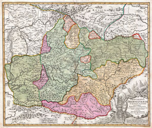
Principatus Transilvaniae in quinque Nationes earum'que Regiones es comitatus cum finitimis vicinorum Statuum Provinciis accuraté divisus.
sold
- Digital Map Information
- Suitable for large format printing
- DPI: 300
- File Size: 20.96 MB
- File Type: ZIP / TIFF
- ICC color profile embedded
- Delivered instantly via download link
A striking example of J. B. Homann's c. 1716 map of Transylvania. Covers what is today the northern part of Romania from the Bereton River eastward as far as Castle Boza. Color coded according to district with superb detail ... (more details)
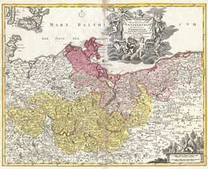
Tabula Marchionatus Brandenburgici et Ducatus Pomeraniae quae sunt Pars Septentrionalis Circuli Saxoniae Superioris…
sold
- Digital Map Information
- Suitable for large format printing
- Full resolution TIFF file
- ICC color profile embedded
- Delivered instantly via download link
A fine example of J. B. Homann's c. 1720 map Brandenburg and Pomerania, Germany. Shows Frankfurt, Brandenburg and Berlin. Also includes parts of Denmark and much of Poland. The map is filled with information including ... (more details)
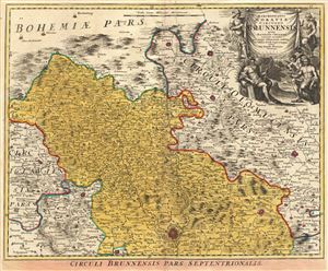
Marchionatus Moraviae Circulus Brunnensis quem Mandato Caesareo.
sold
- Digital Map Information
- Suitable for large format printing
- DPI: 300
- File Size: 21.72 MB
- File Type: ZIP / TIFF
- ICC color profile embedded
- Delivered instantly via download link
This is a scarce and attractive c. 1720 J. B. Homann map of Brunnensis in the historic region of Central Europe, part of modern day Czech Republic. The map covers the region from Hlinsko to Mohelno in great detail. ... (more details)
Depicts 'Gamaland', Lake Apalachy, and Lake Xarayes!
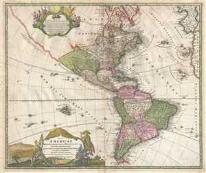
Totius Americae Septentrionalis et Meridionalis. Novissima Repraesentatio.
sold
- Digital Map Information
- Suitable for large format printing
- DPI: 300
- File Size: 11.47 MB
- File Type: ZIP / TIFF
- ICC color profile embedded
- Delivered instantly via download link
This is a 1720 Johann Baptiste Homann map of North and South America. The map depicts from the Pacific Coast of North and South America to Spain, France, and the Atlantic coast of Africa and from northern Canada and ... (more details)
The shifting fortunes of empires in Eastern Europe.
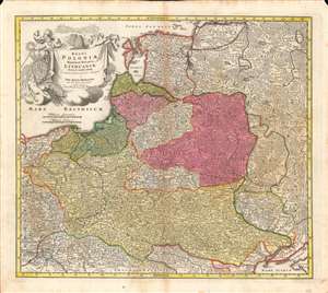
Regni Poloniae magnique Ducatus Lithuaniae...
sold
- Digital Map Information
- Suitable for large format printing
- DPI: 600
- File Size: 59.32 MB
- File Type: ZIP / TIFF
- ICC color profile embedded
- Delivered instantly via download link
Here is a fine example of Johann Baptist Homann's c. 1720 map of the Polish-Lithuanian Commonwealth, covering most of Eastern Europe. It was produced during a transition in the relative balance of power in the region, with Poland-Lithuania itself, Sweden, and the Ottoman Empire waning, and Russia, Prussia, and Austria on the rise. (more details)
The Swedish Empire, Crumbling.
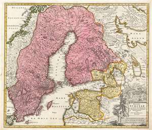
Regni Sueciae in omnes suas Subjacentes Provincias accurate divisi Tabula Generalis edita à Ioh. Bapt. Homanno Noribergae.
sold
- Digital Map Information
- Suitable for large format printing
- Full resolution TIFF file
- ICC color profile embedded
- Delivered instantly via download link
This is Johan Baptist Homann's map of the Kingdom of Sweden, bringing what was the dominant mapping of Sweden and its neighbors up-to-date with the events of the Great Northern War. Homann starts - almost certainly - with Frederic de Wit's 1680 Regni Sueciae but adds detail and placenames that did not exist prior to the 1700–1721 Great Northern War between Sweden and Russia, and particularly before the 1703 capture of the island of Kotlin by Russia from Sweden, the 1703 Russian capture of Nyenskans, and the foundation of the city of St. Petersburg. Also marked is the town of Schlisselburg, formerly Oreshek, which was captured by Russia in 1702 and renamed by Peter the Great during his administrative reforms. An earlier iteration of this map appearing in a 1716 example of the Atlas Novus includes Petersburg and Kronschloss (formerly Kotlin) but does not name Schlüsselburg. That placename would be included in Ingermanland Governorate in 1710 and would in 1727 become part of Sankt-Petersburgsky Uyezd. Many city names have been underlined in an old hand, and, in some cases, placenames have been added. For example, the Finnish city of Wekelax (Veckelax) has had inscribed above it the name 'Fridrichsham.' The city, as originally named on the map, had been burned by the Russians in 1712. Following the peace of 1721, the city was rebuilt, and renamed after Sweden's new King Frederick I. (more details)
The Bufflao Map.

Amplissimae Regionis Mississipi seu Provinciae Ludovicianae a R.P. Ludovico Hennepin Francisc Miss in America Septentrionali Anno 1687. Detectae, Nunc Gallorum Coloniis et Actionum Negotiis Toto Orbe Celeberrimae.
sold
- Digital Map Information
- Suitable for large format printing
- DPI: 300
- File Size: 20.99 MB
- File Type: ZIP / TIFF
- ICC color profile embedded
- Delivered instantly via download link
An iconic c. 1720 map of the Mississippi River Valley by Johann Baptiste Homann. Commonly called the 'Buffalo Map' for its distinctive decorative elements depicting a stylized buffalo, this map is derived from an earlier 1718 map of the same region by G. De L'Isle, although it has been enlarged to include New England. (more details)
Iconic 'Buffalo Map.'
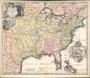
Amplissimae Regionis Mississipi seu Provinciae Ludovicianae a R.P. Ludovico Hennepin Francisc Miss in America Septentrionali Anno 1687. Detectae, Nunc Gallorum Coloniis et Actionum Negotiis Toto Orbe Celeberrimae.
sold
- Digital Map Information
- Suitable for large format printing
- File Size: 24.55 MB
- File Type: ZIP / TIFF
- ICC color profile embedded
- Delivered instantly via download link
An iconic c. 1720 map of the Mississippi River Valley by Johann Baptiste Homann, commonly called the 'Buffalo Map' for its distinctive decorative elements. It is among the most striking and compelling maps of the region to appear in the early 18th century. (more details)
The iconic Bufflao Map.
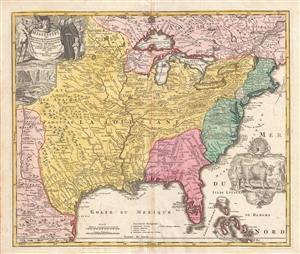
Amplissimae Regionis Mississipi seu Provinciae Ludovicianae a R.P. Ludovico Hennepin Francisc Miss in America Septentrionali Anno 1687. Detectae, Nunc Gallorum Coloniis et Actionum Negotiis Toto Orbe Celeberrimae.
sold
- Digital Map Information
- Suitable for large format printing
- DPI: 300
- File Size: 17.79 MB
- File Type: ZIP / TIFF
- ICC color profile embedded
- Delivered instantly via download link
An iconic c. 1720 map of the Mississippi River Valley by Johann Baptiste Homan. Commonly called the 'Buffalo Map' for its distinctive decorative elements depicting a stylized buffalo, this map is derived from an ... (more details)
Marking the New Borders with the Ottoman Empire.
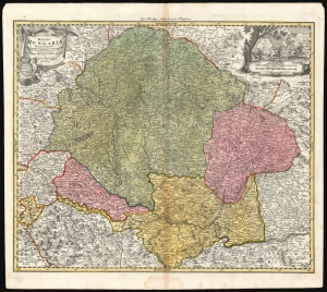
Regni Hungariae tabula generalis ex archetypo Mülleriano SCM capit. et ing.
sold
- Digital Map Information
- Suitable for large format printing
- DPI: 600
- File Size: 73.65 MB
- File Type: ZIP / TIFF
- ICC color profile embedded
- Delivered instantly via download link
This is Johann Baptist Homann's 1724 map of the Kingdom of Hungary, based on the comprehensive 1699 surveys of Johann Christoph Müller. These were undertaken to measure the bounds of Hungary following the Ottoman Empire's surrender at the treaty of Karlowitz. Consequently, this represented the new frontier with the Ottoman Empire following the treaty. (more details)
The Only Glimpse of Strahlenberg's Second Lost Map.
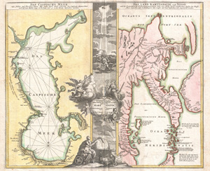
Geographica Nova ex Oriente Gratiosissima, Duabus Tabulis Special. contenta, quarum Una Mare Caspium, Altera Kamtzadaliam, seu Terram Jedso.
sold
- Digital Map Information
- Suitable for large format printing
- DPI: 300
- File Size: 26.86 MB
- File Type: ZIP / TIFF
- ICC color profile embedded
- Delivered instantly via download link
One of Johann Christoph Homann's most interesting and influential works: his 1725 map of the Caspian Sea, and an extremely up-to-date map of Kamchatka. Two maps in one, it juxtaposes two opposite parts of Asia: the Caspian Sea at the western border of Asia and Europe, and the Peninsula of Kamchatka, the easternmost known point in continental Asia. (more details)
War over the Caucasus.
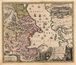
Provinciarum Persicarum Kilaniae nempe Chirvaniae Dagestaniae.
sold
- Digital Map Information
- Suitable for large format printing
- DPI: 600
- File Size: 73.11 MB
- File Type: ZIP / TIFF
- ICC color profile embedded
- Delivered instantly via download link
This map, printed by Johann Baptist Homann and published by his son Johann Christoph Homann, focuses on the Caucuses, now occupied by modern-day Dagestan, Azerbaijan, Armenia, and Iran, on the western coast of the Caspian Sea. The inset view at the upper right depicts Terek, which appears on the map at its northern extent. This was the main outpost of the Terek Cossacks, Russia's vassals on the Empire's Caucasus frontier. (more details)
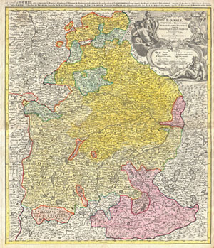
Bavariae Circulus et Electorat Insuadquasque Ditiones tam cum Adiacentibus Quam Insertis Regionibus accuratissime divisus part Jo: Baptistam Homannum Norimbergae. / La cercle de Baviere, qui comprend la regence d'Amberg …
sold
- Digital Map Information
- Suitable for large format printing
- Full resolution TIFF file
- ICC color profile embedded
- Delivered instantly via download link
This is a rare and attractive map of Bavaria, Germany. Covers from Rabiz as far south as Innsbruck, including Munich, Salzburg, Passau, Bamberg, Nuremberg and Augsburg. Detail includes cities, forts, some ... (more details)