
NEW ACQUISITIONS
First atlas issue of Mercator's map of the lands of the Crimean Tatars.
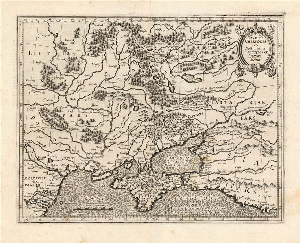
Taurica Chersonesus. Nostra aetate Przecopsca et Gazara dicitur.
$900.00
Acquire
- Digital Map Information
- Suitable for large format printing
- DPI: 600
- File Size: 34.31 MB
- File Type: ZIP / TIFF
- ICC color profile embedded
- Delivered instantly via download link
This is the 1595 first state of Mercator's map of the Crimea, still known to geographers by its Ptolemaic name of Taurica Chersonesus. The engraving is bold and sharp - a product of the youth of the copperplate. Many recognizable place names can be found on this detailed map, including Kiev, Moscow, Smolensk, and Chernobyl. The course of the Dniepr river is particularly well detailed. The primary focus of this map, however, is Muscovy's extremely fluid southeastern border with the Crimean Tatars. The border garrisons of Ryazan (Rezan on the map) and the Crimea suffered yearly assaults from the steppes. Moscow’s response - the annual raising of an army of tens of thousands to patrol this border - was instrumental in developing the centralized power of the Tsar in the 16th and 17th centuries. (more details)
Remarkable mining imagery.
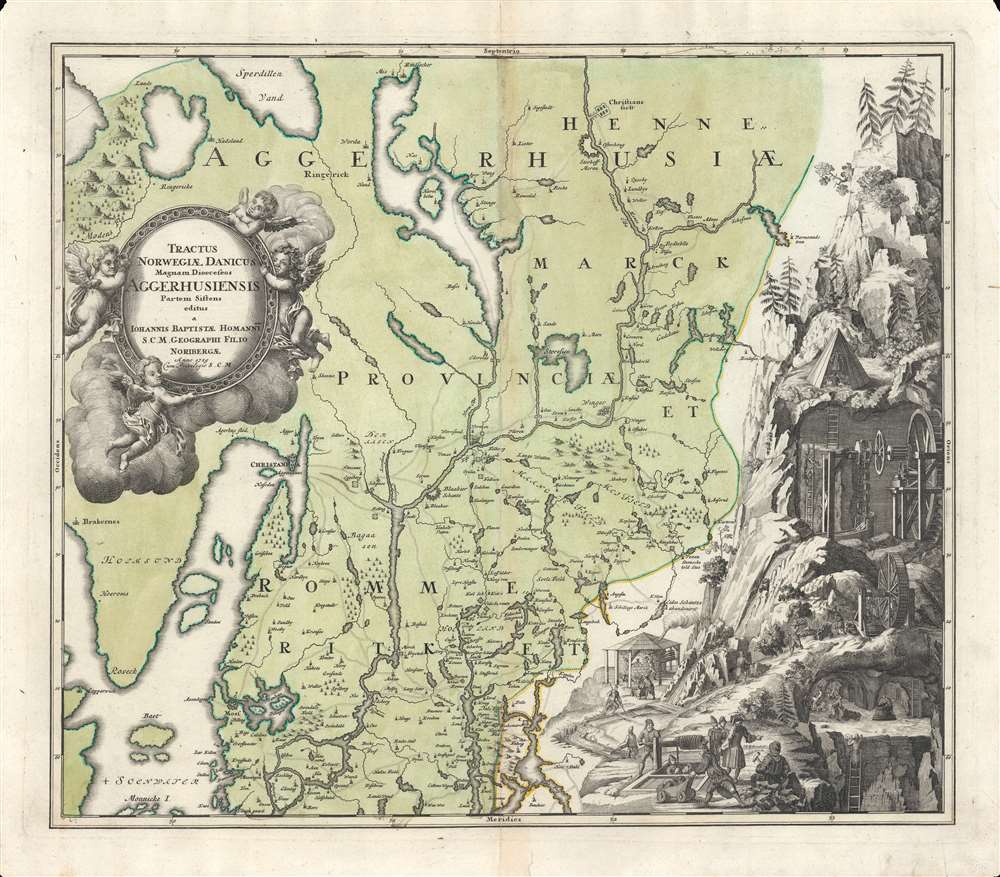
Tractus Norvegiae Danicus Magnam Dioeceseos Aggerhusiensis.
$600.00
Acquire
- Digital Map Information
- Suitable for large format printing
- DPI: 600
- File Size: 61 MB
- File Type: ZIP / TIFF
- ICC color profile embedded
- Delivered instantly via download link
Here is Johann Baptist Homann's 1729 map of the county of Akershus, surrounding Oslo (Christiana), Norway. Aside from its geographic detail, it is distinguished by a large, intricate mining vignette at right - a fascinating insight into 18th-century European mine engineering. (more details)
Using American commercial airlines to transport military supplies.
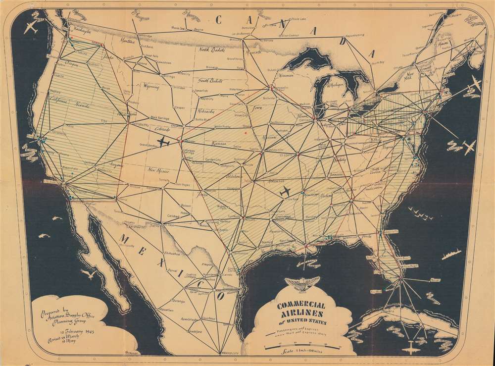
Commercial Airlines of United States.
$550.00
Acquire
- Digital Map Information
- Suitable for large format printing
- File Size: 82.73 MB
- File Type: ZIP / TIFF
- ICC color profile embedded
- Delivered instantly via download link
This is a 1945 Aviation Supply Office Planning Group map of the United States showing airline routes. The pictorial map illustrates a little-known but significant element of the American mobilization for World War II (1939 - 1945) - the nationalization and utilization of commercial aircraft to support the war effort. (more details)
Beautiful Late Medieval Town.
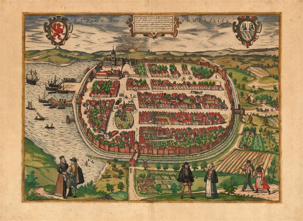
Die Fürstlich Sehestat Barth in Pommern.
$500.00
Acquire
- Digital Map Information
- Suitable for large format printing
- DPI: 600
- File Size: 49.18 MB
- File Type: ZIP / TIFF
- ICC color profile embedded
- Delivered instantly via download link
This is a scarce, beautiful, original color example of Braun and Hogenberg's 1593 bird's-eye view of the city of Barth in Germany, then the capital of the Duchy of Pomerania-Barth. (more details)
Includes a manuscript letter written home to his mother by a soldier in training in Colorado in 1943.
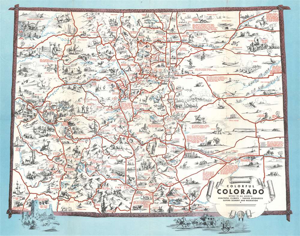
Colorful Colorado Offers to All America Healthful Climate Varied Resources Superb Scenery and Recreation.
$400.00
Acquire
- Digital Map Information
- Suitable for large format printing
- Full resolution TIFF file
- ICC color profile embedded
- Delivered instantly via download link
This is a unique 1943 Ray Schmidt pictorial map of Colorado bearing a letter home from a soldier training to fight in World War II on the verso. (more details)
From cockfights to cricket.
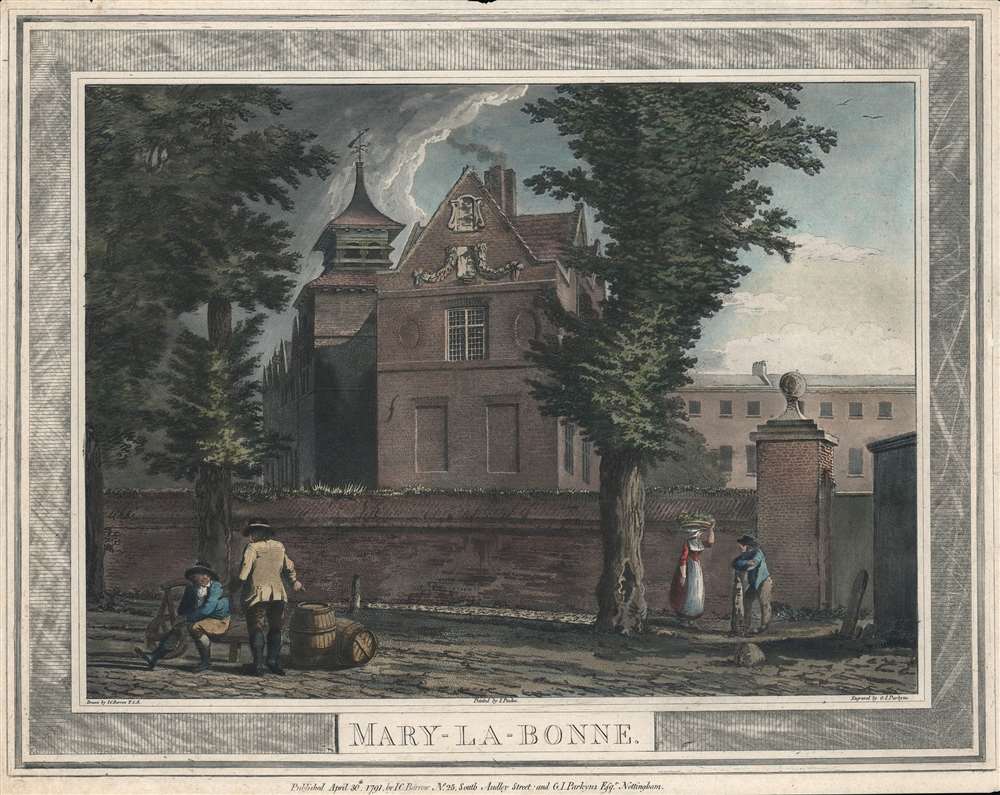
Mary-la-Bonne.
$400.00
Acquire
- Digital Map Information
- Suitable for large format printing
- DPI: 600
- File Size: 26.68 MB
- File Type: ZIP / TIFF
- ICC color profile embedded
- Delivered instantly via download link
This is a 1791 print depicting the Marylebone Manor House in the eponymous Marylebone neighborhood of London. The area underwent rapid development in the 18th century, from a rural and somewhat disreputable parish to a posh neighborhood containing the London homes of country nobility. (more details)
Go for a cruise around Biscayne Bay!
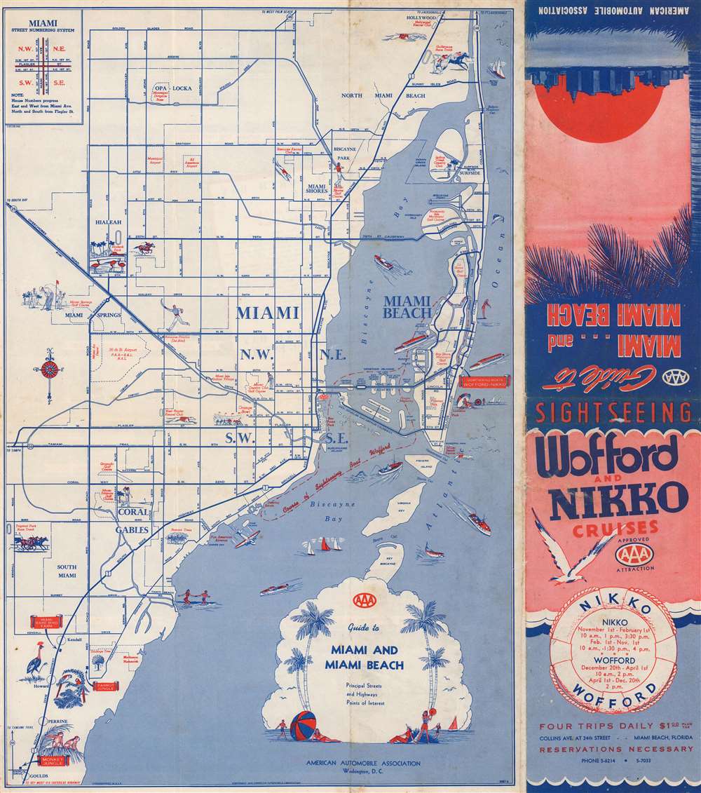
Guide to Miami and Miami Beach.
$250.00
Acquire
- Digital Map Information
- Suitable for large format printing
- Full resolution TIFF file
- ICC color profile embedded
- Delivered instantly via download link
This is a 1945 American Automobile Association city map of Miami and Miami Beach, Florida. Distributed by Wofford and Nikko Cruises, the 'course of Sightseeing Boat Wofford' appears as a dashed line within Biscayne Bay, under the two causeways connecting Miami and Miami Beach, and along Miami's coastline from the Venetian Causeway to the Deering Estate. Pictorial vignettes highlight the Orange Bowl, the West Flagler Kennel Club, Hialeah Park, and the Miami Springs Golf Course. Vignettes also promote the Parrot Jungle, Monkey Jungle, and Miami Rare Bird Farm in South Miami. Red text also identifies numerous city parks, the 36th Street Airport, the Pan American flying boat terminal, and several golf courses. (more details)
Graphically wonderful Japanese world aviation board game.
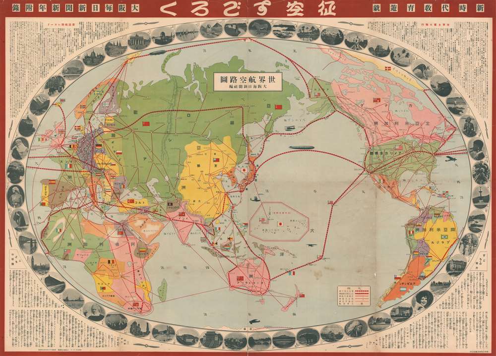
世界航空路圖 / Sekai kōkūrozu. / World Aviation Route Map. / 征空すごろく/ Seikū su-goro ku.
$700.00
Acquire
- Digital Map Information
- Suitable for large format printing
- File Size: 212.57 MB
- File Type: ZIP / TIFF
- ICC color profile embedded
- Delivered instantly via download link
A rare 1930 or Showa 5 Japanese pictorial map of the world and sugoroku game. Presented on a Mollweide projection and centered on Japan, this map illustrates the entire world and historic flights paths are highlighted in red. The historic flights noted include the Circumnavigation of World by the United States Army Air Corps (USAAC) in 1924, Charles Lindbergh’s Solo Transatlantic Flight (May 20-21, 1927), the Airship Italia’s route to the North Pole (1928), and the Circumnavigation by the Graf Zeppelin airship in 1929. The map proper is surrounded by 52 vignette images illustrating global capitals, countryside, flora, fauna, and culture. (more details)
A rare early 19th European century map of China.
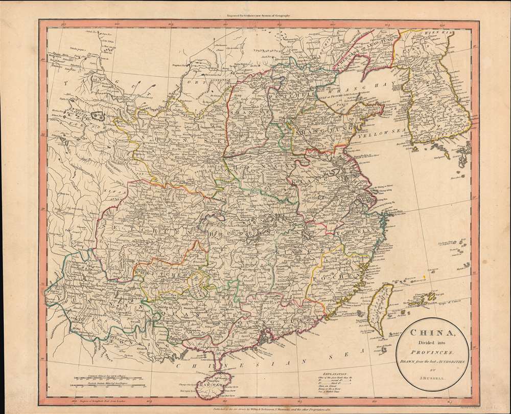
China divided into provinces drawn from the best authorities.
$600.00
Acquire
- Digital Map Information
- Suitable for large format printing
- DPI: 600
- File Size: 43.85 MB
- File Type: ZIP / TIFF
- ICC color profile embedded
- Delivered instantly via download link
John Russell's scarce map of China, produced for the atlas to the 1811 edition of William Guthrie's A System of Modern Geography. Russell highlights the provinces of 'China proper', or roughly the territory of the Ming Dynasty, conquered by the Qing in the mid-17th century. (more details)
Cutting Edge Asian Geography for an English Audience.
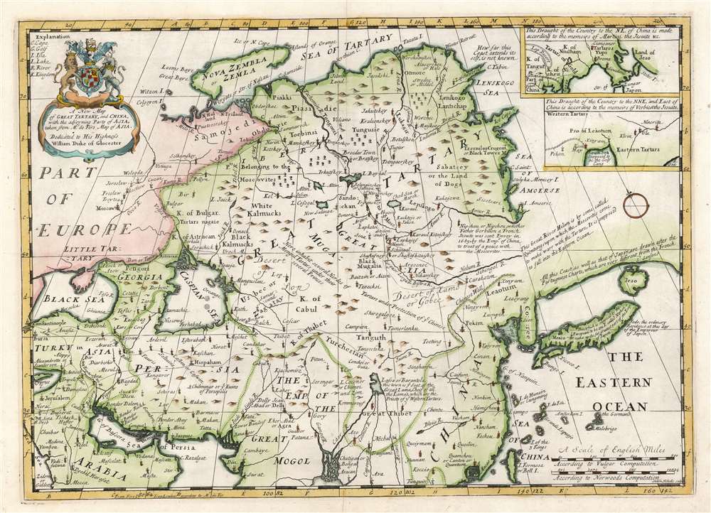
A New Map of Great Tartary, and China, with the adjoyning Parts of Asia.
$550.00
Acquire
- Digital Map Information
- Suitable for large format printing
- DPI: 600
- File Size: 40.85 MB
- File Type: ZIP / TIFF
- ICC color profile embedded
- Delivered instantly via download link
This is Edward Wells' 1700 map of central and northern Asia. The map spans from the near east - Mesopotamia and Persia, and the frontier of Muscovy - to Siberia and Tartary, as well as China, Korea, and Japan. (more details)
Flood control on the Ancholme.
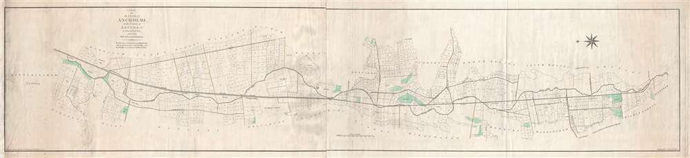
A Plan of the Level of Ancholme in the County of Lincoln. As Survey'd in the Years 1767 and 1768 by E. Johnson and J. Dickinson.
$500.00
Acquire
- Digital Map Information
- Suitable for large format printing
- DPI: 300
- File Size: 14.74 MB
- File Type: ZIP / TIFF
- ICC color profile embedded
- Delivered instantly via download link
This is a 1791 E. Johnson and I. Dalton map of the Ancholme River in Lincolnshire, England. The map depicts from Winteringham Lordship to Glentham. Both the Old River Ancholme and the New River are illustrated. The 'new' was created to address regular flooding of the 'old' Ancholme. As all the highlands in the area are noted by green shading, it is evident that, if the Ancholme did flood, a large majority of landowners were at risk. Plots of land are illustrated and labeled numerically all along the length of the river, along with several drains and dykes. (more details)
First atlas map of the Duchy of Milan.
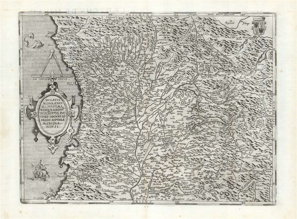
Ducatus Mediolanensis, Finitimarumque Regionū Descriptio,, Auctore Joanne Georgio Septala Mediolanense.
$450.00
Acquire
- Digital Map Information
- Suitable for large format printing
- DPI: 600
- File Size: 55.34 MB
- File Type: ZIP / TIFF
- ICC color profile embedded
- Delivered instantly via download link
This is Abraham Ortelius' 1570 map of the Duchy of Milan, in Italy. It was based the map of Giovanni Giorgio Settala (1520 - 1590) engraved by Hieronymus Cock, which exists in a sole copy in the British Library. Settala was Milanese, and although most of his life was spent building fortifications for Charles V in Spain, his map was drawn while he lived in Milan. (more details)
Charming pictorial map of Penobscot Bay.
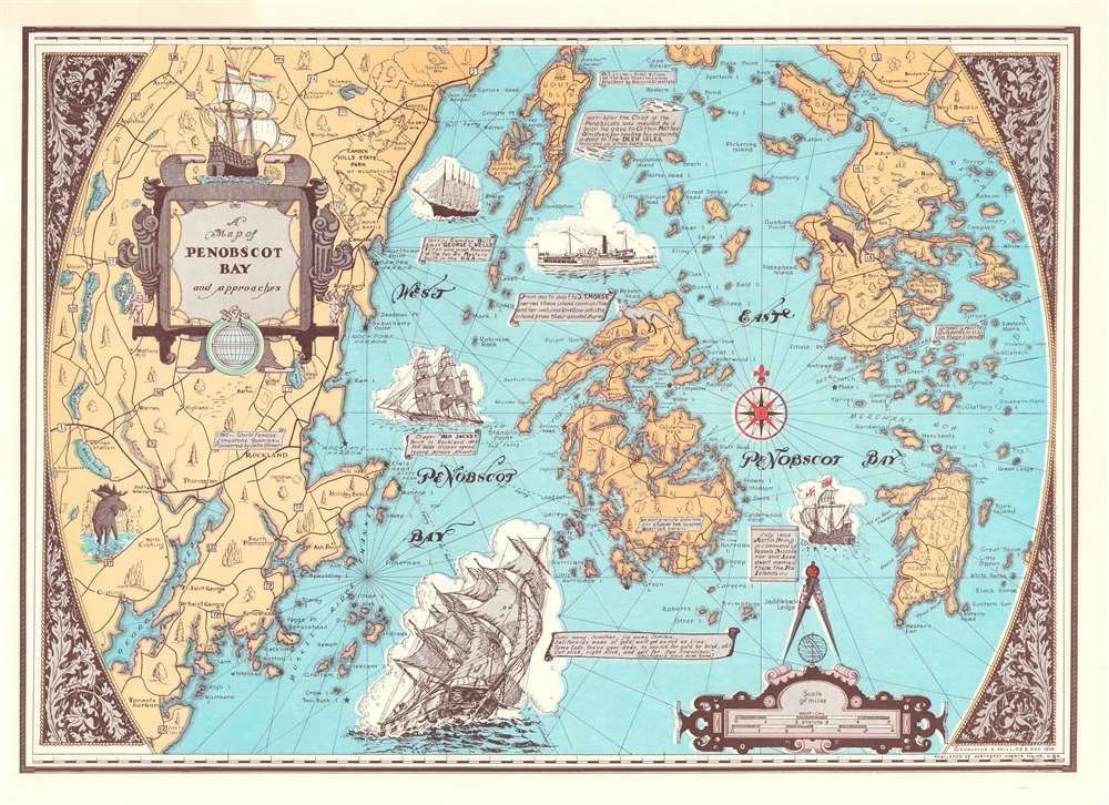
A Map of Penobscot Bay and Approaches.
$250.00
Acquire
This is a 1970 'Augustus Phillips and Son' pictorial map of Penobscot Bay, Maine. Islands throughout the bay are illustrated in detail, including North Haven, Deer Isle, Little Deer Isle, and the Isle au Haut. Maine's coastline appears in detail as well, with coves, harbors, points, and other landmarks noted. The highway network winds its way through the countryside. Vignette views of sailing ships from 1603 through the 20th century decorate the bay. (more details)
A Detailed Diagram of a Late Medieval Siege.
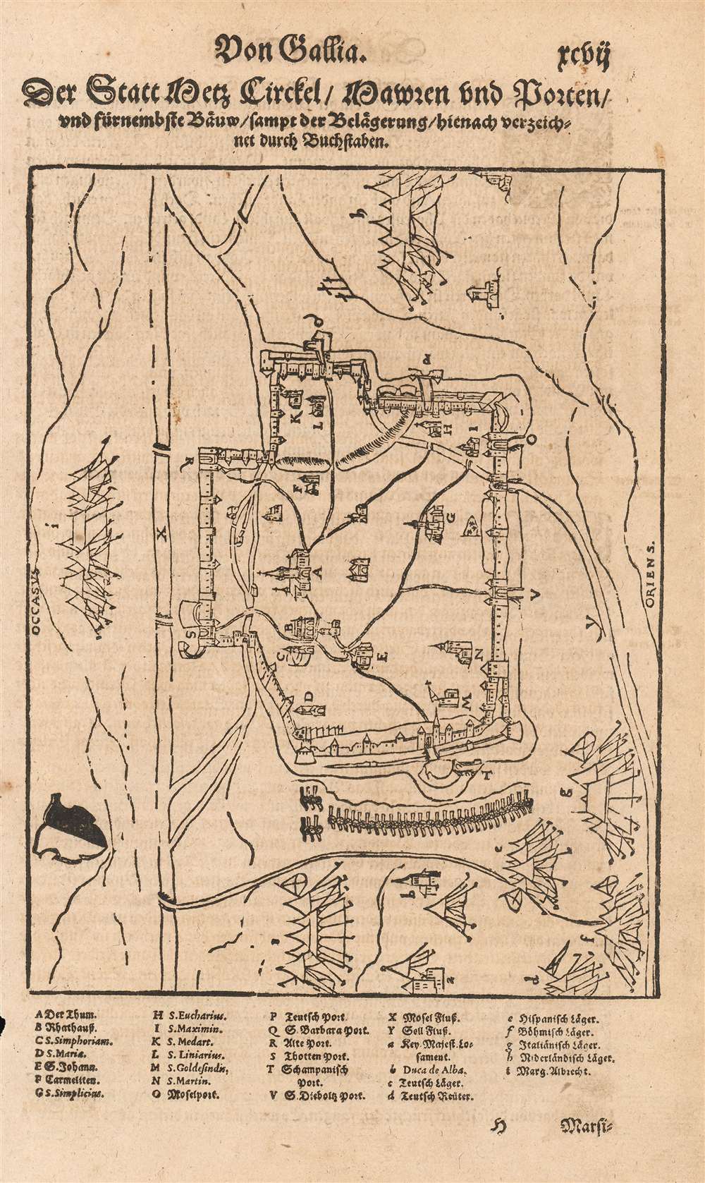
Der Statt Metz circkel, Mauren und porten, und fürnemste baüw, sampt der belaegerung, hienach verzeichnet durch bůchstaben.
$200.00
Acquire
- Digital Map Information
- Suitable for large format printing
- DPI: 600
- File Size: 10.87 MB
- File Type: ZIP / TIFF
- ICC color profile embedded
- Delivered instantly via download link
This fascinating woodcut is a plan of the Habsburg siege of the French city of Metz (October 1552 - January 1553). It appeared in editions of Sebastian Münster's Cosmographia beginning in 1554, added to that work by its publisher Heinrich Petri. The plan illustrates the outline of the walled city, its surrounding rivers and roads, its principal structures (including the great Cathedral,) and the encampments of the besieging Imperial armies. (more details)
One of the largest commercial maps we have seen.
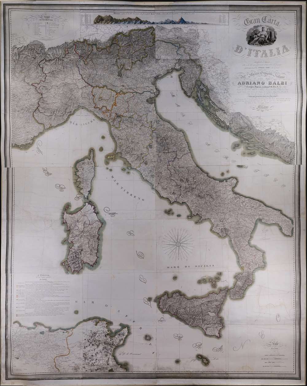
Gran Carta d'Italia.
$6,500.00
Acquire
A truly 'ginormous' production, this is Giuseppe Civelli's great map of Italy, here in its 1845 first edition. The map measures nearly 100 inches high and eighty inches wide, making it one of the largest maps we have seen. It was issued in the early days of the Italian Risorgimento and can be seen as a unique symbol aspiring to a newly ascendant sense of shared Italian national identity. The map embraces the whole of the Italian peninsula and Sicily, as well as Corsica, Sardinia, Dalmatia, Malta, North Africa, and the northern Italian states. Along the top of the map, there appears a detailed comparative elevation chart. Throughout the detail is staggering, making this great work the finest map of Italy to appear in the 19th century. (more details)
Less than a year after the Cape Cod Canal opened.
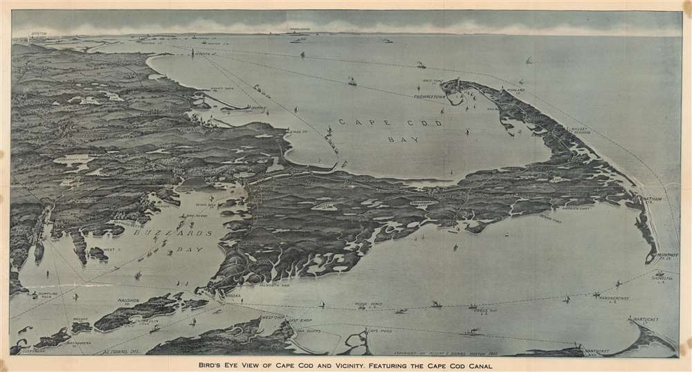
Bird's Eye View of Cape Cod and Vicinity, Featuring the Cape Cod Canal.
$850.00
Acquire
- Digital Map Information
- Suitable for large format printing
- Full resolution TIFF file
- ICC color profile embedded
- Delivered instantly via download link
This is a dramatic 1915 Albert E. Downs bird's-eye view map of Cape Cod, Massachusetts, including the recently completed Cape Cod Canal. This ephemeral style of map became popular in the early 20th century when they were printed and sold by various newsstands operating in train and ferry stations throughout New England, but primarily in Boston. (more details)
The nail in the coffin of the Confederacy.
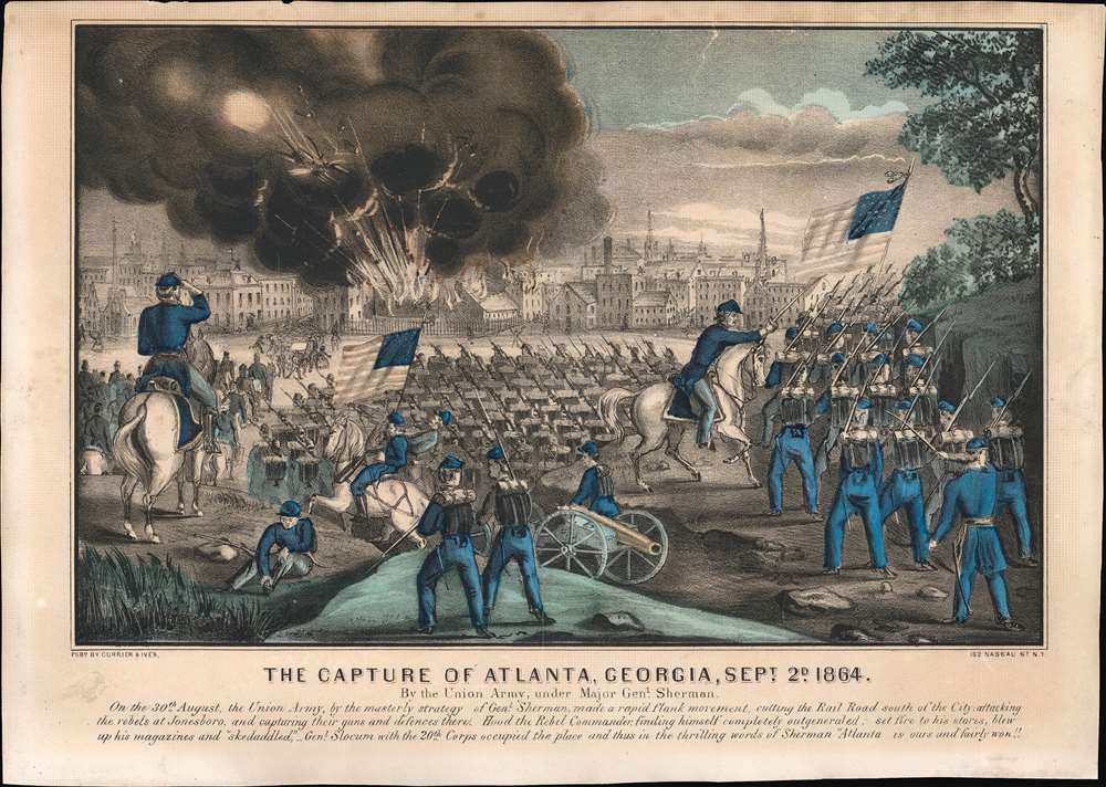
The Capture of Atlanta, Georgia, Sept. 2d, 1864.
$600.00
Acquire
- Digital Map Information
- Suitable for large format printing
- File Size: 26.02 MB
- File Type: ZIP / TIFF
- ICC color profile embedded
- Delivered instantly via download link
This is a nice example of Charles Currier and James Ives' print depicting the 1864 capture of Atlanta by Gen. William Tecumseh Sherman's forces during the U.S. Civil War. The battle was a key victory in Sherman's 1864 Georgia campaign, which culminated in the 'March to the Sea' and the capture of Savannah. Having seized the rebels' rail hub, destroyed their supply lines, and quite literally cut the Confederacy in half, the campaign was decisive in ensuring the Confederacy's ultimate defeat. (more details)
A mysterious Meiji Era Japanese visit to Bangkok.
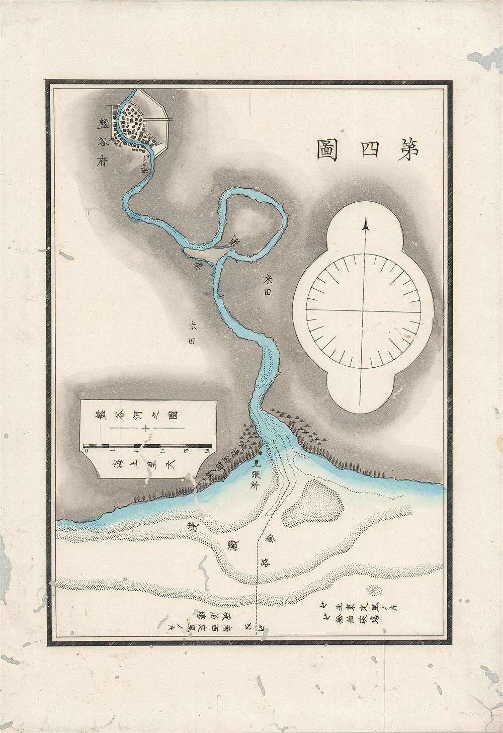
第四圖 / The Fourth Map.
$600.00
Acquire
- Digital Map Information
- Suitable for large format printing
- File Size: 7.85 MB
- File Type: ZIP / TIFF
- ICC color profile embedded
- Delivered instantly via download link
A scarce 1875 (Meiji 8) Japanese map and chart of the Chao Phraya River up to the city of Bangkok. Japanese interest in the region increased considerably in the late 19th century as Japan emerged from the Meiji Restoration and sought to emulate Western empires' interests and activities in Southeast Asia. (more details)
Mantua, Patron of the Arts.
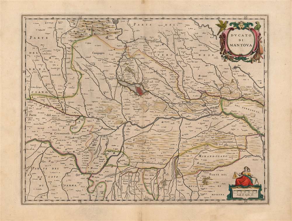
Ducato di Mantova.
$450.00
Acquire
- Digital Map Information
- Suitable for large format printing
- DPI: 600
- File Size: 49.64 MB
- File Type: ZIP / TIFF
- ICC color profile embedded
- Delivered instantly via download link
This is a beautiful, original color example of Joan Blaeu's map of the Duchy of Mantua, Lombardy, Italy. It is centered on the city of Mantua, set on its peninsula amidst the array of lakes created by the widening of the Mincio River. The region's network of rivers is evocatively presented. The Po dominates, roughly bisecting the map. Blaeu's work is a more skilled, artistic rendering of the Antonio Magini map of the same title. Magini's map was the first map of the duchy based on modern surveys, and at the time of this map's production remained the state-of-the-art. Its fortresses, towns, farms, and canals are faithfully presented - here, in the sharp, clear engraving that characterizes Blaeu. (more details)
Documents the horrors of 1939 through photography.
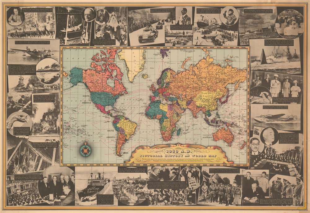
1939 A. D. Pictorial History and World Map.
$425.00
Acquire
- Digital Map Information
- Suitable for large format printing
- File Size: 85.88 MB
- File Type: ZIP / TIFF
- ICC color profile embedded
- Delivered instantly via download link
This 1939 United Press and Columbia Broadcasting System map of the world ravaged by war. The political map at center belies the violence then rampaging across the globe, but its results are apparent. Nazi Germany encompasses Austria and half of Czechoslovakia and Poland, while the Soviet Unit occupies Poland's other half. War had been raging in Asia since 1937, mostly ignored here, apart from Manchukuo. Dashed lines trace global maritime trade routes and provide the distances. (more details)