
NEW ACQUISITIONS
Early Japanese nautical chart.
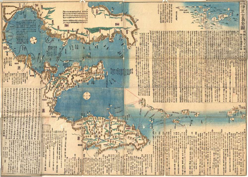
伊豆七島全圖 附無人島八十嶼圖相武房總海岸圖 / The Complete Map of the Seven Islands of Izu with a Map of the Eighty Uninhabited Islands.
$2,000.00
Acquire
- Digital Map Information
- Suitable for large format printing
- Full resolution TIFF file
- ICC color profile embedded
- Delivered instantly via download link
An extraordinary find, this is an 1842 (Tenpō 13) Tokugawa Period Japanese woodblock nautical chart / map of the Izu Islands (伊豆諸島 / Izu-shoto) by Tōjō Kindai. Oriented to the East, this map covers from Chiba, Kanagawa, and Sagami Bay southwards as far as Miyake and Mikurajima Islands. With minimal inland detail this map can best be interpreted as a traditional Japanese nautical chart. Notes nautical routes and many offshore features including dangerous reefs and shoals. (more details)
Art-Deco Shanghai!
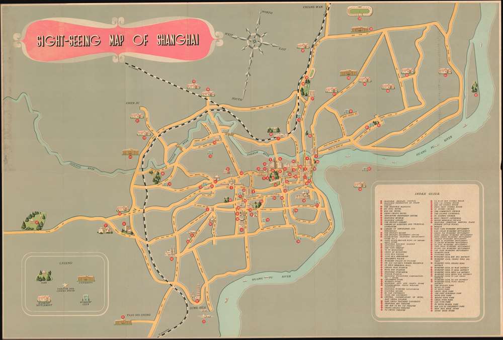
Sight-Seeing Map of Shanghai.
$600.00
Acquire
A charming c. 1955 art deco map of Shanghai, China, issued for tourists by the Shanghai People's Art Publishing House and the China International Tourist Service. The map centers on the historical business district of Shanghai, including the old concession area, but extends north as far as Chiang Wan, south to encompass Long Hua Airport, and west as far as what is described as 'West Suburban Park', which most likely corresponds to the modern day location of Shanghai Zoo. The map tackles the urban complexity of Shanghai with a minimalist aesthetic that removes unnecessary details (such as minor roads) but highlights important locations with indexed pictorial vignettes. There are some 95 indexed sites, but we are not sure how easy it would be to actually get to one of the locations cited using this map, especially those in Pudong, which are apparently inaccessible by any roadway. The map folds into its original binder which is illustrated with a sapan (Chinese sailboat) in front of the Bund. (more details)
Railroads and highways in California.
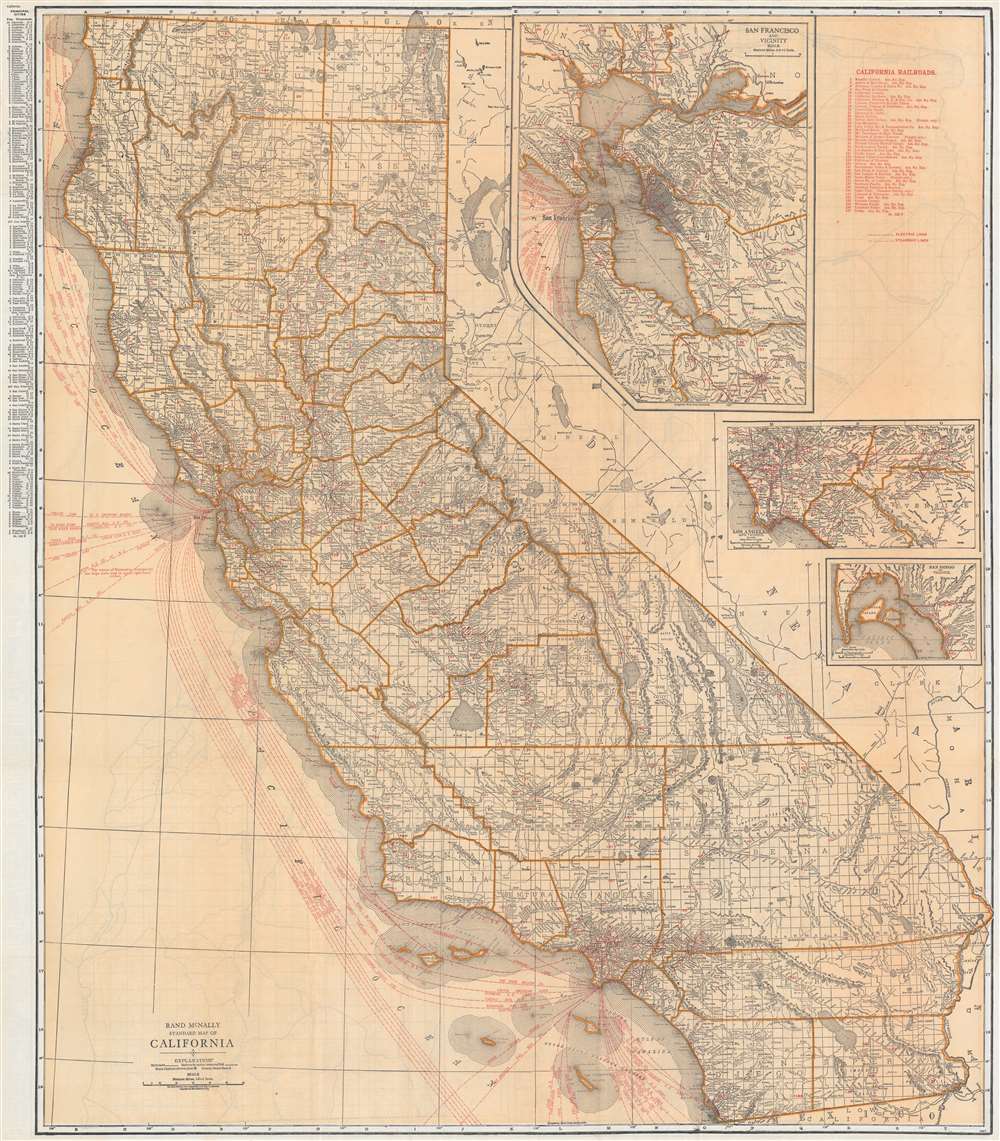
Rand McNally Standard Map of California.
$250.00
Acquire
- Digital Map Information
- Suitable for large format printing
- Full resolution TIFF file
- ICC color profile embedded
- Delivered instantly via download link
This is a c. 1921 Rand McNally railroad map of California. Black lines trace railroad lines throughout the state, most of which are labeled along their respective route. Red overprinted numbers (1 to 157) correspond with an index in the upper right. Red overprinted dashed and dotted lines highlight operating electric railroad lines. Red dashed lines off the coast represent steamship lines, the majority of which operate out of San Francisco, while most of the remainder depart from Los Angeles. Inset maps of San Francisco, Los Angeles, and San Diego appear in the upper right. An index of California's principal cities appears outside the left border. (more details)
Published during the French Revolutionary Wars.
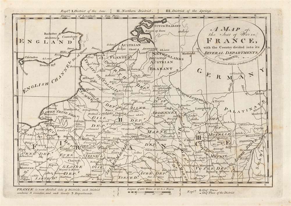
A Map of the Seat of War in France with the Country divided into its Several Departments.
$200.00
Acquire
- Digital Map Information
- Suitable for large format printing
- Full resolution TIFF file
- ICC color profile embedded
- Delivered instantly via download link
This is a 1796 Mathew Carey map of northeastern France, Belgium, Luxembourg, and Germany. Created during the French Revolutionary Wars (1792 - 1802), specifically the War of the First Coalition (1792 - 1797), fantastic detail is present in France. Cities and towns throughout northern France are identified, including Paris, Rouen, Le Havre, Lille, Calais, and Strasbourg. France is also divided into departments, created only six years before this map was created by the National Constituent Assembly. Very little detail is present outside France. Major cities are marked in England, Germany, and modern-day Belgium and the Netherlands. (more details)
'From nowhere to nowhere...' -G. R. Stewart
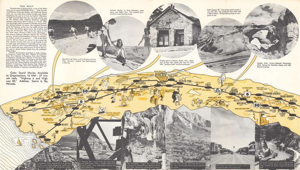
Pleasure Ways Across the West.
$150.00
Acquire
- Digital Map Information
- Suitable for large format printing
- Full resolution TIFF file
- ICC color profile embedded
- Delivered instantly via download link
This is a c. 1953 Utah Bank Note Company map of California, Colorado, Nevada, and Utah promoting the western portions of Highway 6 and Highway 50. Pictorial vignettes highlight sites along the highways, including Death Valley, Arches National Monument, Rocky Mountain National Park, and the Royal Gorge. Other vignettes reinforce stereotypical ideas of the American West, including cattle, cowboys and rodeos, striking it rich while mining, and gambling. Black lines trace the routes of the two highways from Denver and Pueblo, Colorado, to San Francisco and Long Beach, California. Large black dots mark cities and towns that can act as waypoints during a vacationer's trip through the region. Photographs of incredible scenery, tourist sites, and the region's successful mining industry appear above and below the central map. (more details)
Visit 'Imperial Polk County'!
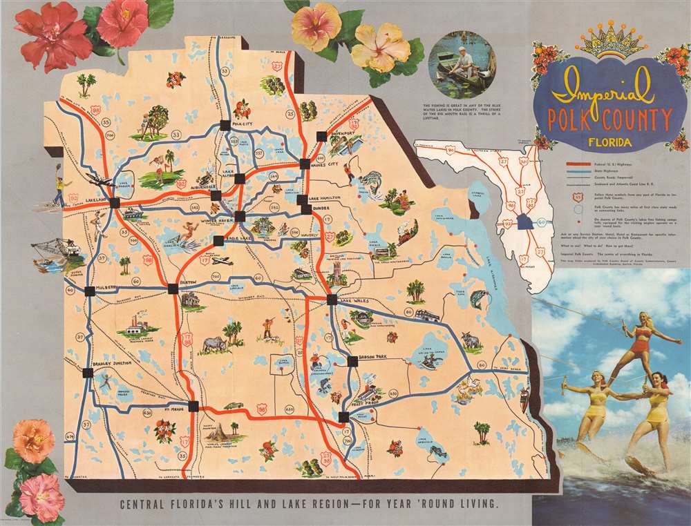
Imperial Polk County Florida.
$150.00
Acquire
This is a c. 1954 Polk County Board of County Commissioners pictorial map of Polk County, Florida. Pictorial vignettes promote Polk County's charms, including its outdoor activities, agricultural prowess, and road network. People are illustrated waterskiing, fishing, hunting, golfing, and more. The famous Bok Tower appears just above Lake Wells, and Cypress Gardens is marked to the right of Winter Haven. Red dots mark 'fishing camps' established to help 'visiting anglers operate on a year-round basis'. Thick red lines mark Federal highways, while the thick blue lines mark paved state highways. (more details)
Rare Nepalese Trekking Map of the Annapurna Circuit.
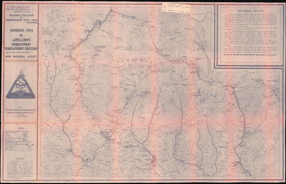
Latest Trekking Map Second Impression August 1983 Around Annapurna, Annapurna Sanctuary, and Kali Gandaki.
$400.00
Acquire
This is a 1983 Nepal Police Mountaineering and Adventure Foundation cyanotype map of the Annapurna Circuit. It is centered on the Annapurna Massif, showing the major towns as well as settlements too small to be named. Typical stops on the trek - Besisahar, Khudi, Bahundanda, Jagat, Dharapani, Chame, Pisang (upper and lower,) Manang, Letdar, the Thorong Pass, Muktinath, Marpha, Lete, Tatopani, Ghorepani, Birethani and Pokhara - are identified. In addition, the trekking path to Annapurna Base Camp via Ghandrung is shown. (more details)
Massachusetts railroads at the beginning of the 20th century.
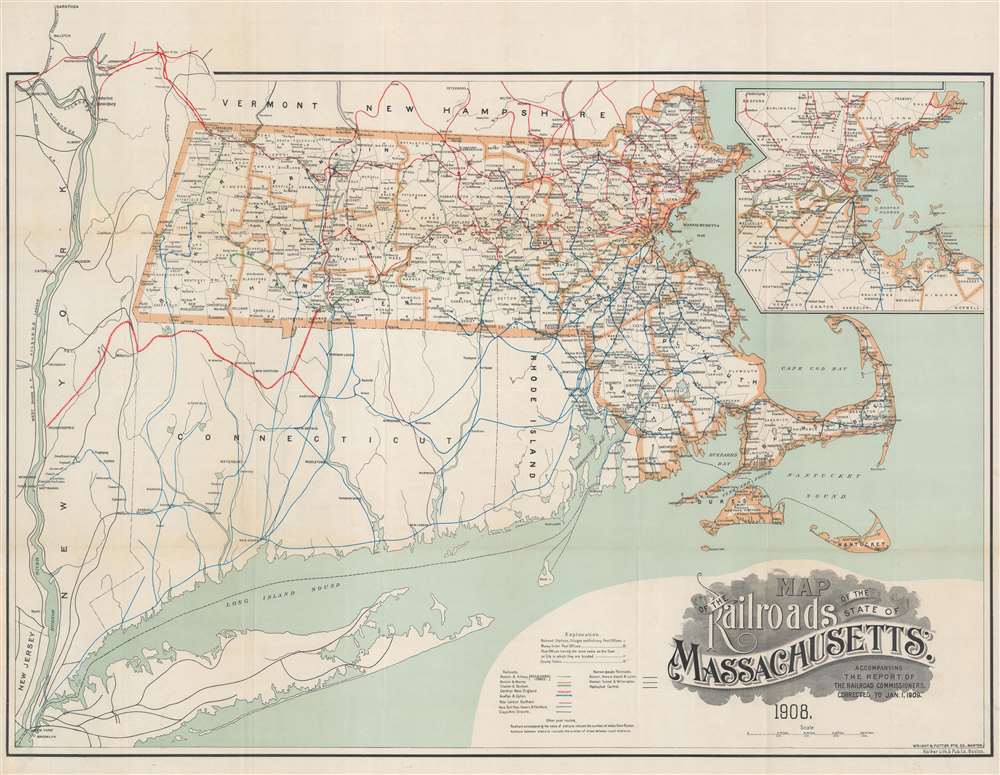
Map of the Railroads of the State of Massachusetts Accompanying the Report of the Railroad Commissioners Corrected to January 1, 1909.
$400.00
Acquire
- Digital Map Information
- Suitable for large format printing
- File Size: 35.91 MB
- File Type: ZIP / TIFF
- ICC color profile embedded
- Delivered instantly via download link
This is a 1908 George Walker railroad map of Massachusetts. Colored lines trace railroads throughout. The red lines highlight the network of the Boston and Maine Railroad, while green follows the Boston and Albany Railroad, and blue the New York, New Haven, and Hartford Railroad. Other colored lines illustrate the networks of the Chester and Becket Railroad, the Central New England Railroad, the Grafton and Upton Railroad, and the New England Northern Railroad. Cities and towns throughout are labeled, and mileage from Boston to various cities provided. An inset in the upper right details the region surrounding Boston and the Boston and Maine, Boston and Albany, and New York, New Haven, and Hartford rail networks in that area. (more details)
The Boston and Maine Railroad rail network.
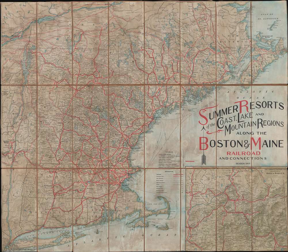
Summer Resorts of the Coast, Lake and Mountain Regions along the Boston and Maine Railroad and Connections.
$350.00
Acquire
- Digital Map Information
- Suitable for large format printing
- File Size: 57.1 MB
- File Type: ZIP / TIFF
- ICC color profile embedded
- Delivered instantly via download link
This is a decorative 1913 Matthews-Northrup map of New England. The map depicts from New York City northwards along the Atlantic coast as far as New Brunswick and the Gulf of Saint Lawrence and from the Hudson River Valley to the Atlantic Seaboard. Thick red lines highlight the Boston and Maine Railroad. This network includes not only the Boston and Maine Railroad, but also the Maine Central Railroad, the New York, New Haven, and Hartford Railroad, and the Boston and Albany Railroad, along with several others. Thinner red lines trace routes of connecting railroads, while other railroads, electric railways, stage lines, and canals, are illustrated by various notations. An inset map on the lower right highlights 'American Switzerland' the White Mountains of New Hampshire. (more details)
Commemorates the centennial of the American Civil War.
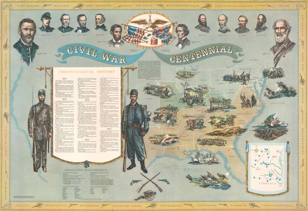
Civil War Centennial 1861 - 1865.
$300.00
Acquire
This is a 1960 Ralph G. Newman and E.B. Long broadside pictorial map of the eastern United States and American Civil War battle locations. Commemorating the centennial of the American Civil War, a map of the eastern United States occupies half the sheet and is shaded to illustrate the Union, the Confederacy, and the two 'border states' (Missouri and Kentucky). Pictorial vignettes illustrate the Draft Riots in New York City, the bombardment of Fort Sumter, the Battle of Gettysburg, and the surrender at Appomattox, among other events. Sixty-four events, listed in chronological order, appear on a banner to the left. Each event is numerically labeled and corresponds with a number on the map or on the inset map of Virginia situated in the lower right. Illustrations of Union and Confederate soldiers flank this banner. Portraits of Union and Confederate leaders, including Abraham Lincoln, Ulysses S. Grant, William T. Sherman, Jefferson Davis, and Robert E. Lee appear along the top border. Names of important battles in chronological order adorn the border and are separated by illustrations of cannons and pistols. (more details)
Mammoth Hot Springs and the immediate vicinity.
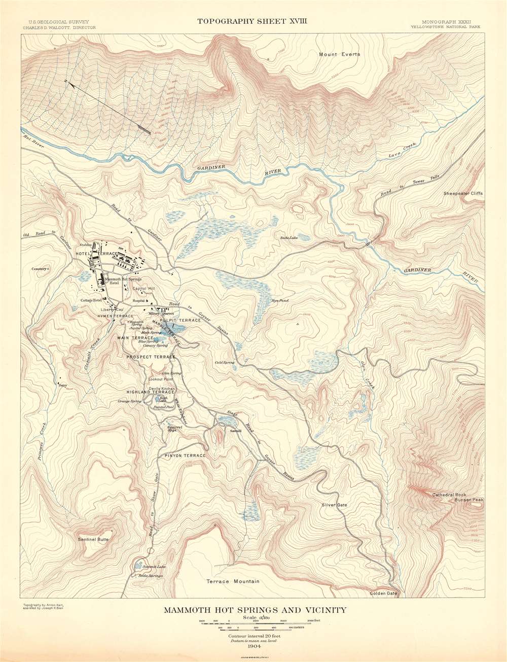
Mammoth Hot Springs and Vicinity. Topography Sheet XVIII.
$250.00
Acquire
- Digital Map Information
- Suitable for large format printing
- File Size: 16.72 MB
- File Type: ZIP / TIFF
- ICC color profile embedded
- Delivered instantly via download link
This is a 1904 Arnold Hague and U.S. Geological Survey topographic map of the spectacular Mammoth Hot Springs in Yellowstone National Park, Wyoming. The map depicts Mammoth Hot Spring Terraces from Terrace Mountain to Mount Everts. Building over thousands of years and still growing, the Mammoth Terraces constantly change shape and color. The map also features a handful of buildings, including the famous Mammoth Hotel built over the old terrace formation called Hotel Terrace. Contour lines highlight the region's unique topography with elevation noted every 500 feet. A dashed line representing the Continental Divide winds its way through the park, while the red dashed lines mark roads. Creeks, rivers, and lakes are labeled, as are plateaus, gulches, and mountain peaks. (more details)
For WWII servicemen serving in Honolulu.
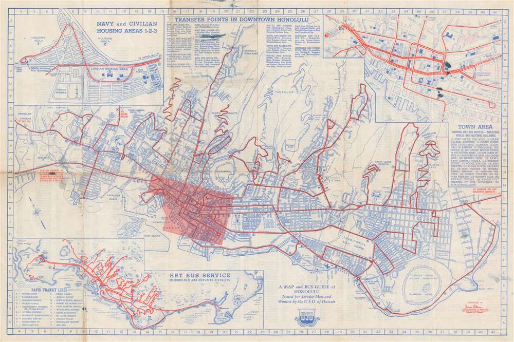
A Map and Bus Guide of Honolulu Issued for Service Men and Women by the USO of Hawaii.
$250.00
Acquire
- Digital Map Information
- Suitable for large format printing
- Full resolution TIFF file
- ICC color profile embedded
- Delivered instantly via download link
This is a c. 1944 James B. Mann and USO of Hawaii city plan or map of Honolulu, Hawaii issued for service men and women during World War II. The map depicts the city from Moanalua Gardens to Kahala Beach and from Dowsett Highlands to Diamond Head. Numerous sites are identified, including beaches, parks, forts, stadiums, schools, canneries, and, of course, golf courses. Thick red lines overlaid on the map highlight bus routes, possibly to encourage the use mass transportation. An inset of downtown Honolulu appears in the upper right and identifies theaters and historic buildings. An inset in the upper left depicts Navy and Civilian Housing Areas 1-2-3. Between the two insets is a detailed commentary on downtown bus transfers. A third and final inset in the lower left corner details the bus network linking Pearl Harbor and Hickam Field with Honolulu and Woodland. (more details)
Pictorial map of Boston created for the American Legion.
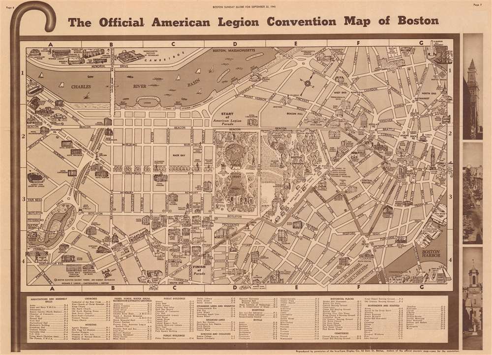
The Official American Legion Convention Map of Boston.
$175.00
Acquire
- Digital Map Information
- Suitable for large format printing
- Full resolution TIFF file
- ICC color profile embedded
- Delivered instantly via download link
This is a 1940 Richard F. Lufkin pictorial map of Boston, Massachusetts. Created for the 1940 American Legion Convention in Boston, the map depicts the city from the Fenway to India Wharf on Boston Harbor and from Cambridge to the intersection of Dartmouth Street and Columbus Avenue. Pictorial vignettes highlight landmarks, hotels, museums, and other sites around the city. Among the illustrated sites are the State House, the Old South Meeting House, the Athenaeum, Old North Church, and the Museum of Fine Arts. Numerous statues, including those of Abraham Lincoln, Alexander Hamilton, and John Winthrop are noted. Boston Common, the Public Garden, and the Fenway are all illustrated with care. The Massachusetts Institute of Technology, Widener Library, and the Fogg Art Museum appear across the Charles River in Cambridge. Sites located off the map, including Boston University, Boston College, and Fenway Park, are also noted, but are accompanied by arrows pointing in their general direction . A dark line traces the route of the American Legion parade from Beacon and Arlington Streets through Boston to Columbus Avenue and Clarendon Street. (more details)
The safe and fast Florida Turnpike!
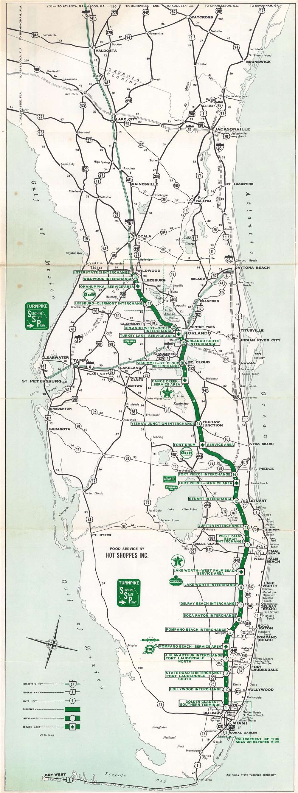
Florida Turnpike. Fast - Safe.
$150.00
Acquire
This is a c. 1964 Dolph Map Company and Florida State Turnpike Authority road map of Florida. A thick green line highlights the Florida Turnpike (Sunshine State Parkway) from Wildwood to Miami. White circles bearing green numbers mark the thirty interchanges, with small white numbers note milage. Federal and state highways are illustrated by black lines and are identified numerically. Interstate 4 and Interstate 75 are marked by thick lighter green lines, while the still incomplete Interstate 95 runs along the Atlantic coast. (more details)
One of a kind comparative view of the Chateaux of France in wall map format!
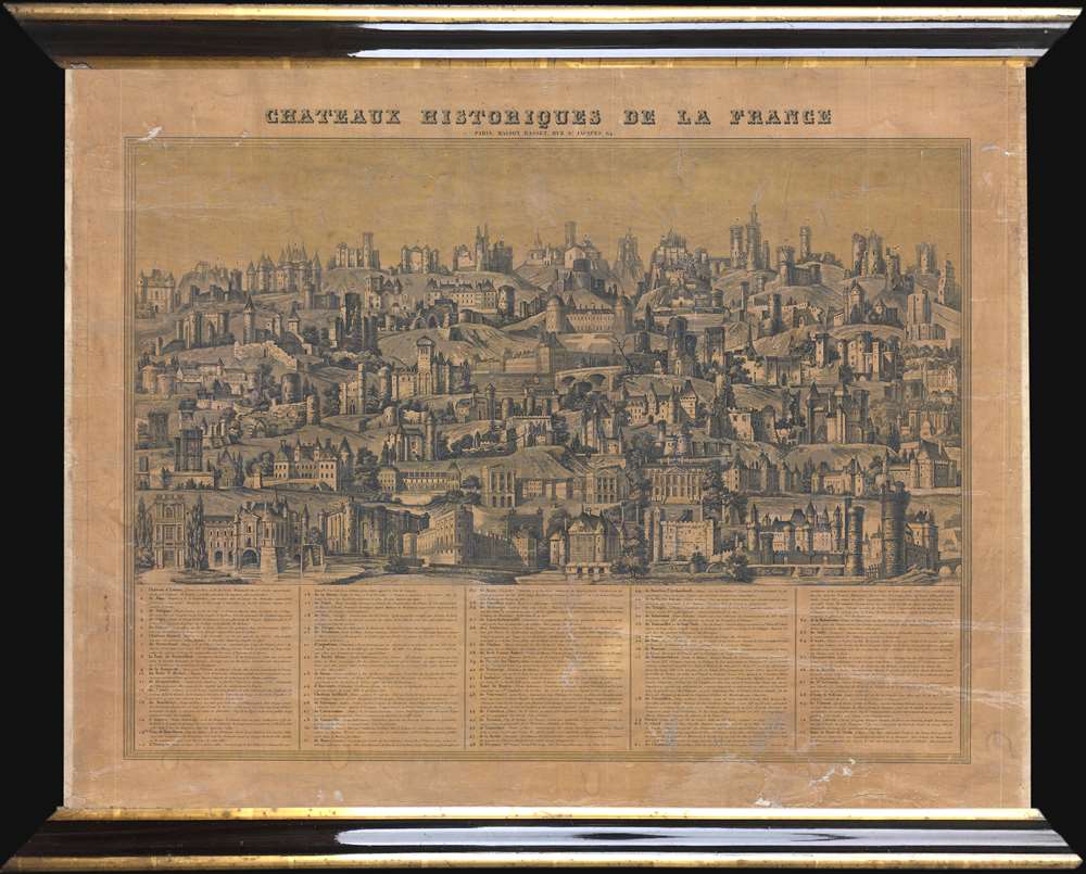
Chateaux Historiques de la France.
$750.00
Acquire
- Digital Map Information
- Suitable for large format printing
- Full resolution TIFF file
- ICC color profile embedded
- Delivered instantly via download link
This is a c. 1840 Maison Basset comparative chart of the Chateaux of France. The chart depicts 71 different French chateaux in profile, from the Château d'Isières to the Tour et Porte de Nesle, which was demolished in 1663. Each of the chateau presented is numerically identified. A table along the bottom border, organized in ascending numerical order, includes the name of each chateau, along with the department in which it is located, it's location relative to the closest city or town, and a short description. The detail renders each chateau visually recognizable. Some of the chateaux represented here have gained international renown, including Mont St. Michel, the Chateau de Tuileries (which today we know as the Louvre, since the two were connected by Louis XIII and Louis XIV), the Chateau de Vincennes, the Chateau de Fontainebleau, the Chateau de Versailles, and the Chateau de Chenonceau (in the Loire Valley). The Vieux Louvre, demolished in 1528, is also depicted. (more details)
Jordan after the 1948 Arab-Israeli War.
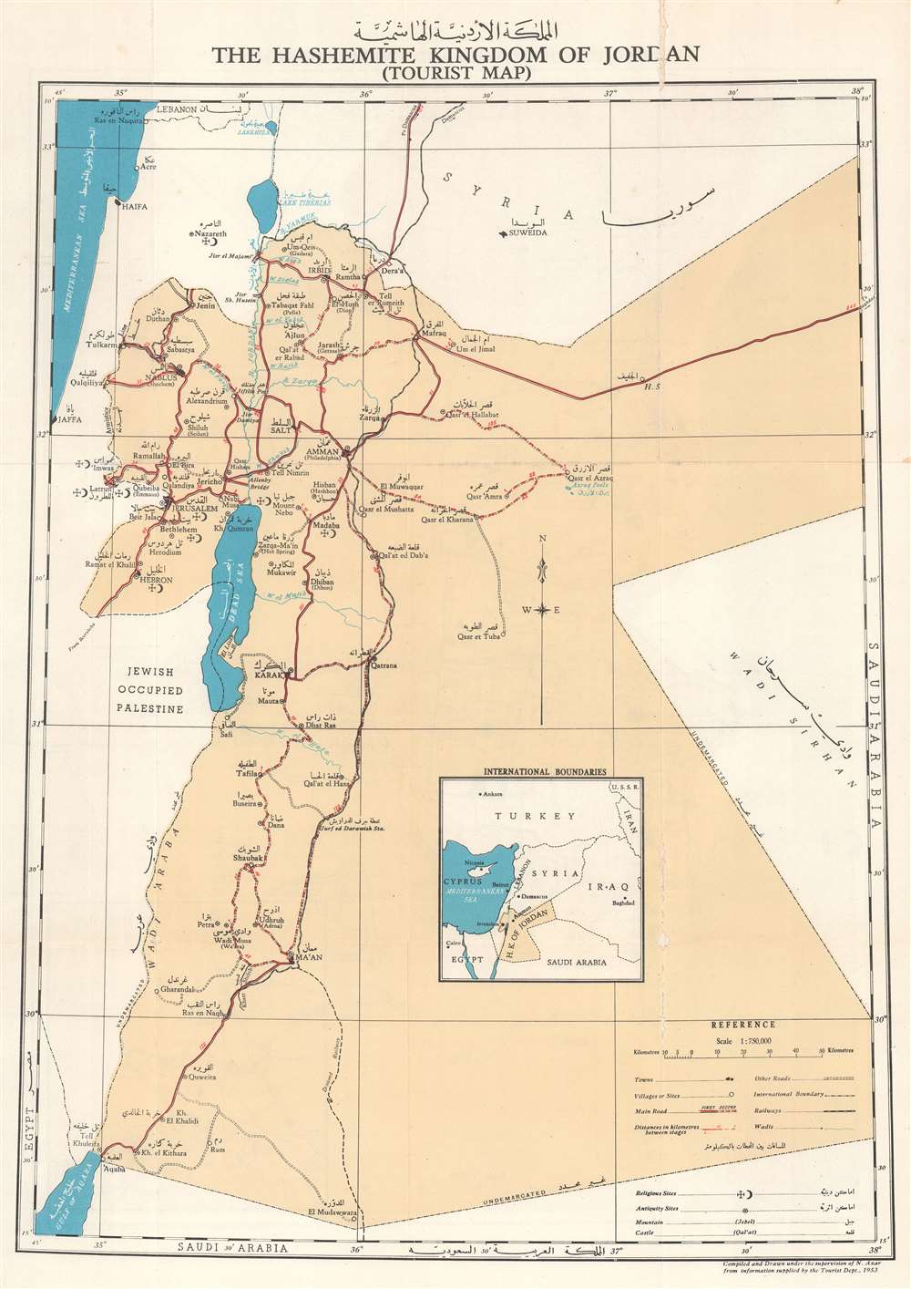
.المملكة الاردنية الاشة The Hashemite Kingdom of Jordan (Tourist Map).
$650.00
Acquire
This is a 1955 N. Azar bilingual English and Arabic tourist map of Jordan, officially known as the Hasemite Kingdom of Jordan. (more details)
'Got this map and had good lemonade with cookies'.
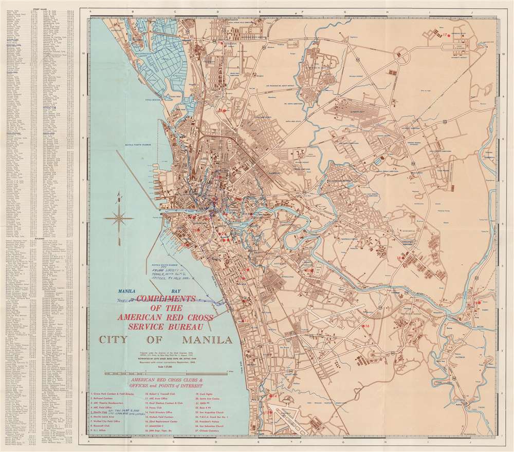
City of Manila. Compliments of the American Red Cross Service Bureau.
$500.00
Acquire
- Digital Map Information
- Suitable for large format printing
- File Size: 19.5 MB
- File Type: ZIP / TIFF
- ICC color profile embedded
- Delivered instantly via download link
This is a September 1945 U.S. Army Forces, Pacific (AFPAC) city plan or map of Manila, Philippines. Distributed by the American Red Cross Service Bureau, red overprinting marks twenty-seven locations around Manila, including two American Red Cross facilities, several canteens, a few clubs, and 'Y.M.C.A. Snack Bar No. 1'. All locations are identified in an index situated in the lower left. Districts within Manila are labeled in blue, along with rivers, lagoons, and locations around the city, including the University of the Philippines. Major streets are identified, but most smaller streets are only illustrated. Two indexes situated along the left border list streets and buildings in alphabetical order. (more details)
From Penobscot Bay to the Canadian border.
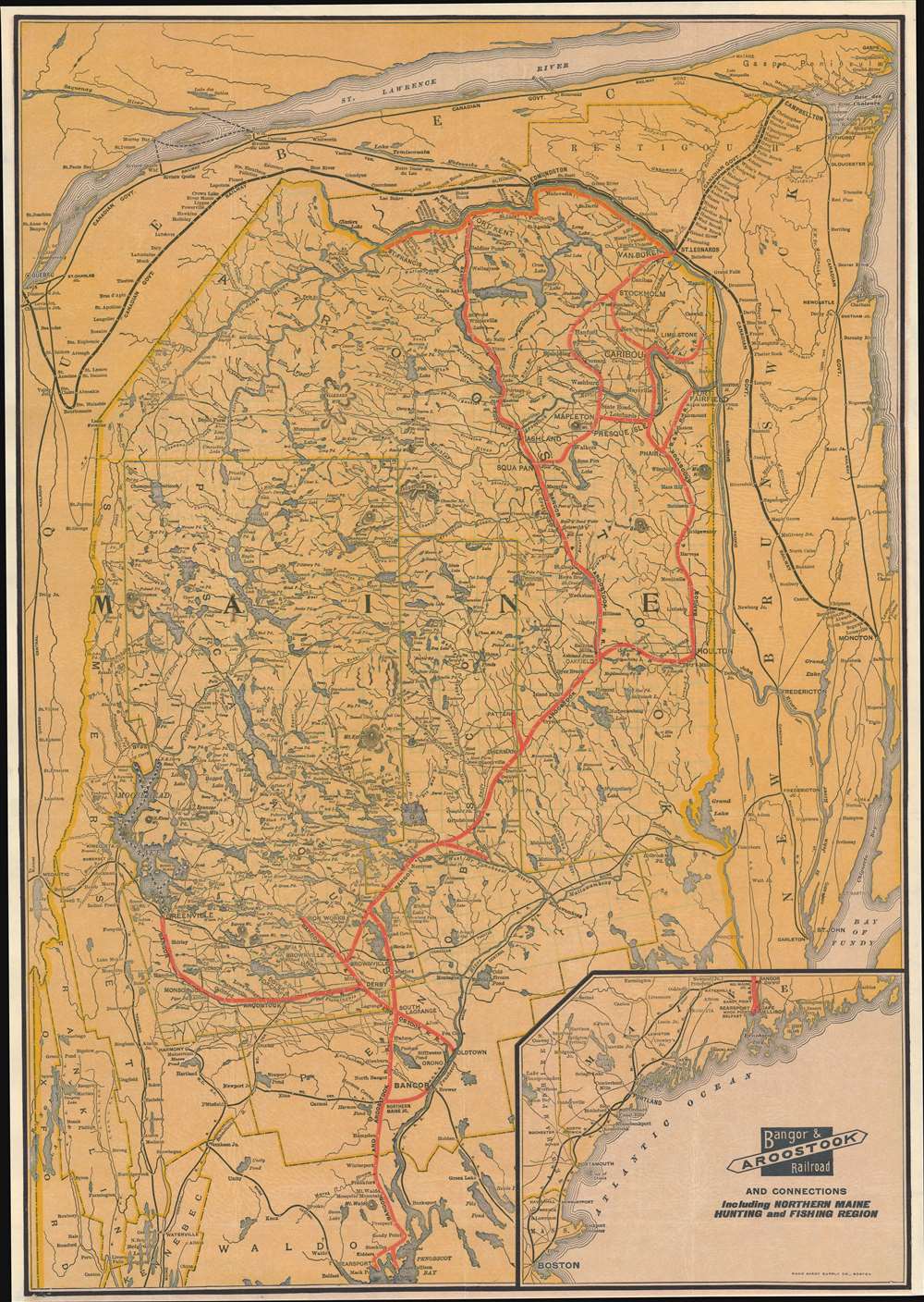
Bangor and Aroostook Railroad and Connections Including Northern Maine Hunting and Fishing Region.
$400.00
Acquire
- Digital Map Information
- Suitable for large format printing
- File Size: 32.79 MB
- File Type: ZIP / TIFF
- ICC color profile embedded
- Delivered instantly via download link
This is a c. 1915 Rand Avery Supply Company railroad map of Maine highlighting the Bangor and Aroostook Railroad. Covering from Belfast to Canada, a solid red line traces the Bangor and Aroostook Railroad's route. Cities, towns, and villages along the Bangor and Aroostook's route are labeled, including the then closed Katahdin Iron Works. Thin black lines follow the routes of the Maine Central Railroad, the Canadian Pacific Railroad, with a thicker black line emphasizing the Canadian Government Railway skirting Maine's northern and eastern borders. Lakes of varying size appear throughout, including Moosehead Lake near the left border. An inset map in the lower right presents the Maine Central Railroad and the Boston and Maine Railroad lines between Boston and Bangor. (more details)
Very good representation of NYC in the mid-19th century.
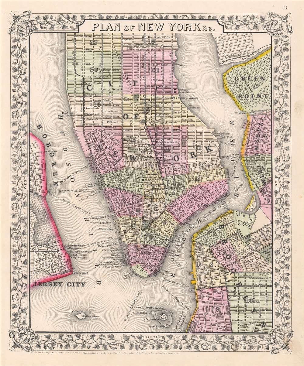
Plan of New York etc.
$250.00
Acquire
- Digital Map Information
- Suitable for large format printing
- File Size: 11.47 MB
- File Type: ZIP / TIFF
- ICC color profile embedded
- Delivered instantly via download link
This is an eye-catching example of Samuel Augustus Mitchell Jr.'s 1866 city plan or map of New York City depicting Manhattan below 45th street. Surrounding lower Manhattan are the noted riverine features of the Hudson River, East River, New York Harbor, Buttermilk Channel, Newtown Creek, and Bushwick Inlet. Adjoining to the borders of the map are parts of Brooklyn, Williamsburg, Greenpoint, Hoboken, and Jersey City. The surrounding neighborhoods and water features draw the viewer's eye into Lower Manhattan from a bygone era. Mitchell offers wonderful detail, referencing parks, streets, piers, railroads, ferries, and important buildings. A few noteworthy features represented in this piece are Ellis Island, Governor's Island, and what is now Battery Park, all of which have since undergone significant geomorphic changes. Within the boroughs of New York City, neighborhoods are color coded with red, green, and yellow pastels according to political divisions. The map is surrounded by an attractive floral border common to Mitchell's atlases between 1860 and 1866. This is a wonderful representation of one of the more attractive atlas maps of New York City to appear in the mid-19th century. (more details)
Miniature map of the Classical Sicily.
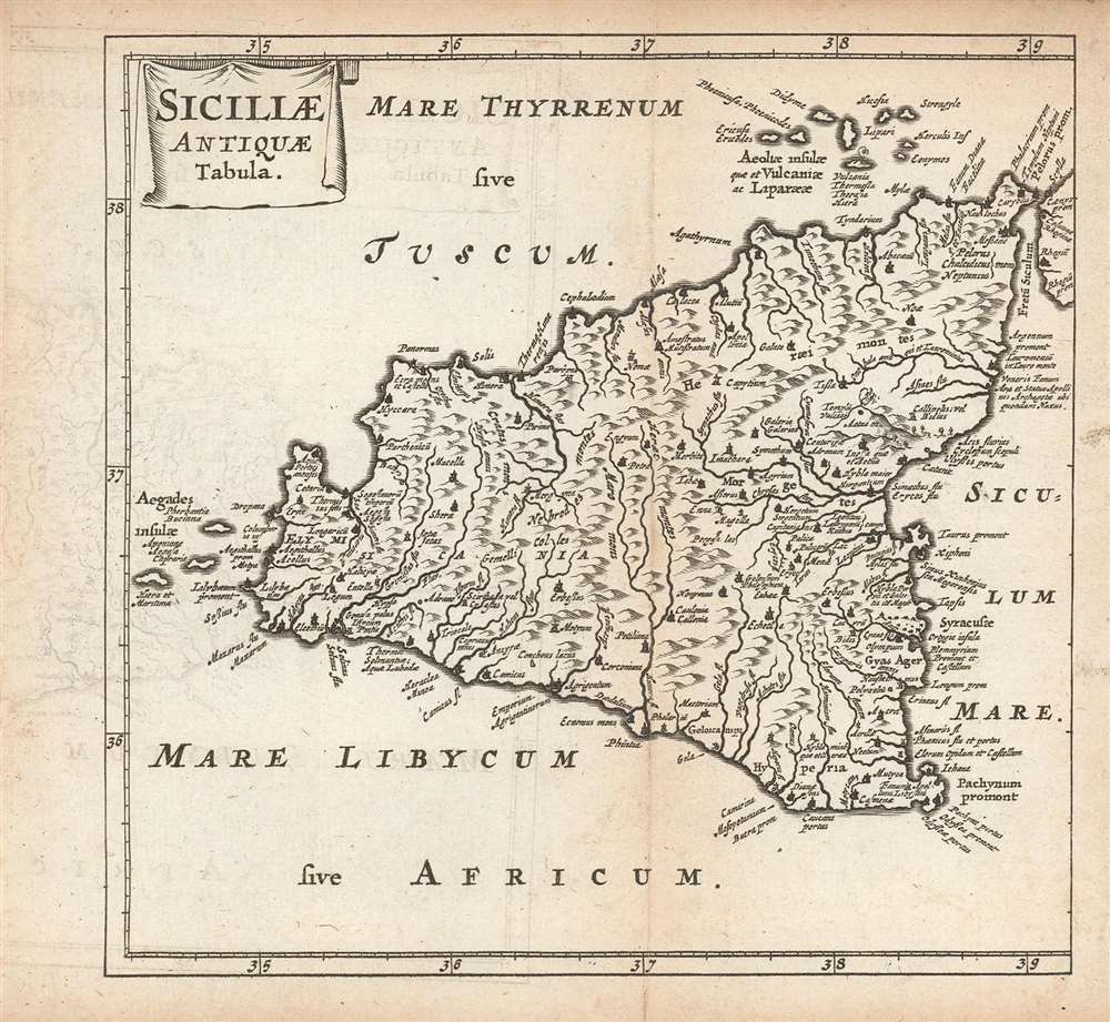
Siciliae Antiquae Tabula.
$275.00
Acquire
- Digital Map Information
- Suitable for large format printing
- Full resolution TIFF file
- ICC color profile embedded
- Delivered instantly via download link
This is a finely-engraved miniature map of Sicily and its adjacent islands, printed in a 1661 Elzevir edition of Philipp Clüver's Introductionis in Universam Geographiam. As is implied in the title, the map shows the Sicily of antiquity, derived from classical sources, including Pliny, Strabo, and Julius Caesar. It therefore depicts the Sicily known to Ancient Rome. Thus Mount Aetna includes the Temple of Vulcan: and the Fretum Siculum (the strait separating Sicily and the Italian Peninsula) is marked with the locations of Scylla and Carybdis, the dual navigational menaces featured in Homer's Odyssey. Forests and mountains are indicated pictorially. (more details)