
NEW ACQUISITIONS
A charming tourist map of the Kashmir Valley highlighting the many outdoor activities popular in the region.
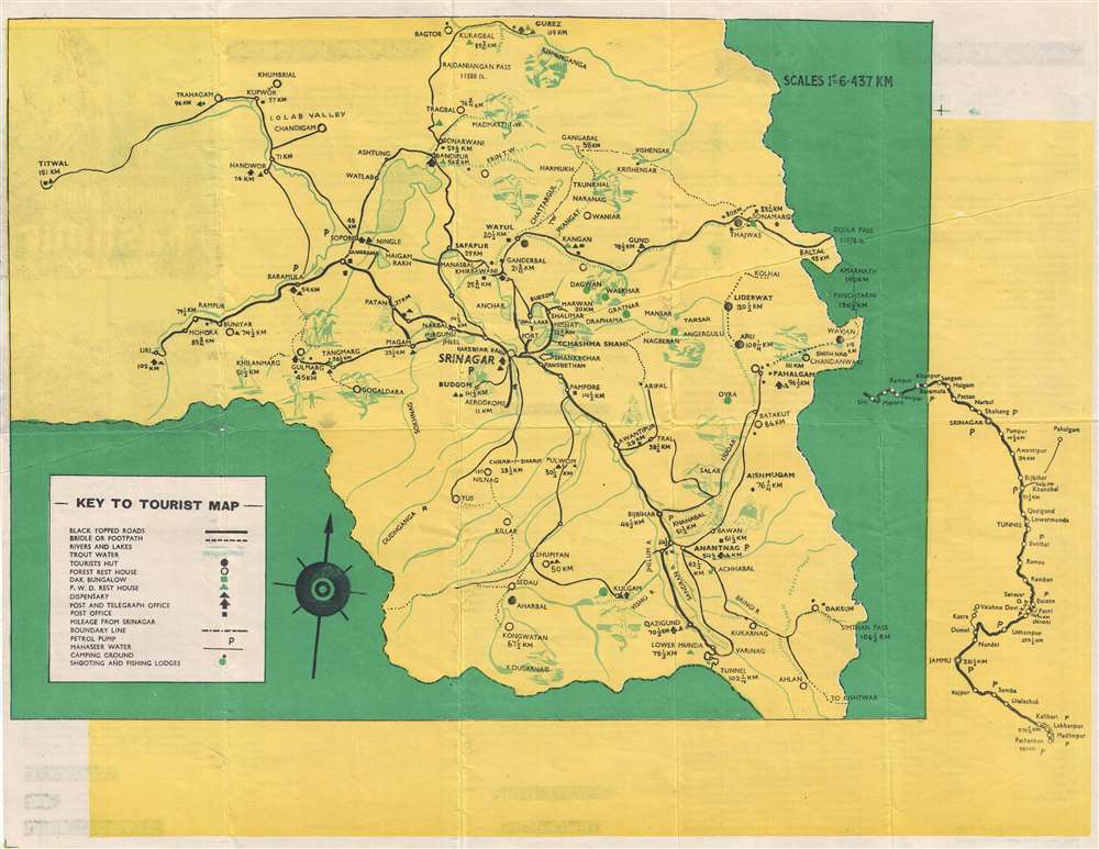
Tourist Map of Kashmir Valley.
$375.00
Acquire
- Digital Map Information
- Suitable for large format printing
- File Size: 5.92 MB
- File Type: ZIP / TIFF
- ICC color profile embedded
- Delivered instantly via download link
This is a c. 1950s Ashok tourist map of the Kashmir Valley in India. Centered on Srinagar, the map depicts the region from Titwal to Zojila Pass and from Bagtor and Burez to Ahlan. Numerous cities, towns, and villages are labeled throughout the region, and the transportation network is clearly marked. Black topped roads are illustrated by the solid black lines, while bridle and foot paths are noted by dashed lines, allowing the traveler to know exactly where they can and cannot drive. Petrol stations are also marked, as are post and telegraph offices. Various types of accommodations are also indicated, including tourist huts, forest rest houses, dak bungalows, and P.W.D. rest houses. Campgrounds and hunting and fishing lodges are also noted. Vignettes of various outdoor activities, including fishing, horseback riding, and hunting, populate the map and led it an air of fun. (more details)
The battle just before Colonel Price and his men reached Taos, New Mexico to put down the Taos Revolt.
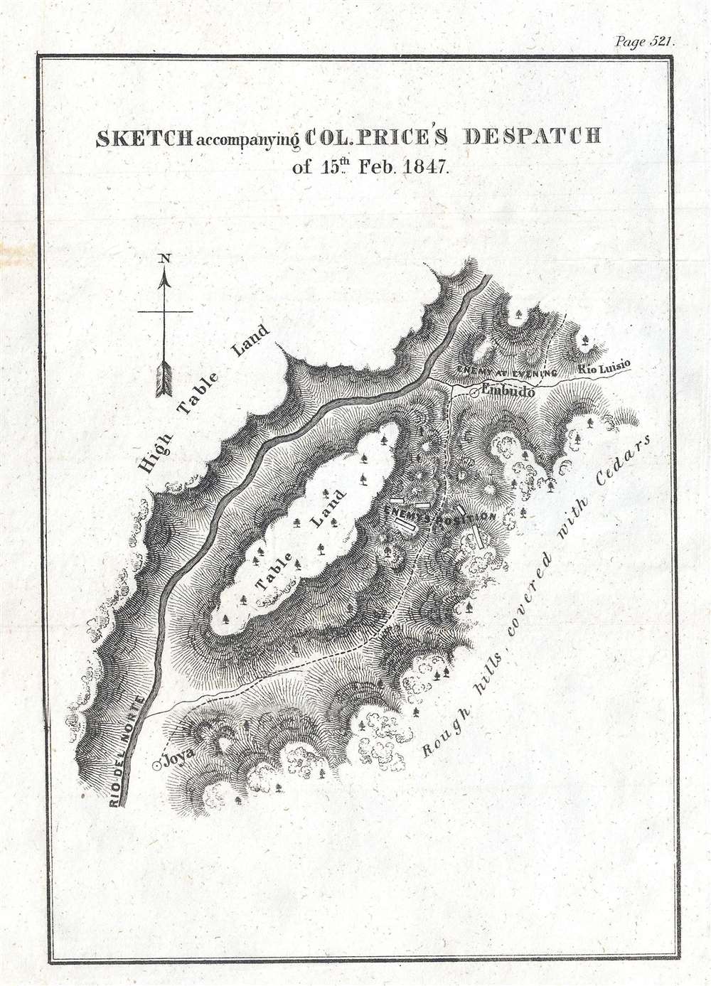
Sketch accompanying Col. Price's Despatch of 15th Feb. 1847.
$300.00
Acquire
- Digital Map Information
- Suitable for large format printing
- DPI: 300
- File Size: 1.14 MB
- File Type: ZIP / TIFF
- ICC color profile embedded
- Delivered instantly via download link
This is an 1847 William Hemsley Emory map of the Battle of Embudo Pass, one of the battles during the Taos Revolt in and near Taos, New Mexico, which was part of the Mexican-American War. Oriented to the north, the map depicts a section of Embudo Pass, a canyon not far from Taos. Colonel Sterling Price and the force he was leading to put down the Taos Revolt needed followed the Rio Grande (Rio del Norte) after defeating the insurrectionists at the Battle of Cañada. The column needed to travel along the road from La Joya (Joya) El Embudo (Embudo), which was flanked on both sides by high, rocky terrain, giving the region the look of a canyon. The road and the insurgent's positions are noted and labeled here, along with the Rio Grande and the highlands on either side of the canyon. (more details)
Probably the finest 19th century atlas map of Jamaica, Queens issued during the 19th century.
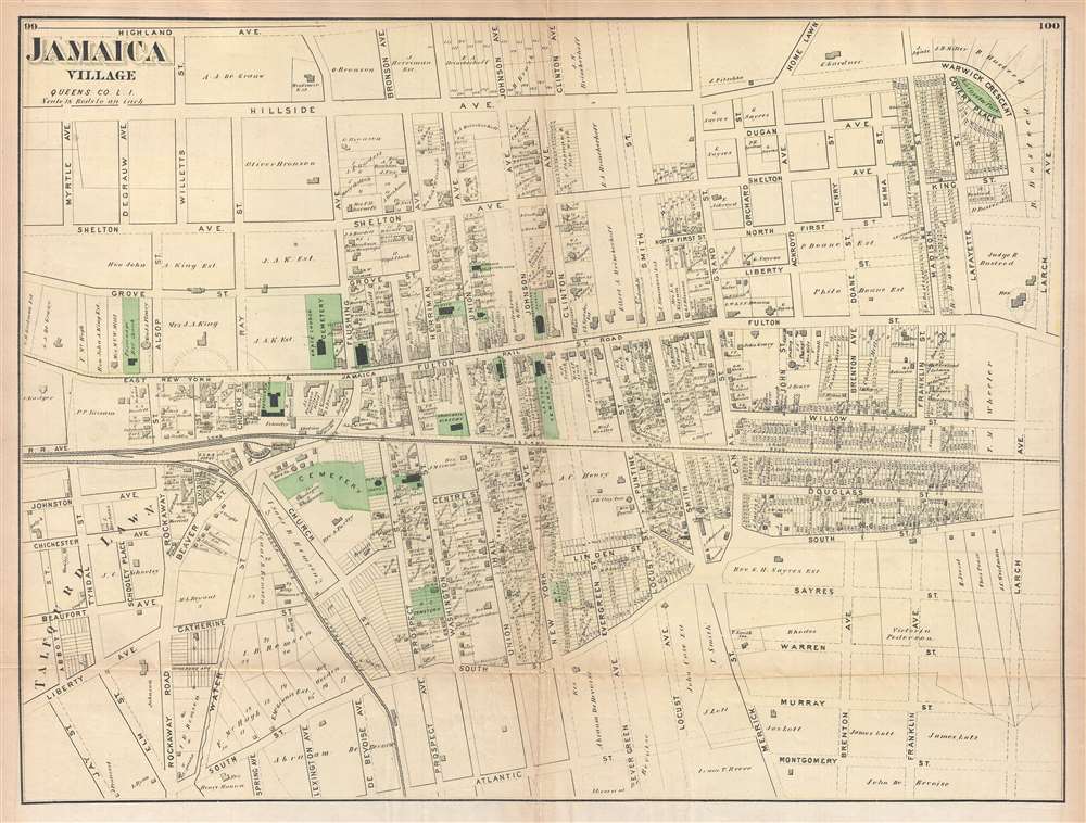
Jamaica Village, Queens Co. L.I.
$250.00
Acquire
- Digital Map Information
- Suitable for large format printing
- File Size: 7.81 MB
- File Type: ZIP / TIFF
- ICC color profile embedded
- Delivered instantly via download link
Probably the finest atlas map of the town of Jamaica to appear in the 19th century, this is an 1873 Fredrick W. Beers map of the town of Jamaica Village, Queens, New York. The map depicts the area from roughly modern-day Highland Avenue to Atlantic Avenue and from ... (more details)
The first significant Union victory during the U.S. Civil War.

Sketch of the Battlefield of Logan's Cross Roads and of the Enemy's Fortified Position at and opposite Mill Spring, KY.
$375.00
Acquire
- Digital Map Information
- Suitable for large format printing
- File Size: 3.21 MB
- File Type: ZIP / TIFF
- ICC color profile embedded
- Delivered instantly via download link
This is an 1877 separate issue Edmund Ruger and Nathaniel Michler map of the American Civil War Battlefield of Logan's Cross Roads / Mill Springs. Located near present-day Nancy, Kentucky, the map depicts the region in two sections: one from the intersection of the Jamestown Road and the Somerset Road to a Confederate Field Hospital along the Mill Spring Road, and then from approximately 1.25 miles from Mill Spring across the Cumberland River to Mill Spring. By separating the map, the cartographer was able to illustrate two separate actions (the Battle of Logan's Cross Roads and the Confederate entrenchment at Mill Spring) on the same sheet. In depicting the Battle of Logan's Cross Roads, numerous Union encampments are illustrated and labeled, as are positions occupied by both Union and Confederate troops. The course of the battle is also included by using shading to illustrate how the Union and Confederate positions changed throughout the battle; Union forces are marked with blue and Confederate positions are noted in red. (more details)
Identifies the Skansen and the Gröna Lund amusement park.
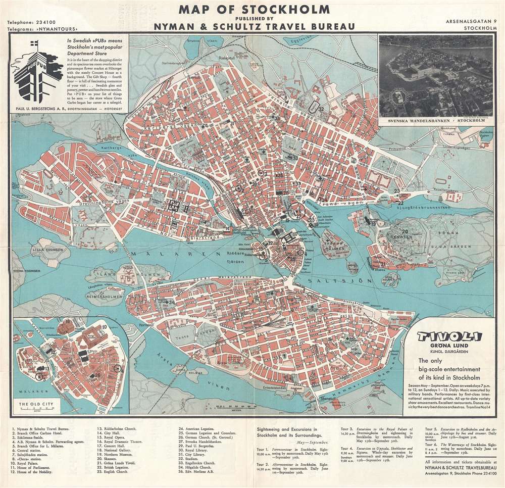
Map of Stockholm.
$350.00
Acquire
- Digital Map Information
- Suitable for large format printing
- File Size: 10.41 MB
- File Type: ZIP / TIFF
- ICC color profile embedded
- Delivered instantly via download link
This is a 1935 Nyman and Schultz city map or plan of Stockholm, Sweden. The map depicts the city from Tranebergsund to Durgården Island and from Brunnsviken to Skanstullbron. Highly detailed, myriad streets throughout the city are labeled, as are several ... (more details)
Monumental twelve panel map of Paris.
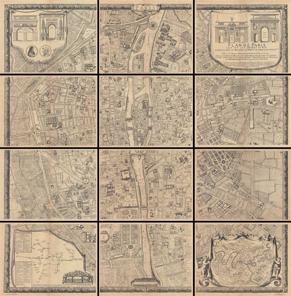
Plan De Paris, Levé Par Les Ordres Du Roy Et Par Les Soins De Messieurs Les Prevost Des Marchands Et Eschevins.
$3,000.00
Acquire
This majestic twelve panel map or plan of Paris is the c. 1900 Taride reissue of an important map originally prepared by Pierre Bullet, Francois Blonde, A. Bonnardt, and Bernard J. H. Jaillot. Like many early maps of Paris, the present example is ... (more details)
Features an inset map of the Wellesley College campus.
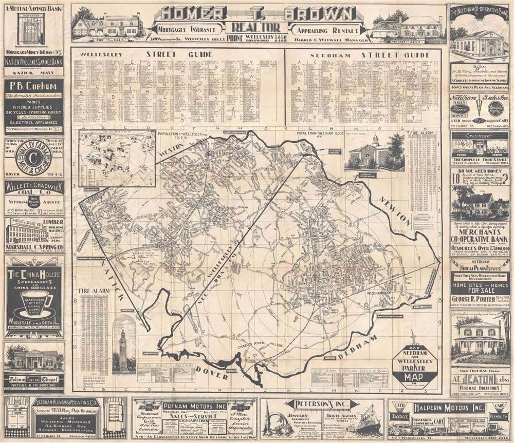
Needham and Wellesley Parker Map.
$350.00
Acquire
- Digital Map Information
- Suitable for large format printing
- File Size: 31.66 MB
- File Type: ZIP / TIFF
- ICC color profile embedded
- Delivered instantly via download link
This is a 1937 Parker Map Company city map or plan of Wellesley and Needham, Massachusetts. The map depicts the region from the boundary between Natick and Wellesley to the Charles River and from boundary between Weston and Wellesley and the ... (more details)
Illustrates the advance of the 79th Infantry Division across eastern France.
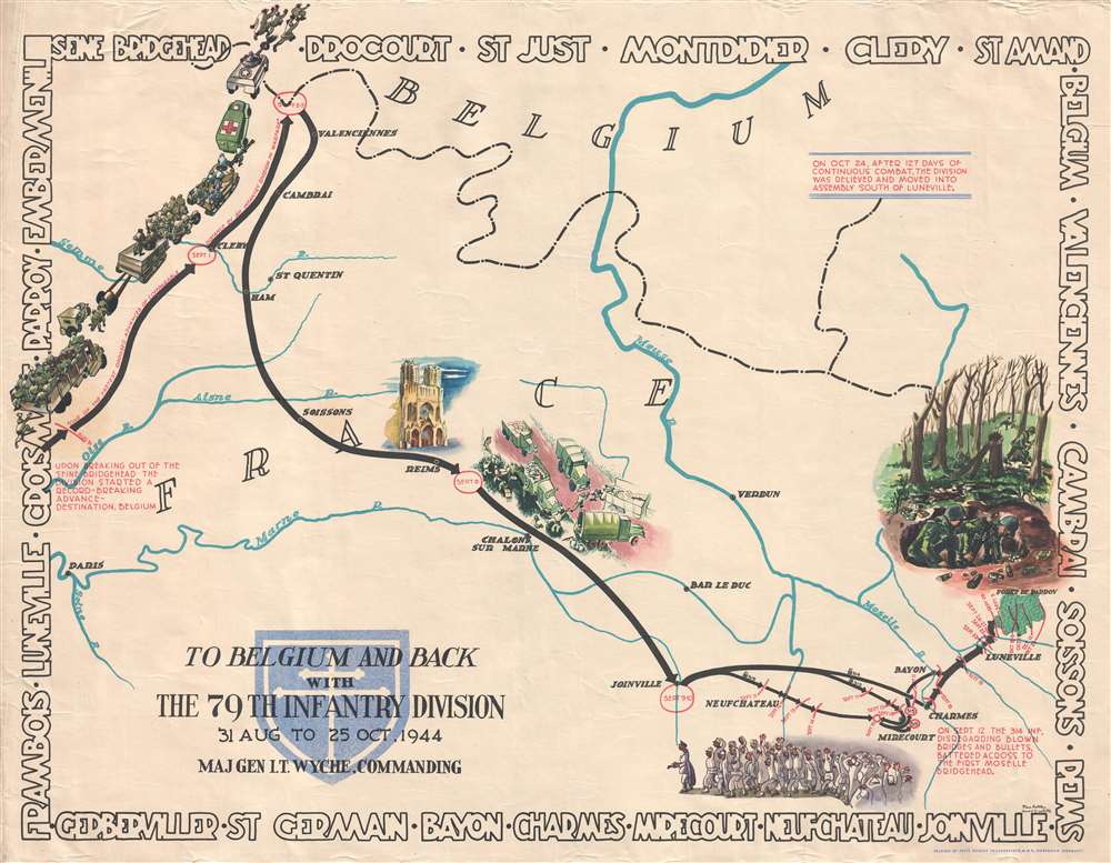
To Belgium and Back with the 79th Infantry Division 31 Aug to 25 Oct, 1944.
$550.00
Acquire
- Digital Map Information
- Suitable for large format printing
- File Size: 12.37 MB
- File Type: ZIP / TIFF
- ICC color profile embedded
- Delivered instantly via download link
This is a 1945 Steve Kaliher and Harry D. White pictorial map of the 79th Infantry Division's route through eastern France from north of Paris near the Oise River to the Parroy Forest. The second in a series of four maps depicting the division's advance through Europe after the Allied invasion, this map follows the division's movements from August 31 until October 25, 1944, when the division was pulled off the combat line for rest and training. Solid black arrows trace the division's progress, with red lettering indicating the date (or dates) spent in a specific location. (more details)
An interactive spinning disk featuring information about the Unbited States.
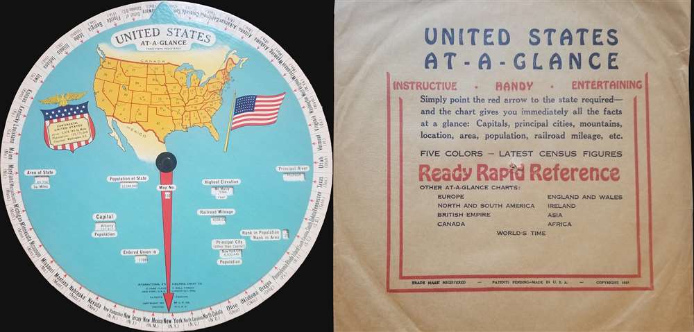
United States At-a-Glance.
$350.00
Acquire
- Digital Map Information
- Suitable for large format printing
- File Size: 1.31 MB
- File Type: ZIP / TIFF
- ICC color profile embedded
- Delivered instantly via download link
This is a 1931 International At-a-Glance Chart Company map of the United States. Created in the form of an interactive disk, the map depicts the entire continental United States from the Pacific Ocean to the Atlantic Ocean and from Canada to ... (more details)
Wonderful view of the short lived Loew Bridge in lower Manhattan.
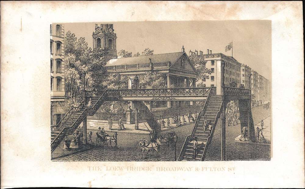
The 'Loew Bridge' Broadway and Fulton St.
$100.00
Acquire
- Digital Map Information
- Suitable for large format printing
- File Size: 1.28 MB
- File Type: ZIP / TIFF
- ICC color profile embedded
- Delivered instantly via download link
This is a lovely 1868 view of the Loew Bridge over Broadway and Fulton Street in New York City, by Shannon and Rogers. The view features the short-lived cast iron pedestrian bridge across New York City’s busiest street. Pedestrians are ... (more details)
Features profile views of the Ohio and Erie Canal and the Miami Canal.
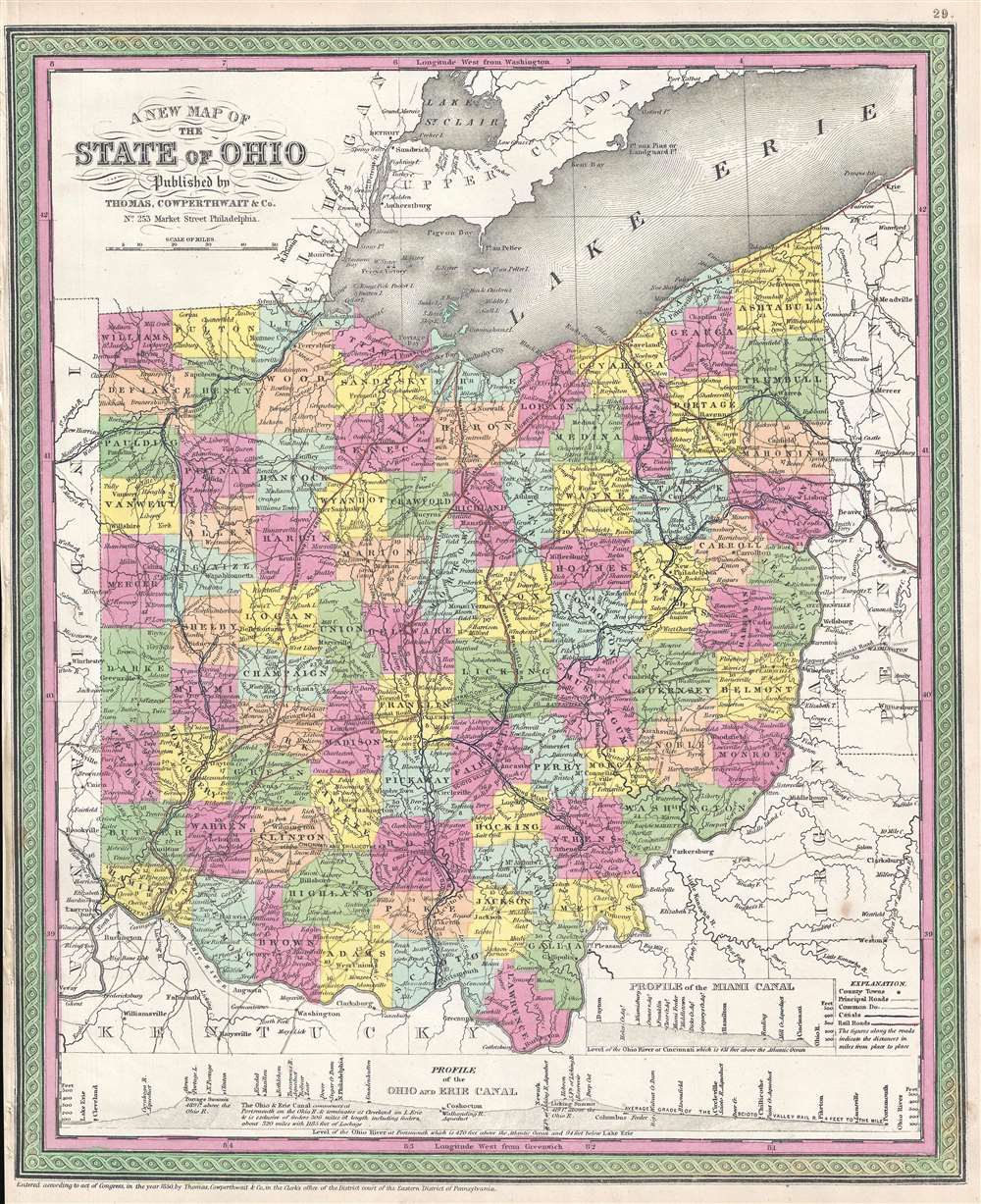
A New Map of the State of Ohio.
$225.00
Acquire
- Digital Map Information
- Suitable for large format printing
- DPI: 300
- File Size: 6.56 MB
- File Type: ZIP / TIFF
- ICC color profile embedded
- Delivered instantly via download link
This is an 1854 Thomas Cowperthwait and S. A. Mitchell's map of Ohio. The map depicts the state from Indiana to Pennsylvania and West Virginia (then still part of Virginia) and from Michigan and Canada to Kentucky and West Virginia. Highly ... (more details)
Depicts the length of the Senegal River in three maps on one sheet.
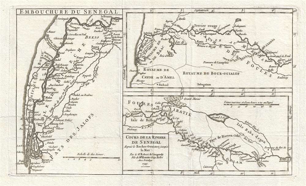
Cours de la Riviere de Senegal depuis le Rocher Gouinea jusqu'a la Mer. Par le Sr. Robert de Vaugondy Fils de Mr. Robert Géog. du Roi.
$200.00
Acquire
- Digital Map Information
- Suitable for large format printing
- DPI: 300
- File Size: 2.29 MB
- File Type: ZIP / TIFF
- ICC color profile embedded
- Delivered instantly via download link
This is a 1749 Didier Robert de Vaugondy map of Senegal and the Senegal River. The map depicts course of the Senegal River (in three maps printed on one sheet) from the Rocher Gouinea (a waterfall) to the Atlantic Ocean. Numerous different ... (more details)
An iconic map of Shanghai, China, featuring a dramatic panoramic photograph of the Bund.
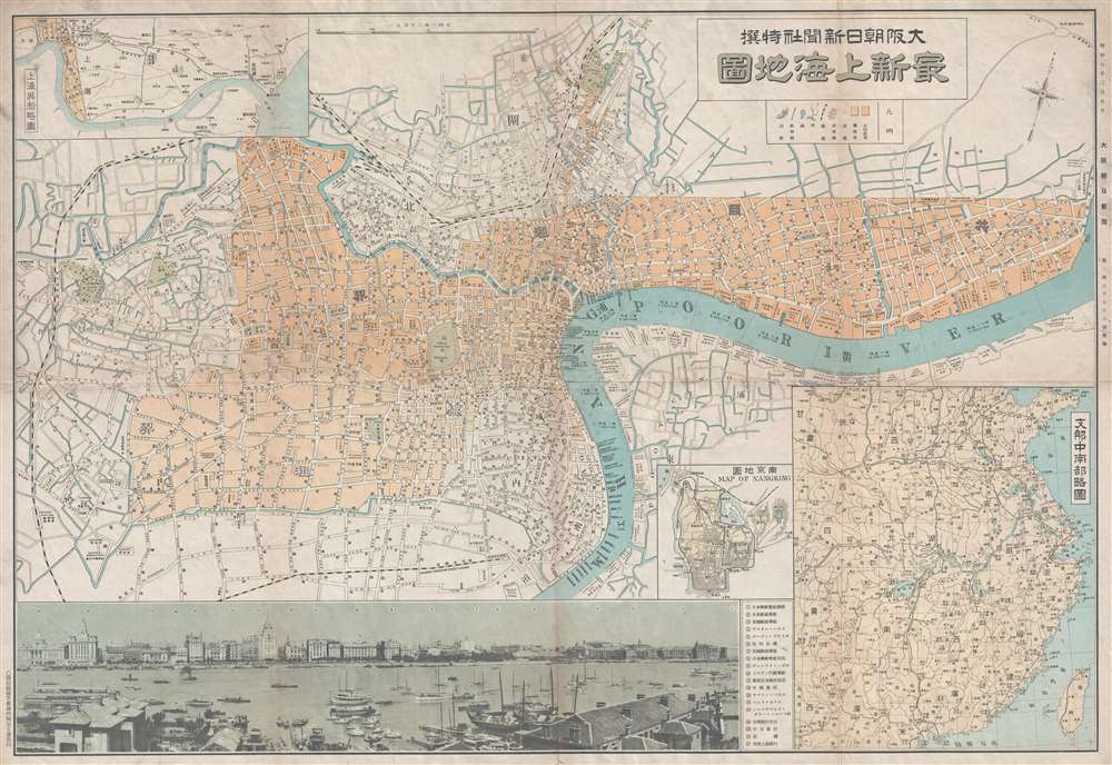
Saishin Shanhai chizu. Ōsaka Asahi Shinbunsha tokusen. / 大阪朝日新聞社特撰 . 最新上海地圖. / Osaka Asahi Shimbun Special Selection. Newest Map of Shanghai.
$600.00
Acquire
- Digital Map Information
- Suitable for large format printing
- File Size: 19.52 MB
- File Type: ZIP / TIFF
- ICC color profile embedded
- Delivered instantly via download link
This is a rare and attractive Showa 7 or 1932 Osaka Asahi Shimbun map of Shanghai, China. Printed in the 7th year of Hirohito's reign (Showa 7), it depicts downtown Shanghai including the Chinese Quarter, the French Concession, the English Quarter (along the Bund), etc. Important buildings along the Bund are carefully noted, including the first HSBC Bank, the British Club, the Palace Hotel (Swatch Art Peace Hotel), Sassoon House (Fairmont Peace Hotel), and the Customs House. There is also a lovely vintage panoramic photo of the Bund along the bottom of the map. A small inset map of Nanjing or Nanking is also included in the lower right quadrant of the map. Another larger inset shows a regional map. Most of the text is written in both Japanese and English. (more details)
A highly detailed city map of Beijing featuring inset maps along the bottom border.
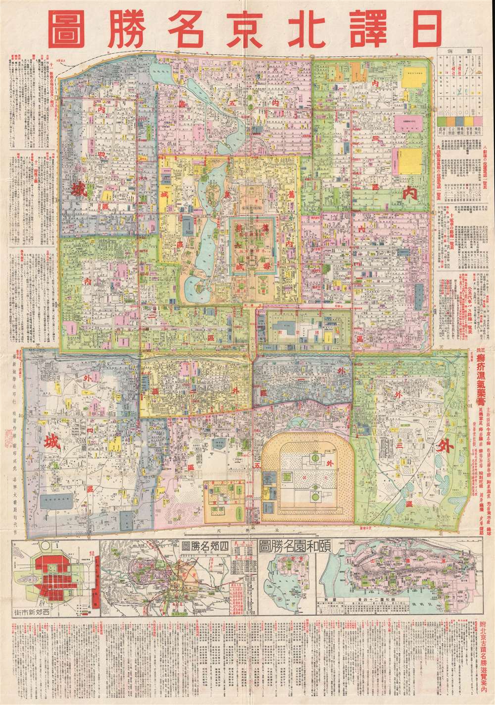
Beijing. / 圖勝名京北譯日.
$1,150.00
Acquire
- Digital Map Information
- Suitable for large format printing
- File Size: 21.39 MB
- File Type: ZIP / TIFF
- ICC color profile embedded
- Delivered instantly via download link
This is a c. 1930 Chinese city map or plan of Beijing (Peking), China. The map depicts the Outer city, the Inner city, the Imperial city, and the Forbidden City in minute detail, Myriad streets are labeled, as are various buildings, parks, ... (more details)
A Japanese bilingual map of Thailand before Thailand became a Japanese ally.

Distribution of Thai Natural Resources. / 圖布分源資國ㄔ夕.
$600.00
Acquire
- Digital Map Information
- Suitable for large format printing
- File Size: 28.05 MB
- File Type: ZIP / TIFF
- ICC color profile embedded
- Delivered instantly via download link
This is a bilingual English and Japanese 1941 Takeo Miyahara map of Thailand marking all Thai natural resources. The map depicts the region from Rangoon to Hainan and from Yunnan Province in China to Malaysia. Highly detailed, the ... (more details)
Dewey went from the victor of the Battle of Manila to being a front-runner for the Republican nomination for President.
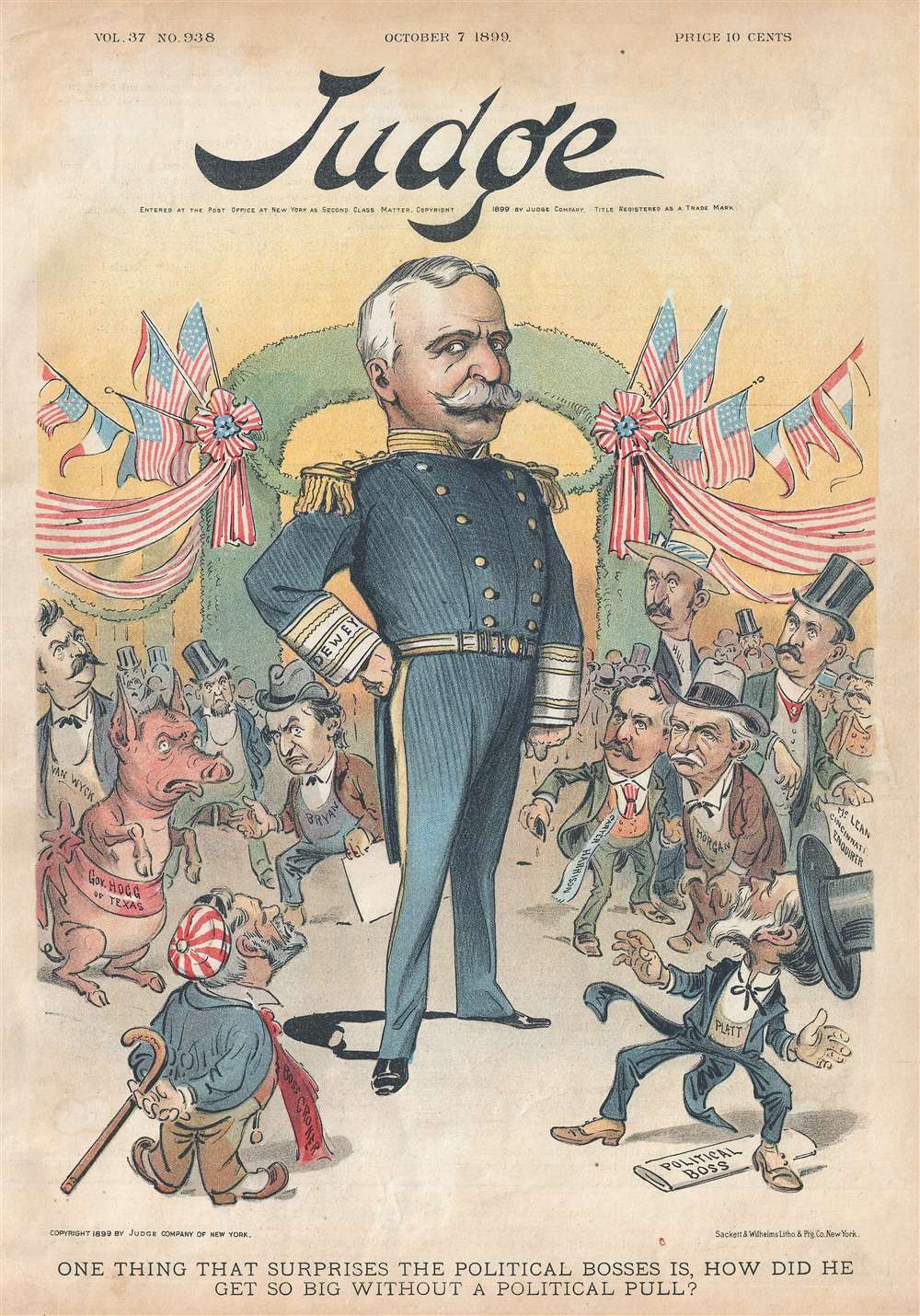
One Thing That Surprises the Political Bosses is, How Did He Get so Big Without a Political Pull?
$350.00
Acquire
- Digital Map Information
- Suitable for large format printing
- File Size: 3.28 MB
- File Type: ZIP / TIFF
- ICC color profile embedded
- Delivered instantly via download link
This is an 1899 Judge political cartoon marveling at the surprising political prominence of Admiral George Dewey in the early part of the presidential election cycle of 1900. The cartoon depicts a gigantic Dewey at the center of a party dressed in his Naval uniform surrounded by the most well-known political heavyweights of the day. William Jennings Bryan is present, as is Richard Welstead Crocker Sr. (November 24, 1843 - April 22, 1922), who was better known as 'Boss Croker' and was a leader of New York's notorious Tammany Hall. Thomas Collier Platt (July 15, 1833 - March 6, 1910) a two-term Congressman and the 'political boss' of the Republican Party in New York State is also included. (more details)
Bryan and the Democrats wilt under the heat of Republican successes and economic resurgence.
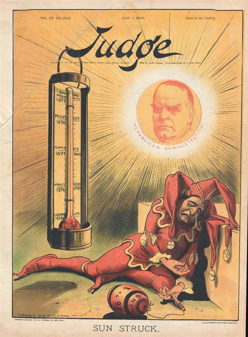
Sun Struck.
$350.00
Acquire
- Digital Map Information
- Suitable for large format printing
- File Size: 3.2 MB
- File Type: ZIP / TIFF
- ICC color profile embedded
- Delivered instantly via download link
This is an 1899 Grant Hamilton political cartoon reducing William Jennings Bryan, the Democratic nominee for President in 1896 and in 1900, to the role of a jester. Dressed in a traditional harlequin outfit, Bryan is wilting under the constant heat applied by the Republican party and the economic resurgence of 1897-1899. Since the main platform of the Democratic Party in 1896 and in 1900 was Free Silver, an economic upswing was not beneficial to the campaign strategy. It is important to note that Judge was a major supporter of McKinley throughout his presidency. (more details)
An official tourist map of the vicinity of Padang, Indonesia.
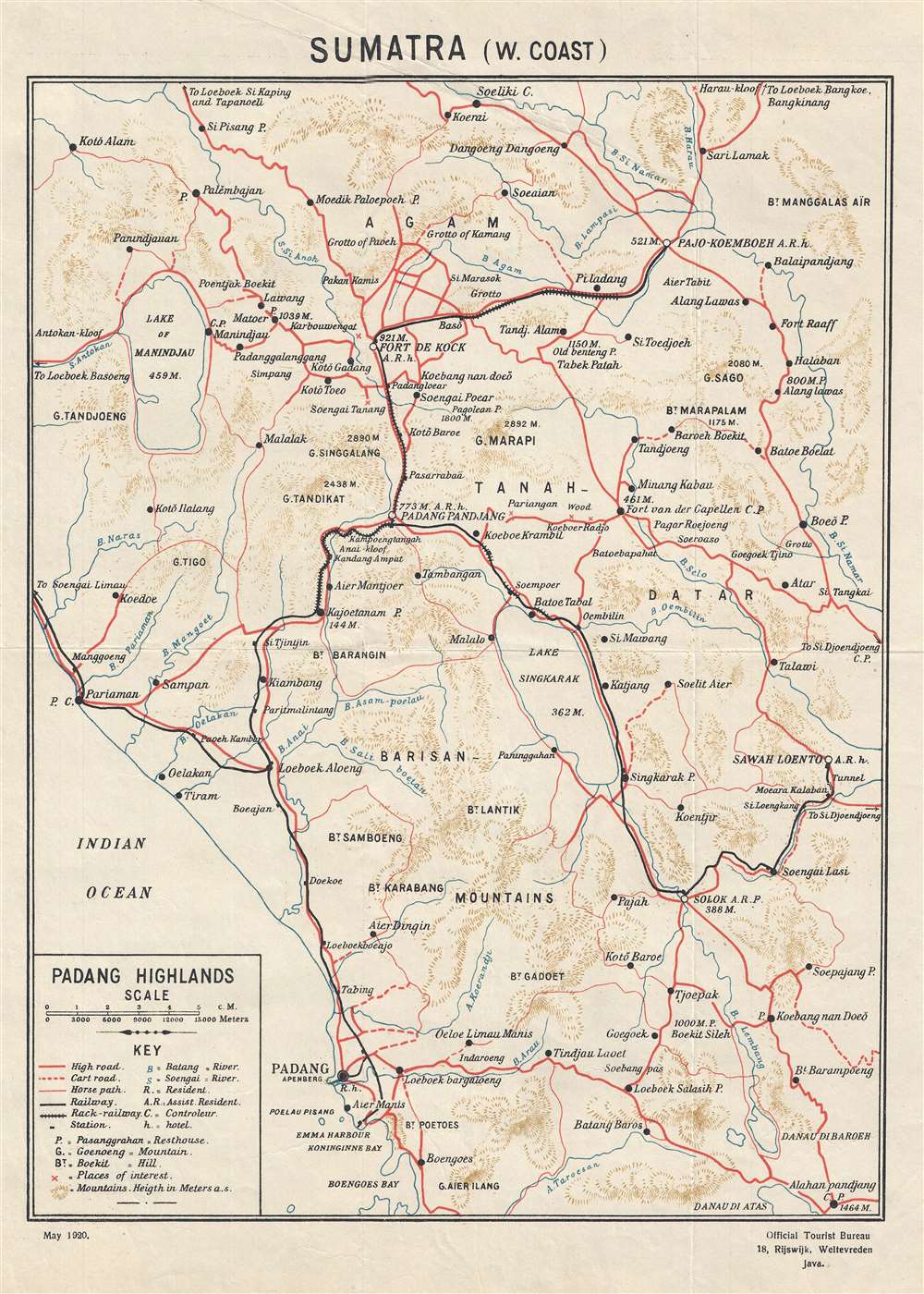
Sumatra (W. Coast)
$200.00
Acquire
- Digital Map Information
- Suitable for large format printing
- File Size: 4.13 MB
- File Type: ZIP / TIFF
- ICC color profile embedded
- Delivered instantly via download link
This is a 1920 Dutch East Indies Official Tourist Bureau map of the Padang Highlands in Sumatra. The map depicts the region from the Indian Ocean and the Lake of Manindjau to Sawah Loento and from Soeliki to Boengoes Bay. Numerous ... (more details)
One of the largest and most beautiful American commercial maps published in the 19th century.
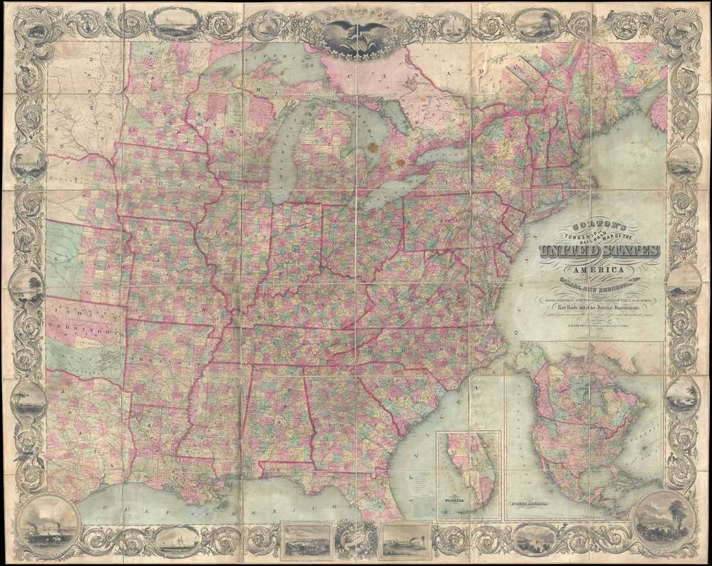
Map of the United States of America Including Canada, and a large portion of Texas, Showing Base Meridian and Township Lines of the U.S. Surveys, Including Lands alotted to the Indian Tribes west of the Mississippi, The various internal improvements.
$7,500.00
Acquire
- Digital Map Information
- Suitable for large format printing
- Full resolution TIFF file
- ICC color profile embedded
- Delivered instantly via download link
One of the most striking American large format wall maps ever issued. This is the 1862 American Civil War era case map of the United States by J. Calvin Smith and updated by J. H. Colton. The map covers from Austin Texas to the eastern seaboard and from Lake Superior to the Gulf of Mexico. Smith first introduced this map in 1843 buy the present much revised and updated example is the 1862 Civil War Colton edition. When it was introduced in 1843, this map was hailed as the largest, best, and most detailed map of the United States yet published. (more details)
A beautifully engraved map of the West Indies printed on highly desirable French Revolution blue handkerchief paper.
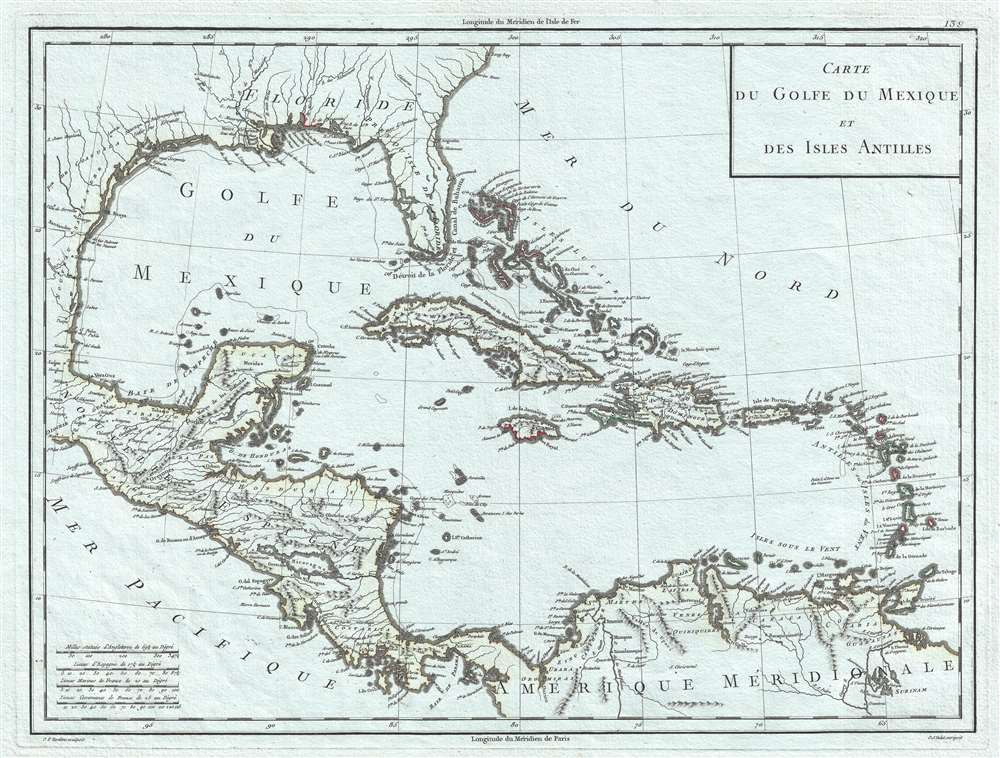
Carte du Golfe du Mexique et des Isles Antilles.
$650.00
Acquire
- Digital Map Information
- Suitable for large format printing
- DPI: 300
- File Size: 6.71 MB
- File Type: ZIP / TIFF
- ICC color profile embedded
- Delivered instantly via download link
This is a strikingly engraved c. 1795 Edme Mentelle and Pierre-Gilles Chanlaire map of the West Indies that is notably printed on high quality light French Revolution blue handkerchief paper, which briefly appeared during the French Revolution. The map depicts the region from Central America to the Atlantic Ocean and from the Gulf Coast of the United States to northern South America. Beautifully engraved, myriad locations throughout the region are labeled, including islands, archipelagos, and points and capes along the islands' coastlines. New Orleans and St. Augustine are labeled in the southern United States, along with Charleston (Charles Town) and numerous rivers. Regions in New Spain (Nouvelle Espagne) are labeled, as are towns, lakes, and mountains. (more details)