
Ruscelli, Girolamo (sold)
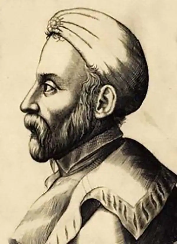
Girolamo Ruscelli (1500 - 1566) was an Italian polymath, humanist, editor, and cartographer active in Venice during the early 16th century. His work as a polygraph - a writer on many subjects, producing, editing, and copying content for the new printing industry - required erudition in a broad array of fields. Born in Viterbo, Ruscelli lived in Aquileia, Padua, Rome, and Naples before relocating to Venice, where he spent much of his life. Cartographically, Ruscelli is best known for his important revision of Ptolemy's Geographia, which he published in 1561, with further editions as late as 1599. Ruscelli's work represented a marked improvement on Gastaldi's 1548 Ptolemy, presenting both the ancient and modern maps in larger, more clearly-engraved examples. His edition also included maps not present in Gastaldi's Ptolemy, including the first double-hemisphere world map to appear in a Geography, the earliest mapping of the British Isles from an English source, and the notorious and influential Zeno map of the North Atlantic. Ruscelli is also listed as the editor of such important works as Boccaccio's Decameron, Petrarch's verse, Ariosto's Orlando Furioso, and various other works. In addition to his well-known cartographic work, many scholars associate Ruscelli with Alexius Pedemontanus, author of the popular De' Secreti del R. D. Alessio Piemontese. This well-known work, or "Book of Secrets," was a compilation of scientific and quasi-scientific medical recipes, household advice, and technical commentary on a range of topics that included metallurgy, alchemy, dyeing, and perfume making. Ruscelli, as Alexius, founded an "Academy of Secrets," a group of noblemen and humanists dedicated to unearthing "forbidden" scientific knowledge. This was the first known experimental scientific society and was later imitated by a number of other groups throughout Europe, including the Accademia dei Secreti of Naples.
Greatest Phantom Island of the Old World.
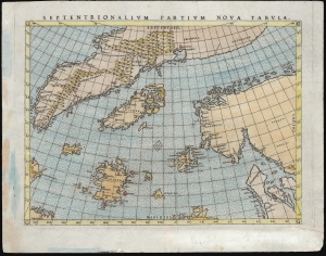
Septentrionalium Partium Nova Tabula.
sold
- Digital Map Information
- Suitable for large format printing
- Full resolution TIFF file
- ICC color profile embedded
- Delivered instantly via download link
This is Girolamo Ruscelli's 1562 edition of the 1558 Carta Da Navegar De Nicolo et Antonio Zeni Furono In Tramontana Lano MCCCLXXX by Nicoló Zeno the Younger, revealing the alleged 14th century voyages of his ancestors, Nicoló and Antonio Zeno. The fraud, seen largely as an attempt to co-opt the 1492 Columbian discovery of America, is responsible for the tenacity with which 16th and early 17th century geographers mapped the phantom islands Frisland, Icaria, Deogeo, and the coastline of Estotiland, which was taken to be the coast of Labrador. This first-plate example of Ruscelli's 1561 engraving, in its 1562 Latin text edition, which would have seen the greatest early dissemination of this image outside of Venice, and the biggest impact of its content on European geographical ideas. (more details)
Earliest acquirable state of the Zeno map.
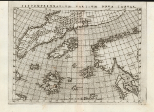
Septentrionalium Partium Nova Tabula.
sold
- Digital Map Information
- Suitable for large format printing
- Full resolution TIFF file
- ICC color profile embedded
- Delivered instantly via download link
This is the most important map of Girolamo Ruscelli's 1561 - 1562 edition Ptolemy: the earliest acquirable iteration of Nicoló Zeno's 1558 Carta Da Navegar De Nicolo et Antonio Zeni Furono In Tramontana Lano MCCCLXXX, revealing the alleged 14th-century voyages of Zeno's ancestors, Nicoló and Antonio. Zeno's fraud, intended to enhance his political power in Venice and later embraced as to co-opt the 1492 Columbia discovery of America, was responsible for the initial appearance and subsequent tenacity of the apocryphal islands Frisland, Icaria, Drogeo, and the coastline of Estotiland, which was taken by some of Europe's finest geographers to be the coast of Labrador. (more details)
Edition of the Earliest Acquirable Englishman's Map of the British Isles.
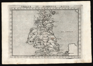
Anglia et Hibernia Nova.
sold
- Digital Map Information
- Suitable for large format printing
- Full resolution TIFF file
- ICC color profile embedded
- Delivered instantly via download link
This is a handsome example of Girolamo Ruscelli's 1561 / 1574 map of the British Isles. Of the maps prepared for Ruscelli's Ptolemy, it is among the most important: while most were larger, superior copies of the maps appearing in the 1548 Gastaldi Ptolemy, this map was a unique, updated work. (more details)
One of the Earliest Double-Hemisphere World Maps, Updated.
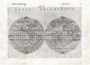
Orbis Descriptio.
sold
- Digital Map Information
- Suitable for large format printing
- DPI: 600
- File Size: 17.05 MB
- File Type: ZIP / TIFF
- ICC color profile embedded
- Delivered instantly via download link
This is a 1598, second-state issue of Girolamo Ruscelli's 1561 map of the world. In its first, 1561 state it was the earliest acquirable double-hemisphere world map, but even this later issue remains one of the earliest acquirable maps to use this format. Like most maps in Ruscelli’s Ptolemy, the geographic details were based on Giacomo Gastaldi's (1500 - 1566) 1548 Ptolemy. Here, the double-hemispherical projection transforms this map into a fully new composition. Amongst printed maps, it is predated only by the unacquirable 1555 Georgio Sideri 'Calapoda' (fl. 1537–1565) map. The 1598 edition of Ruscelli's Ptolemy was edited by Giuseppe Rosaccio, who updated many of the maps in order to make them more competitive; most often, this involved the addition of purely decorative elements. In the case of the present map, significant geographical changes have taken place, most notably the addition of a massive southern continent not present on the 1561 issue. (more details)
Northeastern limits of Ptolemy's landlocked Indian Ocean.
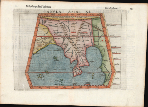
Tabula Asiae XI.
sold
- Digital Map Information
- Suitable for large format printing
- Full resolution TIFF file
- ICC color profile embedded
- Delivered instantly via download link
This is Girolamo Ruscelli's 1561 / 1598 map of Southeast Asia and the Malay Peninsula. The region was known to ancient geographers as 'India Extra Gangem,' or 'India Beyond the Ganges'. (more details)
Early map of Italy.
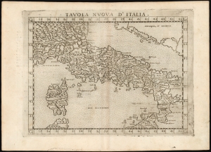
Tavola Nuova d' Italia.
sold
- Digital Map Information
- Suitable for large format printing
- DPI: 600
- File Size: 12.99 MB
- File Type: ZIP / TIFF
- ICC color profile embedded
- Delivered instantly via download link
This is Girolamo Ruscelli's 1574 edition of Giocomo Gastaldi's modern map of Italy, an attractive early copperplate map based on contemporary cartographic information. (more details)
Among the Earliest Acquirable Contemporary Maps of the Baltic Coast.
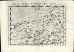
Tavola nuova di Prussia et di Livonia.
sold
- Digital Map Information
- Suitable for large format printing
- Full resolution TIFF file
- ICC color profile embedded
- Delivered instantly via download link
This is the 1561 first Ruscelli edition of Giacomo Gastaldi's map of the Baltic Coast of Prussia and Livonia, now the coastline of Poland, Lithuania, Latvia, and Estonia. It is among the earliest detailed maps of this part of the world based on contemporary geographical knowledge, particularly with respect to the Gulf of Riga. (more details)
One of the earliest works to depict a peninsular Qatar.
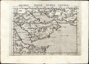
Arabia Felice Nuova Tavola.
sold
- Digital Map Information
- Suitable for large format printing
- Full resolution TIFF file
- ICC color profile embedded
- Delivered instantly via download link
This is a superb example of Girolamo Ruscelli's 1561, first edition of the first modern map of the Arabian Peninsula, specifically the fertile part of Arabia, 'Arabia Felix.' It is an expanded and more finely engraved evolution on Gastaldi's 1548 cartography, and one of the earliest acquirable depictions of Arabia not based on the 2nd-century work of Claudius Ptolemy. The island of Bahrain (Baharam) appears. This is also one of the earliest works to depict a peninsular Qatar. (more details)
Asia and America Conjoined.
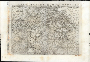
Carta Marina Nuova Tavola.
sold
- Digital Map Information
- Suitable for large format printing
- Full resolution TIFF file
- ICC color profile embedded
- Delivered instantly via download link
This is Girolamo Ruscelli's 1561 map of the world,Carta Marina Nuova Tavola. It was one of three world maps in Ruscelli's edition of Ptolemy: one depicted the ancient world, while two - this, and a double-hemisphere map - were modern works. This striking work, with its array of rhumb lines, was an enlarged and improved version of Giacomo Gastaldi's 1548 Carta Marina Nova Tabula and shared with that earlier map an abundance of unusual features. (more details)
Asia and America Conjoined.
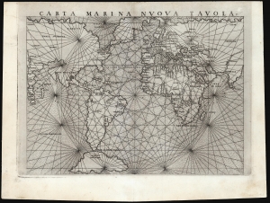
Carta Marina Nuova Tavola.
sold
- Digital Map Information
- Suitable for large format printing
- Full resolution TIFF file
- ICC color profile embedded
- Delivered instantly via download link
This is a superb example of Girolamo Ruscelli's 1561 map of the world,Carta Marina Nuova Tavola. It was one of three maps in Ruscelli's edition of Ptolemy: one depicted the ancient world, while two - this, and a double-hemisphere map - were modern works. This striking work, with its array of rhumb lines, was an enlarged and improved version of Giacomo Gastaldi's 1548 Carta Marina Nova Tabula and shared with that earlier map an abundance of unusual features. (more details)
Ptolemy's Second Projection.
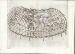
Ptolemaei Typus.
sold
- Digital Map Information
- Suitable for large format printing
- Full resolution TIFF file
- ICC color profile embedded
- Delivered instantly via download link
This is a superb example of a foundational work of Renaissance cartography: Girolamo Ruscelli's 1561 map of the known world during the ascendency of the Roman Empire. This presentation of ancient geography is refreshingly unique in that it employs Ptolemy's second projection rather than the more typical, simpler first projection. (more details)
Ptolemy's Second Projection, Ruscelli's First Edition.
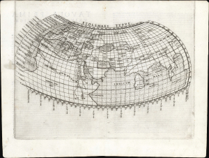
Ptolemaei Typus.
sold
- Digital Map Information
- Suitable for large format printing
- Full resolution TIFF file
- ICC color profile embedded
- Delivered instantly via download link
This is a strong example of a foundational work of Renaissance cartography, in its first edition: Girolamo Ruscelli's 1561 map of the known world during the ascendency of the Roman Empire. This presentation of ancient geography is refreshingly unique in that it employs Ptolemy's second projection rather than the more typical, simpler first projection. (more details)
Ptolemy's Second Projection.
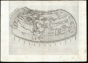
Ptolemaei Typus.
sold
- Digital Map Information
- Suitable for large format printing
- Full resolution TIFF file
- ICC color profile embedded
- Delivered instantly via download link
This is Girolamo Ruscelli's 1561 first issue of a foundational work of Renaissance cartography: the map of the known world as understood at the time of the Roman Empire. This presentation of ancient geography is refreshingly unique in that it employs Ptolemy's second projection, as opposed to the more typical, simpler first projection. (more details)
Ptolemy's Second Projection.
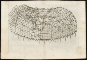
Ptolemaei Typus.
sold
- Digital Map Information
- Suitable for large format printing
- Full resolution TIFF file
- ICC color profile embedded
- Delivered instantly via download link
This is Girolamo Ruscelli's 1561 plate of a foundational work of Renaissance cartography: the map of the known world as understood at the time of the Roman Empire. This presentation of ancient geography is refreshingly unique in that it employs Ptolemy's second projection, as opposed to the more typical, simpler first projection. (more details)
First Double-Hemisphere Map of the World in a Printed Atlas.

Orbis Descriptio.
sold
- Digital Map Information
- Suitable for large format printing
- Full resolution TIFF file
- ICC color profile embedded
- Delivered instantly via download link
This is the 1561 Girolamo Ruscelli map of the world, in the first state of the first plate. It is the earliest acquirable double-hemisphere world map and is the first such to appear in a printed atlas. Like most maps in Ruscelli's Ptolemy, the geographic details were derived from Giacomo Gastaldi's (1500 - 1566) 1548 Ptolemy. Here, the double-hemispherical projection transforms this map into a fully new composition. Amongst printed maps, the only earlier map using this projection is the unacquirable 1555 Georgio Sideri 'Calapoda' (fl. 1537 - 1565) map. (more details)
First Double-Hemisphere Map of the World in a Printed Atlas.
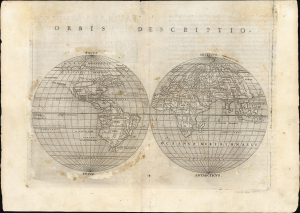
Orbis Descriptio.
sold
- Digital Map Information
- Suitable for large format printing
- Full resolution TIFF file
- ICC color profile embedded
- Delivered instantly via download link
This is the 1561 Girolamo Ruscelli map of the world, in the first state of the first plate. It is the earliest acquirable double-hemisphere world map and is the first such to appear in a printed atlas. Like most maps in Ruscelli's Ptolemy, the geographic details were derived from Giacomo Gastaldi's (1500 - 1566) 1548 Ptolemy. Here, the double-hemispherical projection transforms this map into a fully new composition. Amongst printed maps, the only earlier map using this projection is the unacquirable 1555 Georgio Sideri 'Calapoda' (fl. 1537 - 1565) map. (more details)
First Double-Hemisphere World in a Printed Atlas.
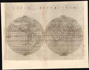
Orbis Descriptio.
sold
- Digital Map Information
- Suitable for large format printing
- Full resolution TIFF file
- ICC color profile embedded
- Delivered instantly via download link
This is a 1561 first plate issue of Girolamo Ruscelli's double hemisphere map of the world. It is the earliest acquirable world map in this format, and is the first such to appear in a printed atlas. Like most maps in Ruscelli’s Ptolemy, the geographic details were based on Giacomo Gastaldi's (1500 - 1566) 1548 Ptolemy. Here, the projection transforms this map into fully new composition. Amongst printed double-hemisphere world maps, it is predated only by the unacquirable 1555 Georgio Sideri 'Calapoda' (fl. 1537–1565) map. (more details)
First Double-Hemisphere World in a Printed 'Atlas.'
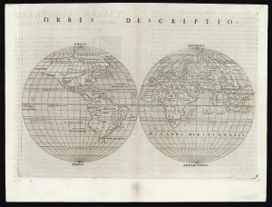
Orbis Descriptio.
sold
- Digital Map Information
- Suitable for large format printing
- Full resolution TIFF file
- ICC color profile embedded
- Delivered instantly via download link
This is the 1561 Girolamo Ruscelli map of the world, in the first state of the first plate. It is the earliest acquirable double hemisphere world map, and is the first such to appear in a geography. Like most maps in Ruscelli's work, the broad geographic details were derived from Giacomo Gastaldi's (1500 - 1566) 1548 Ptolemy. Here, the double-hemispherical projection - along with elements incorporated from new geographical sources - transforms this map into a fully new composition. Amongst printed maps, the only earlier map using this projection is the unacquirable 1555 Georgio Sideri 'Calapoda' (fl. 1537 - 1565) map. (more details)
First Double-Hemisphere World in a Printed Geography.
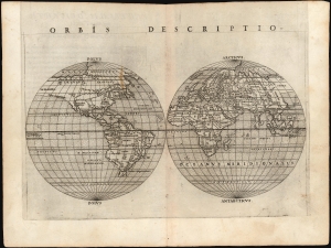
Orbis Descriptio.
sold
- Digital Map Information
- Suitable for large format printing
- Full resolution TIFF file
- ICC color profile embedded
- Delivered instantly via download link
This is the 1561 Girolamo Ruscelli map of the world, in the first state of the first plate. It is the earliest acquirable double hemisphere world map, and is the first such to appear in a printed geography. While many of its geographical details derived from Giacomo Gastaldi's 1548 Ptolemy, this map's incorporation of new information for the north Atlantic and its new projection transformed this map into a fully new composition. Amongst printed maps, the only earlier map using this projection is the unacquirable 1555 Georgio Sideri 'Calapoda' (fl. 1537 - 1565) map. (more details)
First Double-Hemisphere World in a Printed Atlas.
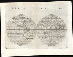
Orbis Descriptio.
sold
- Digital Map Information
- Suitable for large format printing
- Full resolution TIFF file
- ICC color profile embedded
- Delivered instantly via download link
This is a 1561 first plate issue of Girolamo Ruscelli's double hemisphere map of the world. It is the earliest acquirable world map in this format, and is the first such to appear in a printed atlas. Like most maps in Ruscelli’s Ptolemy, the geographic details were based on Giacomo Gastaldi's (1500 - 1566) 1548 Ptolemy. Here, the double-hemispherical projection transforms this map into fully new composition. Amongst printed maps, it is predated only by the unacquirable 1555 Georgio Sideri 'Calapoda' (fl. 1537–1565) map. (more details)
First State of one of the Earliest Modern Maps of the Holy Land and Cyprus.
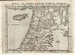
Soria et Terra Santa Nuova Tavola.
sold
- Digital Map Information
- Suitable for large format printing
- Full resolution TIFF file
- ICC color profile embedded
- Delivered instantly via download link
This is a superb, first state example of Girolamo Ruscelli's 1561 map of the Holy Land and Cyprus. It is an enlarged, more finely-engraved iteration of Giocomo Gastaldi's 1548 Soria e Terra Sancta nova tabula. While Tibbetts avers that the Ruscelli contains fewer place names than its Gastaldi source, he is incorrect: Ruscelli's map preserves all the data of the Gastaldi, but between the increased size of the plate and the clear, legible, and well-spaced engraving of the newer map, its data is presented without the crowding evident on the 1548 map. The skill evident in this 1561 work can be credited to the engraver Giulio Sanuto, one of the few Venetian engravers whose career was not isolated either to map engraving or to figurative artistic works, but consisted of both over a career of more than forty years. (more details)
First Specific Copperplate Map of Brazil.
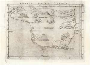
Brasil Nuova Tavola.
sold
- Digital Map Information
- Suitable for large format printing
- Full resolution TIFF file
- ICC color profile embedded
- Delivered instantly via download link
This is a 1561 first plate issue of Girolamo Ruscelli's map of Brazil. It is among the first, detailed specific maps of any part of South America. While most of the maps in Ruscelli’s edition of Ptolemy were based on those appearing in Gastaldi's 1548 Ptolemy, this map was a new composition. It is predated only by the Ramusio woodcut map of 1556, whose geography is also credited to Gastaldi, and from which much of the detail of the Ruscelli is derived. (more details)
One of the First Acquirable Maps of the North American East Coast in its earliest issue.
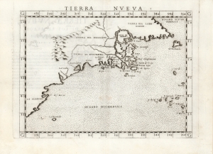
Tierra Nueva.
sold
- Digital Map Information
- Suitable for large format printing
- Full resolution TIFF file
- ICC color profile embedded
- Delivered instantly via download link
This is the first state, first edition, of Girolamo Ruscelli's 1561 map 'Tierra Nueva', an early and influential map of what would become New England and the Canadian Maritime Provinces. It is among the earliest acquirable maps to cover the eastern coastline of North America. The map spans from upper Florida northwards past Cabo de Santa Maria to Larcadia (Kitty Hawk), Angoulesme (New York Harbor), Nova Scotia, and Labrador. The map is a further development of the 1548 Gastaldi map of the same region. The Gastaldi was limited entirely to the coastline, while Ruscelli's map attempted to show a network of rivers and is among the first regional maps to show mountains in the interior of North America. (more details)
One of the earliest obtainable maps of New England. Shows Norumbega, the 'New England El Dorado'.
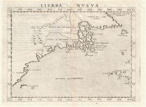
Tierra Nveva.
sold
- Digital Map Information
- Suitable for large format printing
- DPI: 300
- File Size: 3.1 MB
- File Type: ZIP / TIFF
- ICC color profile embedded
- Delivered instantly via download link
This is the first state, first edition, of Girolamo Ruscelli's 1561 map 'Tierra Nveva,' an early and influential map of what would become New england and the Canadian Maritime Provinces. The map covers the eastern coastline of North American from somewhere in upper ... (more details)
One of the First Acquirable Maps of South America.
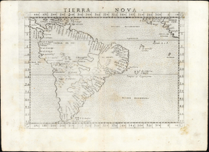
Tierra Nova.
sold
- Digital Map Information
- Suitable for large format printing
- Full resolution TIFF file
- ICC color profile embedded
- Delivered instantly via download link
This is the first state of Girolamo Ruscelli's 1561 map of South America, one of the first printed maps dedicated to the region. Among other points of note, this is among the first maps to provide information on the west coast of South America derived from actual contemporaneous exploration. (more details)
One of the earliest Acquirable Post-Magellan Maps of Southeast Asia.
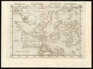
India Tercera Nuova Tavola.
sold
- Digital Map Information
- Suitable for large format printing
- Full resolution TIFF file
- ICC color profile embedded
- Delivered instantly via download link
This is a superb example of the first state of Girolamo Ruscelli's 1561 map of the East Indies and Southeast Asia. It is among the earliest maps of Southeast Asia. Although based on Giacomo Gastaldi's 1548 map of the same title, it is roughly twice the size, and overall, a superior engraving. This was the third of the modern regional Asia maps of this edition of Ptolemy, hence 'Tercera'. (more details)
One of the earliest acquirable Post-Magellan maps of Southeast Asia.
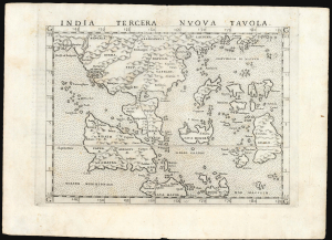
India Tercera Nuova Tavola.
sold
- Digital Map Information
- Suitable for large format printing
- Full resolution TIFF file
- ICC color profile embedded
- Delivered instantly via download link
This is a beautiful first state example of Girolamo Ruscelli's 1561 map of the East Indies and Southeast Asia, among the earliest maps of Southeast Asia. Although based on Giacomo Gastaldi's 1548 map of the same title, it is roughly twice the size and better engraved. (more details)
Early mapping of Florida and California as peninsulas and large iteration of Verrazano's Sea. America is connected to Asia!

Carta Marina Nuova Tavola.
sold
- Digital Map Information
- Suitable for large format printing
- DPI: 300
- File Size: 3.26 MB
- File Type: ZIP / TIFF
- ICC color profile embedded
- Delivered instantly via download link
A nice example of Girolamo Ruscelli's 1561 Carta Marina maritime map of the world. This is one of two 'modern' maps accompanying the Vincenzo Valgrisi / Ruscelli Venice edition of Ptolemy's Geographica . Cartographically it is a slightly enlarged derivation from ... (more details)
One of the earliest maps of the Balkans.
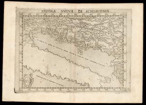
Tavola Nuova di Schiavonia.
sold
- Digital Map Information
- Suitable for large format printing
- DPI: 600
- File Size: 12.15 MB
- File Type: ZIP / TIFF
- ICC color profile embedded
- Delivered instantly via download link
This is Girolamo Ruscelli's 1574 edition of Giocomo Gastaldi's modern map of the Dalmatian coast. (more details)
Describing a Navigable World.
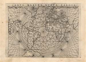
Carta Marina Nuova Tavola.
sold
- Digital Map Information
- Suitable for large format printing
- Full resolution TIFF file
- ICC color profile embedded
- Delivered instantly via download link
This is an attractive example of Girolamo Ruscelli's 1561 map of the world,Carta Marina Nuova Tavola. It was one of three maps in Ruscelli's edition of Ptolemy. One of these was Ptolemy's map while two - this, and a double-hemisphere map - were modern works. This striking work, with its array of rhumb lines, was an enlarged and improved version of Giacomo Gastaldi's 1548 Carta Marina Nova Tabula. As such, it reflects the puzzling features of that earlier map: not merely those which differ from modern understanding of the globe, but sharp differences between Gastaldi's own maps of the same period, and indeed differences between this and Ruscelli's other modern map appearing in the same work. (more details)
Northeastern limits of Ptolemy's landlocked Indian Ocean.
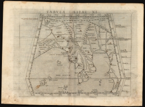
Tabula Asiae XI.
sold
- Digital Map Information
- Suitable for large format printing
- Full resolution TIFF file
- ICC color profile embedded
- Delivered instantly via download link
This is a handsome example of Girolamo Ruscelli's 1561 / 1574 map of Southeast Asia and the Malay Peninsula. The region was known to ancient geographers as 'India Extra Gangem,' or 'India Beyond the Ganges'. (more details)
Mapping the Northern Limits of the Roman Empire.
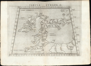
Tabula Europae I.
sold
- Digital Map Information
- Suitable for large format printing
- Full resolution TIFF file
- ICC color profile embedded
- Delivered instantly via download link
This is a handsome example of Girolamo Ruscelli's 1561 Ptolemaic map of the British Isles. The map captures the northwest limits of what Ancient Rome knew of the world, reflecting Julius Caesar and Claudius' invasions of England. (more details)
Latin Edition of an Influential Geography
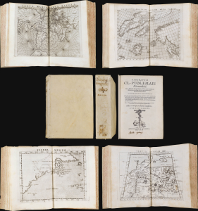
This is a superb example of Girolamo Ruscelli's Geographia Cl. Ptolemaei Alexandrini, the 1562 edition of his expanded Ptolemy, featuring the new Latin re-translation of the work by Giuseppe Moleto, amending Willibald Pirckheimer's translation of Ptolemy's text. Ruscelli's Geographia was a tour de force and, in this Latin edition, it reached its broadest audience, marking this as the most important edition of Ruscelli's Ptolemy. With its complement of maps beautifully engraved by Giulio Sanuto (particularly the Zeno map of the North Atlantic), the work had a long-standing influence on European geographical thought. The maps here are all in their first state and are thus most desirable. (more details)
The Greatest Phantom Island of the Old World.
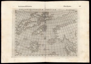
Septenirionalium Partium Nova Tabula.
sold
- Digital Map Information
- Suitable for large format printing
- DPI: 600
- File Size: 15.77 MB
- File Type: ZIP / TIFF
- ICC color profile embedded
- Delivered instantly via download link
This is Girolamo Ruscelli's 1599 edition of the 1558 Carta Da Navegar De Nicolo et Antonio Zeni Furono In Tramontana Lano MCCCLXXX by Nicoló Zeno the Younger, revealing the alleged 14th century voyages of his ancestors, Nicoló and Antonio Zeno. The fraud, largely an attempt to co-opt Columbus' 1492 discovery of America, is responsible for the tenacity with which sixteenth and early seventeenth century geographers mapped the phantom islands Frisland, Icaria, Deogeo, and the coastline of Estotiland, which was taken to be the coast of Labrador. (more details)
A fine early map of Ceylon depicting an Elephant.
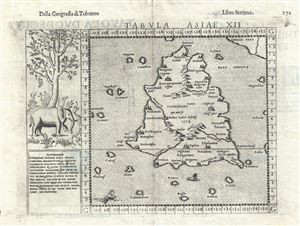
Tabula Asiae XII.
sold
- Digital Map Information
- Suitable for large format printing
- DPI: 300
- File Size: 3.34 MB
- File Type: ZIP / TIFF
- ICC color profile embedded
- Delivered instantly via download link
A highly appealing 1574 map of Ceylon, Sri Lanka, or as it was then known, Tapobrana. The first mention of Tapobrana is in the Geographia of Claudius Ptolemy. Today, Ptolemy's Taprobana is considered by some scholars to be entirely mythological and by others to ... (more details)
Reflects the curious Ptolemaic convention of a landlocked Indian Ocean
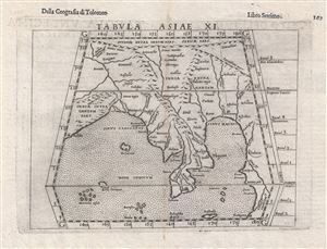
Tabula Asiae XI.
sold
- Digital Map Information
- Suitable for large format printing
- DPI: 300
- File Size: 3.2 MB
- File Type: ZIP / TIFF
- ICC color profile embedded
- Delivered instantly via download link
This is an uncommon 1588 Ptolemaic map of Southeast Asia and the Malay Peninsula issued for Girolamo Ruscelli's Italian edition of the Geografia di Tolomeo . Cartographically Ruscelli based this map on interpretations of Claudius Ptolemy's Geographica by Bernard ... (more details)
First Double-Hemisphere World in a Printed Atlas.
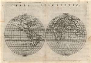
Orbis Descriptio.
sold
- Digital Map Information
- Suitable for large format printing
- Full resolution TIFF file
- ICC color profile embedded
- Delivered instantly via download link
This is Girolamo Ruscelli's 1561 double hemisphere map of the world in its second state of 1574. It is the earliest acquirable world map in this format and is the first such to appear in a printed atlas. Many of its geographic details were derived from the world maps appearing in Giacomo Gastaldi's 1548 Ptolemy, but Ruscelli's double-hemispherical projection transforms this map into a fully new composition. Amongst printed maps, the only earlier map using this projection is the unacquirable 1555 Georgio Sideri 'Calapoda' map. (more details)
One of the earliest obtainable maps of Brazil and among the first to depict an image of Cannibalism.
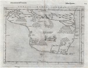
Brasil Nuova Tavola.
sold
- Digital Map Information
- Suitable for large format printing
- Full resolution TIFF file
- ICC color profile embedded
- Delivered instantly via download link
Printed in 1574 by Girolamo Ruscelli, this is one of the earliest obtainable maps of Brazil. The map is oriented to the west and covers from the Rio de la Plata to the mouth of the Amazon (Maranon) River. Little other detail of the interior is given with the ... (more details)
Early Glimpses of Mexico, California and the Gulf Coast.
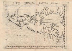
Nueva Hispania Tabula Nova.
sold
- Digital Map Information
- Suitable for large format printing
- DPI: 600
- File Size: 10.08 MB
- File Type: ZIP / TIFF
- ICC color profile embedded
- Delivered instantly via download link
This is Girolamo Ruscelli's 1574 map Tierra Nveva, an early and influential map of what would become Mexico, California, Texas, and Florida. Ruscelli's work is an enlarged and improved version of the 1548 map of the same region by fellow Venetian Giacomo Gastaldi. Apart from the Gastaldi, Ruscelli's map is the earliest to focus so closely on the southern parts of what would become the United States and is one of the earliest acquirable maps to reflect Spanish exploration and colonization in the Americas. Overall, along with the map covering the East Coast north of Florida, this is among the earliest maps to focus on North America. (more details)
Reconciling Verrazano and Cartier.
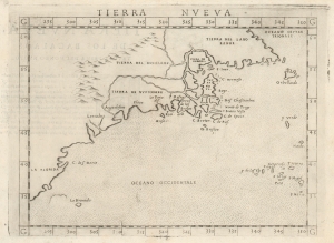
Tierra Nveva.
sold
- Digital Map Information
- Suitable for large format printing
- Full resolution TIFF file
- ICC color profile embedded
- Delivered instantly via download link
This is Girolamo Ruscelli's 1574 map Tierra Nveva, an early and influential map of what would become New England and the Canadian Maritime Provinces. Although the cartography can be confusing by modern standards, the map covers the eastern coastline of North America from somewhere in upper Florida northwards past Cabo de Santa Maria to Larcadia (Kitty Hawk), Angoulesme (New York Harbor), Nova Scotia, and Labrador. Based on the Ptolemaic model, Ruscelli's work follows on the 1548 map of the same region by fellow Venetian Giacomo Gastaldi. (more details)
One of the earliest published maps of Russia.
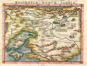
Moschovia Nvova Tavola.
sold
- Digital Map Information
- Suitable for large format printing
- DPI: 300
- File Size: 2.77 MB
- File Type: ZIP / TIFF
- ICC color profile embedded
- Delivered instantly via download link
A beautiful example of Girolamo Ruscelli's c. 1574 map of Moscovie. Covers modern day Russia and the Ukraine from the Arctic to the Crimea and as far east as the Caspian Sea. Interest in this area peaked in Western Europe following the discoveries of ... (more details)
The World as known to Rome.
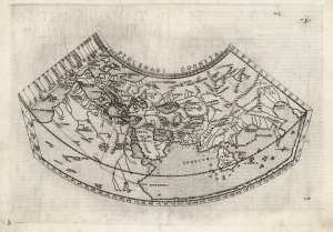
Ptolemaei Cognita.
sold
- Digital Map Information
- Suitable for large format printing
- Full resolution TIFF file
- ICC color profile embedded
- Delivered instantly via download link
This is Girolamo Ruscelli's 1574 edition of a foundational work of Renaissance cartography: the map of the known world as understood at the time of the Roman Empire. Claudius Ptolemy's 2nd-century innovation in representing the three-dimensional world projected on a grid via mathematical formulae provided the basis of all modern cartography. Consequently, his Geographia and the maps derived from it remained canonical and continued to be printed well into the 17th century. This is the first appearance of this specific map in Ruscelli's Ptolemy. (more details)
One of the First Modern Arabia Maps.
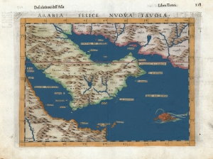
Arabia Felice Nuova Tavola.
sold
- Digital Map Information
- Suitable for large format printing
- DPI: 600
- File Size: 10.3 MB
- File Type: ZIP / TIFF
- ICC color profile embedded
- Delivered instantly via download link
This is Girolamo Ruscelli's 1599 edition of Giocomo Gastaldi's modern map of the Arabian Peninsula, specifically the fertile part of Arabia, 'Arabia Felix.' After Gastaldi's 1548 work, it is nevertheless one of the earliest acquirable depictions of Arabia not based on the second century work of Claudius Ptolemy. The island of Bahrain (Babarem) appears. Also, this is one of the earliest works to depict a peninsula in the region of Qatar. (more details)
Fascinating early map of India.
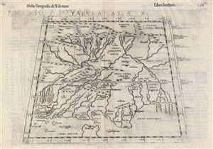
Tabula Asiae X.
sold
- Digital Map Information
- Suitable for large format printing
- DPI: 300
- File Size: 3.58 MB
- File Type: ZIP / TIFF
- ICC color profile embedded
- Delivered instantly via download link
This is an uncommon 1588 Ptolemaic map of India issued for Girolamo Ruscelli's Italian edition of the Geografia di Tolomeo . Cartographically Ruscelli based this map on interpretations of Claudius Ptolemy's Geographica by Bernard Sylvanus and ... (more details)
Fascinating 16th century map depicting modern day Iran and Iraq.
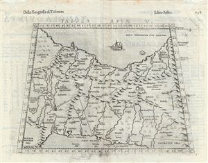
Tabula Asiae V.
sold
- Digital Map Information
- Suitable for large format printing
- DPI: 300
- File Size: 3.61 MB
- File Type: ZIP / TIFF
- ICC color profile embedded
- Delivered instantly via download link
This is an uncommon 1588 Ptolemaic map of Persia issued for Girolamo Ruscelli's Italian edition of the Geografia di Tolomeo . Cartographically Ruscelli based this map on interpretations of Claudius Ptolemy's Geographica by Bernard Sylvanus ... (more details)
Fascinating 16th century map depicting modern day Afghanistan, Iran, and Pakistan.
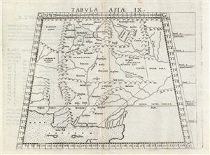
Tabula Asiae IX.
sold
- Digital Map Information
- Suitable for large format printing
- Full resolution TIFF file
- ICC color profile embedded
- Delivered instantly via download link
This is an uncommon 1588 Ptolemaic map of Persia, Afghanistan, and Pakistan issued for Girolamo Ruscelli's Italian edition of the Geografia di Tolomeo . Cartographically Ruscelli based this map on interpretations of Claudius Ptolemy's ... (more details)
Reflects the curious Ptolemaic convention of a landlocked Indian Ocean.
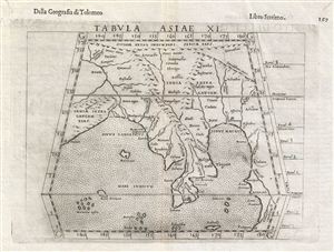
Tabula Asiae XI.
sold
- Digital Map Information
- Suitable for large format printing
- DPI: 300
- File Size: 3.45 MB
- File Type: ZIP / TIFF
- ICC color profile embedded
- Delivered instantly via download link
This is an uncommon 1588 Ptolemaic map of Southeast Asia and the Malay Peninsula issued for Girolamo Ruscelli's Italian edition of the Geografia di Tolomeo . Cartographically Ruscelli based this map on interpretations of Claudius ... (more details)
One of the First Acquirable Maps of the North American East Coast, Updated
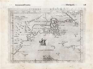
Tierra Nueva.
sold
- Digital Map Information
- Suitable for large format printing
- DPI: 600
- File Size: 15.14 MB
- File Type: ZIP / TIFF
- ICC color profile embedded
- Delivered instantly via download link
This is Girolamo Ruscelli's 1561 map 'Tierra Nueva', in its amended and embellished 1598 Giuseppe Rosaccio edition. In its first issues, this represented an early and influential map of the North American coastline from South Carolina to New England and the Canadian Maritime Provinces. Even in this 1599 edition, this remains one of the earliest acquirable maps to cover the eastern coast of North America. (more details)
The World Known to Rome.
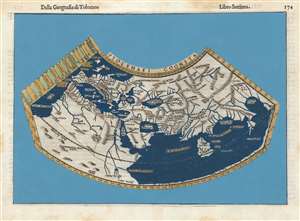
Ptolemaei Cognita.
sold
- Digital Map Information
- Suitable for large format printing
- DPI: 600
- File Size: 9.42 MB
- File Type: ZIP / TIFF
- ICC color profile embedded
- Delivered instantly via download link
This is Girolamo Ruscelli's 1599 edition of a foundational work of Renaissance cartography: The map of the known world as understood at the time of the Roman Empire. Claudius Ptolemy's second-century innovation in representing the three-dimensional world projected on a grid via mathematical formulae provided the basis of all modern cartography. Consequently, his Geographia and the maps derived from it remained canonical and continued to be printed well into the 17th century. (more details)