
Vandermaelen, Philippe Marie Guillaume (sold)
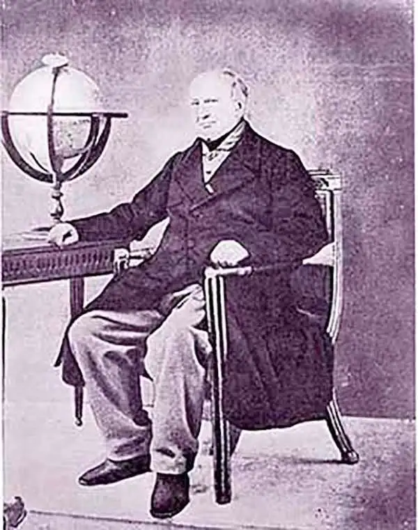
Philippe Marie Guillaume Vandermaelen (December 23, 1795 - May 29, 1869) was a Flemish cartographer active in Brussels during the first part of the 19th century. Vandermaelen is created with "one of the most remarkable developments of private enterprise in cartography," namely his remarkable six volume Atlas Universel de Geographie. Vandermaelen was born in Brussels in 1795 and trained as a globe maker. It was no doubt his training as a globe maker that led him see the need for an atlas rendered on a universal scale in order that all bodies could be understood in relation to one another. In addition to his great work Vandermaelen also produced a number of globes, lesser maps, a highly detailed 250 sheet map of Belgium, and several regional atlases.
The First Detailed, Modern Atlas Map of Northern New Mexico and Colorado and the Best Map of the Long Expedition.
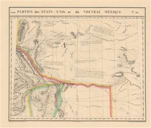
Parties des Etats-Unis et du Nouveau Mexique. Amer. Sep. no. 48.
sold
- Digital Map Information
- Suitable for large format printing
- Full resolution TIFF file
- ICC color profile embedded
- Delivered instantly via download link
This is 1827 Vandermaelen map of the American-Mexican frontier of the Missouri Territory, shown during a period of active exploration. It was the largest-scale map of this region produced to date - 'no mapmaker had previously attempted to use such a large scale for any western American area.' (Wheat). Like all of the maps from Vandermaelen's Atlas, it is the also the first map of the region executed in lithograph. (more details)
One of the Best Early Depictions of the Long Expedition.
Parties des Etats-Unis et du Nouveau Mexique. Amer. Sep. no. 48.
sold
- Digital Map Information
- Suitable for large format printing
- DPI: 600
- File Size: 21.34 MB
- File Type: ZIP / TIFF
- ICC color profile embedded
- Delivered instantly via download link
This is 1827 Vandermaelen map of the American-Mexican frontier of the Missouri Territory, shown during a period of active exploration. It was the largest-scale map of this region produced to date - 'no mapmaker had previously attempted to use such a large scale for any western American area.' (Wheat). Like all of the maps from Vandermaelen's Atlas, it is the also the first map of the region executed in lithograph. (more details)
DetaileddDepiction of the upper Paraguay and Parana rivers.
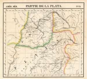
Partie de la Plata. Amer. Mér. no. 31.
sold
- Digital Map Information
- Suitable for large format printing
- Full resolution TIFF file
- ICC color profile embedded
- Delivered instantly via download link
This is the rare 1827 Vandermaelen map of the northern extents of the rivers Paraguay, Parana, and Uruguay in South America. The map is centered on the region of the Misiones, a contentious frontier between the colonial powers in South America. It was produced after the 1814 annexation of the Misiones to Argentina's Corrientes, but in practice, neither Argentina nor any other country exerted de facto control, leaving the area to effectively govern itself. Three years after the printing of this map, the Argentine military took control of the region.
The area takes its name from the 17th century Jesuit establishment of missions among the native Guarani in this area, setting up a number of Jesuit Reductions and establishing as many as thirty mission villages. Along the three major rivers of the region, the map illustrates the settlements in detail. This was among the largest-scale maps of this region produced to date. Vandermaelen's Atlas, by applying a uniform scale to every map, afforded sharper detail to many remote areas of the world previously not so well depicted. This is also the first map of the region executed in lithograph. (more details)
The area takes its name from the 17th century Jesuit establishment of missions among the native Guarani in this area, setting up a number of Jesuit Reductions and establishing as many as thirty mission villages. Along the three major rivers of the region, the map illustrates the settlements in detail. This was among the largest-scale maps of this region produced to date. Vandermaelen's Atlas, by applying a uniform scale to every map, afforded sharper detail to many remote areas of the world previously not so well depicted. This is also the first map of the region executed in lithograph. (more details)
One of the First Detailed Depictions of the Maldives.
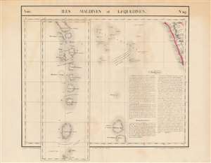
Iles Maldives et Laquedives. Asie. no. 107.
sold
- Digital Map Information
- Suitable for large format printing
- Full resolution TIFF file
- ICC color profile embedded
- Delivered instantly via download link
This is the rare 1827 Vandermaelen map of the Indian Ocean archipelagoes of the Maldives and the Laccadive Islands. It is the first map to specifically focus on these islands. The map of the Maldives - presented as an inset extension of the main map - illustrates the chain of lagoons in sharper detail than any other to date. In particular, the map presents two ships' tracks through the Huvadhu Channel. Since this was and is the broadest channel between any other atoll of Maldives. Its identification by the ships Contractor in 1792 and the Fatty Rair in 1795 would make the channel an important feature to highlight. As a matter of contrast, other channels are identified either as 'dangereux' ('dangerous') or 'inconnu' ('unknown'). The secrets of navigating the Maldives had long been the island kingdom's first line of defense - and the discovery of this channel by European powers was the first break in these defenses in more than 300 years. This was among the largest-scale maps of this region produced to date. Vandermaelen's Atlas, by applying a uniform scale to every map, afforded sharper detail to many remote areas of the world previously not so well depicted. This is also the first map of the region executed in lithograph. (more details)
Focusing on Lewis and Clark's Crossing of the Rockies.
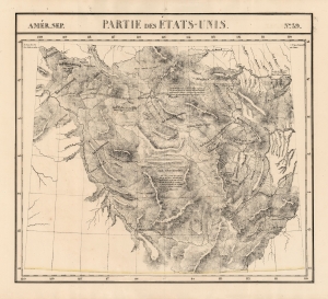
Amer. Sep. Partie des Etats-Unis No. 39.
sold
- Digital Map Information
- Suitable for large format printing
- DPI: 600
- File Size: 70.54 MB
- File Type: ZIP / TIFF
- ICC color profile embedded
- Delivered instantly via download link
This is Philipe Vandermaelen's revised 1827 map of the eastern Oregon Territory, capturing the mountainous region between the upper Missouri River and the headwaters of the Columbia River, which is now Idaho and the western parts of Montana and Wyoming. It was the largest-scale map of this region produced to date - 'no mapmaker had previously attempted to use such a large scale for any western American area.' (Wheat). Like all of the maps from Vandermaelen's Atlas, it is the also the first map of the region executed in lithograph. (more details)
Detailed Depiction of what would become Uruguay.
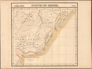
Partie du Brèsil. Amer. Mér. no. 35.
sold
- Digital Map Information
- Suitable for large format printing
- File Size: 19.66 MB
- File Type: ZIP / TIFF
- ICC color profile embedded
- Delivered instantly via download link
This is the rare 1827 Vandermaelen map of the Cisplatine region: the Banda Oriental and southern Brazil, which would become Uruguay in South America. (more details)
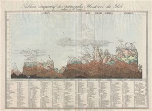
Tableau comparatif des principales hauteurs du globe.
sold
- Digital Map Information
- Suitable for large format printing
- DPI: 300
- File Size: 20.03 MB
- File Type: ZIP / TIFF
- ICC color profile embedded
- Delivered instantly via download link
An unusual, early, and interesting take on the comparative mountains of the world chart. This chart, drawn by Aristide Michel Perrot in 1827, compacts an incredible amount of information in very little space. Perrot's primary goal was to show the relative ... (more details)
First printed map to focus on Oaxaca and Chiapas States.
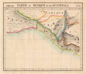
Partie du Mexique et de Guatemala. Amer. Sep. no. 71.
sold
- Digital Map Information
- Suitable for large format printing
- Full resolution TIFF file
- ICC color profile embedded
- Delivered instantly via download link
This is the 1827 Vandermaelen map of southern Mexico and western Guatemala. Vandermaelen's Atlas Universel was the first lithograph atlas as well as the first whose maps were printed on a universal scale. The present map was the first lithograph map of its region, and it is the earliest map to focus so narrowly on the states of Chiapas and Oaxaca. The map also includes the southern part of Tabasco, part of Veracruz, and part of Guatemala. The precursor is Arrowsmith's 1810 A New Map of Mexico and Adjacent Provinces Compiled from Original Documents, one of the first maps to present Alexander von Humboldt's mapping of Mexico. (more details)
The Best Large-Scale Atlas Map of Afghanistan Prior to the Anglo-Afghan War
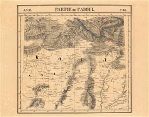
Partie du Caboul Asie no.67.
sold
- Digital Map Information
- Suitable for large format printing
- DPI: 600
- File Size: 30.9 MB
- File Type: ZIP / TIFF
- ICC color profile embedded
- Delivered instantly via download link
This is the 1827 Vandermaelen map of the Afghanistan, Pakistan and the Hindu Kush. It is the first large-scale atlas map to focus on the area, and the first to be executed in lithography. The map's detail - drawn from the first-hand exploration of John Macdonald Kinneir on behalf of the British East India Company - would not be improved upon until the First Anglo-Afghan War. (more details)
First Lithograph Map of Bhutan, Assam and Tibet
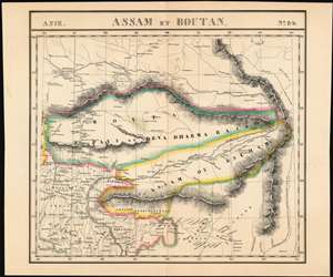
Assam et. Boutan.
sold
- Digital Map Information
- Suitable for large format printing
- DPI: 600
- File Size: 31.19 MB
- File Type: ZIP / TIFF
- ICC color profile embedded
- Delivered instantly via download link
This 1827 Vandermaelen map of Bhutan, Assam and Tibet is one of the earliest printed maps to show this region in detail, and the first to do so in lithograph. Vandermaelen's atlas was also remarkable in adhering to a uniform scale and projection for every map: In doing so, Vandermaelen committed himself to showing Bhutan in sharper focus than any map previously published - inadvertently revealing how little was actually known of the region at the time, beyond the string of cities and fortresses in the western part of the country. (The wealth of detail across the border in India is striking in comparison). Vandermaelen names it 'Boutan ou Pays de Deva Dharma Rajah,' referring to the Buddhist religious leadership of the time. Punakha, the ancient capital of Bhutan is shown. Both within Bhutan and across the border into Tibet, there can be found dzongs - Bhutanese fortresses built in the 17th century to defend against Tibetan invasion. The map also shows part of southern Tibet in similar detail. Lhasa (Lassa on the map) appears, with the 'Pagode du grand Lama,' shown to the east-north-east. Several fortresses are marked - Painom Jeung, Ihansu Jeung, and Anea Gomba, which is noted to be a convent. Yamdrok Lake (here named La Jamdro ou Palte) is shown as well: this is one of three sacred Tibetan lakes. (more details)
First lithograph map of Guzarat and the region around Mumbai, India.
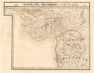
Guzerate, Chandeish et Aurungabad. Asie no. 93.
sold
- Digital Map Information
- Suitable for large format printing
- Full resolution TIFF file
- ICC color profile embedded
- Delivered instantly via download link
This is the 1827 Vandermaelen map of the Indian province of Gujarat, and the coastal part of what is now Maharashtra. It is the first large-scale atlas map to focus on the area, and the first to be executed in lithography. It includes the cities of Mumbai (Bombay on the map,) Surat (Soorut,) and Bhuj (Bhooj.) In the north, it shows part of the Great Rann of Kutch (the massive salt marsh in the Thar Desert) and extends as far south as Mhasala (Mheysala). The eastern reaches of the map include the cities of Ahmednagar, Aurangabad, and Indore in Madhya Pradesh. Topography is pictorial, illustrating the mountains and wetlands with hachures. Vandermaelen appears to have drawn heavily, but not universally, from the maps of Aaron Arrowsmith to inform his work here. (more details)
Detail-Rich Map of the Mid Atlantic Coast of the United States
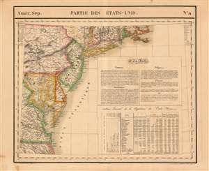
Parties des Etats-Unis. Amer. Sep. 51.
sold
- Digital Map Information
- Suitable for large format printing
- DPI: 600
- File Size: 27.82 MB
- File Type: ZIP / TIFF
- ICC color profile embedded
- Delivered instantly via download link
This is the 1827 Vandermaelen map of the Mid-Atlantic United States. Delaware and New Jersey are shown in completion; northeastern North Carolina, the eastern parts of Virginia, Maryland and Pennsylvania, southeastern New York, and the southern extents of Connecticut, Rhode Island and Massachusetts are shown as well. The map includes an extensive text gloss on the United States' trade offerings, religious groups, government, wealth and climate. A table tracks the young nation's population growth from 1790 to 1820, distinguishing between white, slave, and free black populations broken down state-by-state. Native American populations in each state are noted as well. Topography is shown with hachures. In addition to placenames, the map shows the location of Revolutionary War battles, urban populations, and various mineral resources (specific ones are noted using a key) (more details)
First lithograph map of Baluchistan and the Punjab.
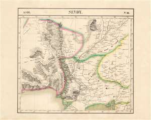
Sindy. Asie no. 81.
sold
- Digital Map Information
- Suitable for large format printing
- DPI: 600
- File Size: 54.64 MB
- File Type: ZIP / TIFF
- ICC color profile embedded
- Delivered instantly via download link
This is the 1827 Vandermaelen map of the lower Indus River valley and the Pakistani province of Sindh. It is the first large-scale atlas map to focus on the area, and the first to be executed in lithography. It includes parts of the Punjab, Balochistan, and Rajasthan in northwestern India, as well as the coast of the Arabian Sea from Omara to modern-day Karachi. Topography is pictorial, illustrating the mountains of the province with vigorous hachuring. The River Indus is shown as far north as Moultan, including its juncture with the River Chinnab. (more details)
The First Large-Scale Atlas Map of Thailand, Cambodia and Central Vietnam.
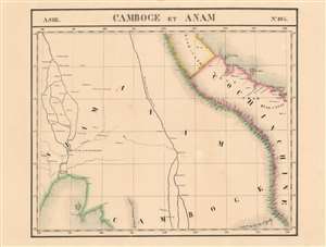
Camboge et Anam. Asie no. 105
sold
- Digital Map Information
- Suitable for large format printing
- DPI: 600
- File Size: 17.87 MB
- File Type: ZIP / TIFF
- ICC color profile embedded
- Delivered instantly via download link
This is 1827 Vandermaelen map of Thailand, Vietnam and the Mekong River delta. It is the first large-scale atlas map of the region, and the first to be executed in lithography. Despite its title, the map embraces central Thailand as well as Cambodia and Vietnam (known as Annam in the west at that time.) As is the case with many of Vandermaelen's maps, his strict adherence to a scale of 1 : 1641836 throughout his atlas resulted in the production of very large-scale maps of regions about which the west knew little. The present map is no exception. (more details)
Earliest Lithograph of the Singapore Strait.
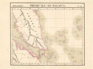
Presqu'ile de Malacca. Oceanique no. 12.
sold
- Digital Map Information
- Suitable for large format printing
- DPI: 600
- File Size: 21.51 MB
- File Type: ZIP / TIFF
- ICC color profile embedded
- Delivered instantly via download link
This is the 1827 Vandermaelen map of Singapore and the Malay Peninsula. It is the first large-scale atlas map to focus on the area, and the first to be executed in lithography. The map shows Singapore Island, Bintan, Kepulauan Anambas, Kepulauan Natuna Besar, and part of Sumatra. The interior details of Malacca - particularly the attractively hachured mountains appearing on the Malay Peninsula - reveal that despite the presence for nearly eight years of an English colony on Singapore, European knowledge of this part of the world remained scant. In all fairness, this ignorance cannot be laid entirely at Vandermaelen's feet: the Jackson plan itself would not be published for still another year, in 1828, and it was the first map to show the colony. (more details)
Earliest Lithograph of the Singapore Strait.

Presqu'ile de Malacca. Oceanique no. 12.
sold
- Digital Map Information
- Suitable for large format printing
- DPI: 600
- File Size: 60.05 MB
- File Type: ZIP / TIFF
- ICC color profile embedded
- Delivered instantly via download link
This is the 1827 Vandermaelen map of Singapore and the Malay Peninsula. It is the first large-scale atlas map to focus on the area, and the first to be executed in lithography. The map shows Singapore Island, Bintan, Kepulauan Anambas, Kepulauan Natuna Besar, and part of Sumatra. The interior details of Malacca - particularly the attractively hachured mountains appearing on the Malay Peninsula - reveal that despite the presence for nearly eight years of an English colony on Singapore, European knowledge of this part of the world remained scant. In all fairness, this ignorance cannot be laid entirely at Vandermaelen's feet: the Jackson plan itself would not be published for still another year, in 1828, and it was the first map to show the colony. (more details)
Earliest lithograph of the Galapagos Islands.
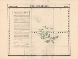
Iles Galapagos. Oceanique no. 17.
sold
- Digital Map Information
- Suitable for large format printing
- Full resolution TIFF file
- ICC color profile embedded
- Delivered instantly via download link
An 1827 Phillipe Vandermaelen map of the Galapagos Islands, considered the earliest lithographed map of those islands. Vandermaelen's Atlas Universel was the first lithograph atlas as well as the first whose maps were printed on a universal scale. (more details)
The Best Large-Scale Map of Northern Mexico Based on First-Hand Survey.
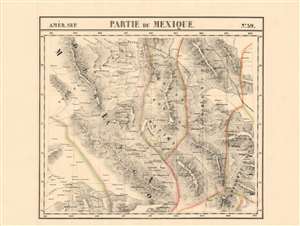
Parties du Mexique. Amer. Sep. no. 59.
sold
- Digital Map Information
- Suitable for large format printing
- DPI: 600
- File Size: 30.61 MB
- File Type: ZIP / TIFF
- ICC color profile embedded
- Delivered instantly via download link
This is the 1827 Vandermaelen map of the northern gold and silver mining region of Mexico, showing the states immediately south of the Rio Grande: Monterrey, parts of Chihuahua, Coahuila, Nuevo Leon, Zacatecas, Durango, and Sinaloa. Vandermaelen drew on the incomparable firsthand surveys of Alexander von Humboldt, whose 1803-4 travels informed his definitive 1804 map of Mexico. Vandermaelen's map, by addressing the geographical data at significantly higher scale than the Humboldt map, provides the best large-format mapping of the region - presented with the remarkable clarity afforded by the new printing technology of lithography. The map faithfully retains Humboldt's own array of symbols to distinguish cities and towns, mines, haciendas, ranches and presidios. No other map of the period provides this level of detail and focus on this region. (more details)