
British Admiralty
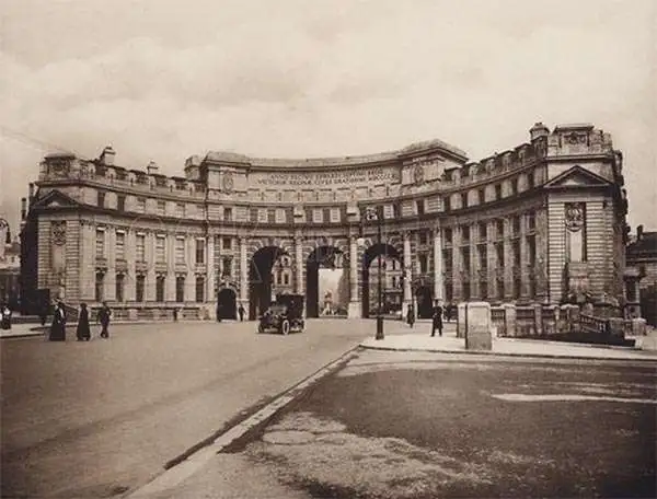
The British Admiralty Office (1795 - Present) or the United Kingdom Hydrographic Office refers to the Branch of the English government that is responsible for the command of the British Navy. In 1795 King George III created the United Kingdom Hydrographic Office, known in short as the U.K.H.O., to provide top notch nautical charts to the vast Royal Navy. Prior the founding of the Admiralty the surveying and creation of nautical charts was primarily a commercial venture wherein the cartographer himself, more of than not, actually financed the printing of his own material. The great navigator Cook himself is known to have scrambled for funds to publish his own seminal charts - the most important and advanced of the period. The system of privately funded nautical mapping and publishing left vast portions of the world uncharted and many excellent charts unpublished. King George III, responding significant loss in trade revenue related to shipwrecks and delay due to poor charts, recognized the need for an institutionalized government sponsored cartographic agency - the Admiralty. The first head of the Admiralty, a position known as Hydrographer, was the important cartographer Alexander Dalrymple. Dalrymple started by organizing and cataloging obtainable charts before initiating the laborious process of updating them and filling in the blanks. The first official Admiralty Chart appeared in 1800 and detailed Quiberon Bay in Brittany. By 1808 the position of Hydrographer fell to Captain Thomas Hurd. Hurd advocated the sale of Admiralty charts to the general public and, by the time he retired in 1829, had issued and published some 736 charts. Stewardship of the organization then passed to Rear Admiral Sir Francis Beaufort. It was under Beaufort's administration that the Admiralty truly developed as a "chart making" as opposed to a "chart cataloging" institution. Beaufort held his post from 1829 to 1854. In his 25 years at the Admiralty Beaufort created nearly 1500 new charts and sponsored countless surveying and scientific expeditions - including the 1831 to 1836 voyage of the H.M.S. Beagle. By 1855 the Admiralty's chart catalog listed some 1,981 charts.
Supporting Vietnamese claims in the South China Sea.
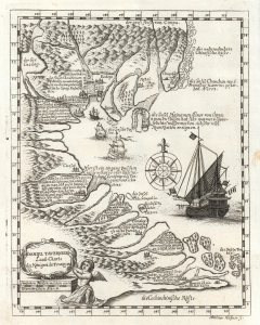
Daniel Taverniers Land-Charte des Königreichs Tunqvin.
$850.00
Acquire
- Digital Map Information
- Suitable for large format printing
- DPI: 600
- File Size: 4.66 MB
- File Type: ZIP / TIFF
- ICC color profile embedded
- Delivered instantly via download link
This is an important 1684 map of Vietnam and the South China Sea by the French Huguenot merchant adventurer, Daniel Tavernier. This is one of several maps citied to support modern-day Vietnamese claims against China to soverignty over disputed island clusters in the South China Sea. (more details)
New treaty port mapped.
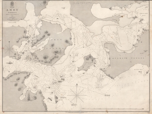
Amoy Harbour.
$950.00
Acquire
- Digital Map Information
- Suitable for large format printing
- DPI: 600
- File Size: 54.59 MB
- File Type: ZIP / TIFF
- ICC color profile embedded
- Delivered instantly via download link
This is an 1846 British Admiralty nautical chart or maritime map of Amoy (Xiamen / 厦门市), China, one of the treaty ports created by the Treaty of Nanking. It was published shortly after the First Opium War (1839 - 1842) and the signing of the Treaty of Nanking. This chart is the result of the important survey work that followed in the wake of the Opium Wars and the opening of wide-scale trade with China. It provided the bases of British maritime trade in and around Amoy for the subsequent 2 decades. (more details)
Treaty Ports in China.
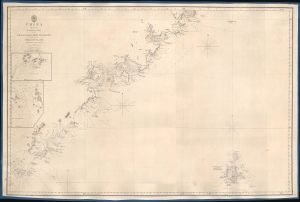
China Sheet IV. Eastern Coast from Chauan Bay to Port Matheson Including the Pescadore Islands.
$1,200.00
Acquire
- Digital Map Information
- Suitable for large format printing
- DPI: 600
- File Size: 24.79 MB
- File Type: ZIP / TIFF
- ICC color profile embedded
- Delivered instantly via download link
This is an 1849 British Admiralty Hydrographic Office nautical map of the Fujian coast of China. First published in 1844, only two years after the end of the First Opium War (1839 - 1842), Xiamen (Amoy) was the first of five treaty ports opened to the Europeans after the signing of the Treaty of Nanking, officially opening China to European traders. Before this treaty, only one port, Guangzhou, was open to European traders. Thus, this chart provided necessary details for mariners and traders taking advantage of this new market. (more details)
Charting the Chinese Coast, in War and Peace.
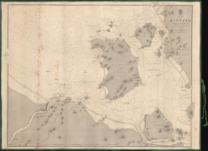
Kintang Channel.
$900.00
Acquire
- Digital Map Information
- Suitable for large format printing
- DPI: 600
- File Size: 633.74 MB
- File Type: ZIP / TIFF
- ICC color profile embedded
- Delivered instantly via download link
A remarkable 1849 first edition example of Richard Collinson's important blueback nautical chart or map of the coasts off Ningbo (Ning-po), between the Chinese mainland and Zhoushan (Chusan). These waters had long been important for China's interactions with the outside world and formed a strategic point of control during the First Opium War (1839 - 1842). (more details)
Civil War blockade-runners map of the Savannah River.
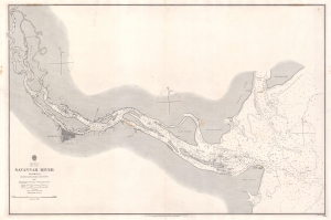
Savannah River Georgia From the United States Coast Survey 1855.
$1,900.00
Acquire
- Digital Map Information
- Suitable for large format printing
- File Size: 57 MB
- File Type: ZIP / TIFF
- ICC color profile embedded
- Delivered instantly via download link
This is an extremely scarce 1861 British Admiralty Chart of the Savannah River and city of Savannah, Georgia, issued at the outset of the American Civil War (1961 - 1865). Although formally neutral in the conflict, British private interests financed blockade runners that sent munitions and luxuries to Confederate ports in return for cotton and tobacco. This map of the Savannah River was doubtless produced for this purpose.
The map is derived from U.S. Coast Survey work in the Savannah region completed in 1855, and although the Admiralty chart is superior in construction and presentation, is substantively similar. Coverage extends from the mouth of the Savanna River, Hilton Head, and Tybee Island, westward towards savanna, as far north as Argyle Island. The triangulation for this map was completed by E.O. Cord, C. O. Boutelle, C. P. Bolles and D. T. Van Buren. The topography is the work of H. I. Whiting. The Hydrography was accomplished by a party under the command of J. N. Maffitt. (more details)
The map is derived from U.S. Coast Survey work in the Savannah region completed in 1855, and although the Admiralty chart is superior in construction and presentation, is substantively similar. Coverage extends from the mouth of the Savanna River, Hilton Head, and Tybee Island, westward towards savanna, as far north as Argyle Island. The triangulation for this map was completed by E.O. Cord, C. O. Boutelle, C. P. Bolles and D. T. Van Buren. The topography is the work of H. I. Whiting. The Hydrography was accomplished by a party under the command of J. N. Maffitt. (more details)
Hong Kong issued shortly after the acquisition of Kowloon.
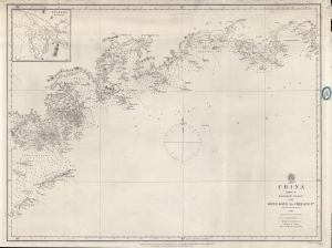
China Sheet II Eastern Coast from Hong Kong to Chelang Pt.
$2,200.00
Acquire
- Digital Map Information
- Suitable for large format printing
- File Size: 21.93 MB
- File Type: ZIP / TIFF
- ICC color profile embedded
- Delivered instantly via download link
A rare 1861 British Admiralty / Richard Collinson nautical map covering the coast of China around Hong Kong. It was issued shortly after the Second Opium War (1856 - 1860) and the British acquisition of Kowloon (which is labeled). (more details)
One of only 4 known examples of this rare early chart of Australia's coast.
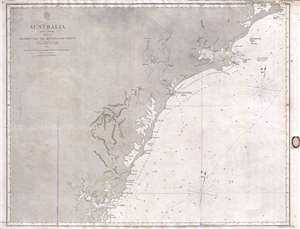
Australia East Coast Sheet IV Broken Bay to Sugarloaf Point.
$1,200.00
Acquire
- Digital Map Information
- Suitable for large format printing
- File Size: 16.08 MB
- File Type: ZIP / TIFF
- ICC color profile embedded
- Delivered instantly via download link
This is an extremely rare 1862 map of eastern Australia covering from Sugarloaf Point to Broken Bay, just north of Syndey. This is one of the earliest large scale Nautical charts provide scientifically surveyed hydrographic detail for a significant portion of the ... (more details)
Charting British Control of Burma.
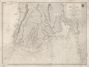
Gulf of Bengal Sheet VII Bassein, Rangoon, Martaban Compiled from various Surveys...
$550.00
Acquire
- Digital Map Information
- Suitable for large format printing
- File Size: 28.43 MB
- File Type: ZIP / TIFF
- ICC color profile embedded
- Delivered instantly via download link
A scarce 1863 British Admiralty chart of the waters off the coast of Burma (now Myanmar), focusing on the Irrawaddy River Delta, the Andaman Sea, and the Gulf of Martaban. It was produced following the Second Anglo-Burmese War (1852 - 1853), when the British took control of the region. (more details)
Just after the Second Opium War.
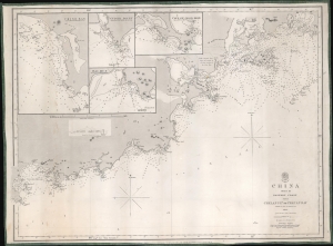
China Sheet III. Eastern Coast from Chelang Pt. to Chauan Bay.
$950.00
Acquire
- Digital Map Information
- Suitable for large format printing
- File Size: 22.28 MB
- File Type: ZIP / TIFF
- ICC color profile embedded
- Delivered instantly via download link
This is a rare 1863 British Admiralty nautical map of Guangdong, China, by Sir Richard Collinson. It was issued in the wake of the Second Opium War (1856 - 1860) and the signing of the 1860 Convention of Peking - an event that led to an explosion of foreign trade with China. (more details)
Laying the French-Atlantic Cable.
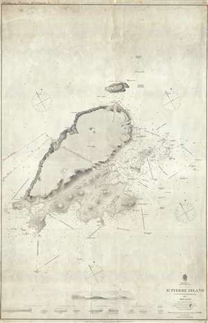
St. Pierre Island.
$750.00
Acquire
- Digital Map Information
- Suitable for large format printing
- File Size: 18.89 MB
- File Type: ZIP / TIFF
- ICC color profile embedded
- Delivered instantly via download link
A rare 1861 map of France's last colony in North America, the tiny island of St. Pierre of the coast of Newfoundland, with manuscript additions related to the French Atlantic Telegraph Company. This chart covers all of St. Pierre Island as well as the adjacent islands and the surrounding seas. The harbor community of St. Pierre is detailed with individual streets and buildings recognizable. This map is noteworthy not only for its rarity but also for the manuscript addition of the course of the French Atlantic Telegraph. (more details)
Important early Stokes nautical chart of Australia inlcuding Sydney, Port Jackson, and Botany Bay.
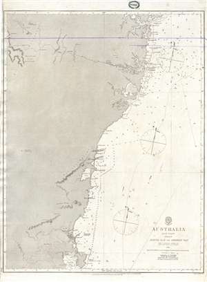
Australia East Coast Sheet III Jervis Bay to Broken Bay.
$1,200.00
Acquire
- Digital Map Information
- Suitable for large format printing
- File Size: 14.58 MB
- File Type: ZIP / TIFF
- ICC color profile embedded
- Delivered instantly via download link
This is an extremely rare 1865 map of eastern Australia covering from Broken Bay to Jervis Bay, including Sydney Port Jackson, and Botany Bay. This is one of the earliest large scale Nautical charts provide scientifically surveyed hydrographic detail for a ... (more details)
Exceptional early nautical chart of southeastern Australia including inland topography.
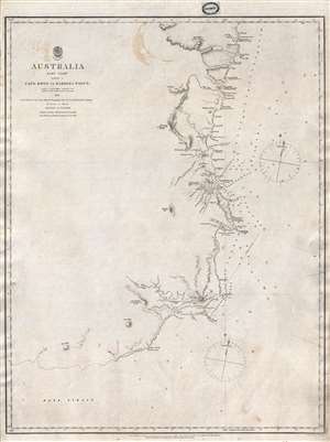
Australia East Coast Sheet I Cape Howe to Barriga Point.
$1,000.00
Acquire
- Digital Map Information
- Suitable for large format printing
- File Size: 8.96 MB
- File Type: ZIP / TIFF
- ICC color profile embedded
- Delivered instantly via download link
This is an extremely rare 1865 map of eastern Australia covering from Cape Howe to Barriga Point. It extends north as far as Mount Townsend and south to Bass Strait. Includes the popular resort of Mallacoota, Twofold Bay, Boyd, and Eden. There are ... (more details)
Exceptional early nautical chart of southeastern Australia including inland topography.
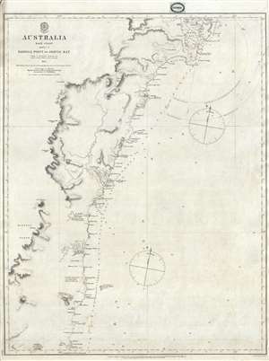
Australia East Coast Sheet II Barriga Point to Jervis Bay.
$1,000.00
Acquire
- Digital Map Information
- Suitable for large format printing
- File Size: 9.07 MB
- File Type: ZIP / TIFF
- ICC color profile embedded
- Delivered instantly via download link
This is an extremely rare 1865 map of eastern Australia covering from Jervis Bay to Barriga Point, including Ulladulla Harbor (then under construction) and Bateman Bay. It extends south as far as Mount Townsend. There are copious annotations ... (more details)
China Survey from the Second Opium War.
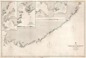
Strelok Bay to St. Vladimir Bay.
$150.00
Acquire
- Digital Map Information
- Suitable for large format printing
- File Size: 55.74 MB
- File Type: ZIP / TIFF
- ICC color profile embedded
- Delivered instantly via download link
This is a rare 1868 Admiralty nautical chart or maritime map of the Pacific coast of Russian Manchuria, just east of Valdivostok. The map is the result of detailed surveys conducted during the Second Opium War Second Opium War (1856 - 1860). The map depicts the coastline in great detail from Nakhodka to St. Vladimir Bay (Zaliv Vladimira). Numerous coastal locations are labeled including several points, islands, rivers, and smaller bays. Depth soundings are noted all along the coast, with the highest concentration around St. Vladimir Bay and America Bay. Four inset maps are situated in the upper left, depicting Tcheniya Bay, Nakhodka Bay, Olga Bay, and Wrangel Bay. Each of these inset maps include numerous depth soundings along with several identified locations. A profile view of the coastline between Olga Bay and St. Vladimir Bay is also illustrated. (more details)
Depicts the Western Coast of England from the Lake District to Blackpool, a seaside resort town.
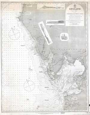
England West Coast. Fleetwood to the Firth of Solway.
$250.00
Acquire
- Digital Map Information
- Suitable for large format printing
- File Size: 12.24 MB
- File Type: ZIP / TIFF
- ICC color profile embedded
- Delivered instantly via download link
This is an 1873 Admiralty nautical chart or maritime map of the west coast of England. The map depicts the region from Harrington, near the Lake District, to Blackpool, a seaside resort town. Myriad depth soundings are included all along the ... (more details)
World's most disputed waters.
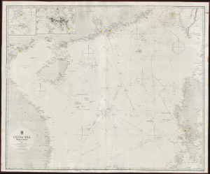
China Sea Northern Portion.
$1,600.00
Acquire
- Digital Map Information
- Suitable for large format printing
- Full resolution TIFF file
- ICC color profile embedded
- Delivered instantly via download link
This exceptional 1867 / 1873 British Admiralty map of the South China Sea includes Hong Kong and the Philippines, depicting some of the world's most disputed waters. (more details)
Best British chart of Manila.
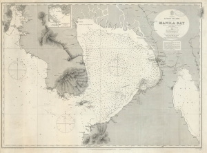
Philippines, Luzon Island, Manila Bay Surveyed by the Spanish Phillipine Hydc. Commission under the direction of Captain Claudio Montero 1861 with Corrections and Additions to 1885.
$1,200.00
Acquire
- Digital Map Information
- Suitable for large format printing
- File Size: 114.17 MB
- File Type: ZIP / TIFF
- ICC color profile embedded
- Delivered instantly via download link
A large, richly detailed 1886 navigational map of Manila Bay in the Philippines, one of the largest available in the English language. Published and updated by the British Admiralty, it was made in cooperation with the Spanish / Philippine hydrographer D. Claudio Montero, who oversaw Spanish navigational charting of the Philippines directly for more than a decade. (more details)
Includes an incredible amount of detail near Singapore and along the Vietnamese coast.
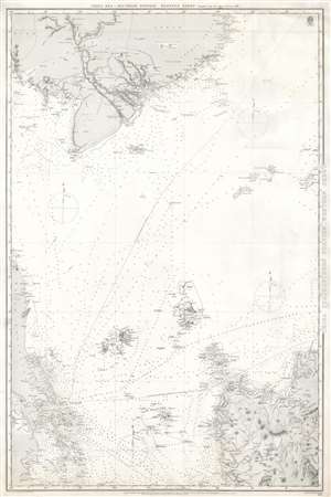
China Sea, Southern Portion, Western Sheet.
$750.00
Acquire
- Digital Map Information
- Suitable for large format printing
- File Size: 41.68 MB
- File Type: ZIP / TIFF
- ICC color profile embedded
- Delivered instantly via download link
This is an 1887 British Admiralty nautical chart or maritime map of Southeast Asia. The chart depicts the region from Singapore, the Malay Peninsula, and Sumatra to northern Luzon in the Philippines and from Cambodia and Vietnam (labeled here as Cochin China and Annam) to Sumatra and Luzon. Highly detailed, myriad depth soundings are indicated throughout, particularly along the coastline of Luzon, in the Straits between Sumatra and Singapore, along the coast of Vietnam, and tracing the habitual shipping lanes around the region. Cities, towns, and villages are identified, including Saigon, as are coastal landmarks, such as rivers and large hills. The dashed lines represent two different routes used to travel between Singapore and Hong Kong, both British possessions at the time of this chart's publication. Boundaries are indicated in Indochina between Cambodia, Lower Cochin China, Annam, and Siam. (more details)
French in Singapore.
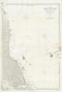
Côte Orientale de la Péninsule Malaise entre le Détroit de Singapoure de la Grande Redan et Partie Occidentale de l'Archipel des Anambas.
$950.00
Acquire
- Digital Map Information
- Suitable for large format printing
- File Size: 18.78 MB
- File Type: ZIP / TIFF
- ICC color profile embedded
- Delivered instantly via download link
This is an 1888 Dépot des Cartes et Plans de la Marine nautical map of the Malay Peninsula and Singapore. The map reflects growing French influence in and around Singapore, a major trading partner for French Indochina. (more details)
Modernizing Ottoman maritime data.
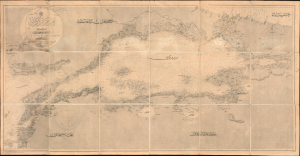
مارمارا ضنيزي / [Sea of Marmara].
$2,800.00
Acquire
- Digital Map Information
- Suitable for large format printing
- File Size: 1762.71 MB
- File Type: ZIP / TIFF
- ICC color profile embedded
- Delivered instantly via download link
A fascinating 1896 nautical chart or map of the Sea of Marmara, including the Bosphorus Straits, published by the Ottoman Matbaa-i Bahriye (Printing House of the Naval Forces). It is based on a British Admiralty chart of the same, reflecting both the advanced state of British hydrography at the time and the efforts of the late Ottoman state to close the gap with Western empires. (more details)
Britain's Bulwark.
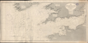
English Channel. [Admiralty Chart No.] 1598.
$600.00
Acquire
- Digital Map Information
- Suitable for large format printing
- File Size: 73.9 MB
- File Type: ZIP / TIFF
- ICC color profile embedded
- Delivered instantly via download link
A large-format 1897 nautical map or chart of the English Channel produced by the British Admiralty. It demonstrates both the notorious hazards of the channel for larger ships, as well as a greater understanding and cataloging of those same hazards in the late 19th century. (more details)
Depicts the Central American coastline from Amatique Bay to the Bahia de Omoa and part of the Northern Railroad to Guatemala City.
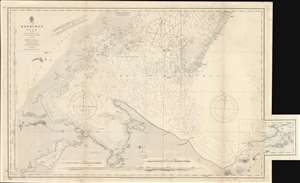
Honduras Gulf with the Zapotillos Cays.
$600.00
Acquire
- Digital Map Information
- Suitable for large format printing
- File Size: 47.54 MB
- File Type: ZIP / TIFF
- ICC color profile embedded
- Delivered instantly via download link
This is an 1899 British Admiralty nautical chart or maritime map of the Gulf of Honduras. The map depicts the Central American coastline from Belize (British Honduras) to the Bahia de Omoa on the coast of Honduras including Amatique Bay and Livingston, Guatemala. Myriad depth soundings are indicated throughout, and coastal islands, shoals, banks, and other maritime hazards are identified. River Sarstoon, which marks the border between British Honduras and Guatemala, is illustrated and labeled, as is El Golfete, but no significant inland detail is present. Some coastal sites, such as points, hills, and settlements, including Port Livingstone and Puerto Barrios, are nonetheless noted. Five views are illustrated along the borders, each of which is labeled alphabetically. Curiously, these views are oriented as they would have been seen from certain points on the map, which are labeled with corresponding letters, instead of oriented toward the bottom of the map, as was customary. (more details)
Lunenburg - Nova Scotia Coast.
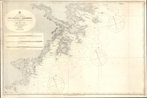
North America. East Coast. Nova Scotia. South East Coast. Port Medway to Lunenburg.
$225.00
Acquire
- Digital Map Information
- Suitable for large format printing
- File Size: 39.33 MB
- File Type: ZIP / TIFF
- ICC color profile embedded
- Delivered instantly via download link
This is a 1901 British Admiralty nautical chart or map of part of the southeastern coast of Nova Scotia from Liverpool Bay (just south of Port Medway) to Lunenburg and Heckman's Island. (more details)
Where the Mississippi meets the Gulf.
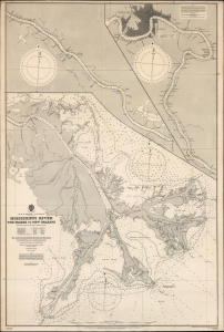
Gulf of Mexico. Louisiana. Mississippi River The Passes to New Orleans.
$1,500.00
Acquire
- Digital Map Information
- Suitable for large format printing
- File Size: 71.86 MB
- File Type: ZIP / TIFF
- ICC color profile embedded
- Delivered instantly via download link
This is a 1903 / 1908 British Admiralty nautical chart or map of the Mississippi River from New Orleans to The Passes: a richly detailed working chart for the navigation of one of the most important water routes in the United States, with all the data necessary for navigating the mouth of the great river. (more details)
New Zealand hydrography.
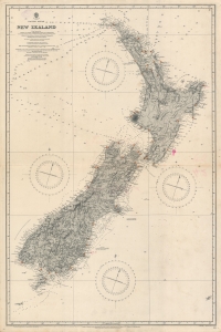
Pacific Ocean. Nea Zealand From Surveys by Captain J. L. Stokes, Commanders B. Drury and G. H. Richards...
$1,000.00
Acquire
- Digital Map Information
- Suitable for large format printing
- File Size: 55.54 MB
- File Type: ZIP / TIFF
- ICC color profile embedded
- Delivered instantly via download link
A rare 1917 British Admiralty nautical chart or maritime map of New Zealand. The map covers both North and South Islands and the surrounding waters. While depth soundings along the coastlines are extensive, soundings further out are few and far between. Lighthouses throughout are marked using the standard red and yellow convention. This map is based upon surveys completed by J. L. Stokes, one of the premier British hydrographers of his generation. Inland detail is derived from surveys completed by the Wellington Public Works Department, c. 1885. (more details)
The Mississippi Sound and Mobile Bay.
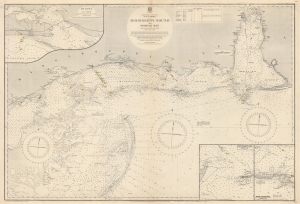
North America. East Coast. Gulf of Mexico. Mississippi Sound and Mobile Bay.
$850.00
Acquire
- Digital Map Information
- Suitable for large format printing
- File Size: 119.39 MB
- File Type: ZIP / TIFF
- ICC color profile embedded
- Delivered instantly via download link
This is a 1919 British Admiralty nautical chart or map of Mobile Bay and Mississippi Sound, part of the Gulf Littoral Intercoastal Waterway. The map provides an overview of the region while insets detail important areas. (more details)
One of the most beautiful places on Earth.
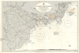
Kua Lakh to Kao Tao Islands Including The Delta of the Song Ka.
$500.00
Acquire
- Digital Map Information
- Suitable for large format printing
- File Size: 76.86 MB
- File Type: ZIP / TIFF
- ICC color profile embedded
- Delivered instantly via download link
This is a 1926 British Admiralty nautical chart or maritime map of northeastern Vietnam in the vicinity of Hanoi and Ha Long Bay. Today, this area is regarded as one of the most beautiful places on Earth. (more details)
The Singapore Strategy.
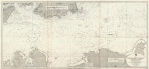
China Sea Singapore Strait Eastern Portion.
$950.00
Acquire
- Digital Map Information
- Suitable for large format printing
- File Size: 33.95 MB
- File Type: ZIP / TIFF
- ICC color profile embedded
- Delivered instantly via download link
This is a first edition 1927 British Admiralty nautical chart or maritime map of the eastern portion of the Singapore Strait. The map was issued during the Interwar Period when British naval hegemony was waning and the 'Singapore Strategy' attempted to turn the island colony into a 'Gibraltar of the East.' (more details)
Notes the island's many sugar processing windmills.
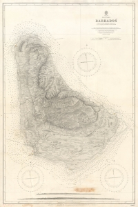
West Indies Barbados.
$850.00
Acquire
- Digital Map Information
- Suitable for large format printing
- File Size: 51.2 MB
- File Type: ZIP / TIFF
- ICC color profile embedded
- Delivered instantly via download link
An impressive 1927 British Admiralty nautical chart of Barbados, with manuscript updates to 1937. (more details)
Malaya and Singapore in the Interwar Period.
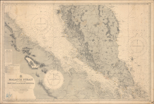
Malacca Strait with part of the East Coast of the Malay Peninsula from the latest British and Foreign Government Surveys.
$750.00
Acquire
- Digital Map Information
- Suitable for large format printing
- Full resolution TIFF file
- ICC color profile embedded
- Delivered instantly via download link
This is a 1929 British Admiralty nautical chart or maritime map of the Malay Peninsula, Singapore, and the Strait of Malacca. It captures the Strait during the Interwar Period (1918 - 1939), when Malaya was the world's largest single source of both rubber and tin, and when the British sought to protect this vitally important waterway from foreign aggression. (more details)
Shows urban development in Hong Kong Victoria, Central, and Kowloon. Extensive manuscript updates!
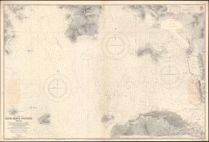
China-South Coast. Hong Kong Waters West.
$3,000.00
Acquire
- Digital Map Information
- Suitable for large format printing
- File Size: 66.09 MB
- File Type: ZIP / TIFF
- ICC color profile embedded
- Delivered instantly via download link
A detailed 1929 British Admiralty nautical chart or maritime map of Hong Kong Harbor and Kowloon. The map covers from eastern Lan Tau Island to Kowloon and from Tsing Yi (青衣, Chung Hue) to Victoria (Hong Kong Central, Sai Wan, Sai Ying Pun, and Sheung Wan. It exhibits copious c. 1930 manuscript updates in the vicinity of Kowloon, including a heavily annotated pastedown. (more details)
Dubai - Origins of an Economic Miracle.
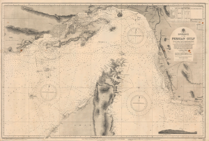
Entrance of the Persian Gulf.
$4,000.00
Acquire
- Digital Map Information
- Suitable for large format printing
- File Size: 50.69 MB
- File Type: ZIP / TIFF
- ICC color profile embedded
- Delivered instantly via download link
This is a 1945 British Admiralty large-format nautical chart of the Strait of Hormuz encompassing the Entrance to the Persian Gulf, one of the most strategically important locations in the world. The chart is notable for its inclusion of Dubai, at this time still a small fishing and pearling port but poised to become an economic powerhouse following the discovery of oil in the 1960s. (more details)
Gateway to the Gulf of Suez
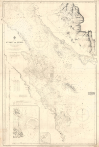
Red Sea Strait of Jubal.
$750.00
Acquire
- Digital Map Information
- Suitable for large format printing
- DPI: 600
- File Size: 32.4 MB
- File Type: ZIP / TIFF
- ICC color profile embedded
- Delivered instantly via download link
This is a 1946 British Admiralty nautical chart of the Strait of Gubal in Egypt, where the Gulf of Suez meets the Red Sea near the tip of the Sinai Peninsula. This strategically important waterway was fought over during both World War II (1939 - 1945) and the Cold War-era struggle between Egypt and Israel. (more details)
Navigating Shanghai's Waters and Turbulent Politics.
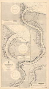
China The Whangpoo.
$1,200.00
Acquire
- Digital Map Information
- Suitable for large format printing
- Full resolution TIFF file
- ICC color profile embedded
- Delivered instantly via download link
This is a 1948 British Admiralty nautical chart or maritime map of the Huangpu (Whangpoo) River. It was produced during the Chinese Civil War (1927 - 1949), shortly after World War II (1939 - 1945), when Shanghai was in a state of turmoil, anxiety, and uncertainty. (more details)
Working navigational chart from an ill - fated ship.
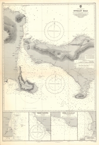
Eastern Archipelago Straat Bali from the Netherlands Government Chart of 1907 With Corrections to 1954.
$200.00
Acquire
- Digital Map Information
- Suitable for large format printing
- File Size: 54.99 MB
- File Type: ZIP / TIFF
- ICC color profile embedded
- Delivered instantly via download link
This is a British nautical map of the Bali Strait, the narrow passage between the islands of Java and Bali, from among the charts of a working oil tanker. The chart is derived from a 1907 Dutch chart produced while the island was a colonial possession. This Admiralty chart, though initially engraved in 1909, was corrected and reprinted in 1954. The chart shows the easternmost coastlines of Java, and the coasts of the western half of Bali. In addition to the expected depth soundings and notations of magnetic variations, the chart is remarkably well-detailed with respect to the coastlines. Elevations are shown topographically, lighthouses are marked in red, and visually important landmarks are noted: Temples, a pyramid, and even 'House with Zinc Roof (conspicuous)' appear as references for the coastal navigator. (more details)
From Wartime Base to Tourism Boom.
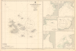
This is a 1953 edition British Admiralty nautical chart or map of the Galápagos Islands, Ecuador, updated to 1956. It presents the islands in the post-World War II period, just before the islands became an international tourist destination. (more details)
Paradise!
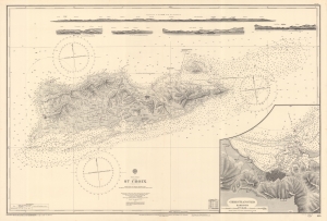
This is a beautiful 1903 British Admiralty nautical chart or maritime map depicting the island of Saint Croix (Santa Cruz) in the U.S. Virgin Islands. Unlike most Admiralty charts, a surprising level of inland detail is presented here. Both Frederiksted and Christiansted are labeled and illustrated with streets and city blocks. Homesteads across the island are identified as well, many of which are marked by windmills. Major roads are also included. Myriad depth soundings are noted all along the island's coast and extend east of the island to Lang Bank. A detailed inset map of Christiansted city and harbor is situated in the lower right corner. Five coastal views are included along the top border. (more details)
Around Doha.
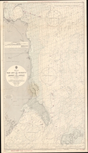
A scarce 1967 nautical map of the eastern part of Qatar, including Doha, focusing on the Persian Gulf coast. Coverage extends from Doha south to the Jabal An Niqyãn - thus reflecting an important shipping corridor rife with undersea dangers. The chart notes lightboats, coral reefs, and various navigational hazards. Countless depth soundings noted throughout. Limited detail inland, but the general layout of Doha is evident, as are the sites of various trees and minarets visible from the sea. (more details)