
Gastaldi, Giacomo (sold)

Giacomo Gastaldi (c. 1500 - October, 1566) was an Italian astronomer, cartographer, and engineer active in the second half of the 16th century. Gastaldi (sometimes referred to as Jacopo or Iacobo) began his career as an engineer, serving the Venetian Republic in that capacity until the fourth decade of the sixteenth century. During this time he traveled extensively, building a large library relating to voyages and exploration. From about 1544 he turned his attention to mapmaking, working extensively with Giovanni Battista Ramusio, Nicolo Bascarini, and Giovanbattista Pedrezano, as well as taking private commissions for, among others, Venice's Council of Ten. He is credited with the fresco maps of Asia and Africa still extant in the map room of the Doge's Palace. Gastaldi was also one of the first cartographers to embrace copper plate over woodblock engraving, marking an important development in the history of cartography. His 1548 edition of Ptolemy's Geographia was the first to be printed in a vernacular; it was the first to be printed in copperplate. As with his Swiss/German contemporary Münster, Gastaldi's work contained many maps depicting newly discovered regions for the first time, including the first map to focus on the East Coast of North America, and the first modern map of the Indian Peninsula. His works provided the source for the vast majority of the Venetian and Roman map publishers of the 1560s and 70s, and would continue to provide an outsize influence on the early maps of Ortelius, De Jode, and Mercator.
First printed map to show New York Harbor
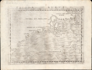
Tierra Nueva.
sold
- Digital Map Information
- Suitable for large format printing
- Full resolution TIFF file
- ICC color profile embedded
- Delivered instantly via download link
This is Giacomo Gastaldi's 1548 map of the eastern coast of North America. It is considered the first printed map specifically of the American eastern coastline and the first obtainable map to illustrate Narragansett Bay, Block Island, New York Harbor, Long Island, the Outer Banks, and Bermuda. (more details)
The First Separate, Modern Map of India
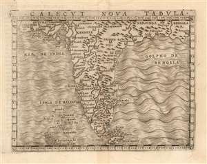
Calecut Nova Tabula.
sold
- Digital Map Information
- Suitable for large format printing
- DPI: 600
- File Size: 2.92 MB
- File Type: ZIP / TIFF
- ICC color profile embedded
- Delivered instantly via download link
This is Giacomo Gastaldi's 1548 map of the Indian Peninsula. It is the earliest printed, modern map of India - all earlier maps of the region being iterations of Claudius Ptolemy's geographical information of the 2nd century. Though a Venetian, Gastaldi's information shows knowledge of the depth of Portuguese penetration of the subcontinent. Guzarat, Goa, Calecut, Delhi and many other place names appear on the map. Sri Lanka (Ceilam) is shown in its correct location and is not conflated with Sumatra, as many of the Ptolemaic maps appeared to do. The archaic term 'Taprobana' does not appear. The Maldives are shown with some exaggeration. (more details)
Earliest Acquirable Italian World Map to show the Western Hemisphere.
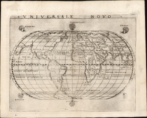
Universale Novo.
sold
- Digital Map Information
- Suitable for large format printing
- Full resolution TIFF file
- ICC color profile embedded
- Delivered instantly via download link
This is Giacomo Gastaldi's 1548 Universale Novo, one of the earliest modern depictions of the world and the earliest acquirable world map from this pillar of Italian geography. It is also the earliest acquirable Italian map to show the full continent of America. It appeared in Gastaldi's edition of Ptolemy's Geographia, the first such to appear in the vernacular. (more details)
'An advance of the first importance' - Wheat
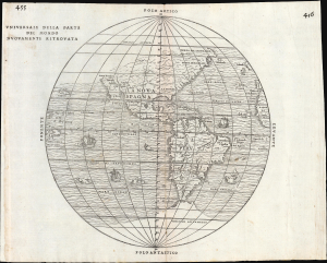
Universale Della Parte De Mondo Nuovamente Ritrovata.
sold
- Digital Map Information
- Suitable for large format printing
- File Size: 10.16 MB
- File Type: ZIP / TIFF
- ICC color profile embedded
- Delivered instantly via download link
This is Giovanni Battista Ramusio's scarce 1556 map of the Americas. It appeared in Ramusio's Navigationi et Viaggi, the first collection of explorers' first-hand accounts of their travels. It is among the earliest detailed representations of the Western Hemisphere, and was the first overall printed map of America to include placenames from Coronado's travels of 1540-1542. Wheat hailed this inclusion as an advance of the first importance, so far as the mapping of the American West is concerned. (more details)
The first state of the earliest specific map of Brazil.
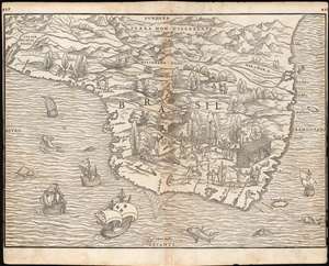
[Brasil].
sold
- Digital Map Information
- Suitable for large format printing
- Full resolution TIFF file
- ICC color profile embedded
- Delivered instantly via download link
This is the seminal, rare 1556 Giovanni Battista Ramusio map of Brazil, the first printed map to focus specifically on the area. It appeared in Ramusio's 1556 Navigationi et Viaggi, the first collection of explorers' first-hand accounts of their travels. The woodcut represents the first glimpse in print specifically of Brazil. The geographical information is generally credited to Giocomo Gastaldi (1500 - 1566). Much of that detail, and all of the socio-ethno-economic imagery of the map appears to have been drawn either from the 1519 manuscript Lopo Homem (1497 - 1572) Carta do Brasil, or from one or another manuscript of the Dieppe school. This is significant. An overwhelming percentage of maps of South America in the 16th century, printed and manuscript, carry either imagery or text describing the indigenous population as savages and cannibals. Of the early printed maps of Brazil, this is the only to highlight instead the harvesting of the lumber, which represented the initial economic draw for Europeans: Brazil wood, which when harvested and processed produced a highly desirable dye. Not only are the natives shown harvesting trees, and hauling them to the shore - they are also shown with parrots and monkeys, also desirable trade items. More significantly, the map shows a native exchanging lumber for a cup, given by men in European garb. This is one of the only printed maps to depict the active trade which had been underway for decades between French mariners from Normandy and the Tupi peoples of Brazil. Ramusio, as Venetian ambassador to France, may well have had access to French manuscript maps of the Dieppe school (which Surekha Davies notes were remarkable for their depiction of Brazilian indigenes as trade partners rather than predators.) The ships shown sailing the Atlantic here tell a related story: The Portuguese enjoyed a Papally decreed monopoly on the exploitation and colonization of Brazil under the 1494 Treaty of Tordesillas. French / Norman trade with Brazilian natives was done in defiance of the Portuguese, frequently meeting armed resistance. Of the five ships on this map, the smaller three sport the arms of Portugal. The two larger ships in the foreground bear the French fleurs-de-lis. This is a common thread appearing on Ramusio's maps: the notion that whatever the Portuguese have found around the world, the French ought to be able to take. (more details)
First Map to show New York Harbor. The First Map to name Canada.
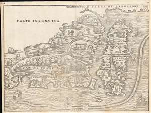
La Nuova Francia.
sold
- Digital Map Information
- Suitable for large format printing
- Full resolution TIFF file
- ICC color profile embedded
- Delivered instantly via download link
This is the seminal 1556 Giovanni Battista Ramusio map of the Northeast and Canada, 'the first printed map devoted to the New England region' (Osher), and the first map to apply a specific name to Canada. The map depicts the northeastern coast of North America from New York to the coast of Labrador, inclusive of New England and maritime Canada. It is the first map to reveal Giovanni da Verrazano's 1524 voyage to America and to depict his discoveries in what would become New York and New England. It is also among the most visually engaging early maps, being richly decorated with depictions of indigenous peoples, Europeans, flora and fauna, sailing ships, sea monsters, and demons. (more details)
One of the Earliest Double-Hemisphere World Maps, Updated.
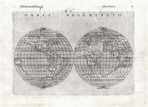
Orbis Descriptio.
sold
- Digital Map Information
- Suitable for large format printing
- DPI: 600
- File Size: 17.05 MB
- File Type: ZIP / TIFF
- ICC color profile embedded
- Delivered instantly via download link
This is a 1598, second-state issue of Girolamo Ruscelli's 1561 map of the world. In its first, 1561 state it was the earliest acquirable double-hemisphere world map, but even this later issue remains one of the earliest acquirable maps to use this format. Like most maps in Ruscelli’s Ptolemy, the geographic details were based on Giacomo Gastaldi's (1500 - 1566) 1548 Ptolemy. Here, the double-hemispherical projection transforms this map into a fully new composition. Amongst printed maps, it is predated only by the unacquirable 1555 Georgio Sideri 'Calapoda' (fl. 1537–1565) map. The 1598 edition of Ruscelli's Ptolemy was edited by Giuseppe Rosaccio, who updated many of the maps in order to make them more competitive; most often, this involved the addition of purely decorative elements. In the case of the present map, significant geographical changes have taken place, most notably the addition of a massive southern continent not present on the 1561 issue. (more details)
Early map of Italy.
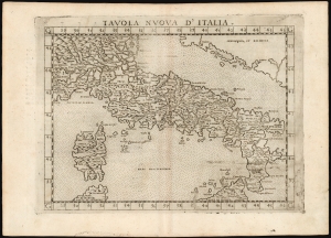
Tavola Nuova d' Italia.
sold
- Digital Map Information
- Suitable for large format printing
- DPI: 600
- File Size: 12.99 MB
- File Type: ZIP / TIFF
- ICC color profile embedded
- Delivered instantly via download link
This is Girolamo Ruscelli's 1574 edition of Giocomo Gastaldi's modern map of Italy, an attractive early copperplate map based on contemporary cartographic information. (more details)
Among the Earliest Acquirable Contemporary Maps of the Baltic Coast.
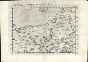
Tavola nuova di Prussia et di Livonia.
sold
- Digital Map Information
- Suitable for large format printing
- Full resolution TIFF file
- ICC color profile embedded
- Delivered instantly via download link
This is the 1561 first Ruscelli edition of Giacomo Gastaldi's map of the Baltic Coast of Prussia and Livonia, now the coastline of Poland, Lithuania, Latvia, and Estonia. It is among the earliest detailed maps of this part of the world based on contemporary geographical knowledge, particularly with respect to the Gulf of Riga. (more details)
One of the earliest works to depict a peninsular Qatar.
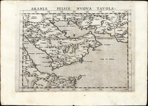
Arabia Felice Nuova Tavola.
sold
- Digital Map Information
- Suitable for large format printing
- Full resolution TIFF file
- ICC color profile embedded
- Delivered instantly via download link
This is a superb example of Girolamo Ruscelli's 1561, first edition of the first modern map of the Arabian Peninsula, specifically the fertile part of Arabia, 'Arabia Felix.' It is an expanded and more finely engraved evolution on Gastaldi's 1548 cartography, and one of the earliest acquirable depictions of Arabia not based on the 2nd-century work of Claudius Ptolemy. The island of Bahrain (Baharam) appears. This is also one of the earliest works to depict a peninsular Qatar. (more details)
Asia and America Conjoined.
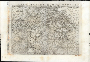
Carta Marina Nuova Tavola.
sold
- Digital Map Information
- Suitable for large format printing
- Full resolution TIFF file
- ICC color profile embedded
- Delivered instantly via download link
This is Girolamo Ruscelli's 1561 map of the world,Carta Marina Nuova Tavola. It was one of three world maps in Ruscelli's edition of Ptolemy: one depicted the ancient world, while two - this, and a double-hemisphere map - were modern works. This striking work, with its array of rhumb lines, was an enlarged and improved version of Giacomo Gastaldi's 1548 Carta Marina Nova Tabula and shared with that earlier map an abundance of unusual features. (more details)
Asia and America Conjoined.
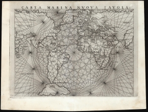
Carta Marina Nuova Tavola.
sold
- Digital Map Information
- Suitable for large format printing
- Full resolution TIFF file
- ICC color profile embedded
- Delivered instantly via download link
This is a superb example of Girolamo Ruscelli's 1561 map of the world,Carta Marina Nuova Tavola. It was one of three maps in Ruscelli's edition of Ptolemy: one depicted the ancient world, while two - this, and a double-hemisphere map - were modern works. This striking work, with its array of rhumb lines, was an enlarged and improved version of Giacomo Gastaldi's 1548 Carta Marina Nova Tabula and shared with that earlier map an abundance of unusual features. (more details)
First Double-Hemisphere Map of the World in a Printed Atlas.

Orbis Descriptio.
sold
- Digital Map Information
- Suitable for large format printing
- Full resolution TIFF file
- ICC color profile embedded
- Delivered instantly via download link
This is the 1561 Girolamo Ruscelli map of the world, in the first state of the first plate. It is the earliest acquirable double-hemisphere world map and is the first such to appear in a printed atlas. Like most maps in Ruscelli's Ptolemy, the geographic details were derived from Giacomo Gastaldi's (1500 - 1566) 1548 Ptolemy. Here, the double-hemispherical projection transforms this map into a fully new composition. Amongst printed maps, the only earlier map using this projection is the unacquirable 1555 Georgio Sideri 'Calapoda' (fl. 1537 - 1565) map. (more details)
First Double-Hemisphere Map of the World in a Printed Atlas.
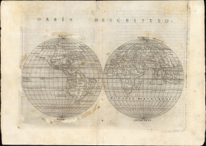
Orbis Descriptio.
sold
- Digital Map Information
- Suitable for large format printing
- Full resolution TIFF file
- ICC color profile embedded
- Delivered instantly via download link
This is the 1561 Girolamo Ruscelli map of the world, in the first state of the first plate. It is the earliest acquirable double-hemisphere world map and is the first such to appear in a printed atlas. Like most maps in Ruscelli's Ptolemy, the geographic details were derived from Giacomo Gastaldi's (1500 - 1566) 1548 Ptolemy. Here, the double-hemispherical projection transforms this map into a fully new composition. Amongst printed maps, the only earlier map using this projection is the unacquirable 1555 Georgio Sideri 'Calapoda' (fl. 1537 - 1565) map. (more details)
First Double-Hemisphere World in a Printed Atlas.
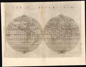
Orbis Descriptio.
sold
- Digital Map Information
- Suitable for large format printing
- Full resolution TIFF file
- ICC color profile embedded
- Delivered instantly via download link
This is a 1561 first plate issue of Girolamo Ruscelli's double hemisphere map of the world. It is the earliest acquirable world map in this format, and is the first such to appear in a printed atlas. Like most maps in Ruscelli’s Ptolemy, the geographic details were based on Giacomo Gastaldi's (1500 - 1566) 1548 Ptolemy. Here, the projection transforms this map into fully new composition. Amongst printed double-hemisphere world maps, it is predated only by the unacquirable 1555 Georgio Sideri 'Calapoda' (fl. 1537–1565) map. (more details)
First Double-Hemisphere World in a Printed 'Atlas.'
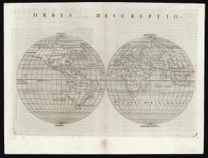
Orbis Descriptio.
sold
- Digital Map Information
- Suitable for large format printing
- Full resolution TIFF file
- ICC color profile embedded
- Delivered instantly via download link
This is the 1561 Girolamo Ruscelli map of the world, in the first state of the first plate. It is the earliest acquirable double hemisphere world map, and is the first such to appear in a geography. Like most maps in Ruscelli's work, the broad geographic details were derived from Giacomo Gastaldi's (1500 - 1566) 1548 Ptolemy. Here, the double-hemispherical projection - along with elements incorporated from new geographical sources - transforms this map into a fully new composition. Amongst printed maps, the only earlier map using this projection is the unacquirable 1555 Georgio Sideri 'Calapoda' (fl. 1537 - 1565) map. (more details)
First Double-Hemisphere World in a Printed Geography.
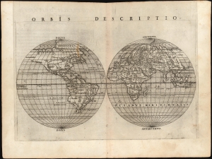
Orbis Descriptio.
sold
- Digital Map Information
- Suitable for large format printing
- Full resolution TIFF file
- ICC color profile embedded
- Delivered instantly via download link
This is the 1561 Girolamo Ruscelli map of the world, in the first state of the first plate. It is the earliest acquirable double hemisphere world map, and is the first such to appear in a printed geography. While many of its geographical details derived from Giacomo Gastaldi's 1548 Ptolemy, this map's incorporation of new information for the north Atlantic and its new projection transformed this map into a fully new composition. Amongst printed maps, the only earlier map using this projection is the unacquirable 1555 Georgio Sideri 'Calapoda' (fl. 1537 - 1565) map. (more details)
First Double-Hemisphere World in a Printed Atlas.
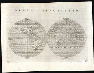
Orbis Descriptio.
sold
- Digital Map Information
- Suitable for large format printing
- Full resolution TIFF file
- ICC color profile embedded
- Delivered instantly via download link
This is a 1561 first plate issue of Girolamo Ruscelli's double hemisphere map of the world. It is the earliest acquirable world map in this format, and is the first such to appear in a printed atlas. Like most maps in Ruscelli’s Ptolemy, the geographic details were based on Giacomo Gastaldi's (1500 - 1566) 1548 Ptolemy. Here, the double-hemispherical projection transforms this map into fully new composition. Amongst printed maps, it is predated only by the unacquirable 1555 Georgio Sideri 'Calapoda' (fl. 1537–1565) map. (more details)
First State of one of the Earliest Modern Maps of the Holy Land and Cyprus.
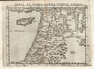
Soria et Terra Santa Nuova Tavola.
sold
- Digital Map Information
- Suitable for large format printing
- Full resolution TIFF file
- ICC color profile embedded
- Delivered instantly via download link
This is a superb, first state example of Girolamo Ruscelli's 1561 map of the Holy Land and Cyprus. It is an enlarged, more finely-engraved iteration of Giocomo Gastaldi's 1548 Soria e Terra Sancta nova tabula. While Tibbetts avers that the Ruscelli contains fewer place names than its Gastaldi source, he is incorrect: Ruscelli's map preserves all the data of the Gastaldi, but between the increased size of the plate and the clear, legible, and well-spaced engraving of the newer map, its data is presented without the crowding evident on the 1548 map. The skill evident in this 1561 work can be credited to the engraver Giulio Sanuto, one of the few Venetian engravers whose career was not isolated either to map engraving or to figurative artistic works, but consisted of both over a career of more than forty years. (more details)
First Specific Copperplate Map of Brazil.
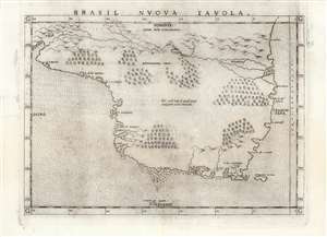
Brasil Nuova Tavola.
sold
- Digital Map Information
- Suitable for large format printing
- Full resolution TIFF file
- ICC color profile embedded
- Delivered instantly via download link
This is a 1561 first plate issue of Girolamo Ruscelli's map of Brazil. It is among the first, detailed specific maps of any part of South America. While most of the maps in Ruscelli’s edition of Ptolemy were based on those appearing in Gastaldi's 1548 Ptolemy, this map was a new composition. It is predated only by the Ramusio woodcut map of 1556, whose geography is also credited to Gastaldi, and from which much of the detail of the Ruscelli is derived. (more details)
One of the First Acquirable Maps of the North American East Coast in its earliest issue.
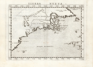
Tierra Nueva.
sold
- Digital Map Information
- Suitable for large format printing
- Full resolution TIFF file
- ICC color profile embedded
- Delivered instantly via download link
This is the first state, first edition, of Girolamo Ruscelli's 1561 map 'Tierra Nueva', an early and influential map of what would become New England and the Canadian Maritime Provinces. It is among the earliest acquirable maps to cover the eastern coastline of North America. The map spans from upper Florida northwards past Cabo de Santa Maria to Larcadia (Kitty Hawk), Angoulesme (New York Harbor), Nova Scotia, and Labrador. The map is a further development of the 1548 Gastaldi map of the same region. The Gastaldi was limited entirely to the coastline, while Ruscelli's map attempted to show a network of rivers and is among the first regional maps to show mountains in the interior of North America. (more details)
One of the First Acquirable Maps of South America.
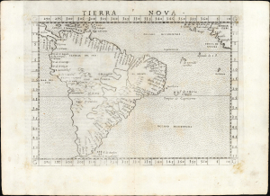
Tierra Nova.
sold
- Digital Map Information
- Suitable for large format printing
- Full resolution TIFF file
- ICC color profile embedded
- Delivered instantly via download link
This is the first state of Girolamo Ruscelli's 1561 map of South America, one of the first printed maps dedicated to the region. Among other points of note, this is among the first maps to provide information on the west coast of South America derived from actual contemporaneous exploration. (more details)
One of the earliest Acquirable Post-Magellan Maps of Southeast Asia.
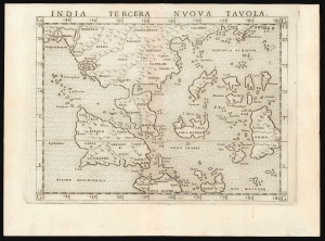
India Tercera Nuova Tavola.
sold
- Digital Map Information
- Suitable for large format printing
- Full resolution TIFF file
- ICC color profile embedded
- Delivered instantly via download link
This is a superb example of the first state of Girolamo Ruscelli's 1561 map of the East Indies and Southeast Asia. It is among the earliest maps of Southeast Asia. Although based on Giacomo Gastaldi's 1548 map of the same title, it is roughly twice the size, and overall, a superior engraving. This was the third of the modern regional Asia maps of this edition of Ptolemy, hence 'Tercera'. (more details)
One of the earliest acquirable Post-Magellan maps of Southeast Asia.
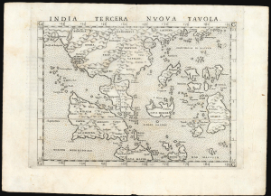
India Tercera Nuova Tavola.
sold
- Digital Map Information
- Suitable for large format printing
- Full resolution TIFF file
- ICC color profile embedded
- Delivered instantly via download link
This is a beautiful first state example of Girolamo Ruscelli's 1561 map of the East Indies and Southeast Asia, among the earliest maps of Southeast Asia. Although based on Giacomo Gastaldi's 1548 map of the same title, it is roughly twice the size and better engraved. (more details)
One of the earliest maps of the Balkans.
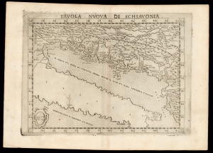
Tavola Nuova di Schiavonia.
sold
- Digital Map Information
- Suitable for large format printing
- DPI: 600
- File Size: 12.15 MB
- File Type: ZIP / TIFF
- ICC color profile embedded
- Delivered instantly via download link
This is Girolamo Ruscelli's 1574 edition of Giocomo Gastaldi's modern map of the Dalmatian coast. (more details)
Describing a Navigable World.
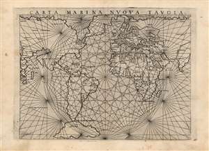
Carta Marina Nuova Tavola.
sold
- Digital Map Information
- Suitable for large format printing
- Full resolution TIFF file
- ICC color profile embedded
- Delivered instantly via download link
This is an attractive example of Girolamo Ruscelli's 1561 map of the world,Carta Marina Nuova Tavola. It was one of three maps in Ruscelli's edition of Ptolemy. One of these was Ptolemy's map while two - this, and a double-hemisphere map - were modern works. This striking work, with its array of rhumb lines, was an enlarged and improved version of Giacomo Gastaldi's 1548 Carta Marina Nova Tabula. As such, it reflects the puzzling features of that earlier map: not merely those which differ from modern understanding of the globe, but sharp differences between Gastaldi's own maps of the same period, and indeed differences between this and Ruscelli's other modern map appearing in the same work. (more details)
Latin Edition of an Influential Geography
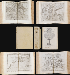
This is a superb example of Girolamo Ruscelli's Geographia Cl. Ptolemaei Alexandrini, the 1562 edition of his expanded Ptolemy, featuring the new Latin re-translation of the work by Giuseppe Moleto, amending Willibald Pirckheimer's translation of Ptolemy's text. Ruscelli's Geographia was a tour de force and, in this Latin edition, it reached its broadest audience, marking this as the most important edition of Ruscelli's Ptolemy. With its complement of maps beautifully engraved by Giulio Sanuto (particularly the Zeno map of the North Atlantic), the work had a long-standing influence on European geographical thought. The maps here are all in their first state and are thus most desirable. (more details)
First detailed, printed map specifically of South America.
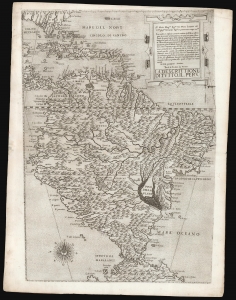
La descrittione di tutto il Peru.
sold
- Digital Map Information
- Suitable for large format printing
- DPI: 600
- File Size: 42.91 MB
- File Type: ZIP / TIFF
- ICC color profile embedded
- Delivered instantly via download link
A superb, untrimmed, first-state example of Paolo Forlani's rare 1562 map of South America. It is the first large-scale, accurate printed map of the southern part of the Americas and is the only map of South America to be produced in the 'Lafreri School' of mapmaking. It is among Forlani's greatest works, and is a prize map not only for collectors of South America in particular, but also the Caribbean, Florida and Bermuda. Through its connection to the 1562 map of Diego Gutiérrez, it offers the most direct available link to contemporaneous Spanish mapping of her American colonies obtainable. (more details)
A rare, early copperplate map of India, Persia, and Arabia.
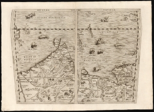
Seconda Tavola.
sold
- Digital Map Information
- Suitable for large format printing
- File Size: 10.98 MB
- File Type: ZIP / TIFF
- ICC color profile embedded
- Delivered instantly via download link
This is a scarce copperplate edition, commonly dated 1563, of the first accurate map of South Asia, including India, Arabia, and the Persian Gulf. It was drawn for Giovanni Battista Ramusio by his friend, the great cartographer Giacomo Gastaldi. The map was first published in Volume I of Ramusio's delle Navigationi et Viaggi in 1554, but this copperplate edition was engraved by Niccolo Nelli to replace the original woodblock after it was lost in a fire. (more details)
One of the rarest, separately-issued 'Lafreri' style maps of Africa,
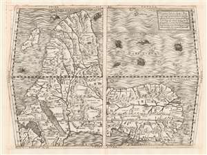
Prima Tavola.
sold
- Digital Map Information
- Suitable for large format printing
- DPI: 600
- File Size: 54.43 MB
- File Type: ZIP / TIFF
- ICC color profile embedded
- Delivered instantly via download link
This beautifully engraved map is Ferando Bertelli's map of Africa, in most respects closely copying the engraved 1563 map of Africa replacing the woodcut provided in 1554 by Giacomo Gastaldi for inclusion in Giovanni Battista Ramusio's Delle Navigationi et Viaggi when the blocks for that work were destroyed by fire. The map's title - Prima Tavola - is in reference to its place alongside a second map of Arabia and India (Seconda Tavola) and a third (Terza Tavola) of Southeast Asia. (The text box in the upper right describes the trio of maps as a sequence.) The map's southern orientation is the most obvious element setting it apart from other maps of Africa from this era, but it should be noted that this map shares that orientation with both others of the trio. The orientation of these three maps appears to have been Ramusio's decision: perhaps the presentation of Africa as viewed from Europe, and in progression from west to east, suited Ramusio's narrative collection of voyages better than following the Ptolemaic convention of having north to the top. Gastaldi's own maps of these regions were oriented to the north, and the other maps appearing in Ramusio's Viaggi - showing west Africa, Sumatra, Brazil, and New France - all adhered to a traditional northern orientation. (more details)
'An advance of the first importance' - Wheat
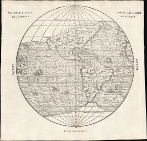
Universale Della Parte De Mondo Nuovamente Ritrovata.
sold
- Digital Map Information
- Suitable for large format printing
- File Size: 7.62 MB
- File Type: ZIP / TIFF
- ICC color profile embedded
- Delivered instantly via download link
This is Giovanni Battista Ramusio's scarce 1565 map of the Americas. It first appeared in Ramusio's 1556 Navigationi et Viaggi, the first collection of explorers' first-hand accounts of their travels. It is among the earliest detailed representations of the Western Hemisphere, predated only by the 1540 Münster and the extremely rare 1554 Bellère map. This was the first printed map of America to include placenames from Coronado's travels of 1540-1542: Wheat hailed this inclusion as 'an advance of the first importance, so far as the mapping of the American West is concerned.'
Ramusio commissioned Giacomo Gastaldi (1500 - 1566) to compose this map, along with the others appearing in the Navigationi et Viaggi; that much of its detail agrees with the western portion of Gastaldi's 1546 world map supports this. (more details)
Ramusio commissioned Giacomo Gastaldi (1500 - 1566) to compose this map, along with the others appearing in the Navigationi et Viaggi; that much of its detail agrees with the western portion of Gastaldi's 1546 world map supports this. (more details)
Ramusio Captures the French Coasting of Africa.
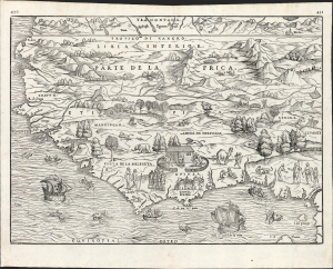
Parte De L'Africa
sold
- Digital Map Information
- Suitable for large format printing
- File Size: 13.42 MB
- File Type: ZIP / TIFF
- ICC color profile embedded
- Delivered instantly via download link
This is Giovanni Battista Ramusio's 1556 / 1565 map of Western Africa. It is the first specific map of the region to be based substantially on contemporaneous report (that of the diplomat and author Leo Africanus). Also, it reveals Ramusio's familiarity with African coastal charts of the Dieppe school of chartmakers, as evidenced not only in the map's distinctive coastal outline but also in its lively decorative elements. (more details)
Earliest specific map of Brazil.
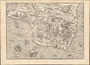
[Brasil].
sold
- Digital Map Information
- Suitable for large format printing
- File Size: 12.38 MB
- File Type: ZIP / TIFF
- ICC color profile embedded
- Delivered instantly via download link
This Giovanni Battista Ramusio's scarce 1565 map of Brazil, the first printed map to focus specifically on the area. It first appeared in Ramusio's 1556 Navigationi et Viaggi, the first collection of explorers' first-hand accounts of their travels. The woodcut represents the first glimpse in print specifically of Brazil. The geographical information is generally credited to Giocomo Gastaldi (1500 - 1566). Much of that detail, and all of the socio-ethno-economic imagery of the map appears to have been drawn either from the 1519 manuscript Lopo Homem (1497 - 1572) Carta do Brasil, or from one or another manuscript of the Dieppe school. This is significant. An overwhelming percentage of maps of South America in the 16th century, printed and manuscript, carry either imagery or text describing the indigenous population as savages and cannibals. Of the early printed maps of Brazil, this is the only to highlight instead the harvesting of the lumber, which represented the initial economic draw for Europeans: Brazil wood, which when harvested and processed produced a highly desirable dye. Not only are the natives shown harvesting trees and hauling them to the shore - they are also shown with parrots and monkeys, also desirable trade items. More significantly, the map shows a native exchanging lumber for a cup, given by men in European garb. This is one of the only printed maps to depict the active trade which had been underway for decades between French mariners from Normandy and the Tupi peoples of Brazil. Ramusio, as Venetian ambassador to France, may well have had access to French manuscript maps of the Dieppe school (which Surekha Davies notes were remarkable for their depiction of Brazilian indigenes as trade partners rather than predators.) The ships shown sailing the Atlantic here tell a related story: The Portuguese enjoyed a Papally decreed monopoly on the exploitation and colonization of Brazil under the 1494 Treaty of Tordesillas. French / Norman trade with Brazilian natives was done in defiance of the Portuguese, frequently meeting armed resistance. Of the five ships on this map, the smaller three sport the arms of Portugal. The two larger ships in the foreground bear the French fleurs-de-lis. This is a common thread appearing on Ramusio's maps: the notion that whatever the Portuguese have found around the world, the French ought to be able to take. (more details)
Capturing a glimpse of Cartier's meeting with the St. Lawrence Iroquois.
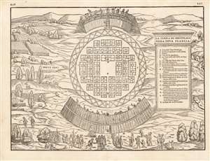
La Terra de Hochelaga Nella Nova Francia
sold
- Digital Map Information
- Suitable for large format printing
- DPI: 600
- File Size: 11.86 MB
- File Type: ZIP / TIFF
- ICC color profile embedded
- Delivered instantly via download link
This is an attractive example of the scarce first map of 'Montreal.' Printed in 1565, it is what Schwartz calls 'The very first plan of a village in the United States or Canada,' and it is the earliest printed map to use the place name 'Monte Real,' which would become Montreal. Perhaps even more significantly, this woodcut is one of the only images from the Discovery Period of an intact indigenous town, and its customs. (more details)
Capturing a glimpse of Cartier's meeting with the St. Lawrence Iroquois.
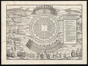
La Terra de Hochelaga Nella Nova Francia.
sold
- Digital Map Information
- Suitable for large format printing
- File Size: 13.66 MB
- File Type: ZIP / TIFF
- ICC color profile embedded
- Delivered instantly via download link
This is an attractive example of the first map of 'Montreal,' in its scarce 1565 second edition. Its first 1556 printing was what Schwartz called 'The very first plan of a village in the United States or Canada,' and it is the earliest printed map to use the place name 'Monte Real,' which would become Montreal. Perhaps even more significantly, this woodcut is one of the only images from the Discovery Period of an intact indigenous town, reflecting its customs. (more details)
First Map to detail New York Harbor; the First Map to name Canada.
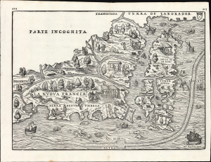
La Nuova Francia.
sold
- Digital Map Information
- Suitable for large format printing
- File Size: 13.96 MB
- File Type: ZIP / TIFF
- ICC color profile embedded
- Delivered instantly via download link
This is a superb example of the seminal 1565 Giovanni Battista Ramusio map of the Northeast and Canada, The first printed map devoted to the New England region (Osher) and the first map to apply a specific name to Canada. Significantly, it is the first map to focus specifically on Giovanni da Verrazzano's 1524 discoveries in what would become New York and New England - making it the first map to depict New York Bay and Harbor. (more details)
The First Map to show New York Harbor; the First Map to name Canada.
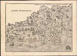
La Nuova Francia.
sold
- Digital Map Information
- Suitable for large format printing
- DPI: 600
- File Size: 14.84 MB
- File Type: ZIP / TIFF
- ICC color profile embedded
- Delivered instantly via download link
This is the seminal 1565 Giovanni Battista Ramusio map of the Northeast and Canada, 'The first printed map devoted to the New England region'(Osher) and the first map to apply a specific name to Canada. The map depicts the northeastern coast of North America from New York to the coast of Labrador, inclusive of New England and maritime Canada. In particular, it is the first map to reveal Giovanni da Verrazano's 1524 voyage to America and to depict his discoveries in what would become New York and New England. It is also among the most visually engaging early maps, being richly decorated with depictions of indigenous peoples, Europeans, flora and fauna, sailing ships, sea monsters, and demons. (more details)
A once-in-a-lifetime opportunity.
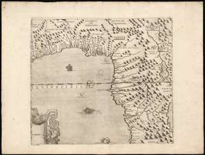
[Gulf of Guinea].
sold
- Digital Map Information
- Suitable for large format printing
- Full resolution TIFF file
- ICC color profile embedded
- Delivered instantly via download link
This is the Gulf of Guinea sheet from Giovanni Francesco Camocio's extraordinary twelve-sheet 1570 wall map of Africa. It is for-all-intent-and-purposes a once-in-a-lifetime opportunity for the serious Africa collector. The complete Camocio map exists in a single known complete example, and even separate sheets, as here, are unobtainable. The map is loosely derived from Giacomo Gastaldi's 1564 map, itself surviving in only 12 examples. Gastaldi's geography was informed by Claudius Ptolemy, the Berber Andalusi diplomat Joannes Leo Africanus (1494 - 1554), the writings of Portuguese scholar João de Barros (1496 - 1570), and the reports of Magellan circumnavigation survivor Duarte Barbosa (c. 1480 - 1521). Gastaldi is also thought to have had access to lost Portuguese portolan charts, influencing the exceptional coastal detail evident here. (more details)
First Double-Hemisphere World in a Printed Atlas.
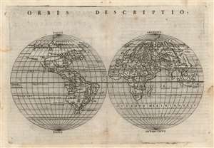
Orbis Descriptio.
sold
- Digital Map Information
- Suitable for large format printing
- Full resolution TIFF file
- ICC color profile embedded
- Delivered instantly via download link
This is Girolamo Ruscelli's 1561 double hemisphere map of the world in its second state of 1574. It is the earliest acquirable world map in this format and is the first such to appear in a printed atlas. Many of its geographic details were derived from the world maps appearing in Giacomo Gastaldi's 1548 Ptolemy, but Ruscelli's double-hemispherical projection transforms this map into a fully new composition. Amongst printed maps, the only earlier map using this projection is the unacquirable 1555 Georgio Sideri 'Calapoda' map. (more details)
One of the First Modern Arabia Maps.
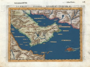
Arabia Felice Nuova Tavola.
sold
- Digital Map Information
- Suitable for large format printing
- DPI: 600
- File Size: 10.3 MB
- File Type: ZIP / TIFF
- ICC color profile embedded
- Delivered instantly via download link
This is Girolamo Ruscelli's 1599 edition of Giocomo Gastaldi's modern map of the Arabian Peninsula, specifically the fertile part of Arabia, 'Arabia Felix.' After Gastaldi's 1548 work, it is nevertheless one of the earliest acquirable depictions of Arabia not based on the second century work of Claudius Ptolemy. The island of Bahrain (Babarem) appears. Also, this is one of the earliest works to depict a peninsula in the region of Qatar. (more details)
Flawless example of one of the earliest modern maps of the East Indies.
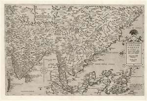
Tertiae Partis Asiae quae modernis India orientalis dicitur acurata delineatio Autore Iacobo Castaldo Pedemontano. Gerardus de Iode excudebat.
sold
- Digital Map Information
- Suitable for large format printing
- Full resolution TIFF file
- ICC color profile embedded
- Delivered instantly via download link
This is a flawless example of the rare 1578 first edition of Gerard De Jode's map of India, the East Indies, and the Philippines. It is broad in scope, including all of India, most of China, the Philippine Islands, and the Malay Peninsula. Singapore appears under the name 'Cingatola.' (more details)
One of the First Acquirable Maps of the North American East Coast, Updated
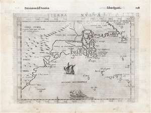
Tierra Nueva.
sold
- Digital Map Information
- Suitable for large format printing
- DPI: 600
- File Size: 15.14 MB
- File Type: ZIP / TIFF
- ICC color profile embedded
- Delivered instantly via download link
This is Girolamo Ruscelli's 1561 map 'Tierra Nueva', in its amended and embellished 1598 Giuseppe Rosaccio edition. In its first issues, this represented an early and influential map of the North American coastline from South Carolina to New England and the Canadian Maritime Provinces. Even in this 1599 edition, this remains one of the earliest acquirable maps to cover the eastern coast of North America. (more details)
Vrients color.
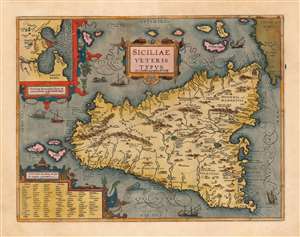
Siciliae Veteris Typus ex Conatibus geographicis Ab. Ortelij.
sold
- Digital Map Information
- Suitable for large format printing
- Full resolution TIFF file
- ICC color profile embedded
- Delivered instantly via download link
This is a superb example of Ortelius' map of Sicily as it was known in antiquity. The map is noteworthy for highlighting Ortelius' scholarship as a historian, as well as for denoting the locations of many sites from classical antiquity and mythology. This example is noteworthy as being from the Jan Bapatista Vrients (1552 - 1612) edition, which are known for exceptionally rich original colorwork. (more details)