
War Office (sold)

The British War Office (1857 - 1964) was a department of the British Government responsible for the administration of the Royal Army until 1964, when its functions were transferred to the Ministry of Defense. The War Office was to the Royal Army what the Admiralty was to the Royal Navy, and later, the Air Ministry. Within the War Office, the General Staff Topographical Section was responsible for thousands of maps issued for British intelligence and military use. The Topographical Section was renamed Geographical Section in April 1907. Many, once their military use passed, were offered through licensed agents to the general public. The sole London agent for War Office material was Edward Stanford.
The Red River Rebellion...
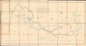
Plan Shewing the Proposed Route from Lake Superior to Red River Settlement.
sold
- Digital Map Information
- Suitable for large format printing
- File Size: 40.99 MB
- File Type: ZIP / TIFF
- ICC color profile embedded
- Delivered instantly via download link
A most interesting and influential 1870 Canadian War Office map issued during the Red River Rebellion (1869 - 1870). The map covers from Lake Winnipeg and the Red River Settlement to the western shores of Lake Superior. It details two alternate river / lake / portage routes from Superior to Fort Garry, modern-day Winnipeg. The first being the traditional route, or 'Pigeon River Route', following the US - Canada border, the second being the longer but wholly Canadian 'Kaministiguia Route'. The map was issued by the War Department for the Wolseley Expedition, a military force sent to suppress the Red River Rebellion and prevent the Settlement's pending annexation by land-hungry Minnesotans. The outcome of the map and the Expedition was the 1870 creation of Manitoba as a province in the Canadian Confederation. The map would later be used for preliminary surveys anticipating the construction of a trans-Canadian railway. (more details)
An official map created by the Anglo-French Boundary Commission.
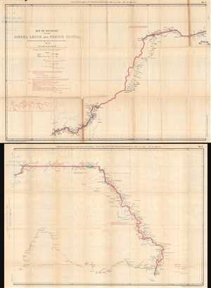
Map of Boundary between Sierra Leone and French Guinea, as demarcated by the Anglo-French Boundary Commission.
sold
- Digital Map Information
- Suitable for large format printing
- File Size: 21.52 MB
- File Type: ZIP / TIFF
- ICC color profile embedded
- Delivered instantly via download link
This is an 1897 War Office Intelligence Division map of the border between Sierra Leone and French Guinea printed on two sheets. The map depicts the region from Kiragba, Sierra Leone to Mount Konkonante in French Guinea. A highly detailed depiction of the boundary ... (more details)
Superbly Detailed Map of the Sudan and the Upper Nile and Congo Basins During the Scramble for Africa
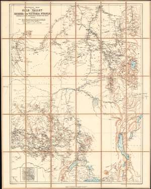
General Map of the Nile Valley from Berber to Victoria Nyanza Compiled at the Intelligence Division War Office 1898.
sold
- Digital Map Information
- Suitable for large format printing
- File Size: 38.32 MB
- File Type: ZIP / TIFF
- ICC color profile embedded
- Delivered instantly via download link
This is an 1898 British War Office, Intelligence Division map of the Upper Nile River Valley published by the Ordnance Survey. The map, printed in black, blue and sepia in the meticulous detail typical of the War Office's maps, encompasses the headwaters of the Blue Nile, the White Nile, and the northeastern Congo watershed: this region embraces Sudan as far north as Berber; Western Sudan, including the Darfur region; most, if not all, of South Sudan; Eritrea and most of inland Ethiopia; the eastern reaches of the Central African Republic; and the northeastern portion of the Democratic Republic of the Congo (Stanley Falls appears in the lower left hand corner of the map.) Most of Uganda is included, as is western Kenya. At the lower left is a detail map of Mashra‘ ar Raqq (Meshra er Rek, on the map.) (more details)
Delineates the border between British and French colonial possessions in West Africa.
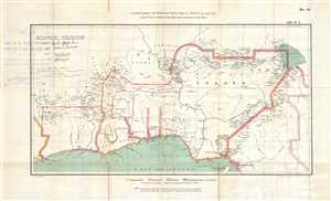
Anglo-French Frontier on the Niger and to the East of that River.
sold
- Digital Map Information
- Suitable for large format printing
- File Size: 8.13 MB
- File Type: ZIP / TIFF
- ICC color profile embedded
- Delivered instantly via download link
This is an 1898 War Office map of West Africa. The map depicts the region from Liberia to Cameroon and from the Niger River to the Gulf of Guinea. Created from Justus Perthe's 1892 Map of Africa solely for the purpose of the Anglo-French Boundary Commission to ... (more details)
Foundational Nigeria map made at the beginning of Britain's most aggressive expansion into the region.
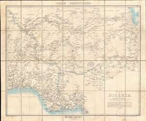
Map of Nigeria.
sold
- Digital Map Information
- Suitable for large format printing
- File Size: 39.32 MB
- File Type: ZIP / TIFF
- ICC color profile embedded
- Delivered instantly via download link
A rare 1901 first edition map of Nigeria issued by the Intelligence Division of the British War Office. The map was issued shortly after the British Crown took full control of Nigeria, establishing the Colony and Protectorate of Nigeria, and at the beginning of a period of aggressive expansion and conquest. Coverage extends from the Bight of Benin to Lake Chad, then south to Mount Cameroon. The map offers impressive detail - and not only along the well-traveled Niger, but also inland, naming hundreds of African cities and villages, as well as conflicting tribal and religious land claims. This is the first edition of the present map, although the basic template and cartographic data was reused until World War II (1939 - 1945), marking it as a foundational map. (more details)
'An iron snake will cross from the lake of salt to the lands of the Great Lake.' - ancient Kikuyu prophecy
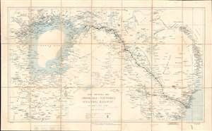
Map Shewing the Mombasa-Victoria (Uganda) Railway.
sold
- Digital Map Information
- Suitable for large format printing
- Full resolution TIFF file
- ICC color profile embedded
- Delivered instantly via download link
A rare and significant 1903 War Office 'Scramble for Africa' map illustrating the course of the Mombasa-Victoria Railway. Generally known as the Uganda Railroad, for its destination, the line is marked here running through Kenya from the Indian Ocean, through Nairobi, to the Lake Victoria port of Kisumu, Uganda. The map's coverage extends from the western shores of Lake Victoria to the Indian Ocean and the Tana River, embracing the heart of modern Kenya. Mount Kilimanjaro is named and connected to the railroad via an overland trade route from the stop of Voi. Beyond the railroad route, the map names countless villages and focuses on inland waterways. The border with rival German East Africa (Tanzania) is noted, underscoring the significance of the completed railroad to strategic control of the region. (more details)
When Central America was the center o the world...
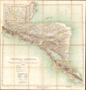
Central America.
sold
- Digital Map Information
- Suitable for large format printing
- Full resolution TIFF file
- ICC color profile embedded
- Delivered instantly via download link
A fascinating chromolithograph map of Central America issued jointly by the British War Office Topographical Section and the British Ordnance. The map emerged during the peak of global conversation about an interoceanic canal or railroad route to connect the Caribbean Sea, and thus the Atlantic, with the Pacific. (more details)
Scarce British Military Map of Lebanon and Syria, with the Bookplate of a Virtually Unknown Map Dealer.
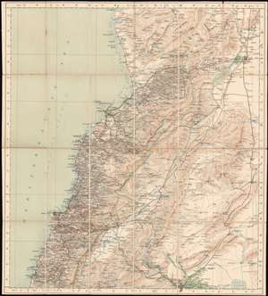
Syria, Homs - Beirut Sheet.
sold
- Digital Map Information
- Suitable for large format printing
- File Size: 34.3 MB
- File Type: ZIP / TIFF
- ICC color profile embedded
- Delivered instantly via download link
This is a 1910 British War Office Map of central and northern Lebanon, and the surrounding parts of Syria. The area mapped extends from Sidon and Damascus in the south to Hosain Al Bahir in the north (Ras al Hassan on the map). The map spans from the Mediterranean Sea eastwards to Homs, Al Nabk, (Nebk) and Jayrud (Jerud). The map is meticulously detailed, showing the country's mountainous terrain with superb hachure, and with the heights of the higher peaks noted in feet. The map distinguishes between 'metalled' roads (levelled, and made of small pieces of stone,) roads passable by automobile, and mule track. Telegraph lines, telegraph offices, railways, and bridges are shown. Coastal areas include soundings, anchorages and lighthouses. Interior details include convents, mosques, ruins and ancient mounds, towers, and garden areas. Rivers, springs and wells, wetlands and even underground water channels are marked as well. The map's reference key is included on the verso, along with the scales. (more details)
Chinese railroad and telegraph networks on the eve of World War I.
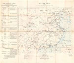
Map of China Shewing Railways, Telegraphs, and Treaty Ports.
sold
- Digital Map Information
- Suitable for large format printing
- File Size: 30.46 MB
- File Type: ZIP / TIFF
- ICC color profile embedded
- Delivered instantly via download link
This is a 1913 British War Office map of China and its railroads, telegraphs, and treaty ports. A system of red lines traces the Chinese railroad network. Solid red lines mark rail lines open to traffic, dashed red and white lines highlight lines currently under construction, and dashed red lines illustrate projected lines. Solid black lines follow telegraph lines. Blue lines in the Yellow Sea, Eastern Sea, and Southern Sea mark undersea cables connecting Chinese ports to other coastal Chinese cities and foreign nations. China's river system is also illustrated and labeled, and many cities along these rivers had been opened to foreign trade, a detail indicated by whether or not the city is underlined. An inset in the lower right details Peking, including the divisions of the Chinese City, Tartar City, and Imperial City. A second inset in the upper left corner illustrates railway connections in Manchuria that connect with Vladivostok and the Trans-Siberian Railway in Russia. (more details)
Chinese railroad and telegraph networks in the early days of the Republic.
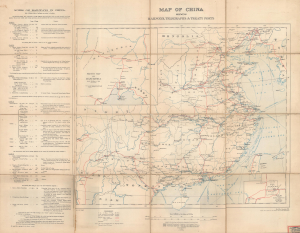
Map of China Shewing Railways, Telegraphs, and Treaty Ports.
sold
- Digital Map Information
- Suitable for large format printing
- Full resolution TIFF file
- ICC color profile embedded
- Delivered instantly via download link
This is a large-format 1913 British War Office map of China and its railroads, telegraphs, and treaty ports. It was published soon after China's transition from an imperial dynasty to a republic, when the country's future direction was highly uncertain and hotly contested. (more details)
Hong Kong Seamen's Strike of 1922.
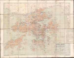
Map of Hong Kong and the Territory Leased to Great Britain under the Convention Between Great Britain and China Signed at Peking on the 9th of June 1898.
sold
- Digital Map Information
- Suitable for large format printing
- File Size: 92.45 MB
- File Type: ZIP / TIFF
- ICC color profile embedded
- Delivered instantly via download link
This is a 1922 British War Office map of Hong Kong and the New Territories. It was issued in March of 1922, shortly following the historic Hong Kong Seaman's Strike. (more details)
The Summation of the First European Surveys of Northern Arabia Embracing the History of the Arab Revolt
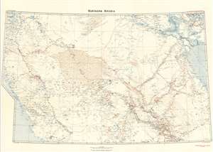
Northern Arabia/ Shakespear's Last Journey. Carruthers. GSGS 2931.
sold
- Digital Map Information
- Suitable for large format printing
- File Size: 46.17 MB
- File Type: ZIP / TIFF
- ICC color profile embedded
- Delivered instantly via download link
This 1922 Royal Geographic Society map of northern Arabia, Jordan, Kuwait and Southern Iraq, capturing the first European surveys of this region, frames the dramatic story of the first efforts on the part of the British government not only to map this previously uncharted part of the world, but also to build alliances in the sweep of the Great War. The map - very probably the work of Douglas Carruthers, but attributed only to the General Staff Geographical Section of the British War Office - has been further overprinted by Carruthers himself to highlight the heroic accomplishments of Captain William Shakespear, the first European to map the north-central part of the Arabian Peninsula and the friend and military advisor to Ibn Saud, the man who would become King of Arabia and founder of the ruling family. (more details)
Summation of the First European Surveys of Northern Arabia Embracing the History of the Arab Revolt.
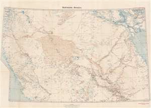
Northern Arabia/ Shakespear's Last Journey. Carruthers. GSGS 2931.
sold
- Digital Map Information
- Suitable for large format printing
- File Size: 51.07 MB
- File Type: ZIP / TIFF
- ICC color profile embedded
- Delivered instantly via download link
This 1922 Royal Geographic Society map of northern Arabia, Jordan, Kuwait and Southern Iraq, capturing the first European surveys of this region, frames the dramatic first British government efforts to map this previously uncharted region and build new alliances before and during World War I (1914 - 1918). The map - very probably the work of Douglas Carruthers but attributed only to the General Staff Geographical Section of the British War Office - has been further overprinted to highlight the heroic accomplishments of Captain William Shakespear, the first European to map the north-central part of the Arabian Peninsula and an advisor to Ibn Saud (1876 - 1953), future King of Saudi Arabia. (more details)
Planning an Allied operation across the River Maas.
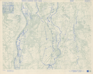
Holland and Germany 1: 25,000 Defence Overprint Sheet F (Rhine) Edition of 31 Oct 44.
sold
- Digital Map Information
- Suitable for large format printing
- Full resolution TIFF file
- ICC color profile embedded
- Delivered instantly via download link
This is an October 1944 World War II Defence Overprint map of the southeastern Netherlands and eastern Germany. The map was compiled from aerial photography during the planning stages of an Allied offensive across the River Maas. (more details)
A map of southern Singapore created by the British War Office near the end of World War II.
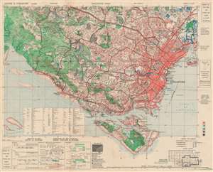
Singapore Main. HIND 610 Sheet 3 L/12/5. First Edition.
sold
- Digital Map Information
- Suitable for large format printing
- File Size: 28.68 MB
- File Type: ZIP / TIFF
- ICC color profile embedded
- Delivered instantly via download link
This is a 1945 British War Office map of southern Singapore. The map depicts the region from the Pandan River to Kallang Airfield and from the Sleepy Valley Estate to Pulau Blakang Mati. Highly detailed, individual buildings are illustrated throughout the region, some of which are labeled, including stores, sports areas, hospitals, prisons, factories, government buildings, schools, and churches. Roads snake their way from one end of the area to the other, providing access to nearly every part of the island. An index of abbreviations used is situated in the lower left quadrant, just above a key explaining the various notations present. (more details)
Preparing to continue fighting east toward Germany.
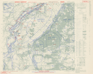
Germany 1:25000. Defence Overprint Sheet 4702 Edition of 7 Feb. 45.
sold
- Digital Map Information
- Suitable for large format printing
- Full resolution TIFF file
- ICC color profile embedded
- Delivered instantly via download link
This is a February 1945 World War II (1939 - 1945) Defence Overprint map of the southeastern Netherlands. Created for British and Canadian forces advancing as part of Operation Veritable, the map highlights German defensive positions along the Meuse River, including a network of trenches and machine gun emplacements that run along the riverbank. (more details)
Hong Kong shortly after World War II.
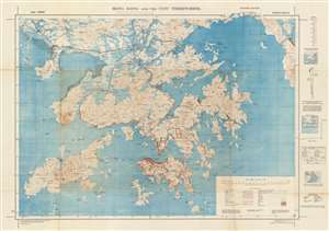
Hong Kong and the New Territories.
sold
- Digital Map Information
- Suitable for large format printing
- File Size: 87.86 MB
- File Type: ZIP / TIFF
- ICC color profile embedded
- Delivered instantly via download link
A rare 1945 map of Hong Kong and the New Territories published by the British War Office. Centered on Kowloon, coverage extends from Tai Tsan Bay to Tai Pong Bay and from Kwai Chung to the Soko Islands. This map was published shortly after the end of World War II and the British reoccupation of Hong Kong following four years of Japanese occupation. It is considered one of the finest and most detailed map of Hong Kong of this period. (more details)
A British War Office map of Victoria, Singapore at the end of World War II
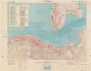
Victoria. / HING 1011. Sheet Victoria. Third Edition.
sold
- Digital Map Information
- Suitable for large format printing
- File Size: 41.53 MB
- File Type: ZIP / TIFF
- ICC color profile embedded
- Delivered instantly via download link
This is a 1945 British War Office map of Victoria, Hong Kong. The map depicts the city from North Street to Kowloon Bay and from Tai Min Tin in Kowloon to Magazine Gap in the hills south of the city. Highly detailed, many streets throughout Victoria and Kowloon are labeled. Buildings in both Victoria and Kowloon are identified, including the Kings College, the lunatic asylum, the Supreme Court, several barracks, and the Royal Naval Yard, and individual buildings are illustrated, though unlabeled. Two manuscript notations bring attention to the two typhoon anchorages in the harbor, both of which are protected by breakwaters. The topography to the south and east of the city is noted by contour lines. (more details)
Fishing at the Edge of the British Empire.
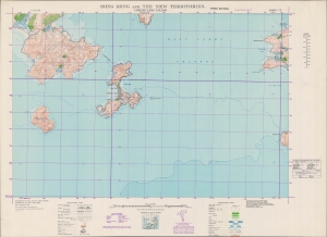
Hong Kong and the New Territories. Cheung Chau Island.
sold
- Digital Map Information
- Suitable for large format printing
- File Size: 38.76 MB
- File Type: ZIP / TIFF
- ICC color profile embedded
- Delivered instantly via download link
An impressive large-format 1949 War Office map of Cheung Chau Islands and environs, part of the New Territories of Hong Kong. (more details)
First bilingual map of Hong Kong!
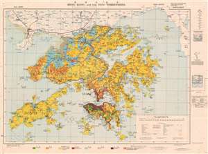
Hong Kong and the New Territories. / 香港及新界.
sold
- Digital Map Information
- Suitable for large format printing
- File Size: 92.6 MB
- File Type: ZIP / TIFF
- ICC color profile embedded
- Delivered instantly via download link
An extremely rare 1957 Geographical Section General Staff map of Hong Kong. Based upon a 1936 map published by the War Office, this is the first bilingual edition of this important. This map is further updated to represent agricultural variance, distinguishing between scrub, roughly grassland, badlands, arable lands, swamp and developed properties. (more details)
State of Singapore, founded.

This is a 1958 British War Office map of Singapore and Johor Bahru (Johore Bahru). This is one of the earliest maps of the self-governed State of Singapore, published in the same month it was established, paving the way for independence in 1965. (more details)