
Georgia and South Carolina Coasts.

Sea Islands (Caroline due Sud).
sold
- Digital Map Information
- Suitable for large format printing
- File Size: 7.55 MB
- File Type: ZIP / TIFF
- ICC color profile embedded
- Delivered instantly via download link
This is a striking 1890 Dumas Vorzet map of the coasts of South Carolina and Georgia, issued to illustrate the scarce atlas volume of the French edition of Price Philippe d'Orléans' Histoire de la Guerre Civile en Amérique. (more details)
Southern Theater of the American Revolution.

A Map of Those Parts of Virginia, North Carolina, South Carolina and Georgia which were the Scenes of the Most Important Operations of the Southern Armies.
sold
- Digital Map Information
- Suitable for large format printing
- File Size: 5.34 MB
- File Type: ZIP / TIFF
- ICC color profile embedded
- Delivered instantly via download link
A lovely example of Samuel Lewis' map of the Carolinas and Virginia that appeared in the 1806 first London edition of John Marshall's The Life of George Washington. The map depicts the Southern Theater of the American Revolutionary War. (more details)
Robert Moses' Stamp on New York City.

The Land of Moses. This map of New York City and Long Island.
sold
- Digital Map Information
- Suitable for large format printing
- File Size: 9.04 MB
- File Type: ZIP / TIFF
- ICC color profile embedded
- Delivered instantly via download link
This 1938 Richard Edes Harrison map of New York City and Long Island focuses on the monumental works of the legendary and tempestuous Commissioner of Parks for New York City, Robert Moses. (more details)
Selling oil to both sides of the Second World War.
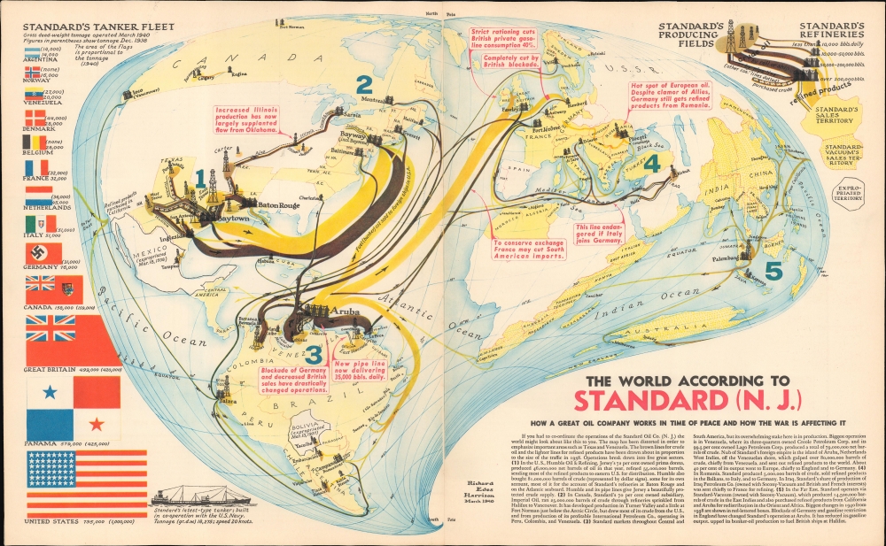
The World According to Standard (N.J.)
sold
- Digital Map Information
- Suitable for large format printing
- File Size: 14.78 MB
- File Type: ZIP / TIFF
- ICC color profile embedded
- Delivered instantly via download link
This is a May 1940 Richard Edes Harrison map of the world, illustrating the international operations of Standard Oil and its partners in the opening year of the Second World War and the oil corporation's continuance of trade with all combatants. (more details)
First issue of an early depiction of Quebec.

Plan du Bassin de Quebec et de ses Environs.
$200.00
Acquire
- Digital Map Information
- Suitable for large format printing
- File Size: 3.91 MB
- File Type: ZIP / TIFF
- ICC color profile embedded
- Delivered instantly via download link
A scarce 1744 first state first issue of Bellin's map of the vicinity of Quebec City, Canada, illustrating the shallows of the St. Lawrence River. When this map was issued, Quebec dominated the French fur trade with its strategic position on a vital St. Lawrence artery. (more details)
Features illustrations of ephemeral tourist attractions, such as Marine Studios and Clyde Beatty's Jungle Zoo.
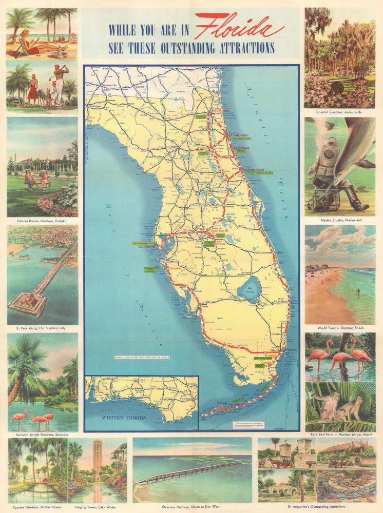
While You Are In Florida See These Outstanding Attractions.
sold
- Digital Map Information
- Suitable for large format printing
- Full resolution TIFF file
- ICC color profile embedded
- Delivered instantly via download link
This is a c. 1942 American Automobile Association pictorial tourist road map of Florida. Appealing vignettes and other illustrations beckon tourists to visit Florida and explore all it offers. (more details)
First usable printed nautical chart of Hispaniola and Puerto Rico.
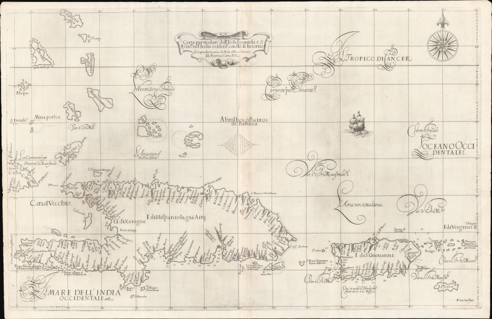
Carta particolare dell'Isola Ispaniola è S. Gioni. nel'India ocidentle. con l'Isola Intorno.
sold
- Digital Map Information
- Suitable for large format printing
- DPI: 600
- File Size: 732.44 MB
- File Type: ZIP / TIFF
- ICC color profile embedded
- Delivered instantly via download link
This is the first edition of Sir Robert Dudley's rare 1647 nautical map of the eastern Greater Antilles, including Hispaniola, Puerto Rico, the Virgin Islands, Turks and Caicos, St. Croix, and the southern Bahamas. Like most Caribbean maps from Dudley's Arcano del Mare, this represents the first usable printed nautical chart of Hispaniola and Puerto Rico. (more details)
First Printed Map to show the Chesapeake Bay.
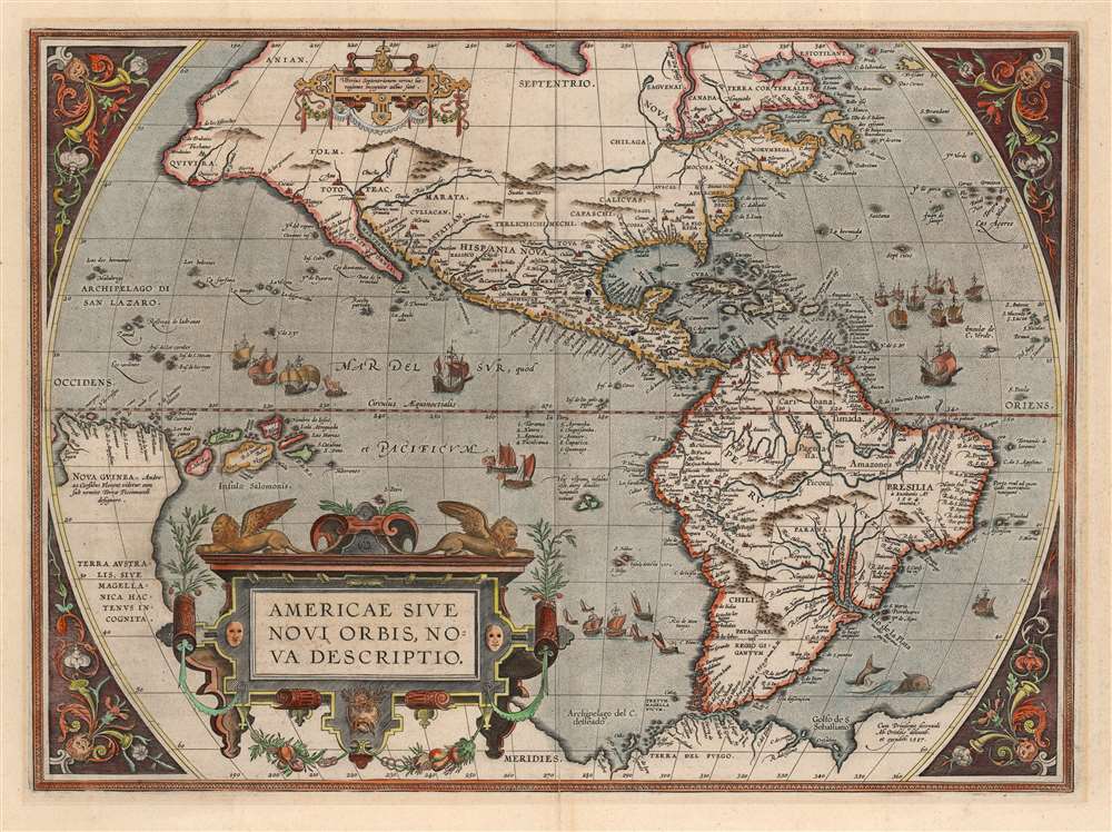
Americae Sive Novi Orbis Nova Descriptio.
sold
- Digital Map Information
- Suitable for large format printing
- DPI: 600
- File Size: 50.62 MB
- File Type: ZIP / TIFF
- ICC color profile embedded
- Delivered instantly via download link
This is Abraham Ortelius' map of the Western Hemisphere, in an attractive example of the 1587 third state. It represents the state-of-the-art mapping of the Americas during the initial period of European Colonization and the first printed map to illustrate the Chesapeake Bay. (more details)
North America from the Great Age of Exploration.
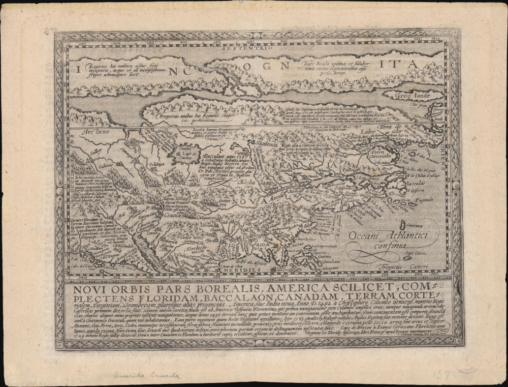
Novi Orbis Pars Borealis, America Scilicet, Complectens Floridam, Baccalaon, Canadam, Terram Corte . . . 1585.
$3,000.00
Acquire
- Digital Map Information
- Suitable for large format printing
- Full resolution TIFF file
- ICC color profile embedded
- Delivered instantly via download link
A beautifully engraved, rare, and important 1600 map of North America by Matthias Quad, in its first edition. This is one of the most significant obtainable maps to incorporate the cartography of Cornelis de Jode, John White, and Jacques Le Moyne. It is additionally significant for its postulation of an open Northwest Passage. (more details)
First Earthside lunar stereographic map - prepping for Apollo.
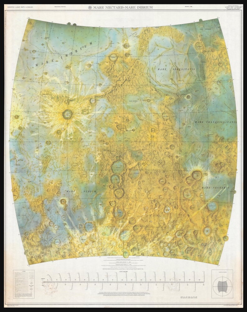
Mare Nectaris - Mare Imbrium.
sold
A seminal cartographic achievement, this is the first Earthside Stereographic map of the Moon produced by the Army Map Service in anticipation of the lunar landing missions of the late 1960s. The map was produced by the Army Map Service, Corps of Engineers, in March 1962 and incorporates the 6 landing sites of the forthcoming Apollo Missions. (more details)
KLM to the East Indies!

KLM Royal Dutch Airlines Winter 1948 - 49.
sold
- Digital Map Information
- Suitable for large format printing
- File Size: 41.66 MB
- File Type: ZIP / TIFF
- ICC color profile embedded
- Delivered instantly via download link
This is a highly decorative art deco large-format 1948 Jan Menting KLM Royal Dutch Airlines route map of the world - highlighting its extensive coverage in the East Indies. The map combines Art Deco and Bauhaus aesthetics - reflecting Jan's early training. Set against a pastel backdrop, air routes and vignettes stand out in bold primary colors. Clouds overlap part of the map and suggest looking upon the world from far above - as one might in a KLM flight. Stylistically, the poster is reminiscent of similar airline promotions issued in France by Lucien Boucher. (more details)
Capturing the Summer Palace!

Entrée des Alliés dans Pékin, le 22 octobre 1860. Entrance of the Allyed in Pekin, the 22nd October 1860.
sold
- Digital Map Information
- Suitable for large format printing
- File Size: 49.41 MB
- File Type: ZIP / TIFF
- ICC color profile embedded
- Delivered instantly via download link
This is an 1860 Albert chromolithograph view of the Franco-British Expedition to China, capturing the Summer Palace outside Peking (Beijing) on October 22, 1860, near the end of the Second Opium War (1856 - 1860). (more details)
Tin and Rubber Booms.
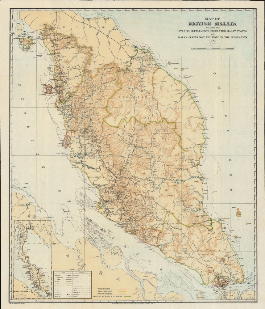
Map of British Malaya including the Straits Settlements Federated Malay States and Malay States Not Included in the Federation.
sold
- Digital Map Information
- Suitable for large format printing
- File Size: 492.69 MB
- File Type: ZIP / TIFF
- ICC color profile embedded
- Delivered instantly via download link
A scarce 1922 map of Malaya, modern-day Malaysia, issued by the surveyor general of the Federated Malay States some 13 years after the British consolidated the northern four Malay states from Siam into the Unfederated Malay States. It illustrates the early days of the Malay tin and rubber booms. (more details)
Modernization and Repression.

نقشۀ ايران / [Map of Iran].
sold
- Digital Map Information
- Suitable for large format printing
- File Size: 282.69 MB
- File Type: ZIP / TIFF
- ICC color profile embedded
- Delivered instantly via download link
A vibrantly-colored large format c. 1930 Farsi-language map of Persia or Iran divided into provinces. It reflects the country at the height of Reza Shah Pahlavi's modernizing reforms, including ambitious infrastructure projects. (more details)
Spanish-Era Land Grants in New Mexico.
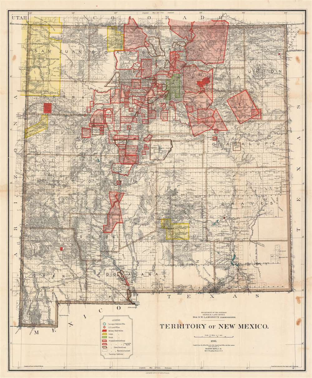
Territory of New Mexico.
$1,200.00
Acquire
- Digital Map Information
- Suitable for large format printing
- File Size: 233.72 MB
- File Type: ZIP / TIFF
- ICC color profile embedded
- Delivered instantly via download link
This is a large and detailed 1896 Robert H. Morton and General Land Office map of the New Mexico Territory. The map highlights private land grants, American Indian reservations, military bases, and forest reserves. Of greatest interest are the illustrated land grants, including the Tierra Amarilla Grant, the Beaubien and Miranda Grant, and the Mora Grant. Other annotations represent private grants that required new boundary surveys, were unconfirmed, or that had been rejected or dismissed by the U.S. government. Yellow areas represent reservations granted to the Jicarilla Apache, the Navajo, the Southern Ute, the Zuni, and the Mescalero Apache. (more details)
Highlights the birds, deer, and bison living in Golden Gate Park.

Map showing the Golden Gate Park the Avenue and Buena Vista Park.
sold
- Digital Map Information
- Suitable for large format printing
- File Size: 33.03 MB
- File Type: ZIP / TIFF
- ICC color profile embedded
- Delivered instantly via download link
This is an 1897 Joseph Britton and Jacques Joseph Rey map of Golden Gate Park, San Francisco. The map depicts the park from the Pacific Ocean to Baker Street and from D Street to H Street and includes both the Panhandle and Buena Vista Park. Park improvements in the eastern third are illustrated in detail, with the numerous buildings, monuments, and other areas all identified. (more details)
Where the American Civil War began!
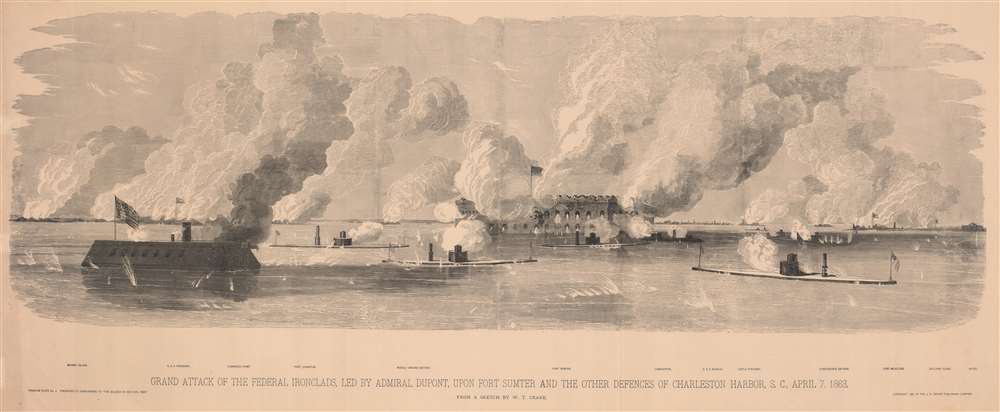
Grand Attack of the Federal Ironclads, led by Admiral Dupont, upon Fort Sumter and the other defences of Charleston Harbor, S. C., April 7, 1863.
sold
- Digital Map Information
- Suitable for large format printing
- File Size: 136.23 MB
- File Type: ZIP / TIFF
- ICC color profile embedded
- Delivered instantly via download link
This is a large and impressive 1885 J. H. Brown panoramic xylographic view of the American Civil War (1861 - 1865) Union attack on Fort Sumter, South Carolina. The dramatic scene pits ironclads - then the forefront of naval technology - against one another and the heavily armed fort. (more details)
New York City of the Roaring Twenties.
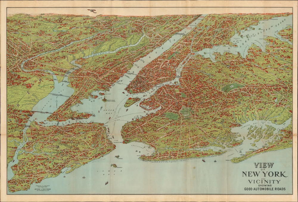
View of New York and Vicinity Showing Good Automobile Roads.
sold
- Digital Map Information
- Suitable for large format printing
- File Size: 43.07 MB
- File Type: ZIP / TIFF
- ICC color profile embedded
- Delivered instantly via download link
This is an engaging 1928 birds-eye view map of New York City and its vicinity by George J. Nostrand, in an unusual transitional state. Brightly colored and evocative, the view presents New York City and its surroundings at the height of 'the Roaring Twenties.' As the title suggests, it was meant to highlight New York City's auto-friendly roads during an era in which the automobile was still a novelty and the outer boroughs not fully urbanised. (more details)
Celebrating Seattle.
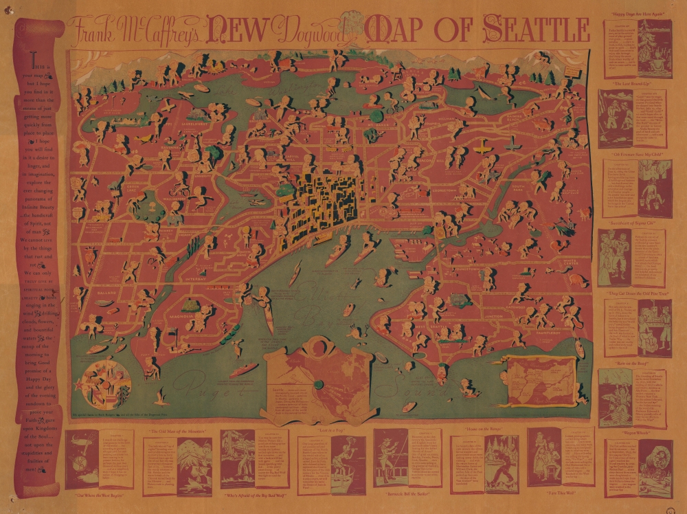
Frank McCaffrey's New Dogwood Map of Seattle.
sold
- Digital Map Information
- Suitable for large format printing
- File Size: 49.04 MB
- File Type: ZIP / TIFF
- ICC color profile embedded
- Delivered instantly via download link
This is a rare 1936 Frank McCaffrey / Dogwood Press pictorial map of Seattle, Washington, and environs. The map was drawn, in the author's own words, to inspire readers to 'linger, and in imagination, explore the ever-changing panorama.' (more details)
France's Winnings from the Treaty of Westphalia.
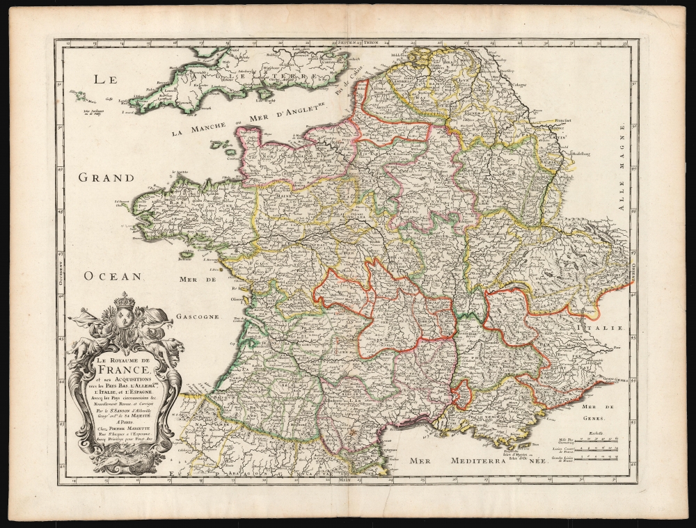
Le Royaume De France et ses Acquisitions vers les Pays Bas, L'Allemagne, L'Italie, et L'Espagne. Avec les Pays Circomvoisins etc. Nouvellement Revue, et Corrigee Par le Sr. Sanson d'Abbeville Geogr. Ordre. de sa Majesté A Paris.
sold
- Digital Map Information
- Suitable for large format printing
- DPI: 600
- File Size: 51.85 MB
- File Type: ZIP / TIFF
- ICC color profile embedded
- Delivered instantly via download link
This is a beautiful, original-color example of Nicolas Sanson's 1678 folio map of the Kingdom of France. Sanson was the preeminent French geographer of the 17th century, and his austere, elegant aesthetic set the standard for French mapmakers into the next century - easily distinguishing the works of French mapmakers from the florid work produced at the same time in the Netherlands. (more details)